Sign In
Upload
Manuals
Brands
Leica Manuals
Measuring Instruments
TPS1200 series
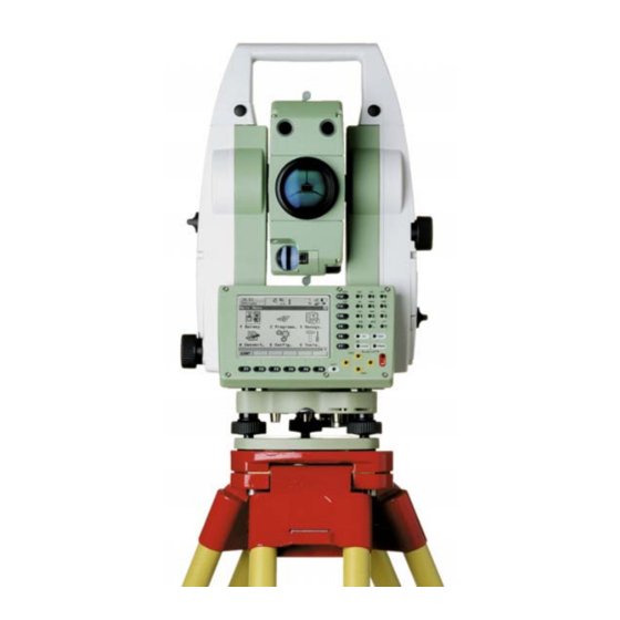
Leica TPS1200 series Manuals
Manuals and User Guides for Leica TPS1200 series. We have
4
Leica TPS1200 series manuals available for free PDF download: Technical Reference Manual, Reference Manual, Getting Started Manual, Quick Start Manual
Leica TPS1200 series Technical Reference Manual (1406 pages)
Brand:
Leica
| Category:
Measuring Instruments
| Size: 9 MB
Table of Contents
Table of Contents
3
1 Instrument Protection with PIN
24
2 Configurable Keys
30
Hot Keys
30
USER Key
32
3 Quick Settings - SHIFT USER
34
Overview
34
QUICK SET Change Settings to
35
Quick Setting Functions
39
Orientation with Compass
39
Positioning Hz/V
42
Move by Joystick
44
Check Recorded Point / Backsight Point
46
L.go (F5)/L.int (F5)
49
PS Powersearch
50
Working Examples
51
Working Example 1 - ATR
51
Working Example 2 - LOCK
52
Working Example 3 - Loss of LOCK
53
Working Example 4 - PS
55
4 Main Menu
56
Main Menu Functions
56
Survey
59
Programs
60
Manage
62
Convert
64
Config
65
Tools
66
Overview
68
Manage...\Jobs
68
5 Manage
69
Accessing Job Management
69
Creating a New Job
71
Editing a Job
75
Managing Job Codes
78
6 Manage
79
Overview
82
Manage...\Data
82
Accessing Data Management
83
Point Management
88
Terminology
88
Creating a New Point
98
Editing a Point
102
Mean Page
107
Line/Area Management
114
Overview
114
Creating a New Line/Area
115
Editing a Line/Area
119
Working Example
122
Data Log
125
Point Sorting and Filters
128
Sorting and Filters for Points, Lines and Areas
128
Point, Line and Area Code Filter
137
Stakeout Filter
139
7 Manage
139
Terminology
142
Manage...\Codelists
142
Overview
149
Accessing Codelist Management
150
Creating/Editing a Codelist
152
Managing Codes
153
Accessing MANAGE Codes
153
Creating a New Code
156
Editing a Code
159
Managing Code Groups
160
8 Coding
162
Overview
162
Thematical Coding
165
Thematical Coding with Codelist
165
Thematical Coding Without Codelist
169
Free Coding
171
Free Coding Using a Codelist
171
Free Coding with Direct Input
175
Quick Coding
177
Smartcodes
181
Overview
181
Configuring Smartcodes
182
Code Block
186
Using Smartcodes
189
Code and Attribute Mismatch
190
Code Mismatch
190
Attribute Mismatch
192
9 Linework
194
Overview
194
Performing Linework
195
Combining Linework and Coding
200
10 Manage
206
Overview
206
Terminology
210
Accessing Coordinate System Management
213
Coordinate Systems
216
Creating a New Coordinate System
216
Editing a Coordinate System
218
Transformations
220
Accessing Transformation Management
220
Creating a New Transformation
223
Editing a Transformation
225
Ellipsoids
226
Accessing Ellipsoid Management
226
Creating a New Ellipsoid
228
Editing an Ellipsoid
229
Projections
230
Accessing Projection Management
230
Creating a New Projection
235
Editing a Projection
236
Geoid Models
237
Geoid Models Overview
237
Accessing Geoid Model Management
239
Creating a New Geoid Model from the Compactflash Card / Internal Memory
241
CSCS Models
242
11 Manage
244
Overview
244
Accessing Configuration Set Management
245
Creating a New Configuration Set
247
Editing a Configuration Set
249
Overview
252
Manage...\Reflectors
252
12 Manage
253
Accessing Reflector Management
253
Creating a New Reflector
255
Editing a Reflector
257
13 Convert
258
Overview
258
Convert...\Export Data from Job
258
Accessing the Data Export Functionality
260
Exporting Data from a Job to a Custom ASCII Format
261
Exporting Data from a Job to Another Device
264
Exporting Data in DXF Format
266
14 Convert
270
Overview
270
Accessing the Data Import Functionality
275
Importing Data in ASCII Format
276
Importing Data in GSI Format
278
Importing Data in DXF Format
280
15 Convert
282
16 Config
284
ID Templates
284
Overview of Templates
284
Accessing ID Template Configuration
287
Creating a New ID Template
289
Editing an ID Template
293
Deleting an ID Template
295
Working Example
296
Display Settings
299
Coding & Linework Settings
306
Offsets
312
Target Check
315
17 Config
318
EDM & ATR Settings
318
Search Windows
324
Automatic Prism Search
328
TPS Corrections
331
Compensator
338
Instrument ID
341
18 Config
344
Wizard Mode
344
Hot Keys & User Menu
346
Units & Formats
350
Language
359
Lights, Display, Beeps, Text
361
Start up & Power down
368
19 Interfaces, Ports, Devices
374
Overall Concept
374
Interfaces
377
Overview of Interfaces
377
Accessing CONFIGURE Interfaces
378
Ports
380
Devices
381
Overview of Devices
381
Devices
382
Creating a New Device
385
Accessing CONFIGURE Devices / CONFIGURE GPRS Internet Devices
385
Editing a Device
389
Device - Digital Cellular Phones
390
Device - Modems
393
Device - Radios for GPS Real-Time
395
Device - Radios for Remote Control
397
Device - RS232
399
Device - GPRS / Internet Devices
401
20 Config
404
GSI Output
404
Config...\Interfaces... - Editing the Interface
404
Geocom Mode
414
RCS Mode
416
Export Job
418
Gps Rtk
420
Internet
421
21 Config
424
Digital Cellular Phones
424
Overview
424
Configuring a GSM Connection
426
Configuring a CDMA Connection
429
Modems
432
Radios for GPS Real-Time
434
Radios for Remote Control
437
Rs232
439
GPRS / Internet Devices
441
Internet
443
Scanning Reference Stations
446
Configuring the Stations to Dial
448
Overview
448
Accessing CONFIGURE Stations to Dial
449
Creating a New Station to Dial
451
Editing a Station to Dial
453
Configuring the Server to Connect
454
Overview
454
Accessing CONFIGURE Server to Connect
455
Creating a New Server
457
Editing a Server to Connect
458
22 Config
460
Real-Time Mode
460
Configuration of Real-Time
460
Configuration of GGA Message Sending for Ref Network Applications
471
Point Occupation Settings
475
Satellite Settings
481
Local Time Zone
484
Quality Control Settings
486
Logging of Raw Obs
488
23 Tools
492
Tools...\Format Memory Device
492
24 Tools
494
25 Tools
498
Application Programs
498
System Languages
500
Instrument Firmware
502
26 Tools
502
Overview
504
Tools...\Calculator
504
Accessing the Calculator
505
Configuring the Calculator
506
Using the Calculator
508
RPN Mode
508
Standard Mode
511
Description of Softkeys
514
Calling and Closing the Calculator from an Input Field for Numeric Characters
519
Tools...\File Viewer
522
27 Tools
526
29 Tools
530
Overview
530
Tools...\Check & Adjust
530
Details on Instrument Errors
533
Accessing Check & Adjust Menu
539
Configure Check & Adjust
541
Combined Adjustment (L, T, I, C and ATR)
544
Tilting Axis Adjustment (A)
551
Compensator Adjustment (L, T)
556
Current Instrument Errors
560
Adjusting the Circular Level of the Instrument and Tribrach
562
Adjustment of the Reflectorless EDM
564
Adjusting the Circular Level of the Prism Pole
568
Inspecting the Laser Plummet of the Instrument
569
Servicing the Tripod
571
30 Status
572
STATUS Functions
572
STATUS: Station Information
574
STATUS: Battery & Memory
576
STATUS: System Information
580
STATUS: Interfaces
583
STATUS: Bluetooth
585
STATUS: Level & Laser Plummet
586
STATUS: Smartstation
589
Satellite Status
589
Real-Time Status
594
Current Position
603
Logging Status
606
Smartantenna System Info
609
31 Telescope Positioning
610
32 Functions
612
Edm
612
Prism Search Methods
614
Atr
614
Powersearch
618
Follow Moving Prisms - LOCK
620
Rcs
623
Egl
624
Illumination
627
33 NTRIP Via Internet
630
Overview
630
Configuring Smartstation for Using NTRIP Service
634
Configuring an Access to the Internet
634
Configuring to Connect to a Server
637
Using the NTRIP Service with Smartstation
640
34 Mapview Interactive Display Feature
644
Overview
644
Accessing Mapview
646
Configuring Mapview
649
Mapview Components
655
Softkeys
655
Screen Area
657
Toolbar
659
Point Symbols
660
Map Mode
662
Mapview in Map Mode
662
Selecting Points, Lines and Areas
664
Plot Mode - Mapview Screen Area
668
Survey Mode
672
Mapview in Survey Mode
672
Mapview in Staking out Survey Mode
674
Selecting Lines and Areas
677
35 Application Programs - General
680
Overview
680
Accessing the Programs Menu
683
36 Cogo
686
Overview
686
Accessing COGO
688
Configuring COGO
696
COGO Calculation - Inverse Method
703
Overview
703
Inverse between Two Known Points (Pt - Pt)
705
Inverse between a Known Point and a Line (Pt - Line)
707
Inverse between a Known Point and an Arc (Pt - Arc)
709
COGO Calculation - Traverse Method
712
Overview
712
Traverse with Azimuth/Bearing
715
Traverse with Angle Right
720
COGO Calculation - Intersections Method
722
Intersection with Bearing - Bearing
722
Intersection with Bearing - Distance
728
Intersection with Distance - Distance
733
Intersection with by Points
736
Intersection with TPS Observation - TPS Observation
740
COGO Calculation - Line Calculations Method
744
Line Calculation - Base Point
744
Line Calculation - Offset Point
751
Line Calculation - Segmentation
753
COGO Calculation - Arc Calculations Method
757
Arc Calculation - Arc Center
757
Arc Calculation - Base Point
763
Arc Calculation - Offset Point
766
Arc Calculation - Segmentation
768
COGO Calculation - Shift, Rotate & Scale (Manual) Method
769
COGO Calculation - Shift, Rotate & Scale (Match Pts) Method
784
Area Division
790
Overview
790
Choosing an Area to be Divided
797
Dividing an Area
802
Results of the Area Division
807
Working Example
810
Selecting a Result from Previous COGO Inverse Calculations
814
Modifying Values for Azimuths, Distances and Offsets
816
37 Determine Coordinate System - General
820
Overview
820
Accessing Determine Coordinate System
832
Configuring Determine Coordinate System
835
Configuring Determine Coordinate System - Normal
835
Configuring Determine Coordinate System - One Point Localisation
841
38 Determine Coordinate System - Normal
848
Overview
848
Determining a New Coordinate System
849
Updating a Coordinate System
862
Matching Points
863
Overview
863
Selecting a New Pair of Matching Points
864
Editing a Pair of Matching Points
865
Transformation Results
866
Accessing Transformation Results
866
Results for Onestep and Twostep Transformations
867
Results for Classic 3D Transformation
870
39 Determine Coordinate System - One Point Localisation
874
Accessing Determine Coordinate System - One Point Localisation
874
Determine Coordinate System - Onestep Transformation
877
Determine Coordinate System - Twostep Transformation
889
Twostep Transformation
889
Computing the Grid Scale Factor
902
Computing the Height Scale Factor
904
Determine Coordinate System - Classic 3D Transformation
907
Computing Required Azimuth
911
40 GPS Survey
914
Application Program
914
Management of Antennas Overview
922
Accessing Antenna Management
923
Creating a New Antenna
925
Editing an Antenna
927
Antenna Heights
928
41 Hidden Point
930
Overview
930
Accessing Hidden Point
933
Configuring Hidden Point
935
Measuring Hidden Points
938
42 Reference Line
944
Overview
944
Accessing Reference Line
949
Configuring Reference Line
952
Starting Reference Line
961
Manually Entering a Reference Line/Arc
961
Selecting an Existing Reference Line/Arc
967
Defining the Offsets Related to a Reference Line/Arc
974
Defining the Slope Related to a Reference Line/Arc
978
Measuring to a Reference Line/Arc
984
Measuring the Points
984
Working Example
995
Staking to a Reference Line/Arc
998
Staking the Points
998
Working Example
1010
Gridstaking to a Reference Line/Arc
1014
Gridstaking the Points
1014
Working Example
1022
43 Reference Plane & Face Scan
1026
Overview
1026
Accessing Reference Plane
1031
Configuring Reference Plane
1034
Managing Reference Planes
1038
Measuring Points to a Reference Plane
1046
Scanning a Plane
1048
44 Sets of Angles
1052
Overview
1052
Sets of Angles
1055
Accessing Sets of Angles
1055
Configuring Sets of Angles
1059
Managing the Points List
1064
Measuring the New Points
1067
Measuring the Sets
1071
Calculations - Calculating Angles and Distances in Two Faces
1075
Calculations - Viewing Angle and Distance Results in Two Faces
1077
Calculations - Viewing Results in One Face
1082
Monitoring
1084
45 Setup
1090
Overview
1090
Accessing Setup
1095
Configuring Setup
1098
Setup with Smartstation
1107
Setup with Smartpole
1111
Setup Methods
1115
Setup Reminder
1115
Set Azimuth
1117
Known Backsight Point
1125
Orientation and Height Transfer
1131
Resection/Resection Helmert
1137
Local Resection
1139
Setup Results
1143
Least Square and Robust Calculation
1143
Additional Information
1148
Local Resection Calculation
1152
Finding a Target Point
1155
46 Stakeout
1158
Overview
1158
Accessing Stakeout
1162
Configuring Stakeout
1165
Staking out
1175
Elements of the Graphical Display in the Stakeout
1175
Manual Entry of Points to be Staked
1177
Staking out in Orthogonal Mode
1179
Staking out in Polar Mode
1188
Staking out a DTM
1192
Stakeout Difference Limit Exceeded
1195
47 Survey - General
1198
Accessing Survey
1198
Surveying Points
1201
48 Survey - Auto Points
1206
Overview
1206
Configuring Auto Points
1208
Auto Points
1217
Offset Points of Auto Points
1222
Overview
1222
Configuring Offset Points
1225
Working Example
1230
49 Survey - Remote Point
1234
Overview
1234
Accessing Remote Point
1236
Configuring Remote Point
1239
Working Example
1241
50 Survey Cross Section
1244
Overview
1244
Accessing Survey Cross Section
1247
Configuring Survey Cross Section
1250
Surveying Cross Sections
1253
Cross Section Templates
1259
Accessing Cross Section Template Management
1259
Creating a New Cross Section Template
1262
Editing a Cross Section Template
1268
Working Example
1269
51 Traverse
1274
Overview
1274
Accessing Traverse
1276
Configuring Traverse
1279
Traverse Methods
1283
Starting Traverse
1283
Measuring Traverse
1285
Closing Traverse
1287
Traverse Point Statistics
1291
Traverse Results
1293
52 Volume Calculations
1296
Overview
1296
Accessing Volume Calculations
1298
Configuring Volume Calculations
1302
Calculating the Volume
1304
Step 1) Surveying the Points
1304
Step 2) Triangulating the Surface
1307
Step 3) Computing the Volume
1314
Appendix A Menu Tree
1318
Appendix B Memory Types
1324
Appendix C Directory Structure of the Memory Device
1326
Pin Assignments and Sockets
1328
Appendix D Pin Assignments and Sockets
1328
Instrument
1328
Smartantenna
1330
Appendix E Cables
1334
Appendix Fnmea Message Formats
1340
Overview
1340
Used Symbols for Describing the NMEA Formats
1341
GGA - Global Positioning System Fix Data
1346
GGK - Real-Time Position with DOP
1348
GGK(PT) - Real-Time Position with DOP, Trimble Proprietary
1350
GGQ - Real-Time Position with CQ
1352
GLL - Geographic Position Latitude/Longitude
1354
GNS - GNSS Fix Data
1356
GSA - GNSS DOP and Active Satellites
1358
GSV - GNSS Satellites in View
1360
LLK - Leica Local Position and GDOP
1362
LLQ - Leica Local Position and Quality
1364
RMC - Recommended Minimum Specific GNSS Data
1366
VTG - Course over Ground and Ground Speed
1368
ZDA - Time and Date
1370
Appendix Gat Commands
1372
Appendix H General Terminology
1374
Index
1376
Advertisement
Leica TPS1200 series Reference Manual (207 pages)
geodetic measurement instruments
Brand:
Leica
| Category:
Laser Level
| Size: 1 MB
Table of Contents
Table of Contents
2
1 Geocom
5
Introduction
5
Tps1200 System Software
5
Principles of Geocom Operation
6
2 General Concepts of Using Geocom
7
Introduction
7
General Concept of Operation
7
Ascii Protocol
7
Function Call Protocol - C/C
8
Function Call Protocol - Vba
9
3 Fundamentals of Programming Geocom
10
Introduction
10
Ascii Protocol Programming
10
C/C++ - Programming
12
Vba - Programming
14
Units of Values
16
Tps1200 Instrument Modes of Operation
16
Common Communication Errors
16
4 Remarks on the Description
19
Structure of Descriptions
19
5 Communication Settings
21
Usage
21
Constants and Types
21
General Geocom Functions
22
Client Specific Geocom Functions
24
6 Alt User - aus
38
Usage
38
Constants and Types
38
Functions
39
7 Automation - Aut
43
Usage
43
Cancelling / Aborting Current Functions
43
Constants and Types
43
Functions
45
8 Basic Applications - Bap
69
Usage
69
Constants and Types
69
Functions
71
9 Basic man Machine Interface - Bmm
89
Usage
89
Constants and Types
89
Functions
90
10 Communications - Com
94
Usage
94
Constants and Types
94
Functions
95
11 Central Services - Csv
101
Introduction
101
Usage
101
Constants and Types
101
Functions
103
12 Electronic Distance Measurement - Edm
113
Introduction
113
Usage
113
Constants and Types
113
Functions
114
13 File Transfer - Ftr
117
Usage
117
Constants and Types
117
Functions
118
14 Image Processing - Img
127
Introduction
127
Usage
127
Constants and Types
127
Functions
128
15 Motorisation - Mot
131
Introduction
131
Usage
131
Constants and Types
131
Functions
132
16 Supervisor - Sup
137
Usage
137
Constants and Types
137
Functions
138
17 Theodolite Measurement and Calculation - Tmc
140
Introduction
140
Usage
140
Constants and Types
141
Measurement Functions
144
Measurement Control Functions
157
Data Setup Functions
160
Information Functions
177
Configuration Functions
179
18 Porting a Tps1100 Application
191
Introduction
191
Rpc Changes
191
Data Types and Constants Changes
193
Return-Codes
193
19 Geocom Releases
194
Release 1.00
194
Release 1.10
194
Release 1.20
194
Release 1.50
194
20 Appendix
195
Return-Code Names and Return-Code Values
195
B Hardware Interface
201
Serial Interface
201
Debugging Utility
202
C Provided Samples
203
C-1.1 VBA Sample Program
203
C-1.2 C/C++ Sample Programs
203
Program Frames
203
C-1.3 TCC Image Grabber Sample Program
204
D List of Remote Procedure Calls (RPC
205
Rpc in Alphabetical Order
205
Leica TPS1200 series Quick Start Manual (2 pages)
Brand:
Leica
| Category:
Measuring Instruments
| Size: 1 MB
Table of Contents
Setup Tripod at User Height
1
Attach Tribach
1
Centre Bubble on Tribach Using Black Foot Screws
1
Attach Instrument
1
Lock in
1
To Turn on
1
Level
1
Circle Centre
1
Main Menu
1
Programs Menu
1
Horizontal Jumps
2
To Change Event
2
Measure Foul: Point 1
2
Measure Foul: Point 2
2
To Measure a Jump
2
To Turn off
2
Advertisement
Leica TPS1200 series Getting Started Manual (6 pages)
GeoCOM
Brand:
Leica
| Category:
Measuring Instruments
| Size: 0 MB
Advertisement
Related Products
Leica TPS1200+ Series
Leica TPS800 Series
Leica tps1100
Leica TPS400 Series
Leica TPS 300
Leica TS02
Leica TCR307
Leica TS15
Leica TC303
Leica TC805L
Leica Categories
Digital Camera
Microscope
Measuring Instruments
Laboratory Equipment
Binoculars
More Leica Manuals
Login
Sign In
OR
Sign in with Facebook
Sign in with Google
Upload manual
Upload from disk
Upload from URL