Sign In
Upload
Manuals
Brands
Leica Manuals
Measuring Instruments
TPS1200+ Series
Leica TPS1200+ Series Manuals
Manuals and User Guides for Leica TPS1200+ Series. We have
4
Leica TPS1200+ Series manuals available for free PDF download: Field Manual, User Manual, Reference Manual
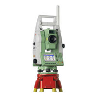
Leica TPS1200+ Series Field Manual (258 pages)
Brand:
Leica
| Category:
Measuring Instruments
| Size: 3 MB
Table of Contents
Table of Contents
3
1 Application Programs - Getting Started
7
Starting an Application Program
7
Configuration of a Logfile
10
Overview
11
Accessing COGO
12
Configuring COGO
13
COGO Calculation - Inverse Method
16
Overview
16
Inverse between Two Known Points
18
Inverse between a Known Point and a Line
19
Inverse between a Known Point and an Arc
20
COGO Calculation - Traverse Method
22
COGO Calculation - Intersections Method
26
COGO Calculation - Line/Arc Calculations Method
30
COGO Calculation - Shift, Rotate & Scale (Manual) Method
36
COGO Calculation - Shift, Rotate & Scale (Match Pts) Method
41
COGO Calculation - Area Division
43
3 Determine Coordinate System - General
49
Overview
49
Configuring Det Coord System
51
Configuring Det Coord System - Normal
51
Configuring Det Coord System - One Point Localisation
53
4 Determine Coordinate System - Normal
55
Determining a New/Updating a Coordinate System
55
Selecting/Editing a New Pair of Matching Points
60
Transformation Results
61
5 Determine Coordinate System - One Point Localisation
63
Accessing Det Coord System - One Point Localisation
63
Det Coord System - Onestep/Twostep Transformation
64
Determining a New/Coordinate System
64
Computing the Grid Scale Factor for Twostep Transformation
70
Computing the Height Scale Factor for Twostep Transformation
71
Det Coord System - Classic 3D Transformation
72
Computing Required Azimuth
73
6 GPS Survey
75
Overview
75
Management of Antennas
79
Overview
79
Creating a New Antenna/Editing an Antenna
80
7 Hidden Point
83
Overview
83
Configuring Hidden Point
85
Measuring Hidden Points
87
8 Reference Line
91
Overview
91
Configuring Reference Line
92
Starting Reference Line
97
Manually Entering a Reference Line/Arc
97
Selecting an Existing Reference Line/Arc
100
Defining the Offsets Related to a Reference Line/Arc
104
Defining the Slope Related to a Reference Line/Arc
106
Measuring to a Reference Line/Arc
110
Staking to a Reference Line/Arc
113
Gridstaking to a Reference Line/Arc
117
Staking to a Polyline
119
Overview
119
Accessing Staking to Polylines & Choosing a Polyline
120
Stake Parameters
121
Staking Operation
123
Results of Stakeout
126
9 Reference Plane & Face Scan
129
Overview
129
Configuring Reference Plane
132
Managing Reference Planes
134
Measuring Points to a Reference Plane
139
Scanning a Plane
140
10 Sets of Angles
143
Overview
143
Sets of Angles
144
Accessing Sets of Angles
144
Configuring Sets of Angles
145
Managing the Points List
148
Measuring the New Points
150
Measuring the Sets
151
Calculating Angles and Distances in Two Faces
152
Viewing Angle and Distance Results in Two Faces
153
Viewing Angle and Distance Results in One Face
155
Monitoring
156
11 Setup
159
Overview
159
Configuring Setup
162
Setup with Smartstation
165
Setup with Smartpole
168
Setup Reminder
171
Setup Method - Set Azimuth
172
Setup Method - Known Backsight Point
175
Setup Method - Orientation & Height Transfer
177
Setup Method - Resection/Resection Helmert
180
Setup Method - Local Resection
181
Setup Results - Least Square and Robust Calculation
182
Setup Results - Local Resection
185
12 Stakeout
187
Overview
187
Configuring Stakeout
188
Staking out
193
Stakeout Difference Limit Exceeded
196
13 Survey - General
197
14 Survey - Auto Points
201
Overview
201
Configuring Auto Points
202
Auto Points
206
Offset Points of Auto Points
209
Overview
209
Configuring Offset Points
210
15 Survey - Remote Point
213
Overview
213
Configuring Remote Point
214
Remote Point
215
16 Survey Cross Section
217
Overview
217
Configuring Survey Cross Section
218
Surveying Cross Sections
220
Cross Section Templates
222
Accessing Cross Section Template Management
222
Creating/Editing a Cross Section Template
223
17 Traverse
227
Overview
227
Configuring Traverse
228
Traverse Information and Traverse Management
230
Traverse Data
232
Traverse Point Results
233
Traverse Results
235
Traverse Methods
237
Starting Traverse
237
Continuing an Existingtraverse
238
Closing Traverse
240
Traverse Adjustment
242
Accessing Traverse Adjustment
242
Adjustment Results
243
18 Volume Calculations
245
The Volume Calculations Menu
245
Step 1) Surveying the Points
246
Step 2) Triangulating the Surface
248
Step 3) Computing the Volume
251
Index
253
Advertisement
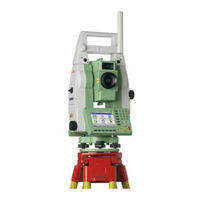
Leica TPS1200+ Series Field Manual (210 pages)
Brand:
Leica
| Category:
Measuring Instruments
| Size: 2 MB
Table of Contents
Table of Contents
3
Tps1200
5
1 User Interface
7
Keyboard
7
Screen
8
Operating Principles
9
Icons
10
Symbols
17
2 Configurable Keys
19
Hot Keys
19
USER Key
20
3 Quick Settings - SHIFT USER
21
4 Instrument Setup
23
Levelling up with the Electronic Level
25
Smartstation Setup
26
Instrument Setup for Remote Control
28
5 Setup, Measure and Record
29
6 Manage
31
Overview
35
Manage...\Jobs
35
Creating a New Job/Editing a Job
36
Overview
39
8 Manage...\Data
39
Point Management
40
Creating a New Point/Editing a Point
40
Mean Page
44
Line/Area Management
47
Overview
47
Creating a New Line/Area/Editing a Line/Area
48
Point Sorting and Filters
51
Sorting and Filters for Points, Lines and Areas
51
Point, Line and Area Code Filter
53
9 Manage...\Codelists
55
Creating a New Codelist/Editing a Codelist
55
Creating a New Code/Editing a Code
56
10 Linework
59
Performing Linework
59
Combining Linework and Coding
62
11 Manage
65
Overview
65
Creating a New Coordinate System/Editing a Coordinate System
66
Transformations/Ellipsoids/Projections
68
Accessing Transformation/Ellipsoid/Projection Management
68
Creating/Editing a Transformation/Ellipsoid/Projection
69
Geoid/Cscs Models
71
12 Manage
73
Overview
73
Creating a New Configuration Set
74
Editing a Configuration Set
75
Overview
77
13 Manage...\Reflectors
77
Creating a New Reflector/Editing a Reflector
78
14 Convert
79
Overview
79
Exporting ASCII Data
80
Exporting DXF Data
82
Exporting Landxml Data
83
15 Convert
85
Overview
85
Importing ASCII/GSI Data
86
Importing DXF Data
88
16 Convert
89
17 Config
91
ID Templates
91
Overview
91
Creating a New ID Template/Editing an ID Template
92
Display Settings
93
Coding & Linework Settings
95
Offsets
97
18 Config
99
EDM & ATR Settings
99
Search Windows
103
Automatic Prism Search
105
TPS Corrections
106
Compensator
109
Instrument ID
110
Telescope Accessories
111
19 Config
113
Wizard Mode
113
Hot Keys & User Menu
114
Units & Formats
116
Language
119
Lights, Display, Beeps, Text
120
Start up & Power down
122
20 Interfaces, Ports, Devices
125
Interfaces
125
Overview of Interfaces
125
Configuring an Interface
126
Ports
127
Devices
128
Overview of Devices
128
Configuring a Device
129
Controlling a Device
130
Creating a New Device/Editing a Device
131
21 Config
133
GSI Output
133
Geocom Mode
134
RCS Mode
135
Export Job
136
Gps Rtk
137
Internet
138
22 Config
139
Digital Cellular Phones
139
Modems
142
Radios for GPS Real-Time
143
Radios for Remote Control
144
Rs232
145
GPRS / Internet Devices
146
Internet
147
Creating a New Station to Dial/Editing a Station to Dial
149
Creating a New Server to Connect/Editing a Server to Connect
151
23 Config
153
Real-Time Mode
153
Point Occupation Settings
157
Satellite Settings
160
Local Time Zone
162
Quality Control Settings
163
Logging of Raw Obs
164
24 Tools
165
Format Memory Device
165
Transfer Objects
166
Upload System Files
167
Calculator and File Viewer
169
Licence Keys
170
Field to Office
171
25 Status
173
STATUS: Station Information
173
STATUS: Battery & Memory
174
STATUS: System Information
175
STATUS: Interfaces
177
STATUS: Bluetooth
178
STATUS: Level & Laser Plummet
179
STATUS Smartstation
180
Satellite Status
180
Real-Time Status
182
Current Position
187
Logging Status
189
Smartantenna System Info
191
26 NTRIP Via Internet
193
Overview
193
Configuring Smartstation for Using NTRIP Service
194
Configuring an Access to the Internet
194
Configuring to Connect to a Server
196
Using the NTRIP Service with Smartstation
198
27 Menu Tree
201
Index
203
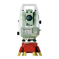
Leica TPS1200+ Series Reference Manual (207 pages)
geodetic measurement instruments
Brand:
Leica
| Category:
Laser Level
| Size: 1 MB
Table of Contents
Table of Contents
2
1 Geocom
5
Introduction
5
Tps1200 System Software
5
Principles of Geocom Operation
6
2 General Concepts of Using Geocom
7
Introduction
7
General Concept of Operation
7
Ascii Protocol
7
Function Call Protocol - C/C
8
Function Call Protocol - Vba
9
3 Fundamentals of Programming Geocom
10
Introduction
10
Ascii Protocol Programming
10
C/C++ - Programming
12
Vba - Programming
14
Units of Values
16
Tps1200 Instrument Modes of Operation
16
Common Communication Errors
16
4 Remarks on the Description
19
Structure of Descriptions
19
5 Communication Settings
21
Usage
21
Constants and Types
21
General Geocom Functions
22
Client Specific Geocom Functions
24
6 Alt User - aus
38
Usage
38
Constants and Types
38
Functions
39
7 Automation - Aut
43
Usage
43
Cancelling / Aborting Current Functions
43
Constants and Types
43
Functions
45
8 Basic Applications - Bap
69
Usage
69
Constants and Types
69
Functions
71
9 Basic man Machine Interface - Bmm
89
Usage
89
Constants and Types
89
Functions
90
10 Communications - Com
94
Usage
94
Constants and Types
94
Functions
95
11 Central Services - Csv
101
Introduction
101
Usage
101
Constants and Types
101
Functions
103
12 Electronic Distance Measurement - Edm
113
Introduction
113
Usage
113
Constants and Types
113
Functions
114
13 File Transfer - Ftr
117
Usage
117
Constants and Types
117
Functions
118
14 Image Processing - Img
127
Introduction
127
Usage
127
Constants and Types
127
Functions
128
15 Motorisation - Mot
131
Introduction
131
Usage
131
Constants and Types
131
Functions
132
16 Supervisor - Sup
137
Usage
137
Constants and Types
137
Functions
138
17 Theodolite Measurement and Calculation - Tmc
140
Introduction
140
Usage
140
Constants and Types
141
Measurement Functions
144
Measurement Control Functions
157
Data Setup Functions
160
Information Functions
177
Configuration Functions
179
18 Porting a Tps1100 Application
191
Introduction
191
Rpc Changes
191
Data Types and Constants Changes
193
Return-Codes
193
19 Geocom Releases
194
Release 1.00
194
Release 1.10
194
Release 1.20
194
Release 1.50
194
20 Appendix
195
Return-Code Names and Return-Code Values
195
B Hardware Interface
201
Serial Interface
201
Debugging Utility
202
C Provided Samples
203
C-1.1 VBA Sample Program
203
C-1.2 C/C++ Sample Programs
203
Program Frames
203
C-1.3 TCC Image Grabber Sample Program
204
D List of Remote Procedure Calls (RPC
205
Rpc in Alphabetical Order
205
Advertisement
Leica TPS1200+ Series User Manual (214 pages)
Brand:
Leica
| Category:
Measuring Instruments
| Size: 4 MB
Table of Contents
Table of Contents
6
1 Description of the System
12
System Components
12
System Concept
19
Software Concept
19
Data Storage and Data Conversion Concept
21
Power Concept
23
Container Contents
24
Instrument Components
28
2 User Interface
32
Keyboard
32
Screen
36
Operating Principles
38
Icons
45
3 Operation
50
Instrument Setup
50
Autodetect Behaviour
53
Instrument Setup as Smartstation
55
Smartstation Setup
55
LED Indicators on Smartantenna
59
Working with the Clip-On-Housings for Devices
61
LED Indicators on Clip-On-Housings
65
Instrument Setup for Remote Control
69
Remote Control Setup
69
LED Indicators on Radiohandle
71
Battery
73
Operating Principles
73
Instrument Battery
75
Smartantenna Battery
77
Working with the Compactflash Card
79
Accessing Survey Application Program
82
Guidelines for Correct Results
86
4 Check & Adjust
90
Overview
90
Preparation
94
Combined Adjustment (L, T, I, C and ATR)
96
Tilting Axis Adjustment (A)
101
Adjusting the Circular Level of the Instrument and Tribrach
106
Adjusting the Circular Level of the Prism Pole
108
Inspecting the Laser Plummet of the Instrument
109
Servicing the Tripod
111
5 Care and Transport
112
Transport
112
Storage
114
Cleaning and Drying
115
Maintenance
117
6 Safety Directions
118
General Introduction
118
Intended Use
119
Limits of Use
121
Responsibilities
122
Hazards of Use
124
Laser Classification
130
General
130
Distancer, Measurements with Reflectors (IR Mode)
131
Distancer, Measurements Without Reflectors (RL Mode)
133
Automatic Target Recognition ATR
138
Powersearch PS
140
Electronic Guide Light EGL
142
Laser Plummet
143
Electromagnetic Compatibility EMC
146
FCC Statement, Applicable in U
149
Internal Battery
154
7 Technical Data
156
Angle Measurement
156
Distance Measurement with Reflectors (IR Mode)
157
Distance Measurement Without Reflectors (RL Mode)
160
Distance Measurement - Long Range (lo Mode)
162
Automatic Target Recognition ATR
164
Powersearch PS
168
Smartstation
169
Smartstation Accuracy
169
Smartstation Dimensions
171
Smartantenna Technical Data
172
Conformity to National Regulations
176
Communication Side Cover with Bluetooth
176
GFU24, Siemens MC75
177
GFU19 (US), GFU25 (CAN), GFU26 (US) CDMA Multitech MTMMC-C
179
Radiohandle
181
Smartantenna with Bluetooth
183
General Technical Data of the Instrument
185
Scale Correction
192
Reduction Formulas
198
Advertisement
Related Products
Leica TPS800 Series
Leica TPS1200 series
Leica tps1100
Leica TPS400 Series
Leica TPS 300
Leica TS06
Leica TS30 Series
Leica TM30 Series
Leica Nova TS60
Leica TM50
Leica Categories
Digital Camera
Microscope
Measuring Instruments
Laboratory Equipment
Binoculars
More Leica Manuals
Login
Sign In
OR
Sign in with Facebook
Sign in with Google
Upload manual
Upload from disk
Upload from URL