Table of Contents
Advertisement
Quick Links
Advertisement
Table of Contents

Related Manuals for Advanced Navigation GNSS Compass


Summary of Contents for Advanced Navigation GNSS Compass
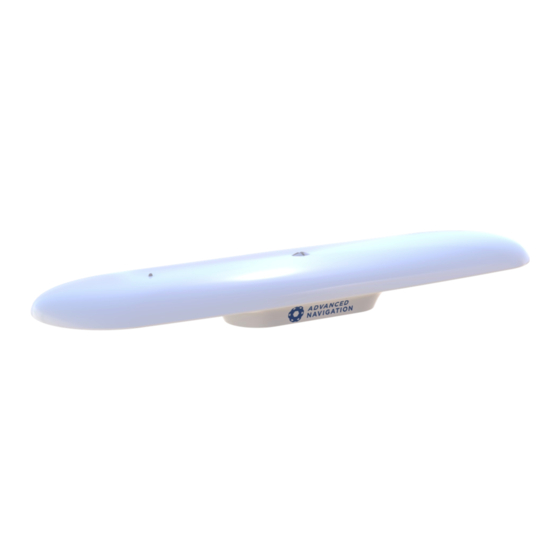
- Page 1 GNSS Compass Reference Manual v2.0 04 Nov 2021...
-
Page 2: Table Of Contents
5.2.3 Mechanical Drawings 5.2.4 Axes 5.2.5 Serial Number 5.3 Communication Specifications 5.3.1 Ethernet Variant 5.3.2 Serial Variant 5.4 Electrical Specifications 5.5 Certification 6 Installing GNSS Compass 6.1 Installation Checklist 6.1.1 Connection Options 6.1.1.1 NMEA 2000 6.1.1.2 NMEA 0183 6.1.1.3 Ethernet Page i... - Page 3 7.9.3 Supported RTCM Messages 7.10 Heave 7.11 Environmental Exposure 7.11.1 Temperature 7.11.2 Water 7.11.3 Salt 7.11.4 Dirt and Dust 7.11.5 pH Level 7.11.6 Shocks 7.11.7 Atmospheres 7.12 Upgrading the GNSS Compass Firmware 8 Configuring and Monitoring GNSS Compass Page ii...
- Page 4 8.1.3.4 Alignment 8.1.3.5 Reset 8.1.3.6 Manual Initialisation 8.1.3.7 Ethernet Settings 8.1.3.8 NTRIP Client 8.1.4 Tools Menu 8.1.4.1 Firmware Update 8.2 Using GNSS Compass Manager 8.2.1 Software Changelog 8.2.2 System Requirements 8.2.3 Installation and Starting 8.2.4 Troubleshooting 8.2.4.1 Windows 8.2.4.2 Linux 8.2.5 Main View...
- Page 5 9.1.2.7 Simrad 3000 Output 9.1.2.8 GNSS Receiver Passthrough 9.2 Serial Interface 9.2.1 Baud Rate 9.2.2 Format 9.3 1PPS Signal 9.4 CAN Interface 10 Advanced Navigation Packet Protocol 10.1 About Packets 10.1.1 Packet Structure 10.1.1.1 Header LRC 10.1.1.2 Packet ID 10.1.1.3 Packet Length 10.1.1.4 CRC 10.1.2 Packet Requests...
- Page 6 10.2 Data Types 10.3 System Packets 10.3.1 Acknowledge Packet 10.3.1.1 Acknowledge Result 10.3.2 Request Packet 10.3.3 Boot Mode Packet 10.3.3.1 Boot Mode Types 10.3.4 Device Information Packet 10.3.4.1 Device ID 10.3.5 Restore Factory Settings Packet 10.3.6 Reset Packet 10.3.6.1 Verification Sequence Values 10.3.7 Serial Port Passthrough Packet 10.3.7.1 Passthrough Routes 10.3.8 IP Configuration Packet...
- Page 7 10.4.19 Body Acceleration Packet 10.4.20 Euler Orientation Packet 10.4.21 Quaternion Orientation Packet 10.4.22 DCM Orientation Packet 10.4.23 Angular Velocity Packet 10.4.24 Angular Acceleration Packet 10.4.25 External Position and Velocity Packet 10.4.26 External Position Packet 10.4.27 External Velocity Packet 10.4.28 External Body Velocity Packet 10.4.29 External Heading Packet 10.4.30 Running Time Packet 10.4.31 Local Magnetic Field Packet...
- Page 8 10.5.6.1 Ports 10.5.6.2 Transmit and Receive Functions 10.5.7 Set Zero Orientation Alignment Packet 10.5.8 Reference Point Offsets Packet 10.5.9 Port Output Configuration Packet 10.5.9.1 NMEA Fix Behaviour 10.5.9.2 Port Output Rates 10.5.9.3 Output Rates Index 10.5.10 User Data Packet 11 Reference Information 11.1 Technology Overview 11.1.1 GNSS 11.1.2 AHRS...
- Page 9 If any part of this document refers to any third party products or services it shall not be deemed a license grant by Advanced Navigation for the use of such third party products or services, or any intellectual property contained therein or considered as a warranty covering the use in any manner whatsoever of such third party products or services or any intellectual property contained therein.
-
Page 10: Revision History
GNSS Compass Reference Manual • Revision History 1 Revision History Version Date Changes 4 November 2021 Major update for v2 hardware Updated 2.1 Firmware Changelog Updated POE injector from AC to DC 13 Jan 2021 Updated 2.1 Firmware Changelog Updated... -
Page 11: Introduction
NMEA 0183, NMEA 2000 and Ethernet interfaces. The GNSS Compass can provide amazing results but it does need to be set up properly and operated with an awareness of its limitations. Please read through this manual carefully to ensure success within your application. -
Page 12: Firmware Changelog
GNSS Compass Reference Manual • Introduction to GNSS Compass 2.1 Firmware Changelog Version Date Changes 6 October Updated to support v2 hardware 2021 1.24 12 January Improved heading reliability 2020 Fix intermittent issue with heading status indicator in Web UI 1.23... -
Page 13: Getting Started
, or purchased as Advanced Navigation supplied optional Accessories. 1. Install the GNSS Compass in an area where it has a full clear view of the sky and away from strong radio transmission sources as shown in Figure 2: GNSS Compass ideal mounting location Figure 2: GNSS Compass ideal mounting location 2. - Page 14 GNSS Compass Reference Manual • Getting Started with GNSS Compass Figure 3: GNSS Compass alignment 3. Plug the cable into the GNSS Compass and rotate the nut clockwise to lock it in place. See GNSS Compass connector locking Figure 4: GNSS Compass connector locking v2.0...
-
Page 15: Nmea 2000 Connection
3.3 Power over Ethernet Connection 1. Plug the Ethernet cable from the GNSS Compass into the “Data+Power” port on the PoE injector. Plug an Ethernet cable into the Data port and connect the other end to a DHCP router. -
Page 16: Evaluation Kit
GNSS Compass Reference Manual • Getting Started with GNSS Compass 3 Evaluation Kit The Evaluation Kits provides the necessary parts and accessories to set up and connect a GNSS Compass unit. They are available in both an Ethernet (POE) and Serial version. - Page 17 GNSS Compass Reference Manual • Getting Started with GNSS Compass Part Number Quantity Description Notes Ethernet Serial GC2-EK-POE GNSS Compass Ethernet GNSS Compass Ethernet variant Variant Power over Ethernet interface Supports GPS, GLONASS, Galileo & BeiDou constellation L1/L2 10mm RTK...
- Page 18 GNSS Compass Reference Manual • Getting Started with GNSS Compass Part Number Quantity Description Notes Ethernet Serial Table 4: Evaluation Kit Contents v2.0 Page 9 04 Nov 2021...
-
Page 19: Part Numbers And Ordering
GNSS Compass Reference Manual • Guide to ordering GNSS Compass 4 Part Numbers and Ordering This topic covers information about: 4.1 Evaluation Kits 4.2 Standalone Units 4.3 Accessories 4.1 Evaluation Kits Part Number Description Notes GC2-EK-POE GNSS Compass Ethernet Evaluation Kit... -
Page 20: Accessories
GNSS Compass Reference Manual • Guide to ordering GNSS Compass 4.3 Accessories Part Number Description Notes GC-POE- 20m Ethernet cable for 20m CAT5e Ethernet cable with RJ45 CABLE-20M GNSS Compass Compatible with Ethernet units only (GC2-POE) IP67 environmentally sealed connector... -
Page 21: Specifications
GNSS Compass Reference Manual • Specifications 5 Specifications Review the following specifications for GNSS Compass Ethernet: 5.1 Navigation Specifications 5.2 Hardware Specifications 5.3 Communication Specifications 5.4 Electrical Specifications NMEA 2000 Drop Cable Ethernet Connection Serial Connection 5.5 Certification 5.1 Navigation Specifications... -
Page 22: Hardware Specifications
75 g 11 ms Dimensions (length x width x height) 672 mm x 190 mm x 73.9 mm Weight 1450 grams Table 10: Hardware Specifications for GNSS Compass Ethernet 5.2.2 Serial Variant Specification Value Power Input 9 to 36 V... -
Page 23: Mechanical Drawings
GNSS Compass Reference Manual • Specifications 5.2.3 Mechanical Drawings Figure 5: Mechanical Drawings of GNSS Compass v2.0 Page 14 04 Nov 2021... -
Page 24: Axes
GNSS Compass Reference Manual • Specifications 5.2.4 Axes Figure 6: GNSS Compass axes with arrows showing positive direction 5.2.5 Serial Number Units can be identified and tracked using the device serial number. This can be observed in a numbers of ways: Through the Device Information page in the web UI (8.1.2 View... - Page 25 GNSS Compass Reference Manual • Specifications Figure 7: GNSS Compass External Serial Number Sticker v2.0 Page 16 04 Nov 2021...
-
Page 26: Communication Specifications
GNSS Compass Reference Manual • Specifications 5.3 Communication Specifications 5.3.1 Ethernet Variant Interfaces Ethernet Speed 10/100 Mbps Protocols NMEA 0183 Advanced Navigation Packet Protocol TSS1 Simrad Ports Up to 4 TCP or UDP ports Timing PTP Server NTP Server Timing Accuracy... -
Page 27: Certification
50 mA Table 14: Electrical Specifications 5.5 Certification The GNSS Compass is designed to meet IMO wheelmark for MED/4.7 Speed and Distance Measuring Equipment (SDME) and MED/4.41 Transmitting Heading Device (THD, GNSS method) based on the Directive 2014/90/EU. The Serial model GC2-SER is pending certification to the following standards. -
Page 29: Installing Gnss Compass
Ordering. 6.1 Installation Checklist The GNSS Compass is designed to be plug and play such that it does not normally require any customer configuration. Typical installations utilising NMEA 0183 or NMEA 2000 will work out of the box. 6.1.1 Connection Options The cables available from Advanced Navigation feature a connector with a locking nut and o-ring that are waterproof and dirtproof to the IP67 standard as well as resistant to shock and vibration. -
Page 30: Nmea 2000
NMEA 2000 Drop Cable is required (part number GC- NMEA2000-CABLE). One end of the cable should be connected to the GNSS Compass and the other end to a T-connector on the NMEA 2000 backbone of the vessel. 6.1.1.2 NMEA 0183 For connection to an NMEA 0183 network the Advanced Navigation Serial Breakout Cable... - Page 31 6.2 Mounting GNSS Compass. 2. Plug the Ethernet cable from the GNSS Compass into the “Data+Power” port on the PoE injector. Plug an Ethernet cable into the Data port and connect the other end to a DHCP router. 3. Download and install the Bonjour ZeroConf networking utility from the link https://www.advancednavigation.com/Bonjour64.msi.
- Page 32 Mount the unit at least 10 cm away (and preferably as far as possible) from sources of dynamic magnetic interference such as high current wiring or large motors for best performance. Figure 9: Mounting Location example 6.2.2 Mounting Options The GNSS Compass can either be pole mounted, or surface mounted. See 5.2.3 Mechanical Drawings details 6.2.2.1 Pole mounting If pole mounting the unit, connection is via a single 1-14 UNS-2A thread.
- Page 33 GNSS Compass Reference Manual • Installing GNSS Compass Figure 10: Pole mounting assembly 6.2.2.2 Surface mounting If mounting on a surface, use the 4 x M8 fixing holes as indicated in the 5.2.3 Mechanical Drawings. It is strongly recommended to use the included shoulder washers to provide a small gap between the GNSS Compass and the mounting surface.
- Page 34 6.3 Mounting Alignment. 6.3 Mounting Alignment The GNSS Compass should be aligned such that it is level with the vehicle and the indicator on the lid is directly forward of the sight, see Figure 12: GNSS Compass alignment. The sight can be used to visually align the indicator for best results.
- Page 35 GNSS Compass Reference Manual • Installing GNSS Compass Figure 12: GNSS Compass alignment Install the unit such that the X+ axis points forward towards the front of the vehicle and the Z+ axis points straight down towards the ground as shown below.
- Page 36 6.5 Vibration GNSS Compass is able to tolerate a high level of vibration compared to other inertial systems. This is due to a unique gyroscope design and a special filtering algorithm among other things. There is however a limit to the amount of vibration that a unit can tolerate and large levels of vibration can cause degraded accuracy.
- Page 37 Try to find a mounting point with less vibration. Mount GNSS Compass to a plate which is then mounted to the platform through vibration isolation mounts. Be mindful that a plate with very soft mounts may also cause problems with shifts in orientation over time.
- Page 38 GNSS Compass Manager. Figure 15: Initialisation Levels After all four levels of initialisation, the GNSS Compass INS filter takes several minutes to achieve its full accuracy. It is recommended to wait two minutes after initialisation for applications requiring high accuracy.
- Page 39 Advanced Navigation GNSS/INS devices were the first on the market with hot-start functionality. This hot-start functionality allows GNSS Compass to start inertial navigation within 500 ms to 1 s, and obtain a GNSS fix in as little as 2 seconds. The hot-start functionality is always on and fully automatic. See 5.1 Navigation...
- Page 40 7.4.2 External Heading This can be used if there is some other way to derive heading that is external to GNSS Compass. The heading must be supplied to GNSS Compass using the 10.4.29 External Heading Packet...
- Page 41 Longitudinal and transverse speed Table 18: NMEA 2000 transmitted messages 7.6 NMEA 0183 The GNSS Compass supports outputting the version 4.10 compliant NMEA 0183 messages over both Serial and Ethernet connections. For the serial variant (GC2-SER): Serial data is output on the Auxiliary serial port.
- Page 42 GNSS Compass Reference Manual • Using GNSS Compass Ethernet messages are enabled by default, however can be selectively disabled. NMEA 0183 broadcast packets are sent via multicast to IP address 239.192.0.4. These are sent whenever an Ethernet connection is established and cannot be disabled.
- Page 43 GNSS Compass supports dynamic ranging on its sensors. Each of the three sensors have three different range settings. At lower ranges the sensor performance is better, but at higher ranges GNSS Compass can be used in more extreme dynamics. The best performance is achieved by choosing the lowest range that your application won't generate over-range events.
- Page 44 GNSS Compass unit (the “rover”). The radio modem receiver and GNSS Compass unit must remain within radio range of the base station to receive these corrections. The base station should be located no more than 50 km from the GNSS Compass, and ideally closer.
- Page 45 7.11.2 Water GNSS Compass complies with IP67 standard, which means that it can be submersed in water to a depth of up to 1 m deep for a maximum of 30 minutes. Submersion to depths beyond 1 metre can cause water entry and destruction of the internal electronics, and the sealing is not designed for prolonged or repetitive immersion.
- Page 46 GNSS Compass Reference Manual • Using GNSS Compass Shocks applied directly to the GNSS Compass enclosure can affect the unit. Therefore, care should be taken when handling the unit prior to mounting. When mounted in a vehicle, the effect of most operating shocks is negligible.
- Page 47 Ethernet. Applicable to the GC2-POE Ethernet variant only GNSS Compass Manager, accessed on a computer via a serial adaptor. Applicable to the GC2-SER Serial variant only the Advanced Navigation Packet Protocol (8.4 Using ANPP...
- Page 48 Figure 18: GNSS Compass Web UI Home Page 8.1.1.1 Status Indicator The Status Indicator section contains the current GNSS Compass status, the GNSS fix type indicator, and the heading status. These are visible on every page. Status Indicator: This indicator shows any problems with GNSS Compass. Once the filter has initialised it will show “HEALTHY”.
- Page 49 8.1.1.5 Map The map shows the GNSS Compass position on Earth as well as a red trail showing position history since the last reset. When the filter initialises the map will automatically reset the view to the GNSS Compass position. To move the camera click and drag on the map.
- Page 50 GNSS Compass Reference Manual • Configuring and Monitoring GNSS Compass Figure 19: GNSS Compass Web UI Device Information Page 8.1.2.3 Status The Status page shows the current status of GNSS Compass as reported by the System State packet (ID #20) detailed in section 10.4.1 System State Packet.
- Page 51 GNSS Compass Reference Manual • Configuring and Monitoring GNSS Compass maximum of 28 satellites will be displayed, even if more are accessible. This plot shows the SNR of each satellite at the primary and secondary antenna. As a guideline, these should be within 5-10 dB of each other in...
- Page 52 GNSS Compass Reference Manual • Configuring and Monitoring GNSS Compass Figure 22: Web UI Raw Sensors Page 8.1.2.6 Orientation The Orientation page shows the GNSS Compass orientation and angular velocity. Course is determined by measuring sequential positions. Slip is the difference between the heading and the course. v2.0...
- Page 53 Figure 23: GNSS Compass Web UI Orientation Page 8.1.2.7 Position The Position page shows the GNSS Compass position and position standard deviation. Latitude and longitude are converted to North and East metres from a reference point that can be reset by refreshing the web page in your browser.
- Page 54 GNSS Compass Reference Manual • Configuring and Monitoring GNSS Compass Figure 24: GNSS Compass Web UI Position Page 8.1.2.8 Velocity and Acceleration The Velocity and Acceleration page shows the GNSS Compass velocity, acceleration and g-force. v2.0 Page 45 04 Nov 2021...
- Page 55 GNSS Compass Reference Manual • Configuring and Monitoring GNSS Compass Figure 25: GNSS Compass Web UI Velocity and Acceleration Page 8.1.2.9 GNSS Receiver Information This page shows information about the GNSS receiver fitted to GNSS Compass. Figure 26: GNSS Compass Web UI GNSS Receiver Information Page v2.0...
- Page 56 GNSS Compass Reference Manual • Configuring and Monitoring GNSS Compass 8.1.3 Configuration Menu These menus contain the set of configuration settings for GNSS Compass. 8.1.3.1 Sensor Ranges The Sensor Ranges page is used to set the dynamic range of the sensors. If you are experiencing over-range events during operation, these settings should used to increase the range of the sensor which is reporting the over-range.
- Page 57 Alignment Offset If GNSS Compass is installed into the vehicle with the positive X axis pointing forwards and the positive Z axis pointing down, then no alignment offset is required and the roll, pitch and heading offset values can remain at the factory defaults of zero.
- Page 58 Figure 31: GNSS Compass Web UI Reset Page 8.1.3.6 Manual Initialisation This page can be used to manually initialise GNSS Compass when a GNSS fix is not available. Setting the position will initialise the navigation filter. Setting the heading will also initialise the heading filter.
- Page 59 Figure 33: GNSS Compass Web UI Ethernet Settings page 8.1.3.8 NTRIP Client The NTRIP client built into GNSS Compass can be used to connect to a network DGPS (Differential GPS, a older standard for GNSS corrections of lower performance than RTK) or RTK service to stream correction data to GNSS Compass for DGPS or RTK.
- Page 60 The Tools menu contains tools for performing certain procedures with GNSS Compass. 8.1.4.1 Firmware Update This page is used to update the GNSS Compass firmware, Advanced Navigation firmware files have the extension .anfw. Note: To upgrade the Ethernet compass via the Web UI, it must be using a dynamic IP from a DHCP server.
- Page 61 GNSS Compass Manager is a software tool provided by Advanced Navigation for logging, testing, display and configuration of GNSS Compass. It is designed to be simple and easy to use. It should run on most Windows, MacOS and Linux computers.
- Page 62 Table 21: GNSS Compass Manager Software Changelog 8.2.2 System Requirements GNSS Compass Manager is a Java application and therefore requires a recent version of Java to be pre- installed. This is available for download at no charge at www.java.com. Ensure you install 64-bit Java.
- Page 63 When operating GNSS Compass on Windows at a high data rate, data can be lost due to the latency of the FTDI driver. To resolve this problem the latency of the driver should be reduced to 1 ms: 1.
- Page 64 GNSS Compass Reference Manual • Configuring and Monitoring GNSS Compass Figure 37: Setting the Windows Port Latency Value - 1 Figure 38: Setting the Windows Port Latency Value - 2 v2.0 Page 55 04 Nov 2021...
- Page 65 GNSS Compass Reference Manual • Configuring and Monitoring GNSS Compass Figure 39: Setting the Windows Port Latency Value - 3 8.2.4.2 Linux If serial ports do not show up, the typical reason is a lack of permissions. The user should add themselves to the...
- Page 66 Figure 40: GNSS Compass Manager Main View 8.2.5.1 Serial Port The Serial Port dialogue is used to connect to GNSS Compass. Select the serial port and baud rate and click Connect. The default baud rate of GNSS Compass is 115200. The Connection Indicator displays whether there is communication with a GNSS Compass unit.
- Page 67 8.2.5.4 3D Map The 3D map shows the GNSS Compass position on the Earth as well as a red trail of position history. When the filter initialises the map will automatically reset the view to the GNSS Compass position. To move the camera click and drag on the map.
- Page 68 Alignment Offset If GNSS Compass is installed into the vehicle with the positive X axis pointing forwards and the positive Z axis pointing down, then no alignment offset is required and the roll, pitch and heading offset values can remain at the factory defaults of zero.
- Page 69 GNSS Compass Reference Manual • Configuring and Monitoring GNSS Compass Figure 44: GNSS Compass Manager Baud Rates Dialogue 8.2.7.4 GPIO This allows the user to set the functionality of the auxiliary ports. Figure 45: GNSS Compass Manager GPIO configuration Dialogue 8.2.7.5 GPIO Output...
- Page 70 GNSS Compass Reference Manual • Configuring and Monitoring GNSS Compass Figure 46: GNSS Compass Manager GPIO Output Dialogue 8.2.8 Tools The Tools menu contains tools for performing certain procedures with GNSS Compass. v2.0 Page 61 04 Nov 2021...
- Page 71 8.2.8.1 Log Converter This tool allows the user to convert GNSS Compass log files into various standard formats that are readable by many programs. The offset is used to project the exported position to a point other than the centre of the GNSS Compass unit.
- Page 72 Figure 49: GNSS Compass Manager NTRIP Client Dialogue Note: These settings refer to the NTRIP Client built into the GNSS Compass Manager application. It is not possible to configure the NTRIP Client built into GNSS Compass using GNSS Compass Manager.
- Page 73 GNSS Compass Manager features a fully automatic logging system. Every time the serial port Connect button is clicked GNSS Compass Manager starts a new log file in the current directory. The log file is given the file name GNSS CompassLog_date_time.anpp and contains all of the raw data received from GNSS Compass in the AN packet protocol.
- Page 74 GNSS Compass Reference Manual • Interfacing 9 Interfacing Communication with GNSS Compass is possible on the following ports: Ethernet 9.2 Serial Interface 1PPS Signal Each port has different input and output capabilities. 9.1 Ethernet The Ethernet interface offers a 100 MBit port for connection to a network, router or laptop/computer. The interface offers a UI, as well as 4 (four) configurable data ports.
- Page 75 GNSS Compass Reference Manual • Interfacing 9.1.2 Ethernet Functions Function Type Name Ethernet Input 9.1.2.1 NMEA Input 9.1.2.8 GNSS Receiver Passthrough 9.1.2.2 ANPP Input Ethernet Output 9.1.2.3 NMEA Output 9.1.2.4 ANPP Output 9.1.2.5 TSS1 Output 9.1.2.6 Simrad 1000 Output 9.1.2.7 Simrad 3000 Output 9.1.2.8 GNSS Receiver Passthrough...
- Page 76 GNSS Compass Reference Manual • Interfacing 9.1.2.1 NMEA Input This function accepts external data in the NMEA 0183 format. Description Advanced Navigation recommends against using NMEA 0183 input wherever possible due to the inefficiency, low accuracy and precision and weak error checking of the format. All NMEA messages received must have a valid checksum.
- Page 77 GPVTG, GPRMC, GPHDT, PASHR, GPROT, GPHEV, GPGSV, PFECGPAtt, and PFECGPHve tion at up to 50 Hz. The messages output and the output rate can be configured using the web UI or GNSS Compass Manager. An example output is shown below. $GPZDA,031644.460,07,05,2013,00,00*52 $GPGGA,031644.460,3352.3501851,S,15112.2355488,E,6,00,1.4,150 .0,M,0.0,M,,*7E...
- Page 78 9.2.1 Baud Rate The default baud rate of GNSS Compass is 115,200. The primary and auxiliary port baud rate can be set anywhere from 4800 to 4,000,000 baud and can be modified using the Baud Rates page in the web UI or GNSS Compass Manager.
- Page 79 It has a well defined specification and is very flexible. It is used across all Advanced Navigation products. A packet type can be identified by its unique Packet ID. For more information about packets, see 10.1...
- Page 80 GNSS Compass Reference Manual • Advanced Navigation Packet Protocol Packet Name Length 10.4.6 Velocity Standard Devi- ation Packet 10.4.7 Euler Ori- entation Stand- ard Deviation Packet 10.4.8 Quaternion Orientation Stand- ard Deviation Packet 10.4.9 Raw Sensors Packet 10.4.10 Raw GNSS Packet 10.4.11 Satellites...
- Page 81 GNSS Compass Reference Manual • Advanced Navigation Packet Protocol Packet Name Length 10.4.23 Angular Velocity Packet 10.4.24 Angular Acceleration Packet 10.4.25 External Position and Velo- city Packet 10.4.26 External Position Packet 10.4.27 External Velocity Packet 10.4.28 External 16 or 24...
- Page 82 GNSS Compass Reference Manual • Advanced Navigation Packet Protocol Packet Name Length 10.4.38 Auto- motive Packet 10.4.39 External Magnetometers Packet Packet ID Name Length Configuration Packets 10.5.1 Packets Period Packet 10.5.2 Baud Rates Packet 10.5.3 Sensor Ranges Packet 10.5.4 Installation Alignment Packet 10.5.5 Filter...
- Page 83 See 10.3.1 Acknowledge Packet. 10.1.4 Packet Rates The packet rates can be configured either using the web UI, or GNSS Compass Manager or through the 10.5.1 Packets Period Packet. By default GNSS Compass is configured to output the 10.4.1 System State Packet...
- Page 84 GNSS Compass Reference Manual • Advanced Navigation Packet Protocol at 20 Hz and the 10.4.9 Raw Sensors Packet at 20 Hz. When configuring packet rates it is essential to ensure the baud rate is capable of handling the data throughput. This can be calculated using the rate and packet size.
- Page 85 GNSS Compass Reference Manual • Advanced Navigation Packet Protocol 10.3 System Packets 10.3.1 Acknowledge Packet Acknowledgement Packet Packet ID Length Read / Write Read Field # Bytes Offset Data Type Size Description Packet ID being acknowledged CRC of packet being acknowledged 10.3.1.1 Acknowledge Result...
- Page 86 GNSS Compass Reference Manual • Advanced Navigation Packet Protocol 10.3.1.1 Acknowledge Result Value Description Acknowledge success Acknowledge failure, CRC error Acknowledge failure, packet size incorrect Acknowledge failure, values outside of valid ranges Acknowledge failure, system flash memory failure Acknowledge failure, system not ready...
- Page 87 GNSS Compass Reference Manual • Advanced Navigation Packet Protocol Table 33: Boot Mode Types 10.3.4 Device Information Packet Device Information Packet Packet ID Length Read / Write Read Field # Bytes Offset Data Type Size Description Software version Device ID...
- Page 88 GNSS Compass Reference Manual • Advanced Navigation Packet Protocol Restore Factory Settings Packet Type Verification sequence (set to 0x85429E1C) Table 36: Restore Factory Settings Packet 10.3.6 Reset Packet Reset Packet Packet ID Length Read / Write Write Field # Bytes Off-...
- Page 89 GNSS Compass Reference Manual • Advanced Navigation Packet Protocol 10.3.8 IP Configuration Packet IP Configuration Packet Packet ID Length Read / Write Read / Write Field # Bytes Offset Data Type Size Description Permanent 10.3.8.1 DHCP Mode IP Address IP Netmask...
- Page 90 GNSS Compass supports a large number of packets providing extensive functionality. However for the majority of users the easiest approach is to configure GNSS Compass using the web UI or GNSS Compass Manager software and then support only the single system state packet shown in 10.4.1 System State...
- Page 91 GNSS Compass Reference Manual • Advanced Navigation Packet Protocol Packet Name Length ition Packet 10.4.15 UTM Pos- ition Packet 10.4.16 NED Velo- city Packet 10.4.17 Body Velocity Packet 10.4.18 Accel- eration Packet 10.4.19 Body Acceleration Packet 10.4.20 Euler Ori- entation Packet 10.4.21 Qua-...
- Page 92 GNSS Compass Reference Manual • Advanced Navigation Packet Protocol Packet Name Length 10.4.32 External Time Packet 10.4.33 Geoid Height Packet 10.4.34 RTCM Corrections Packet 10.4.35 Heave Packet 10.4.36 Raw Satel- lite Data Packet Raw Satellite Ephemeris Packet GNSS Compass Manager will automatically convert this packet to RINEX 3.02 format.
- Page 93 GNSS Compass Reference Manual • Advanced Navigation Packet Protocol 10.4.1 System State Packet System State Packet Packet ID Length Read / Write Read Field # Bytes Offset Data Type Size Description 10.4.1.1 System Status 10.4.1.2 Filter Status 10.4.1.4 Unix Time Seconds 10.4.1.5 Microseconds...
- Page 94 GNSS Compass Reference Manual • Advanced Navigation Packet Protocol 10.4.1.1 System Status This field contains 16 bits that indicate problems with the system. These are boolean fields with a zero indicating false and one indicating true. Use the Raw GNSS packet #29 to identify which of the GNSS receivers or antennas has a problem.
- Page 95 GNSS Compass Reference Manual • Advanced Navigation Packet Protocol 10.4.1.2 Filter Status This field contains 16 bits that indicate the status of the filters. These are boolean fields with a zero indicating false and one indicating true. Description Orientation Filter Initialised...
- Page 96 GNSS Compass Reference Manual • Advanced Navigation Packet Protocol 10.4.1.4 Unix Time Seconds This field provides UTC time in seconds since January 1, 1970, including leap seconds. 10.4.1.5 Microseconds This field provides the sub-second component of time. It is represented as microseconds since the last second.
- Page 97 GNSS Compass Reference Manual • Advanced Navigation Packet Protocol 10.4.4 Status Packet Status Packet Packet ID Length Read / Write Read Field # Bytes Offset Data Type Size Description System Status Filter Status Table 49: Status Packet 10.4.5 Position Standard Deviation Packet...
- Page 98 GNSS Compass Reference Manual • Advanced Navigation Packet Protocol 10.4.7 Euler Orientation Standard Deviation Packet Euler Orientation Standard Deviation Packet Packet ID Length Read / Write Read Field # Bytes Offset Data Type Size Description fp32 Roll standard deviation (rad)
- Page 99 GNSS Compass Reference Manual • Advanced Navigation Packet Protocol 10.4.9 Raw Sensors Packet Raw Sensors Packet Packet ID Length Read / Write Read Field # Bytes Offset Data Type Size Description fp32 Accelerometer X (m/s/s) fp32 Accelerometer Y (m/s/s) fp32...
- Page 100 GNSS Compass Reference Manual • Advanced Navigation Packet Protocol 10.4.10 Raw GNSS Packet This packet represents the raw data as it is received from the GNSS receiver. The position is not corrected for antenna position offset and the velocity is not compensated for the antenna lever arm offset. The INS position and velocity that are in the other packets are corrected for antenna position offset and lever arm.
- Page 101 GNSS Compass Reference Manual • Advanced Navigation Packet Protocol Description Tilt valid Heading valid Floating ambiguity heading 9-15 Reserved (set to zero) Table 56: Raw GNSS Status 10.4.11 Satellites Packet Satellites Packet Packet ID Length Read / Write Read Field #...
- Page 102 GNSS Compass Reference Manual • Advanced Navigation Packet Protocol 10.4.12 Detailed Satellites Packet Detailed Satellites Packet Packet ID Length 7 x number of satellites Read / Write Read Field # Bytes Off- Data Size Description Type Satellite System Satellite number (PRN) 10.4.12.2 Satellite Frequencies...
- Page 103 GNSS Compass Reference Manual • Advanced Navigation Packet Protocol Description L2 C L2 P L2 M Table 60: Satellite Frequencies 10.4.13 Geodetic Position Packet Geodetic Position Packet Packet ID Length Read / Write Read Field # Bytes Offset Data Type...
- Page 104 GNSS Compass Reference Manual • Advanced Navigation Packet Protocol UTM Position Packet fp64 Easting (m) fp64 Height (m) Zone number Zone character Table 63: UTM Position Packet 10.4.16 NED Velocity Packet NED Velocity Packet Packet ID Length Read / Write...
- Page 105 GNSS Compass Reference Manual • Advanced Navigation Packet Protocol Acceleration Packet fp32 Acceleration X (m/s/s) fp32 Acceleration Y (m/s/s) fp32 Acceleration Z (m/s/s) Table 66: Acceleration Packet v2.0 Page 96 04 Nov 2021...
- Page 106 GNSS Compass Reference Manual • Advanced Navigation Packet Protocol 10.4.19 Body Acceleration Packet This packet does not include the acceleration due to gravity. Body Acceleration Packet Packet ID Length Read / Write Read Field # Bytes Offset Data Type Size...
- Page 107 GNSS Compass Reference Manual • Advanced Navigation Packet Protocol 10.4.22 DCM Orientation Packet DCM Orientation Packet Packet ID Length Read / Write Read Field # Bytes Offset Data Type Size Description fp32 DCM[0][0] fp32 DCM[0][1] fp32 DCM[0][2] fp32 DCM[1][0] fp32...
- Page 108 GNSS Compass Reference Manual • Advanced Navigation Packet Protocol 10.4.24 Angular Acceleration Packet Angular Acceleration Packet Packet ID Length Read / Write Read Field # Bytes Offset Data Type Size Description fp32 Angular acceleration X (rad/s/s) fp32 Angular acceleration Y (rad/s/s)
- Page 109 GNSS Compass Reference Manual • Advanced Navigation Packet Protocol 10.4.26 External Position Packet External Position Packet Packet ID Length Read / Write Read / Write Field # Bytes Offset Data Type Size Description fp64 Latitude (rad) fp64 Longitude (rad) fp64...
- Page 110 GNSS Compass Reference Manual • Advanced Navigation Packet Protocol 10.4.28 External Body Velocity Packet This packet has been defined to support a single velocity standard deviation for all three axes, or, different values for all three axes. Modify the packet length in the packet header accordingly, depending on which format you are using.
- Page 111 GNSS Compass Reference Manual • Advanced Navigation Packet Protocol Running Time Packet Running time seconds Microseconds Table 78: Running Time Packet 10.4.31 Local Magnetic Field Packet Local Magnetic Field Packet Packet ID Length Read / Write Read Field # Bytes Offset...
- Page 112 Geoid height (m) Table 81: Geoid Height Packet 10.4.34 RTCM Corrections Packet This packet is used to encapsulate RTCM v3 correction data to be sent to the GNSS Compass internal GNSS receiver for DGPS or RTK GNSS functionality. RTCM Corrections Packet...
- Page 113 Heave point 4 (m) Table 83: Heave Packet 10.4.36 Raw Satellite Data Packet The GNSS Compass Manager Log Converter will automatically convert this packet to RINEX 3.02 format. Raw Satellite Data Packet Packet ID Length 16 + Satellites * (6 + Frequencies * 26)
- Page 114 GNSS Compass Reference Manual • Advanced Navigation Packet Protocol Raw Satellite Data Packet fp64 Pseudo range (m) fp32 Doppler frequency (Hz) fp32 Signal to noise ratio (dB-Hz) Table 84: Raw Satellite Data Packet 10.4.36.1 Satellite Systems Value System Unknown GLONASS...
- Page 115 GNSS Compass Reference Manual • Advanced Navigation Packet Protocol 10.4.36.3 Tracking Status Description Carrier phase valid Carrier phase cycle slip detected Carrier phase half-cycle ambiguity Pseudo range valid Doppler valid SNR valid Reserved (set to zero) Table 87: Tracking Status 10.4.37 GNSS Receiver Information Packet...
- Page 116 GNSS Compass Reference Manual • Advanced Navigation Packet Protocol Manufacturer Receiver Description Value Description Unknown Trimble BD920 Trimble BD930 Trimble BD982 Trimble MB-One Trimble MB-Two Trimble BD940 Trimble BD992 Advanced Navigation GNSS Receiver Model Unknown Aries Aries GC2 Table 89: GNSS Manufacturer IDs and Receiver Models 10.4.37.2 RTK Software License Accuracy...
- Page 117 10.5 Configuration Packets Configuration packets can be both read from and written to the GNSS Compass. On many of the configuration packets the first byte is a permanent flag. A zero in this field indicates that the settings will be lost on reset, a one indicates that they will be permanent (i.e.
- Page 118 GNSS Compass Reference Manual • Advanced Navigation Packet Protocol Packet ID Name Length 10.5.3 Sensor Ranges Packet 10.5.4 Installation Alignment Packet 10.5.5 Filter Options Packet 10.5.6 Port Func- tion Configuration Packet 10.5.7 Set Zero Ori- entation Alignment Packet 10.5.8 Reference...
- Page 119 GNSS Compass Reference Manual • Advanced Navigation Packet Protocol 10.5.1 Packets Period Packet Packets Period Packet Packet ID Length 2 + (5 x number of packet periods) Read / Write Read / Write Field # Bytes Off- Data Size Description...
- Page 120 GNSS Compass Reference Manual • Advanced Navigation Packet Protocol 10.5.2 Baud Rates Packet Baud Rates Packet Packet ID Length Read / Write Read / Write Field # Bytes Off- Data Size Description Type Permanent Primary RS232 and RS422 baud rate (4800 to 4000000)
- Page 121 GNSS Compass Reference Manual • Advanced Navigation Packet Protocol 10.5.3 Sensor Ranges Packet Sensor Ranges Packet Packet ID Length Read / Write Read / Write Field # Bytes Offset Data Type Size Description Permanent 10.5.3.1 Accelerometers Range 10.5.3.2 Gyroscopes Range 10.5.3.3 Magnetometers Range...
- Page 122 GNSS Compass Reference Manual • Advanced Navigation Packet Protocol Installation Alignment Packet Read / Write Read / Write Field # Bytes Offset Data Type Size Description Permanent fp32 Alignment DCM[0][0] fp32 Alignment DCM[0][1] fp32 Alignment DCM[0][2] fp32 Alignment DCM[1][0] fp32...
- Page 123 GNSS Compass Reference Manual • Advanced Navigation Packet Protocol 10.5.4.1 Alignment DCM The alignment DCM (Direction Cosine Matrix) is used to represent an alignment offset of GNSS Compass from its standard alignment. A DCM is used rather than Euler angles for accuracy reasons. To convert Euler angles to DCM, use the formula below with angles in radians.
- Page 124 GNSS Compass Reference Manual • Advanced Navigation Packet Protocol Value Description Hovercraft Submarine 3D Underwater Vehicle Fixed Wing Plane 3D Aircraft Human Boat Large Ship Stationary Stunt Plane Race Car Table 104: Vehicle Types 10.5.6 Port Function Configuration Packet Port Function Configuration Packet...
- Page 125 GNSS Compass Reference Manual • Advanced Navigation Packet Protocol Port Function Configuration Packet Table 107: Transmit and Receive Func- tions Port 4 transmit function. See Table 106: Ports Table 107: Transmit and Receive Functions Port 4 receive function. See Table 106: Ports...
- Page 126 GNSS Compass Reference Manual • Advanced Navigation Packet Protocol Set Zero Orientation Alignment Packet Field # Bytes Off- Data Size Description Type Permanent Verification sequence (set to 0x9A4E8055) Table 108: Set Zero Orientation Alignment Packet v2.0 Page 117 04 Nov 2021...
- Page 127 By default all the values of this packet are zero and the measurement point that all data is referenced to is the centre of the GNSS Compass unit. The primary reference point offset can be used to adjust the measurement point to a different location on the vehicle, in the body co-ordinate frame.
- Page 128 GNSS Compass Reference Manual • Advanced Navigation Packet Protocol 10.5.9 Port Output Configuration Packet Port Output Configuration Packet Packet ID Length Read / Write Read / Write Field # Bytes Off- Data Size Description Type Permanent NMEA fix behaviour. See...
- Page 129 10 Hz 25 Hz 50 Hz Table 113: Output rates Index 10.5.10 User Data Packet This packet is for storage of users data. The data itself is not used by GNSS Compass. User Data Packet Packet ID Length Read / Write...
- Page 130 GNSS Compass Reference Manual • GNSS Compass Reference Information 11 Reference Information This chapter is a learning reference that briefly covers knowledge essential to understanding GNSS Compass and INS generally. It explains the following concepts in simple terms so that people unfamiliar with the technology may understand it: 11.1 Technology...
- Page 131 GNSS Compass Reference Manual • GNSS Compass Reference Information enhanced position and velocity solution that can withstand GNSS drop outs. 11.2 The Sensor Co-ordinate Frame Inertial sensors have 3 different axes: X, Y and Z and these determine the references around which angles and accelerations are measured.
- Page 132 GNSS Compass Reference Manual • GNSS Compass Reference Information Figure 54: First Right-hand Rule You take your right hand and extend your thumb, index and middle. Your thumb then denotes the positive X axis, your index denotes the positive Y axis and your middle denotes the positive Z axis.
- Page 133 This can be hard for some people to grasp at first and is often best learned experimentally by rotating GNSS Compass with your hand whilst watching the orientation plot in real time on the computer.
- Page 134 GNSS Compass Reference Manual • GNSS Compass Reference Information Figure 56: Latitude and longitude represented visually to describe a position on an ellipsoid The figure below shows latitude and longitude on a map of the world, represented with a standard Mercator projection.
- Page 135 GNSS Compass Reference Manual • GNSS Compass Reference Information Figure 57: World map showing latitudes and longitudes Latitude and longitude give the 2D point on the surface of the Earth. These are combined with height to give the 3D position on the Earth.
- Page 136 GNSS Compass Reference Manual • GNSS Compass Reference Information Figure 58: Graphic Showing Geodetic, NED and ECEF Co-ordinates 11.7 ECEF Co-ordinate Frame The ECEF (Earth-centred earth-fixed) co-ordinate frame is a Cartesian co-ordinate frame used to represent absolute positions on the Earth. Its origin is at the centre of the Earth. ECEF is an alternative to the geodetic co- ordinate frame.
Need help?
Do you have a question about the GNSS Compass and is the answer not in the manual?
Questions and answers