
Subscribe to Our Youtube Channel
Related Manuals for Novatel MiLLennium OM-20000040


Summary of Contents for Novatel MiLLennium OM-20000040
- Page 1 OM-20000040 Rev 1 OM-20000040 REV 1 MiLLennium -GLONASS GPSCard User Manual User Manual NovAtel Inc.
-
Page 2: User Manual
Information in this document is subject to change without notice and does not represent a commitment on the part of NovAtel Inc. The software described in this document is furnished under a license agreement or non-disclosure agreement. The software may be used or copied only in accordance with the terms of the agreement. It is against the law to copy the software on any medium except as specifically allowed in the license or non-disclosure agreement. -
Page 3: Table Of Contents
Table of Contents TABLE OF CONTENTS TABLE OF CONTENTS Warranty Policy Customer Service and Caution Notice Caution ............................7 Foreword 8 Congratulations ........................8 Scope ............................8 Prerequisites ..........................8 1 Introduction 1.1 MiLLennium-GLONASS GPSCard ..................9 1.2 GPS and GLONASS Overview ..................10 1.3 GPS System Design ......................10 1.3.1 The Space Segment ...................... - Page 4 4.6 Logs Common To All GPSCards ..................34 4.6.1 Logs Specific To MiLLennium-GLONASS GPSCard ............34 4.6.2 Output Logging ........................34 4.6.3 NovAtel Format Data Logs ....................36 4.6.4 NMEA Format Data Logs ....................38 4.7 Differential Position Operation ..................39 4.7.1 Pseudorange (PSR) Differential Positioning ...............40 4.7.2 Real-Time Kinematic (RTK) Differential Positioning ............41...
- Page 5 1.1 View of GPS and GLONASS Combined Satellite Orbit Arrangement ......10 1.2 View of GPS Satellite Orbit Arrangement .................11 1.3 View of GLONASS Satellite Orbit Arrangement ..............12 2.1 NovAtel Coaxial and Serial Cables ..................15 3.1 Typical System Configuration ...................17 3.2 Edge-view of Connector P1 on the MiLLennium-GLONASS ..........20 3.3 LNA Power Jumper P301 - 3 Cases ...................21...
-
Page 6: Warranty Policy
Software Support One (1) Year Date of sale shall mean the date of the invoice to the original customer for the product. NovAtel’s responsibility respecting this warranty is limited solely to product replacement or product repair at an authorized NovAtel location only. -
Page 7: Customer Service And Caution Notice
Customer Service and Caution Notice CUSTOMER SERVICE AND CAUTION NOTICE CUSTOMER SERVICE For customer support contact your local NovAtel dealer first. If the problem is still unresolved contact NovAtel directly in any of the following ways: • GPS/GLONASS Hotline at 1-800-NOVATEL (U.S. and Canada only) •... -
Page 8: Foreword
The focus of this manual is on your perspective for integration, evaluation and operation purposes. It is beyond the scope of this manual to provide service details. Please consult your local NovAtel dealer for any customer service problems or inquiries. Should the need arise to contact NovAtel directly please see the Customer Support section on Page 7. -
Page 9: Introduction
GLONASS requires a much lower correction update rate. Table 1.1 lists the two types of NovAtel MiLLennium-GLONASS GPSCards available, each capable of multiple positioning modes of operation: Table 1.1 Positioning Modes of Operation... -
Page 10: Gps And Glonass Overview
The GPS satellite signal identifies the satellite and provides the positioning, timing, ranging data, satellite status and ephemerides (orbit parameters) of the satellite to the receiver. The satellites can be identified either by the Space Vehicle Number (SVN) or the Pseudorandom Code Number (PRN). The PRN is used by the NovAtel GPSCard. -
Page 11: The Control Segment
1.3.3 THE USER SEGMENT The user segment such as the NovAtel GPSCard receiver, consists of equipment which tracks and receives the satellite signals. The user equipment must be capable of simultaneously processing the signals from a minimum of four satellites to obtain accurate position, velocity and timing measurements. -
Page 12: The Control Segment
1 Introduction • The orbit period of each satellite is approximately 8/17 of a sidereal day such that, after eight sidereal days, the GLONASS satellites have completed exactly 17 orbital revolutions. A sidereal day is the rotation period of the earth and is equal to one calendar day minus four minutes. -
Page 13: The User Segment
GLONASS C/A code. The system’s potential civil applications are many and mirror that of GPS. 1.5 TIME As stated above, both GPS and GLONASS satellites broadcast their time within their satellite messages. NovAtel’s MiLLennium-GLONASS GPSCard is able to receive and record both time references as well as report the offset information between GPS and GLONASS time (see GCLA/B, Page 91). -
Page 14: Comparison Of Glonass And Gps Characteristics
1 Introduction Table 1.2 Comparison of GLONASS and GPS Characteristics Parameter Detail GLONASS Satellites Number of satellites 21 + 3 spares 21 + 3 spares Number of orbital planes Orbital plane inclination (degrees) 64.8 Orbital radius (kilometers) 25 510 26 560 Signals Fundamental clock frequency (MHz) 10.23... -
Page 15: Quick Start
For more information see Antenna Cable Considerations (Page 23) and RF Section (Page 57). Connect COM1 on the receiver to a serial port on your PC with a null-modem serial data cable (NovAtel part number 01016329). A typical serial cable is shown in Figure 2.1, on the right. See also Chapter 4, Operation (Page 24), Digital Electronics Section (Page 57) and ProPak II Enclosure Installation (Page 59). - Page 16 2 Quick Start See Communications with the MiLLennium-GLONASS GPSCard, Page 24. Select View | Command Console and then View | ASCII Records from the menu. You may also open other visual displays from the View menu at any stage. See Getting Started, Page 25. If high-accuracy GLONASS pseudoranges are desired, run the calibration procedure.
-
Page 17: Installation
Optional choke ring ground plane 64-pin, 0.1”, DIN 41612, Type B, right angle) Antenna model 504 shown Status LEDs (green & red) with 5/8” adapter or any NovAtel LNA power jumper P301, the External L1 GPS/GLONASS antenna Power section, Page 21... -
Page 18: Minimum Configuration
• NovAtel GPS/GLONASS antennas (model 504 or model 514) • NovAtel coaxial cable (note that a conversion is required between the male SMB connector on the MiLLennium-GLONASS GPSCard and the female TNC connector on the GPS/ GLONASS antenna) •... -
Page 19: Mounting The Printed Circuit Board
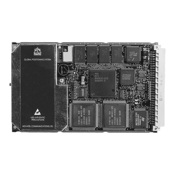
3 Installation 3.4.1 MOUNTING THE PRINTED CIRCUIT BOARD The MiLLennium-GLONASS GPSCard is an OEM product and therefore the printed circuit board is not enclosed in a housing structure. This allows flexibility in creating a mounting environment to suit particular product and marketing requirements. -
Page 20: Edge-View Of Connector P1 On The Millennium-Glonass
3 Installation Figure 3.2 Edge-view of Connector P1 on the MiLLennium-GLONASS PIN NUM- PIN NUMBER Description Description 1A, 1B, 4A, 7A,15A, 21A-32A DCD2 2A, 2B DSR2 3A, 5B-8B, 12A, 12B-16B, 20A, 20B VARF Reserved for future use External LNA power Measure out 5A, 6A, 13A, 14A, 26B, 27B, 30B-32B Factory use... -
Page 21: External Power
3 Installation 3.4.3 EXTERNAL POWER See Figure 3.2, Page 20 for external power input connections: • Digital ground = pins 1A/B (internally connected) • Vcc, main power (+5 V DC) = pins 2A/B (internally connected) • Optional external LNA power = pin 4B (30 V DC) and 4A (GND) See Table B.1, Page 49, for specifications concerning external power inputs. -
Page 22: Rs232C Communications
• No guarantee is made that the MiLLennium-GLONASS GPSCard will meet its performance specifications if a non-NovAtel antenna is used. It is recommended that appropriate fuses or current limiting be incorporated as a safety precaution on all power lines used. Use a sufficient gauge of wire, for example AWG 24, to ensure that the voltage at the 64-pin connector is within the MiLLennium-GLONASS GPSCard’s requirements. -
Page 23: L1 Gps/Glonass Antenna Considerations
An appropriate coaxial cable is one that is matched to the impedance of the antenna being used, and whose line loss does not exceed the recommendations shown in Table 3.2, Page 23. NovAtel offers a variety of coaxial cables to meet your single-frequency GPS/GLONASS antenna interconnection requirements. Your local NovAtel dealer can advise you about your specific configuration. -
Page 24: Operation
4 Operation OPERATION 4 OPERATION 4.1 BEFORE OPERATION Before operating the MiLLennium-GLONASS for the first time, ensure that you have followed the installation instructions of Chapter 3. The following instructions are based on a configuration such as that shown in Figure 4.1. -
Page 25: Serial Port Default Settings
GPSCard that you are using and adjusts the displays accordingly. Figure 4.2 shows a sample GPSolution screen. The Convert utility is a Windows-based utility that allows you to convert between NovAtel ASCII and binary file formats, and strips unwanted records for data file compilation. NovAtel’s Loader program is a DOS utility program designed to facilitate program and model updates. -
Page 26: Power-On
RGEA/B/D and RVSA/B data output logs (please refer to the MiLLennium Command Descriptions Manual). If a persistent error develops, please contact your local NovAtel dealer first. If the problem is still unresolved please contact NovAtel directly through any of the methods in the Customer Service section, Page 7. -
Page 27: Dos
4 Operation NOTE: Most valid commands do not echo a response to a command input; the indication that they have been accepted is a return of the port prompt from the GPSCard. VERSION, HELP and ? are the only commands that do provide a data response other than the port prompt. -
Page 28: Microsoft Windows 3.1 Or Higher
4 Operation C:\GPS> The GPSCard is now initialized with the contents of the BOOT1.TXT command file, and logging is directed from the GPSCard’s COM2 port to the remote terminal. 4.3.3 MICROSOFT WINDOWS 3.1 OR HIGHER As any text editor or communications program can be used for these purposes, the use of Windows 95 is described only as an illustration. - Page 29 4 Operation 82. For details on Special Data Input Commands, see Page 30. NOTE: You will find the HELP command a useful tool for inquiring about the various commands available. The following rules apply when entering commands from a terminal keyboard: •...
-
Page 30: Special Data Input Commands
Bit 16 for GPS and Bit 28 for GLONASS in the receiver status word. See Table H.2, Page 96, for more information. There are no specific NovAtel log option commands to independently specify output of ionospheric or UTC parameters. These parameters will always output following the GPS almanac $ALMA log and will be identified by a $IONA and $UTCA header respectively. - Page 31 4 Operation 4.5.1.2 Almanac Data Input Types The GPSCard has the capability to accept injection of previously logged NovAtel-format ASCII almanac data ($ALMA, $GALA, $IONA, and $UTCA). The GPSCard will interpret this log data as special data input commands. This provides the user with the advantage of being able to inject recent almanac data into non-volatile memory, for example after a FRESET where the almanac information has been erased, without having to wait the 5 - 12.5 minutes described in above paragraphs.
- Page 32 4 Operation $GALA... Use this special data input command to quickly update the MiLLennium-GLONASS GPSCard GLONASS almanac tables following a system restart. It is generated from a MiLLennium-GLONASS GPSCard GALA log and is accepted as the following format: $GALA,993,151144.24,993,114250.25,3,21,1,3.86373E+004,3.12420055E+000,4.37933539E-002,2.68745422E-003, -2.9627880E+000,-2.6559473E+003,4.88281250E-004,-2.3651123E-004*01 (one record for each valid satellite) $GALA,993,151144.24,993,115025.72,24,1,0,3.94127E+004,3.12265458E+000,4.52344569E-002,2.80475616E-003, -3.0648936E+000,-2.6519570E+003,0.00000000E+000,0.00000000E+000*18...
-
Page 33: Differential Corrections Data
NovAtel GPSCards can utilize the special data input commands $RTCA and $RTCM. These special data input commands are utilized by a GPSCard operating as a remote station to accept NovAtel ASCII format differential corrections. The data is generated by a GPSCard operating as a reference station with intent to be received by remote stations. -
Page 34: Logs Common To All Gpscards
4 Operation 4.6 LOGS COMMON TO ALL GPSCARDS The MiLLennium-GLONASS GPSCard receiver is capable of generating many NovAtel-format output logs, in either ASCII or binary format. Please refer to the MiLLennium Command Descriptions Manual’s Logs Chapter for a complete list of logs categorized by function. - Page 35 4 Operation Syntax log [port],datatype,[trigger],[period],[offset],[hold] Syntax Description Example port COM1 or COM2 COM1 datatype Enter one of the valid ASCII or Binary Data Logs (see later in this chapter and Appendix H, Page 88) POSA trigger Enter one of the following triggers. ONTIME ONCE Immediately logs the selected data to the selected port once.
-
Page 36: Novatel Format Data Logs
4.6.3.1 General The NovAtel GPSCard is capable of executing more than 40 NovAtel format log commands. Each log is selectable in ASCII and Binary formats. The one exception to this rule is the RGE log, which can be logged as RGED. The “D”... - Page 37 The size of a signed or unsigned int item is the standard size of an integer on a particular machine. On a 32-bit processor (such as the NovAtel GPSCard), the int type is 32 bits, or 4 bytes. The int types all represent signed values unless specified otherwise. Signed integers are represented in two’s-complement form.
-
Page 38: Nmea Format Data Logs
4 Operation 4.6.4 NMEA FORMAT DATA LOGS 4.6.4.1 General The NMEA log structures follow format standards as adopted by the National Marine Electronics Association (NMEA). The reference document used is "Standard For Interfacing Marine Electronic Devices NMEA 0183 Version 2.20". For further information, refer to the MiLLennium Command Descriptions Manual, Appendix F, Standards and References. -
Page 39: Differential Position Operation
The ‘GP’ log types (i.e. GPGLL) will still be accepted to support backwards compatibility but the output will always conform to the NMEA specification with respect to the output prefix. Table 4.1 NMEA Messages Supported By The MiLLennium-GLONASS GPSCard NovAtel Log Type NMEA Message Identifier Description... -
Page 40: Pseudorange (Psr) Differential Positioning
The MiLLennium-GLONASS GPSCard also supports the NovAtel ASCII and Binary versions of the new RTCM Type 31 and 34 messages. These are of the same form but are wrapped in a NovAtel header and checksum. The ASCII version has the RTCM data portion converted to hexadecimal before transmission. -
Page 41: Real-Time Kinematic (Rtk) Differential Positioning
4 Operation 4.7.2 REAL-TIME KINEMATIC (RTK) DIFFERENTIAL POSITIONING Available as an option on the MiLLennium-GLONASS GPSCard is R10 positioning which makes use of the precise carrier-phase measurement. This implementation is similar to the RT20 software available on the standard MiLLennium GPSCard but has been augmented to allow the use of GLONASS satellites. The position accuracy achievable with RT10 positioning is substantially greater than PSR differential positioning. -
Page 42: Monitoring Your Rtk Output Data
4 Operation Reference Station initialization fix position lat, lon, height, station ID log comn,rtcaref,ontime,interval log comn,rtcaobs2,ontime,interval example: fix position 51.11358042,-114.04358013,1059.4105,”RW34” log com1, rtcaref, ontime, 10 log com1, rtcaobs2, ontime, 2 Remote Station initialization accept comn, rtca example: accept com2, rtca Once initialized, the RTK system is ready to go. -
Page 43: Integrity Algorithm
The integrity algorithm in the NovAtel MiLLennium-GLONASS card does not use this minimum detectable blunder concept but will check for any satellite failure based on the strength of the current satellite geometry. -
Page 44: Firmware Updates And Upgrades
The first step in updating your receiver is to contact your local NovAtel dealer. Your dealer will assist you in selecting the best update option that suits your specific combined GPS/GLONASS needs. If your needs are still unresolved after seeing your dealer then you can contact NovAtel directly through any of the methods described in the Customer Service section, Page 7, at the beginning of this manual. -
Page 45: Updating Using The Loader Utility
FTP site (http\\www.novatel.ca), or via e-mail (support@novatel.ca). If transferring is not possible, the file can be mailed to you on floppy disk. For more information on how to contact NovAtel Customer Service please see Page 7 at the beginning of this manual. -
Page 46: Using The Loader Utility
5 Firmware Updates and upgrades 5.1.2.2 Using the LOADER Utility The Loader utility can operate from any DOS directory or drive on your PC. The program is comprised of three parts: Program Card (authorization procedure), Setup (communications configuration) and Terminal (terminal emulator). -
Page 47: Aanti-Static Practices
A Anti-Static Practices ANTI-STATIC PRACTICES A ANTI-STATIC PRACTICES This appendix only applies if you are handling a MiLLennium-GLONASS GPSCard without a ProPak II enclosure or a PowerPak II enclosure. If you purchased either enclosure then the sections that follow are not applicable. A.1 OVERVIEW Static electricity is electrical charge stored in an electromagnetic field or on an insulating body. -
Page 48: Prime Static Accumulators
A Anti-Static Practices could act as a “lightning rod”, funneling the entire charge into the components inside the bag. • Do not allow chargeable plastics, such as binders, within 0.6 m of unshielded PCBs. • Do not allow a PCB to come within 0.3 m of a computer monitor. A.3 PRIME STATIC ACCUMULATORS Table A.1 provides some background information on static-accumulating materials. -
Page 49: Btechnical Specifications
B Technical Specifications TECHNICAL SPECIFICATIONS B TECHNICAL SPECIFICATIONS B.1 MILLENNIUM-GLONASS GPSCARD Table B.1 MiLLennium-GLONASS GPSCard Specifications PHYSICAL Size 100.00 x 179.27 x 18.09 mm with connectors; Eurocard format Weight 175 grams MECHANICAL DRAWINGS Figure B.1 OEM5 Board Dimensions All dimensions in millimeters followed by inches GPS/GLONASS Receiver User Manual Rev 1... -
Page 50: B.2 L1/L1 Series Side & End Views
B Technical Specifications Table B.1 MiLLennium-GLONASS GPSCard Specifications Figure B.2 L1/L1 Series Side & End Views All dimensions in millimeters followed by inches GPS/GLONASS Receiver User Manual Rev 1... - Page 51 B Technical Specifications Table B.1 MiLLennium-GLONASS GPSCard Specifications (continued) ENVIRONMENTAL Operating Temperature -40°C to +85°C Storage Temperature -45°C to +95°C Humidity 95% non-condensing (max.) Altitude Sea level to 5000 m [may operate above 5000 m in a controlled environment, however is not certified as such] ACCELERATION Acceleration...
- Page 52 B Technical Specifications Table B.1 MiLLennium-GLONASS GPSCard Specifications (continued) PERFORMANCE (Subject To GPS and GLONASS System Characteristics) Frequency (L1) GPS = 1575.42 MHz (± 0.5) GLONASS = 1602 - 1615.5 MHz Codes tracked C/A codes Channels 10 GPS, 6 GLONASS (10 GPS, 8 GLONASS channel configuration is an option) Re-acquisition 1.5-5 s typical Computed Position Update Rate...
-
Page 53: 64 Pin I/O Connector Description
Input, power supply Reserved for future use LNA_PWR Optional external power to antenna other than a standard Digital Ground NovAtel GPS/GLONASS antenna (jumper plug P301 must be correctly set) For factory use only For factory use only Digital Ground DTR1... -
Page 54: C Common Unit Conversions
C Common Unit Conversions COMMON UNIT CONVERSIONS C COMMON UNIT CONVERSIONS Section C.1 to C.4 list commonly used equivalents between the SI (Système Internationale) units of weights and measures used in the metric system, and those used in the imperial system. A complete list of hexadecimal values with their binary equivalents is given in Section C.5 while an example of the conversion from GPS time of week to calendar day is shown in Section C.6. - Page 55 C Common Unit Conversions C.6.1 CALENDAR DATE TO GPS TIME Example: Days from January 6, 1980 to January 28, 2005 = 6 years x 365 days /year = 9125 days Add one day for each leap year (a year is a leap year if it is divisible by 4 but not by 100, except for years that are divisible by 400) 7 days Days into 2005 (28th is not finished)
-
Page 56: D Functional Overview
GLONASS antenna. Note that the antenna self-test will return a “fail” condition if a passive antenna is used (for further information on self-test status codes, please see RVSA/B log, Page 109). NovAtel active antennas are GPS/GLONASS Receiver User Manual Rev 1... - Page 57 Both models have an environmentally-sealed radome. NovAtel also offers high-quality coaxial cable in standard 5 (Model C005), 15 (Model C015) and 30 m (Model C030) lengths. These come with a TNC male connector at each end. Should your application require the use of cable longer than 30 m you will find the application note Extended Length Antenna Cable Runs at our website, http://www.novatel.ca, or you may obtain it from NovAtel Customer Service directly, see Page 7.
- Page 58 MiLLennium-GLONASS GPSCard presents information to you in the form of pre-defined logs in a number of formats. In addition, when a MiLLennium-GLONASS GPSCard is linked to a NovAtel GPSCard receiver or second MiLLennium-GLONASS GPSCard for differential positioning, they can communicate directly through their serial ports.
-
Page 59: E Propak Ii Enclosure
Model C005, C015, or C030 (5, 15 or 30 m lengths) coaxial cable - to connect the GPS/ GLONASS antenna to the ProPak II enclosure • 33.5 cm or 75 cm 4-pin LEMO plug to 4-pin LEMO plug connector (NovAtel part numbers 01016724 and 01016725 respectively) •... -
Page 60: Propak Ii Enclosure Front End-Cap
E ProPak II Enclosure E.1.2 CONNECTIONS AND INDICATORS The ProPak II enclosure features front and rear end-caps (Figure E.2 and Figure E.3), each with appropriate indicator lights and connectors. The front end-cap indicator glows red when power is on, and green when a valid position is computed. -
Page 61: Propak Ii Enclosure Specifications
E ProPak II Enclosure E.2 SPECIFICATIONS Only those specifications which differ from the MiLLennium-GLONASS GPSCard (see Table B.1, Page 49) will be shown in Table E.1. Table E.1 ProPak II Enclosure Specifications PHYSICAL Size: 251 mm x 130 mm x 62 mm Weight: 1.3 kg ENVIRONMENTAL... -
Page 62: Propak Ii Enclosure
E ProPak II Enclosure E.3 HARDWARE CONFIGURATION Installing the ProPak II enclosure is a straightforward process. As shown in Figure E.4, a minimum configuration is established with the following setup: • Set up the GPS/GLONASS antenna, see GPS/GLONASS Antenna Considerations, Page 23. •... - Page 63 It accepts a single input voltage between the range +10 to +36 V DC, which can be supplied either from an automotive DC source or by the optional auto-ranging AC/DC converter (NovAtel part number GPS-APRO) which operates over a range of 110 - 220 V AC and 50 - 60 Hz. The power input is reverse- polarity protected.
- Page 64 E.3.3.1 I/O Strobe Port Cable The I/O strobe lines can be accessed by inserting the 8 pin LEMO connector of the I/O strobe port cable (NovAtel part number 01016330) into the I/O port. The other end of the cable is provided without a connector so that you can provide an application-specific one;...
- Page 65 E ProPak II Enclosure E.3.3.1.1 I/O Strobe Port Cable (NovAtel part number 01016330) LEMO Pin Number Pin Description Wire Color Code Pin 1 VARF, variable frequency Brown Pin 2 1 PPS, one pulse per second Black Pin 3 MSR, measure output...
- Page 66 E ProPak II Enclosure E.3.3.2.1 Straight Serial Cable - receiver to PC (NovAtel part number 01016383) LEMO Pin Number RS232C Signal Wire Color Code DE9P Pin Number Pin 1 Brown Pin 1 Pin 2 Black Pin 2 Pin 3 Pin 3...
- Page 67 E ProPak II Enclosure E.3.3.2.2 Null-modem Serial Cable - Receiver to radio (NovAtel part number 01016329) LEMO Pin Number RS232C Signal Wire Color Code DE9S Pin Number Pin 1 Brown Pin 4 Pin 2 Black Pin 3 Pin 3 Pin 2...
- Page 68 Optional 4-pin LEMO socket connector to auto-ranging AC/DC converter, and AC power cord (NovAtel part number GPS-APRO) • Optional 33.5 cm or 75 cm 4-pin LEMO plug to 4-pin LEMO plug connector (NovAtel part numbers 01016724 and 01016725 respectively) E.3.3.3.1 Input Power Cable (NovAtel part number 01016331)
- Page 69 Female LEMO plug AC plug Auto-ranging AC/DC converter Red marker at top of connector AC socket E.3.3.3.4 Straight Power Cable In 33.5 cm and 75 cm lengths (NovAtel part numbers 01016724 and 01016725 respectively) 1 (-) 4 (-) 2 (+)
-
Page 70: Battery Assembly
E.4.1 BATTERY ASSEMBLY (NOVATEL PART NUMBER 01016698) The optional NovAtel battery for the ProPak-II (NovAtel part number 01016698), see Figure E.5, has been selected to offer the best compromise between availability, ease of maintenance and duration of operation. It should be handled with care, and prevented from being severely knocked or dropped. - Page 71 E ProPak II Enclosure DISPOSAL: Sealed lead-acid batteries are considered as Hazardous Waste by most local and Federal Waste Control Boards and must be disposed of properly. This means that spent batteries must be taken or shipped to an appropriate disposal site. Contact your local battery dealers or Waste Control authority to find out the specific regulations in your area concerning battery disposal.
- Page 72 E ProPak II Enclosure E.4.1.2 BATTERY CARE • Do not disassemble the battery, as its strong acid electrolyte may burn your skin. • Do not short the battery as it can burn the connections, wires, and could damage the equipment. •...
-
Page 73: Fpowerpak Ii Enclosure
The PowerPak II enclosure, see Figure F.1, is intended to be used with the following NovAtel accessories and options: •... -
Page 74: Powerpak Ii Enclosure Front Panel
F PowerPak II Enclosure • an electrostatic discharge (ESD) wrist grounding strap • an external automotive cigarette-lighter power adapter • a RS232C Y-type null-modem cable to facilitate communications with a PC • (Optional) an autoranging AC to DC power converter •... -
Page 75: Powerpak Ii Enclosure Specifications
F PowerPak II Enclosure F.2 SPECIFICATIONS Only those specifications which differ from the MiLLennium-GLONASS GPSCard, see Table B.1, Page 49, will be shown in Table F.1. Table F.1 PowerPak II Enclosure Specifications INPUT/OUTPUT CONNECTORS Power 2.1 mm plug, centre positive (+10 to +36 V DC), with screw-on retaining nut External Oscillator Input SMB male jack Frequency: 5MHz or 10 MHz CW... -
Page 76: F.3 Typical Powerpak Ii Enclosure Installation Configuration
F PowerPak II Enclosure F.3 HARDWARE CONFIGURATION Installing the PowerPak II enclosure is a straightforward process. As shown in Figure F.3, Page 76, a minimum configuration is established with the following setup: • Set up the GPS/GLONASS antenna, see GPS/GLONASS Antenna Considerations, Page 23. •... - Page 77 It accepts a single input voltage between the range +10 to +36 V DC, which can be supplied either from an automotive DC source or by the optional auto-ranging AC/DC converter (NovAtel part number GPS-APRO) which operates over a range of 110 - 220 V AC and 50 - 60 Hz. The power input is reverse- polarity protected.
-
Page 78: F.4 Opening The Powerpak Ii Enclosure
F PowerPak II Enclosure Figure F.4 Opening the PowerPak II Enclosure Reference Description Reference Description Back panel GPSCard 64 pin connector P1 Front panel Second slot from top Remove screws Spacer bumper GPSCard Second slot from bottom Back plane PCB Antenna cable Ground wire with connector Power fuse... - Page 79 The RS232C Y-type null-modem cable, 10-pin LEMO plug to 9-pin D-connector (DE9S socket), is used to connect the receiver to a serial (RS232C) communication port on a terminal or computer. Its NovAtel part number is 60715062. Please see section F.3.3.2.1 for a drawing of this cable.
- Page 80 F PowerPak II Enclosure F.3.3.2.1 RS232C Y-type Null-Modem Cable (NovAtel part number 60715062) This serial data cable supplied with the PowerPak II provides a means of communications with a personal computer. As shown in the following figure, the cable is equipped with a 9-pin connector at the PowerPak II end which can be plugged into either COM1 or COM2.
- Page 81 F PowerPak II Enclosure The EXTERNALCLOCK FREQUENCY command sets the GPSCard to accept either 5 MHz or 10MHz external oscillator frequency. Command External Oscillator Frequency EXTERNALCLOCK FREQUENCY 5 5 MHz EXTERNALCLOCK FREQUENCY 10 10 MHz For more information on the EXTERNALCLOCK command refer to the MiLLennium Command Descriptions Manual.
-
Page 82: G Glonass Commands
G GLONASS Commands GLONASS COMMANDS G GLONASS COMMANDS G.1 GLONASS-SPECIFIC COMMANDS This chapter describes MiLLennium-GLONASS GPSCard commands important to GLONASS. GLONASS-specific commands are generated by using information obtained from the GLONASS satellite system. Please see the following sections for definitions of these commands. G.1.1 DGLOTIMEOUT The differential GLONASS time out (DGLOTIMEOUT) command’s function is to set the maximum age of differential data that will be accepted when operating as a remote station. - Page 83 PZ90 to WGS84. Example: PZ90TOWGS84 DEFAULT PZ90TOWGS84 SET 0.1,0.4,-0.3,6,0,0,4 NOTE: The format and sign conventions in this command are set up to conform to the given reference and differ from the NovAtel USERDATUM command. GPS/GLONASS Receiver User Manual Rev 1...
-
Page 84: Other Relevant Gpscard Commands
SLOT and FREQUENCY are in the range 1 to 24 inclusive G.2.1 ASSIGN The ASSIGN command for Glonass channels will accept a standard NovAtel Glonass satellite identifier (i.e. frequency*10000 + slot + 37). The search is done by frequency and not by slot number which is ignored by the ASSIGN command. - Page 85 G GLONASS Commands G.2.4 COMn_DTR This command enables versatile control of the DTR handshake line [control (high, low or toggle), active (high or low), lead time and tail time] for use with output data logging in conjunction with external devices such as a radio transmitter.
-
Page 86: G.1 Illustration Of Magnetic Variation & Correction
G GLONASS Commands G.2.7 MAGVAR Two field options are included; a standard deviation field and an auto field. The MiLLennium-GLONASS GPSCard computes directions referenced to True North. Use this command (magnetic variation correction, see Figure G.1, Page 86) if you intend to navigate in agreement with magnetic compass bearings. -
Page 87: Unimplemented Commands
G GLONASS Commands G.2.8 SAVECONFIG This command saves your present configuration in non-volatile memory. Example: SAVECONFIG G.2.9 SETNAV This command permits entry of one set of navigation waypoints. The origin (FROM) and destination (TO) waypoint coordinates entered are considered on the ellipsoidal surface of the current datum (default WGS84). -
Page 88: H Novatel Format Logs
H NovAtel Format Logs NOVATEL FORMAT LOGS H NovAtel FORMAT LOGS H.1 GLONASS-SPECIFIC LOGS GLONASS-specific logs provide data by using information obtained from the GLONASS satellite system. Following are the descriptions of MiLLennium-GLONASS GPSCard’s CALA/B, GALA/B, GCLA/B and GEPA/ B logs. The syntax and fields are as described below. - Page 89 H NovAtel Format Logs CALB Format: Message ID = 87 Message byte count = 32 + (16 * 32) Field # Data Bytes Format Units Offset Sync char Checksum char Message Id integer Message byte count integer bytes Week number...
-
Page 90: Message Byte Count
H NovAtel Format Logs GALB Format: Message ID = 78 Message byte count = 112 Field # Data Bytes Format Units Offset Sync char Checksum char Message Id integer Message byte count integer bytes Week number integer weeks Seconds of week... - Page 91 H NovAtel Format Logs H.1.3 GCLA/B CLOCK INFORMATION This log contains the time difference information between GPS and GLONASS time as well as status flags. The status flags are used to indicate the type of time processing used in the least squares adjustment. GPS and GLONASS time are both based on the Universal Time Coordinated (UTC) time scale with some adjustments.
-
Page 92: Char 1 Char
H NovAtel Format Logs GCLB Format: Message ID = 88 Message byte count = 68 Field # Data Bytes Format Units Offset Sync char Checksum char Message Id integer Message byte count integer bytes Week number integer weeks Seconds of week... - Page 93 H NovAtel Format Logs H.1.4 GEPA/B EPHEMERIS INFORMATION GLONASS ephemerides are referenced to the Parametry Zemli 1990 (PZ-90) geodetic datum, and GLONASS ephemeris information is available through the GEPA/B log. GLONASS coordinates are reconciled internally through a position filter and output to WGS84. Refer to the SVDA/B log in the MiLLennium Command Descriptions Manual for information on WGS84.
-
Page 94: Glonass Ephemeris Flags Coding
H NovAtel Format Logs Example: $GEPA,991,496487.00,991,495913.00,10787,4,12,83,0,-2.102581933593754E+007 -1.216645166015627E+007,7.7982763671875110E+006,-9.655075073242192E+002 -5.014476776123048E+002,-3.387468338012698E+003,-1.862645149230957E-006 9.3132257461547851E-007,-9.313225746154785E-007,-3.913920372724533E-004 7.2759576141834267E-012,73800,0,13,*49,[CR][LF] GEPB Format: Message ID = 77 Message byte count = 156 Field # Data Bytes Format Units Offset Sync char Checksum char Message Id integer Message byte count integer bytes... -
Page 95: Other Relevant Gpscard Logs
H NovAtel Format Logs Table H.1, Bits 0 - 1: P1 Flag Range Values State Description 0 minutes 30 minutes 45 minutes 60 minutes H.2 OTHER RELEVANT GPSCARD LOGS Please refer to the MiLLennium Command Descriptions Manual’s logs chapter for a list of GPSCard logs categorized by function. -
Page 96: H.2 Receiver Self-Test Status Codes
3. Bits 1, 5, 11: Refer to the primary L1 RF/digital path (For GPS). 4. BIts 17-19: Refer to the secondary L1 RF/digital path (For GLONASS). 5. Bit 29: Is used by the NovAtel "GPS Time Simulator" firmware. GPS/GLONASS Receiver User Manual Rev 1... - Page 97 Bit 4 If this bit is set to 0, one or both of the DSP chips has failed self-test; please contact NovAtel Customer Service. This bit will be set to 1 when the digital signal processors (DSP) have passed the self-test requirements.
- Page 98 If this bit is continuously set clear, and you cannot identify an external cause for the failed test, please contact NovAtel Customer Service. When set to 1, the Secondary ARG circuits are operating within a normal range of control.
-
Page 99: Channel Tracking Status
H NovAtel Format Logs Bit State Description Bit 23 Position Solution Invalid Valid position computed Position solution is not valid Bit 24 Position Fixed Position has not been fixed. A fix position command has been accepted Bit 25 Clock Model Invalid... -
Page 100: H.4 Gpscard Range Reject Codes
H NovAtel Format Logs Table H.3, Bits 0 - 3: Channel Tracking State State Description L1 Idle L1 Sky search L1 Wide frequency band pull-in L1 Narrow frequency band pull-in L1 Phase-lock loop L1 Re-acquisition L1 Steering L1 Frequency-lock loop Higher numbers are reserved for future use Table H.3, Bits 12-14: Correlator Spacing... - Page 101 H NovAtel Format Logs H.2.1 ETSA/B EXTENDED CHANNEL TRACKING STATUS This log provides channel tracking status information for each of the MiLLennium-GLONASS GPSCard parallel channels. NOTE: This log is intended for status display only; since some of the data elements are not synchronized together, they are not to be used for measurement data.
-
Page 102: Navigation Status
H NovAtel Format Logs H.2.2 NAVA/B WAYPOINT NAVIGATION DATA This log reports the status of your waypoint navigation progress. It is used in conjunction with the SETNAV command. REMEMBER: The SETNAV command must be enabled before valid data will be reported from this log. -
Page 103: H.1 Navigation Parameters
H NovAtel Format Logs Figure H.1 Navigation Parameters Reference Description Reference Description FROM, lat-lon Current GPS position TO, lat-lon Current distance and bearing from F to D Great circle line drawn between Xtrack perpendicular reference point FROM A lat-lon and TO B lat-lon... - Page 104 H NovAtel Format Logs H.2.4 PRTKA/B COMPUTED POSITION This log contains the best available position computed by the receiver, along with three status flags. In addition, it reports other status indicators, including differential lag, which is useful in predicting anomalous behavior brought about by outages in differential corrections.
- Page 105 H NovAtel Format Logs PVAA Structure: $PVAA week seconds Pos-x Pos-y Pos-z Vel-x Vel-y Vel-z Acc-x Acc-y Acc-z Pos-status Vel-status Acc-status [CR][LF] NOTE: 0 = bad; 1 = good Example: $PVAA,991,428492.00,-1634529.404,-3664640.553,4942523.994,0.114,-0.462,0.228,-0.159,0.983,-0.955,1,1,1*23 H.2.6 RCCA RECEIVER CONFIGURATION This log outputs a list of all current GPSCard command settings. It will include MiLLennium-GLONASS GPSCard configurations.
- Page 106 H NovAtel Format Logs H.2.7 RGEA/B/D CHANNEL RANGE MEASUREMENTS The receiver supports differential combined GPS/GLONASS, RT-10 GPS/GLONASS and most single-point logs and commands described in the MiLLennium Command Description Manual. GLONASS pseudorange data is transmitted along with the GPS pseudoranges in the RGEA/B/D log, and can be discerned by monitoring the channel tracking status bits in the range logs.
-
Page 107: H.6 Range Record Format (Rged Only)
H NovAtel Format Logs Table H.6 Range Record Format (RGED only) Data Bit(s) from first to last Length(bits) Format Scale Factor 0..5 integer 6..10 integer (20+n)dB-Hz C/No 11..31 integer 1/32 s Lock time 32..63 integer 2’s comp. 1/256 cycles Doppler frequency 68..95... - Page 108 H NovAtel Format Logs H.2.8 RTKA/B COMPUTED POSITION - TIME MATCHED This log represents carrier phase positions that have been computed from time matched reference and remote observations. There is no reference station prediction error on these positions, but because they are based on buffered measurements, they lag real time by some amount depending on the latency of the data link.
- Page 109 H NovAtel Format Logs H.2.9 RTKOA/B RTK SOLUTION PARAMETERS This is the “RTK output” log, and it contains miscellaneous information regarding the RTK solution. It is based on the matched update. Note that the length of the log messages will vary depending on the number of matched satellites in the solution, a quantity represented by #sv in the field numbers.
- Page 110 H NovAtel Format Logs H.2.11 SATA/B SATELLITE SPECIFIC DATA This log provides satellite specific data for satellites actually being tracked. The SATA example was produced using MiLLennium-GLONASS GPSCard. The record length is variable and depends on the number of satellites.
-
Page 111: Velocity Status
H NovAtel Format Logs H.2.13 VLHA/BVELOCITY, LATENCY, & DIRECTION OVER GROUND The actual speed and direction of the antenna over ground is provided. The VLHA/B log provides a measure of the latency in the velocity time tag and a new velocity status word which gives you quality velocity information. The velocity status indicates varying degrees of velocity quality. -
Page 112: Position Type
H NovAtel Format Logs Table H.9 Position Type State Description No position Single point position Differential pseudorange position (GPS) RT-20 position (GPS) RT-2 position (GPS) WAAS position solution Differential combined GPS/GLONASS DGPS with uncorrected GLONASS RT-10 GPS/GLONASS Reserved Reserved Differential pseudorange position (GLONASS) -
Page 113: Searcher Status
H NovAtel Format Logs Table H.12 Searcher Status Searcher Status Definition No search requested Searcher buffering measurements Currently searching Search decision made Hand-off to L1 and L2 complete Higher numbers are reserved for future use Table H.13 RTK Status RTK Status... -
Page 114: I Gps/Glonass Glossary Of Terms
I GPS/GLONASS Glossary of Terms GPS/GLONASS GLOSSARY OF TERMS I GPS/GLONASS GLOSSARY OF TERMS ASCII — A 7 bit wide serial code describing numbers, upper and lower case characters, special and non-printing characters. Accuracy — The degree of conformance between the estimated or measured position, time, and/or velocity of a GPS receiver and its true time, position, and/or velocity as compared with a constant standard. - Page 115 I GPS/GLONASS Glossary of Terms Bandwidth — The range of frequencies in a signal. Bearing — the horizontal direction of one terrestrial point from anther terrestrial point, expressed as the angular distance from a reference direction, usually measured from 000° at the reference direction clockwise through 360°.
- Page 116 I GPS/GLONASS Glossary of Terms Cross Track Error (XTE) — the distance from the vessel’s present position to the closest point on a great circle line connecting the current waypoint coordinates. If a track offset has been specified in the GPSCard SETNAV command, the cross track error will be relative to the offset track great circle line.
- Page 117 I GPS/GLONASS Glossary of Terms ECEF — Earth-Centered-Earth-Fixed. This is a coordinate-ordinate system which has the X-coordinate in the earth's equatorial plane pointing to the Greenwich prime meridian, the Z-axis pointing to the north pole, and the Y-axis in the equatorial plane 90° from the X-axis with an orientation which forms a right-handed XYZ system.
- Page 118 I GPS/GLONASS Glossary of Terms Global Positioning System (GPS) — full name NAVSTAR Global Positioning System, a space-based radio positioning system which provides suitably equipped users with accurate position, velocity and time data. When fully operational, GPS will provide this data free of direct user charge worldwide, continuously, and under all weather conditions.
- Page 119 Obscuration — term used to describe periods of time when a GPS receiver’s line-of-sight to GPS satellites is blocked by natural or man-made objects. Observation — an input to an estimation algorithm. The two observations used in NovAtel’s RTK algorithms are the pseudorange measurement and the carrier phase measurement.
- Page 120 I GPS/GLONASS Glossary of Terms Observation Set — a set of GPSCard measurements taken at a given time which includes one time for all measurements, and the following for each satellite tracked: PRN number, pseudorange or carrier phase or both, lock time count, signal strength, and channel tracking status. Either L1 only or L1 and L2 measurements are included in the set.
- Page 121 GPS positions. (The terms rover and remote are interchangeable.) RT-10 — NovAtel’s Double Differencing Technology for real-time kinematic (RTK) carrier phase floating ambiguity resolution. RTCA — Radio Technical Commission for Aeronautics, an organization which developed and defined a message format for differential positioning.
- Page 122 I GPS/GLONASS Glossary of Terms SV — Space Vehicle ID, sometimes used as SVID; also used interchangeably with Pseudo-Random Noise Number (PRN). SEP — spherical error probable; a sphere’s radius, centered at the true antenna position, containing 50 percent of the points in the three-dimensional scatter plot. Static —...
- Page 123 I GPS/GLONASS Glossary of Terms WGS84 — World Geodetic System 1984 is an ellipsoid designed to fit the shape of the entire Earth as well as possible with a single ellipsoid. It is often used as a reference on a worldwide basis, while other ellipsoids are used locally to provide a better fit to the Earth in a local region.
-
Page 124: J Gps/Glonass Glossary Of Acronyms
J GPS/GLONASS Glossary of Acronyms GPS GLOSSARY OF ACRONYMS J GPS/GLONASS GLOSSARY ACRONYMS 1PPS: One Pulse Per Second HTDOP Horizontal position and Time Dilution Two Dimensional Of Precision 2DRMS Twice distance RMS Hertz 3DThree Dimensional Integrated Circuit Analog-to-Digital Interface Control Document Accumulated Doppler Range IERS International Earth Rotation Service... - Page 125 J GPS/GLONASS Glossary of Acronyms Aviation Services RTCM Radio Technical Commission for Maritime Services Real Time Kinematic Request To Send Received Data Selective Availability SCAT-I Special Category I Spherical Error Probable Signal-to-Noise Ratio Standard Positioning Service Space Vehicle Space Vehicle Number TCXO Temperature Compensated Crystal Oscillator...
-
Page 126: K Replacement Parts And Accessories
Optional PowerPak II enclosure Cigarette lighter power adapter 01014989 Y-type null modem cable 60715062 Optional AC/DC power converter GPS-APWR Optional NovAtel GPS/GLONASS antennas Model 504 (L1 only) GPS-504 Model 514 Aviation Antenna (L1 only) GPS-514 Optional RF Antenna Cable 5 meters... -
Page 127: L Index
L Index INDEX L INDEX channel 52, 57, 63, 95, 99, 100, 101, 106, 116, 120, 121 tracking 95, 100, 101 Numerics channels 101, 116, 120, 121 chatter 31 1PPS 52, 124 checksum 33, 36, 115, 117, 119 output 53 clock 11, 13, 17, 51, 53, 56, 97, 99, 106, 116–117, 120 2D 116, 122, 124 offset 13, 120... - Page 128 L Index ephemerides 10, 11 LNA 17, 20, 21, 22, 51, 53, 56, 57, 61, 75, 84, 97, 98, 124 ephemeris 11, 100, 117, 121, 124 longitude 10, 116, 117, 119, 120 equipment configuration 18 loop control 57 errors 98, 106, 116, 118, 121 extended cable lengths 22, 23, 57 external oscillator 56 magnetic variation 86, 119...
- Page 129 L Index trigger 34, 35, 58, 108 true north 86, 114, 115, 118, 119, 122 quick start 15, 58 undulation 122 user radio frequency 56, 57, 124 datum 102 RAM 97, 124 segment 10, 11 range reject codes 95, 100 UTC 13, 30, 32, 122 raw data 52 data 30...
- Page 130 Recyclable NovAtel Inc. 1120 - 68 Avenue NE Calgary, Alberta, Canada, T2E 8S5 GPS Hotline: 1-800-NOVATEL (Canada & U.S. only) Printed in Canada on GPS Fax: (403) 295-4901 recycled paper E-mail: support@novatel.ca Web site: http://www.novatel.ca OM-20000040 Rev 1 11/18/99...
Need help?
Do you have a question about the MiLLennium OM-20000040 and is the answer not in the manual?
Questions and answers