Sign In
Upload
Manuals
Brands
Leica Manuals
GPS
GPS1200 Series
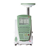
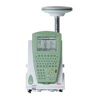
Leica GPS1200 Series Manuals
Manuals and User Guides for Leica GPS1200 Series. We have
5
Leica GPS1200 Series manuals available for free PDF download: Technical Reference Manual, Field Manual, Manual, User Manual
Leica GPS1200 Series Technical Reference Manual (1416 pages)
Brand:
Leica
| Category:
GPS
| Size: 13.91 MB
Table of Contents
Table of Contents
5
Gps1200
8
Gps1200
14
Gps1200
16
Gps1200
18
Gps1200
20
Gps1200
22
Gps1200
24
1 Equipment Setup
26
Receiver Ports
26
Post-Processed Static Reference on Pillar
30
Post-Processed Static Reference on Tripod
34
Post-Processed Kinematic, Pole and Minipack
38
Post-Processed Kinematic, All-On-Pole - Option 1
44
Post-Processed Kinematic, All-On-Pole - Option 2
48
Real-Time Reference, Single Tripod
51
Real-Time Reference, Two Tripods
55
Real-Time Reference Using Smartantenna, RX1250 and GHT56
59
Smartrover - External Radio
63
Smartrover - External Radio, Maximized Radio Coverage
67
Real-Time Rover, Pole and Minipack
71
Real-Time Rover, All-On-Pole - Option 1
77
Real-Time Rover, All-On-Pole - Option 2
80
Using the Minipack
83
Checking and Adjusting the Circular Level on the Tribrach
86
2 Antenna Heights
90
Mechanical Reference Planes, MRP
93
Determining Antenna Heights
95
Pillar Setup
95
Tripod Setup
100
Pole Setup
103
Measuring Slope Antenna Heights
105
3 Using GPS1200 Without RX1200
108
4 Using RX1250
112
Overview
112
Switching between Leica Software and Windows CE Desktop
113
Sleep Mode
115
Configuring Interfaces
116
Overview
116
Configuring Smartantenna Interface
117
Configuring Clip-On Interface
119
5 Receiver Protection with PIN
120
6 Configurable Keys
126
Hot Keys
126
USER Key
128
7 Main Menu
130
Main Menu Functions
130
Survey
133
Programs
134
Manage
136
Convert
138
Config
139
Tools
140
8 Manage
143
Accessing Job Management
143
Creating a New Job
145
Editing a Job
149
Managing Job Codes
152
9 Manage
153
Overview
156
Manage...\Data
156
Accessing Data Management
157
Point Management
162
Terminology
162
Creating a New Point
172
Editing a Point
176
Mean Page
181
Line/Area Management
188
Overview
188
Creating a New Line/Area
189
Editing a Line/Area
193
Working Example
196
Data Log
199
Point Sorting and Filters
202
Sorting and Filters for Points, Lines and Areas
202
Point, Line and Area Code Filter
211
Stakeout Filter
213
10 Manage
213
Terminology
216
Manage...\Codelists
216
Overview
223
Accessing Codelist Management
224
Creating/Editing a Codelist
226
Managing Codes
227
Accessing MANAGE Codes
227
Creating a New Code
230
Editing a Code
233
Managing Code Groups
234
11 Coding
236
Overview
236
Thematical Coding
239
Thematical Coding with Codelist
239
Thematical Coding Without Codelist
244
Free Coding
246
Free Coding Using a Codelist
246
Free Coding with Direct Input
250
Quick Coding
252
Code and Attribute Mismatch
256
Code Mismatch
256
Attribute Mismatch
258
12 Linework
260
Overview
260
Performing Linework
261
Combining Linework and Coding
266
13 Manage
274
Overview
274
Terminology
277
Accessing Coordinate System Management
280
Coordinate Systems
283
Creating a New Coordinate System
283
Editing a Coordinate System
285
Transformations
287
Accessing Transformation Management
287
Creating a New Transformation
290
Editing a Transformation
292
Ellipsoids
293
Accessing Ellipsoid Management
293
Creating a New Ellipsoid
295
Editing an Ellipsoid
296
Projections
297
Accessing Projection Management
297
Creating a New Projection
302
Editing a Projection
303
Geoid Models
304
Geoid Models Overview
304
Accessing Geoid Model Management
306
Creating a New Geoid Model from the Compactflash Card / Internal Memory
308
CSCS Models
309
14 Manage
310
Overview
310
Accessing Configuration Set Management
311
Creating a New Configuration Set
313
Initial Steps
313
Configuration Set for Static Operations
315
Configuration Set for Post-Processed Kinematic Operations
318
Configuration Set for Real-Time Reference Operations
321
Configuration Set for Real-Time Rover Operations
324
Editing a Configuration Set
327
Overview
330
Manage...\Antennas
330
15 Manage
331
Accessing Antenna Management
331
Creating a New Antenna
333
Editing an Antenna
335
16 Convert
336
Overview
336
Convert...\Export Data from Job
336
Accessing the Data Export Functionality
338
Exporting Data from a Job to a Custom ASCII Format
339
Exporting Data from a Job to Another Device
342
17 Convert
344
Overview
344
Accessing the Data Import Functionality
349
Importing Data in ASCII Format
350
Importing Data in GSI Format
352
Importing Data in DXF Format
354
18 Convert
356
19 Config
358
Config...\Survey Settings
358
ID Templates
358
ID Templates Overview
358
Accessing ID Template Configuration
360
Creating a New ID Template
362
Editing an ID Template
366
Deleting an ID Template
368
Working Example
369
Display Settings
372
Coding & Linework
378
Quality Control Settings
384
Logging of Raw Obs
387
Point Occupation Settings
393
Configuration of Point Occupation Settings
393
Working Example
405
Seismic Recording
407
Ring Buffer
410
Overview
410
Configuring and Using a Ring Buffer
412
20 Config
416
Antenna & Antenna Heights
416
Satellite Settings
419
Time Zone
424
Instrument ID
426
Set NET Parameters
428
21 Config
432
Wizard Mode
432
Hot Keys & User Menu
434
Units & Formats
438
Language
446
Display, Beeps, Text
448
Start up & Power down
452
22 Config
460
Overview
460
Accessing Configuration Interfaces
461
Real-Time
464
Overview
464
Configuration Without Real-Time Interface
466
Configuration of a Reference Real-Time Interface
467
Configuration of a Rover Real-Time Interface
479
Configuration with Digital Cellular Phone and Radio
493
Configuration of SBAS
494
Configuration of GGA Message Sending for Reference Network Applications
497
ASCII Input
501
Overview
501
Configuration of an ASCII Input Interface
502
Configuration of Annotations
504
Configuration of a Command to the Device
506
Working Example 1
507
Working Example 2
510
NMEA out
513
Export Job
521
Hidden Point
524
Tilt
532
Meteo
536
Smartantenna
537
Internet
540
PPS Output
544
Event Input
547
External Oscillator
550
ASCII Remote
553
Remote
556
23 Configuration of Devices
560
Devices
560
Overview
560
Digital Cellular Phones
561
Modems
564
Radios
566
Rs232
568
Smartgate
569
Hidden Point Measurement Devices
570
GPRS / Internet Devices
572
Accessing CONFIGURE Devices / CONFIGURE GPRS Internet Devices
574
Creating a New Device
577
Editing a Device
581
24 Config
582
Digital Cellular Phones
582
Overview
582
Configuring a GSM Connection
584
Configuring a CDMA Connection
587
Modems
590
Radios
592
Rs232
595
Smartgate Boxes
597
Hidden Point Measurement Devices
599
GPRS / Internet Devices
601
Internet / Ethernet
603
Scanning Reference Stations
607
Configuring the Stations to Dial
609
Overview
609
Accessing CONFIGURE Stations to Dial
610
Creating a New Station to Dial
612
Editing a Station to Dial
614
Configuring the Server to Connect
615
Overview
615
Accessing CONFIGURE Server to Connect
616
Creating a New Server
618
Editing a Server to Connect
619
25 Tools
620
26 Tools
622
27 Tools
626
Application Programs
626
System Languages
628
Instrument Firmware
630
28 Tools
630
Overview
632
Tools...\Calculator
632
Accessing the Calculator
633
Configuring the Calculator
634
Using the Calculator
636
RPN Mode
636
Standard Mode
639
Description of Softkeys
642
Calling and Closing the Calculator from an Input Field for Numeric Characters
647
Tools...\File Viewer
650
29 Tools
654
31 Status
658
STATUS Functions
658
STATUS: Survey
660
Satellite Status
660
Real-Time Status
665
Current Position
676
Logging Status
680
Occupation Information Status
685
STATUS: Battery & Memory
688
STATUS: System Information
692
STATUS: Interfaces
694
Real-Time Input
694
ASCII Input
695
Tilt
697
Meteo
699
Smartantenna
700
Internet
701
Event Input
702
Remote Interfaces
704
Bluetooth
706
32 Mapview Interactive Display Feature
708
Overview
708
Accessing Mapview
710
Configuring Mapview
713
Mapview Components
718
Softkeys
718
Screen Area
720
Toolbar
722
Point Symbols
723
Map Mode
724
Mapview in Map Mode
724
Selecting Points, Lines and Areas
726
Plot Mode - Mapview Screen Area
730
Survey Mode
735
Mapview in Survey Mode
735
Mapview in Staking out Survey Mode
737
Selecting Lines and Areas
740
33 Update Setups
742
Terminology
742
Procedure of Updating Setups
744
34 NTRIP Via Internet
748
Overview
748
Configuring a Real-Time Rover for Using NTRIP Service
752
Configuring an Access to the Internet
752
Configuring to Connect to a Server
755
Using the NTRIP Service with a Real-Time Rover
758
Configuring a GRX1200 Pro/Grx1200 GG Pro for Connecting a NTRIP Server
761
35 Reference Station
766
36 Application Programs - General
768
Overview
768
Accessing the Application Programs Menu
770
37 Cogo
772
Overview
772
Accessing COGO
774
Configuring COGO
783
COGO Calculation - Inverse Method
789
Inverse Point - Point
789
Inverse Point - Line
793
Inverse Point - Arc
799
Inverse Point - Current Position
806
COGO Calculation - Traverse Method
810
COGO Calculation - Traverse Method Overview
810
Traverse with Azimuth/Bearing
813
Traverse with Angle Right
818
COGO Calculation - Intersections Method
820
Intersection with Bearing - Bearing
820
Intersection with Bearing - Distance
826
Intersection with Distance - Distance
831
Intersection with by Points
834
Intersection with TPS Observation - TPS Observation
839
COGO Calculation - Line Calculations Method
843
Line Calculation - Base Point
843
Line Calculation - Offset Point
850
Line Calculation - Segmentation
852
COGO Calculation - Arc Calculations Method
856
Arc Calculation - Arc Center
856
Arc Calculation - Base Point
862
Arc Calculation - Offset Point
865
Arc Calculation - Segmentation
867
COGO Calculation - Shift, Rotate & Scale (Manual) Method
868
COGO Calculation - Shift, Rotate & Scale (Match Pts) Method
882
COGO Calculation - Area Division
888
Overview
888
Choosing an Area to be Divided
895
Dividing an Area
900
Results of the Area Division
904
Working Example
907
Selecting a Result from Previous COGO Inverse Calculations
911
Modifying Values for Azimuths, Distances and Offsets
913
38 Determine Coordinate System - General
918
Overview
918
Accessing Determine Coordinate System
930
Configuring Determine Coordinate System
933
Configuring Determine Coordinate System - Normal
933
Configuring Determine Coordinate System - One Point Localisation
939
39 Determine Coordinate System - Normal
946
Overview
946
Determining a New Coordinate System
947
Updating a Coordinate System
960
Matching Points
961
Overview
961
Selecting a New Pair of Matching Points
962
Editing a Pair of Matching Points
963
Transformation Results
964
Accessing Transformation Results
964
Results for Onestep and Twostep Transformations
965
Results for Classic 3D Transformation
967
40 Determine Coordinate System - One Point Localisation
970
Accessing Determine Coordinate System - One Point Localisation
970
Determine Coordinate System - Onestep Transformation
972
Determine Coordinate System - Twostep Transformation
984
Twostep Transformation
984
Computing the Grid Scale Factor
997
Computing the Height Scale Factor
999
Determine Coordinate System - Classic 3D Transformation
1002
Computing Required Azimuth
1006
41 Reference Line
1008
Overview
1008
Accessing Reference Line
1013
Configuring Reference Line
1016
Managing Reference Lines/Arcs
1024
Overview
1024
Manually Entering a Reference Line/Arc
1025
Selecting a Reference Line/Arc from the Job
1031
Defining Reference Line/Arc Offsets
1038
Defining Reference Line/Arc Slopes
1042
Measuring to a Reference Line/Arc
1045
Measure Points
1045
Working Example
1055
Staking to a Reference Line/Arc
1059
Stakeout Points
1059
Working Example
1071
Gridstaking to a Reference Line/Arc
1075
Gridstaking Points
1075
Working Example
1083
42 Reference Plane
1088
Overview
1088
Accessing Reference Plane
1092
Configuring Reference Plane
1095
Managing Reference Planes
1099
Measuring Points to a Reference Plane
1107
43 Stakeout
1110
Overview
1110
Accessing Stakeout
1113
Configuring Stakeout
1116
Staking out
1124
Elements of the Graphical Display in the Stakeout
1124
Staking out in Orthogonal Mode
1126
Staking out in Polar Mode
1136
Staking out a DTM
1140
Stakeout Difference Limit Exceeded
1144
44 Survey - General
1148
Accessing Survey
1148
GPS Surveying Techniques
1152
Surveying Points
1156
Post-Processed Kinematic and Static Operations
1156
Real-Time Reference Operations
1161
Real-Time Rover Operations
1171
Adding Annotations for All Types of Operations
1176
Timed Occupations for All Types of Operations
1178
Initialisation for Real-Time Rover Operations
1181
Terminology
1181
Accessing Initialisation for Real-Time Rover Operations
1183
Initialise While Moving
1185
Initialise While Static
1186
Initialise on Known Point
1188
45 Survey - Auto Points
1190
Overview
1190
Configuring Auto Points
1192
Auto Points for Post-Processed Kinematic and Real-Time
1200
Offset Points of Auto Points
1205
Overview
1205
Configuring Offset Points
1208
Working Example
1213
46 Survey - Hidden Points
1218
Overview
1218
Accessing Hidden Point Measurement
1221
Measuring Hidden Points
1223
Bearing & Distance
1223
Double Bearing
1228
Double Distance
1233
Chainage & Offset
1239
Backwards Bearing & Distance
1245
Computing an Azimuth
1247
Using the Sun
1247
Using Auxiliary Point
1249
Computing Horizontal Distances from Slope Distances
1252
Hidden Point Measurement Including Heights
1255
47 Survey Cross Section
1260
Overview
1260
Accessing Survey Cross Section
1263
Configuring Survey Cross Section
1266
Surveying Cross Sections
1269
Cross Section Templates
1275
Accessing Cross Section Template Management
1275
Creating a New Cross Section Template
1278
Editing a Cross Section Template
1284
Working Example
1285
48 Volume Calculations
1290
Overview
1290
Accessing Volumes Calculations
1292
Configuring Volume Calculations
1296
Calculating Volumes
1298
Survey Points
1298
Triangulate Surfaces
1302
Compute Volumes
1308
49 Wake-Up
1312
Overview
1312
Creating a New Wake-Up Session
1315
Editing a Wake-Up Session
1319
Appendix A Menu Tree
1320
Appendix B Memory Types
1324
Appendix C Directory Structure of the Memory Device
1326
Appendix D Pin Assignments and Sockets
1328
Receiver
1328
Smartantenna
1335
Appendix E Cables
1338
Appendix Fnmea Message Formats
1346
Overview
1346
Used Symbols for Describing the NMEA Formats
1347
GGA - Global Positioning System Fix Data
1352
GGK - Real-Time Position with DOP
1354
GGK(PT) - Real-Time Position with DOP, Trimble Proprietary
1356
GGQ - Real-Time Position with CQ
1358
GLL - Geographic Position Latitude/Longitude
1360
GNS - GNSS Fix Data
1362
GSA - GNSS DOP and Active Satellites
1364
GSV - GNSS Satellites in View
1366
LLK - Leica Local Position and GDOP
1368
LLQ - Leica Local Position and Quality
1370
RMC - Recommended Minimum Specific GNSS Data
1372
VTG - Course over Ground and Ground Speed
1374
ZDA - Time and Date
1376
Appendix J at Commands
1384
Index
1386
Advertisement
Leica GPS1200 Series Field Manual (212 pages)
System
Brand:
Leica
| Category:
Receiver
| Size: 3.41 MB
Table of Contents
Table of Contents
4
1 User Interface
7
Keyboard
7
Screen
9
Operating Principles
10
Icons
13
Symbols
19
2 Equipment Setup
21
Receiver Ports
21
Post-Processed Static Reference on Pillar
22
Real-Time Reference, Single Tripod
23
Real-Time Reference Using Smartantenna, RX1250 and GHT56
24
Smartrover - External Radio
25
Real-Time Rover, Pole and Minipack
26
Real-Time Rover, All-On-Pole
28
3 Determining Antenna Heights
29
4 Using RX1250
31
Switching between Leica Smartworx Software and Windows CE Desktop
31
Sleep Mode
32
Interface Configuration
33
Overview
33
Configuring Smartantenna Interface
34
Configuring Clip-On Interface
35
5 Receiver Protection with PIN
37
6 Manage
39
Overview
43
Manage...\Jobs
43
Creating a New Job/Editing a Job
44
Overview
47
8 Manage...\Data
47
Point Management
48
Creating a New Point/Editing a Point
48
Mean Page
52
Line/Area Management
55
Overview
55
Creating a New Line/Area/Editing a Line/Area
56
Point Sorting and Filters
59
Sorting and Filters for Points, Lines and Areas
59
Point, Line and Area Code Filter
61
Creating a New Codelist/Editing a Codelist
63
9 Manage...\Codelists
63
Creating a New Code/Editing a Code
64
10 Linework
67
Performing Linework
67
Combining Linework and Coding
70
11 Manage
73
Overview
73
Creating a New Coordinate System/Editing a Coordinate System
74
Transformations/Ellipsoids/Projections
76
Accessing Transformation/Ellipsoid/Projection Management
76
Creating/Editing a Transformation/Ellipsoid/Projection
77
Geoid/Cscs Models
79
12 Manage
81
Overview
81
Creating a New Configuration Set
82
Editing a Configuration Set
83
Overview
85
13 Manage...\Antennas
85
Creating a New Antenna/Editing an Antenna
86
14 Convert
89
Overview
89
Exporting ASCII Data
90
Exporting DXF Data
92
15 Convert
93
Overview
93
Importing ASCII/GSI Data
94
Importing DXF Data
96
16 Convert
97
17 Config
99
ID Templates
99
Overview
99
Creating a New ID Template/Editing an ID Template
100
Display Settings
101
Coding & Linework
103
Quality Control Settings
105
Logging of Raw Obs
106
Point Occupation Settings
108
18 Config
113
Antenna & Antenna Heights
113
Satellite Settings
114
Time Zone
116
Instrument ID
117
19 Config
119
Wizard Mode
119
Hot Keys & User Menu
120
Units & Formats
121
Language
124
Display, Beeps, Text
125
Start up & Power down
127
Overview
129
20 Config...\Interfaces
129
Real-Time
131
Overview
131
Configuration Without Real-Time Interface
132
Configuration of a Reference Real-Time Interface
133
Configuration of a Rover Real-Time Interface
138
Configuration of SBAS
143
Configuration of GGA Message Sending for Reference Network Applications
144
Hidden Point
146
Smartantenna
149
Internet
151
21 Configuration of Devices
153
Overview
153
Accessing CONFIGURE Devices / GPRS Internet Devices
154
Creating a New Device / Editing a Device
156
22 Config
159
Accessing Config
159
Digital Cellular Phones
160
Radios
163
Hidden Point Measurement Devices
164
GPRS / Internet Devices
165
Creating a New Station to Dial/Editing a Station to Dial
166
Creating a New Server to Connect/Editing a Server to Connect
168
23 Tools
171
Format Memory Device
171
Transfer Objects
172
Upload System Files
173
Calculator and File Viewer
174
Licence Keys
175
24 Status
177
STATUS: Survey
177
Satellite Status
177
Real-Time Status
179
Current Position
184
Logging Status
186
Occupation Information Status
189
STATUS: Battery & Memory
191
STATUS: System Information
193
STATUS: Interfaces
194
25 NTRIP Via Internet
195
Overview
195
Configuring a Real-Time Rover for Using NTRIP Service
196
Configuring an Access to the Internet
196
Configuring to Connect to a Server
198
Using the NTRIP Service with a Real-Time Rover
200
26 Menu Tree
203
Index
205
Leica GPS1200 Series User Manual (153 pages)
Leica GPS Receiver User Manual
Brand:
Leica
| Category:
GPS
| Size: 1.73 MB
Table of Contents
User Manual
1
Table of Contents
4
Gps1200
6
1 How to Use this Manual
8
2 Description of the System
12
System Components
12
Antennas Used with Receivers
14
Geo Office
15
GPS Spider
16
Software Concept
17
System Concept
17
Software Upload
18
Data Storage and Data Conversion Concept
19
Power Concept
21
Container Contents
23
Receiver Components
25
ON/OFF Button
25
3 User Interface
26
Operating Principles
26
Switching between the Software and Windows CE Desktop
27
Access Leica Software
28
Access Windows CE Desktop
28
Selecting from a Menu
29
Selecting a Page
29
Appearance and Selection from a Choicelist
30
Listbox Dialogue
31
Icons
32
Icon Description
34
4 Operation
36
Equipment Setup
36
Battery Use/Charging
38
Change Battery
39
Working with the Compactflash Card
41
Working with the Clip-On-Housings for Devices
44
Devices Fitting into a Clip-On-Housing
44
Attach a Clip-On-Housing
45
Detach a Clip-On-Housing
45
Insert a SIM Card
46
Remove a SIM Card
48
LED Indicators
50
Accessing Survey Application Program
55
Guidelines for Correct Results
58
Operation with a Typical Configuration Set
59
Static Operations
59
5 Reference Station
64
Overview
64
Equipment Setup
67
Reference Station Setup
68
Behaviour When Turning off and on
71
Behaviour after Power Failure
71
Ways of Operating
72
Getting Started with the GRX1200 Series
72
Configure a Remote Interface Connection
75
Configure a Modem Interface
76
Configure a NET Port
78
6 Care and Transport
80
Storage
81
Cleaning and Drying
82
7 Safety Directions
84
General Introduction
84
Intended Use
85
Adverse Use
85
Limits of Use
87
Responsibilities
88
International Warranty, Software Licence Agreement
89
Hazards of Use
91
Lightning Conductors
98
Air Terminal Arrangement
99
Grounding the Receiver/Antenna
100
Electromagnetic Compatibility EMC
101
FCC Statement, Applicable in U
104
Labelling
105
8 Technical Data
110
Tracking Characteristics of the Receiver
110
Supported Codes
111
Carrier Tracking
111
Code Measurements
113
Satellites Tracked
114
Accuracy
115
Dimensions
117
Weight
117
Technical Data
117
Operating Times
119
Environmental Specifications
120
PPS Output
121
Event Input
122
External Oscillator Input
122
Antennas Technical Data
123
RX1200 Technical Data
128
Conformity to National Regulations
132
Rx1250
132
Receiver
134
GFU16, Bluetooth Communication
136
GFU17, Siemens MC45
138
GFU24, Siemens MC75
140
GFU19 (US), GFU25 (CAN) CDMA Multitech MTMMC-C
142
Index
144
Advertisement
Leica GPS1200 Series User Manual (148 pages)
Brand:
Leica
| Category:
GPS
| Size: 1.95 MB
Table of Contents
Table of Contents
6
Table of Contents
8
1 Description of the System
10
System Components
10
System Concept
15
Software Concept
15
Data Storage and Data Conversion Concept
17
Power Concept
19
Container Contents
21
Receiver Components
23
2 User Interface
24
Operating Principles
24
Icons
30
3 Operation
34
Equipment Setup
34
Battery
36
Working with the Compactflash Card
39
Working with the Clip-On-Housings for Devices
43
Accessing Survey Application Program
53
Guidelines for Correct Results
56
Operation with a Typical Configuration Set
57
4 Reference Station
62
Overview
62
Equipment Setup
66
Getting Started with the GRX1200 Series
71
5 Care and Transport
80
Transport
80
Storage
81
Cleaning and Drying
82
6 Safety Directions
84
General Introduction
84
Intended Use
85
Limits of Use
87
Responsibilities
88
Hazards of Use
89
Electromagnetic Compatibility EMC
99
FCC Statement, Applicable in U
102
7 Technical Data
108
Receiver Technical Data
108
Tracking Characteristics of the Receiver
108
Accuracy
113
Technical Data
115
Antennas Technical Data
121
RX1200 Technical Data
126
Conformity to National Regulations
130
Rx1250
130
Receiver
132
GFU24, Siemens MC75
134
GFU19 (US), GFU25 (CAN), GFU26 (US) CDMA Multitech MTMMC-C
136
Leica GPS1200 Series Manual (186 pages)
Brand:
Leica
| Category:
Receiver
| Size: 1.74 MB
Table of Contents
Table of Contents
4
How to Use this Manual
6
User Interface
12
Equipment Setup
38
Determining Antenna Heights
54
Manage
58
Advertisement
Related Products
Leica GPS1200+
Leica GPS500
Leica GX1230 GG
Leica GX1230
Leica GX1210
Leica GRX1200 Classic
Leica GRX1200 Lite
Leica GRX1200 Pro
Leica GRX1200 GG Pro
Leica GS09
Leica Categories
Digital Camera
Microscope
Measuring Instruments
Laboratory Equipment
Laser Level
More Leica Manuals
Login
Sign In
OR
Sign in with Facebook
Sign in with Google
Upload manual
Upload from disk
Upload from URL