Sign In
Upload
Manuals
Brands
Furuno Manuals
Marine Radar
FAR-3220-NXT-BB
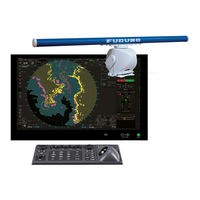
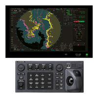
Furuno FAR-3220-NXT-BB Manuals
Manuals and User Guides for Furuno FAR-3220-NXT-BB. We have
6
Furuno FAR-3220-NXT-BB manuals available for free PDF download: Operator's Manual, Installation Manual, Instruction Manual
Furuno FAR-3220-NXT-BB Operator's Manual (556 pages)
CHART RADAR
Brand:
Furuno
| Category:
Marine Radar
| Size: 59 MB
Table of Contents
Important Notices
3
Safety Instructions
4
Table of Contents
7
Foreword
20
Signal Processing Functions
21
Program Number
22
Virus Prevention
22
Network Connection
22
Open Source Software
23
System Configurations
24
Operational Overview
31
Radar Control Unit RCU-025
31
Radar Control Unit RCU-025 Description
31
Operator Fitness
33
Trackball Control Unit RCU-026
34
Trackball Control Unit RCU-026 Description
34
Operator Fitness
34
Processor Unit EC-3000
35
How to Turn the System On/Off
36
How to Select a Color Palette
37
How to Adjust the Display Brilliance, Control Unit Backlighting
38
Manual Brilliance Adjustment
38
Control Unit Backlighting
39
Display Modes
40
How to Select a Display Mode
40
Limitations When Using the Chart Radar Mode
40
Limitations When Using Back-Up ECDIS Mode
40
Display Screens
41
Radar Display
41
Chart Radar Display
43
Chart Display
44
Status Bar
45
Status Bar for Radar, Chart Radar Mode
45
How to Operate the Buttons, Slider Bars on the Status Bar
46
Instantaccess Bar
47
How to Operate the Buttons, Slider Bars on the Instantaccess Bar
49
Sensor Information, Datum Box
50
Menu Overview
51
Basic Menu Operation
51
Menu History Feature
52
How to Enter Numeric Data
53
How to Enter Alphanumeric Character Data
53
Context-Sensitive Menus in the Radar Mode
54
Context-Sensitive Menus Available with Buttons and Boxes
54
Context-Sensitive Menus in the Display Area in the Radar and Chart Radar Modes
56
Cursor Position
57
How to Select Sensor Settings
57
How to Enter Ship Speed
58
How to Enter Heading
60
How to Mark MOB Position
61
How to Offset Position
62
How to Select Time Format, Set Local Time
62
How to Take a Screenshot of the Display
63
The Settings Menu
63
User Profiles for Radar, Chart Radar
63
How to Create a Profile
63
How to Disable a Profile
63
How to Activate a Profile
64
How to Restore a Profile to the Default Settings
64
How to Change the Settings on the Current Display to the Recommended Settings
64
How to View Chart Software Version No., Chart System Information, and Operator's Manual
67
Tips (Operational Guidance)
68
Printer Information
68
Radar, Chart Radar Operation
69
How to Transmit
69
How to Tune the Radar Receiver
69
Tuning for Magnetron Radar
69
Manual Tuning
70
Pulse Length
70
How to Select a Pulse Length
70
How to Change the Pulse Length
71
How to Adjust the Sensitivity
71
How to Suppress Sea Clutter
71
How to Reduce Sea Clutter Automatically
72
How to Reduce Sea Clutter Manually
72
How to Suppress Rain Clutter
73
How to Use the BERTHING STC Function
73
How to Reduce Rain Clutter Automatically
73
How to Reduce Rain Clutter Manually
74
Interference Rejector
75
Echo Stretch
76
Echo Averaging
76
Automatic Clutter Elimination (ACE) Function
77
How to Turn the Automatic Clutter Elimination (ACE) Function On/Off
77
How to Adjust the Gain in the Automatic Clutter Elimination (ACE) Mode
77
Automatic Clutter Elimination (ACE) Menu
77
How to Get the High Sensitivity
78
How to Suppress the False Echoes
78
Noise Rejector
79
Wiper
79
How to Preset Controls for Specific Navigation Purpose
80
How to Select a Customized Echo
82
How to Edit a Customized Echo
83
How to Restore a User Customized Echo to the Saved Settings
84
How to Restore a User Customized Echo to the Factory Default Settings
84
How to Suppress Second-Trace Echoes
84
Presentation Modes
85
How to Select a Presentation Mode
85
Description of Presentation Modes
86
How to Reset the Course-Up Automatically
88
How to Scroll the Display in True Motion Mode (B-Type Only)
88
How to Select the Range Scale
88
How to Measure the Range to a Target
89
How to Measure the Range by Using a VRM
89
How to Set VRM Attributes
90
How to Measure the Bearing to a Target
91
How to Measure the Bearing
91
How to Select Bearing Reference
92
Collision Assessment by Offset EBL
92
How to Assess Risk of Collision
92
Point of Reference for Origin Point of Offset EBL
93
How to Measure the Range and Bearing between Two Targets
94
How to Off-Center the Display
95
Target Trails
96
Target Trails-Related Indications
96
True or Relative Target Trails
96
Trail Time
97
How to Reset Target Trails
97
How to Temporarily Remove All Target Trails from the Display
97
Trail Stabilization in True Motion
97
Target Trail Attributes on the TRAIL Menu
98
Parallel Index (PI) Lines
99
How to Display, Erase a PI Line
99
How to Enable/Disable PI Lines
99
How to Adjust PI Line Orientation, PI Line Interval
100
How to Select the Number of PI Lines to Display
100
How to Select the Bearing Reference for the PI Line
100
How to Select the PI Lines Orientation
101
How to Reset PI Lines
101
How to Adjust PI Line Length
102
Zoom
103
Markers
104
Heading Line
104
Stern Marker
104
North Marker
104
Own Ship Marker
104
Vectors
105
Barge Marker
105
Antenna Marker
106
Cursor
106
Curved EBL
107
10Display Predictor
107
How to Adjust Brilliance of Screen Data
108
Watch Alert
109
Information Box
110
Information Box Contents
110
Route Information
111
How to Show the Information Box
112
How to Turn NAV Data On/Off
112
How to Output Data to the Wave Analysis Software (Option)
114
Interswitch
115
Displaying Antenna Information
115
How to Preset Antenna and Display Combinations
116
Antenna Selection Considerations
116
How to Select an Antenna
118
How to Revert to Own Antenna
118
Dual Radar
118
How to Enable or Disable the Dual Radar Display
119
Operating Considerations for the Dual Radar Display
119
Performance Monitor
121
Magnetron Reset (for A- and B-Types)
123
CCRP (Common Consistent Reference Point)
124
Drop Mark
126
How to Show, Hide the Drop Mark Box
126
How to Inscribe a Drop Mark
126
Drop Mark Bearing Reference
126
How to Erase a Drop Mark
127
Anchor Watch
127
Sart
128
What Is an SART
128
How to Receive an SART
128
Doppler Feature (X-Band Solid State Radars Only)
129
Alert Box, Alert List
130
Alert Box
130
Alert List
130
Echo Area
131
Echo Color
131
Icing Prevention
131
Shuttle Ferry
132
Chart Radar Functions
133
How to Switch between Radar and Chart Radar Modes
133
How to Show or Hide Chart Objects
133
How to Create and Recall Custom Sets of Chart Display Objects
135
Chart Database Information
136
How to Set Value for Shallow Contour, Safety Depth, Safety Contour and Deep Contour
136
How to Select the Chart Color and Tone
137
Chart Scale Indications
137
Chart Status
137
Chart Alert Function
137
Notes Details
138
Radar Observation
139
General
139
Minimum Range
139
Maximum Range
139
False Echoes
140
Racon
142
Radar Target Enhancer (RTE)
142
Solid State Radar
143
Target Tracking (Tt)
145
About TT
145
How to Show, Hide the TT Display
145
How to Input Your Ship's Speed
146
Echo-Referenced Speed Input
146
Automatic Acquisition
147
How to Enable Auto Acquisition
147
How to Set an Automatic Acquisition Zone
148
Manual Acquisition
149
How to Set Manual Acquisition Conditions
149
How to Manually Acquire a Target
150
Tts Symbols and Tts Symbol Attributes
151
How to Stop Tracking Targets (Including Reference Targets)
151
How to Cancel Tracking on Individual Tracked Targets
151
TT Symbols
151
TT Symbol Brilliance
152
Color for TT Symbol
153
How to Display TT Data
154
How to Display Target Data for Individual TT
154
TT Pop-Up Information
155
Target List
156
Vector Modes
157
Description of Vectors
157
Vector Motion and Length
159
Past Position Display
159
How to Enable/Disable the Past Position Display, Select Past Position Reference
160
Past Position Points
160
How to Enter Set and Drift
160
TT CPA/TCPA Alarm
161
How to Set the CPA and TCPA Limits
161
How to Enable, Disable the TT CPA/TCPA Alarm
161
How to Acknowledge the TT CPA/TCPA Alarm
161
TT Lost Target Alert
163
How to Enable, Disable the TT Lost Target Alert
163
How to Set the TT Lost Target Filter
163
Trial Maneuver
164
Types of Trial Maneuvers
164
How to Do a Trial Maneuver
165
How to Terminate a Trial Maneuver
168
TT Simulation Mode
169
TT Alerts
170
How to Set a Target Name (B-Types Only)
170
How to Enable the Target Name Feature
170
How to Set up Preset Names
171
How to Assign a Name to a Target
172
Criteria for Selecting Targets for Tracking
173
Factors Affecting Target Tracking
174
Blind and Shadow Sectors
175
Indirect Echoes
175
Radar Interference
175
Ais Operation
177
How to Deactivate the AIS Function
178
How to Show, Hide the AIS Display
179
AIS Symbols
179
How to Filter AIS Targets
182
How to Activate Targets
182
How to Activate Specific Target
182
How to Automatically Activate Targets
183
How to Sleep Targets
183
How to Sleep an Activated AIS Target
183
How to Display AIS Target Data
184
How to Sleep All Activated AIS Targets
184
AIS Pop-Up Information
184
Basic AIS Target Data
184
Expanded AIS Data
186
AIS CPA/TCPA Alarm
187
AIS Symbol Brilliance
187
AIS Symbol Color
188
AIS Lost Targets
188
How to Enable, Disable the AIS Lost Target Alert
188
How to Set the AIS Lost Target Filter
189
How to Display AIS Target Past Positions
189
How to Enable/Disable the Past Position Display, Select Past Position Reference
189
Past Position Points
190
How to Display True or Relative Speed Vectors
190
Association of TT and AIS Targets
190
How to Select Association Method
190
How to Set the Conditions for Association
191
Voyage Data
191
AIS Messages
192
How to Create and Transmit a New AIS Message
193
How to Transmit a Saved AIS Message
193
How to Display Received AIS Messages
194
How to View Own Ship Data
195
Other AIS Features
195
Radar Map and Track
197
What Is a Radar Map
197
Presentation Modes
197
How to Show, Hide the Radar Map Display
197
How to Enter Radar Map Marks and Lines
198
How to Find Number of Map Points Used
199
How to Select the Radar Map to Display
200
How to Attach a Comment to a Radar Map, Find Comment for a Map
200
How to Attach a Comment to a Radar Map
200
How to Find the Comment for a Map
200
How to Erase Radar Map Marks and Lines
201
How to Erase Individual Radar Map Marks and Lines
201
How to Erase Map Marks and Lines in an Area
201
How to Erase All Radar Map Marks and Lines in a Map File
202
How to Copy Radar Map Marks and Lines
203
How to Copy Individual Radar Map Mark and Line to Another Map File
203
How to Copy Radar Map Marks and Lines Within an Area to Another Map File
203
How to Copy All Radar Map Marks and Lines in a Map File to Another Map File
204
How to Export Radar Map
205
How to Import Radar Map
206
How to Show, Hide Radar Map Features
209
Track
209
How to Set up Ship's Track
209
How to Erase Track
210
Route Display
210
User Chart Display
211
Chart Overview
213
Chart Screen Overview
213
Electronic Chart Area
214
Status Bar
216
Instantaccess Bar
218
Sensor Information Box
221
Own Ship Functions Box
222
Route Information Box
223
Overlay/Nav Tools Box
224
Alert Box
224
Permanent Warning Box
224
EBL, VRM Boxes
224
North Mark
225
Context-Sensitive Menus
225
How to Enter Alphanumeric Data
226
How to Select a Display Mode
227
How to Select the Chart Operating Mode
228
How to Select the Chart Scale
228
How to Select the Presentation Mode
229
Cursor Position Box
230
The Silent Mode
230
True Motion Reset
231
How to Control Route and User Charts in Voyage Navigation and Voyage Planning Modes
232
How to Use the VRM and EBL
233
How to Hide/Show an EBL, VRM
233
How to Measure the Range and Bearing
233
How to Select Bearing Reference
233
EBL, VRM Functions Available with the Context-Sensitive Menu
234
How to Select the Calculation Method for EBL and VRM
235
Split Screen
236
How to Activate, Deactivate the Split Screen
236
Function Availability
236
Split Screen Usage Characteristics
237
Datum
237
General
237
Paper Charts
237
Electronic Sea Charts
237
Positioning Devices and Datum
237
Chart Radar and Datum
238
How to Select Sensor Settings
238
How to Enter Ship Speed
239
How to Enter Heading
241
Set up before Departure
242
Updates before Departure
242
Create or Update a Route
243
How to Check and Prepare the Route, User Chart to Monitor
244
Check Configuration of Navigation Sensors
247
How to Reset Odometer and Trip Meter
248
How to Manage Charts
249
How to Install Public Keys for ENC Charts
249
How to Install ENC Licenses, Charts
250
How to Install an ENC License
250
Manual Installation
251
How to Install ENC Charts
251
How to Delete ENC Licenses
253
How to Update ENC Chart Manufacturer Info
254
How to Install C-MAP Charts
255
How to Register the Etoken
255
How to Install the C-MAP Database
255
How to Install C-MAP Licenses
257
Automatic Installation
257
How to Generate and Order an Update File
258
How to Apply the Update File
258
How to Check License Status
259
How to Delete a C-MAP Database
259
How to Export a List of Charts
259
How to Export a List of Specific Licenses
259
How to Show the ENC Permit
260
How to Backup, Restore Licenses
260
How to View Permit Expiration Date
261
How to Display Install/Update History
262
Catalog of Chart Cells
263
How to Group Chart Cells
265
How to View Status of Chart Cells
267
How to Open Charts
267
How to Print Chart List, Cell Status List
268
How to Print the Chart List
268
How to Show the Cell Status List
269
How to Delete Charts
270
How to Show Publishers Notes for ENC Charts
270
How to Find the Chart Type
271
How to Update ENC, C-MAP Charts Manually
271
How to Insert Update Symbols
272
How to Copy Objects from an Official Chart and Insert Them
273
How to Ignore Chart Objects
273
How to Delete (Hide) a Chart Object
274
How to Modify Existing Update Symbols
274
How to Review a Chart Object
274
How to Remove All Manual Update Data
275
How to Synchronize Chart Data
275
How to Select the Units to Synchronize
276
How to Check Synchronization Status
276
Manual Updates and Synchronization
277
How to Reconvert All SENC Charts
278
How to Manage Gate-1 Charts
278
How to Select the Chart Type(S) to Install
278
How to Install Charts and Licenses
279
How to Order Licenses
279
How to Delete Chart Data
280
How to Control Chart Objects
281
How to Browse Your Charts
281
How to Control Visibility of Chart Objects
281
How to Set Value for Shallow Contour, Safety Depth, Safety Contour and Deep Contour
281
Basic Setting Menu
283
Chart Display Menu
284
Standard Page
285
Display Base
285
How to Control Visibility of Symbols, Features
286
General Page
286
Tracking Page
287
Route Page
289
Mariner Page
290
Targets Page
291
Control of Predefined IMO Chart Display Settings
292
Vector (S57) Charts
293
Introduction to S57 Charts
293
Definitions of Terms
294
Chart Legend for S57 Charts
294
Permanent Warnings for S57 Charts
295
Chart Viewing Dates and Seasonal Features of the S57 Chart
296
Introduction
296
How to Set Display Date and Update Review Dates
296
About Chart Viewing Date Dependency of S57 Standard
297
How to Approve and Highlight S57 Chart Updates
298
Symbology Used in S57 Charts
299
Presentation Library Used for S57 Chart Features
299
How to Find Information about S57 Chart Objects
300
Admiralty Information Overlay (AIO)
301
Installation
301
How to Display the AIO
301
Catalog of AIO Cells
302
How to Find AIO Chart Object Information
302
How to Select the Information to Display
303
10. C-Map Charts
305
How to Register the System at C-MAP
305
How to Order Charts
305
How to Apply for Licenses
305
Troubleshooting
306
Chart Display
306
Introduction
306
Permanent Warnings
307
Notice to Mariners (NM)
308
11. Chart Alerts
309
How to Set Safety Contour
310
Chart Object Related Settings
311
How to Activate Own Ship Look-Ahead Area
312
Route Planning
313
Chart Alerts for Route Planning
313
12. Routes
315
Route Planning Overview
315
Main Menu for Route Planning
316
How Route Data Is Synced
316
How to Create a New Route
318
How to Use the Waypoints Page
320
How to Use the User Chart Page
321
How to Use the Optimize Page
322
How to Use the Alert Parameters Page
322
How to Use the Check Results Page
324
How to Modify an Existing Route
324
How to Change Waypoint Position
324
How to Change Other Waypoint Data
325
How to Add a New Waypoint at the End of a Route
325
How to Insert a Waypoint
325
How to Delete a Waypoint
325
Geometry Check of Route
326
SAR Operations
327
Route Bank
330
Route Optimization
331
Available Route Optimization Strategies
331
How to Optimize a Route
332
How to Plan a Speed Profile
333
How to Import Routes
334
How to Import FMD-3X00, FCR-2Xx9, FAR-3Xx0 Route Data
334
How to Import FEA-2X07 Route Data
334
How to Import RTZ, CSV, ASCII Format Route Data
335
12.10 How to Export Route Data
336
1How to Export FAR-3Xx0 Route Data
336
2How to Export Route Data in RTZ, CSV, ASCII Format
336
12.11 How to Delete Routes
337
12.12 How to Transfer Routes
338
1How to Turn Route Transfer On/Off
338
2How to Send and Receive Monitored Routes
339
3How to Send and Receive Planned Routes
340
12.13 Reports
341
13. User Charts
345
Introduction
345
Objects of User Charts
345
How User Charts Are Synced
346
How to Create a User Chart
348
How to Edit Objects on a User Chart
352
How to Delete Objects from a User Chart
353
How to Copy User Chart Objects
353
How to Select the User Chart Objects to Display
354
How to Import User Chart Data
354
How to Import User Chart Data from Other Units
354
How to Import a User Chart Created with ECDIS FEA-2X07
355
How to Import RTZ Format User Charts
356
How to Export User Chart Data
356
How to Export User Chart Data Created on the FMD-3X00
356
How to Export RTZ Format User Chart Data
356
13.10 How to Delete User Charts
357
13.11 User Chart Reports
357
Full Report
358
Tidal Report
358
Line Report
359
Area Report
360
Circle Report
360
Label Report
360
How to Select the User Chart(S) to Use in Route Monitoring
361
14. How to Monitor Routes
363
How to Start Route Monitoring
363
How to Stop Route Monitoring (Manual, Auto)
366
How to Select What Parts of a Route to Display
366
How to View Waypoint Information
367
How to View User Chart Information Linked Monitoring Route
368
How to View User Chart Object Information in Route Monitoring
368
How to Change Monitored Route to Planned Route
369
How to Use Instant Track to Return to or Deviate from Monitored Route
369
Safe off Track Mode
370
Back to Track Mode
371
Instant Track Messages
372
Instant Track Details
373
How to Monitor, Stop Monitoring an Instant Track Route
373
How to Change a Monitored Route When Following an Instant Track Route (Safe off Track Mode Only)
374
Button Label and Unit State
375
How to Share Route During Route Monitoring
375
15. Navigation Tools
377
How to Access the NAV Tools in the Overlay/Nav Tools Box
377
Radar Overlay
378
How to Show the Radar Overlay
379
Error between Radar Echo Image and Chart
379
Error Sources for Radar Echo Image and TT Mismatch
380
Parallel Index (PI) Lines
381
How to Activate, Deactivate PI Lines
381
PI Line Bearing Reference
381
Number of PI Lines to Display
381
PI Line Mode
381
How to Adjust PI Line Orientation, PI Line Interval
382
How to Reset the PI Lines
382
How to Adjust PI Line Length
383
Look-Ahead
383
Ring
384
Predictor
385
Anchor Watch
386
UKC (under Keel Clearance)
387
UKC Overview
387
How to Set UKC
388
UKC Window
388
Curved EBL
389
15.10 Divider
390
How to Use the Divider
390
2Usage Characteristics, Limitations
391
3How to Deactivate and Erase the Divider
391
4How to Select the Calculation Method for the Divider
392
16. Navigation Sensors
393
Ccrs
393
How to Select Navigation Sensors
394
Sensors Menu Description
394
Source of Position
398
Primary and Secondary Positions of Own Ship
399
Source of Navigation Data
400
Switching of Sensor and Indication
402
Filter Status
402
Position Alignment
405
How to Align Position
405
How to Cancel Position Alignment
405
Wind Sensor
405
16.10 Depth Sensor
407
Ais Safety, Navtex Messages
409
AIS Safety Messages
409
How to Send an AIS Safety Message
409
How to Display Received and Sent AIS Safety Messages
410
How to Delete Received and Sent AIS Safety Messages
411
Navtex Messages
411
How to Receive Navtex Messages
412
How to Delete Received Navtex Messages
413
18. Tt and Ais Displays
415
TT Display
415
TT Symbols
415
TT Symbol Color and Size
415
How to Display Tracked Target Data
416
Past Position Point Attributes
417
How to Set the TT Lost Target Filter
417
TT Recording Functions
417
AIS Display
418
AIS Symbols
418
Voyage Data
418
How to Filter AIS Targets
419
How to Set Conditions for Automatic Activation of Sleeping Targets
420
How to Sleep All Activated Targets
420
How to Set the AIS Lost Target Filter
421
How to Display AIS Target Data
421
Normal Data
421
How to Display Own Ship Data
423
Association
423
How to Select Association Method
423
How to Set the Conditions for Association
424
19. Recording Functions
425
How to Record User, Position Events
425
User Events
425
Position Events
426
Details Log
429
Voyage Log
430
How to Set Conditions of Logging
432
Chart Usage Log
432
Danger Targets Log
433
How to Filter the Danger Targets Log
434
Route Transfer Log
435
20. Alerts
437
What Is an Alert
437
Alert Priority
437
Alert Box
438
Alert State Icons
440
How to Temporarily Silence the Buzzer for an Emergency, Alarm or Warning
441
How to Acknowledge an Emergency, Alarm or Warning
441
Alert List
443
Alert Log
446
Alert Reception from Connected Sensors
447
21. Parameters
449
Ship and Route Parameters
449
Forwarding Distances
450
Cost Parameters
451
Instant Track Parameters
452
22. Settings Menu
453
How to Access the Settings Menu
453
File Export
454
File Import
455
File Maintenance
456
Self Test
457
Data Sharing
461
Customize
462
Display Test
463
Keyboard Test
464
22.10 Screenshots
466
How to Export Screenshots
467
How to Delete Screenshots
467
22.11 User Default
468
22.12 Ccrp
469
23. Common Reference System
471
Installation of the System
471
Accuracy of the System
471
CONNING (Optional Specification)/Mini CONNING/SIDE CONNING
473
Conning Display
473
Conning Display Examples
475
Mini Conning Display
483
Side Conning Display (Landscape Monitor Only)
484
Maintenance and Troubleshooting
485
Maintenance
486
How to Replace the Fuses
487
Trackball Maintenance
488
How to Clean and Replace the Air Inlet Filter
489
RCN-303/304 Console Units
490
Troubleshooting
491
Consumable Parts
493
Color Differentiation Test for S57 Charts
494
Fallback Arrangements
495
Appx. 1 Menu Tree
497
Radar Menu
497
Chart Menu
501
Appx. 2 Abbreviations and Symbols
505
Appx. 3 Data Color and Meaning
518
Appx. 4 Alert List
519
Appx. 5 Radio Regulatory Information
544
Specifications
545
Index
550
Advertisement
Furuno FAR-3220-NXT-BB Installation Manual (245 pages)
CHART RADAR
Brand:
Furuno
| Category:
Radar
| Size: 38 MB
Table of Contents
Table of Contents
1
Safety Instructions
3
System Configuration
6
Equipment Lists
14
Installation
23
Antenna Unit (X-Band Radar)
23
Antenna Unit (S-Band Radar)
29
Monitor Unit
34
Control Unit
35
Power Supply Unit
37
Processor Unit
38
Transceiver Unit
39
Sensor Adapters (Option)
40
Intelligent HUB (Option)
41
Switching Hub (Option)
42
Junction Box (Option)
42
Wiring
43
Overview
43
Antenna Unit (X-Band, TR-UP)
47
Antenna Unit (X-Band, TR-DOWN)
56
Antenna Unit (S-Band, TR-UP)
62
Antenna Unit (S-Band, TR-DOWN)
70
Processor Unit
83
Power Supply Unit
84
Transceiver Unit
87
Monitor Unit
93
Sensor Adapters (Option)
94
LAN Signal Converter Kit (Option)
109
Junction Box (Option)
115
Intelligent HUB (Option)
115
How to Extend the Control Unit Cable (Option)
116
VDR Connection
120
Settings and Adjustments
121
Radar Installation Menu
121
How to Align the Heading
121
How to Adjust the Sweep Timing
122
How to Suppress Main Bang
123
Dual Radar Display
123
Other Settings
126
Network Transmission Setting between ECDIS and Radar
133
Forwarding Distance
133
Synchronization with Ship's Clock
134
How to Change the Display Color for Sensor Data Based on Integrity
135
How to Display the [Echo] Page
135
Web Setting Menu
136
How to Set up the Back-Up ECDIS
136
ICE Mode
136
Input/Output Data
138
IEC 61162 Sentences
138
Appx. 1 Jis Cable Guide
139
Appx. 2 Rod Terminals
140
Appx. 3 Digital Interface
144
Appx. 4 Alert List
156
Interconnection Diagram(S
245
Furuno FAR-3220-NXT-BB Installation Manual (167 pages)
Chart Radar
Brand:
Furuno
| Category:
Marine Radar
| Size: 17 MB
Table of Contents
Table of Contents
1
Safety Instructions
3
System Configuration
5
Equipment Lists
10
1 Installation
15
Antenna Unit
15
Monitor Unit
21
Radar Control Unit, Trackball Control Unit
21
Power Supply Unit
24
Processor Unit
25
Sensor Adapters (Option)
26
Intelligent HUB (Option)
27
Switching Hub (Option)
29
Junction Box (Option)
29
2 Wiring
31
Overview
31
Antenna Unit
34
Processor Unit
42
Power Supply Unit
52
Monitor Unit
56
Sensor Adapters (Option)
57
LAN Signal Converter Kit (Option)
72
Junction Box (Option)
78
Intelligent HUB (Option)
79
How to Extend the Control Unit Cable (Option)
80
VDR Connection
84
3 Settings and Adjustments
85
How to Access the Radar Installation
85
How to Align the Heading
85
How to Adjust the Sweep Timing
86
How to Suppress Main Bang
87
Dual Radar Display
87
Other Settings
90
Network Transmission Setting between
97
How to Set the Forwarding Distance
97
Synchronization with Ship's Clock
98
How to Change the Display Color for Sensor Data Based on Integrity
99
How to Display the [Echo] Page
100
Web Setting Menu
100
How to Set up the Back-Up ECDIS
100
4 Input/Output Data
102
IEC 61162 Sentences
102
Appendix 1 Jis Cable Guide
103
Appendix 2 Rod Terminals
105
Appendix 3 Digital Interface
109
Interconnection Diagrams
167
Advertisement
Furuno FAR-3220-NXT-BB Instruction Manual (97 pages)
Brand:
Furuno
| Category:
Marine Radar
| Size: 11 MB
Table of Contents
Table of Contents
4
Initial Setting and Adjustment
7
How to Access the Common Installation Settings Menu
7
Laptop PC (LAN Connection) Access
7
Control Unit RCU-024/025/026
8
Basic Setting] Menu
10
Basic Setting] Window
10
Peripherals] Window
12
VDR] Window
14
Route Transfer] Window
15
Application] Window
16
Ship Name] Window
16
ECDIS/RADAR] Window
17
Language] Window
17
Own Ship Setting] Menu
18
Installation Parameters] Menu
20
Sensor Setting
20
Processor Unit Configuration
22
Activating the Connection with the Processor Unit of the FAR-2Xx8 Series Radar
28
Sensor Adapter Configuration
30
Antenna Unit Configuration
33
Monitoring of HUB
34
Signal and Port Settings for External Equipment
35
Customized Sensor Setting
37
Settings to Activate the Shuttle Ferry Mode
38
Installation Setting Examples
39
CCRS] Menu
41
How to Select the [Data Source]
41
How to Set [Transmission Group]
42
CCRS Setting] Window
45
TCS] Menu
45
AMS] Menu
46
Alert Define List] Menu
47
Alert Group Setting
47
How to Add an Alert Group
48
How to Edit an Alert Group
49
How to Delete an Alert Group
50
Alert Definition Setting for each Equipment
50
How to Add an Alert Definition
52
How to Edit an Alert Definition
53
[Data Sharing] Menu
54
Save and Sync] Menu
54
Consistency Check and Save the Configuration
54
How to Save the Configuration Data to a Medium
56
How to Load the Configuration Data
56
Radar Installation] Menu
57
System Monitor] Menu
57
Software Update] Menu
57
Factory Test & Default] Menu
58
Conning] Menu
60
How to Select the Data Source
61
Advanced Settings Window
61
Setting for Sensor Adapter
85
How to Set the Equipment ID
85
How to Save the Log File
86
How to Update the Firmware (MC-3000S)
86
How to Activate the Maintenance Program
87
How to Confirm the Firmware Program Version
87
How to Update the Firmware Program
88
HUB-3000 IGMP Querier
91
APPENDIX 1 EQUIPMENT ID List
95
Appendix 2 Sub System
97
Furuno FAR-3220-NXT-BB Operator's Manual (20 pages)
CHART RADAR
Brand:
Furuno
| Category:
Marine Radar
| Size: 8 MB
Table of Contents
AIS Operations
7
Instant Access Bar
11
User Charts
14
Alert Icons and Their Meanings
19
Furuno FAR-3220-NXT-BB Operator's Manual (20 pages)
CHART RADAR
Brand:
Furuno
| Category:
Marine Radar
| Size: 9 MB
Table of Contents
AIS Operations
7
Instant Access Bar
11
User Charts
14
Alert Icons and Their Meanings
19
Advertisement
Related Products
Furuno FAR 3220
Furuno FAR-3220-BB
Furuno FAR-3220W-BB
Furuno FAR-3220-NXT
Furuno FAR-3230S
Furuno FAR-3210-BB
Furuno FAR-3230S-BB
Furuno FAR-3210
Furuno FAR-3230S-SSD-BB
Furuno FAR-3230SW-BB
Furuno Categories
Marine Radar
Marine Equipment
Sonar
Monitor
GPS
More Furuno Manuals
Login
Sign In
OR
Sign in with Facebook
Sign in with Google
Upload manual
Upload from disk
Upload from URL