
Related Manuals for Lowrance LCX-112C


Summary of Contents for Lowrance LCX-112C
-
Page 1: Operation Instructions
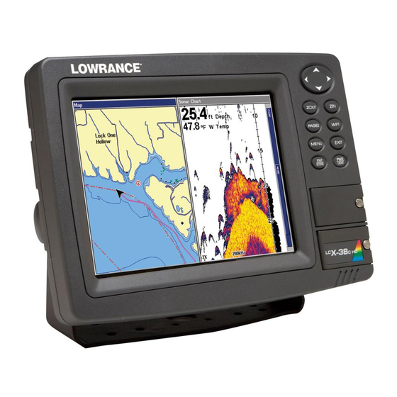
Pub. 988-0151-511 www.lowrance.com LCX-27 ; LCX-28 C HD LCX-37 ; LCX-38 C HD LCX-112 ; LCX-113 C HD Fish-finding Sonar & Mapping GPS Operation Instructions... - Page 2 Additional mapping data: copyright © 2006 by Transas Ltd.; copyright © 2006 by Maptech Inc. Lowrance Electronics may find it necessary to change or end our policies, regulations and special offers at any time. We reserve the right to do so without notice. All features and specifications subject to change without notice.
-
Page 3: Table Of Contents
Table of Contents Section 1: Read Me First! ............1 How Your Sonar Works..............3 How Your GPS Works ..............4 Introduction to GPS and WAAS ........... 5 How to use this manual: typographical conventions ....7 Section 2: Installation & Accessories........9 Preparations .................. - Page 4 Keyboard ..................47 Power/lights on and off..............48 Main Menu................... 48 Pages .................... 50 Satellite Status Page............... 50 Navigation Page ..............51 Map Page ................. 52 Sonar Page ................52 Sonar Quick Reference ............55 Sonar Operations................. 56 Fish Symbols vs. Full Sonar Chart ........58 Other Free Training Aids ............
- Page 5 Split Zoom Sonar Chart ............88 Digital Data/Chart ..............89 Sonar Simulator ................89 Stop Chart..................91 Surface Clarity ................91 Upper and Lower Limits............. 92 User Presets................. 92 Zoom & Zoom Bar................ 93 Zoom Pan ..................93 Section 5: Sonar Troubleshooting ........95 Section 6: Basic GPS Operations .........
- Page 6 Section 7: Advanced GPS Operations ....... 129 Find Distance From Current Position ........129 Find Distance from Point to Point ........... 129 Icons ................... 129 Create Icon on Map ............... 130 Create Icon at Current Position ........... 130 Delete an Icon ................ 130 Navigate to an Icon ...............
- Page 7 Initialize GPS ................149 Map Auto Zoom ................. 149 Map Data ................... 150 Pop-up Map Info: ..............150 Map Boundaries: ..............151 Fill Water With White: ............151 Trackline Extension: ............. 151 Presentation Mode: ............... 151 Safety Contour:..............151 Map Overlays (Range Rings; Lat/Long Grid): ..... 151 Map Datum Selection..............
- Page 8 Find a Street ................182 Find an Intersection.............. 183 Find Waypoints ................. 185 Section 10: NMEA 2000 Device Configuration....187 NMEA 2000 Menu..............187 Bus Setup................... 187 Engine & Tank Configuration ..........188 Tank Select ................ 189 Tank Size ................189 Set Configuration button ..........
- Page 9 WARNING! A CAREFUL NAVIGATOR NEVER RELIES ON ONLY ONE METHOD TO OBTAIN POSITION INFORMATION. CAUTION When showing navigation data to a position (waypoint), a GPS unit will show the shortest, most direct path to the waypoint. It provides navigation data to the waypoint regardless of obstructions.
- Page 10 Notes viii...
-
Page 11: Section 1: Read Me First
GPS receiver. First, we want to thank you for buying a Lowrance sonar/GPS unit. Whether you're a first time user or a professional fisherman, you'll discover that your unit is easy to use, yet capable of handling demanding navigation and sonar tasks. - Page 12 After you've gained some experience with your sonar, you'll want to check out Section 4, which discusses advanced Sonar Options and Other Features. When you come to a sonar menu command on the unit's screen, you can look it up in the manual by skimming over the table of contents, flipping through Section 3, or scanning through the sonar options in Section 4.
-
Page 13: How Your Sonar Works
Sonar is an abbreviation for SOund NAvigation and Ranging, a technology developed during World War II for tracking enemy submarines. (Lowrance developed the world's first transistorized sportfishing sonar in 1957.) A sonar consists of a transmitter, transducer, receiver and display. Here’s a simple explanation of how it finds the bottom and the fish. -
Page 14: How Your Gps Works
How Your GPS Works You'll navigate faster and easier if you understand how this unit scans the sky to tell you where you are on the earth — and, where you're going. (But if you already have a working understanding of GPS receivers and the GPS navigation system, skip on ahead to Section 2, Installation &... -
Page 15: Introduction To Gps And Waas
'em and record new ones, over and over again. Like any computer file, these GPS Data Files (file format *.usr) can be shared between other Lowrance GPS or sonar/GPS units and even personal computer. Your unit has one more thing in common with a personal computer. - Page 16 navigation, look over this segment describing how GPS and its new companion WAAS work together to get you where you're going. The United States Department of Defense launched Global Positioning System (GPS) on July 17, 1995. It was designed as a 24-hour-a-day, 365-days-a-year, all weather global navigation system for the armed forces of the U.S.
-
Page 17: How To Use This Manual: Typographical Conventions
Like most GPS receivers, this unit doesn’t have a compass or any other navigation aid built inside. It relies solely on the signals from the satellites to calculate a position. Speed, direction of travel, and distance are all calculated from position information. Therefore, in order for the unit to determine direction of travel, you must be moving and the faster, the better. -
Page 18: Arrow Keys
Arrow Keys The arrow keys control the movement of dotted cross-hair lines on your mapping screen called the cursor. The arrow keys also control a horizontal line depth cursor on the sonar screen. The arrow keys also help you move around the menus so you can execute different commands. -
Page 19: Section 2: Installation & Accessories
Section 2: Installation & Accessories Preparations You can install the sonar and GPS systems in some other order if you prefer, but we recommend this installation sequence: CAUTION: You should read over this entire installation section before drilling any holes in your vehicle or vessel! 1. -
Page 20: Recommended Tools And Supplies
Read these instructions carefully before attempting the installation. Determine which of the mounting positions is right for your boat. Use extreme care if mounting the transducer inside the hull; because, once the epoxy is applied and it is set into position, the transducer cannot be removed. - Page 21 NOTE: Some aluminum boats with strakes or ribs on the outside of the hull create large amounts of turbulence at high speed. These boats typically have large outboard motors capable of propelling the boat at speeds faster than 35 mph. Typically, a good transom location on aluminum boats is between the ribs closest to the engine.
-
Page 22: Shoot-Thru-Hull Vs. Transom Mounting
How low should you go? For most situations, you should install your Skimmer transducer so that its centerline is level with the bottom of the boat hull. This will usually give you the best combination of smooth water flow and protection from bangs and bumps. -
Page 23: Transom Transducer Assembly And Mounting
The shoot-thru-hull installation, however, does have its drawbacks. First, some loss of sensitivity does occur, even on the best hulls. This varies from hull to hull, even from different installations on the same hull. This is caused by differences in hull lay-up and construction. Second, the transducer angle cannot be adjusted for the best fish arches on your sonar display (This is not an issue for flasher-style sonars.). - Page 24 Align plastic ratchets in bracket. B. Two-piece bracket: Locate the four plastic ratchets in the transducer's hardware package. Press two ratchets into the sides of the plastic bracket and two on either side of the transducer as shown in the following illustrations.
- Page 25 Transducer Transducer bracket Ratchet Ratchet Add ratchets to bracket and transducer. 2. Aligning the transducer on the transom. A. One-piece bracket: Slide the transducer between the two ratchets. Temporarily slide the bolt though the transducer assembly and hold it against the transom. Looking at the transducer from the side, check to see if it will adjust so that its face is parallel to the ground.
- Page 26 B. Two-piece bracket: Assemble the transducer and bracket as shown in the following figure. Temporarily slide the bolt though the transducer assembly but don't tighten the nut at this time. Hold the assembled transducer and bracket against the transom. Looking at the transducer from the side, check to see if it will adjust so that its face is parallel to the ground.
- Page 27 B. Two-piece bracket: Once you determine the correct position for the ratchets, assemble the transducer as shown in the figure in step 2B. Don't tighten the lock nut at this time. 4. Drilling mounting holes. Hold the transducer and bracket assembly against the transom. The transducer should be roughly parallel to the ground.
- Page 28 Both bracket types: Attach the transducer to the transom. Slide the transducer up or down until it's aligned properly with the bottom of the hull as shown in the preceding and following figures. Tighten the bracket's mounting screws, sealing them with the caulking compound. Adjust the transducer so that it's parallel to the ground and tighten the nut until it touches the outer washer, then add 1/4 turn.
-
Page 29: Trolling Motor Bracket Installation (Single-Frequency Only)
7. Make a test run to determine the results. If the bottom is lost at high speed, or if noise appears on the display, try sliding the transducer bracket down. This puts the transducer deeper into the water, hopefully, below the turbulence causing the noise. Be careful not to install the transducer bracket below the bottom of the hull! TROLLING MOTOR BRACKET INSTALLATION (single-frequency only) -
Page 30: Transducer Orientation And Fish Arches
TRANSDUCER ORIENTATION AND FISH ARCHES If you do not get good fish arches on your display, it could be because the transducer is not parallel with the ground when the boat is at rest in the water or at slow trolling speeds. Partial fish arches Transducer aimed Transducer aimed... -
Page 31: Shoot-Thru-Hull Preparation
SHOOT-THRU-HULL PREPARATION Hulls With Floatation Materials The transducer installation inside a fiberglass hull must be in an area that does not have air bubbles in the resin or separated fiberglass layers. The sonar signal must pass through solid fiberglass. A successful transducer installation can be made on hulls with flotation materials (such as plywood, balsa wood or foam) between layers of fiberglass if the material is removed from the chosen area. - Page 32 Transducer location Transducer location (high speed) (trolling speed) Shoot-thru-hull transducer locations for high speed or trolling speed operation. To choose the proper location for shoot-thru-hull mounting, follow these testing procedures: (You may need a helper to complete these steps.) 1. Anchor the boat in about 30 feet of water. Add a little water to the sump of the boat.
-
Page 33: Shoot-Thru-Hull Installation
3. Now move the transducer around to find the best location with the strongest possible bottom signal. If you find a spot with an acceptable bottom signal, mark the location and move on to Step 4. If you can't get an acceptable bottom signal, try turning up the sensitivity by three or five keystrokes and then move the transducer around once more. - Page 34 Spread epoxy here Sand this surface (unit's face) Orient the Skimmer with the nose facing the bow of the boat. To bow Epoxy transducer to hull. WARNING: Use only the epoxy available from LEI. It has been formulated to work with these installation procedures. Other epoxy types may be too thin or may not cure to the right consistency for optimum transducer performance.
-
Page 35: Speed/Temperature Sensors
Optional Speed Sensor Installation If you wish to purchase an optional or additional speed sensor for your unit, visit our website, www.lowrance.com, or refer to the accessory ordering information inside the back cover of this manual. The following instructions describe how to install the speed sensor. -
Page 36: Gps Antenna/Receiver Module
GPS Antenna/Receiver Module The LCX-27C, LCX-28C HD, LCX-37C, LCX-38 C HD, LCX-112C and LCX- 113C HD packages include the LGC-3000 GPS module. This device contains the unit's external antenna and receiver for GPS and WAAS signals. The antenna/receiver module comes with a 15-foot extension cable. -
Page 37: Power Connections
You need to select an antenna installation location that has a clear, unobstructed view of the sky. After the module is installed, connect it to the unit. The LGC-3000 can communicate with your GPS unit either ® directly (using the supplied extension cable) or through a NMEA 2000 network. -
Page 38: Powering Your Display Unit
NOTE: There are two basic power connection options, which are shown in the following two diagrams. Read the following instructions carefully to determine which power connection applies to your unit. Depending on your configuration, you may not use all of these wires. Caution: All of the wires in the power/data cable have bare ends for easier installation. -
Page 39: Power Diagram A
If a malfunction happens inside the unit, extensive damage can occur if the enclosed fuse is not used. As with all electrical devices, this unit could be damaged to a point that it is irreparable and could even cause harm to the user when not properly fused. Failure to use a 3-amp fuse will void your warranty. -
Page 40: Power Diagram B
The network and any NMEA 2000 devices, including the GPS module, will not operate unless the NMEA 2000 Power Cable is connected to power. The NMEA 2000 power cable must be connected to power even if your only NMEA 2000 device is the GPS module and it is connected to the display unit's Network socket. -
Page 41: Nmea 2000 Cable Connections
NMEA 2000 bus installed. Over the next few years, however, NMEA 2000 will become much more common. To help you get the most out of this technology, your Lowrance unit is designed to work with a NMEA 2000 network. -
Page 42: Nmea 0183 Wiring (Data Cable)
Network port on display unit Double T Connector Extension cable 120-ohm terminator 120-ohm terminator Extension cable LGC-3000 LGC-3000 and display unit as an expandable NMEA 2000 network. The diagram above has a double T connector with two 120-ohm terminators — one at each end of the connector. It is easy to expand this network by removing a terminator from one end of the double T connector, then inserting a new T connector or extension cable between the double T connector and terminator (See the NMEA 200 network general... - Page 43 Yellow (Transmit) Receive Orange (Receive) Transmit To Other Com-1 To unit Device Shield (Ground) Ground Com-1 wiring to exchange position information with another device. Blue (Transmit) Receive Green (Receive) Transmit Com-2 To Other To unit Device Shield (Ground) Ground Com-2 wiring to exchange position information...
-
Page 44: Expanding To A Nmea 2000 Network
Display unit, rear view Power/Data Sonar socket socket Ethernet socket (for future use) Network NMEA 0183 socket data cable Display unit power cable Optional Double T speed connector sensor terminator NMEA 2000 120-ohm power cable terminator Extension cables Transducer antenna module LCX-112 and LCX-113... - Page 45 Display unit rear view Power/Data socket Sonar Ethernet socket socket (for future use) Network NMEA 0183 socket Data Cable Double T connector Optional Display unit speed power cable sensor terminator NMEA 2000 Power Cable 120-ohm terminator Extension cables Transducer antenna module LCX-37 and LCX-38...
- Page 46 Display unit, rear view Sonar socket Ethernet socket (for future use) Power/Data Network socket socket NMEA 0183 Data Cable Display unit power cable Optional Double T speed connector sensor terminator 120-ohm terminator NMEA 2000 Power Cable Extension cables Transducer antenna module LCX-27 and LCX-28...
- Page 47 Expanding to a NMEA 2000 Network A network bus is an installed and operational network cable (backbone) running the length of your boat, already connected to a power supply and properly terminated. Such a bus provides network connection nodes at various locations around your boat.
-
Page 48: Adding A Network Node
NOTE: If you have a double T Connector on your network that is not attached to a device, you must cap the unused connector with a NMEA 2000 cap. This will protect the pin connectors from corrosion. The NMEA 2000 cap looks like a terminator, but has "Cap"... -
Page 49: Mounting The Unit: Bracket Or In-Dash
You do not need a Bus Adapter Cable with this unit if you use an approved Devicenet NMEA 2000 connector. Approved Devicenet NMEA 2000 connectors work with Lowrance red connector display units and components, so no adapter cables are needed. - Page 50 make sure there is enough room behind the unit to attach the power, transducer and GPS antenna/receiver module cables. (A drawing on the next page shows the dimensions of a gimbal-mounted unit.) Holes in the bracket's base allow wood screw or through-bolt mounting. You may need to place a piece of plywood on the backside of thin fiberglass panels to reinforce the panel and secure the mounting hardware.
- Page 51 Millimeter [Inch] Front view (left) and side view (right) showing dimensions of the LCX- 27C and LCX-28C HD mounted on gimbal brackets. Front view (left) and side view (right) showing dimensions of the LCX- 112C and LCX-113C HD mounted on gimbal brackets.
- Page 52 Front view (left) and side view (right) showing dimensions of the LCX- and LCX-38C HD mounted on gimbal brackets. To pass all connectors through the 1" hole, first pass the transducer connector up through the hole from under the dash, followed by the antenna connector and any accessory cables.
-
Page 53: Mmc Or Sdc Memory Card Installation
In-dash mounting template for the LCX-27C and LCX-28C HD, showing dimensions. NOTE: The figure above is not printed to scale. MMC or SDC Memory Card Installation Your unit uses MultiMedia Cards to store information, such as sonar logs, custom maps, waypoints, trails and other data. The unit can also use Secure Digital Cards (SD card) to store data. - Page 54 Slide the drawer back into the unit and twist the retainer clockwise. The MMC is now ready for use. In the LCX-37C, LCX-38C HD, LCX-112C and LCX-113C HD, the two MMC slots are located in compartments on the front of the case. The water-proof compartment doors are located at the lower right corner.
-
Page 55: To Remove An Mmc Or Sd Card
MMC groove for card removal Thumb screw Insert card face up, this way Memory card compartment with a 16 MB MMC card installed. To remove an MMC or SD Card 1. Open the card compartment door by unscrewing the thumb screw. The screw should only be finger tight. -
Page 56: Switch Boxes
Switch Boxes Two switch boxes are available for this unit. One transducer switch box switches two transducers to one sonar unit. The other transducer switch box switches two sonar units to one transducer. If these accessories are not available from your dealer, see the accessory ordering information on the inside back cover of this manual. -
Page 57: Section 3: Basic Sonar Operation
Section 3: Basic Sonar Operation This section addresses the unit's most basic sonar operations. The instructions presented in Sec. 3 follow a chronological order. Sec. 4, Sonar Options & Other Features, will discuss other more advanced functions and utilities. Material in Sec. 4 is arranged in alphabetical order. Before you turn on the unit, it's a good idea to learn about the different keys, the Main Menu, the four Page screens and how they all work together. -
Page 58: Power/Lights On And Off
Page, Map Page and Sonar Page). Each page represents one of the unit's major operation modes. 3. MENU – Press this key to show the menus and submenus, which allow you to select a command or adjust a feature. This also accesses search functions for streets, intersections, addresses and highway exits. - Page 59 show sonar signals on your screen. This unit will work fine right out of the box with the factory default settings. But, if you want to learn about the various sonar options, see Sec. 4, Sonar Options & Other Features (For general system setup and GPS options, see Sec. 8, System Setup and GPS Setup Options).
-
Page 60: Pages
Sonar Setup command: sets various sonar options. GPS Setup command: sets various GPS receiver options. System Setup command: sets general configuration options. NMEA 2000 command: allows you to be set up on the NMEA network. Sun/Moon Calculations command: finds the rising and setting time of the sun and the moon. -
Page 61: Navigation Page
No matter what Page you are on, a flashing current position indicator/question mark symbol and flashing GPS data displays indicate that satellite lock has been lost and there is no position confirmed. WARNING: Do not begin navigating with this unit until the numbers have stopped flashing! Satellite Status Page. -
Page 62: Map Page
Map Page The Map Page screens show your course and track from a "bird's-eye" view, on a moving map. By default, this unit shows the map with north always at the top of the screen. The arrow in the center of the screen is your present position. - Page 63 Pages Menu, showing sonar chart display option commands (left). Sonar display options: full sonar chart (left) and split zoom chart (right). Sonar chart display options (from left) digital data and FlashGraf™. Sonar chart display options: Sonar with Custom Gauges.
- Page 64 Sonar Page Menu. Most of these functions are discussed in Sec. 4. Digital data Surface clutter Surface signal overlay Depth scale (depth & temperature) In FasTrack, fish arches show as Fish arches horizontal bars. Zoom bar Structure FasTrack Bottom signal bar graph Sonar Page, showing full sonar chart mode.
-
Page 65: Sonar Quick Reference
Sonar Quick Reference 1. Mount the transducer, antenna and unit. Connect the unit to electric power and the transducer (If GPS operation is desired, connect GPS antenna, too.). Make sure the MMC is in (See complete installation details beginning on page 9.). 2. -
Page 66: Sonar Operations
Sonar Operations As you can see from the quick reference on the previous page, basic operation is easy, right out of the box. If you are a sonar novice, try operating the unit with the factory defaults until you get a feel for how it's working. As you're learning the basics, there is one setting you might want to tinker with from time to time —... -
Page 67: To Adjust Sensitivity
You can change the sensitivity level whether you are in Auto Sensitivity mode or Manual Sensitivity mode. The adjustment method works the same in both modes, but gives you slightly different results. Adjusting sensitivity in Auto Sensitivity Mode is similar to manually adjusting a car's speed with the accelerator pedal while cruise control is on. -
Page 68: Fish Symbols Vs. Full Sonar Chart
Bay saw clouds of clutter in the water but no fish arches. When he pulled downrigger up, it brought up several small jellyfish. The fisherman switched his Lowrance sonar to Fish I.D., which screened out the schools of jellyfish and clearly showed the game fish there as fish symbols. -
Page 69: Other Free Training Aids
Aside from being just plain fun, this program can help you learn both basic and advanced operations without burning boat fuel! Lowrance is the first sonar manufacturer to provide this type of training tool for customers. - Page 70 A free training emulator is available for your unit on our web site. The emulator works exactly like your real sonar/GPS unit. Using the Sonar Simulator and GPS Simulator features, it allows you to play back sonar logs, run GPS routes and trails, even create real waypoints you can use in the field! You can even take snapshots of the Sonar Chart and print them or e-mail them to friends.
-
Page 71: Section 4: Sonar Options & Other Features
Section 4: Sonar Options & Other Features Material in this section is arranged in alphabetical order. ASP™ (Advanced Signal Processing) The ASP™ feature is a noise rejection system built into the sonar unit that constantly evaluates the effects of boat speed, water conditions and interference. -
Page 72: Alarms
Alarms This unit has three different types of sonar alarms. The first is the Fish Alarm. It sounds when the Fish I.D.™ feature determines an echo is a fish. Another alarm is the Zone Alarm, which consists of a bar on the side of the screen. -
Page 73: Zone Alarm
To switch to a different depth setting, open the Sonar Alarms menu and repeat the instructions in step 3 above. To adjust and turn on the deep alarm: 1. Press |↓ to |↓ to MENU MENU LARMS ONAR LARMS 2. Press ↓... -
Page 74: Fish Alarm
Fish Alarm You can use the Fish Alarm to make a distinctive audible alarm when the Fish I.D. feature (Fish I.D. must be turned on for the Fish Alarm to work) detects fish or other suspended objects. A different tone will sound for each fish symbol size shown on the display. -
Page 75: Chart Speed
Chart Speed The chart speed is the rate echoes scroll across the screen. The default is maximum. We recommend you leave the setting there for virtually all fishing conditions. You, however, might consider experimenting with chart speed when you are stationary or drifting very slowly. You may sometimes achieve better images as you slow the chart speed to match how fast you are moving across the bottom. - Page 76 mostly as blue arches. A hard bottom or other relatively hard target returns a strong signal displayed as a wide, brightly colored line (reddish yellow to bright yellow.) If you have two signals of equal size, one with red to yellow color and the other without, then the target with brighter color (yellow) is the stronger signal.
- Page 77 Fig. 1A Fig. 1B Fish near Hard structure structure Colorline Fig. 2A Fig. 2B Hard Muddy bottom bottom Colorline Fig. 3A Fig. 3B Hard Muddy bottom bottom Colorline The "A" figures to the left show locations with Colorline set at the factory level of 70 percent.
-
Page 78: Customize Page Displays
Customize Page Displays Every Page display option except Full Map (on the Map Page) has customizable Digital Data boxes to provide on-screen information. The various data available from your unit are divided into categories in the Data Viewer menu. These categories include GPS Data, Navigation, Trip Calculator, Time, Sonar and Miscellaneous Data. -
Page 79: Flashgraf
FlashGraf™ The FlashGraf sonar page option represents the flasher style sonar combined with a scrolling chart. A circular dial shows all returning echoes at a high screen refresh rate. It uses the Colorline® feature to show weaker targets as darker colors. The bottom depth is shown as a black bar across the outer circle. -
Page 80: Sonar With Custom Gauges
When this screen is activated, you need to specify which side of the Menu, is active. To toggle between the two windows, press . The PAGES PAGES window with the blue title bar at the top of the screen is the active window. To switch back, just press again. -
Page 81: Depth Range - Automatic
You can move the cursor to any location on the screen, letting you pinpoint the depth of a target. 1. From the Sonar Page, press |↓ to MENU EPTH URSOR 2. The depth cursor appears. Press ↓ ↑ to move the cursor line. 3. -
Page 82: Depth Range - Upper And Lower Limits
Depth Range - Upper and Lower Limits Virtually any segment of the water column can be displayed by using the upper and lower limit feature. This lets you pick the shallow and deep range limits shown on the screen, provided there is at least 10 feet between the upper and lower limit you select. -
Page 83: Fastrack
Fish arches Area "zoomed" Normal display, in auto depth range mode, (left); Display "zoomed" with Upper and Lower Limits focusing on the portion of the water column from 25 feet to 45 feet deep (right). In the "zoomed" image on the right, note the target definition, showing two fish holding just off the structure. -
Page 84: Fish I.d.™ (Fish Symbols & Depths)
Fish I.D.™ (Fish Symbols & Depths) The Fish I.D. feature identifies targets that meet certain conditions as fish. The microcomputer analyzes all echoes and eliminates surface clutter, thermoclines, and other undesirable signals. In most instances, remaining targets are fish. The Fish I.D. feature displays fish symbols on the screen in place of the actual fish echoes. -
Page 85: Fishtrack
Fig. 1 B Fig. 1 A Fish symbols appear in surface clutter Many fish Fewer fish arches visible symbols visible Fig. 2 B Fig. 2 A No fish shown Fish arches above structure Figures 1A and 2A (left) show Sonar Page in normal chart mode. Figures 1B and 2B (right) show the same underwater scene with Fish I.D. -
Page 86: Frequency (Change Transducer Frequency)
Symbols with FishTrack depths Sonar Features menu with Fish I.D. Depths selected (left). When the check box to the left is unchecked, the feature is off. Sonar Page showing Fish I.D. symbols and FishTrack depths turned on (right). Frequency (Change Transducer Frequency) A dual-frequency transducer operates with both 200 kHz and 50 kHz. -
Page 87: Log Sonar Chart Data
Sonar Simulator.) If you have a personal computer and internet access, download our free Sonar Viewer and your unit’s emulator at our web site, www.lowrance.com. That will allow you to replay sonar logs on your personal computer. -
Page 88: Overlay Data (Add, Remove, Change)
The Sonar Page menu with the Log Sonar Chart Data command selected (left). Sonar Chart Logging menu, with the Start Logging command selected (right). The MMC has 11.7 MB of free space, which will record the scrolling chart for 20 minutes and 44 seconds. To record or log chart data: 1. -
Page 89: To Overlay Information On Your Screen
Overlay Data Shown window (left); Data viewer with the Sonar Data category expanded (right). To overlay information on your screen: 1. Press |↓ to MENU VERLAY 2. If you have overlay data on your display, you’ll see a list of that data on the overlay data shown menu. -
Page 90: To Move Overlaid Data
Overlay Data Shown, with water speed selected (left). Press ENT to access R option (right). Press ENT again to remove item and EMOVE return to the Overlay Data Shown screen. To move overlaid data: You may find it useful to rearrange data floating in your display window. 1. -
Page 91: Overlay Data Style
The overlay data on this sonar display includes, Depth, Temperature, Ground Speed and the Track the boat is following. NOTE: Some data types can be displayed in only one font size. If that is the case, the Data Size box will not be displayed for that data type. Overlay Data Style Do you like a digital readout or do you prefer an analog gauge look? With the Overlay Style feature you can mix and match your data to suit... -
Page 92: Ping Speed & Hyperscroll
Gauge Setup Menu. There are four primary setup options in the analog menu: Themes, Tick Marks, Thresholds and Text. You can make gauges transparent from all setup menus except Text Setup. To change the setup menu, arrow over, highlight one of the four setup . -
Page 93: Reset Options
in a large amount of clutter appearing on the screen. If this occurs, just decrease the sensitivity to a level that eliminates the clutter. When you turn HyperScroll off, you can return to your original sensitivity level. Sonar Menu with Ping Speed command selected (left). The Ping Speed Control Bar (right) at default setting. -
Page 94: Reset Water Distance
System Setup menu with Reset Options command selected (left). The Reset Options dialog box (right). NOTE: Reset Options does not erase any waypoints, routes, plot trails, or sonar logs. Reset Water Distance The sonar chart's Digital Data display option includes a window that shows distance traveled, called Water Distance ("W Distance"). -
Page 95: Sensitivity & Auto Sensitivity
1. Press |↓ to MENU MENU ENT. ONAR ETUP 2. Use ↓ to scroll down to , then press The Keel Offset ENT. FFSET dialog box appears. Press ↓ to change the plus (+) sign to a minus (–) sign. to the first number, then press ↑... - Page 96 Situations occur, however, when it becomes necessary to increase or decrease sensitivity. This typically happens when you wish to see more detail, so an increase in sensitivity is needed. Or when wave action and boat wakes create tiny air bubbles that clutter much of the water column.
-
Page 97: Sonar Chart Mode
To turn Auto Sensitivity back on: From the Sonar Page, press |↓ to MENU EXIT ENSITIVITY NOTE: To return to the original factory setting for Auto Sensitivity, see the entry in this section on Reset Options. If sensitivity is in manual mode, the Reset Options command will switch back to Auto and reset the factory setting at the same time. -
Page 98: Full Sonar Chart
Full Sonar Chart This is the default mode used when the unit is turned on for the first time or when it's reset to the factory defaults. The bottom signal scrolls across the screen from right to left. Depth scales on the right side of the screen aid in determining the depth of targets. -
Page 99: Digital Data/Chart
Digital Data/Chart This mode shows the chart on the right side of the screen. The left side has four digital boxes containing, Depth, Track, Bearing and a Temperature Graph. Digital Data/Chart. Sonar Simulator This unit has a built-in simulator that lets you run it as if you were on the water. - Page 100 3. To use the default sonar chart log stored in the unit, press ↓ to HART . The recorded chart | ENT | EXIT| EXIT | EXIT ONAR HART begins scrolling across the screen, just as if you were on the water. 4.
-
Page 101: Stop Chart
Stop Chart If you are running multiple units on a boat or using this unit in a car, there are times when you may want to turn off the sonar. This command turns off the sonar and stops the chart from scrolling. Sonar restarts automatically each time you turn on your unit. -
Page 102: Upper And Lower Limits
Sonar Features menu with Surface Clarity selected. 2. Press → ENT. URFACE LARITY 3. Press ↓ or ↑ to select clarity level| EXIT EXIT EXIT Surface clutter In the illustration on the left, Surface Clarity is turned off. The view on the right shows Surface Clarity set on high. Upper and Lower Limits See the entry in this section for Depth Range - Upper and Lower Limits User Presets... -
Page 103: Zoom & Zoom Bar
To reset the presets: |↓ to The unit will → R | ENT ENT. ONAR EATURES ESET RESET automatically reset the presets. Zoom & Zoom Bar "Zooming in" is a fast and easy method used to enlarge small detail, fish signals and the bottom with its associated structure. This unit lets you zoom in quickly and easily by pressing the Zoom In key, Pressing once doubles the size (2X) of all echoes on the screen. - Page 104 Notes...
-
Page 105: Section 5: Sonar Troubleshooting
Section 5: Sonar Troubleshooting If your unit is not working, or if you need technical help, please use the following troubleshooting section before contacting the factory customer service department. It may save you the trouble of returning your unit for repair. For contact information, refer to the last page, just inside the back cover of this manual. - Page 106 2. Electrical noise from the boat's motor can interfere with the sonar. This causes the sonar to automatically increase its Discrimination or noise rejection feature. This can cause the unit to eliminate weaker signals such as fish or even structure from the display. 3.
- Page 107 NOISE A major cause of sonar problems is electrical noise. This usually appears on the sonar's display as random patterns of dots or lines. In severe cases, it can completely cover the screen with black dots, or cause the unit to operate erratically, or not at all. To eliminate or minimize the effects of electrical noise, first try to determine the cause.
- Page 108 Notes...
-
Page 109: Section 6: Basic Gps Operations
Section 6: Basic GPS Operations This section addresses the unit's most basic GPS operations. The tutorials presented in Sec. 6 follow a chronological order. Sec. 7, Advanced GPS Operations, will discuss other more advanced functions and utilities. Material in Sec. 7 is arranged in alphabetical order. Before you turn on the unit and find where you are, it's a good idea to learn about the different keys, the four Page screens and how they all work together. -
Page 110: Power/Lights On And Off
3. MENU – Press this key to show the menus and submenus, which allow you to select a command or adjust a feature. This also accesses search functions for streets, intersections, addresses and highway exits. 4. ARROW KEYS – These keys are used to navigate through the menus, make menu selections, move the map and sonar chart cursors and enter data. - Page 111 Main Menu. The Main Menu commands and their functions are: Screen command: changes the contrast or brightness of the display screen. Sounds command: enables or disables the sounds for key strokes and alarms and sets the alarm style. Alarms command: turns GPS or sonar alarms on or off and changes alarm thresholds.
-
Page 112: Sonar Page
Pages The unit has four Page displays that represent the four major operating modes. They are the Satellite Status Page, the Navigation Page, Map Page and the Sonar Page. They are accessed by pressing the key, PAGES then using to select a Page (Clear the menu by pressing →... - Page 113 The Satellite Status Page. This screen shows a graphical illustration of the satellites that are in view. Each satellite is shown on the circular chart relative to your position. The point in the center of the chart is directly overhead. The small inner ring represents 45°...
-
Page 114: Navigation Page
Navigation Page This screen has a compass rose that not only shows your direction of travel, but also the direction to a recalled waypoint. It also has a Navigation with Sonar option that will display two windows, one with a sonar chart, the other with the compass rose. -
Page 115: Map Page
The cross track error range is shown on the compass rose as a wide, white, corridor enclosing the course line. The outer edges of this white corridor represent lines that show the current cross track error range. The default for the cross track error range is 0.20 miles. For example, if the present position symbol touches the right cross track error line, then you are 0.20 miles to the right of the desired course. - Page 116 The Over Zoomed notice in the top left corner means you have reached the map’s detail limits for the area. Zooming in closer will reveal no more detail because a custom map has not been loaded on the MMC. If you're using only the factory-loaded background map, the maximum zoom range is 20 miles.
- Page 117 are Interstate, U.S. and state highways, large- and medium-sized lakes and streams and more than 60,000 navigation aids with 10,000 wrecks and obstructions in U.S. coastal and Great Lakes waters. New for 2007 are more than 3,000 enhanced lake maps that show better defined shorelines, depth contours and other underwater features.
- Page 118 Tip: In some urban areas, businesses are so close to one another that their POI icons crowd each other on the screen. In the preceding figure, you can see a jumbled pile of POIs along Highway 34. You can reduce screen clutter and make streets and other map features easier to see by turning off the display of undesired POIs (To see how, check out the Map Detail Category section, page 153.).
- Page 119 Resize Window is another handy feature for pages that have two major windows. You can change the horizontal size of the windows to suit your viewing preference. Here's how: 1. From any two-window display, press ↓ MENU ESIZE INDOW 2. Two flashing arrows appear along the centerline dividing the two windows.
-
Page 120: Map With Custom Gauges
Map with Custom Gauges You unit can also display both the map and only the gauges you want to see. This is useful if you find you only use certain gauges when the GPS features are on. To do this: | ↓| PAGES AP WITH... -
Page 121: Gps Quick Reference
GPS Quick Reference Start outdoors, with a clear view of the open sky. As you practice, try navigating to a location at least a few blocks away. While you're learning, navigation in too small an area will constantly trigger arrival alarms. 1. -
Page 122: Find Your Current Position
Find Your Current Position Finding your current position is as simple as turning the unit on. Under an unobstructed sky, the unit automatically searches for satellites and calculates its position in approximately one minute or less. If for some reason satellite acquisition takes longer, you may be inside a structure, a vehicle or in terrain that is blocking signal reception. -
Page 123: Selecting Any Map Item With The Cursor
Now that you've seen how the unit can find where you are, let's search for something somewhere else. Searching is one of the most powerful features in the Lowrance GPS product line. In this example, we'll look for the nearest fast-food restaurant. For more information on different types of searches, refer to Sec. - Page 124 Category Selection menu (left) and list of the nearest restaurants (right). Select the nearest restaurant highlighted at the top and press ENT. The POI information screen appears. This is how you can use the unit as a business phone directory! If you wanted to navigate there, you could press since the command is highlighted.
-
Page 125: Set A Waypoint
Map screen showing the result of a restaurant search. 7. To clear the search and return to the last page displayed, press EXIT repeatedly (Before you completely exited out of the Search menus, you could have gone looking for another place.). NOTE: Search works from mapping and POI data loaded in the unit. -
Page 126: Create Waypoint On Map
Fig 1. Fig 2. Fig 4. Fig 3. Sequence for setting a waypoint. Fig. 1: While traveling, press WPT twice to call up the Find Waypoint screen (Fig. 2) and set a point. Fig. 3: A message says the waypoint has been saved. Fig. 4: vehicle continues on its way;... -
Page 127: Create Waypoint By Entering A Position
Create Waypoint by Entering a Position 1. Press |→ to column|↓ to UBCATEGORY 2. Press ↓ to |→ to NTERED OSITION REATE 3. Press → to . Enter the latitude by pressing ↑ or ↓ to change ATITUDE the first character, then press to the next character and repeat until the →... -
Page 128: Set Man Overboard (Mob) Waypoint
Course line Trail line Off course Waypoint range, set name at 0.20 mile Navigation Page, navigating toward waypoint 001. Set Man Overboard (MOB) Waypoint One of boating's most terrifying events is having a friend or family member fall overboard. It's particularly dangerous at night or if you're out of sight of land. -
Page 129: Navigate To Cursor Position On Map
The cursor is redirected toward the Man Overboard position on the Map Page. The victim is astern of the vessel. The GPS shows which direction to steer for the rescue. The man overboard position is also stored in the waypoint list for future reference. -
Page 130: Navigate To A Point Of Interest
Navigate to cursor. In this example, the town of Oologah, Oklahoma has been selected. 3. Press and the unit will begin navigating to the cursor location. MENU The Map Page will display a course line from your current position to the cursor position. -
Page 131: Creating And Saving A Trail
After you have looked up an item with the Find Waypoint command, use the to make sure the command is highlighted at the top of → the screen, then press . The unit begins navigating to the item. To cancel navigation, press |↓... -
Page 132: Displaying A Saved Trail
4. To return to the previous page, press . As you EXIT EXIT EXIT EXIT left the Edit Trail menu, you will notice a new trail was started with a new sequential number. In the example below, the new trail is number 15, showing zero points. -
Page 133: Navigating Trails
To turn off trail display: 1. Press ↓ MENU MENU RAILS 2. Press ↓ to enter the Saved Trail list, then use ↑ or ↓ to select the desired Trail Name| 3. Press ↓ → to . To return to the previous page, press ISIBLE EXIT EXIT... -
Page 134: Navigate A Trail (Forward)
Navigate a Trail (forward) The following figures illustrate the menu sequence for navigating a trail. 1. Press ↓ MENU MENU RAILS 2. Press ↓ to enter the Saved Trail list, then use ↑ or ↓ to select the desired Trail Name| 3. -
Page 135: Navigate A Back Trail (Backtrack, Or Reverse)
On the Map Page, a course line represents the trail you are navigating. The bearing arrow on the compass rose points to the next waypoint on the trail. As you travel, the arrival alarm will go off when you near a trail waypoint, and the bearing arrow on the compass rose will swing around and point to the next trail waypoint. -
Page 136: Transfer Custom Maps And Gps Data Files
Transfer Custom Maps and GPS Data Files Custom Maps Custom maps work only from the MMC card or SD card unless you have a hard drive model. When a card containing a Custom Map File is loaded into the unit, it automatically loads the map into memory when the unit is turned on. - Page 137 2. The Transfer My Data menu includes a message that tells you if a MMC is present or not. If no MMC is present, you must insert a card into the unit to activate the Load or Save commands. To transfer data from the unit to the MMC: press (for To transfer data from the MMC to the unit: press →...
-
Page 138: Save Gps Data To Hard Drive
Save GPS Data to Hard Drive If you do not have a MMC or SD card but a LCX HD model, you can save any GPS data (trails, routes, waypoints and icons) to the unit's hard drive. To do this from the Map Page: 1. -
Page 139: Section 7: Advanced Gps Operations
Section 7: Advanced GPS Operations Find Distance From Current Position 1. While on the Map Page press: ↓ MENU ISTANCE 2. To find the distance to a specific location, center your cursor over the position. A rubber band line appears, connecting your current position to the cursor's location. -
Page 140: Create Icon On Map
Icons are similar to waypoints, but they do not store as much information. You can't use a menu to navigate to icons like you can with waypoints. But, you can use the map cursor and navigate to any icon on the map. You can create an icon at the cursor position on the map, or at your current position while you are navigating. -
Page 141: Navigate To An Icon
Delete icons menu. The Delete All Icons command will ask if you are sure. Press ← to . All icons will be deleted from the map. The Delete by Symbol command will launch the Select Symbol menu. Press ← or ↑ or → or ↓ to select the icon symbol to delete, then press . -
Page 142: Create And Save A Route
Create and Save a Route You have the option of creating and editing a route in the unit, or you can make a route on your computer with our MapCreate 6 software. PC-created Routes MapCreate is the easiest method for preparing a route, simply because your PC's larger screen, keyboard and mouse are easier to manipulate than the gimbal-mounted unit. - Page 143 Edit Route menu (left). Edit Route Waypoints menu (right) with Add From Map command selected. 3. Use the Zoom keys and arrow keys to move the map and cursor until the cursor is centered on the spot where you want your route to begin. 4.
-
Page 144: Delete A Route
5. Move the cursor to the next point in the route, a spot where you need to turn or change direction, and press to set the next waypoint. 6. Repeat step five until the route reaches the destination. 7. To save your route, press . -
Page 145: Navigate A Route
Edit Route Waypoints menu. 3. Use ↓ and ↑ to select a command from the Edit Route Waypoints menu and press . Add From Map lets you insert a waypoint in the route by clicking on a map location with the cursor. Add Waypoint calls up the Waypoint list so you can insert a waypoint. -
Page 146: Navigate A Route In Reverse
Navigate a Route in Reverse Here's how you run a route backward, from the end waypoint to the beginning waypoint: 1. From the , press or from MENU AVIGATION WITH DIGITAL DATA , press |↓ to MENU MENU OUTE LANNING 2. -
Page 147: Edit A Trail Color
Tip: You can quickly call up the Edit Trail menu by selecting a trail on the map with the cursor. Simply move the cursor over a trail and a pop-up box appears. Press and the Edit Trail menu opens. Trail selected with map cursor (left). The pop-up box shows distance and bearing from the current position to the selected point on the trail. -
Page 148: Utilities
Utilities Utilities are useful tools for traveling or for outdoor activities. Alarm Clock To get to the alarm clock menu: press |↓ to |↓ MENU MENU IMERS LARM LOCK Sun/Moon Rise & Set Calculator To get to the Sun/Moon menu: press |↓... -
Page 149: Selecting A Waypoint
Waypoint Position To edit waypoint position: 1. Press |↓ to waypoint name| |↓ to AYPOINT 2. Latitude: press → to . Press ↑ or ↓ to change the first character, ATITUDE then press → to the next character and repeat until the latitude is correct. Press EXIT 3. - Page 150 5. Press ↓ to . Press ↑ or ↓ to change the first character, EARING then press → to the next character and repeat until the bearing is correct. Press 6. Press ↑ to . The Edit Waypoint menu appears. You can ROJECT simply save the new projected waypoint by pressing or you...
-
Page 151: Section 8 System & Gps Setup Options
Section 8 System & GPS Setup Options Alarms This unit has several GPS alarms. The factory default setting has all the alarms turned on. You can turn the alarms off and on and change their distance settings. An arrival alarm also can be set to flash a warning message and sound a tone when you cross a preset distance from a waypoint. -
Page 152: Auto Satellite Search
4. When your adjustments are finished, return to the last page displayed by repeatedly pressing EXIT. IMPORTANT ALARM NOTES: Anchor Alarm - The anchor alarm may be triggered even when you're sitting still. This typically happens when using small (less than 0.05 mile) anchor alarm ranges. -
Page 153: Check Mmc Files And Storage Space
Check MMC Files and Storage Space To check MMC Files: Press |↓ to MENU MENU ENT. ROWSE ILES Main Menu (left); MMC File Browser (right). Communications Port Configuration The unit has two NMEA 0183 version 2.0 compatible communication ports, or com ports for short. The Com Port Menu, which is accessed from the System Setup Menu, allows you to configure the communications ports to send or receive data to another electronic device, such as an autopilot. -
Page 154: Configure Nmea 0183
Configure NMEA 0183 You can configure the unit to use specific NMEA 0183 sentences. 1. Press |↓ to MENU MENU YSTEM ETUP 2. Press ↓ to |↓ to NMEA OMMUNICATIONS ONFIGURE 3. A menu appears showing the prefixes of the available NMEA sentences. -
Page 155: Map Fix
The military grid reference system (MGRS) uses two grid lettering schemes, which are referred to as standard and standard + 10 MGRS on this unit. Your position and datum in use determines which one to use. If you use standard, and your position is off significantly, then try the alternate. -
Page 156: To Configure A Map Fix
To configure a map fix: To use this format, you need to follow these steps in order. First, take your map of the area and determine a reference latitude/longitude. (Please note that in order for this system to work, the latitude/longitude lines must be parallel with the edge of the map. -
Page 157: Customize Page Displays
Customize Page Displays Several page display options have customizable data boxes to provide constant on-screen information. The various data available from your unit are divided into categories in the Data Viewer menu. These categories include GPS Data, Navigation, Trip Calculator, Time, Sonar Data and Miscellaneous Data. You can select items from any of these categories for display in any data box. -
Page 158: Gps Simulator
GPS Simulator The GPS simulator lets you use the unit as if you were navigating outdoors. It's a great way to practice using your unit. You can set the starting location from a stored waypoint, map place or POI location or by entering latitude and longitude. -
Page 159: Hide Gps Features
2. Set to zero. Select command and press ENT, PEED TEER WITH RROWS which turns on the simulator and returns you to the Map Page 3. Begin navigating along the trail/route. (If you are close enough to the first waypoint, the arrival alarm will usually go off as soon as navigation begins. -
Page 160: Map Data
You can also turn on or off Map Overlays, which display latitude and longitude grid lines or range. This menu lets you select between Inland Lakes/Land, NauticPath, Lowrance (MMC/SD) and Navionics (MMC/SD). If you own either the LCX-28CHD or LCX-113CHD the NauticPath and Inland Lakes/Land maps already are loaded into your unit's 30GB hard drive. -
Page 161: Map Boundaries
Map Boundaries: Press ↓ and → to . With the option highlighted, OUNDARIES press to check it (turn on) or uncheck it (turn off). After the option is set, press to return to the page display. EXIT EXIT Fill Water With White: Press ↓... -
Page 162: Map Datum Selection
The distance from your current position to the smaller ring (the ring's radius) is 25 miles. With the arrow keys and map cursor, you can scroll the map to see the third and fourth rings. In this example, the distance to the third ring is 75 miles and distance to the fourth ring is 100 miles from your current position. -
Page 163: Map Detail Category Selection
Map Detail Category Selection This menu determines which of the mapping features are shown on the screen. This includes waypoints, trails, icons, cities, highways, etc. You can select any of these items, customizing the map to your needs. To get to Map Categories: 1. -
Page 164: Nauticpath™ Usa Marine Charts
To correct this problem, a track-up mode rotates the map as you turn. Thus, what you see on the left side of the screen should always be to your left, and so on. Another option is course-up mode, which keeps the map at the same orientation as the initial bearing to the waypoint. -
Page 165: Port Information
NauticPath chart showing Chart Note icon selected by cursor (left). Note information screen (right). To view Chart Note information: 1. Use the arrow keys to move the cursor over a Chart Note icon. When it's selected, a pop-up name box appears. 2. -
Page 166: Tidal Current Information
To view Port Services information: 1. Use the arrow keys to move the cursor over a Port Services icon. When it is selected, a pop-up name box appears. 2. Press to display the Port Services Information screen. Pop-up name box Port Services icon NauticPath chart showing Port Services icon selected by cursor. -
Page 167: To View Tidal Current Information
When you zoom in to a sufficiently small zoom range (0.8 nautical mile), the icon becomes an animated arrow showing tidal current velocity and direction for the selected tidal station at the present time. At larger zoom ranges, you can select the boxed "C" icon and it becomes an animated arrow with a pop-up name box (the name box disappears after a few seconds). -
Page 168: Tide Information
The Tidal Current Information screen displays daily tidal current data for this station on this date at the present time. The graph at the top of the screen is an approximate view of the flood and ebb pattern for the day, from midnight (MN), to noon (NN) to midnight (MN). -
Page 169: To View Tide Information
To view tide information: 1. Use the arrow keys to move the cursor over a tide station icon. When it is selected, a pop-up name box appears. 2. Press to display the Tide Information screen. Current Time Line Height Scale MLLW Line Tide... -
Page 170: To Display A Navionics Chart
inserted into the unit. Navionics charts must be inserted into the unit, then selected as a Map Choice option in the Map Data menu. To display a Navionics chart: 1. Install the Navionics MMC in the memory card compartment and turn on the unit. - Page 171 Overlay Data Shown window (left); Data viewer with the Sonar Data category expanded (right). To overlay information on your screen: 1. Press |↓ to MENU VERLAY 2. If you have overlay data on your display, you’ll see a list of that data on the overlay data shown menu.
- Page 172 Overlay Data Shown, with bearing selected (left). Press ENT to access option (right). Press ENT again to remove item and return to EMOVE the Overlay Data Shown screen. To move overlaid data: You may find it useful to rearrange data floating in your display window.
- Page 173 The overlay data on this map display includes, Ground Speed, Distance, Track and Bearing. NOTE: Some data types can be displayed in only one font size. If that is the case, the Data Size box will not be displayed for that data type. Overlay Data Style Do you like a digital readout or do you prefer an analog gauge look? With the Overlay Style feature, you can mix and match your data to...
- Page 174 Gauge Setup Menu. There are four primary setup options in the analog menu: Themes, Tick Marks, Thresholds and Text. You can make gauges transparent from all setup menus except Text Setup. To change the setup menu, scroll down and use → or ← to highlight one .
- Page 175 Min/Max setup gives you the option of modifying the gauges minimum and maximum angles, values and ticks. Minimum and Maximum Angles gives you control over the numerical layout of the gauge. You can spread the numbers out around the gauge or bunch them together in a smaller area.
-
Page 176: Popup Help
A display with a transparent track gauge (left). The screen on the right is displaying Track and speed gauges. Popup Help Help is available for virtually all of the menu labels on this unit. By highlighting a menu item and leaving it highlighted for a few seconds, a "pop-up"... -
Page 177: Screen Contrast And Brightness
Reset Options command (left) and the Reset Options Menu (right). Screen Contrast and Brightness To access the Screen menu, press MENU MENU Once in the Screen menu: To adjust the display's contrast: slider bar is already selected. Press to move the →... -
Page 178: Set Language
Display Mode menu. Set Language This unit's menus are available in 10 languages: English, French, German, Spanish, Italian, Danish, Swedish, Russian, Dutch and Finnish. To select a different language: 1. Press |↓ to MENU MENU YSTEM ETUP 2. Press ↓ to ANGUAGE 3. -
Page 179: Show Waas Alarm
Press Press ↑ or ↓ to select the ↓ → to Y To set the Year: ENT. year, then press ENT. You also may switch the Time Format between 12 and 24-hour options. The Date Format also may be modified between three options: Month/Day/Year, Day/Month/Year and Year/Month/Day. -
Page 180: Software Version Information
Software Version Information From time to time, Lowrance updates the operating system software in some of its products. These software upgrades are usually offered to customers as free downloads from our web site, www.lowrance.com. The upgrades make the unit perform better or introduce a new feature or function. -
Page 181: Track Smoothing
Press ↓ to With the option To set Alarm Sounds: LARM OUNDS highlighted, press to check it (turn on) or uncheck it (turn off). After the option is set, press to return to the page display. EXIT EXIT Press ↓ to . -
Page 182: Delete All Trails
My Trails command (left); Trails Menu (left); Trail Options (right). Delete All Trails To remove all of the trails from memory, from the Trails Menu, press → ← ENT. ELETE Update Trail Option This menu lets you change the way the trail updates occur. WARNING: If you uncheck the Update Trail option, automatic trail creation and recording will be turned off. -
Page 183: Delete Trail
Update Time Rate (left) and Update Distance(right). Specific Trail Options Delete Trail To delete a specific trail, from the Trails Menu, press ↓ to Saved . Select a trail and press . The Edit Trail menu appears as Trails seen in the following figure. Press →... -
Page 184: Units Of Measure
Units of Measure This menu sets the speed and distance (statute or nautical miles, meters), depth (feet, fathoms, or meters), temperature (degrees Fahrenheit or Celsius) and heading (true or magnetic) units. To change the units: Press ↓ MENU MENU ENT. YSTEM ETUP System Setup Menu (left);... -
Page 185: Section 9: Searching
Section 9: Searching NOTE: The Search function depends on the type of map data loaded in your unit. LCX HD models are fully "searchable" out of the box because they contain a hard drive loaded with complete mapping information. These maps include all the data contained in our MapCreate custom maps, Fishing Hot Spots lake maps and NauticPath coastal charts. -
Page 186: Find Addresses
Find Addresses 1. From the Map Page, press ↓ MENU ENT. DDRESS 2. Press to search in the Address field. Find Address Menu. press ↑ or ↓ to change the first number, then 3. To enter an address, press → to move the cursor to the next number and repeat until the number is correct, then press ENT. - Page 187 If you select yes, there are two options: A. You can spell out the city name in the top selection box. Press ↑ or ↓ to change the first letter, then press → to move the cursor to the next letter and repeat until the name is correct, then press B.
-
Page 188: Find Any Item Selected By Map Cursor
cursor. If you are only looking up an address (not navigating), just press to see the location pinpointed on the map. Tip: If the address also happens to be an item in the Point of Interest database, you can look up the item's phone number in the Waypoint Information list. -
Page 189: Find Interstate Highway Exits
Find Interstate Highway Exits 1. From the Map Page, press which calls ↓ MENU ENT, IGHWAY XITS up the menu. Find Highway Exits command (left) and Find Exit menu (right). 2. First, select a highway name by pressing , which calls up the menu. -
Page 190: Find Map Places Or Points Of Interest (Poi)
Find Exit menu, with an exit selected in the Exit List. 4. In the Exit Information screen you have two choices. A. Press navigate or . B. Press to find the exit on the map → Go To Exit option (left); Find On Map option (right). Tip: You can also look up some additional information on the services located near this exit. - Page 191 Find Waypoint menu with Lodging POI category selected (left) and with the RV Parks subcategory selected (right). Press menu will show a ↓ 2. Search by nearest POI. ENT. EAREST calculating screen, then a list of the nearest POIs will appear Press ↓...
-
Page 192: Find Streets Or Intersections
Go To Waypoint POI option (left); Find on Map POI option (right). Find Streets or Intersections Find a Street 1. From the Map Page, press and the Find ↓ MENU TREETS Streets Menu appears Find Streets command (left); Find Streets menu (right). 2. -
Page 193: Find An Intersection
The Find Streets menu (left) with the Find First Street command highlighted. Streets Found list (right). The Map Page appears, with the cursor pointing to the found street Map Page showing results of a street search. The cursor points to the located street. If you want to navigate to the found street at the cursor location, just press MENU... - Page 194 4. Now fill in the second street. Press and the ↓ ECOND TREET menu appears again. Just like before, there are two options You can : A. spell out the second street in the top selection box. Press to change the ↑...
-
Page 195: Find Waypoints
Map Page showing results of an intersection search. The cursor points to the located intersection. Find Waypoints 1. Press ENT. 2. If searching for the waypoint , press If searching for the ENT. waypoint, press (To search by name, jump to step ↓... - Page 196 to the waypoint, press The Go To Waypoint A. To navigate ENT ( command is already highlighted.). The unit will show navigation information to the waypoint. the waypoint, press The Map Page ↓ B. To find ENT. appears with the cursor highlighting the found waypoint. Waypoint Information screens with the Go To Waypoint command selected (left) and the Find on Map command selected (right).
-
Page 197: Section 10: Nmea 2000 Device Configuration
Section 10: NMEA 2000 Device Configuration NMEA 2000 Menu The NMEA 2000 menu on your display unit's main menu allows you to configure, calibrate and monitor devices on a NMEA 2000 network. The NMEA 2000 menu provides access to the Bus Setup, Fuel Management and NMEA 2000 Alarms. -
Page 198: Engine & Tank Configuration
The NMEA Diagnostics page displays information about the performance of the network bus, keeping you updated on bus status, mode, errors and bus traffic. The Ethernet Diagnostics page keeps you updated on the performance of an Ethernet connection (if applicable) supplying information ranging from IP Address to upload and download rates (bytes per second). -
Page 199: Tank Select
Tank Select The Tank Select menu allows you to choose from up to three tanks (Port, Center and Starboard), depending on the Engine-tank configuration that has been selected. This allows you to set up each tank individually. Tank Size The Tank Size menu allows you to input the size of a selected tank in gallons. -
Page 200: Device Configuration Menu
8. Repeat Steps 5-7 for each remaining tank. 9. When all tanks have been configured, press the ONFIGURATION button. The following confirmation message will appear: Are you sure you wish to change the bus configuration? Choose and press Press to get back to the main display. EXIT Device Configuration Menu When a device is selected from the network devices list on the Bus... -
Page 201: Fuel Management Menu
Fuel Management Menu The Fuel Management menu gives you access to the following options: Tank Location, Fuel Added, Add Fuel, Fill Tank, Engine Select, Reset Calibration, Reset Trip and Reset Seasonal. Those options allow you to configure, calibrate, reset calibration, reset trip fuel and reset seasonal fuel for select NMEA 2000 devices. -
Page 202: Engine Operations
1. Press , select and press MENU MENU NMEA 2000 2. The NMEA 2000 menu will appear with five options: Bus Setup, Fuel Management, NMEA 2000 Alarms, Waypoint Sharing and Backlight Synchronization. Select and press ANAGEMENT 3. Highlight and press . -
Page 203: Nmea 2000 Alarms
To Reset Trip: The Reset Trip function allows you to reset to zero the running total of fuel used on a particular trip. 1. Press , select and press MENU MENU NMEA 2000 2. Highlight and press . The Fuel Management ANAGEMENT menu will appear. -
Page 204: Waypoint Sharing
7. Highlight and press to finalize alarm settings. ONFIGURATION Press repeatedly to get back to the main display. EXIT NOTE: To turn off (uncheck) an alarm, highlight its and press NABLED BOX ENTER Waypoint Sharing Waypoint Sharing allows you to share a waypoint from one display unit with display units across the network. -
Page 205: Advanced Options Menu
4. Press and use ↑ ↓, ← → to input the desired name for the temp sensor. Press . Press repeatedly to get back to the main EXIT display. To select Temp Type: , use ↑ ↓ to select 1. Press and press . -
Page 206: Ep-10 Fuel Flow Configuration
To restore default settings 1. Press , use ↑ ↓ to select and press . The MENU| MENU NMEA 2000 NMEA 2000 menu will appear with five options: Bus Setup, Fuel Management, NMEA 2000 Alarms, Waypoint Sharing and Backlight Synchronization. 2. -
Page 207: Advanced Options Menu
5. Highlight the desired location and press . The following message will appear: Are you sure you wish to change this device's configuration? 6. Select and press . Press repeatedly to get back to the EXIT main display. Advanced Options menu The Fuel Flow sensor Advanced Options menu contains two categories: Instance and Restore Defaults. -
Page 208: Ep-15 Fluid Level Configuration
EP-15 Fluid Level Configuration To input Device Name: , use ↑ ↓ to select 1. Press and press . The MENU| MENU NMEA 2000 NMEA 2000 menu will appear with five options: Bus Setup, Fuel Management, NMEA 2000 Alarms, Waypoint Sharing and Backlight Synchronization. -
Page 209: Advanced Options Menu
4. Press ↓ to and press , which will open the Fluid Type LUID menu with the following options: Fuel, Water, Gray Water, Live Well, Oil, Black Water and Unknown. 5. Select the desired fluid type and press . The following message will appear: Are you sure you wish to change this device's configuration? 6. -
Page 210: Suzuki Engine Interface Configuration
To restore default settings: , use ↑ ↓ to select 1. Press and press . The MENU| MENU NMEA 2000 NMEA 2000 menu will appear with five options: Bus Setup, Fuel Management, NMEA 2000 Alarms, Waypoint Sharing and Backlight Synchronization. 2. -
Page 211: Advanced Options Menu
3. Select the desired engine interface and press . The Device Configuration menu will appear. 4. Highlight and press , which will open the Location menu OCATION with the following options: Port, Center, Starboard and Unknown. 5. Select the desired location and press . -
Page 212: Calibrating Ep Sensors
Restore Defaults command from your Port Engine Interface Advanced Options menu, only the settings for the Port Engine Interface will be reset to factory defaults. Other engine interfaces on the network will not be affected. To restore default settings: , use ↑ ↓ to select 1. - Page 213 6. Select and press . The following confirmation message will appear: Do you wish to re-calibrate the device? 7. Highlight and press 8. Take your vessel out on the water and burn at least five gallons of fuel. Be sure you run only ONE engine — the engine connected to your fuel flow.
-
Page 214: Ep-15 Fluid Level Calibration
EP-15 Fluid Level Calibration The default calibration for the EP-15 Fluid Level is just as accurate as standard fluid level gauges. If, however, the tank has an irregular shape or greater accuracy is needed, calibration is recommended. There are three calibration options: 2-Point, 3-Point and 5-Point. - Page 215 3-Point Calibration 3-point calibration is designed for tanks that vary in shape from the top to the bottom. You can begin calibration at any point in the 3-point process, but we recommend starting calibration with an empty tank. In a 3-point calibration, you will set three points, one each for empty, half and full levels.
- Page 216 5-Point Calibration 5-point calibration is best suited tanks that vary greatly in shape from top to bottom. You can begin calibration at any point in the 5-point calibration process. We recommend starting calibration with an empty tank. In a five-point calibration you will set five points: Empty Level, 1 Qtr Level, Half Level, 3 Qtr Level and Full Level.
-
Page 217: Fuel Flow Calibration In A Suzuki Engine Interface
Select and press . The following message will appear: ALIBRATE Full Level Calibration Completed. Press , then press EXIT repeatedly to get back to the main display. Fuel Flow Calibration in a Suzuki Engine Interface The default calibration for the Suzuki Engine Interface is adequate in most cases, but if Fuel Used readings are off by more than 3 percent, calibration is recommended. -
Page 218: Engine Trim Calibration
appear: Are you sure you wish to Fill Tank? Select and press 14. The following message will appear: Do you wish to re-calibrate the device? Select and press 15. Repeat these steps for each engine interface you want to calibrate. Engine Trim Calibration Engine Trim is calibrated through the Suzuki Engine Interface Device Configuration menu. -
Page 219: To Reset Calibration
3. Highlight and press . The Device Calibration window ALIBRATE will appear with a list of calibration instructions. 4. Select and press . The following message will TART ALIBRATION appear: Please fully raise Trim Tabs. 5. After fully raising the trims tabs, press . - Page 220 Notes...
-
Page 221: Section 11: Supplemental Material Datums Used
Section 11: Supplemental Material Datums Used by This Unit WGS 1984 Arc 1950 - Botswana Default Bermuda 1957 - Bermuda Arc 1950 - Burundi Adindan Bissau - Guinea-Bissau Mean for Ethiopia, Sudan Arc 1950 - Lesotho Bogota Observatory - Colombia Adindan Arc 1950 - Malawi Burkina Faso... - Page 222 European 1950 Mahe 1971 DOS 1968 Italy (Sardinia) Mahe Island New Georgia Islands (Gizo Island) European 1950 Massawa (Sicily) Ethiopia (Eritrea) Easter Island 1967 European 1950 Easter Island Malta Merchich Morocco European 1950 Ireland 1965 Mean for Austria, Ireland Midway Astro 1961 Belgium, Denmark, Midway Islands Finland, France, West...
- Page 223 North American 1927 Scotland, Shetland Mean for Canada North American 1927 Islands, Wales Canal Zone North American 1927 Ordinance Survey Mean for CONUS North American 1927 Great Britain 1936 - (Continental United Cuba England States) North American 1927 North American 1927 Ordinance Survey Mean for CONUS (East Greenland (Hayes...
- Page 224 SGS 85 Tokyo Soviet Geodetic System South American 1969 Korea 1985 Guyana Tokyo South American 1969 South American 1969 Mean for Argentina, Paraguay Okinawa Bolivia, Brazil, Chile, South American 1969 Colombia, Ecuador, Peru Tristan Astro 1968 Guyana, Paraguay, Peru, Tristan da Cunha Trinidad &...
-
Page 225: Fcc Compliance
FCC Compliance This device complies with Part 15 of the U.S. Federal Communications Commission (FCC) Rules. Operation is subject to the following two conditions: (1) this device may not cause harmful interference, and (2) this device must accept any interference received, including interference that may cause undesired operation. - Page 226 Notes...
- Page 227 THIS IS A LEGAL AGREEMENT BETWEEN THE END-USER WHO FIRST PURCHASES THIS PRODUCT AS A CONSUMER ITEM FOR PERSONAL, FAMILY, OR HOUSEHOLD USE ("YOU") AND LOWRANCE ELECTRONICS, INC., THE MANUFACTURER OF THIS PRODUCT ("WE", "OUR", OR "US"). USING THE PRODUCT ACCOMPANIED BY THIS LICENSE AGREEMENT CONSTITUTES ACCEPTANCE OF THESE TERMS AND CONDITIONS.
-
Page 228: Databases Limited Warranty
DATABASES LIMITED WARRANTY "We", "our", or "us" refers to Lowrance Electronics, Inc., the manufacturer of this product. "You" or "your" refers to the first person who purchases the product as a consumer item for personal, family, or household use. The Databases Limited Warranty applies to the one or more databases that your product may contain. - Page 229 LOWRANCE ELECTRONICS FULL ONE-YEAR WARRANTY "We," "our," or "us" refers to LOWRANCE ELECTRONICS, INC., the manufacturer of this product. "You" or "your" refers to the first person who purchases this product as a consumer item for personal, family or household use.
-
Page 230: How To Obtain Service
…in the USA: We back your investment in quality products with quick, expert service and genuine Lowrance parts. If you're in the United States and you have technical, return or repair questions, please contact the Factory Customer Service Department. Before any product can be returned, you must call customer service to determine if a return is necessary. -
Page 231: Accessory Ordering Information
To locate a Lowrance dealer near you, visit our web site, www.lowrance.com and look for the Dealer Locator. Or, you can consult your telephone directory for listings. -
Page 232: Visit Our Web Site
Visit our web site: Lowrance Pub. 988-0151-511 © Copyright 2006 All Rights Reserved Printed in USA 121406 Lowrance Electronics, Inc.
Need help?
Do you have a question about the LCX-112C and is the answer not in the manual?
Questions and answers