Table of Contents
Advertisement
Quick Links
GISmore
Operator's Manual
Version 2.0
Last Revised June 29, 2012
All contents in this manual are copyrighted by JAVAD GNSS.
All rights reserved.The information contained herein may not be used, accessed, copied,
stored, displayed, sold, modified, published, or distributed, or otherwise reproduced without express written
consent from JAVAD GNSS
Advertisement
Table of Contents

Subscribe to Our Youtube Channel
Related Manuals for Javad GISmore


Summary of Contents for Javad GISmore
- Page 1 Version 2.0 Last Revised June 29, 2012 All contents in this manual are copyrighted by JAVAD GNSS. All rights reserved.The information contained herein may not be used, accessed, copied, stored, displayed, sold, modified, published, or distributed, or otherwise reproduced without express written...
- Page 2 www.javad.com...
-
Page 3: Table Of Contents
5. GISmore Configuration ........ - Page 4 Appendix C. Warranty Terms ..........49 www.javad.com...
-
Page 5: Preface
Thank you for purchasing this product. The materials available in this Manual (the “Manual”) have been prepared by JAVAD GNSS, Inc. (“JAVAD GNSS”) for owners of JAVAD GNSS products. It is designed to assist owners with the use of the GISmore and its use is subject to these terms and conditions (the “Terms and Conditions”). Note: Please read these Terms and Conditions carefully. -
Page 6: Regulatory Information
Conditions. The user is granted a personal, non-exclusive, non-transferable license to use such Software under the terms stated herein and in any case only with a single GISmore or single computer. You may not assign or transfer the Software or this license without the express written consent of JAVAD GNSS. - Page 7 For more detailed information about the take-back and recycling of this product, please contact your supplier where you purchased the product or consult. www.javad.com...
-
Page 8: Manual Conventions
Technical Assistance If you have a problem and cannot find the information you need in the product documentation, contact your local dealer. Alternatively, request technical support using the JAVAD GNSS World Wide Web site at: www.javad.com To contact JAVAD GNSS Customer Support use the QUESTIONS button available on the www.javad.com. -
Page 9: Chapter 1. Description And Operation
PERATION 1. Principles of Operation GISmore receiver is based on our TRIUMPH Technology implemented in our TRIUMPH Chip. For the first time in the GNSS history we offer very powerful GIS field mapping receiver with up to 100 Hz RTK, 216 channels of single frequency GPS, Galileo and GLONASS in a small attractive, sturdy, and watertight box. -
Page 10: Gnss Overview
In a mixed satellite scenario (GPS, GLONASS, Galileo), the receiver must lock onto five or more satellites to account for the different time scales used in these systems and to obtain an absolute position. www.javad.com... -
Page 11: Calculating Differential Positions
RTK corrections, and sends this data to the Rover receiver. The Rover processes this transmitted data with its own carrier phase observations to compute its relative position with high accuracy, achieving an RTK accuracy of up to 1 cm horizontal and 1.5 cm vertical. www.javad.com... -
Page 12: Getting Acquainted
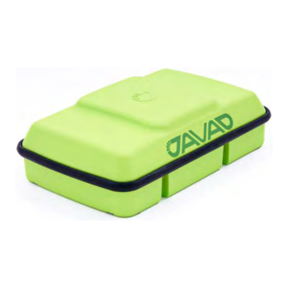
Bluetooth® Module 2. Getting Acquainted The GISmore is a 216-channel GNSS receiver with internal batteries, an internal GSM modem, and a Bluetooth® wireless technology module. The GISmore is a receiver that has been configured for surveying. The GISmore is built with internal memory for recording survey data, and recorded data can be downloaded using the Bluetooth®... -
Page 13: Modem
Description and Operation Getting Acquainted Modem 2.2. Modem The GISmore receiver incorporates an internal Cellular GSM/GPRS Modem with Telit® Module (GE864 - QUAD) - GSM/GPRS single quad-band cell phone frequency modem (Europe: 900/1800 MHz; USA and Canada: 850/1900 MHz). Note: To comply with RF exposure requirements, maintain at least 20 cm between the user and the transceiver. -
Page 14: Option Authorization File (Oaf)
Typically, all GISmore receivers ship with a temporary OAF that allows the receiver to be used for a predetermined period of time. When the receiver is purchased, a new OAF activates desired, purchased options permanently. -
Page 15: Operation
Software Installation 4. Operation GISmore receiver can be configured via Victor controller with Tracy software, or via new JAVAD GNSS VICTOR-VS controller with Tracy software or TRIUMPH software. Refer to the Tracy Software Manual for detailed description how to configure receiver using Tracy software. Refer to TRIUMPH-VS Operator’s Manual for detailed description how to configure GISmore using TRIUMPH Software. -
Page 16: Installing Optional Sim Card
Battery Screw Figure 3. SIM Card installation 3. Remove battery and open SIM holder. 4. Carefully insert the SIM into the SIM card holder and push it to LOCK to close it tightly. Figure 4. SIM Card installation 2 www.javad.com... -
Page 17: Charging The Battery
Warning: Do not disassemble the battery pack. Warning: Do not charge in conditions different than specified. Warning: Do not use other than the specified battery charger. Warning: Do not short circuit the battery pack. Warning: Do not crush or modify the battery pack. www.javad.com... -
Page 18: Power Supply Requirements
Limited Power Source and rated for Outdoor Use and have an output rated for +4.5 to + 14 volts DC, 3A. This may not be the same range as other JAVAD GNSS products with which you are familiar. : To avoid the introduction of hazards when operating and installing, before connecting of the equip-... -
Page 19: Connecting The Receiver And A Computer
JAVAD GNSS Victor, an IPAQ, or a computer with USB-to-Bluetooth adapter ® or PCMCA-to-Bluetooth adapter installed. The GISmore and external device connection procedure varies slightly depending on the type of external device used. In general, the connection procedure is as follows: ® Note: Refer to your Bluetooth -enabled external device documentation for more detailed connection information. -
Page 20: Gismore Configuration
Configuring Receiver 5. GISmore Configuration 5.1. Configuring Receiver GISmore receiver can be configured according the desired survey type, for RTK DGPS or for post- processing: • A stand-alone L1 device for mapping. • A static rover which collects observation data from the same satellites during the same time interval as the static base station. - Page 21 Description and Operation GISmore Configuration Configuring Receiver Table 2. TriPad Settings Parameter Base Rover Implicit Message 15 seconds Output Period Elevation mask angle 15 degrees File name prefix Enter a unique ID, such as the last 3 digits of receiver’s serial number. By deafault the prefix is log Рисунок...
- Page 22 Description and Operation GISmore Configuration Configuring Receiver 5. Open Positioning tab and set the Elevation mask to 15 degrees (Figure 9). Figure 9. Positioning tab - Elevation Mask • To set up the rover, open Positioning tab and set the Position Computation Mode - this drop-down list box allows selecting the mode of position computation: •...
- Page 23 Description and Operation GISmore Configuration Configuring Receiver ambiguity search time. This is the price one pays for the higher reliability of the ambiguity fixed solution.. Figure 10. Rover tab 6. For RTK DGPS survey, open the Ports tab and set up the parameters according Table 3, then click Apply (Figure 11 on page 24).
- Page 24 Description and Operation GISmore Configuration Configuring Receiver Figure 11. Ports tab 7. Open Advanced tab, and then Multipath Reduction subtab. Activate Code multipath reduction (mpnew) on base and rover for DGPS mode. For RTK DGPS mode activate Carrier multipath reduction (mpnew) as well (Figure 12).
-
Page 25: Configuring The Gsm/Gprs Module
• Displaying information about the radio modem installed in the receiver. • Programming the radio modem’s settings. See the ModemVU Software Manual available on the JAVAD GNSS website for details on configuring the receiver with an GSM radio modem. To configure an GSM module, have the following ready: •... -
Page 26: Configuring The Gsm Module For Point-To-Point Radio Link
Description and Operation GISmore Configuration Configuring the GSM/GPRS Module Configuring the GSM module for Point-to-Point radio link Note: To comply with RF exposure requirements, maintain at least 20 cm between the user and the GSM modem. 1. On the General tab, set the following parameters (Table 4) and click Apply (Figure 14 on page 26). -
Page 27: Configuring The Gsm Module For Internet Access
Description and Operation GISmore Configuration Configuring the GSM/GPRS Module Figure 15. Master/Slave tab 3. Click Apply, and then click FileDisconnect. Configuring the GSM module for Internet access Note: To comply with RF exposure requirements, maintain at least 20 cm between the user and the GSM modem. - Page 28 Description and Operation GISmore Configuration Configuring the GSM/GPRS Module Figure 16. General tab 2. In the GPRS tab it is necessary to set the dial number, user name and password, access point name and PDP context identifier to establish a GPRS connection. Usually, this information is given by cell provider (Figure 1-1 on page 28).
- Page 29 Mode •OFF means service is disabled. •RCV means that modem will receive data from another (remote) JAVAD GNSS receiver configured as a base station. •This base station have to be connected with Internet via Ethernet or GPRS and have static IP address.
-
Page 30: Settings For The Rcv Subtab
Internet via Ethernet or GPRS. The description of these parameters exceeds the scope of this document, see TriVU Software Manual, available from http:///www.javad.com, for detailed information of base station’s configuration and Ethernet and TCP port settings. Settings for the NTRIP subtab The NTRIP subtab is depicted in Figure 1-4: Figure 1-4. -
Page 31: Setup And Survey
GISmore is suitable for GIS applications which do not require precise antenna installation even for RTK DGPS mode. The main goal of RTK solution in GISmore is to make job of GIS operator much more reliable and effective by providing to him RTK quality of positioning for applications where before it was impossible. -
Page 32: Single-Frequency Static Surveying
Description and Operation Setup and Survey Single-Frequency Static Surveying An example of GISmore installation is inside of safety helmet of operator and on the standard pole: Figure 1-5. GISmore possible installation 6.2. Single-Frequency Static Surveying This method, sometimes called static surveying, is used surveying projects that require high accuracy. In this method, each receiver at each point logs data continuously for a pre-planned length of time. -
Page 33: Differential Gps (Dgps) Surveying
GPS using radios). Differential corrections can also be applied in the office once the rover and base station files are transferred to your office computer. This is called post processed differential correction and is carried out by the Differential Correction utility. www.javad.com... -
Page 34: Receiver And File Maintenance
When your measuring finishes, you can download your measuring files to a computer for storage, post- processing, or backup. Also, the GISmore memory holds a finite amount of files and information, so downloading the files to a computer ensures that no files are lost. You should download files as soon as possible after collecting data at the jobsite. -
Page 35: Deleting Files
• Date – the date the leased option will be disabled, if applicable Loading OAFs JAVAD GNSS dealers provide customers with OAF files. For any OAF related questions, E-mail at support@javad.com. Please have your receiver ID number available. 1. Connect your receiver and computer. See “Connecting the Receiver and a Computer” on page 19 for this procedure. -
Page 36: Clearing The Nvram
NVRAM can eliminate communication or tracking problems. Clearing the NVRAM in your GISmore can be interpreted as a “soft boot” in your computer. After clearing the NVRAM, your receiver will require some time to collect new ephemerides and almanacs (around 15 minutes). -
Page 37: Chapter 2. Troubleshooting
• Check all power sources. • Check that the most current software is downloaded onto the computer and that the most current firmware is loaded into the receiver. Check the JAVAD GNSS website for the latest updates. Then, try the following: •... - Page 38 • Order a new OAF with the desired options activated to enable or extend validity of the corresponding receiver options. Contact your dealer or visit the JAVAD GNSS website for details. • Refer to the NetView Software Manual for a detailed description of options.
- Page 39 • Check that the radio modem’s antenna is securely and properly connected to the antenna connector. • Check that the radio modem’s antenna is undamaged. If damaged, contact your JAVAD GNSS dealer to replace the antenna. • The specified baud rate is incompatible with the baud rates the receiver supports.
-
Page 40: Technical Support
Troubleshooting Technical Support 3. Technical Support If the troubleshooting hints and tips in this Operator’s Manual fail to remedy the problem, contact JAVAD GNSS Support. Before contacting JAVAD GNSS Customer support about any problems with the receiver, see “Check This First!” on page 37 for some solutions that may fix the issue. -
Page 41: Appendix A. Specifications
Appendix A PECIFICATIONS This JAVAD GNSS product is a 216-channel GNSS receiver with a Bluetooth® wireless technology module, GMS module, and a rugged plastic housing. Note: Performance specifications assume a minimum of 6 GPS satellites above 15 degrees in elevation and adherence to the procedures recommended in this manual. - Page 42 Output interval for RTCM correction data 1, 5, 10, 20 Hz optional Elevation mask 0 to 90 deg (independent of data logging Multi-base DGPS Differential correction select mode: Nearest, Mix, Best (optional) Correction format RTCM SC104 Ver 2.2, 2.3, or 3.0 www.javad.com...
-
Page 43: Gnss Board Details
< 0.5 m Real Time Cold Start//Warm Start/Reacquisition < 35 sec/< 5 sec/< 1 sec 1.2. GNSS Board Details Table 2. GNSS Board Specifications Tracking Signals GISmore GPS L1; Galileo E1; GLONASS L1 (G3 only) Tracking Functions Multipath reduction Code and Carrier PLL/DLL settings... -
Page 44: Bluetooth® Module Details
Multi-slot class 10 (4 Down; 2 Up; 5 Total) Max BR Downlink 236.8 Kbps (Over RS232) Coding Scheme MCS1-MCS9 Max BR 14.4 Kbps SIM Card SIM card support, 3.0 V, STK 3.1 Regulatory and Approvals FCC, IC, CCC; FTA, PTCRB; R&TTE; GCF; EMC; QS9000 manufacturing; RoHS/WEEE www.javad.com... -
Page 45: Appendix B. Safety Warnings
General Warnings JAVAD GNSS receivers are designed for survey and survey related uses (that is, surveying coordinates, distances, angles and depths, and recording such measurements). This product should never be used: • Without the user thoroughly understanding operator’s manual. -
Page 46: Battery Pack Warnings
: To avoid the introduction of hazards when operating and installing, before connecting of the equip- AUTION ment to the supply, make sure that the supply meets local and national safety ordinances and matches the equipment’s voltage and current requirements. www.javad.com... -
Page 47: Usage Warnings
The owner should periodically test this product to ensure it provides accurate measurements. Inform JAVAD GNSS immediately if this product does not function properly. Only allow authorized JAVAD GNSS warranty service centers to service or repair this product. Storage Precautions 1. - Page 48 Safety Warnings Storage Precautions www.javad.com...
-
Page 49: Appendix C. Warranty Terms
JAVAD GNSS’ Authorized Dealers During the warranty period, JAVAD GNSS will, at its option, repair or replace this product at no additional charge. Repair parts and replacement products will be furnished on an exchange basis and will be either reconditioned or new. - Page 50 900 Rock Avenue, San Jose, CA 95131 USA Phone: +1(408)770-1770 Fax: +1(408)770-1799 www.javad.com Copyright © JAVAD GNSS, Inc., 2012 All rights reserved. No unauthorized duplication.
Need help?
Do you have a question about the GISmore and is the answer not in the manual?
Questions and answers