Sign In
Upload
Manuals
Brands
Leica Manuals
Car Navigation system
MX420
Leica MX420 Manuals
Manuals and User Guides for Leica MX420. We have
2
Leica MX420 manuals available for free PDF download: Operator's Manual
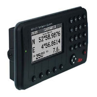
Leica MX420 Operator's Manual (235 pages)
Brand:
Leica
| Category:
Car Navigation system
| Size: 4 MB
Table of Contents
Product Information
2
Table of Contents
6
About GPS Navigation
12
Special Notes
13
Gps
13
Dgps
13
Charts and Navigational Aids
13
Functional Description
14
MX420 Configurations
14
Mx420/2 Gps
14
Mx420/2 Dgps
14
Mx420/8 Gps
14
Mx420/8 Dgps
14
Mx420/Br
15
MX420/BRIM (Dual Control Integrity Monitor)
15
MX420/AIS Basic (Automatic Identification System-Basic)
16
MX420/AIS (AIS & Navigation System)
16
DGPS Beacon System
18
Keypad & Display Description
19
Differential GPS Traffic Light Operation
20
Red Flashing
20
Red/Yellow Solid
20
Red Solid
20
Yellow/Green Solid
20
Yellow Solid
21
Green Solid
21
GPS Traffic Light Operation
21
Red Flashing
21
Red/Yellow Solid
21
Red Solid
21
Yellow Solid
22
Green Solid
22
The Display
22
The Softkeys
23
The Function Keys
23
Operator Manual
23
Mark Position
23
Goto
24
Light
24
Power On/Off
24
Man over Board (Mob)
25
E (Edit)
26
C (Clear)
26
Cursor
26
N Av Abc
26
Function
26
Ais
28
Automatic Identification System (AIS)
28
Navigate
29
Dead Reckoning
30
NAV1 - the Panorama Screen
30
NAV2 - Basic Steering Information
33
NAV 3 - Expanded Navigation Information
34
NAV4 - Sensor Input Navigation
35
Route
39
RTE1 - the Active Route
40
Creating a Route Using the GOTO Key
41
Erasing an Existing Route
44
Creating a Multi-Waypoint Active Route
45
Insert by Number
46
Choose in Bank
47
Insert New Waypoint
48
Insert Route
49
Maneuvering Within the Route
50
Scrolling
50
Skipping and Unpassing Waypoints
50
Inserting Waypoints or Routes into an Existing Route
51
Reversing the Active Route
53
ETA Setup
55
SOG Based on Arrival Date & Time
56
ETA Based on Speed
56
RTE2 - the Route Bank
57
Waypoint
59
Creating and Editing Waypoints
60
Waypoint Lock/Unlock
65
Removing Waypoints
67
Moving Waypoints
69
Downloading Waypoints & Routes to Other Devices
70
Rnn - Routes
71
RTE - Active Route
71
WPL - Waypoint Location - NMEA 0183 Standard
72
WPL - Waypoint with Symbols & Description - NMEA 0183 Expanded
72
Downloading Waypoints to a Personal Computer
73
Uploading Waypoints from Other Devices
75
Uploading Waypoints from a Personal Computer
76
Mark or Event
78
Goto
79
Plot
82
PLOT 1 - Relative to Boat
84
Modifying the Active Route Using the Plot Screen
84
Customizing the Display
85
Operator Manual
86
PLOT 2 - Relative to Marker
88
Plot3
88
Plot Screen Use Examples
89
Station Keeping
89
Grid Search
91
Man over Board
91
Remote MOB
93
Tide
94
TIDE1 - Current Tide Display
94
TIDE2 - Tide Table Port List
95
Adding a Port
97
Auxiliary
98
AUX1 - Alarm Log
98
AUX2 - Speed Graph
98
AUX3 - Not Used
98
AUX4 - Sun Almanac
98
AUX5 - Moon Phases
98
AUX6 - Batteries
100
AUX7 -Unit Information
101
Position
102
POS1 - Position Display (Large)
102
Loran-C
103
Utm
103
POS2 - Position, Altitude, Magnetic Variation, & Time
104
POS3 - Position & Log
104
Gps
106
GPS1 - GPS Status Screen
106
Gps6 - Dgps Status
107
GPS7 - DGPS Messages
109
Table of Contents
110
Configuration
110
AIS Config
110
AIS Static
110
AIS Voyage
110
Alarms
111
Anchor - Anchor Watch Alarm
111
COG SOG - Course & Speed Filter Settings & Setup
111
Compass - External Compass Input & Magnetic Variation Table
112
Datum - Current Position Calculation
113
Depth - NMEA Input Control
114
DGPS - DGPS Configuration
115
DR - Dead Reckoning
117
Dual Contr. - Dual Station Control
117
GPS - Elevation Mask Control
118
Init Pos - Initial Position Entry
119
Language - Language Configuration
120
Lighting - Display/Keyboard Light & Contrast Control
120
Log - Speed Log Input (Pulse or NMEA 0183)
120
Log Pulses - GPS SOG Log Pulse Output
122
MX480 - MX480 PC Chart Interface Control
122
Navigation - Navigation Method & Waypoint Pass Criterion Control
123
NMEA out 1 through N* - NMEA 0183 Output Data Control
126
Other Special Cases Affecting NMEA 0183 Records
131
Operation - General Setup and Control Settings
132
Organizer - Automated Message Reminders
133
Position - Positioning Reference, Mode, & Alarm Control
134
Printout 2 - Printer Output Control
136
ROT (Rate of Turn)
139
Security
139
Operator Manual
140
Serial I/O
140
Time - Mode and Format Control
140
Wind
141
Wpt & Rte Input - Uploading Waypoints into the Receiver
142
Appendix A - Automatic Identification System (AIS)
144
Introduction
144
AIS System Setup
153
Configuring the AIS Static Setup
154
Configuring the AIS Voyage
159
AIS Function Key
162
Ais1 - Own Ship Data
162
Ais 2 - Remote Ship List
164
Ais 3 - Received (Rx) Safety Messages
166
Ais 4 - Transmit (Tx) Safety Message
167
Ais 5 - Tx Safety List
169
Ais 6 - Regional Areas
170
Ais 7- Long Range (Lr) Display
172
Ais 8 - Ais Data Link Status
174
Ais 9 - Ais Status
175
Ais 10 - Ais Password
176
PLOT 3 - AIS Plot Screen
178
Appendix B - Datum List
179
Appendix C - Beacon List
180
Appendix D- Engineering Mode
194
AUX7 - Unit Information & Self Test
194
CDU Cold Start - Clearing Memory to Factory Default
196
GPS - GPS CDU Troubleshooting
197
GPS3 - Visible Satellite Information
197
GPS4 - GPS Position Uncertainty
198
GPS5 - GPS Debug Screen
198
MX421 Reset
201
Appendix E - Dual Control Head Mode
202
Appendix F - Demonstration Mode
206
Glossary
208
Advertisement
Leica MX420 Operator's Manual (233 pages)
Brand:
Leica
| Category:
Car Navigation system
| Size: 13 MB
Table of Contents
Table of Contents
2
About GPS Navigation
13
Special Notes
14
Gps
14
Ogps
14
Charts and Navigati0N.al Aids
14
Functional Description
15
MX420 Configurations
15
Mx42012Gps
15
Mx42012 Ogps
15
Mx420Ls GPS
15
Mx420Ls OGPS
15
Mx420Ibr
16
Mx420Lbrim (Dual Control Integrity Monitor)
16
Mx420Lais Basic (Automatic Identification System-Basic)
17
Mx420Lais (AIS & Navigation System)
17
OGPS Beacon System
18
Keypad & Display Description
18
Differential GPS Traffic Light Operation
20
Red Flashing S
20
Red/Yellow Solid
20
Red Solid S
20
Yellow/Green Solid
20
Green Solid
21
GPS Traffic Light Operation
21
Red Flashing
21
Red Solid
21
Yellow Solid
21
Green Solid
22
The Display
22
The Softkeys
23
The Function Keys
23
Mark Position
23
Goto
24
Light
24
Power On/Off
24
Man over Board (Mob)
25
Cursor
26
Function
26
F!./ Automatic Identification System (AIS)
28
Navigate
29
Dead Reckoning
30
NAV2 - Basic Steering Information
33
NAV 3 - Expancfcd Navigation Information
34
NAV4 - Sensor Input Navigation
35
Insert by Number
46
Insert New Waypoint
48
Insert Route
49
Inserting Waypoints or Routes into an Existing Route
51
Reversing the Active Route
53
SOG Based on Arrival Date & Time
56
ETA Based on Speed
56
Waypoint
59
Creating and Editing Waypoints
60
Waypoint Lock/Unlock
65
Removing Waypoints
67
Moving Waypoints
69
Rnn - Routes
71
WPL - Waypoint Location - NMEA 0183 Standard
72
WPL - Waypoint with Symbols & Description - NMEA 0183 Expanded
73
Uploading Waypoints from a Personal Computer
76
Version 7.5
77
Mark or Event
78
Goto
79
Plot
84
Modifying the Active Route Using the Plot Screen
84
Customizing the Display
86
PLOT 2 - Relative to Marker
89
Plot3
89
Plot Screen Use Examples
90
Station Keeping
90
Gridsearch
91
Man over Board
92
Remote MOB
93
Tide
94
Adding a Port
97
Auxiliary
99
AUX1 - Alarm Log
99
AUX2 - Speed Graph
100
AUX3 - Not Used
100
AUX4 - Sun Almanac
100
AUX5 - Moon Phases
101
AUX6 - Batteries
101
Position
103
Loran-C
104
Utm
104
POS2 - Position, Altitude, Magnetic Variation,& Time
105
POS3 - Position & Log
105
Gps
107
Configuration
111
AIS Static
111
AIS Voyage
111
Alarms
111
Compass - External Compass Input & Magnetic Variation Table
113
Datum - Current Position Calculation
114
Dual Contr. - Dual Station Control
118
GPS - Elevation Mask Control
119
Language - Language Configuration
120
Lighting - Display/Keyboard Light & Contrast Control
121
Log Pulses - GPS SOG Log Pulse Output
123
MX480 - MX480 PC Chart Interface Control
123
NMEA out 1 through N* - NMEA 0183 Output Data Control
127
Other Special Cases Affecting NMEA 0183 Records
132
Operation - General Setup and Control Settings
133
Organizer - Automated Message Reminders
134
Position - Positioning Reference, Mode, & Alarm Control
135
Printout 2 - Printer Output Control
137
ROT (Rate of Turn)
140
Security
140
Wind
142
Wpt & Rte Input - Uploading Waypoints into the Receiver
143
Appendix A - Automatic Identification System (AIS)
150
AIS System Setup
153
Configuring the AIS Static Setup
153
Configuring the AIS Voyage
158
AIS Function Key
161
AIS 2 - Remote Ship List
163
Ais 3 - Received (Rx) Safety Messages
165
Ais 6 - Regional Areas
169
Ais 7- Long Range (Lr) Display
172
Ais 9-Ais Status
175
PLOT 3 - AIS Plot Screen
178
Appendix B - Datum List
179
Appendix,C - Beacon List
180
Appendix D- Engineering Mode
194
AUX7 - Unit Information & Self Test
194
CDU Cold Start - Clearing Memory to Factory Default
196
GPS - GPS CDU Troubleshooting
197
GPS3 - Visible Satellite Information
197
GPS4 - GPS Position Uncertainty
198
GPS5 - GPS Debug Screen
198
Appendix E - Dual Control Head Mode
202
Appendix F - Demonstration Mode
205
Advertisement
Related Products
Leica Mojo Mini
Leica MX421 Series
Leica MX400
Leica MZ12s
Leica MZAPO
Leica M530 OHX
Leica M620 F18
Leica M11-P
Leica WILD M650
Leica MSS1200
Leica Categories
Digital Camera
Microscope
Measuring Instruments
Laboratory Equipment
Binoculars
More Leica Manuals
Login
Sign In
OR
Sign in with Facebook
Sign in with Google
Upload manual
Upload from disk
Upload from URL