Table of Contents
Advertisement
Advertisement
Table of Contents

Related Manuals for Leica BLK2FLY


Summary of Contents for Leica BLK2FLY
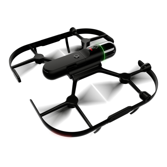
- Page 1 Leica BLK2FLY User Manual Version 1.0 English...
- Page 2 Introduction Validity of this This manual applies to the BLK2FLY. Where there are differences between the manual standard setups they are clearly described. This manual contains important safety directions as well as instructions for setting up the product and operating it. Refer to...
- Page 3 Description mySupport Create new support requests for your products that will be answered by your local Leica Geosystems Support Team. View the complete history of your support requests and view detailed information on each request in case you want to refer to previous support requests.
- Page 4 Term Description Outside Ambient Temperature Original Equipment Manufacturer Operational Safety Objectives Remote Controller RTCM Radio Technical Commission for Maritime Services Real Time Kinematic SAIL Specific Assurance and Integrity Level State of Charge SORA Specific Operational Risk Assessment. Unmanned Aircraft Unmanned Aerial Vehicle UAV Traffic Management System VLOS Visual Line of Sight...
-
Page 5: Table Of Contents
Electromagnetic Compatibility (EMC) Scanning Laser Laser Classification Regulatory Situation Product Overview BLK2FLY Hardware BLK2FLY Connectivity BLK2FLY Software Accessories Description of Manufacturer Description of the BLK2FLY Performance Characteristics Control of the BLK2FLY Operational Limitations 6.3.1 Meteorological Conditions 6.3.2 Day/Night Operations 6.3.3 Environmental Considerations Description of Lights 6.4.1... - Page 6 Dome Cleaning Procedure 13.3 Transport Technical Data 14.1 BLK2FLY 14.2 Smart Battery GEB374 14.3 Tablet 14.4 BLK2FLY System Certificates 14.4.1 EU Declaration of Conformity 14.5 Conformity to National Regulations 14.5.1 Labelling 14.5.2 BLK2FLY Aircraft 14.6 Dangerous Goods Regulations Software Licence Agreement/Warranty...
-
Page 7: Usage Instructions And Necessary Training
Get an appropriate license & operator registration. Refer to 3 Regulatory • Situation for details Comply with all applicable laws. Refer to 3 Regulatory Situation for details • Application training offered by Leica Geosystems is recommended for • BLK2FLY Usage Instructions and Necessary Training... -
Page 8: Safety Directions
Safety Directions General Introduction Description The following directions enable the person responsible for the product, and the person who actually uses the equipment, to anticipate and avoid opera- tional hazards. The person responsible for the product must ensure that all users understand these directions and adhere to them. -
Page 9: Definition Of Use
Even the BLK2FLY is rated IP54, flying while raining/snowing is prohibited • DO NOT add extra weight to the BLK2FLY •... -
Page 10: Risks Related To Operation Of A Uav
• Hazards of Use General The BLK2FLY may only be operated after instruction, training and certification by Leica Geosystems or an approved partner. Despite of all automatic functions and safety technology, the operator is the sole responsible person for the safe flight and the final take-off decision. - Page 11 WLAN interference The BLK2FLY may not carry any WLAN enabled equipment. This restriction includes cellphones or similar devices. Anything operating wirelessly on other frequencies may only be used with the express written consent of Leica Geosystems. If you ignore this warning, any warranty will be void.
- Page 12 Crash landing due to critical low batteries. Risk of serious injuries and dam- ages because of falling device. To prevent a crash landing due to low bat- teries, the BLK2FLY starts an automatic descent depending on the current altitude. Once started, this procedure cannot be interrupted. Controlling the position and heading is possible.
- Page 13 Land immediately if a temperature warning appears. DANGER Mental fatigue of the operator The operation of the BLK2FLY causes considerable mental fatigue. Failure to observe these precautions may cause the operator to lose concentration and lead to a crash landing, accident.
- Page 14 Sudden start of propellers while working close at the UAV may lead to serious injuries. Precautions: ▶ Avoid touching areas near propellers when UAV is powered. ▶ Block Apple iPad screen when not intended to fly or manage BLK2FLY. WARNING Adverse weather condition Crash landing due to adverse weather conditions Precautions: ▶...
- Page 15 Precautions: ▶ Although the product meets the strict regulations and standards which are in force in this respect, Leica Geosystems cannot completely exclude the possibility that other equipment can be disturbed or that humans or animals can be affected. ▶...
-
Page 16: Electromagnetic Compatibility (Emc)
Wet equipment Operating wet equipment leads to damage or malfunction of the instrument. Precautions: ▶ Do not power on the BLK2FLY system during cleaning and drying process. ▶ Do not connect power cables to the power source. ▶ If the equipment becomes wet, leave it unpacked. - Page 17 Although the product meets the strict regulations and standards which are in force in this respect, Leica Geosystems cannot completely exclude the possib- ility that the function of the product may be disturbed in such an electromag- netic environment.
-
Page 18: Scanning Laser
Scanning Laser General The laser incorporated in the product produces an invisible beam which emerges from the rotating mirror. The laser product described in this section is classified as laser class 1 in accordance with: IEC 60825-1 (2014-05): “Safety of laser products” •... -
Page 19: Regulatory Situation
It is the sole responsibility of the user who operates the aircraft to comply • with all applicable laws. Leica is not responsible where and when the aircraft is operated. It is the • sole responsibility of the user. The cameras installed on the BLK2FLY record images during flight. As •... -
Page 20: Product Overview
Power: ON. To turn the BLK2FLY off, remove battery Battery: Smart Battery GEB374, hot-swap (< 10 s) LTE antenna: Main Hot-swap The BLK2FLY is switched on. Swap a used battery against a charged battery within < 10 s without the need of rebooting the BLK2FLY. Bottom view 22345_003... -
Page 21: Blk2Fly Connectivity
Interfaces 23347_001 USB Type-C connector: Flight data transfer SIM card: LTE communication BLK2FLY, position LED 23492_001 Rear position LED – red Front position LED – green BLK2FLY Connectivity Description Schematic overview HxDR HxGN SmartNet, general NRTK provider Airspace Information Provider... -
Page 22: Blk2Fly Software
Install this application on the Apple iPad to control the BLK2FLY. ☞ Refer to 7 Description of the Application, Mission Planning for more information. Apple App store BLK2FLY Live app can only be updated over the Apple App store. Product Overview... -
Page 23: Accessories
Multi-charger, 889 087 Charge up to five batteries sim- available in 2022 ultaneously. The information/control of the battery is done by the BLK2FLY Live app: Charging state • Notification once the bat- • tery is fully charged Option to automatically •... - Page 24 Type Ordering number Detail Apple iPad Not sold by Leica • Apple iPad with LTE sup- • port ☞ The BLK2FLY can only be flown with the Apple iPad. Product Overview...
-
Page 25: Description Of Manufacturer
Description of Manufacturer We, Leica Geosystems AG, as the manufacturer of the BLK2FLY are designing and verifying our products against all technical and legal aspects. We have a proper process management in place acc. ISO9001 and this contains a well-documented and implemented innovation process. This process follows the best practices from all industries and has also certain milestone gates to ensure the safety and compliance of our products throughout all life phases. -
Page 26: Description Of The Blk2Fly
Control of the BLK2FLY Overview The application BLK2FLY Live, installed on the Apple iPad, is the only way to remote control the BLK2FLY. There is no hardware remote control with mechanical joysticks similar to other UAV. Refer to 7 Description of the Application, Mission Planning for more details. -
Page 27: Instrument Status
• Blinking • Pulsating • Wing light guide The wing LEDs, position lights, light up to show the operation states of the BLK2FLY and indicate the orientation of the UAV in air. 23983_001 Description Details Colours Green: Front LED •... - Page 28 Green Idle. On ground. The Static, 100% brightness Static, 40% brightness. BLK2FLY is ready. → Green Idle. The BLK2FLY is not Static, 100% brightness Static, 40% brightness. ready to take-off. Pos- → Yellow sible reasons: Can be high tilt or wings not being unfolded com- pletely.
- Page 29 Yellow Finished calibration. 2 Hz blinking for 10 s 2 Hz blinking for 10 s. 100% / 0% brightness → Green BLK2FLY – USB-C powered State/action LiDAR light guide Wing light guides USB Type-C connector Fade in to 100% bright- Turned off.
-
Page 30: Smart Battery Geb374
75-90% 60-75% 45-60% 30-45% 15-30% 0-15% Error 23484_001 In case of an error, refer to the Leica GKL352 User Manual ☞ Description of Data Link Refer to chapter 4.2 BLK2FLY Connectivity. Safety Features Overview Most errors in BLK2FLY operations are human errors. Refer to ☞... -
Page 31: Payload
Radar does not reliably detect very thin objects like cardboard or small • tree branches. It might miss glossy, transparent or dark surfaces Payload No additional payloads are allowed on the BLK2FLY. Hazard Assessment List of possible Unintentional propeller start... - Page 32 Area isolated from unin- • sons volved persons Bird strike Safety risk Possible effects/ Mitigations consequences Bird flock. Abort flying if increased • bird activity is noticed Take over manual con- • trol to avoid collision Description of the BLK2FLY...
- Page 33 • • surrounding button when safe to do objects or people Change to manual mode • Lose position and land BLK2FLY manu- • control due to ally lack of stable Do not fly in dark envir- • visual ground onments...
- Page 34 Changing the landing involved sur- landing position position from return to rounding per- Take over manual con- • launch to return to pilot sons trol and adjust position without carefully check- before landing ing the landing area. Description of the BLK2FLY...
- Page 35 Excess of environmental limits Safety risk Possible effects/ Mitigations consequences Flying in rain or starting Property dam- Do not use the BLK2FLY • • rain during a flight. in rain Injury of unin- Immediately land • •...
- Page 36 Avoid flying beyond set • • speeds. away from wind limitations desired loca- If increased unstability • tion of BLK2FLY is noticed, Collision with abort/postpone flying • potential until conditions normal- property dam- ised age or injury of surround- ing persons...
-
Page 37: Description Of The Application, Mission Planning
Description of the Application, Mission Planning Start Up Screens Description The following step table gives an overview on starting the BLK2FLY Live app. Moreover, it shows which menus appear. Start the BLK2FLY Live app from the tablet. Pairing between the BLK2FLY and the BLK2FLY Live app. - Page 38 BLK2FLY that was used the last time if available. To change to a different BLK2FLY, repeat the pairing process. ☞ If no BLK2FLY appears in the list, make sure BLK2FLY is in pairing ☞ mode (blue light). Tap to repeat the search.
-
Page 39: Menu Welcome
Open this menu optionally direct from the hamburger menu. Refer to 7.6.1 Live View Screen for details User Manual: Tap to open the digital version of the BLK2FLY User Manual. Search func- tionality given Description of the Application, Mission Planning... -
Page 40: Status Bar
Description 23612_001_en FLIGHT STATUS Warning STORAGE REMAINING Tap to reduce/maximise the CONNECTIVITY status status bar BLK2FLY BATTERY status Reduced status bar Detailed description Menu Description FLIGHT STATUS Shows ground speed and relative altitude. STORAGE REMAINING Data Recording Time. Storage remaining in hh:mm. -
Page 41: Icons
Icons Description Use this list of icons for reference when operating the software. Icon Description Hamburger menu. Obstacle avoidance turned off. A warning appears before finally turned off. Obstacle avoidance activated. Timer. Shows the time elapsed when recording. Return to launch. Land in place. - Page 42 Icon Description Start scan mission. Cancel Exit Next Repeat search for UAV while pairing. The fencing set up is deactivated. The fencing set up is activated. Warning System Warning. AIRSPACE INFORMATION. Description of the Application, Mission Planning...
- Page 43 Icon Description Add surface/area to scan. Emergency off switch. Tap the icon to show the slider. If the slider is used, the motors of the BLK2FLY immediately turn off. Pause Cancel Live View selected. Map 2D View selected. 3D View selected.
- Page 44 Icon Description Area Recording. Centre the UAV in the screen. Toggle layer map. Restriction info. Flight restriction info. 3D View unlocked. 3D View locked. Set back to default value. Edit UAV flying speed. UAV flying height. Storage remaining. Description of the Application, Mission Planning...
- Page 45 Icon Description Number of satellites connected. WLAN - full signal. WLAN - half signal. WLAN - UAV no signal. LTE - full signal. LTE - half signal. LTE - no signal. RTK active. RTK inactive. RTK active with warning. Battery status. Full. Connection lost.
- Page 46 Icon Description Tap/hold the take-off button for > 3 s. ☞ The BLK2FLY starts and hovers at 1 m Description of the Application, Mission Planning...
-
Page 47: Hamburger Menu
Hamburger Menu Description Tap the hamburger icon opens the side menu. The hamburger menu is access- ible from every menu. The position is always top/left. Live View. Refer to 7.6.1 Live View Screen for more details 3D View. Refer to 7.6.2 3D View Screen for more details Map View. -
Page 48: Live View Screen
Open the ADD A NEW SCAN menu • Manual control the BLK2FLY using the virtual joysticks • Zooming in this view flies the BLK2FLY to a new position to be able to ☞ show the area of interest. Digital zoom is only possible in 3D View. -
Page 49: 3D View Screen
7.6.2 3D View Screen Description This screen shows a visualisation of the onboard map in real-time. This voxel- ized map does not represent the current data being captured. 23386_001 23374_002_en Hamburger menu. Refer to 7.6 Hamburger Menu for details Virtual joysticks Emergency off switch Tap to open the ADD A NEW SCAN menu Toggle between Map View, 3D View and Live View... - Page 50 Centre button Centres view on BLK2FLY Live app: Short tap centres for the current loca- • tion of BLK2FLY, but won`t keep centred on BLK2FLY Long tap, button turns white and view • will always centre on the BLK2FLY, even location is changed.
-
Page 51: Map View Screen
Show flight advisories and rulesets • Define a permitted flight area, so called fence. This fence supports the • pilot to fly with the BLK2FLY only in the permitted area. 23375_001_en Hamburger menu. Refer to 7.6 Hamburger Menu for details Fencing button. -
Page 52: Project Browser Screen
7.6.4 Project Browser Screen Description Open this screen optionally direct from the menu WELCOME. Use this screen to manage projects. PROJECTS screen 23361_001_en Hamburger menu. Refer to 7.6 Hamburger Menu for details Add new project to the existing project list Given projects. -
Page 53: Airspace Information Screen
7.6.5 AIRSPACE INFORMATION Screen Description ADVISORIES: Rulesets for current airspace • RULESETS: Rulesets for the country where flying the BLK2FLY • AIRSPACE INFORMATION can be checked in the Map View or in the ☞ AIRSPACE INFORMATION screen. Flight restrictions on... - Page 54 Flight restrictions on 23660_001_en Help text for active selection on overlay. Description of the Application, Mission Planning...
-
Page 55: Battery Management Screen
7.6.6 Battery Management Screen Description This screen gives an overview of the Smart Battery GEB374 installed in the BLK2FLY. 23377_001_en Name of the BLK2FLY Battery info Predefined charge levels for ref- erence Detailed description Type Description Predefined charge levels READY \nTO FLY = 100% •... -
Page 56: Settings Screen
7.6.7 Settings Screen Description Use this screen to check/set up settings of the BLK2FLY Live app and BLK2FLY. 23866_001_en Hamburger menu. Refer to Scanning Hamburger Menu for details Flight Profile About Name Detailed description Type Description Profile Refer to 7.6.7.1 Profile Screen for details. -
Page 57: Profile Screen
Sign In Hamburger Menu for details Forgot Password Detailed description Type Description Sign In Sign in to HxDR Leica Geosystems network. Refer Sign In entry mask for details. Forgot Password Redirect to webpage hxdr.app/pw-recovery request new password. Sign In entry mask... -
Page 58: Blk2Fly Screen
7.6.7.2 BLK2FLY Screen Description Use this screen to configure, calibrate and update the BLK2FLY. 23389_002_en BLK2FLY connection status SmartNet/NRTK Configuration Name Remote ID serial number Calibration WLAN Connection Firmware LTE Connection Unpair Detailed description Type Description BLK2FLY connection Connected •... - Page 59 Unpair the BLK2FLY from the Apple iPad for pair- ing with a different BLK2FLY. BLK2FLY WLAN Con- Use this screen to select/connect to the BLK2FLY using WLAN. nection screen The WLAN connection is used for data transfer using Leica Cyclone REGISTER 360 or uploading to HxDR.
- Page 60 BLK2FLY LTE Connec- tion screen BLK2FLY 23892_002_en Information message IMEI number Detailed description Type Description SIM card This menu highlights that a SIM card must not have a SIM lock. Remove SIM lock by using for example a mobile phone before usage with BLK2FLY.
- Page 61 SmartNet/NRTK Con- Use this menu to configure the Network configuration. figuration screen 23391_001_en Enable SmartNet/NRTK Username NRTK Configuration Password Server Edit Credentials TCP Port GNSS/NRTK Status Network Mount Point Detailed description Type Description Enable SmartNet/ Tap to enable/disable SmartNet/NRTK. NRTK NRTK Configuration Tap and choose the NRTK Configuration Mode from the list.
- Page 62 Remote ID screen Use this menu to enter the operator registration number. 24504_001_en Edit Operator Number button Tap Edit Operator Number to open the entry mask. 24503_001_en Registration number Security code (3 digits) Detailed description Type Description Registration number Enter the registration number. Security code (3 digits) Enter the security code –...
- Page 63 Firmware screen This screen shows the current firmware versions for BLK2FLY and Smart Bat- tery GEB374. The operator gets informed once new firmware versions are available. Refer to the blue text lines on this screen. 23890_002_en Current firmware on %@ con-...
- Page 64 Size of firmware is about 1 GB. NOTICE It is highly recommended to have a SIM with unlimited data contract. Flying using LTE as connection protocol to BLK2FLY, uses mobile data too. Option 2: Tap Preload %@ to Tablet directly in this menu.
-
Page 65: Scanning Screen
7.6.7.3 Scanning Screen Description 23406_001_en Scan velocity 2D Map Scanning Live Image Scanning Detailed description Type Description Scan velocity Define flying speed for autonomous scanning. Refer to Scan velocity screen for details. Live Image Scanning Define parameters for live image scanning. Refer Live Image Scanning screen for details. - Page 66 Live Image Scanning screen 23864_001_en Distance between scan paths Max. adaption distance away Typical scan distance from object from object Max. adaption distance towards object Detailed description Type Description Distance between Defines the distance between scan lines/flight scan paths lines. The closer the scan lines are defined, the more dense is the point cloud.
- Page 67 2D Map Scanning screen 23865_001_en Distance between scan paths Max. adaption distance away Max. adaption distance from sur- from surface face Detailed description Type Description Distance between Defines the distance between scan lines/flight scan paths lines. The closer the scan lines are defined, the more dense is the point cloud.
- Page 68 7.6.7.4 Flight Screen Description Use this screen to manage the profile of the current logged in operator. 23399 _001_en Altitude limit Return behaviour Velocity limits Joystick mode Control interactions Detailed description Type Description Altitude limit Define maximum flight height. Refer to Altitude limit screen for details.
- Page 69 Altitude limit screen 23400 _001_en Altitude limit Detailed description Type Description Altitude limit Set the maximum height relative to the home position. Velocity limits screen 23401 _001_en Manual flight velocity (obstacle Manual flight velocity (obstacle avoidance active) avoidance deactivated) Detailed description Type Description Manual flight velocity...
- Page 70 23402_001_en Double tap flight distance Detailed description Type Description Double tap flight dis- To set the distance the BLK2FLY is flying in direc- tance tion of the double tap when being in the Live View. Return behaviour screen 23403 _001_en...
- Page 71 Be aware, that the BLK2FLY is landing wherever it currently is. There is no setting for minimum height to return to home. The ☞ BLK2FLY always flies directly to the defined return location using obstacle avoidance. Joystick mode screen 23902 _001_en...
-
Page 72: Support Screen
Refer to Issue Reporting screen for details. Contact Support Option to access the Leica support network and the possibility to upload logs from the BLK2FLY and the BLK2FLY Live application. Refer to Contact Support screen for details. Description of the Application, Mission Planning... - Page 73 Product Feedback Use this screen to share feedback with Leica Geosystems about your experi- screen ence with BLK2FLY. 24505_001_en Entry mask for sharing feedback Issue Reporting Use this screen to upload reports from your flight after any issue. screen 24506_001_en...
- Page 74 Contact Support Any issue using BLK2FLY? Use this screen to locate your closest Leica support screen contact. 24507_001_en Open Leica Support network button Description of the Application, Mission Planning...
-
Page 75: Scan Modes
Operational assumptions about the scan modes • When to use the operational assumptions and when not to use them • The level of control the operator can still exercise over the BLK2FLY in • each scan mode Description Menu Start Scanning... -
Page 76: Manual Recording
7.7.1 Manual Recording Overview This menu is used to manually operate/fly the BLK2FLY for recording. 23811_002_en Hamburger menu. Refer to Emergency off switch Hamburger Menu for details Add a new scan Status bar. Refer to 7.4 Status Switch between different views for details. - Page 77 Tap Manual Recording. The Live View opens. Use the virtual joysticks to con- trol the BLK2FLY to manually record the surface/area. ☞ As soon as the menu opens, the recording starts immediately.
- Page 78 ☞ In case battery runs low, an acoustic warning and additional information appears on the screen. Once the count-down is finished, the BLK2FLY returns automatically to the position defined in settings. Joystick control is automatically disabled, once the battery life lasts only for direct landing any more.
-
Page 79: Surface Recording
7.7.2 Surface Recording Overview This menu is used to fly a mission. A mission automatically records data of a predefined surface. If the battery life does not last for the whole surface scan, divide the surface into more than one individually planned surfaces. Currently, a surface scan stopped due to low batteries, cannot be resumed. - Page 80 Use the virtual joysticks and/or tap/hold and shift to navigate to the front of the surface of interest. ☞ If prompted by the BLK2FLY Live app mes- sage, fly the BLK2FLY closer to the surface. Within 20 metre from surface of interest is fine.
- Page 81 23907_002_en Once defined, accept the area. The flying pattern for the surface ☞ recording is displayed. The BLK2FLY is ready to start the mission. Option: Tap one of these but- tons to open the area editor again. Option: Tap to add an area to the already defined area.
- Page 82 Land in place Return to user Return to launch Once the surface recording is finished, the dialog box shows Mission Completed!. Stop: Return the BLK2FLY • and land. Continue: depending on bat- • tery status, define a new area for surface recording and continue to record data.
-
Page 83: Area Recording
AIRSPACE INFORMATION but- Tap to edit Tap to open the area editor for Current position/orientation of scan pattern A again the BLK2FLY Add another scan pattern. Simply Status bar. Refer to 7.4 Status drag and drop scan patterns A, B, for details. - Page 84 Area Recording, Tap/hold the take-off button for step-by-step > 3 s. ☞ The BLK2FLY starts and hovers at 1 m Tap the icon to open the menu to add a new scan. Tap Area Recording. ☞ Tap/hold to shift the map to the area of interest.
- Page 85 BLK2FLY to fly the mission 23994_001_en Once defined, accept the area. The flying pattern for the area ☞ recording is displayed. The BLK2FLY is ready to start the mission. 23996_001_en Option: Tap one of these but- tons to open the area editor again.
- Page 86 Return to user Return to launch Once the surface recording is finished, the dialog box shows Mission Completed!. Stop: Return the BLK2FLY • and land. Continue: depending on bat- • tery status, define a new area for surface recording and continue to record data.
-
Page 87: Alerts, Geo-Awareness, Operational Information
Alerts, Geo-awareness, Operational Information Description of Alerts, Warnings and Information Warnings Warnings are always in the center of the screen, just below the status bar. Example: Low battery in 3D View Example: Low battery in Live View Alerts, Geo-awareness, Operational Information... - Page 88 Flight restrictions Tap on to see flight restriction information on map and a specific location. Flight restriction information on map Flight restriction information on a specific location Alerts, Geo-awareness, Operational Information...
- Page 89 Notifications Warning messages that have occurred are listed under NOTIFICATIONS. Alerts, Geo-awareness, Operational Information...
-
Page 90: Geo-Awareness System, Fencing
8.2.1 Geo-awareness System Once the fencing is set up and active, BLK2FLY cannot pass the fence. This flight limitation is valid for horizontal and vertical direction. When the BLK2FLY flies into the active fence, it stops continue flying in that direction automatically. - Page 91 Define the maximum flight height by using the slider on the left side. The maximum set flight height is displayed on top of the slider. Example: 85 m When flying, the slider shows the current flight height of the ☞ BLK2FLY. Example: 31 m Alerts, Geo-awareness, Operational Information...
- Page 92 Tap OFF to activate the fence and finalise the setup. ☞ Button turns to ON indicating that geo-awerness/fencing is activated. Tap the tickmark or the fencing button to leave the fencing editing mode. When in editing mode, the fence can always be deleted ☞...
-
Page 93: Description Of Further Components
Single Charger Single charger, The single charger Leica GKL352 is shipped together with the BLK2FLY. A Leica GKL352 single Smart Battery GEB374 can be charged at a time. Refer to the enclosed Leica GKL352 Quick Guide or documentation on https://myworld.leica-geosys-... -
Page 94: Operation
BLK2FLY Live app in Map View. An Internet connection over the SIM card or WLAN is mandatory. It is also possible to open the Map View within the BLK2FLY Live app in the office being connected to WLAN, pan within the map to the upcoming flight areas and check the airspace information. -
Page 95: Pre-Flight Procedures
Ensure a safe take off and landing area • Take off and landing zone on grass: The BLK2FLY is able to take off and • land on grass. However, the grass should not be higher than 5 cm above the ground. - Page 96 ☞ The hamburger menu slides in from the left side. Example: Tap on Settings. The settings for the BLK2FLY are shown. Example: ☞ 23903_001_en Tap on a) in the Settings menu. Operation...
- Page 97 ☞ The Calibration menu opens. 23583_001_en ☞ Read the instructions on the page. Tap b) Start Calibration to start the calibration. Follow the calibration guide step 1–4 as shown on the screen. Refer to Blinking patterns for help during the calibration. UAV-01 23584_001_en Operation...
- Page 98 After successful calibration, the message CALIBRATION SUCCESS- FUL is displayed. UAV-01 23585_001_en Tap c) Close to close this menu and finish the calibration. Blinking patterns LiDAR LED ring colour Lighting Instrument status interval 0.5 Hz Keep rotating. pulsating, 100% / 10% brightness 2 Hz blinking Finished calibration.
-
Page 99: Flight Procedures
Make sure to not be close to metal objects • BLK2FLY positioned in wrong orientation • If BLK2FLY is positioned in the wrong orientation, the BLK2FLY Live • app waits until the BLK2FLY is in the required orientation 10.5 Flight Procedures... -
Page 100: Post-Flight Procedures
Leica Cyclone REGISTER 360 (BLK Edition) • Leica Cyclone BLK Data Manager • In case an issue needs to be reported to Leica support, go to the Support menu to upload logs. Refer to 7.6.8 Support Screen for details. Post processing software Leica Cyclone REGISTER 360 •... -
Page 101: Occurrence Reporting
Occurrence reporting is mandated by law. Information is available from the national aviation authority. It is the pilots responsibility to report any occurrence happened while • flying with the BLK2FLY The operator must know how to recover flight log information from the • BLK2FLY. Refer to 7.6.8 Support Screen... -
Page 102: Maintenance
Maintenance Plan General BLK2FLY is a professional UAV solution and is used in varying conditions. It needs regular maintenance to maximise the usage, life and secures the invest- ment of the UAV solution. Find this guideline on maintenance activities that the pilot and Leica Geosystems Service Center should perform for the system regularly. -
Page 103: Manufacturer Repair
Ship the BLK2FLY to your local Leica Geosystems Customer Support Centre • for inspection and overhaul 11.2 Manufacturer Repair In case other parts of the BLK2FLY are damaged, Leica Geosystems support must be contacted. Refer to 7.6.8 Support Screen for details. 11.3 Maintenance Recordkeeping We recommended recording when propellers have been exchanged. -
Page 104: Troubleshooting
Troubleshooting Help for trouble- Problem Solution shooting BLK2FLY cannot take BLK2FLY is not ready to take off. This can be due off –LiDAR LED ring is to reasons like: yellow. BLK2FLY standing on a tilted or moving plat- • form System error –... - Page 105 Delete old data like projects or individual • recordings Reboot the BLK2FLY • BLK2FLY fails to start or Adjust BLK2FLY position by manual control, • proceed with planned move a few metres in any direction and retry mission. resuming/starting the mission.
-
Page 106: Care And Transport
13.2 Cleaning and Drying General Only use a damp microfibre cloth to clean the BLK2FLY. Do not use detergent on carbon fibre parts. Use a brush to remove loose dust. NOTICE Prevent scratching the LiDAR lighthouse ▶... -
Page 107: Transport
• Watch out not to touch/scratch the LiDAR lighthouse, camera and tof • lenses Watch out for the propellers when folding BLK2FLY. Do not scratch the • lighthouse. Shipping When transporting the product by rail, air or sea, always use the complete original BLK2FLY packaging, container and cardboard box, or its equivalent, to protect against shock and vibration. -
Page 108: Technical Data
53 × 32 × 14 Propeller [inch] Diameter Pitch Weight Type Weight [kg] BLK2FLY including batteriy Maximum takeoff mass MTOM No additional weight must be added. Flight performance Type Value 13 min Typical flight time Maximum speed, obstacle avoidance inactive 5 m/s Flight start temperature at +5 °C is allowed, once the temperature of the... - Page 109 According to the safety standard IEC 61010-1, it is neces- sary to wear hearing protection at levels higher than 80 dB. Therefore, a minimum distance of 6 m from the BLK2FLY must be maintained during take-off and landing. There, the value is lower than 80 dB. For each country, the pilot is responsible for clarifying the valid limit values beforehand.
- Page 110 Fully integrated, receive, external LTE - Radio antenna, 403 to 470 MHz BLE - Bluetooth Low Energy Fast pairing between BLK2FLY and Apple iPad Concrete/brick surface 4 m distance from object, 2 m/s flying speed, 8 min flight, concrete/brick surface...
-
Page 111: Smart Battery Geb374
Type Data WLAN Video streaming, Live View on • the Apple iPad Control link to navigate the • BLK2FLY by the Apple iPad Data offload from the BLK2FLY • to the Cloud Data processing Type Details Data transfer Wireless: WLAN/LTE and USB 3.1 (USB C) -
Page 112: Blk2Fly System Certificates
EN 301 908-13 V11.1.1 EN 305 550-2 V1.2.1 Leica Geosystems AG, [mmm dd, yyyy] Hannes Juen Director Global Quality Engineering Translation into the official EU languages please see www.leica-geosystems.com/about-us/compliance- Leica Geosystems AG standards/conformity-declarations Heinrich-Wild-Strasse CH-9435 Heerbrugg Switzerland Phone +41 71 727 31 31 www.leica-geosystems.com... -
Page 113: Conformity To National Regulations
14.5 Conformity to National Regulations 14.5.1 Labelling Labelling BLK2FLY Model: BLK2FLY Art. No.: 938405 This device complies with part 15 of the FCC Rules. Operation is subject to the following two conditions: (1) This device must accept any interference received, including interference that may cause undesired operation. - Page 114 Radio technology Frequency band [MHz] LTE (FDD 12) UL: 698–718, DL: 728–746 LTE (FDD 13) UL: 777–787, DL: 746–756 LTE (FDD 18) UL: 815–830, DL: 860–875 LTE (FDD 19) UL: 830–845, DL: 875–890 LTE (FDD 20) UL: 832–862, DL: 791–821 LTE (FDD 26) UL: 814–849, DL: 859–894 LTE (FDD 28)
- Page 115 Radio technology Output power [dBm] [Conducted] 5 GHz (100–144, HT40, 1SS) 5 GHz (100–144, HT40, 2SS) 5 GHz (36–64, VHT20, 1SS) 5 GHz (36–64, VHT20, 2SS) 5 GHz (36–64, VHT40, 1SS) 5 GHz (36–64, VHT40, 2SS) 5 GHz (36–64, VHT80, 1SS) 5 GHz (36–64, VHT80, 2SS) 5 GHz (100–144, VHT20, 1SS) 5 GHz (100–144, VHT20, 2SS)
- Page 116 Radar 60100–63900 Europe Hereby, Leica Geosystems AG declares that the radio equipment type BLK2FLY is in compliance with Directive 2014/53/EU and other applicable European Directives. FCC ID: RFD-BLK2FLY FCC Part 15 This device complies with part 15 of the FCC Rules. Operation is subject to the...
-
Page 117: Dangerous Goods Regulations
400‑foot radius of a structure; and (2) does not fly higher than 400 feet above the structure's immediate uppermost limit. U.S. sales will not exceed 400 Leica Ictos devices in the first year and up to 800 per year for subsequent years. The Leica Ictos device is not be marketed for retail consumer markets. - Page 118 Damaged or defective batteries are prohibited from being carried or ☞ transported onboard any aircraft. Therefore, ensure that the condi- tion of any battery is safe for transportation. Technical Data...
-
Page 119: Software Licence Agreement/Warranty
Property Rights, Limitation of Liability, Exclusion of other Assurances, Govern- ing Law and Place of Jurisdiction. Please make sure, that at any time you fully comply with the terms and conditions of the Leica Geosystems Software Licence Agreement. Such agreement is provided together with all products and can also be referred to and downloaded at the Leica Geosystems home page at Hexagon −... - Page 120 947309-1.1.0en Original text Printed in Switzerland, © 2022 Leica Geosystems AG Leica Geosystems AG Heinrich-Wild-Strasse 9435 Heerbrugg Switzerland www.leica-geosystems.com...
Need help?
Do you have a question about the BLK2FLY and is the answer not in the manual?
Questions and answers