Sign In
Upload
Manuals
Brands
Raymarine Manuals
GPS
C70
Raymarine C70 Manuals
Manuals and User Guides for Raymarine C70. We have
6
Raymarine C70 manuals available for free PDF download: Reference Manual, Installation Manual, New Features Manual, Operating Manual
Raymarine C70 Reference Manual (244 pages)
C Series LCD Color Displays
Brand:
Raymarine
| Category:
GPS
| Size: 9.7 MB
Table of Contents
Trademarks and Registered Trademarks
2
Important Information
3
Intended Use
3
About this Manual
5
Emc Conformance
5
Technical Accuracy
5
Table of Contents
7
Chapter 1: Overview
15
What will My C-Series Integrate with
15
What Can the C-Series Display Do
16
The Simulator
18
Chapter 2: General Operation
19
Introduction
19
Powering the Display ON/OFF
19
Using the Controls
20
The Control Panel
20
Buttons and Soft Keys
21
The Cursor
22
Displaying Applications
22
Additional Screen Information
23
Status Icons
26
Initial Setup Procedures
27
Setting the Language, Date/Time Format and Units of Measurement
27
Selecting a Page Set
28
Selecting an Application Page
28
Selecting an Application Window
29
Adjusting the Display Lighting
30
Backlight Level
30
Using Compactflash Cards
31
Cautions
31
What Are Compactflash Cards Used for
31
Inserting a Card
32
Removing a Card
32
Managing Data
33
Writing/Retrieving Data to a Compactflash Card
33
Sending and Receiving Information Using a PC
36
Password Protecting Your Waypoints
37
Emergencies and Warnings
40
Man Overboard (MOB)
40
Silencing and Clearing Mob
41
Alarms
41
C-Series Display Reference Manual
42
Chapter 3: Working with Waypoints
43
What Is a Waypoint
43
How Are Waypoints Represented
44
Placing a Waypoint
45
Navigating to a Waypoint
46
Start Navigating to a Waypoint
46
Stop Navigating to a Waypoint
47
Viewing Waypoint Information
47
Editing a Waypoint
48
Changing Waypoint Details
49
Moving a Waypoint
49
Erasing a Waypoint(S)
50
Changing the Default Symbol or Group
51
Sorting the Waypoint List
52
Organising Waypoints into Groups
52
Displaying the Waypoint Group List
52
Making a New Waypoint Group
53
Moving Waypoints between Groups
53
Renaming an Existing Group
54
Erasing a Group
55
Controlling Waypoint Display
55
Show/Hide Waypoint Names
55
Showing/Hiding Waypoint Symbols
56
Showing/Hiding Waypoint Groups
56
Chapter 4: Using the Chart
57
Important
57
Safety
57
Chart Functionality
57
Chart Cards
58
Uses of the Chart Application
58
Viewing the Chart
59
The Chart Display
59
Where am I on the Chart
60
Moving Around the Chart
60
Additional Information on the Chart
61
Displaying Details of Objects and Features
62
Finding Nearby Features and Services
62
Displaying Details of Tides
63
Displaying Details of Currents
64
Displaying Details of Port Services
64
Displaying Details of Business Services & Points of Interest
67
Displaying Vessel Identity (AIS)
68
Measuring Distances and Bearings
69
From Your Boat
69
Between Two Points on Your Chart
69
Navigating to a Specific Point
70
Go to an Existing Waypoint
71
Resetting Cross Track Error (XTE)
71
Arriving at Your Target Waypoint
71
Stop Navigating to Your Target Waypoint
72
Maintaining a View of Your Navigation
72
Building and Following a Route
73
What Is a Route
73
What Can I Do with a Route
73
Building a Route
74
Saving Routes
77
Quick Routes
77
Following a Route
78
Resetting Cross Track Error (XTE)
80
Viewing Details of Routes
81
Editing Routes
82
Selecting a Route for Editing
82
Editing the Selected Route
83
Changing the Name or Color of a Route
87
Erasing a Route
87
Monitoring Where You Are Going
88
Using Chart Vectors
88
Using the Course Deviation Indicator (CDI)
89
Warnings of Potential Dangers
89
Using the Radar with the Chart
90
Synchronizing the Chart with Radar Range
90
Viewing MARPA Targets on the Chart
90
Distinguishing between Fixed and Moving Objects
91
Recording Where You Have Been
92
What Is a Track
92
How Can I Use Tracks
93
Creating a Track
93
Creating a Route from a Track
94
Editing Tracks
95
Selecting a Track for Editing
95
Editing the Selected Track
96
Defining How the Chart Windows Are Presented
97
Working with Multiple Chart Views
97
Setting the Orientation of the Chart
98
Setting the Motion Mode
99
Relative Motion with Optional Vessel Offset
99
Altering the Level of Chart Detail Displayed
100
Showing or Hiding Waypoints/Waypoint Information
101
Showing or Hiding a Route or a Track
102
Showing or Hiding Cartographic Features
103
Setting up Your Chart and Its Cartography
104
Chart Setup
104
Chart Offset
105
Cartography Setup
107
Chapter 5: Using the Fishfinder
109
Introduction
109
How Does the Fishfinder Work
109
What Can the Fishfinder Show Me
110
Interpreting the Bottom Structure
111
Factors Influencing Target Display
111
Factors Impairing a Fishfinder Picture
112
Seeing a Live Image
112
Enhancing What You See
114
Changing the Range
114
Shifting the Image
114
Zooming in on the Bottom
115
Simplifying the Bottom Image
117
Isolating Bottom Fish
118
Changing How the Image Scrolls
119
Changing How the Depth Digit Is Displayed
120
Marking a Position
121
Determining Depths and Distances of Targets
122
Measuring Using Vrms
123
Fishfinder Alarms
124
Setting up Your Fishfinder
124
Display Settings
125
Transducer Calibration
126
DSM Setup
127
Other Settings Affecting the Fishfinder Image
128
Operating Frequency Modes
128
Gain Modes
129
Adjusting the Power Setting
131
Chapter 6:Using The Radar
133
Introduction
133
What Is Radar
133
Detecting Targets
133
Maximum Radar Range
134
Factors Impairing a Radar Picture
134
Powering On/Off the Various Scanner Operating Modes
138
The Radar Picture
139
Marking a Position on the Radar Screen
140
Changing What You See in the Radar Window
140
Setting the Orientation of the Radar
140
Setting the Motion Mode
142
Showing or Hiding the Range Rings
144
Changing the Bearing Mode for Ebls
144
Getting the Best Picture
144
Using the GAIN Functions
144
Auto Mode
145
Using the Enhance Echoes Functions
146
Changing the Displayed Range
149
Radar Range and Chart Scale Synchronization
149
Measuring Distances, Ranges and Bearings
150
Using the Range Rings
150
Using the Cursor
150
Using Vrms and Ebls
151
Using Floating Vrms/Ebls
153
Using Radar to Avoid a Collision
154
Guard Zones
154
Marpa
157
Setting up MARPA
160
Acquiring a Target to Track
161
Cancelling Targets
161
Displaying Vessel Identity (AIS)
162
Setting up Your Radar
162
Warnings of Potential Dangers
164
Chapter 7: Using the Data Application
165
Introduction
165
Selecting a Data Application
165
Selecting the Data for Display
166
Pre-Configured Data Panels
166
Customize the Panels
167
Chapter 8: Using the Course Deviation Indicator
171
Introduction
171
The CDI Screen
171
Steering Instructions
172
Selecting the CDI Application
172
Modifying the CDI Application
172
Chapter 9: Using the Engine Monitor
173
Introduction
173
Displaying and Setting up the Engine Monitor
173
The Engine Monitor Display
175
Configuring the Engine Panels
175
What Should I Do When an Alarm Is Triggered
175
Chapter 10: Navtex
177
Overview
177
Setting up Navtex Weather
177
Incoming Message Alerts
177
Viewing Messages
178
Displaying the Navtex Message List
178
Displaying and Scrolling through a Message
178
Managing Navtex Messages
178
Selecting Message Alert Categories
178
Sorting the Message List
179
Chapter 11: Automatic Identification System (AIS)
181
Introduction
181
What Is AIS
181
Classes of AIS Data
181
What Do I Need to Run AIS
183
Selecting the AIS Function
183
AIS Status
183
How Is AIS Data Displayed
184
AIS Target Symbols
184
Viewing Target Information
185
Ais List
186
Using AIS for Collision Avoidance
187
Safe Zones
187
MARPA and AIS Options
188
Safety Messages
188
AIS Alarms
188
Local AIS Alarms
189
Active Alarm List
189
Simulator
190
AIS Layer Setup Menu
190
Chapter 12: System Setup and Customizing
191
Customizing the
191
Reconfiguring the Application and Page Layout
191
Rename a Page Set
192
Return to Default Setting
192
Changing the Databar
193
Databar Position
193
Data Bar Size
193
Customizing the Contents of the Data Bar
194
Trip Log
195
Changing the Set up Menu Options
197
Application Specific
197
External Equipment Menus
197
System-Wide Menus
197
Alarm Setup Menu
201
Navigation Alarms Setup
202
Fishfinder Alarms Setup
202
Gps Status
203
Compass Setup
205
Display Setup
205
System Diagnostics
206
Chapter 13: Maintenance & Troubleshooting
207
Introduction
207
Maintenance Procedures
207
Servicing and Safety
207
Routine Checks
207
Cleaning the Display
208
Resetting the Display
208
Settings Reset
208
Settings and Data Reset
209
Troubleshooting Your Display
209
Common Problems and How to Solve Them
209
Getting Technical Support
212
World Wide Web
213
Contacting Raymarine in the US
213
Contacting Raymarine in Europe
214
For Navionics Cartography
215
Appendixa: Specification
217
Data Features
221
Appendixb: List of Abbreviations
223
Appendixc: List of Cursor Labels
225
Raymarine World Wide Warranty
239
Product Warranty
241
Warranty Limitations
242
Advertisement
Raymarine C70 New Features Manual (54 pages)
C-Series Display
Brand:
Raymarine
| Category:
GPS
| Size: 0.74 MB
Table of Contents
New Features
1
Trademarks and Registered Trademarks
2
Table of Contents
3
Important Information
7
Intended Use
7
Safety Notices
7
About this Manual
9
Emc Conformance
9
Technical Accuracy
9
Chapter 1: New Features of the C-Series Display Unit
11
Navionics Support
11
Chart Application
11
Graphical Data
11
Autopilot Control
11
Weather (US Only)
12
Sirius Audio (US Only)
12
Chapter 2: Chart Application Updates
13
Animated Tides and Currents
13
To View Tide and Current Animations
13
Controlling the Animation
14
Range Rings
15
To Turn Range Rings on or off
15
Navionics Combined Data Cards
16
To Display Bathymetric Information
16
Chapter 3: Graphical Data
17
Compass Bar
17
Turning the Compass Bar on and off
17
Compass Bar Setup
18
Graphical Engine Data
18
To Set up an Engine Data Page
18
Engine Tilt and Trim
18
Genset Data
18
To Change the Number of Gensets
19
Chapter 4: Autopilot Control
21
Emergency Disengage
21
Enabling and Engaging the Autopilot
21
To Enable Autopilot Control
21
To Engage the Autopilot in Normal Operation
21
To Engage the Autopilot from the Setup Menu
22
To Disengage the Autopilot in Normal Operation
22
Emergency Disengage
22
Autopilot Status Indicator
23
The Autopilot Control Screen
23
Waypoint Arrival
24
When There Are more Waypoints in Your Route
24
When You Reach the Last Waypoint in Your Route
24
Chapter 5: Weather (US Only)
27
Overview
27
Disclaimer
27
Setting up the Weather Application
27
Pre-Requisites for Using the Weather Application
28
Adding a Weather Application
28
Specifying the Weather Elements Displayed
28
The Weather Display
28
Moving Around the Weather Map
29
Placing Waypoints
29
Weather Graphics
30
Precipitation (Nowrad)
31
Storm Cast
31
Sea Surface Temperature (SST)
32
Canadian Radar
32
Tracking Storms
32
Lightning
33
Surface Observation Stations
33
City Forecasts
34
Wind
35
Waves
35
Surface Pressure
36
Viewing Data at a Particular Location
36
Animated Weather Graphics
36
Setting up Animation
36
Running the Animation
37
Viewing Weather Reports
37
Tropical Statements
37
Marine Warnings
38
Marine Zone Forecasts
38
Watchbox Warnings
39
Watchbox Warning Alerts
39
Displaying Marine Watchboxes
40
Displaying Watchbox Data
40
Weather Application Setup
41
Selecting the Weather Setup Menu
41
Weather Setup Options
41
Showing/Hiding Marine Watchboxes and Zone Boundaries
41
Troubleshooting
42
Chapter 6: Sirius Audio (US Only)
43
To Start Using Sirius Radio
43
Tuning to a Channel
44
Browsing Channels
44
Filtering Categories from the Browse
45
To Filter Categories
45
Scanning Channels
45
To Scan Channels
45
Hiding or Showing Channels and Categories
45
To Hide or Show a Channel or Category
45
Presets
46
To Assign a Channel to a Preset
46
To Delete a Channel from a Preset
46
To Move a Channel to a New Preset
46
Parental Locking
46
To Enable Blocking
47
To Set up a Password
47
To Change an Existing Password
47
To Block a Channel
47
To Enter a Password
48
Favourite Song Alerts
48
To Enable Favourite Alerts
48
To Set up a Song or Artist Alert
48
Raymarine C70 Installation Manual (54 pages)
C-Series Display
Brand:
Raymarine
| Category:
GPS
| Size: 2.05 MB
Table of Contents
Installation Manual
1
Trademarks and Registered Trademarks
2
Important Information
3
Intended Use
3
Safety Notices
3
Emc Conformance
4
Handbook Information
5
Table of Contents
7
Chapter 1: Preparation for Installation
11
General Information
11
Contents of this Pack
11
Dimensions
12
C70 Display
12
C80 Display
12
C120 Display
13
Accessories and Spares
13
Planning the Installation
14
EMC Installation Guidelines
14
Suppression Ferrites
15
Where Should the Display Unit be Located
15
EMC Conformance
15
Chapter 2: System Integration
17
Introduction
17
What Is System Integration
17
What Is Seatalk
17
Seatalk
17
Seatalk2
17
What Is NMEA
18
Nmea 0183
18
Nmea 2000
18
Compatibility
18
Radar Scanners
18
Digital Sounder Module
19
Engines
19
Media Storage Cards
19
Navionics Chart Cards
19
Compactflash Cards
20
Functionality
20
Data or Equipment Required for Applications/Functions
20
How Is the C-Series Display Integrated
22
Seatalk System
22
Integrated System1
23
Integrated System 2
24
Integrated System 3
25
Chapter 3: Installation
27
Introduction
27
Mounting the Display
27
Trunnion Mount
27
Flush Mount
28
Attaching the Front Bezel
30
Removing the Front Bezel
31
Cables
32
Siting and Securing Cables
32
Connecting Cables
32
Using Cable Splicers
33
Extension Cable
34
Power Cable (R08003)
34
Seatalk Cable
35
NMEA 0183 Cable
35
Seatalk2 (Not Supplied)
35
Fishfinder Cable
36
Dsm 250
36
Dsm 300
36
Radar Cable (Not Supplied)
36
Connecting a Radome
36
Connecting to an Open Array
37
Chapter 4: Commissioning the System
41
Introduction
41
Pre-Start Checks
41
Initial Power on Procedure
42
Tests and Checks
43
Test and Align the Radar
43
Radar Transmission Check
43
Radar Alignment Checks
44
Adjusting the Bearing Alignment
45
Checking the GPS
45
Checking Heading Data
46
Checking the Chart Application
46
Testing the Fishfinder Application
47
Setting the NMEA for AIS or Navtex
47
Testing Instrument Data
48
Running AIS
48
Advanced Settings
49
Adjusting the Settings
49
Display Timing
50
Chapter 5: Troubleshooting
51
How Can I Troubleshoot My Display
51
Technical Support
52
World Wide Web
52
Help Us to Help You
52
Contacting Raymarine in the US
53
Accessories and Parts
53
Product Repair and Service
53
Advertisement
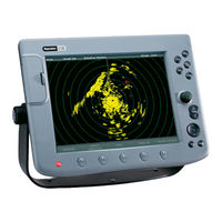
Raymarine C70 Installation Manual (64 pages)
C-Series Displays
Brand:
Raymarine
| Category:
Marine Equipment
| Size: 1 MB
Table of Contents
Trademarks and Registered Trademarks
2
Table of Contents
3
Important Information
7
EMC Installation Guidelines
9
Radar Scanners
10
Digital Sounder Module
11
Electronic Cards
11
Navionics Chart Cards
11
Compactflash Cards
11
Chapter 1: System Integration
13
Introduction
13
What Is System Integration
13
What Is Seatalk
13
What Is NMEA
14
How Is the C-Series Display Integrated
15
Seatalk System
15
Integrated System1
16
Integrated System 2
17
Integrated System 3
18
Chapter 2: Installation
19
Introduction
19
Selecting the Display Unit Location
19
Selecting the Scanner Unit Location
20
What Comes in the Box
26
What Size Is the Display Unit
27
C70 Display
27
C80 Display
27
C120 Display
28
What about the Cables
28
What Cables will be Needed
29
Power Input Cable
29
Seatalk Cable
30
NMEA Input Cable
31
Fish Finder Cable
31
Radar Cable
32
How Are the Cable Connections Made on the Display
34
How Can the Display Unit be Mounted
34
How Is the Mounting Bracket Fitted
35
How Is the Unit Console Mounted
37
How Is the Front Bezel Attached to the Display
39
How Do I Remove the Front Bezel
40
Chapter 3: System Tests and Alignment
41
Introduction
41
The Screen
41
How Do I Test the Radar and Align It
41
Pre-Start Checks
41
Testing and Alignment
42
Transmission Check
42
Alignment Checks
43
Adjusting the Bearing Alignment
44
Display Timing
44
Heading Data
45
Advanced Settings
45
Adjusting the Settings
45
Stc Preset
46
Tune Preset
46
How Do I Test the Chartplotter
47
How Do I Insert or Remove a Compactflash Card
47
How Do I Test the Fishfinder
51
Chapter 4: Maintenance & Troubleshooting
53
Introduction
53
What Maintenance Can I Do
53
Servicing and Safety
53
What Routine Checks Should I Do
53
How Do I Clean the Display
54
When Should I Reset a Display
54
What Happens if I Reset the System
54
How Can I Troubleshoot My Display
55
What Are the Common Problems and How Do I Solve Them
56
How Can I Get Technical Support
56
World Wide Web
56
Help Us to Help You
56
How Can I Contact Raymarine in the US
57
How Can I Contact Raymarine in Europe
58
Appendix A: Specification
59
General
59
Radar Features
60
Chartplotter Features
61
Fishfinder
62
Interfacing
62
List of Abbreviations
63
Raymarine C70 Installation Manual (54 pages)
C-Series Display
Brand:
Raymarine
| Category:
GPS
| Size: 2.04 MB
Table of Contents
Trademarks and Registered Trademarks
2
Important Information
3
Intended Use
3
Safety Notices
3
Handbook Information
5
Table of Contents
7
Chapter 1: Preparation for Installation
11
General Information
11
Contents of this Pack
11
Dimensions
12
C70 Display
12
C80 Display
12
C120 Display
13
Accessories and Spares
13
Planning the Installation
14
EMC Installation Guidelines
14
Suppression Ferrites
15
Where Should the Display Unit be Located
15
EMC Conformance
15
Chapter 2: System Integration
17
Introduction
17
What Is System Integration
17
What Is Seatalk
17
Seatalk
17
Seatalk2
17
What Is NMEA
18
Nmea 0183
18
Nmea 2000
18
Compatibility
18
Radar Scanners
18
Digital Sounder Module
19
Engines
19
Media Storage Cards
19
Navionics Chart Cards
19
Compactflash Cards
20
Functionality
20
Data or Equipment Required for Applications/Functions
20
How Is the C-Series Display Integrated
22
Seatalk System
22
Integrated System1
23
Integrated System 2
24
Integrated System 3
25
Chapter 3: Installation
27
Introduction
27
Mounting the Display
27
Trunnion Mount
27
Flush Mount
28
Attaching the Front Bezel
30
Removing the Front Bezel
31
Cables
32
Siting and Securing Cables
32
Connecting Cables
32
Using Cable Splicers
33
Power Cable (R08003)
34
Seatalk Cable
35
NMEA 0183 Cable
35
Seatalk2 (Not Supplied)
35
Fishfinder Cable
36
Dsm 250
36
Dsm 300
36
Radar Cable (Not Supplied)
36
Connecting a Radome
36
Connecting to an Open Array
37
To Replace a Raymarine Pathfinder Display
38
Chapter 4: Commissioning the System
41
Introduction
41
Pre-Start Checks
41
Initial Power on Procedure
42
Tests and Checks
43
Test and Align the Radar
43
Radar Transmission Check
43
Radar Alignment Checks
44
Adjusting the Bearing Alignment
45
Checking the GPS
45
Checking Heading Data
46
Checking the Chart Application
46
Testing the Fishfinder Application
47
Setting the NMEA for AIS or Navtex
47
Testing Instrument Data
48
Running AIS
48
Advanced Settings
49
Adjusting the Settings
49
Display Timing
50
Chapter 5: Troubleshooting
51
How Can I Troubleshoot My Display
51
Technical Support
52
World Wide Web
52
Help Us to Help You
52
Contacting Raymarine in the US
53
Accessories and Parts
53
Product Repair and Service
53
Raymarine C70 Operating Manual (20 pages)
C-Series Display
Brand:
Raymarine
| Category:
GPS
| Size: 2.61 MB
Table of Contents
The Control Panel
2
General Operation
2
Buttons
3
Soft Keys
3
The Cursor
3
Setting up the Display
4
Understanding the Chart
6
More Information
6
Displaying Additional Information
8
Working with Waypoints
9
Basic Navigation
9
What Is a Waypoint
9
Using AIS
14
Ais Target Symbols
14
What Is Ais
14
How Is Ais Data Displayed
14
Monitoring Data and Engines
18
Navtex
18
Advertisement
Related Products
Raymarine C120
Raymarine C80
Raymarine Chartplotter
Raymarine Compass
Raymarine C-Series
Raymarine c97
Raymarine CP200
Raymarine CP470
Raymarine DownVision CPT-70
Raymarine DownVision CPT-120
Raymarine Categories
Marine Equipment
GPS
Monitor
Autopilot System
Radio
More Raymarine Manuals
Login
Sign In
OR
Sign in with Facebook
Sign in with Google
Upload manual
Upload from disk
Upload from URL