Furuno FCR-2107 series Manuals
Manuals and User Guides for Furuno FCR-2107 series. We have 3 Furuno FCR-2107 series manuals available for free PDF download: Operator's Manual
Furuno FCR-2107 series Operator's Manual (540 pages)
MARINE RADAR
Brand: Furuno
|
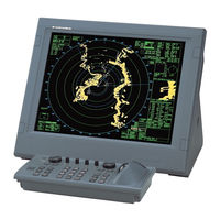
Category: Marine Radar
|
Size: 10.65 MB
Table of Contents
-
Foreword17
-
-
-
-
Radar Mode41
-
-
Pulse Length58
-
Echo Stretch62
-
Markers67
-
Stern Marker67
-
North Marker67
-
Watch Alarm75
-
Interswitch76
-
Drop Mark82
-
Anchor Watch83
-
-
-
General87
-
False Echoes89
-
Racon92
-
-
-
Vector Modes104
-
Predictor108
-
Set and Drift109
-
TT Alerts113
-
Trial Maneuver114
-
5 AIS Operation
121-
Controls for AIS122
-
AIS Symbols124
-
-
Basic Data129
-
-
Lost AIS Targets135
-
AIS Alerts146
-
-
6 ECDIS Overview
147-
ECDIS Overview148
-
-
7 Vector Charts
165-
S57 Charts165
-
-
-
Introduction196
-
Permits196
-
Product List196
-
Authentication196
-
-
-
-
Display Base220
-
Tracking Page221
-
Targets Page221
-
Mariner Page222
-
General Page222
-
-
8 Manual Updates
245 -
9 Chart Alerts
269-
Chart Alerts270
-
Route Planning277
-
Route Monitoring280
-
-
-
-
Parameters289
-
-
Backup296
-
WPT Table Report296
-
Full WPT Report297
-
-
Introduction311
-
-
Point Page319
-
Symbol Page320
-
Line Page321
-
Tidal Page322
-
Area Page323
-
-
12.10 Reports330
-
-
13 Notes
331-
Introduction331
-
Notes Modes332
-
-
How to Use Notes333
-
-
-
Introduction341
-
File Operations342
-
ASCII Text File343
-
Chart345
-
-
-
Kalman Filter354
-
Kalman Filter356
-
Wind Sensor361
-
Depth Sensor363
-
-
Details Log366
-
Voyage Log367
-
Chart Usage Log373
-
16.10 Alert Log377
-
18 Anchor Watch
381
Advertisement
Furuno FCR-2107 series Operator's Manual (556 pages)
MARINE RADAR/ARPA
Brand: Furuno
|
Category: Marine Radar
|
Size: 8.13 MB
Table of Contents
-
Foreword17
-
-
Charts40
-
-
-
Radar Mode43
-
-
Pulse Length61
-
Echo Stretch66
-
Markers70
-
Watch Alarm79
-
Interswitch80
-
Drop Mark87
-
Anchor Watch88
-
-
-
Controls for TT100
-
Vector Modes110
-
Predictor114
-
Set and Drift115
-
TT Alerts119
-
Trial Maneuver120
-
5 AIS Operation
127-
Controls for AIS128
-
AIS Symbols130
-
Sleeping Targets134
-
-
Basic Data135
-
-
Lost AIS Targets141
-
AIS Alerts153
-
-
6 ECDIS Overview
155-
ECDIS Overview156
-
-
-
S57 Charts173
-
-
Introduction208
-
Permits208
-
Product List208
-
Authentication208
-
-
-
Display Base233
-
-
8 Manual Updates
261 -
9 Chart Alerts
285 -
-
Choosing Datum302
-
-
Parameters309
-
-
Backup317
-
WPT Table Report317
-
Full WPT Report319
-
-
-
Introduction333
-
Choosing Datum338
-
-
Point Page341
-
Symbol Page342
-
Line Page343
-
Tidal Page344
-
Area Page345
-
-
12.10 Reports352
-
-
13 Notes
353-
Introduction353
-
Notes Modes354
-
-
Using Notes355
-
-
-
Introduction363
-
File Operations364
-
ASCII Text File365
-
Chart366
-
-
-
Kalman Filter378
-
Wind Sensor384
-
Depth Sensor387
-
-
Voyage Records390
-
Details Log390
-
Voyage Log391
-
Chart Usage Log397
-
Alert Log402
-
-
-
Introduction405
-
-
18 Anchor Watch
407

Furuno FCR-2107 series Operator's Manual (16 pages)
MARINE RADAR/ARPA
Brand: Furuno
|
Category: Marine Radar
|
Size: 1.46 MB
Table of Contents
-
Notes11
-
Chart Alerts14
Advertisement
Advertisement