Table of Contents
Advertisement
Quick Links
Advertisement
Chapters
Table of Contents

Related Manuals for Alpine NVE-M300P


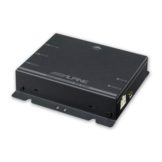
Summary of Contents for Alpine NVE-M300P
- Page 1 Australian Edition...
-
Page 2: Important Information
If there is anything in the manual which you do not understand, or are uncertain about the If there is anything in the manual which you do not understand, or are uncertain about the operation of the navigation system, please contact an authorised ALPINE representative operation of the navigation system, please contact an authorised ALPINE representative before using the navigation system. -
Page 3: Warnings
Read the manuals for this device and the system components carefully before using your navigation system. They contain instructions on how to use the system in a safe and effective manner. ALPINE cannot be held responsible for problems resulting from failure to observe the instructions in these manuals. -
Page 4: Caution
If the fuse(s) blow(s) more than once, carefully check all electrical connections for short circuiting. Also have your vehicle’s voltage regulator checked. Servicing the Unit If you have problems, do not attempt to repair the unit yourself. Return it to your ALPINE dealer or the nearest ALPINE Service Station for servicing. Installation Location Make sure the NVE-M300P Navigation Module will not be exposed to: •... -
Page 5: End User Licence Agreement
2.7 The right to use the System shall expire either when the user destroys this software, or when any of the terms for use is violated and Alpine exercise the option to revoke the license to use this software. 4.4 Error corrections, additions, updates used by the User following the conclusion of this Agreement 4.4 Error corrections, additions, updates used by the User following the conclusion of this Agreement... - Page 6 RDS TMC traffic information service) for his/her own personal 4.8 Alpine will at its option repair or replace the product with a new or reconditioned product benefit and at his/her own risk. It is strictly prohibited to store, to transfer or to distribute these data or benefit and at his/her own risk.
- Page 7 7.1 All intellectual property rights (including copyright) in and to the System (including the Data) are the sole property of Alpine and or its suppliers and except for the rights granted to you in this License, you will not acquire any intellectual property or other rights in or to the System or any part of the System.
-
Page 8: Copyright Note
Alpine Electronics (Europe) GmbH. consent of Alpine Electronics (Europe) GmbH. © 2010 - Alpine Electronics of Australia Pty. Limited. © 2009 - Alpine Electronics (Europe) GmbH. © 2009 - Alpine Electronics (Europe) GmbH. -
Page 9: Table Of Contents
3 End User Licence Agreement..................5 4 Copyright note........................8 5 Table of contents ......................9 6 Getting started with Alpine Navigation Software ............12 6.1 Buttons and other controls on the screen ................14 6.1.1 Using keyboards..........................15 6.1.2 Permanent buttons (Menu, Return, Monitor Control and Map).............15 6.2 Using the map......................... - Page 10 NVE-M300P Navigation Module Owner’s Manual 7.1.2.4 Selecting an intersection as the destination .................... 32 7.1.2.5 Selecting a city centre as the destination ....................33 7.1.2.6 Entering an address with a postal code ....................34 7.1.2.7 Tips on entering addresses quickly ......................34 7.1.3 Selecting the Home address ......................35...
- Page 11 NVE-M300P Navigation Module Owner’s Manual 8.5.1 Map Screen settings ........................59 8.5.2 Sound settings ..........................60 8.5.3 Route Planning options ........................61 8.5.4 Regional settings..........................63 8.5.5 Adjust Display ..........................63 8.5.6 Navigation settings.........................64 8.5.7 Warning settings ..........................64 8.5.8 GPS ..............................65 8.5.9 TMC...............................65 8.5.10 Track Log settings........................66 8.5.11 User Data Management........................67...
-
Page 12: Getting Started With Alpine Navigation Software
Start using Alpine Navigation Software When you turn on NVE-M300P Navigation Module for the first time, you need to do the following: Select the written language of the application interface. Later you can change it in Settings (page 63). -
Page 13: The Navigation Menu
NVE-M300P Navigation Module Owner’s Manual The Navigation menu: The typical way of using Alpine Navigation Software is to select a destination and start navigating. You can select your destination in the following ways: • Use the selected location on the map (the Cursor) - (page 28). -
Page 14: Buttons And Other Controls On The Screen
When you are using Alpine Navigation Software, you usually tap buttons on the touch screen. You only need to confirm selections or changes in Alpine Navigation Software if the application needs to restart, it needs to perform a major reconfiguration, or you are about to lose some of your data or settings. -
Page 15: Using Keyboards
NVE-M300P Navigation Module Owner’s Manual 6.1.1 Using keyboards You only need to enter letters or numbers in Alpine Navigation Software when you cannot avoid it. You can type with your fingertips on the full-screen keyboards and you can switch between various keyboard layouts, for example ABC, QWERTY or numerical. -
Page 16: Using The Map
6.2 Using the map 6.2 Using the map The map screen is the most frequently used screen of Alpine Navigation Software. It can be accessed The map screen is the most frequently used screen of Alpine Navigation Software. It can be accessed... - Page 17 (3D) the top of the map always points in the current driving direction Multi-function Show Start position / Return to GPS position / Repeat button. voice instruction. See page 15 for details. Map scale Alpine Navigation Software shows the scale of the map in 2D mode.
-
Page 18: Lane Information And Signposts
When navigating on multilane roads, it is important to take the appropriate lane in order to follow the recommended route. If lane informations are available in the map data, Alpine Navigation Software recommended route. If lane informations are available in the map data, Alpine Navigation Software displays the lanes and their directions using small arrows at the bottom of the map. -
Page 19: More Information
The area in the bottom left corner is a combined status indicator field. Tap this area to open the GPS Data screen (page 53). Icon Status for More information GPS position quality A higher number of lit bars indicates better GPS position accuracy. Track log recording Alpine Navigation Software records a Track log when GPS position is available. -
Page 20: Using The Cursor (The Selected Map Location)
NVE-M300P Navigation Module Owner’s Manual 6.2.4 Using the Cursor (the selected map location) First, place the Cursor at the desired map location with one of the following options: • Use the Destination menu to select a location. The map returns with the selected point (the Cursor) in the middle, and the Cursor menu appears with the available options. -
Page 21: Alpine Navigation Software Concepts
6.3.2 Position markers 6.3.2.1 Current GPS position and Lock-on-Road When your GPS position is available, Alpine Navigation Software marks your current position with the icon on the map. The exact location of the position marker depends on the vehicle type used for route calculation. The vehicle type can be selected in Route settings (page 61). -
Page 22: Selected Location (Cursor)
If you select a location in the Destination menu, or you tap the map when the map control buttons are visible, the Cursor appears at the selected point on the map. Alpine Navigation Software displays the Cursor with a large circle ( ) to make it visible at all zoom levels, even when it is in the background of a 3D map view. -
Page 23: Route Calculation And Recalculation
Alpine Navigation Software automatically recalculates the route if you deviate from the proposed itinerary. Depending on the type of the TMC event, Alpine Navigation Software also recalculates the route if a TMC event concerns a part of the recommended route. -
Page 24: Turn List (Itinerary)
NVE-M300P Navigation Module Owner’s Manual 6.3.6 Turn List (Itinerary) The Itinerary is the list of the route events, it equals the driving instructions. To display the Turn List, tap the following buttons: You have the following options on the Itinerary screen:... -
Page 25: Track Logs
A simulation drives you through the route, following the driving instructions (page 38). You can use it, for example, to see which bridge Alpine Navigation Software planned for the route; if you do not want to take that bridge, you can avoid it. -
Page 26: Road Safety Cameras
The location of a Road Safety Camera is a special POI. These cannot be searched like other POIs, and there is a special proximity warning only for cameras. Is NVE-M300P Navigation Module shipped with a built-in database of Road Safety Cameras? -
Page 27: Speed Limit Warning
NVE-M300P Navigation Module is sold with a TMC module, which is needed to receive TMC data. To receive the signal, you also need a TMC antenna – several models can be purchased as accessory –... -
Page 28: Navigating With Alpine Navigation Software
NVE-M300P Navigation Module Owner’s Manual 7 Navigating with Alpine Navigation Software You can set up your route in Alpine Navigation Software in several ways: • if you need a simple route (a route with only one destination, without any intermediate waypoints), you can select the destination and start navigating to it right away •... -
Page 29: Entering An Address Or Part Of An Address
Tap the following buttons: Tap the following buttons: By default, Alpine Navigation Software proposes the country and settlement where you are. If By default, Alpine Navigation Software proposes the country and settlement where you are. If needed, tap the button with the name of the country, and select a different one from the list. -
Page 30: Entering An Address If House Numbering Is Restarted
Tap the following buttons: By default, Alpine Navigation Software proposes the country/state and settlement where you are. If needed, tap the button with the name of the country/state, and select a different one from the list. -
Page 31: Entering An Address Without Knowing The District/Suburb
In this case, follow the instructions below: Tap the following buttons: By default, Alpine Navigation Software proposes the country/state and settlement where you are. If needed, tap the button with the name of the country/state, and select a different one from the list. -
Page 32: Selecting An Intersection As The Destination
7.1.2.4 Selecting an intersection as the destination Tap the following buttons: By default, Alpine Navigation Software proposes the country/state and settlement where you are. If needed, tap the button with the name of the country/state, and select a different one from the list. -
Page 33: Selecting A City Centre As The Destination
In towns and villages, it is usually the most important intersection; in larger cities, it is an important intersection. Tap the following buttons: By default, Alpine Navigation Software proposes the country/state and settlement where you are. If needed, tap the button with the name of the country/state, and select a different one from the list. -
Page 34: Entering An Address With A Postal Code
7.1.2.7 Tips on entering addresses quickly • When you are entering the name of a settlement or a street, Alpine Navigation Software only displays those characters that appear in possible search results. The other characters are greyed out. -
Page 35: Selecting The Home Address
7.1.5 Selecting the destination from the POIs You can select your destination from the POIs included with Alpine Navigation Software or from the ones you have previously created. Tap the following buttons: Select the area around which the POI should be searched for: •... -
Page 36: Selecting The Destination From The History
NVE-M300P Navigation Module Owner’s Manual • : The POI will be searched for not around a given point, but by the size of the detour it adds to the active route. This can be useful if you search for a later stopover that causes only a minimal detour, for example upcoming petrol stations or restaurants. -
Page 37: Selecting The Destination By Entering Its Coordinates
NVE-M300P Navigation Module Owner’s Manual 7.1.7 Selecting the destination by entering its coordinates Tap the following buttons: [optional] Tap to change the format of the displayed coordinates. Tap the latitude or longitude value to change the coordinates. Enter the coordinate values in WGS84 format on the keyboard: the latitude (N or S) and the longitude (E or W). -
Page 38: Editing The Route
The simulation can be aborted any time by tapping 7.5 Pausing the active route You do not need to pause the active route: when you start driving again, Alpine Navigation Software restarts the voice instructions from your position. -
Page 39: Deleting The Next Waypoint From The Route
Tap it to cancel the whole route. 7.8 Using Track Logs Alpine Navigation Software can record the track (how your GPS position changed) that you drive. Tip! You do not need to select a destination and create a route for this; you can also record your driving path while cruising. -
Page 40: Saving The Active Route
7.9 Saving the active route Tap the following buttons: Enter a name for the saved route, and then tap When you save a route, Alpine Navigation Software not only saves the route points but the whole itinerary: • The saved route might have been influenced by TMC information. When you later use the route, it appears as it was saved. -
Page 41: Loading A Saved Route
NVE-M300P Navigation Module Owner’s Manual 7.10 Loading a saved route Tap the following buttons: Tap the route you wish to navigate. In the very likely case when the start position of the saved route is different from the current GPS position, you need to confirm whether you want to stop navigating from the current GPS position to use the start point of the loaded route. -
Page 42: Reference Guide
8 Reference Guide 8 Reference Guide On the following pages you will find the description of the different menu screens of Alpine Navigation On the following pages you will find the description of the different menu screens of Alpine Navigation Software. - Page 43 NVE-M300P Navigation Module Owner’s Manual Symbol Name Action Turn Preview Opens the Route Information (the next route event) screen Traffic information Opens the list of Traffic events Trip data Opens the Trip Information screen Opens the GPS Data screen GPS position quality...
-
Page 44: Icons On The Map
NVE-M300P Navigation Module Owner’s Manual Symbol Name Action Lane information Signpost information Orange line Active route Map scale (2D map only) Speed limit 8.1.1 Icons on the map There are several status icons on the map. Most of them also function as a button. The information they provide is as follows: •... -
Page 45: Next Route Event (Turn Preview Field)
GPS reception quality shows the current accuracy of the position information. Icon Description Alpine Navigation Software is connected to the GPS receiver, but the signal is too weak and the receiver cannot determine the GPS position. Only a few satellites are received. Position information is available, but elevation (altitude) cannot be calculated. -
Page 46: Objects On The Map
8.1.2 Objects on the map 8.1.2.1 Streets and roads Alpine Navigation Software shows the streets in a way that is similar to how the paper road maps show them. Their width and colours correspond to their importance: you can easily differentiate a motorway from a small street. -
Page 47: Elements Of The Active Route
NVE-M300P Navigation Module Owner’s Manual 8.1.2.3 Elements of the active route Alpine Navigation Software shows the route in the following way: Symbol Name Description Current GPS position Your current position displayed on the map. If any vehicle type is selected for route calculation and roads are near, the symbol is put on the nearest road. -
Page 48: Cursor Menu
NVE-M300P Navigation Module Owner’s Manual Symbol Name Description Navigation Software cannot avoid such roads, the route will include them and it will show them in a colour that is different from the route colour. 8.1.3 Cursor menu As soon as you select one point in the Destination menu, the map appears with the Cursor menu, a menu with possible actions for the selected point. -
Page 49: Route Information Screen
NVE-M300P Navigation Module Owner’s Manual Button Description choose one of the routes to navigate. The Cursor is added to the active route as an intermediate route point, a point to be reached before the destination. If there is already a waypoint in the route, the Edit Route screen opens to let you decide where the new waypoint is to appear in the route. -
Page 50: Trip Information Screen
NVE-M300P Navigation Module Owner’s Manual Name Description Function Time Left Shows the time needed to reach the final destination of the route based on information available for the remaining segments of the route. The calculation cannot take into account traffic jams and other possible delays. -
Page 51: Trip Computer Screen
This button replaces the previous one if it has been activated. Tap it to resume collecting trip data. Resets all counters of the currently shown trip. Collecting trip data is restarted only when Alpine Navigation Software receives a position from the GPS. Cycles through all trips. -
Page 52: Tmc Events Screen
You can change the content of the list: Button Description All TMC events received by Alpine Navigation Software appear in the list. On Route Only TMC events concerning a part of your active route appear in the list. -
Page 53: Gps Data Screen
NVE-M300P Navigation Module Owner’s Manual 8.1.7 GPS Data screen Tap the status field to open the GPS Data screen and to see the status of GPS reception. Icon Colour Name Description Green GPS position quality Alpine Navigation Software has a... -
Page 54: Destination Menu
35 You can select the previously saved Home location as your destination. The destinations that you have already entered in Alpine page 36 Navigation Software are available in the History list. You can select your destination from the thousands of POIs... -
Page 55: Edit Menu
You can run a demonstration of the route at normal speed. page 25 8.4 Edit menu You can manage the content that Alpine Navigation Software stores. Tap the following buttons: Button Description Reference... -
Page 56: Manage Favourites
NVE-M300P Navigation Module Owner’s Manual 8.4.1 Manage Favourites You can manage the list of your Favourites. Tap the following buttons: Button Description Button with the name of the Opens the selected Favourite for editing. Favourite Deletes the selected item in the list of Favourites. -
Page 57: Manage Saved Routes
NVE-M300P Navigation Module Owner’s Manual When a POI group is open for editing: Button Description Items in the POI group will not be shown on the map. The distance buttons set the zoom level from which the items in the POI group will be shown on the map. -
Page 58: Manage Track Logs
Saves the Track Log onto an inserted USB stick in GPX format. 8.5 Settings menu You can configure the program settings and modify the behaviour of Alpine Navigation Software. Tap the following buttons: The Settings menu has more pages of submenus. Tap... -
Page 59: Map Screen Settings
Reference You can fine-tune the appearance and content of the Map page 59 screen. You can adjust the sounds of Alpine Navigation Software. page 60 These settings determine how routes will be calculated. page 61 These settings allow you to customise the application for your... -
Page 60: Sound Settings
Colour Profiles Alpine Navigation Software is able to show the map and the menus in different colours during the day and during the night. Select the colour profiles to be used in each mode and select the automatic or manual switching between the daytime and night colour profiles. -
Page 61: Route Planning Options
Cursor menu. TMC Reroute Method This setting determines how Alpine Navigation Software uses the received TMC information in route recalculation: • Auto: When route recalculation becomes necessary based on the received TMC events, Alpine Navigation Software recalculates the route automatically. - Page 62 Per-use Toll By default Alpine Navigation Software includes toll roads (pay roads where there is a per-use charge) in the routes. If you disable toll roads, Alpine Navigation Software plans the best toll-free route. Period Charge Charge roads are pay roads where you can purchase a pass or vignette to use the road for a longer period of time.
-
Page 63: Regional Settings
You can set the date and time format. Various international formats are available. Time and Time Zone Settings You can access time and time zone settings. Alpine Navigation Software helps you with correcting the device time to the ever accurate GPS time. Alpine Navigation Software can also help you set the time zone based on your current GPS position. -
Page 64: Navigation Settings
Warn When Speeding Maps may contain information about the speed limits of the road segments. Alpine Navigation Software is able to warn you if you exceed the current limit. This information may not be available for your region (ask your local dealer) or may not be fully correct for all roads in the map. -
Page 65: Gps
Button Description Use Auto-tuner If Auto-tuner is enabled, the tuner of Alpine Navigation Software sweeps through the FM CCIR radio band searching for a TMC signal. The first station with TMC data will be used automatically. When no TMC signal is available, the tuner keeps on searching. Turn off Auto- tuner to select a radio station manually. -
Page 66: Track Log Settings
Independently of the normal track log, you can instruct Alpine Navigation Software to record the native GPS data received from the GPS device. These logs are saved as separate text files on an inserted USB stick and they cannot be shown or replayed in Alpine Navigation Software. -
Page 67: User Data Management
NVE-M300P Navigation Module Owner’s Manual 8.5.11 User Data Management You can manage the data you have saved (e.g. POIs, Favourites or History) and the settings you have made in the program. Tap the following buttons: Button Description Backup User Data All user data and the current settings will be saved on an inserted USB stick. -
Page 68: Glossary
GPS device does not give you elevation data: only 2D reception is possible. Active route The currently navigated route. You can save and load routes in Alpine Navigation Software, but only one route can be active at any given time and it is always active until you delete it, reach your destination or you quit Alpine Navigation Software. - Page 69 Scheme Alpine Navigation Software comes with different colour schemes for the map for daytime or night use. Schemes are custom graphic settings for the map and they can have different colours for streets, blocks or surface waters in 2D and 3D modes and they display shades or shadows in different ways in 3D mode.
-
Page 70: In The Box
NVE-M300P Navigation Module Owner’s Manual 10 In the Box 10.1 Accessories • NVE-M300P Navigation Module • TMC Module • Power Vehicle Hanes Cable • Velcro Fastener • Flanged Self-tapping Screw (M4×14) • 13pin RGB Extension Cable • USB Mini Cable •... -
Page 71: Specifications
NVE-M300P Navigation Module Owner’s Manual NVE-M300P Navigation Module Owner’s Manual NVE-M300P Navigation Module Owner’s Manual NVE-M300P Navigation Module Owner’s Manual 11 Specifications 11 Specifications 11 Specifications 11 Specifications Main Unit Size (WxHxD) 85mm x 25mm x 110mm (3.35" x 0.98" x 4.33") Main Unit Size (WxHxD) 85mm x 25mm x 110mm (3.35"... - Page 72 ALPINE ELECTRONICS DE ESPAÑA, S.A. Portal de Gamarra 36, Pabellón, 32 01013 Vitoria (Alava)-APDO 133, Spain Phone 945-283588 ALPINE ELECTRONICS (BENELUX) GmbH Leuvensesteenweg 510-B6, 1930 Zaventem, Belgium Tel.: 02-725 1315 © 2009 NAVTEQ. All Rights Reserved. © 2009 ALPINE Electronics, Inc. All Rights Reserved.
Need help?
Do you have a question about the NVE-M300P and is the answer not in the manual?
Questions and answers