Table of Contents
Advertisement
Contents
1. GPS PLOTTER ........................................................................................... 3
2. FEATURES ................................................................................................. 5
3. Device & Display ....................................................................................... 9
4. Operating Instruction .............................................................................. 21
1. GPS Overview ......................................................................................... 4
1. GPS Antenna & Receiver ........................................................................ 6
2. Main Unit Features & Functions .............................................................. 6
3. Standard Scope of Supply ....................................................................... 8
1. Display Device ....................................................................................... 10
2. Remote Controller Button ....................................................................... 11
3. Power ON/OFF ...................................................................................... 12
4. Menu ...................................................................................................... 13
5. Display mode ......................................................................................... 14
1. Data ....................................................................................................... 22
1.1 Track Data ............................................................................. 22
1.2 Mark Data ............................................................................. 30
1.3 User Coast Line .................................................................... 37
1.4 Waypoint Data ....................................................................... 42
1.5 Route Data ............................................................................ 48
1.6 Disk Format ........................................................................... 50
1.7 Seabed Symbol ..................................................................... 51
1.8 Program Update .................................................................... 52
2. Set Up .................................................................................................... 53
2.1 Navigation Set ....................................................................... 53
2.2 Alarm Set .............................................................................. 61
2.3 Own Ship Set ........................................................................ 68
2.4 Cursor Setup ......................................................................... 70
2.6 Simulation ............................................................................. 72
2.7 Etcetera Set .......................................................................... 73
3. System................................................................................................... 75
3.1 Satellite Information .............................................................. 75
3.2 Screen Print ("S" type plotter has no this function) ............ 77
3.3 How to test Keyboard ........................................................... 78
3.4 How to set up System ........................................................... 79
3.5 System Information ............................................................... 87
4. FISHFINDER (NAVIS-800FS) ............................................................... 88
4.1 Screen Speed ....................................................................... 91
4.2 Noise Erase .......................................................................... 92
4.3 Color Erase ........................................................................... 93
4.4 Tx Power Set ........................................................................ 94
4.5 PULSE WIDTH SET ............................................................. 95
4.6 COLOR PATTERN SET ........................................................ 96
4.7 A-SCOPE SET ...................................................................... 97
4.8 ETC SET ............................................................................... 98
1
Advertisement
Table of Contents

Related Manuals for Samyung NAVIS800FS


Summary of Contents for Samyung NAVIS800FS
-
Page 1: Table Of Contents
Contents 1. GPS PLOTTER ................... 3 1. GPS Overview ..................4 2. FEATURES ....................5 1. GPS Antenna & Receiver ................ 6 2. Main Unit Features & Functions .............. 6 3. Standard Scope of Supply ............... 8 3. Device & Display ..................9 1. - Page 2 5. System Maintenance & Diagnosis ............100 1. System Maintenance and Repair ............101 2. Diagnosis ..................... 102 6. Appendix ....................104 Appendix Installation Drawing .............. Failure to avoid the following potentially hazardous situations may result in injury or property damage.
-
Page 3: Gps Plotter
GPS PLOTTER 1. GPS PLOTTER This chapter provides an overview of the GLOBAL POSITIONING SYSTEM (GPS). -
Page 4: Gps Overview
1. GPS Overview The Global Positioning System is based on a radio navigational system using satellites. An unlimited number of users are provided with accurate three-dimensional positions. This 24/7, worldwide coverage, is available under any weather condition. GPS can provide two-dimensional and three-dimensional position information. 3D positioning is mostly used in aircraft or other applications requiring latitude, longitude and altitude. -
Page 5: Features
FEATURES 2. FEATURES This chapter provides Features of NAVIS GPS Plotter. GPS Antenna & Receiver Main Unit Features & Functions Standard Components... -
Page 6: Gps Antenna & Receiver
1. GPS Antenna & Receiver GPS Antenna Type : All-weather Micros trip patch antenna Power Supply : Receiver Module Size & Weight : 102 x 65mm (+150mm mounting bar) 0.2kg Receiver : 1575.42 ± 1MHz Receiving Frequency ... - Page 7 Alarm : Arrival Alarm, Course Break, Anchor Alarm, Boundary Geodetic Datum : Selectable Datum in worldwide Navigation data input/output format : Output/Input (Other brand’s equipment available) SAMYUNG, FURUNO, JRC, NMEA0183(IEC 61162) Calendar Display : The Solar Calendar...
-
Page 8: Standard Scope Of Supply
3. Standard Scope of Supply NAVIS GPS Plotter (with Fish Finder) Q’ty Name Specification Remark Main Unit NAVIS 800S FishFinder:NAVIS800FS GPS Antenna SAN-60 Antenna Cable RG-58C/U Option : 20m DC Cable CVV SB 0.75 SQ MM x 2C Spare Fuse... -
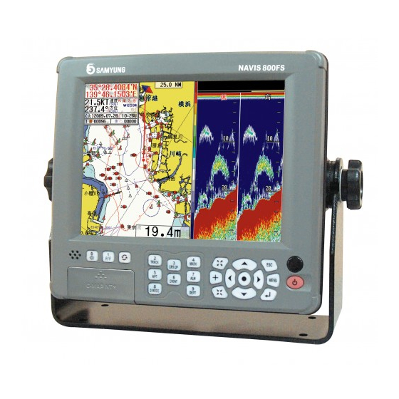
Page 9: Device & Display
Device & Display 3. Device & Display This chapter provides Device & Display about GPS Plotter. Display Device Remote Controller Power ON/OFF Menu Plotter Display... -
Page 10: Display Device
1. Display Device Speaker Button, Alarm sound. Bright LCD dimmer control LCD Day/Night Mode F1 function menu Power Power ON/OFF Fish Finder Depth Range Menu. Pressing twice, Gain Menu Remote Controller Receiver Switch Button ... -
Page 11: Remote Controller Button
2. Remote Controller Button POWER Fish Finder Low/High Power ON/OFF Select Low/High Frequency Depth Range Change Depth Range GAIN/STC Adjust GAIN/STC MOB D.MODE “Man Over Board” Switch Plotter & Fish ENT Finder .Select Menu ... -
Page 12: Power On/Off
3. Power ON/OFF Power ON Press Power OFF ) and hold approximately 2 sec. Press... -
Page 13: Menu
4. Menu 1. DATA 1. TRACK DATA 2.SET 1. NAVIGATION SET 2. MARK DATA 2. ALARM SET 3. USER’S LINE 3. OWN SHIP SET 4. WAYPOINT DATA 4. CURSOR SET 5. ROUTE DATA 5. SHIP TRACKING 6. DISK FORMAT 6. SIMULATION 7. -
Page 14: Display Mode
5. Display mode Able to choose a wishable display mode by Display mode change at [Plotter Display Only] Plotter Navigation Display mode change at [Plotter/Fishfinder Display] Plotter Plotter/Fishfinder Fishfinder Navigation GPS Plotter Display 5 6 7 21 22 25 26 27... - Page 15 Definition Description Latitude position of ownship’s Ownship Latitude Longitude position of ownship’s Ownship Longitude Present Ownship’s Speed, SOG(Speed of Ground) Ownship Speed Present Ownship’s Course, COG(Course of Ground) Ownship Course GPS status If no GPS or DGPS signal, Displays "Not-Ready" If GPS is received "GPS", and DGPS is received "DGPS"...
- Page 18 Day/Night Mode in Plotter Display Press ) Open the menu such as Transparency, Day/Night mode.
-
Page 19: Navigation Display
Navigation Display In Navigation Display(Press ) ), You can see Ownship’s position, Speed, Bearing in full screen which is helpful for your sailing. - Page 20 Fish finder Combo Display & Fish finder Display...
-
Page 21: Operating Instruction
Operating Instruction 4. Operating Instruction This chapter provides Operating Instruction in NAVIS series. DATA SET SYSTEM FISH(Fishfinder : NAVIS 800FS) -
Page 22: Data
1. Data 1.1 Track Data 1.1.1 Track Set Use this function to set the Vessel’s navigation Track. Total track capacity is 20,000 points. When the point is over 20,000, it is deleted previous point one by one. Press ) button and move [1.DATA] [1.TRACK DATA] [1.SET]. ... - Page 23 To select color of TRACK line, Press ) select [2.T/COLOR] and Press...
- Page 24 < TRACK Memory Interval & Max. Memory time, Date> Memory Interval Maximum Memory time & Date 5 sec 27h 47m = 1day 4h 10 sec 55h 33m = 2days 7h 30 sec 166h 39m = 6days 22h 1 min 333h 19m = 13days 21h 5 min 1666h 35m = 69days 10h 10 min...
- Page 25 1.1.2 Track Clear Use this function to erase the TRACK line of the Vessel. Press ) button and move [1.DATA] [1.TRACK DATA] [2.CLEAR]. Select one of below TRACK CLEAR method, Press 1.ALL TRACK : Clear all TRACK line ...
- Page 26 1.1.3 Track CALC. Use this function to calculate the Vessel’s TRACK. Press ) button and move [1.DATA] [1.TRACK DATA] [3.CALC.]. After selecting below TRACK CALC, Press 1. ALL TRACK : Calculate all memory TRACK • 2. COLOR : Calculate each color memory TRACK...
- Page 27 1.1.4. Track Save Use this function to save TRACK DATA to selected device while Vessel navigates. Insert things to be saved. (☞ Possible to omit when using Internal ROM & COM PORT) ) button and move [1.DATA] [1.TRACK DATA] [4.SAVE]. ...
- Page 28 1.1.5 Track Load Load saved file from '1.1.4 TRACK Save' and Display on the plotter screen. Insert save device to load saved file. (☞ Possible to omit when using Internal ROM & COM PORT) ) button and move [1.DATA] [1.TRACK DATA] [5. LOAD]. ...
- Page 29 1.1.6 Track Erase It is a function to erase TRACK file saved device at '1.1.4 TRACK Save'. Be pay attention to use this menu, You never recover once you complete this menu. Insert the device that has files to be erased. (☞ Possible to omit when using Internal ROM) ) button and move [1.DATA] ...
-
Page 30: Mark Data
1.2 Mark Data 1.2.1 Mark Select Use this function to select which MARK type to show on the screen. There are 21 unique MARK types. ) button and move [1.DATA] [2.MARK DATA] [1.SELECT]. Press Select MARK & its color using by Direction key & On the screen, Use ) to select MARK. - Page 31 1.2.2 Mark Append It is a function to append MARK at location of Ownship or certain Latitude/Longitude. Press ) button and move [1.DATA] [2.MARK DATA] [2.APPEND]. Select the position of MARK to append, Press 1.SHIP POS : Append MARK at current Ownship’s position. ...
- Page 32 [ Ref. ] ☞ The other way to input MARK 1. In no cursor, Press ) to be input MARK at ownship position. 2. Press ), Move cursor, Press ) to input easier. [ Ref. ] ☞ MARK Management User needs to manage its color before input MARK. Then you may erase it easier after you need to.
- Page 33 1.2.3 Mark Clear '1.2.2 Function to clear a mark. Possible to clear when you press ) button after put the cursor onto MARK in a Plotter screen. ) button and move [1.DATA] [2.MARK DATA] [3.CLEAR]. Press Press ) button after select [Mark Clear].
- Page 34 1.2.4 Mark Save '1.2.2 Mark Append’ is saved to saving tool as a file. Insert things to be saved. (☞ Possible to omit when using Internal ROM & COM PORT) ) button and move [1.DATA] [2.MARK DATA] [4.SAVE]. ...
- Page 35 1.2.5 Mark Load '1.2.4 Display a mark in a Plotter screen after calling a saved file from a storage tool. Insert save device to load saved file. (☞ Possible to omit when using Internal ROM & COM PORT) ) button and move [1.DATA] [2.MARK DATA] [5.LOAD]. ...
- Page 36 1.2.6 Mark Erase '1.2.4 Erased a saved MARK file from a storage tool. Must be careful to command this delete due to no-recover the file. Insert the device that has files to be erased. (☞ Possible to omit when using Internal ROM) ) button and move [1.DATA] ...
-
Page 37: User Coast Line
1.3 User Coast Line 1.3.1 Coast Line Display Displayed a coastal line drawn by a user into a Plotter screen. In setting『ON』, the coastal line is displayed in a function of '1.3.2 User’s Line Drawing' in advance. Press ) button and move [1.DATA] [3.USER’S LINE] [1.DISPLAY]. ... - Page 38 1.3.2 Coastal Line Drawing Displayed a coastal line by a user and it can register Line drawing(Mud), MARK, TEXT till 999 score each. ) button and move [1.DATA] [3.USER’S LINE] [2.DRAWING] and then press Press ) button. ...
- Page 39 press ) button . The line color or Mark color is changed after press ) button. 1.3.3 Coastal Line Save '1.3.2 Coastal data is saved into a storage tool in a coastal drawing. Insert things to be saved. (☞ Possible to omit when using Internal ROM & COM PORT) ...
- Page 40 1.3.4 Coastal Line Load '1.3.3 Displayed a mark in a Plotter screen after calling a saved file from a storage tool. Insert save device to load saved file. (☞ Possible to omit when using Internal ROM & COM PORT) ) button and move [1.DATA] ...
- Page 41 1.3.5 Coastal Line Erase '1.3.3 Delete a coastal line file from a storage tool. Must be careful to command this delete due to no-recover the file. Insert the device that has files to be erased. (☞ Possible to omit when using Internal ROM) ) button and move [1.DATA] ...
-
Page 42: Waypoint Data
1.4 Waypoint Data 1.4.1 Waypoint Display Function to mark the waypoint that the user registered into a Plotter screen. In setting『[ON], the waypoint is marked in a function of '1.4.2 Waypoint Edit' in advance. Press ) button and move [1.DATA] [4.WAYPOINT DATA] [1.DISPLAY]. ... - Page 43 1.4.2 Waypoint Edit Function to register a point of an important or frequent navigation in advance and can be possible to register till 999 score. ) button and move [1.DATA] [4.WAYPOINT DATA] [2.EDIT]. Press After move the cursor to a waypoint number by using a direction button and press ) button.
- Page 44 ) button, the position that has a current In there are cursors onto a Plotter Screen, when press cursor is auto-registered as the waypoint. In there are no cursors onto a Plotter Screen, when press ) button, the position of the current own-ship is auto-registered as the waypoint Besides, after move to the position to be registered as a waypoint onto a Plotter Screen and then, move [1.DATA] ...
- Page 45 1.4.3 Waypoint Save This function is to save the Lat/Long of the waypoint, MARK, name registered from '1.4.2 Waypoint Edit' into an available storage tool as a file. Insert things to be saved. (☞ Possible to omit when using Internal ROM & COM PORT) ) button and move [1.DATA] ...
- Page 46 1.4.4 Waypoint Load '1.4.3 Display a waypoint in a Plotter screen after calling a saved file from a storage tool. Insert save device to load saved file. (☞ Possible to omit when using Internal ROM & COM PORT) ) button and move [1.DATA] [4.WAYPOINT DATA] [4.LOAD]. ...
- Page 47 1.4.5 Waypoint Erase '1.4.3 Deleted a coastal line file from a storage tool. Must be careful to command this erase due to no-recover the file. Insert the device that has files to be erased. (☞ Possible to omit when using Internal ROM) ) button and move [1.DATA] ...
-
Page 48: Route Data
1.5 Route Data 1.5.1 Route Edit Function to register waypoint into a navigation route and it can be registered till 20 numbers and the waypoint can be registered till 20 numbers per a route. The Lat/Lon of the waypoint should be registered into [1.DATA] [4.WAYPOINT DATA] [2.EDIT] in advance and it can be possible to register to a route DATA. - Page 49 ) and ) buttons, the waypoint to be registered into a route can be shown If press with a 10 unit. In order to cancel the waypoint of the setting route, move the cursor to a waypoint number to be canceled and then press ) button.
-
Page 50: Disk Format
1.6 Disk Format After you purchase SD card, you must format it in advance. You can’t save any data without the Disc Format. Press ) button and move [1.DATA] [6.DISK FORMAT]. Insert SD card for a format ... -
Page 51: Seabed Symbol
1.7 Seabed Symbol Use this function to see description of abbreviated form and symbol for seabed displayed on the plotter chart. Press ) button and move [1.DATA] [7.SEABED TYPE] and then, press button. [ Ref. ] ☞ Display ‘Calendar' on the screen ), and Select [7.CALENDAR]. -
Page 52: Program Update
1.8 Program Update Able to replace the plotter program in a main after call the newest plotter program saved into a storage tool. Insert a storage tool with a newest Plotter program. ) button and move [1.DATA] [7.PROGRAM UPDATE], then press ... -
Page 53: Set Up
2. Set Up 2.1 Navigation Set 2.1.1 Waypoint Navigation Set This function is used when the vessel navigates between two waypoints registered in '1.4.2 Waypoint Edit' or to the waypoint registered in a current own position. Press ) button and move [2.SET] [1.NAVIGATION SET] [1.WAYPOINT NAVIGATION]. ... - Page 54 The red line is shown from a start point of Waypoint to an arrival point of Waypoint and the Lat/Lon, distance, direction, estimated time, approach speed and navigation time of the arrival point of the waypoint are shown in a bottom-left of the plotter screen. ( ☞...
- Page 55 2.1.2 Route Navigation Set Set up a Route Navigation by using a menu This function is used when course-navigate along the route registered in '1.5.1 Route Edit' with. ) button and move [2.SET] [1.NAVIGATION SET] [2.ROUTE NAVIGATION]. ...
- Page 56 The red line is shown from a current position to a first route position and the rest positions registered into a route navigation is shown with a bright-grey line. The Lat/Lon, distance, direction, estimated time, approach speed and navigation time of the navigating route point are shown in a bottom-left of the plotter screen.
- Page 57 How to set up a Route Navigation by using a course button. ) button and set up a route-navigation at the same time. It can Register a new waypoint by using be used in order to set up a new route-navigation in a plotter screen with ease. ...
- Page 58 2.1.3 Anchor Set In case of Anchor, it is used to protect a break away from an anchor range set up as inputting the position information of the current own-ship. It can be used with ‘2.2.3 Anchorage Alarm’. ) button and move [2.SET] [1.NAVIGATION SET] [3.ANCHOR]. ...
- Page 59 If set up a range of Anchor Alarm to [2.SET] [2.ALRAM SET] [3.ANCHOR ALARM], the range of anchor alarm show as a red circle in a plotter screen. Besides, the relative information as such Lat/Lon, direction, break away distance etc. with set up “ANCHOR” in a bottom-left of the Plotter screen are shown. If the vessel breaks away from a range of anchor alarm, the alarm sounds and the red circle blinks in order to advise of the vessel’s break away from the range.
- Page 60 2.1.4 EXIT WPT/RTE/ANCHOR (Navigation Cancellation) This function enables the operators to clear the Waypoint Navigation, the navigational functions of Route Navigation, Anchorage Setup and Monitoring Setup. ) button and move [2.SET] [1.NAVIGATION SET] [4.EXIT WPT/RTE/ANCHOR]. Press Press ) button, then the above-shown navigational functions, the anchorage setup, the monitoring setup will be all cleared.
-
Page 61: Alarm Set
2.2 Alarm Set 2.2.1 Arrival Alarm In using Waypoint Navigation and Route Navigation, this function is designed to create an alarming once the own ship enters into the radius distance of the preset final destination. ) button and move [2.SET] [2.ALARM SET] [1.ARRIVAL ALARM]. ... - Page 62 2.2.2 Derailment Alarm In using the Waypoint Navigation and Route Navigation, this function creates an alarming once the own ship derails the preset course range on her way to the destination. ) button and move [2.SET] [2.ALARM SET] [2.XTE ALARM]. ...
- Page 63 2.2.3 Anchorage Alarm In using the anchorage in '2.1.3 Anchor Set', establish the anchorage range so that the equipment can send out an alarming when the owns ship gets out of the preset range mostly due to the tidal wave, the ocean weather etc.
- Page 64 2.2.4 Underwater Cable Alarm When under voyage, the own ship can use the function to create an alarming where any underwater cables are installed. ) button and move [2.SET] [2.ALARM SET] [4.SEA-CABLE ALARM]. Press Press ) button to select [ON] / [OFF].
- Page 65 2.2.5 Water Depth Alarm This function is to provide an alarming for the operators when it senses any specific water depth within the preset alarming range through the transducers. It is available to input 1m ~ 999m. ) button and move [2.SET] [2.ALARM SET] [5.DEPTH ALARM]. ...
- Page 66 2.2.6 Fish Alarm This is a function to make an alarming when the equipment senses any fish school under voyage. Press ) button and move [2.SET] [2.ALARM SET] [6.FISH ALARM]. Use ) button to select [ON] / [OFF] and the signals of fish school as [Low], [Mid], [High].
- Page 67 2.2.7 AIS Alarm After input own ship data at the ‘2.3 Own Ship Set’, AIS alarm will activate when another vessel comes thru within a own ship radius in AIS screen. ), Move [2.Set] [2.Alarm Set] [7.AIS Alarm] in turn. ...
-
Page 68: Own Ship Set
2.3 Own Ship Set With this function, it is available to set up a variety of information on the own ship. ) button and move [2.SET] [3.OWN SHIP SET]. Press Use the directional buttons, ) button to set up every items shown ) button, below. - Page 69 [ CAUTION ] ☞ HOW TO SET UP SMOOTHING The position of the vessel, speed, and direction can fluctuate due to the vessel type and speed. Refer to the below and set up smoothing. 1. In case the vessel speed is low : In case vessel speed/Direction fluctuate, increase the value more. 2.
-
Page 70: Cursor Setup
2.4 Cursor Setup This enables the operator to set up the information on Cursor shown on the plotter display. Press ) button and move [2.SET] [4.CURSOR SET]. Use the directional buttons ) buttons to select the size, color, shape, and line. ... -
Page 71: Ship Tracking ("S" Type Plotter Has No This Function)
2.5 Ship Tracking (“S” type plotter has no this function) -
Page 72: Simulation
2.6 Simulation This enable the operators to artificially make the data required for the real navigation to look as if ships are under voyage on the Plotter Display. ) button and move [2.SET] [6.SIMULATION]. Press Use ) button to set up [ON] / [OFF] to be used for Simulation. ... -
Page 73: Etcetera Set
2.7 Etcetera Set User can set up any additional functions on SYSTEM and Plotter. Press ) button and move [2.SET] [7.ETC. SET]. Use the directional buttons, ) button to set up the items shown below. ) button,... - Page 74 Miscellaneous Setup Input Range Description Items 1. DISTANCE UNIT NM/KM/MM Select the distance unit on the Display. NM: Nautical Mile (1NM = 1,852 m) KM: Kilometer (1KM = 1,000 m) MM: Land Mile (1MM = 1,610 m) 2. MAGNETIC VAR. True/Magnetic True North differs slightly from Magnetic E00.0°~ E99.9°...
-
Page 75: System
3. System 3.1 Satellite Information This is to set up the related information on GPS and DGPS necessary for navigation. It is basically similar to DGPS(Differential GPS) but it also provides the more preciseness of position information to decrease the position differentiation, through receiving the position correction signal from a separate standard correction station located on land. - Page 76 Satellite Info. Item Input Range Description 1.Initial Pos. LAT: 90°N ~ 90°S User can set up the information on the own ship position. LON: 180°E ~ 180°W Ex) When cannot receive GPS, DGPS signal, the information on the current position of own ship can be input.
-
Page 77: Screen Print ("S" Type Plotter Has No This Function)
3.2 Screen Print (“S” type plotter has no this function) Users can print out the plotter display or the fish-finder display they have on the screen. -
Page 78: How To Test Keyboard
3.3 How to test Keyboard Users can make a self-test to see if the remote works okay. Press ) button and move [3.SYSTEM] [3.KEYBOARD TEST]. Whenever each button is pressed, it is normal if the button is conversed on the screen. If not, it is judged abnormal. -
Page 79: How To Set Up System
3.4 How to set up System Users can set up Input/Output ports used for system, AIS, memory, map, language in use etc. Press ) button and move [3.SYSTEM] [4.SYSTEM SET]. Use the directional buttons and ) button to set up each item shown below. - Page 80 Output PORT Set : Data compatible with other equipment. 【[Note] ☞ PLT』Sentence is designed to work normally when it is connected with SAMYUNG autopilot and selected. 3.AIS Set Selection Range This is to receive the information on ship name, MMSI, ship...
- Page 81 AIS Setup This is to show on the plotter display the ship together with the information received from AIS, such as Ship Name, MMSI numbers, Lat/Log, SOG, COG. Each ship has her own MMSI number, which is 9-digit ID, assigned and the first 3-digit numbers mean MID (Country Code) which tells her nationality or area.
- Page 82 Details on AIS-Mounted Ship NAME C.SIGN : Ship Name : Call Sign MMSI IMO.NO : Maritime ID : IMO number DRAUGHT S-TYPE : Draught : Ship Type DEST. NAV. : Destination : Current Navigational Status ...
- Page 83 Press ) button and move [3.SYSTEM] [4.SYSTEM SET] [3.AIS Set]. Use the directional button to select [1.RUN / STOP SET], then press ) button to make AIS function [RUN] or [STOP] on the screen. In selecting ‘[RUN]’, users can see [AIS] on the right top side of the screen. [ Ref.
- Page 84 Use the directional buttons to select [2.DISPLAY SET], then press ) button to see the sub- menu on the screen that shows Ship Name,『MMSI,『Speed(SOG). Select the ship information of AIS to be displayed on the screen, then press ) button.
- Page 85 Use the directional buttons to select [3.TARGET COLOR-1], then press ) button to input the target color of AIS. Press the number buttons to input MID(or country code) for the target to be set up on the screen, then press ) button.
- Page 86 Use the directional button to select [9. ETC. COLOR], then press ) button. It is available to select any color for other ships that have MID(or country code), except the preset colors from [3.TARGET COLOR-1] through [8.TARGET COLOR-6]. Use the directional buttons to select the target color shown below, then press ) button.
-
Page 87: System Information
It is advised that users normally should not work on setting up as the default value is set. 2.PLOT-MODE LCD-640-Norm/ To set up the Plot model of SYSTEM LCD-640-Auto LCD-640-Norm : Plot Mode for normal use LCD-640-Auto : Plot Mode used with SAMYUNG autopilot system... -
Page 88: Fishfinder (Navis-800Fs)
4. FISHFINDER (NAVIS-800FS) GPS chart plotter with fish-finder To see the display of GPS chart plotter with fish finder, press Depth Fish-finder: Low Freq Plotter Fish-finder: High Freq. STC & GAIN set of fish-finder: Low Freq./High Freq. Press on plotter with fish-finder or fish-finder mode. 【... - Page 89 Display for fish-finder only ) and also the display mode depends on frequency (High You may choose a display mode by freq./Low freq.) by Fish-finder with High Freq. Fish-finder with Low Freq. ) set ON/OFF ) button on plotter/fish-finder display or display only for It shows setting menu if press fish-finder.
- Page 90 Fish-finder line & homing magnification screen ) button to choose a display mode, ) button for high freq./low freq. and ) button for line(Btm.) & homing(Trl.) magnification screen.
-
Page 91: Screen Speed
4.1 Screen Speed A function to adjust a screen moving speed. Press ) button and move [4.FISH] [1.SCREEN SPEED]. Select one of [Stop], [Low], [Mid], [High], [X 2] by using direction cursor and press Normally you may set [High]』. -
Page 92: Noise Erase
4.2 Noise Erase To erase an interfacing signal occurs periodically or temporally is shown as noise on fish-finder display. Press ) button and move [4.FISH] [2.NOISE ERASE]. Select one of [Off], [Low], [Mid], [High] by using direction cursor and press... -
Page 93: Color Erase
4.3 Color Erase Clear a color for noise and response for unnecessary school of fish step by step. It helps to recognize of big fish group with distinct display. ) button and move [4.FISH] [3.COLOR ERASE]. Press Select one of [Off], [Low], [Mid], [High] by using direction cursor and press... -
Page 94: Tx Power Set
4.4 Tx Power Set To adjust a transmitting output of supersonic wave transmitted from transducer. Press ) button and move [4.Fish] [4.TX-POWER SET]. Select [High], [Low] and press In case of [Low], the output is automatically adjusted depends on water depth range. -
Page 95: Pulse Width Set
4.5 PULSE WIDTH SET In response to range of depth and transmitting times, adjust transmitting power by LOW and HIGH about automatic adjustment of pulse width. ) button and move [4.FISH] [5.PULSE WIDTH]. Press Select [Low], [High] and then press... -
Page 96: Color Pattern Set
4.6 COLOR PATTERN SET Select a color to show a fish group and three colors available. Press ) button and move [4.FISH] [6.COLOR PATTERN]. Select [Pattern 1], [Pattern 2], [Pattern 3] and then press... -
Page 97: A-Scope Set
4.7 A-SCOPE SET A-scope on or off. Press ) button and move [4.FISH] [7.A-SCOPE SET]. Select [ON], [OFF] and then press... -
Page 98: Etc Set
4.8 ETC SET To set a draft (water-depth adjustment), water temperature display/offset and frequency. Press ) button and move [4.FISH] [8.ETC. SET]. You are able to set following item by direction cursor, number button and ) button. List of system info. -
Page 100: System Maintenance & Diagnosis
System Maintenance & Diagnosis 5. System Maintenance & Diagnosis This Chapter describes a Maintenance and Diagnosis for NAVIS Series. System Maintenance and Repair. Diagnosis... -
Page 101: System Maintenance And Repair
1. System Maintenance and Repair It is essence to have a routine maintenance and troubleshooting for the equipment for keeping its performance in a normal condition. Maintenance and troubleshooting means periodical check up the system, software up-grade including following items. Item Contents Connector &... -
Page 102: Diagnosis
2. Diagnosis Following describes the general status of the troubles and how to treat the troubles. Operator should not try to check inside the machine even the application of routine troubleshooting described in Manual does not work. Wrong check and maintenance, repair can cause to deteriorate the performance of the machine and reduce the lifetime of the machine. -
Page 104: Appendix
Appendix 6. Appendix This Chapter describes the appendix related to the operation of the unit. Appendix Installation Drawings...
Need help?
Do you have a question about the NAVIS800FS and is the answer not in the manual?
Questions and answers
전원 on시 한자를 한글로 변환 하는법
To change Chinese characters to Korean on the Samyung NAVIS800FS when powered on, follow these steps:
1. Go to the Language Set menu.
2. Select Korean from the available language options.
3. Reboot the system for the language change to take effect.
This answer is automatically generated
سیم مثبت و منفی رو اشتباهی وصل کردم فیوز شیشه ای سوخته دستگاه هم روشن نمیشه