Sign In
Upload
Download
Table of Contents
Contents
Add to my manuals
Delete from my manuals
Share
URL of this page:
HTML Link:
Bookmark this page
Add
Manual will be automatically added to "My Manuals"
Print this page
×
Bookmark added
×
Added to my manuals
Manuals
Brands
JRC Manuals
Marine GPS System
JLR-20
Instruction manual
JRC JLR-20 Instruction Manual
Gps compass
Hide thumbs
1
2
3
4
5
6
7
8
Table Of Contents
9
10
11
12
13
14
15
16
17
18
19
20
21
22
23
24
25
26
27
28
29
30
31
32
33
34
35
36
37
38
39
40
41
42
43
44
45
46
47
48
49
50
51
52
53
54
55
56
57
58
59
60
61
62
63
64
65
66
67
68
69
70
71
72
73
74
75
76
77
78
79
80
81
82
83
84
85
86
87
88
89
90
91
92
93
94
95
96
97
98
99
100
101
102
103
104
105
106
107
108
109
110
111
112
113
114
115
116
117
118
page
of
118
Go
/
118
Contents
Table of Contents
Troubleshooting
Bookmarks
Table of Contents
Before Commencing the Operation
Precautions Upon the Operation
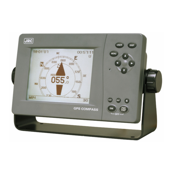
Appearance of the Equipment
Table of Contents
Section 1 Equipment Overview
Functions
Features
Configuration
Construction
System Diagram
Section 2 Installation
Sensor Installation
Display Unit Installation
Cable Connection
Section 3 Names and Functions of each Unit
Nwz-4700 Display Unit
Nnn-20/30 Sensor Unit
Section 4 Display
Display Screen
Compass Screen
Bow Heading Screen
Navigation Screen
Turn Rate Screen
Water Speed / Ground Speed Screen
Configuration Screen
Section 5 Operation
Menu List
Basic Operation
Turning the Unit on
Startup (Standard)
Startup (Error-1)
Startup (Error-2)
Startup (Error-3)
Turning the Unit off
Adjusting the Backlight
Adjusting the Contrast
Stopping the Alarm Buzzer
Changing the Display
Displaying Satellite Information
Alarm History Display
Main Menu
Display Settings
Adjusting the Contrast
Brightness Settings (DIMMER)
Click Sound Settings (CLICK SOUND)
Display Reversing Setting (REVERSING MODE)
Setting the Heading (HEADING)
GPS Configuration (GPS)
Initial Settings (INITIALIZATION)
SBAS Settings (SBAS)
Beacon Settings (BEACON)
System Settings
Data I/O Settings (DATA I/O)
Checking the Version
Others Settings
Language Settings (LANGUAGE)
Maintenance Menu
Antenna Check
Input Check
Self-Diagnosis (DIAGNOSIS)
Demo
Product Type Settings
Master Reset (RESET)
Software Update (SOFT UPDATE)
Section 6 Maintenance and Inspection
General Maintenance and Inspection
Alarms
Troubleshooting
Repair Unit
Regular Replacement Parts
Section 7 After-Sales Service
Warranty
Repair Parts Stocking Period
When Requesting Service
Recommended Checks and Inspections
Section 8 Disposal
Disposal of the Equipment
Disposal of Used Batteries
Section 9 Specifications
Display Unit (Nwz-4700)
Panel
Power Supply
Environment
Dimensions and Mass
Sensor Unit (Nnn-20/30)
Electrical Specifications
Environment
Dimensions and Mass
Appendix
Appendix 1 List of Geodetic Systems
Appendix 2 Data Output Formats
Appendix 3 Terminology
Advertisement
Quick Links
1
Sensor Installation
2
Cable Connection
3
Data I/O Settings (Data I/O)
Download this manual
JLR-20/30
JLR-20/30
GPS COMPASS
GPS COMPASS
INSTRUCTION
INSTRUCTION
MANUAL
MANUAL
Table of
Contents
Previous
Page
Next
Page
1
2
3
4
5
Advertisement
Table of Contents
Need help?
Do you have a question about the JLR-20 and is the answer not in the manual?
Ask a question
Questions and answers
Related Manuals for JRC JLR-20
Marine GPS System JRC JCY-1800 Brochure
Voyage data recorder (2 pages)
Marine GPS System JRC JCY-1850 Brochure
Simplified voyage data recorder (2 pages)
Marine GPS System JRC JHS-182 Instruction Manual
Automatic identification system (98 pages)
Marine GPS System JRC JLR-10 Brochure
(2 pages)
Marine GPS System JRC JUE-250 Operation Manual
Inmarsat fleetbroadband fb250 maritime satellite communication terminal (147 pages)
Marine GPS System JRC JUE-410F Brochure
Fleet f77 maritime satellite communication terminal (2 pages)
Marine GPS System JRC JLR-30 Instruction Manual
Gps compass (118 pages)
Marine GPS System JRC JHS-183 Installation Manual
Automatic identification system (102 pages)
Marine GPS System JRC J-Marine NeCST JAN-470 Series Instruction Manual
(358 pages)
Marine GPS System JRC JLR-21 Instruction Manual
(164 pages)
Marine GPS System JRC JLR-31 Instruction Manual
(164 pages)
Marine GPS System JRC PRONAV V200S User Manual
(67 pages)
Marine GPS System JRC Alphatron LT-3100 Iridium Installation & Operation Manual
(52 pages)
This manual is also suitable for:
Jlr-30
Table of Contents
Save PDF
Print
Rename the bookmark
Delete bookmark?
Delete from my manuals?
Login
Sign In
OR
Sign in with Facebook
Sign in with Google
Upload manual
Upload from disk
Upload from URL


Need help?
Do you have a question about the JLR-20 and is the answer not in the manual?
Questions and answers