Table of Contents
Advertisement
Quick Links
Advertisement
Table of Contents

Subscribe to Our Youtube Channel
Related Manuals for CHC LT400HS


Summary of Contents for CHC LT400HS
- Page 1 LT400HS | G ETTING TARTED UIDE GNSS/GIS H ANDHELD ECEIVER...
- Page 2 Operation is subject to the following two conditions: (1) this device may not cause harmful interference and (2) this device must accept any interference received, including interference that may cause undesired operation. LT400HS Getting Started Guide – Revision 1.0 Aug 2013...
- Page 3 Changes or modifications made to this equipment not expressly approved by Shanghai Huace Navigation Technology Ltd. may void the FCC authorization to operate this equipment. NOTE: This equipment has been tested and found to comply with the limits for a Class B digital device, pursuant to Part 15 of the FCC Rules.
-
Page 4: Table Of Contents
Table of Contents Introduction............................1 1.1. Technical Assistance......................1 1.2. Your Comments........................1 Overview............................2 2.1. Features..........................2 2.2. Specifications........................2 Description............................4 First-Time Use............................6 4.1. Inserting the Battery, Storage card and SIM card............... 6 4.2. Charging the Battery......................6 4.3. Turning the device on/off or standby..................7 4.4. -
Page 5: Introduction
1. I NTRODUCTION Thank you for choosing LT400HS GNSS Handheld Receiver. This Getting Started Guide will provide useful information about your receiver. It will also guide you through your first steps of using LT400HS in the field. 1.1. T ECHNICAL... -
Page 6: Overview
VERVIEW 2.1. F EATURES LT400HS is a handheld GNSS RTK receiver and a precision GIS data collector that incorporate a survey-grade professional L1/L2 GNSS core engine as well as Microsoft Windows Mobile® 6.1 operating system. LT400HS comes in a rugged design suitable for all your demanding survey and construction environment as well as numerous mapping applications. - Page 7 Shock : survive a 1.2 meters drop onto concrete Electrical Li-ion battery capacity : 6800 mAh Battery life : up to 8 hours Package content 1x LT400HS Handheld GNSS Receiver 1x Li-Ion battery 1x AC Adapter 1x Stylus 1x 4GB memory card 1x LEMO to USB Data Cable ...
-
Page 8: Description
3. D ESCRIPTION Front view GNSS Antenna Speaker Touch Screen Indicator Light Function Keys Camera Key Power Button Reboot Button Microphone Page 4... - Page 9 Rear view External Antenna Connector Camera Latch Battery Data cable Connector Page 5...
-
Page 10: First-Time Use
Connect the AC adapter to a power plug. Connect data cable to the LT400HS to start charging the battery. If the receiver is off, a charging icon will display on the screen. If the receiver is on, a charging icon will show on the top right corner of the screen. -
Page 11: Turning The Device On/Off Or Standby
ONNECT TO FFICE OMPUTER To install software or access to the LT400HS, you can use your office computer and a Microsoft ActiveSync connection to transfer the installation files from the computer to LT400HS. It means Microsoft Windows Mobile Device Center or ActiveSync should first be installed on your computer. -
Page 12: Installing Software
Select and click on the installation file to install, or if the installation file runs only on LT400HS, please copy the file to LT400HS, double click it to install. You can also copy files to LT400HS’s relevant location to save it. - Page 13 Open GNSSViewer software: o Run “My Device”-“Program Files”-“GNSSViewer”. o The symbol “GNSSViewer” will appearing at the bottom right corner of the main screen when the software is running. Double click the icon will take you come back to software interface. o Choose Com6 and 57600 for connecting GPS Port.
-
Page 14: Using The Camera
4.8. U SING THE CAMERA Press the Camera key to enter in the picture taking mode. Press the Camera Key again to take a picture. Click the OK icon on the top right corner to exit. 4.9. E STABLISHING IRELESS CONNECTION LUETOOTH... -
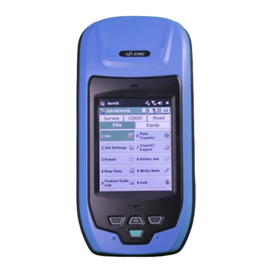
Page 15: Getting Started With Survce 3
On the Software port tab: select COM4 Then on the Hardware port tab: select COM3 and Baud: 57600 Start SurvCE 3: Go to GPS Rover, in Current tab--> choose Manufacturer CHC, Model: LT400HS In Comms tab, select Cable, Port COM3 and Baud 57600 automatically. -
Page 16: Getting Started With Digiterra Explorer 7
If you intend to use RTCM corrections go to the Settings > NTRIP tab and set Port: COM4 and Baud: 57600 Finally select the proper script from the /Scripts/CHC folder in the installation directory on the Settings > Command tab > Command File button and then you can connect to the GNSS receiver on the GPS >... -
Page 17: Outputting Nmea 0183 Data From The 9-Pin Port
NMEA 0183 UTPUTTING DATA FROM THE PIN PORT The LT400HS can output the default NMEA 0183 V2.2 messages at 1Hz: GPGGA, GPGSA, GPGSV, GPGST, GPRMC. Go to Start menu --> Settings --> System Select External GPS icon On the Software port tab: select COM6... -
Page 18: Frequent Settings
8. F REQUENT ETTINGS Stylus Setting Go to Start-->Settings-->System-->Screen Click Align Screen to start the stylus setting. Backlight Setting Go to Start-->Settings-->System -->Backlight, Adjust settings according to your requirements. Power Setting Go to Start-->Settings-->System-->Power-->Advanced, Adjust settings according to your requirements. ... - Page 19 CHC - Shanghai HuaCE Navigation Technology Ltd. Building 35, n° 680 Guiping Road 200233 Shanghai – China Tel : +86 21 542 60 273 Fax : +86 21 649 50 963 Email : sales@chcnav.com | www.chcnav.com Page 15...
Need help?
Do you have a question about the LT400HS and is the answer not in the manual?
Questions and answers