
Subscribe to Our Youtube Channel
Related Manuals for Furuno WR-2100


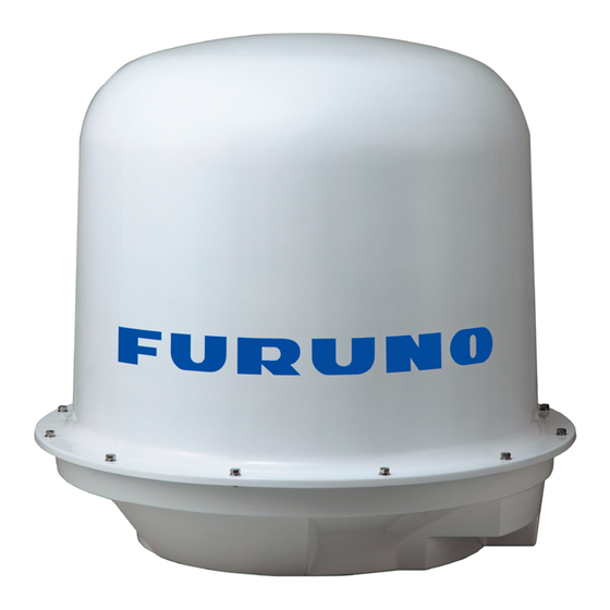
Summary of Contents for Furuno WR-2100
- Page 1 SSE-14-0023_17 INSTALLATION MANUAL Compact X-band Dual Polarimetric Doppler Weather Radar WR-2100 MODEL www.furuno.com...
- Page 2 • The operator of this equipment must read and follow the descriptions in this manual. Wrong operation or maintenance can cancel the warranty or cause injury. • Do not copy any part of this manual without written permission from FURUNO. • If this manual is lost or worn, contact your dealer about replacement.
-
Page 3: Safety Instructions
SSE-14-0023_17 SAFETY INSTRUCTIONS The user and installer must read the appropriate safety instructions before attempting to install or operate the equipment. Indicates a hazardous situation which, if not avoided, will result DANGER in death or serious injury. Indicates a potentially hazardous situation which, if not WARNING avoided, could result in death or serious injury. - Page 4 SSE-14-0023_17 Use only the specified power cable. Fire or damage to the equipment can result if a different cable is used. Use the power supply grounded certainly. Electrical shock or defect of operation can occur. When a thunderbolt is expected, do not approach a system or do not touch a hand.
-
Page 5: Table Of Contents
SSE-14-0023_17 Contents: IMPORTANT NOTICES ........i 8.2.2. Management list ....38 SAFETY INSTRUCTIONS ........ ii 8.3. Radar Operation ......40 System Configuration ........vi 8.4. Initial setting of Azimuth ....42 CHAPTER: 8.5. Total operation test ......44 1. System Summary ......... 1 8.6. -
Page 6: System Configuration
SSE-14-0023_17 System Configuration The observation system consists of an Antenna Unit (Radome), a Signal Processing Unit (storage box) , and a Display Unit (indoor unit) are shown below. (1) Antenna Unit (radome) The antenna, stored in the radome, turns to radiate the radio waves. The radiated waves are backscattered by precipitation particles on the propagation path, return to the antenna, and are processed by RF converter to transfer the signals to the Signal Processing Unit . -
Page 7: Chapter: 1. System Summary
SSE-14-0023_17 1. System Summary RADAR (Radio Detection and Ranging) developed during World War II as a method to detect the presence of ships and aircraft (the military considered weather targets as noise). Since WWII, there have been many advances in radar technology (e.g., Doppler techniques) and it’s used on land, sea, and in space for both research and operational needs. -
Page 8: Anatomy Of Weather Radar
SSE-14-0023_17 1.2. Anatomy of Weather Radar Radome Feedhorn Antenna 70km Receiver Transmitter Antenna: The main purpose of the antenna is to focus the transmitted power into a small beam and also to listen and collect the returned signal. This cassegrain antenna is designed and manufactured with the highest performance, quality, low loss, low profile, and light weight compared to other high gain antennas. -
Page 9: Multi-Radar System
0.0 to 0.1 degrees. Elevation Angle Azimuth Angle 1.4. Multi-radar system Furuno provide multi-radar system. Use 3 radars to make 3 dimensions that makes possible to detect precipitation faster and accurate with high resolution. Start of detection with Conventional... -
Page 10: Other Weather Observation System
SSE-14-0023_17 1.5. Other weather observation system There are several types of instruments to measure weather with pinpoint. Rain gauge, Disdrometer, and Wind sensor are the major type of observation system. For example, rain gauge is the most popular tool to know how much rain has fallen. The three major types of rain gauges are the standard rain gauge, tipping bucket gauge, and weight gauge. -
Page 11: Radar System Certificate
SSE-14-0023_17 2. While installing antenna on a rooftop of building or build a tall tower in urban area. Mount the radar on the stand or tower; it must be higher than any surrounding interception (building, structure) for radar observation. The tower must be designed strong enough against the heavy storms and severe weather conditions. -
Page 12: Peripheral Devices
SSE-14-0023_17 1.9. Peripheral devices External HDD (Hard Disk Drive): It is useful for saving data. Use USB3.0 connector type to transfer the data without stress. Recommendation of using 6TB (possible to save data around half year by compression) UPS (Uninterruptible Power Supply): Solution to avoid risk of DPU crash by instantaneous power failure because of the trouble of electric power company, facility power, or natural disaster such as thunderstorm. -
Page 13: Specification
SSE-14-0023_17 2. Specifications 2.1. Antenna Unit Parameter Descriptions Remarks Unit name WR-2100-ATU Operating Frequency 9.4 GHz band Carrier Frequency Displayable observation level : Maximum range Max. observation level: 70km 70km Doppler measurement Max. ±48m/sec Power supply 100-240VAC, Single Phase, 50/60 Hz Power consumption Max. -
Page 14: Signal Processing Unit
SSE-14-0023_17 2.2. Signal Processing Unit Parameter Descriptions Unit name WR-2100-SPU Rainfall intensity Rain (mm/h), Reflectivity factor Zh (dBZ), Doppler velocity V (m/s), Doppler velocity spectrum width W (m/s), Data Output Cross polarization difference phase φdp (deg), Specific differential phase KDP (deg/km), Co-poral correlation coefficient ρHV, Differential reflectivity ZDR... -
Page 15: Display Unit
SSE-14-0023_17 2.4. Display Unit Receive data from Signal Processing Unit (SPU) to indicate a picture of rainfall in real time. Hardware Parameter Descriptions Unit name WR-2100-DPU Power supply 100-240VAC, 50/60Hz Power consumption Max. 200W Rated Ampere 0.8-2.0A Core-i7 (3GHz) or better... -
Page 16: Accessories
SSE-14-0023_17 2.5. Accessories Cables & Tube Antenna Unit (radome) <-> Signal Processing Unit (storage box) cable Descriptions Length (*1) Control cable 25pin cable (Both Dsub-25pin) (*1) Control cable 9pin cable (Both Dsub-9pin) (*1) Signal cable 3D-2W (Both SMA-P Connector) (*1) AC Power cable VCTF 2sq 3core or equivalent (*2) -
Page 17: Construction Materials List
LAN Ratchet Crimper For LAN cable work LAN cable tester For LAN cable work Note: The stand of radar depends on installation environment, therefore consultation will be necessary. 2.7. Overall appearance Refer the outline drawing of WR-2100 on chapter 15. -
Page 18: Prior Confirmation
SSE-14-0023_17 3. Prior confirmation 3.1. Confirmation items 1. The mount plate must be installed properly for Antenna Unit (radome). 2. Power cable (AC100V-240V) must be laid safely. Minimum electric current must be installed for using 100V is 10A, and 240V is 4.2A. 3. -
Page 19: Storage Box
SSE-14-0023_17 3.5. Storage box Air Conditioner Type Outdoor Storage box Lateral mounting Cooling capacity 100W Rated voltage Single phase, 100V AC to 240V AC (50/60Hz) Rated 0.8A(at 100VAC), 0.4A(at 200VAC) Current consumption Max. 1.0A(at 100VAC), 0.5A(at 200VAC) Starting current 4.0A(at 100VAC), 8.5A(at 200VAC) Rated Power consumption Max. -
Page 20: Peripherals Equipment
SSE-14-0023_17 3.6. Peripherals equipment The purposes of using these peripherals are for remote control: 1. Wired router Function Connect with an external network WAN port 10/100/1000BASE-T, 1 port, MDI/MDI-X auto switch LAN port 10/100/1000BASE-T, 4 port or more, MDI/MDI-X auto switch Input voltage AC100V-240V, Single phase, 50/60 Hz Remarks... -
Page 21: Precautionary Item
SSE-14-0023_17 4. Precautionary item 1) Use only the commercial power supply of single phase 100-240VAC. 2) DO NOT overhaul or remodel. 3) DO NOT work during the thunder is occurring. 4) DO NOT scratch, cut, forcedly bend, pull, twist, bundle, or damage the power cable. Also, not to put a heavy thing on top or interpose. -
Page 22: Construction
SSE-14-0023_17 5. Construction All installation places will be considered for installing DPU, cables, pipes, and mount plate during the environmental survey. 5.1. Mount plate <Case 1> Use pedestal without making a hole. <Case 2> The way of using steel frames. Adjust 4 holes with the mount plate and the steel frames. - Page 23 SSE-14-0023_17 <Case 3> Use mount plate directly on a wooden pedestal. Make 4 holes to a wooden pedestal with 20Φ for M16 Hexagon Bolts to join with the mount plate. In this case, it may need to make 2 big holes for Protecting Tube to get through.
-
Page 24: Antenna Unit
SSE-14-0023_17 5.2. Antenna Unit (Radome) 1. Remove buffer material and cable tie. After received radar by shipping, open radome to remove the buffer material and cable tie. Buffer material Cable tie 2. Remove PF connector from inside and attach it from outside bottom. If using Panasonic DMW2028B If using Mirai FPK-28F 3. - Page 25 SSE-14-0023_17 Top view of mount plate Under view Notch & Cable instruction of the mount plate Aim 3 drain tubes into hole of the mount plate 5 holes to join the mount plate and radome by Bolts M12x40 Hex Bolts Aim 5 lugs into the mount plate 4.
- Page 26 SSE-14-0023_17 5. Adjust the levelling accurately from inside radome 1) Turn off the main power of ATU 2) Open radome Caution: Do not open radome during rainy day to make inside radome wet. 3) Put a levelling tool on axis of radar (refer the left photo) 4) Turn round the radar by hand to check all directions of horizontal level.
- Page 27 SSE-14-0023_17 7. Every location must have to measure a length in between ATU SPU DPU for adjustment. And to lay the Protecting Tube. (Indo PT 4 PT 1 PT 3 PT 2 8. Insert the outdoor cable into the protecting tube (6 pcs).
- Page 28 SSE-14-0023_17 10. Wire the MTR Unit 1) Connect the Control cable (both end Dsub 9pin connector) 2) Tighten 2 screws of connector to fix by hand. Dsub-9pin control cable RF Unit 11. Wire the power filter Caution: Make sure an electric current is off. 1) Fix / Connect AC power cable (3pin) 2) Confirm the circuit diagram of power filter Power filter...
-
Page 29: Signal Processing Unit
SSE-14-0023_17 5.3. Signal Processing Unit (Store into storage box) 1. Connect the cable from Display Unit *Caution: Make sure an electric current is not 2. (3) Signal cable 1. (2) LAN cables flow (1) Connect the AC power cables (3pin) to the terminal base (TB1) (2) Connect LAN cable (U3 LAN 1) to the 1 LAN socket of PXI and the other side of... - Page 30 SSE-14-0023_17 3.Pull outdoor cable into protecting tube (10 pcs) Cables pull between SPU and DPU Protecting Tube 4 : AC power cable (3pin) Protecting Tube 3 : LAN cable Cables pull between SPU and ATU (radome) Protecting Tube 2 : Signal cable (3 pcs) Protecting Tube 1 : AC power cable (3pin) Control cable (both end Dsub-25pin connector)
- Page 31 SSE-14-0023_17 6. Activation test - Turn ON the circuit breaker. - Follow the instruction to test it. 7. Air conditioner temperature setting Setup the cooling temperature to 25ºC. (1) Press [Set] button to indicate a temperature of setting. (2) Press [Up], [Down] button Setup a temperature to 25 Celsius degree.
-
Page 32: Display Unit
SSE-14-0023_17 5.4. Display Unit Sample image of DPU 1. Setup Data Processing Unit (1) Connect AC power supply cord from Type A: Neousys Nuvo-5006LP electrical outlet to DPU. Note: Power “ON” ATU first and then power “ON” DPU. ② Connect LAN cable from DPU to ATU (SPU), and setup IP address of DPU. -
Page 33: Open The Radome Temporary
SSE-14-0023_17 5.6. Open the radome temporary This is the instruction to open radome temporary by using bolts to fix upper radome for maintenance work. One set of tension bolt (4 bolts) is in the rack. Fix these bolts by putting into hole of upper and bottom radome and make sure to take a balance as shown below: Caution: DONOT open an upper radome during strong wind. -
Page 34: Operation Test
SSE-14-0023_17 6. Operation Test Follow the step as below: 6.1. Before cover (Upper part of radome) (1) Check azimuth offset by GPS or some angle measurement.(see section 8.8) (2) Turn ON the power of DPU User name: radar Password: radar (*1) (3) Stay away from radar farther than 5.9m : It might cause a damage to the human body,... -
Page 35: After Cover
SSE-14-0023_17 6.2. After cover (Upper part of radome) (1) Make sure the power of all ATU, SPU, and DPU are ON. (2) S tart the observation from the menu of the display unit (3) Set to indicate the observation state, picture to the Display Unit, and to output the data periodically. -
Page 36: Teamviewer Installation
Computer name: Enter location’s name And then click [OK] and then click [Exit] 123 456 789 3. After installed software, please inform “Your ID” to the headquarter of Furuno who is in charge. 4. Use other DPU to confirm remote access by TeamViewer. -
Page 37: Dpu Operation
2. Factory setting: Adjust the setting of installed station use only for installation engineer. Notice: Follow the management list Setup all values. 1) Network Select and setup the SPU channel. Manual / 1ch (for WR-50) / 2ch (for WR-2100) Command transfer IP Setup the IP address of command transfer. Constant value: 192.168.1.100... - Page 38 SSE-14-0023_17 2) TRX Echo data mode Select Echo data mode. - IQ Data: Use amplitude of Horizontal wave only. - Multiple Parameter: Use all information of reflected wave such as H/V amplitude and phase. Rainfall intensity calculation method Select a method of Rainfall intensity calculation. ・...
- Page 39 SSE-14-0023_17 Zh, Kr decay correction method 1. Calculate rainfall intensity �� from Zh using same method of “Zh method” previously ��ℎ described. β �� × 10 10×β ��ℎ 2. Calculate attenuation correction parameter Kr(r) from �� ��ℎ 1.15 Kr(r) = 0.013 × ∫ �� ��ℎ...
- Page 40 SSE-14-0023_17 Zdr, Kdp+Zh method 1. Calculate corrected reflectivity difference ������ [dB] from Adp and Zdr (see “Zh and Zdr �������� method”) 2. Calculate rainfall intensity R from ������ and Kdp. This calculation will be selected by the �������� elevation correction setting of RainMap. 0.883 −0.0988×������...
- Page 41 SSE-14-0023_17 3) RDR Parameter Antenna rotation speed (H) [rpm] Setup a horizontal rotation speed of antenna. Azimuth offset Setup an azimuth offset angle from origin of radar. 4) Interference Rejection Interference rejection 0 - 1 Turn On or OFF an interference rejection function from other radar.
- Page 42 SSE-14-0023_17 Sector Blank azimuth and elevation angle area range. Azimuth: 0 to 360 Element: -2 to +182 Notice: Enter -179 for setting +181 -178 for setting +182. Menu items Values PPI elevation [deg] -180.0 to 180.0 SPI minimum elevation angle [deg] -2.00 to 90.00 SRHI elevation 0 / 1[deg] -180.0 to 180.0...
- Page 43 SSE-14-0023_17 9) Environment Serial number Enter the serial number. Product number Enter the product number. Product name Enter the product name. 10) Scan Correction Azimuth level correction [deg] Setup an azimuth offset from initial position. Parameters affect to elevation angle calibration. It adjusts the offset of magnet sensor by elevation calibration.
-
Page 44: Management List
SSE-14-0023_17 8.2.2. Management list The management list would be attached with the RainMap to every location for setting. ・ Please setup some values that belong to the location. ・ Default value of each equipment has listed on a separate sheet. ・... - Page 45 SSE-14-0023_17 2. Service...
-
Page 46: Radar Operation
SSE-14-0023_17 8.3. Radar Operation 1. Turn on the power of Display Unit 2. Software will start automatically. 3. Click [Connect] button to start radar operation. [Connect] will be indicated in the left bottom. 4. Click [TX] button to start observation. Radar echo will indicate with rotate scanning line after the message of [Initializing] on the screen. - Page 47 SSE-14-0023_17 e.g.) It may take approx. 6 hours to complete measurement and create reference map data. - Setup the maximum HSQ Period of 4(15/[h]) [min] on HSQ scan mode. - Setup HSQ setting elevation from 0 to 5 [deg] - Setup 10.00 [rpm] on Antenna rotation speed of RDR Parameter. - Select “1”...
-
Page 48: Initial Setting Of Azimuth
SSE-14-0023_17 8.4. Initial setting of Azimuth The real geographical feature and azimuth are different on the initial echo indication. Therefore it has to make an adjustment. At first, it has Setup “Azimuth Offset” on RainMap software measure with the azimuth at origin. It generally use a magnetic compass or GPS compass to measure. - Page 49 SSE-14-0023_17 1. Setup an Antenna elevation a little higher to 5 degree. 2. Make only the higher mountain that can be seen by echo instead of surrounding buildings. 3. Infer a correct echo indicate azimuth from characteristic echo and a location of mountain map.
-
Page 50: Total Operation Test
If turned off the circuit breaker in the Signal Processing Unit, the radar system will be off either. 1) Case of Windows version installed in PXI *Please ask either Windows or RT version from Furuno if you are not sure. Process of the Display Unit operation is necessary when shut down the Signal Processing Unit. - Page 51 SSE-14-0023_17 (2) Enter “192.168.1.100” (IP address of PXI) in a column of [Computer] on Remote Desktop Connection screen. (3) Enter “WR” on password of “WR” account in a Windows Security. And then click [OK]. (4) If security message shows up on a screen, click [Yes] to continue. (5) Use [Search programs and files] in a start menu and to enter “cmd”...
-
Page 52: Reboot Spu (Pxi)
SSE-14-0023_17 (7) Confirm a lamp inside the PXI (inside the Signal Processing Unit). If it turned to red, it means the PXI is down. Red lamp (8) Shutdown the circuit breaker of the Signal Processing Unit. Power Breaker 2) In the case of RT version installed in PXI Turn off the circuit breaker in Signal Processing Unit directly. -
Page 53: Rainmap Parameter
SSE-14-0023_17 8.9. Rainmap Parameter Click [RainMapParameter.exe] to startup this tool for adjusting the RainMap parameter. Notice: Turn off the RainMap before startup this tool because it will not be saved even pressed [Change] after changed values. -
Page 54: Ni Max
SSE-14-0023_17 10. NI MAX NI MAX is a software to confirm a connection and condition of SPU (PXI) from Display Unit. 1. Click [NI MAX] icon on the desktop to open software. 2. Click [Remote Systems] in the Navigation Windows, then click [NI-PXIe8135-2F19B238] to confirm IP address, and system state of SPU. -
Page 55: Fwr
SSE-14-0023_17 11. FWR Notice: This software is only allowed to use in Japanese Language. (see [14.4. Windows Languages settings] for changing a language) FWR Host RTvu is software to upgrade and reboot SPU (PXI). It must be connected with display unit and SPU (PXI) by LAN cable. -
Page 56: Create Map File For Rainmap
SSE-14-0023_17 12. Create map file for RainMap 12.1. Required software ・ Image software: Paint.NET, Photoshop, SAI, etc. (Require to use a layer) This manual is explained by using Paint.NET. ・ Software to confirm map: RainMap.exe 12.2. Web Browser ・ Main map: OpenStreetMap ・... -
Page 57: Create A Map
SSE-14-0023_17 12.5. Create a map [Map setting] Center position:Radar position :11 Type of map :Transit map 12.5.1. Cut maps 1. <OpenStreetMap> from browser. Open website of OpenStreetMap Click [Go] after entered Lon/Lat of radar position. Click the target of Lon/Lat to move a map and display. Click it to show a point Mark will be... - Page 58 SSE-14-0023_17 2. <OpenStreetMap> Click [+] or [-] button or change scale number of URL directly to11. http://www.openstreetmap.org/#map=11/29.5624/-95.2089&layers=T ) 3. <OpenStreetMap> Change layer to transport map. Click [Layer] Select [Transport Map] from windows of [Map Layers].
- Page 59 SSE-14-0023_17 4. <OpenStreetMap> Close [Search result] and [Map layer] windows to enlarge capture screen. 5. <Paint.NET> Setup canvas size on Paint.NET. [Canvas Size] Width :3500 pixel Height :3000 pixel Cut a map about 100km from the center position. ・Select [Canvas Size] -> [Image] from menu bar.
- Page 60 SSE-14-0023_17 ・Set a pixel size of canvas size. 6. <Paint.NET> To indicate [Windows] -> [Layer] if windows of layer is not shown on the screen. Activate Layer is highlighting Check box Move Layer Up/Down Merge Layer down Delete Layer Add New Layer Caution: 1) Activate layer is highlighting.
- Page 61 SSE-14-0023_17 7. <OpenStreetMap> Press [Alt] + [PrtSc] to copy a map screen of OpenStreetMap. 8. <Paint.NET> Click [Add New Layer] at a windows of Layers (New layer would be highlighted), then click [Paste] to paste a screen of Open StreetMap into a new layer.
- Page 62 SSE-14-0023_17 9. <Paint.NET> Copy only a part of map from procedure “8” and Select [Tools] -> [Rectangle Select]. could make a fine adjust by using [Move Selection]. Rectangle Select Move Selection Select only a part of map and click [Copy]. 10.
- Page 63 SSE-14-0023_17 11. <Paint.NET> Move the pasted screen to the center of canvas and bring radar position to the center. 12. <Paint.NET> Delete unnecessary layer of without having map (procedure “8”). Confirm the highlight before click [Delete] button.
- Page 64 SSE-14-0023_17 13. <OpenStreetMap> Slide a map display position of OpenStreetMap. (Pile up a little with the previous copy range.) Previous copy range Pile up a little with the previous copy range 14. <Paint.NET> Copy a map screen -> Add new layer by Paint.NET -> Confirm that added layer is selected -> Paste a copy screen.
- Page 65 SSE-14-0023_17 16. <Paint.NET> Adjust two layers to pile up the same part of map by indicating layer of procedure “11” and “14”.. (To correct the position deviation by clicking check box of layer to turn ON/OFF and move one of a map a little when both map screens are nearly piled up.) Tilt to adjust the layer Turn ON/OFF the indication of layer to...
- Page 66 SSE-14-0023_17 17. <Paint.NET> Click [Merge layer down] button to merge the bottom layer and selected layer to joint it. Example to merge selected Layer 3 and Layer 5. 18. <Paint.NET> Repeat procedure “13” to “17” until it becomes canvas size. 19.
- Page 67 SSE-14-0023_17 20. <Paint.NET> 1) Add layer and click [Paste] to paste a screen of OpenStreetMap including a mark. 2) Use [Rectangle Select] to cut a part of mark. (Cut a part of map that easy to confirm a position.) Mark Choose a map with easy to confirm a position to pile up.
- Page 68 SSE-14-0023_17 23. <Paint.NET> Indicate a layer of mark and map layer. 1) Choose a layer map and range of Top-Left to Bottom-Right. 2) Click [Copy] to copy this image (Choose a position of layer with a mark).
- Page 69 SSE-14-0023_17 24. <Paint.NET> 1) Click [File] menu Select [New] for making a new image. 2) Canvas size: Width 800 x Length 600 pixel (It should be smaller than image to paste) 3) Paste a data that copied at procedure “23”. 4) Select [Expand canvas] Complete color map:...
-
Page 70: Change Color Of Map
SSE-14-0023_17 12.5.2. Change color of map Change the color of map to gray for RainMap because OpenStreetMap is having lots of colors. (The reason of changing a color to gray is because of the view range on RainMap is using white) [Map color] Land:RGB255 Sea :RGB232... - Page 71 SSE-14-0023_17 2) Delete all unnecessary color on land and sea. (e.g. Sea line/dotted line, green mountain) line dotted line Green mountain 2-1) Erase indication of sea line/dotted line: 1) Click [Tool] -> [Color Picker] to get a value of sea color (except line/dotted line). [Colors] R:173 G:222 B:255 2) Use the same sea color value to fill line/dotted line.
- Page 72 SSE-14-0023_17 Sea line and Sea dotted line are erased: Sea line dotted line 2-2) Erase indication of green mountain: 1) Click [Tool] -> [Color Picker] to get a value of land color. [Colors] R:247 G:247 B:247 2) Use the same land color value to fill green mountain. Tool: Paint Bucket Flood Mode: Global Tolerance: 20%...
- Page 73 SSE-14-0023_17 3) Change colors to Black and White. [Adjustments] -> [Black and White] After changed colors to Black and White: 4) Adjust levels. [Adjustments] -> [Levels] Input Histogram (Black): 150 Output Histogram (White): 225...
- Page 74 SSE-14-0023_17 After adjusted levels: 5) Change colors of sea and land. [Tool] -> [Paint Bucket] : R:232 G:232 B:232 (Gray) Land : R:255 G:255 B:255 (White) Flood Mode: Global Tolerance : 0% Complete a map...
- Page 75 SSE-14-0023_17 6) Save image after deleted all unnecessary layers and to remain a layer of map image. 6-1) [File] -> [Save as] 6-2) Select “Save as type” to “BMP (*bmp)”. 6-3) Save “File name” as “Top-Left Lon/Lat Bottom-Right Lon/Lat (decimal number)” e.g.
-
Page 76: Confirm A Created Map
SSE-14-0023_17 12.5.3. Confirm a created map Confirm positions and distance of created map by RainMap view. 1) Confirm distance. Compare a map by RainMap view and website map to confirm distance. 1-1) Startup RainMap.exe. 1-2) Click [Menu] -> [Setting] -> [View] 1-3) Click [Apply] after entered a range to 50km. - Page 77 SSE-14-0023_17 1-6) Indicate radar view range (white) and map. Confirm with website map that RainMap indicates the correct position. RainMap screen From [Draw circles on the Google Map] http://www.nanchatte.com/map/circleService-e.html Website map...
- Page 78 SSE-14-0023_17 2) Confirm by RainMap screen. 2-1) Confirm map by changing windows size of RainMap. Map must be fit into a screen. Change windows size Bad example) Bottom part of map is missing. This map is fail because of bottom part of map is missing.
-
Page 79: Create A Map License
SSE-14-0023_17 2-2) Confirm by RainPlay screen. Choose a map file at [Disp] -> [Map] to confirm a map. 12.5.4. Create a map license. Copyright of OpenStreetMap URL: http://www.openstreetmap.org/copyright Create a text file with the same name of map file. File name: “Top-left Lon/Lat, Bottom-Right Lon/Lat.txt” It would readout text file by RainMap.exe / RainPlay.exe and prints on the Bottom-Right screen. -
Page 80: Antenna Pointing Adjustment
- If the software have installed on DPU, click setup.exe inside folder of Installer. - Ask headquarter of Furuno who’s in charge to receive this software if this is not existing in your DPU. 13.2. PC setup... -
Page 81: Antenna Position
SSE-14-0023_17 13.4. Antenna position Here explains the process of using the software of Antenna_position.exe. 1. Click “Antenna_position.exe” on your DPU desktop or installed folder to startup the software. 2. Click the folder icon locates on [Radar_data_path] to choose some observed data files (.scn, .rhi, .sppi). (Refer the 14.5 and 14.6 where written the way of receiving observation data) 3. -
Page 82: Process Of Antenna Adjustment
SSE-14-0023_17 13.6. Process of the antenna adjustment It recommends for adjusting the antenna by solar measurement when installed the radar in the beginning to somewhere, and after maintain or repair the driving system of the antenna. Here explains the process of adjusting the antenna using dedicated software. Terms of use: 1) The weather of radar site area must be fine or sunny. -
Page 83: Uninstall The Software
SSE-14-0023_17 Process outline 1. Scan Azimuth by [Sector PPI] 2. Deviation analysis of azimuth and adjustment 3. Confirm that the deviation of azimuth is revised by [Sector PPI] 4. Scan Elevation by Sector RHI] 5. Deviation analysis of elevation and adjustment 6. -
Page 84: Outline Drawing
SSE-14-0023_17 14. Outline drawing 1) Antenna Unit... - Page 85 SSE-14-0023_17 2) Antenna Unit with mount plate...
- Page 86 SSE-14-0023_17 3) Storage box...
-
Page 87: System Diagram
SSE-14-0023_17 15. System diagram RJ45 RJ45 TX IF TX IF Rx IF H Rx IF H Keyboard Mouse Rx IF V Rx IF V USB3.0 USB3.0 AC IN HDMI AC IN External HDD RJ45 RJ45 HDMI AC IN AC IN Router/SW HUB Dsub_25pin LCD monitor... - Page 88 SSE-14-0023_17 Dsub 9pin S-COM Dsub_9pin Dsub_9pin MOTOR CTRL Male Female BLACK ORANGE YELLOW GREEN S-COM BLUE Dsub_9pin ANT ANGLE Female BLACK ORANGE YELLOW GREEN BLUE Dsub 25pin Dsub_9pin RF CTRL Female BLACK ORANGE Dsub_25pin YELLOW Male GREEN SPU-TX-P BLUE SPU-TX-N SPU-RX-P Dsub_25pin SPU-RX-N...
-
Page 89: Appendix
SSE-14-0023_17 APPENDIX: A. Lightning protection assessment 1. Introduction This document assess lightning protection based on the international standard IEC (International Electrotechnical Commission) 62305 series. The series consists by four documents shown as follows: IEC 62305 series: Protection against lightning IEC 62305-1:2010 Part 1: General principles IEC 62305-2:2010 Part 2: Risk management IEC 62305-3:2010 Part 3: Physical damage to structures and life hazard IEC 62305-4:2010 Part 4: Electrical and electronic systems within structure... - Page 90 SSE-14-0023_17 Figure 1: Procedure for deciding the need of protection and for selecting protection measures...
- Page 91 SSE-14-0023_17 2.2. Assessment of risk components Each risk component �� , �� �� , �� , �� and �� , consists �� and �� may be expressed by the �� ��, �� �� �� �� following general equation: �� = �� ×...
- Page 92 SSE-14-0023_17 2.2.2. Assessment of annual number �� of dangerous events �� According to the statistic information provided by the National Environment Agency of Singapore, ) at Changi is 168. The lightning ground flash density �� average thunderstorm days per year (�� ��...
- Page 93 SSE-14-0023_17 The collection �� extends to a line located at a distance of 500 m from the perimeter of the �� structure: = 2 × 500 × ( �� + ) + �� × 500 �� �� Where length L and width W of the structure are expressed in meter. Therefore the �� ��...
- Page 94 SSE-14-0023_17 2.3. Risk assessment conclusion Values of the risk components for the unprotected structure are reported in the regulation. The public service loss (L2) and the economic loss (L4) are relevant for this type of structure. It is required to evaluate the need for protection. This implies the determination of the risk �� for L2 and risk ��...
- Page 95 SSE-14-0023_17 3. Solution: Way of making a current installation safer Lightning protection level definition Lightning protection level (LPL) is defined in the regulation based on peak current. LPL will be selected installation situation, LPL IV is generally used. Protection area will be made by rolling sphere, its radius is determined in the Table .
- Page 96 SSE-14-0023_17 3.2. Modification Plan As shown in the table 6, current condition is not enough to protect the weather radar. So we will suppose modification plan to protect the weather radar. 3.2.1. Extend existing lightning rod We have installed new lightning rod to protect the radar, but it is not enough due to some restrictions.
- Page 97 SSE-14-0023_17 3.2.2. Add extra lightning rod This is a sample of adding lightning rod with some reason: It installed beside a chimney, 8 meters away from the radar. In this case the chimney is fixed, therefore it is better to install a new lightning rod as shown in the figure 4. The weather radar will be covered by combination with new and existent lightning rods.
- Page 98 SSE-14-0023_17 Height LPL Condition 7.305 m 5.475 m 4.472 m 4.0 m Table 9: Height requirement for the new lightning rod 4. Protection of structures against lightning 4.1. Old JIS lightning and angle of protection JIS was provided the protection angle of lightning rods protecting from lightning against people, electrical facilities, petroleum complexes, gas tanks, plant, and equipment was 60º...
- Page 99 SSE-14-0023_17 4.2. New JIS lightning and angle of protection Height and protection efficiency of lightning rod were revised when IEC standards was renewal in 2003 (JIS A 4201) from what enacted in 1990. The angle of protection gets decreased as the height of the protected structure is getting higher, and any protection level over 60 meters of structure will not be enacted in protection angle because a lightning rod cannot receive the lighting if building is over 60 meters to a side-on lighting strike that hits the side of a building.
-
Page 100: Communication Network
SSE-14-0023_17 B. Communication network Data communications refers to the transmission of this digital data between two or more computers and a computer network or data network is a telecommunications network that allows computers to exchange data. The physical connection between networked computing devices is established using either cable media or wireless media. - Page 101 SSE-14-0023_17 9) Cable (Broadband Internet Connection): Through the use of a cable modem you can have a broadband Internet connection that is designed to operate over cable TV lines. Cable Internet works by using TV channel space for data transmission, with certain channels used for downstream transmission, and other channels for upstream transmission.
- Page 102 SSE-14-0023_17 use of the fiber-optic lines for other services. The FCC says that most modern fiber connections transmit at speeds of tens to hundreds of Mbps faster than other broadband options Summary: We recommend you to use the fiber optical network or any faster network for transferring the weather observation data to the data center server or office.
-
Page 103: Storage Media
SSE-14-0023_17 It also has to setup the Subnetwork and Subnet mask. Address space of subnetwork is indicated by subnet mask. Ex. Subnet mask is 255.255.255.0, it can use 254 addresses. Regarding IP address, 0 indicates the network itself, 255 is a broadcast address. In this case, it can use xxx.xxx.xxx.1 to xxx.xxx.xxx.254 Router Switching Hub... -
Page 104: Ups Setting
SSE-14-0023_17 D. UPS setting This procedure is only for Smart-UPS 1500RM model, it picked up only for some main points to setup on software of “Power Chute”. General Power High Transfer Parameters Low Transfer [V] Sensitivity High Nominal Output Audible Warning On Battery Server Shutdown... - Page 105 SSE-14-0023_17 1. Login Power Chute would be popup after start DPU. User Name: radar Password: radar Server: 127.0.0.1 Click [Connect] to login. 2. Power Protection Strategy Preserve Battery Power: 2) Click [Power-Protection Strategy] tab: 1) Open configuration profile: Put a check on [Preserve battery power] [Tools] ->...
- Page 106 SSE-14-0023_17 3) Click [Power Parameter] Setup the power settings: High-Transfer Voltage: 265 Low-Transfer Voltage: 196 Sensitivity: High Nominal Output Voltage: 220 Audible Warning: On Battery Shutdown Sequence 1) Click [Server Shutdown] -> [Shutdown Sequence] Setup the shutdown sequence: Command File: Not Enabled Operating System: Delay [mins]: 0:00 Duration [mins]: 1:30 Click [Apply] if anything changed.
- Page 107 SSE-14-0023_17 6) Click [Finish] to close shutdown sequence Power Failure 1) Click [Server Shutdown] -> [Power Failure] Setup as follows: When power fails, begin a shutdown procedure: At runtime limit When power returns, reboot UPS: Put a check and enter a percentage & time on [After the following occurs:] Battery charges to 0 % And the elapsed time is 60 seconds...
- Page 108 SSE-14-0023_17 ・FURUNO Authorized Distributor/Dealer FURUNO ELECTRIC CO.,LTD 9-52 Ashihara-cho, Nishinomiya, 662-8580, Japan All rights reserved Printed in Japan Issued: March 2014 Last revised: June 2018...
Need help?
Do you have a question about the WR-2100 and is the answer not in the manual?
Questions and answers