Garmin G900X Manuals
Manuals and User Guides for Garmin G900X. We have 3 Garmin G900X manuals available for free PDF download: Pilot's Manual, Installation And Maintenance Manual
Garmin G900X Pilot's Manual (708 pages)
Integrated Flight Deck
Brand: Garmin
|
Category: Avionics Display
|
Size: 72.79 MB
Table of Contents
-
-
-
Menus53
-
Data Entry53
-
Page Groups55
-
-
Overview
149 -
COM Operation
158 -
NAV Operation
167 -
-
Introduction
193 -
-
Map Orientation196
-
Map Range198
-
Map Panning200
-
Topography205
-
Map Symbols208
-
Airways214
-
Track Vector216
-
Wind Vector217
-
Nav Range Ring218
-
Fuel Range Ring219
-
No-EIS Option222
-
-
Waypoints
228-
Airports229
-
Intersections236
-
Ndbs238
-
Vors240
-
User Waypoints242
-
-
Airspaces
248 -
Flight Planning
258-
Parallel Track283
-
Procedures
297-
Departures297
-
Arrivals300
-
Approaches302
-
-
Trip Planning
308 -
RAIM Prediction
312 -
Siriusxm Weather
348
-
-
-
No Product Image387
-
(Precip)388
-
Pireps409
-
Terrain-SVS
449 -
Taws-B
459-
TAWS-B Page463
-
TAWS-B Alerts465
-
System Status471
-
-
Traffic Map Page476
-
TIS Alerts477
-
System Status479
-
-
TAS Alerts485
-
System Test486
-
Operation487
-
TAS600 Traffic
495-
TAS Symbology495
-
Altitude Display497
-
TAS Alerts499
-
TAS Voice Alerts500
-
System Status500
-
-
AFCS Controls
505 -
Vertical Modes
510 -
Lateral Modes
526 -
-
-
SVS Operation555
-
SVS Features557
-
Field of View566
-
-
Safetaxi
568 -
Chartview
574 -
Flitecharts
595 -
Scheduler
638 -
-
-
AFCS Alerts668
-
Taws-B Alerts670
-
-
Garmin Databases677
-
Glossary
683 -
Map Symbols
697 -
Index
701
-
Advertisement
Garmin G900X Installation And Maintenance Manual (681 pages)
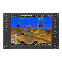
Integrated Flight Deck
Brand: Garmin
|
Category: Avionics Display
|
Size: 24.12 MB
Table of Contents
-
-
-
2 Gdu 1040
41 -
4 Gia 63W
67 -
5 Gea 71
89 -
6 Gdc 74A
121 -
7 Grs 77/Gmu 44
133 -
8 Gtx 33
143 -
-
Description175
-
-
-
-
-
Gdu 1040297
-
P10001 Connector297
-
Power298
-
Configuration299
-
Serial Data300
-
-
Gma 1347302
-
Gia 63W311
-
P601 (Com311
-
P602 (Vor/Ils313
-
P605 (I319
-
P606 (I321
-
Serial Data324
-
Discrete I/O330
-
Rmi/Obi335
-
Auto Pilot338
-
-
Gea 71343
-
P701 Connector343
-
P702 Connector345
-
Analog Inputs347
-
Power347
-
Discrete Signals350
-
Remote Power off351
-
-
Gdc 74A352
-
P741 Connector352
-
Power354
-
Serial Data354
-
Grs 77/Gmu 44358
-
P771 Connector358
-
-
-
-
Gtx 33362
-
P3301 Connector362
-
Power364
-
Serial Data367
-
-
-
Power369
-
Lighting370
-
Serial Data370
-
-
-
P691 Connector371
-
Ethernet373
-
Power373
-
Audio out374
-
Discrete Inputs374
-
Line out374
-
-
GRT 10 (Optional375
-
P201 Connector375
-
Power375
-
Volume Lock375
-
Aircraft Power376
-
GWX 68 (Optional376
-
P400 Connector376
-
-
-
Remote On/Off377
-
Configuration378
-
Serial Data378
-
Stabilization378
-
-
-
B.1 Introduction381
-
-

Garmin G900X Pilot's Manual (486 pages)
Integrated Flight Deck
Table of Contents
-
-
Menus40
-
Data Entry40
-
Page Groups42
-
-
EIS Display
95 -
Engine Page
100-
Electrical105
-
Temperatures106
-
-
-
Turbocharged109
-
-
-
Lean Display113
-
System Display118
-
-
Overview
123 -
COM Operation
128 -
NAV Operation
137 -
-
Introduction
159 -
-
Gps Navigation161
-
No-Eis Option162
-
-
-
Inset Map193
-
PFD Windows195
-
-
-
Operations204
-
-
-
Operations239
-
-
-
Operations301
-
-
Procedures (MFD)
306 -
Procedures (PFD)
319 -
-
TAWS Page359
-
TAWS Alerts361
-
System Status367
-
-
TraffiC Map Page371
-
TIS Alerts372
-
System Status373
-
-
TraffiC Map Page379
-
TAS Alerts381
-
System Status382
-
Safetaxi
387 -
Chartview
393 -
Flitecharts
415 -
Glossary
463 -
Map Symbols
475 -
Index
479
Advertisement