Sign In
Upload
Manuals
Brands
Garmin Manuals
Marine GPS System
GPSMAP 6212
Garmin GPSMAP 6212 Manuals
Manuals and User Guides for Garmin GPSMAP 6212. We have
9
Garmin GPSMAP 6212 manuals available for free PDF download: Owner's Manual, Technical Reference, Supplement Manual, Installation Instructions Manual, Declaration Of Conformity, Template
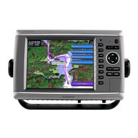
Garmin GPSMAP 6212 Owner's Manual (132 pages)
GPSMAP 6000/7000 Series
Brand:
Garmin
| Category:
Marine GPS System
| Size: 5 MB
Table of Contents
Tips and Shortcuts
3
Manual Conventions
3
Table of Contents
4
Getting Started
7
Front and Back Panels
7
Turning on the Chartplotter
9
Turning off the Chartplotter
9
Initial Chartplotter Settings
9
GPS Satellite Signal Acquisition
9
Adjusting the Backlight
9
Adjusting the Color Mode
9
Inserting and Removing Data and Memory Cards
10
Viewing System Information
10
About the Home Screen
11
Charts and 3D Chart Views
12
Navigation Chart
12
Zooming in and out on the Map
12
Chart Symbols
13
Viewing Location and Object Information on a Chart
15
Viewing Tide Station Information
16
Automatic Identification System
21
About AIS
21
Perspective 3D
25
Adjusting the View
25
Viewing Details about Navaids
25
Radar Overlay
27
Bluechart G2 Vision
27
Mariner's Eye 3D
28
Fish Eye 3D
30
Fishing Chart
30
Showing Satellite Imagery on the Navigation Chart
31
Viewing Aerial Photos of Landmarks
32
Animated Tide and Current Indicators
33
Detailed Road and POI Data
33
Auto Guidance
33
Combinations
34
About the Combinations Screen
34
Combinations Screen Configuration
34
Using Full-Screen View
37
Navigation
38
Basic Navigation Questions
38
Navigation with a Chartplotter
38
Waypoints
40
Moving a Saved Waypoint
41
Deleting All Waypoints
41
Routes
41
Creating and Navigating a Route from Your Present Location
41
Creating and Saving a Route
43
Deleting All Saved Routes
44
Deleting a Saved Route
44
Editing a Saved Route
44
Copying Routes
45
Tracks
45
Showing Tracks
45
Setting the Color of the Active Track
45
Viewing a List of Saved Tracks
46
Retracing the Active Track
46
Deleting All Saved Tracks
46
Saving the Active Track
46
Saving a Track as a Route
46
Deleting a Saved Track
46
Editing a Saved Track
46
Copying Tracks
47
Navigating with a Garmin Autopilot
47
Where to
48
Marine Services Destinations
48
Browsing for and Navigating to a Saved Waypoint
49
Stopping Navigation
49
Browsing for and Navigating Parallel to a Saved Route
50
Browsing for and Navigating a Saved Route
50
Browsing for and Navigating a Recorded Track
51
Almanac, Environmental, and On-Boat Data
52
Almanac Data
52
Tide Station Information
52
Current Information
53
Celestial Information
54
Environmental Data
54
Depth Data
57
On-Boat Data
57
Engine Gauges
57
Viewing Video
61
Device Configuration
63
Basic Device Configuration Questions
63
Simulator Mode
63
Turning the Chartplotter on Automatically
64
Display Configuration
64
Navigation Preferences
64
Auto Guidance Line Configurations
65
Coordinate Systems
67
Configuring the Time
67
Units of Measure
68
Information about Your Boat
72
Calibrating a Water Speed Device
72
Alarms
73
Navigation Alarms
73
System Alarms
74
Collision Alarm
74
Chartplotter Data Management
75
Copying Waypoints, Routes, and Tracks to a Memory Card
76
Copying Built-In Maps to a Memory Card
76
Networked Device Configuration
77
Radar
78
Transmitting Radar Signals
78
Stopping the Transmission of Radar Signals
78
Adjusting the Zoom Scale on the Radar Screen
78
Radar Display Modes
78
Cruising Mode
79
Harbor Mode
80
Sentry Mode
81
Radar Targeting
83
Waypoints and Routes on the Radar Screen
87
Marking a Waypoint on the Radar Screen
87
About the Radar Overlay
89
Radar Overlay and Chart Data Alignment
89
Showing the Radar Overlay
90
Optimizing the Radar Display
90
Radar Display Appearance
97
Radar Display Settings
99
Radar Overlay Display Appearance
102
Sonar Views
105
Full-Screen Sonar View
105
Sonar
105
Split-Frequency Sonar View
106
Split-Zoom Sonar View
106
Pausing the Sonar Display
107
Transducer Temperature Log
107
Waypoints on the Sonar Screen
107
Sonar Display Appearance
108
Configuring the Appearance of Suspended Targets
109
Adjusting the Gain on the Sonar Screen
110
Selecting Frequencies
110
Setting the Color Scheme
110
Adjusting the Range of the Depth Scale
111
Setting the Water Temperature Alarm
111
Sonar Alarms
111
Setting the Fish Alarm
112
Setting the Keel Offset
112
Transducer Configuration
112
Setting the Water Temperature Offset
113
Digital Selective Calling
114
Networked Chartplotter and VHF Radio Functionality
114
Turning on DSC
114
About the DSC List
114
Incoming Distress Calls
115
Man-Overboard Distress Calls Initiated from a VHF Radio
116
Man-Overboard Distress Calls Initiated from the Chartplotter
116
Position Tracking
116
Editing Information in a Position Report
117
Deleting a Position-Report Call
117
Individual Routine Calls
118
Selecting a DSC Channel
119
Making an Individual Routine Call to an AIS Target
119
Specifications
120
Physical Specifications
120
GPS Performance
120
Appendix
120
Calibrating the GPSMAP 7000 Series Touchscreen
121
Screenshots
121
Viewing GPS Satellite Locations
121
System Information
121
Restoring the Original Chartplotter Factory Settings
122
Saving System Information to a Memory Card
122
Communication with Wireless Devices
122
Viewing the Event Log
122
NMEA 0183 and NMEA 2000
123
Nmea 2000
124
Product Registration
126
Contact Garmin
126
Declaration of Conformity
126
Software License Agreement
126
Index
127
Advertisement
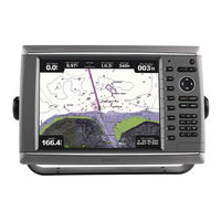
Garmin GPSMAP 6212 Owner's Manual (136 pages)
GPSMAP 6000/7000 Series Chartplotter
Brand:
Garmin
| Category:
GPS
| Size: 5 MB
Table of Contents
Tips and Shortcuts
3
Manual Conventions
3
Table of Contents
4
Getting Started
7
Front and Back Panels
7
Turning on the Chartplotter
9
Turning off the Chartplotter
9
Initial Chartplotter Settings
9
GPS Satellite Signal Acquisition
9
Adjusting the Backlight
9
Adjusting the Color Mode
9
Inserting and Removing Data and Memory
10
Cards
10
Viewing System Information
10
About the Home Screen
11
Charts and 3D Chart Views
12
Navigation Chart
12
Chart Symbols
13
Viewing Tide Station Information
16
Automatic Identification System
20
Perspective 3D
25
Radar Overlay
27
Bluechart G2 Vision
27
Mariner's Eye 3D
28
Fish Eye 3D
30
Fishing Chart
31
Showing Satellite Imagery on the Navigation
31
Viewing Aerial Photos of Landmarks
32
Animated Tide and Current Indicators
33
Detailed Road and POI Data
33
Auto Guidance
33
Combinations
34
About the Combinations Screen
34
Combinations Screen Configuration
34
Navigation
38
Basic Navigation Questions
38
Navigation with a Chartplotter
38
Waypoints
40
Routes
41
Tracks
45
Navigating with a Garmin Autopilot
47
Where to
48
Marine Services Destinations
48
Stopping Navigation
49
Browsing for and Navigating to a Saved Waypoint
49
Browsing for and Navigating a Saved Route
50
Browsing for and Navigating Parallel to a Saved Route
50
Browsing for and Navigating a Recorded Track
51
Data ���������������������������������������������������������� 46
52
Almanac, Environmental, and On-Boat Data
52
Almanac Data
52
Current Information
53
Current Station Information
53
Environmental Data
54
On-Boat Data
57
Viewing Video
61
Device Configuration
63
Basic Device Configuration Questions
63
Simulator Mode
63
Turning the Chartplotter on Automatically
64
Display Configuration
64
Navigation Preferences
64
Auto Guidance Line Configurations
65
Coordinate Systems
67
Information about Your Boat
72
Alarms
73
System Alarms
74
Chartplotter Data Management
75
Networked Device Configuration
77
Radar
78
Transmitting Radar Signals
78
Stopping the Transmission of Radar Signals
78
Radar Display Modes
78
Sentry Mode
81
Radar Targeting
83
Waypoints and Routes on the Radar
87
About the Radar Overlay
89
Optimizing the Radar Display
90
Radar Display Appearance
97
Radar Display Settings
99
Radar Overlay Display Appearance
102
Sonar
105
Sonar Views
105
Water Temperature Log
106
Waypoints on the Sonar Screen
106
Sonar Screen Settings
107
Frequencies
109
Noise and Interference Settings
110
Sonar Screen Appearance
110
Sonar Alarms
112
Transducer Configuration
113
Setting the Water Temperature Offset
114
Digital Selective Calling
115
Networked Chartplotter and VHF Radio
115
Functionality
115
Turning on DSC
115
About the DSC List
115
Incoming Distress Calls
116
Man-Overboard Distress Calls Initiated from the
117
Position Tracking
117
Individual Routine Calls
119
Target
120
FUSION-Link™ Media Player
121
Switching to a Different FUSION-Link Stereo
121
Opening the Media Player
121
Selecting the Media Source
121
Browsing for Music
121
Muting and Adjusting the Volume
122
Turning off the FUSION-Link Stereo
122
Appendix
123
Specifications
123
Calibrating the GPSMAP 7000 Series Touchscreen
124
Screenshots
124
Viewing GPS Satellite Locations
124
System Information
124
Restoring the Original Chartplotter Factory Settings
125
Communication with Wireless Devices
125
NMEA 0183 and NMEA 2000
126
Product Registration
128
Contact Garmin
128
Declaration of Conformity
128
Software License Agreement
128
Garmin GPSMAP 6212 Technical Reference (42 pages)
Technical Reference for Garmin NMEA 2000 Products
Brand:
Garmin
| Category:
Marine Equipment
| Size: 5 MB
Table of Contents
Contact Garmin
3
Table of Contents
4
NMEA 2000 Fundamentals
5
Garmin NMEA 2000 Device Overview
5
Building a NMEA 2000 Network
7
Existing NMEA 2000 Installation Considerations
12
NMEA 2000 Glossary
12
General NMEA 2000 Data Type Requirements
13
NMEA 2000-Certified Display Device PGN Information
17
NMEA 2000-Certified Sensor PGN Information
22
GPS 17X (GPS Antenna)
22
GFS 10 (Garmin Fuel Sensor)
22
GRA 10 (Garmin Rudder Angle Adapter)
22
GET 10 (Garmin Engine Tilt Adapter)
22
GFL 10 (Garmin Fluid Level Adapter)
23
GBT 10 (Garmin Bennett Trim Tab Adapter)
23
GST 10 (Garmin Water Speed and Temperature Adapter)
23
Intelliducer (Intelligent Depth Transducer-Transom Mount and Thru-Hull)
23
GWS 10 (Garmin Wind Sensor)
24
GHP 10 (Marine Autopilot System)
24
Gxm 51
25
Vhf 200
25
Vhf 300
25
Ais 300
26
Ais 600
26
NMEA 2000-Certified Sensor Configuration Information
27
GPS 17X (GPS Antenna)
27
GFS 10 (Garmin Fuel Sensor)
28
Restoring Factory Default Settings
29
GRA 10 (Garmin Rudder Angle Adapter)
30
GET 10 (Garmin Engine Tilt Adapter)
31
GFL 10 (Garmin Fluid Level Adapter)
33
Restoring Factory Default Settings
36
GBT 10 (Garmin Bennett Trim Tab Adapter)
36
GST 10 (Garmin Water Speed and Temperature Adapter)
37
Restoring Factory Default Settings
39
Intelliducer (Intelligent Depth Transducer-Transom Mount and Thru-Hull)
40
GWS 10 (Garmin Wind Sensor)
40
NMEA 2000 Checklist
41
Advertisement
Garmin GPSMAP 6212 Supplement Manual (24 pages)
Weather and XM Satellite Radio GPSMAP 4000 Series; GPSMAP 5000 Series; GPSMAP 6000 Series; GPSMAP 7000 Series
Brand:
Garmin
| Category:
GPS
| Size: 1 MB
Table of Contents
Introduction
3
Cellular Equipment Requirements
3
XM Equipment Requirements
3
Contacting Garmin Product Support
3
Simulator Mode
3
Table of Contents
4
XM WX Satellite Weather and Cellular Weather
5
Cellular Weather
5
XM WX Satellite Weather
5
Weather Features
5
Weather Data Broadcasts
6
Status Messages
6
Viewing Precipitation Information
6
Switching Weather Charts
6
Storm Cell and Lightning Information
7
Hurricane Information
7
Weather Warnings and Weather Bulletins
8
Forecast Information
8
Viewing Sea Conditions
9
Viewing Fishing Information
11
Visibility Information
11
Viewing Buoy Reports
12
Viewing Local Weather Information Near a Buoy
12
Creating a Waypoint on the Forecast Chart
13
About the Weather Overlay
13
Weather Alarms
15
Selecting a Cellular or XM Antenna
15
Selecting an External Cellular Antenna
15
Viewing Weather Subscription Information
15
XM Satellite Radio
16
Using XM Radio
16
Appendix
18
Weather Data Warranty
18
Software License Agreement
19
Weather Warnings and Weather Bulletin Color Shading Descriptions
19
XM Satellite Radio Service Agreement
19
Index
20
Garmin GPSMAP 6212 Installation Instructions Manual (21 pages)
Garmin GPS Chart Plotter User Manual
Brand:
Garmin
| Category:
GPS
| Size: 3 MB
Table of Contents
Product Registration
1
Mounting the GPS 17X Antenna
4
Surface-Mounting the GPS 17X Antenna
5
Pole Mounting the GPS 17X Antenna
5
Under-Deck-Mounting the GPS 17X Antenna
6
Installing Cables
6
Installing Locking Rings on the Cables
6
Installing Cable Grommets
7
Tools Required
7
Wiring the Power Cable
7
Connecting to an Existing NMEA 2000 Network
8
Network Connections
8
Creating a Basic NMEA 2000 Network
9
Wiring a Garmin Marine Network
9
Sample Garmin Marine Network Setups
10
Wiring Additional NMEA 0183 Devices
12
Basic NMEA 0183 Wiring
12
Advanced NMEA 0183 Wiring
13
Wiring to a Lamp or to a Horn (Optional)
15
Wiring to a DB-9 PC Serial Connector
15
Wiring to a GPS 17 or GPS 17 Hvs Antenna
15
Installing Video Cables
16
Primary Video Cable (Video-Yellow Connector)
16
Secondary Video Cable (Video 2-Purple Connector)
16
Updating the Chartplotter Software
17
Physical Specifications
18
GPS Performance
18
Nmea 2000 Pgn Information
18
Marine Video Cable Pin Assignments
19
Garmin GPSMAP 6212 Supplement Manual (24 pages)
Supplement
Brand:
Garmin
| Category:
Weather Radio
| Size: 2 MB
Table of Contents
Introduction
3
Contact Garmin
3
Table of Contents
4
XM WX Satellite Weather and XM Satellite Radio
5
XM WX Satellite Weather
5
Viewing XM WX Satellite Weather Subscription Information
15
XM Satellite Radio
15
Appendix
18
Weather Data Warranty
18
Software License Agreement
19
XM Satellite Radio Service Agreement
19
Index
20
Garmin GPSMAP 6212 Declaration Of Conformity (6 pages)
Marine Navigation Equpment (GPS Receiver)
Brand:
Garmin
| Category:
Marine GPS System
| Size: 0 MB
Table of Contents
Declaration of Conformity
1
Declaration de Conformite
2
Dichiarazione DI Conformità
3
Declaración de Conformidad
5
Declaração de Conformidade
6
Garmin GPSMAP 6212 Template (2 pages)
Flush Mount Template
Brand:
Garmin
| Category:
Marine GPS System
| Size: 0 MB
Table of Contents
Printing a Mounting Template
1
Recommended Clearance for Sun Cover Handle
2
Recommended Clearance for SD Card Door
2
Unit Dimensions
2
Flush Mount Template
2
Garmin GPSMAP 6212 Owner's Manual (2 pages)
RF Remote For Use with GPSMAP 4000/5000 Series Chartplotters
Brand:
Garmin
| Category:
Remote Control
| Size: 0 MB
Table of Contents
Getting Started
2
Specifications
2
Introduction
2
Description of Buttons
2
Advertisement
Related Products
Garmin GPSMAP 620
Garmin GPSMAP 6008
Garmin GPSMAP 6012
Garmin GPSMAP 6208
Garmin ECHOMAP 60 Series
Garmin GPSMAP 188 Sounder
Garmin GPSMAP 238 Sounder
Garmin GPSMAP 215
Garmin GPSMAP 4010
Garmin GPSMAP 5012 - Marine GPS Receiver
Garmin Categories
GPS
Watch
Car Navigation system
Avionics Display
Marine Equipment
More Garmin Manuals
Login
Sign In
OR
Sign in with Facebook
Sign in with Google
Upload manual
Upload from disk
Upload from URL