Table of Contents
Advertisement
Quick Links
Advertisement
Table of Contents

Related Manuals for Hi-Target V30 Plus


Summary of Contents for Hi-Target V30 Plus
- Page 1 V30 Plus GNSS RTK System User Manual...
-
Page 2: Manual Revision
V30 Plus GNSS System User Manual Manual Revision Revision Date Revision Level Description Jul, 2019 V30 Plus GNSS RTK System User Manual... - Page 3 V30 Plus GNSS System User Manual V30 Plus GNSS RTK System User Manual...
- Page 4 V30 Plus GNSS System User Manual Preface Introduction Welcome to the Hi-Target V30 Plus receiver. This introduction describes how to use this product. Experience Requirement In order to help you use Hi-Target series products better, Hi-Target suggests you carefully read the instructions. If you are unfamiliar with the products, please refer to http://www.hi - target.com.cn/...
-
Page 5: Table Of Contents
V30 Plus GNSS System User Manual Contents Chapter 1 Overview ............................ 1 1.1 Foreword ........................... 2 1.2 Features..........................2 1.3 Use and Precautions......................2 Chapter 2 Product Introduction ........................4 2.1 Overall Appearance ......................5 2.1.1 Upper Cover........................ 5 2.1.2 Bottom Cover ......................6 2.2 Button &... -
Page 6: Overview
V30 Plus GNSS System User Manual Chapter 1 Overview This chapter contains: - Foreword - Features - Use and Precautions... -
Page 7: Foreword
V30 Plus GNSS System User Manual 1.1 Foreword A new generation of miniaturized V30 Plus GNSS RTK system, condensing our ultimate professional pursuit, with enthusiast performance configuration, using magnesium alloy structure, supporting tilt measurement, using Wi- Fi wireless connection, control distance up to 100 meters;... - Page 8 V30 Plus GNSS System User Manual In order to ensure the continuous tracking observation of the satellite and the quality of the satellite signal, it is required that the space above the station should be as wide as possible, and there should be no obstacles above the 15 ° elevation angle; in order to reduce the...
-
Page 9: Product Introduction
V30 Plus GNSS System User Manual Chapter 2 Product Introduction This chapter contains: - Overall Appearance - Button & Indicator Lamp - Static Survey - Dynamic RTK Survey - Firmware Upgrade... -
Page 10: Overall Appearance
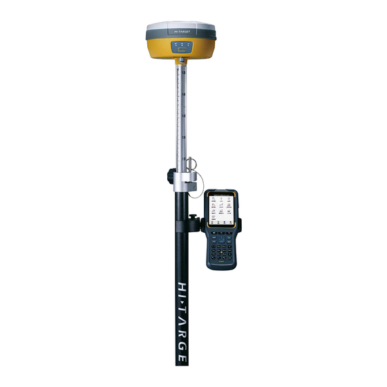
V30 Plus GNSS System User Manual 2.1 Overall Appearance The product appearance is divided into three parts, including the upper cover, bottom cover and control panel. Upper Cover Bottom Cover Control Panel Figure 2-1-1 Front 2.1.1 Upper Cover The product appearance is divided into three parts, including the upper cover, bottom cover and control panel. -
Page 11: Bottom Cover
V30 Plus GNSS System User Manual 2.1.2 Bottom Cover Figure 2-1-3 Bottom Cover 1.Five-pin socket & Protective plug Battery compartment and cover 2.Host label USB socket and protective plug 3.Connection screw Network/radio antenna interface and protective plug 4.Speaker ◇ Connection screw: For fixing the instrument to the base or a pole ◇... -
Page 12: Button & Indicator Lamp
V30 Plus GNSS System User Manual 2.2 Button & Indicator Lamp 2.2.1 Button Function Table 2-2-1 Button Function Description Function Description Power-On Long press the button for 1 second. In the power-on state, long press button more than 3 seconds and less than 6 seconds, Power-Off the first voice of the speaker Dingdong, release the button to normal shutdown. -
Page 13: Indicator Lamp
Error (Insufficient Storage Space) 2.3 Static Survey V30 Plus receiver can be used for static measurement. It is set by double-clicking the power key to enter the mode switching, every double-clicking, switching one mode of operation. In the mode switching process, click the power key to confirm, the red state light... -
Page 14: Steps Of Static Survey
The collected GNSS static data is stored in the static drive letter in the 8 GB storage of the V30 Plus receiver (effective storage space is about 6.6 GB). There are three folders: log, gnss and rinex. The log folder stores log information. The data format stored in the gnss folder is *.gns;... -
Page 15: Static Data Download
V30 Plus receiver file management using U disk storage, plug-and-play, direct drag-and- drop download, do not need to download the management software. V30 Plus receiver can only download static data by using U disk mode, and can not write to the V30 Plus receiver. -
Page 16: Dynamic Rtk Survey
V30 Plus GNSS System User Manual Point Name Antenna Height Figure 2-3-4 Edit File Notice: Static files in removable disks can not be deleted directly, we can use controller software to conduct 2.4 Dynamic RTK Survey The dynamic RTK measurement can be based on the propagation mode of the differential signal for the radio mode (internal radio, external radio, external station) and network mode. - Page 17 V30 Plus GNSS System User Manual Parameter Sittings of Base Station The base station parameters include setting the target height, base station coordinates, working mode and corresponding parameters, message format, elevation angle, and so on. After completing the relevant parameter editing, click the Settings button in the upper right...
-
Page 18: Firmware Upgrade
V30 Plus GNSS System User Manual 2.5 Firmware Upgrade The receiver uses 3G network, and the host firmware can be automatically upgraded through the network (Please refer to: Hi-Survey Road Software User Manual), and the user can also choose to manually upgrade through U disk. -
Page 19: Technical Specification
V30 Plus GNSS System User Manual Chapter 3 Technical specification This chapter contains: - Technical specification... - Page 20 V30 Plus GNSS System User Manual 3.1 Technical specification Configuration Detailed Indicators System: Multi-star System Core (UB4B0M) Channels: 432 BDS: B1, B2, B3 GPS: L1, L2, L5 GLONASS: L1,L2 Satellite Signals Tracked GALILEO: E1, E5a, E5b Simultaneously QZSS: L1,L2,L5 GNSS...
- Page 21 V30 Plus GNSS System User Manual Φ164 mm × 83.5 mm Dimensions Physical ≤1.4kg (Includes Battery) Weight Power Consumption 4.2W Materials The Shell Is Made of Magnesium Alloy Material IP67 It Can Resist Temporary Immersion Under 1 Meter Water/Dustproof Underwater, Completely Preventing Dust From Entering Free Fall Resistance to natural fall of 2m height rod, free fall of 1.2m...
-
Page 22: Accessories And Interfaces
V30 Plus GNSS System User Manual Chapter 4 Accessories and Interfaces This chapter contains: - SIM Card Installation - Data Cable - Antenna - Benchmark - Battery & Charger... -
Page 23: Sim Card Installation
Table 4-1-1 SIM Card Description GPRS (VRS/intRTK) SIM Card To implement an RTK work using the V30 Plus receiver, you need to prepare a SIM card and open the data communication service. The number of cards required depends on your RTK measurement system configuration. -
Page 24: Data Cable
V30 Plus GNSS System User Manual 4.2 Data Cable The Mini USB cable has a standard USB interface on one end and a Mini USB interface on the other end; it is used for connection between the host and external devices for data transmission. -
Page 25: Antenna
V30 Plus GNSS System User Manual 4.3 Antenna There are UHF internal radio antenna and 3G/GPRS antenna, you can select the appropriate antenna according to the operation mode. The UHF radio antenna is used in the UHF mode, and the external 3G/GPRS antenna is used in the internal GSM mode. -
Page 26: Battery And Charger Model
V30 Plus GNSS System User Manual Figure 4-5-1 Unload Put the on the bottom of the battery marked with Open to the battery compartment, and into the battery rack. Figure 4-5-2 Installed Battery Unload Gently press and push in the direction marked Open, pour out the battery and complete the battery unloading. -
Page 27: Cautions For Charging
V30 Plus GNSS System User Manual Notice: 1.Service time of lithium battery will decrease with the reduction of temperature and increase of charging and discharging times. Generally, one new 5000 mAh lithium battery can be used for 10 hours for static data collection, or 8 hours as GPRS rover, or 7 hours as 2W internal transceiver transmitting station. - Page 28 V30 Plus GNSS System User Manual Notice: 1.Only use battery and charger configured by manufacturer, and do not throw them into the fire or use the metallic short-circuit electrode. In case of heating, deformation, liquid leakage, smell emission or other anomaly phenomenon during the use, charging or storage period of the battery, please stop using and replace it with new one.
- Page 29 V30 Plus GNSS System User Manual...
Need help?
Do you have a question about the V30 Plus and is the answer not in the manual?
Questions and answers
He target V30