Volvo SENSUS NAVIGATION Manual
Hide thumbs
Also See for SENSUS NAVIGATION:
- Owner's manual (114 pages) ,
- Infotainment manual (108 pages) ,
- User manual (100 pages)
Table of Contents
Advertisement
Advertisement
Table of Contents

Related Manuals for Volvo SENSUS NAVIGATION


Summary of Contents for Volvo SENSUS NAVIGATION
- Page 1 S E N S U S N A V I G A T I O N...
- Page 2 Text and symbols on the screen Action to take at the next guidance point Distance to the next guidance point Name of the next street or road Facility/point of interest (POI) Intermediate destination in an itinerary Symbol for destination/final destination Calculated remaining time to destination Calculated remaining distance to destination The vehicle’s current location...
- Page 3 SENSUS NAVIGATION NOTE • Do not export your Volvo to another country before investi- gating that country's applicable safety and exhaust emission Sensus Navigation is a satellite-based guidance and traffic information requirements. In some cases it may be difficult or impossible system.
-
Page 4: Table Of Contents
INTRODUCTION SETTING A DESTINATION, TRAFFIC INFORMATION ITINERARY AND ROUTE Introduction Navigation – traffic information Navigation: setting a destination Sensus Navigation Navigation–Real Time Traffic Information (RTTI) Navigation – points of interest (POI) Sensus navigation symbols Navigation – text wheel and keypad Navigation –... - Page 5 MAP AND SYSTEM INFORMATION INDEX Navigation – map and system information Index Navigation – Menu overview Navigation – troubleshooting Navigation – License agreements and copyrights...
- Page 7 INTRODUCTION...
-
Page 8: Introduction
Modifications to the If you have any further questions, please contact emission control system(s) may render a Volvo retailer or other representative of the your Volvo not certifiable for legal opera- Volvo Car Corporation. tion in the U.S., Canada and other coun- All information, illustrations and specifications tries. -
Page 9: Sensus Navigation
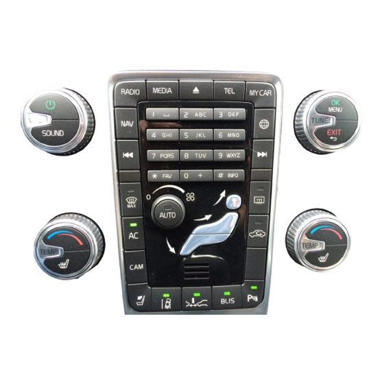
• Steering wheel keypad for navigating in Be aware of the current traffic situation. Volvo Sensus Navigation uses the WGS84 refer- menus and adjusting volume and voice guid- • Always comply with relevant traffic regu- ence system, which provides your location includ- ance. - Page 10 INTRODUCTION Audio from the navigation system comes from NOTE the infotainment system's front speakers. Throughout the navigation system informa- tion, the text "press the thumb wheel/OK/ MENU" refers to the thumb wheel on the steering wheel keypad and the control on the center console respectively.
- Page 11 INTRODUCTION Map overview Generic examples of map views The type of information shown on the screen is settings that have been applied, the points of determined by geographic location, the system interest chosen for display, etc.
- Page 12 Voice instructions are also provided, see (p. 27). An area selected to be avoided, see (p. 27). Scroll mode, seek (p. 11). Related information • Sensus navigation (p. 11) • Navigation – voice control (p. 14)
-
Page 13: Sensus Navigation
This article provides basic information and exam- • Always use good judgment when follow- The system can be used even when the ples about operating the Sensus Navigation sys- ing navigation system guidance, and do engine is not running but will be switched off tem. - Page 14 INTRODUCTION 1. While in Scroll mode, press the thumb 2. Press NAV. Scrolling wheel/OK/MENU. – Press one of the center console's number > The Shortcut menu will open. keys 1-2-3-4-6-7-8-9: an arrow showing > A menu will open for the point on the map 3.
-
Page 15: Navigation - Text Wheel And Keypad
INTRODUCTION Navigation – text wheel and keypad Using the text wheel Entering text using the center console keypad Use the text wheel or the center console keypad to enter text or to display information about e.g., an address or point of interest. Text wheel (generic view) 1. -
Page 16: Navigation - Voice Control
> The system will respond with: " Start Related information pressing OK/MENU, see Setting a destina- guidance ." • Sensus navigation (p. 11) tion (p. 18). Canceling guidance List of alternatives The following voice control dialog cancels guid- ance. 1. Say "... - Page 17 > A route will be calculated and guidance will begin. Additional commands Additional navigation system voice commands can be found in the normal view for MY CAR by pressing OK/MENU and selecting Settings Voice control settings Command list Navigation commands. Related information • Sensus navigation (p. 11)
-
Page 19: Setting A Destination, Itinerary And Route
SETTING A DESTINATION, ITINERARY AND ROUTE... -
Page 20: Navigation: Setting A Destination
"Send to Car" app of information desired: or by using the Volvo On Call mobile app. See – In the navigation system's normal view, press • : displays a map of the location with... - Page 21 SETTING A DESTINATION, ITINERARY AND ROUTE 5. Set the address as an intermediate destina- 2. Search for a POI in the following ways: 4. Set the address as an intermediate destina- tion or a single destination: tion or a single destination: •...
- Page 22 SETTING A DESTINATION, ITINERARY AND ROUTE 2. Open the stored destination: 2. Select a destination from the list. 2. Enter the zip code and the country if neces- sary. • Routes : e.g., recorded sections of the For additional information about the destina- route.
- Page 23 SETTING A DESTINATION, ITINERARY AND ROUTE Setting a destination using a position 1. In the navigation system's normal view, press 4. Set the address as an intermediate destina- the thumb wheel/OK/MENU and select tion or a single destination: on the map Set destination Latitude and longitude.
-
Page 24: Navigation - Points Of Interest (Poi)
POI symbols, grouped according to functions: Railway access • Navigation – text wheel and keypad (p. 13) Car dealer/repair Airport • Sensus navigation (p. 11) • Navigation – itineraries (p. 23) Gas station Bus station Ferry terminal Car repair Government or comunity facility... -
Page 25: Navigation - Itineraries
SETTING A DESTINATION, ITINERARY AND ROUTE Navigation – itineraries 3. For more detailed information about an inter- Hospital or health care facility mediate destination, select it, press the This article shows how to create an itinerary and thumb wheel/OK/MENU and select start guidance to the desired destination. -
Page 26: Navigation - Routes
SETTING A DESTINATION, ITINERARY AND ROUTE Navigation – routes Modifying itineraries 3. Turn the thumb wheel/TUNE to move the intermediate destination up/down in the list. A route can be displayed in detail or an overview can be selected. This article describes how an 4. - Page 27 SETTING A DESTINATION, ITINERARY AND ROUTE 2. Select one of the following: Alternative routes Route overview 1. In the navigation system's normal view, press – In the navigation system's normal view, press the thumb wheel/OK/MENU and select the thumb wheel/OK/MENU and select Route Alternative routes to Route...
- Page 28 Map of the remaining part of the route • Navigation – itineraries (p. 23) the thumb wheel/OK/MENU and select This function shows the remaining section of • Sensus navigation (p. 11) your route. Route Record route. • Navigation – traffic information (p. 36) >...
-
Page 29: Navigation - Route Options
SETTING A DESTINATION, ITINERARY AND ROUTE Navigation – route options Rerouting on request This selection enables you to request a new Route option settings include e.g., type of route route based on e.g., traffic information. and the number of alternative routes. 1. - Page 30 SETTING A DESTINATION, ITINERARY AND ROUTE is activated, lanes of this type will be included Avoiding an area when a route is calculated. This feature allows you to avoid an entire area on the map when a route is calculated. It can be 1.
-
Page 31: Navigation - Map Options
Navigation: setting a destination (p. 18) perature will still be displayed on the • Sensus navigation (p. 11) upper and lower sections of the screen respectively. This function is only available if this type of information is included in the map database. - Page 32 SETTING A DESTINATION, ITINERARY AND ROUTE Map type 2. Select a function: The compass needle's red pointer points to the north. A 1. In the navigation system's normal view, press • Checked box: If you are driving on a high- text-based compass can also the thumb wheel/OK/MENU and select way, the next 3 exits will be displayed, e.g.,...
-
Page 33: Navigation - Guidance Alternatives
SETTING A DESTINATION, ITINERARY AND ROUTE Navigation – guidance alternatives Points of interest (POIs) on the map Map colors 1. In the navigation system's normal view, press 1. In the navigation system's normal view, press the thumb wheel/OK/MENU and select the thumb wheel/OK/MENU and select Settings Map options... - Page 34 SETTING A DESTINATION, ITINERARY AND ROUTE 2. Select one of the following: Automatic read-out Use the infotainment system's volume control to adjust voice guidance volume (while the system 1. In the navigation system's normal view, press • Checked box: distance, direction and is providing voice guidance).
- Page 35 SETTING A DESTINATION, ITINERARY AND ROUTE With simple voice guidance activated, voice guid- 2. Select one of the following: NOTE ance will only be provided once for each guid- • Checked box: an audible signal alerts the • Speed limits can be changed and may ance point.
-
Page 36: Navigation - Importing/Exporting Stored Locations
Therefore, this the file format is .gpx. article cannot provide exact step-by-step 1. Connect a USB flash drive to the USB instructions. Contact your Volvo retailer if you socket in the tunnel console storage com- have any questions. partment. -
Page 37: Traffic Information
TRAFFIC INFORMATION... -
Page 38: Navigation - Traffic Information
TRAFFIC INFORMATION Navigation – traffic information This symbol marks the location of a traffic problem. For more The navigation system constantly receives upda- information, see "Traffic infor- ted traffic information, which is used for dynamic mation on the map" below. guidance. - Page 39 TRAFFIC INFORMATION Traffic information with a set Traffic information on the map All traffic destination 1. In the navigation system's normal view, press 1. In the navigation system's normal view, press the thumb wheel/OK/MENU and select the thumb wheel/OK/MENU and select This function shows traffic problems when a des- tination has been set.
- Page 40 TRAFFIC INFORMATION Direct listed information 2. Select a traffic problem and confirm by pressing the thumb wheel/OK/MENU. > Additional information and the location on the map will be displayed. The map image will be centered around the location of the problem.
-
Page 41: Navigation–Real Time Traffic
TRAFFIC INFORMATION Navigation–Real Time Traffic Current traffic information is shown for highways/ Activating/deactivating Information (RTTI) freeways, major roads, secondary roads and in The vehicle must be connected to the Internet in some cases for urban routes. order to use RTTI. When the vehicle is connected to the Internet, The amount of traffic information shown on the enhanced traffic information (RTTI... -
Page 43: Map And System Information Index 42
MAP AND SYSTEM INFORMATION... -
Page 44: System Information
NOTE information • Instructions for downloading information NOTE Volvo offers maps covering North America as and updating the navigation system are well as other parts of the world. Map data may not provide complete coverage available on the Internet. of all remote areas. -
Page 45: Navigation - Menu Overview
Navigation – troubleshooting (p. 46) NOTE described in their respective articles. • Sensus Navigation (p. 7) Some of the navigation system's functions will – In the navigation system's normal view, press be disabled or reduced while updating is in the thumb wheel/OK/MENU to open the progress. - Page 46 MAP AND SYSTEM INFORMATION Address (p. 18) Stored location (p. 18) Zip code (p. 18) Country: Set single destination Country: City: Edit Zip code Street: Delete Street: Number: Delete all Number: Intersection Intersection Previous destination (p. 18) Set single destination Set single destination Set single destination Add as waypoint...
- Page 47 MAP AND SYSTEM INFORMATION Travel guide (p. 18) Route overview (p. 24) Route options (p. 27) Start guidance Next Route type Details Previous Reroute on request Photos Zoom in Route proposals Play audio Zoom out Use carpool lane Pause audio Use express lane Map of remaining route (p.
-
Page 48: Navigation - Troubleshooting
The vehicle’s position on the map is owner's Turn-by-turn navigation incorrect manual. Sensus Navigation uses the Global Positioning Automatic read out of Import/export stored locations (p. 34) System (GPS), which indicates the vehicle’s posi- traffic tion with an accuracy of about 65 feet Audio fadeout (20 meters). - Page 49 The map database is enhance and updated regu- or train, or in such a way as to impede the recep- larly. Please contact your Volvo retailer for more tion of GPS signals, it can take up to 5 minutes information about availability.
-
Page 50: Navigation - License Agreements And Copyrights
The following is information for the end-user of supplier terms and copyright notices set forth at • Navigation – routes (p. 24) the Sensus Navigation system. the following URL: http://corporate.navteq.com/ • Navigation – route options (p. 27) ENDUSER LICENSE AGREEMENT supplier_terms.html... - Page 51 MAP AND SYSTEM INFORMATION use this Data with any products, systems, or PARTICULAR PURPOSE OR NON- TERMS AND CONDITIONS applications installed or otherwise connected to INFRINGEMENT. Some States, Territories and License Limitations on Use: You agree that or in communication with vehicles capable of Countries do not allow certain warranty your license to use this Data is limited to and vehicle navigation, positioning, dispatch, real time...
- Page 52 MAP AND SYSTEM INFORMATION with all licenses and approvals required under, or (ii) the United Nations Convention for 425 West Randolph Street, Chicago, IL applicable export laws, rules and regulations, Contracts for the International Sale of Goods, 60606. including but not limited to the laws, rules and which is explicitly excluded.
- Page 53 MAP AND SYSTEM INFORMATION CONTRATO DE LICENCIA DE USUARIO Pacífico y (b) HERE Europe B.V.a para los Datos este Contrato de licencia de usuario final; y (c) de Europa, Medio Oriente y/o África. usted transfiere la Información en la manera FINAL exacta en la que la compró...
- Page 54 MAP AND SYSTEM INFORMATION circunstanciaos fuentes utilizadas, y el hecho de Exclusión de Responsabilidad: NI HERE NI SUS Control de Exportaciones: Usted acuerda no recopilar una gran cantidad de Información LICENCIANTES (INCLUYENDO A LOS exportar de ningún otro lado ningún componente geográfica, lo que puede tener como LICENCIANTES Y PROVEEDORES DE ESTOS) de la Información, ni ningún producto directo de...
- Page 55 Estados Unidos o Related information cualquier otra entidad buscando o solicitando • Sensus Navigation (p. 7) tener derechos similares a aquellos usualmente • Navigation – map and system information reclamados por el gobierno de Estados Unidos, (p.
- Page 57 USB connector (audio system) menu overview Real Time Traffic Information (RTTI) route options traffic information 36, 39 Keypad troubleshooting Voice control Volvo Navigation System general information License agreement Points of interest (POI) Route alternative routes and route overview...
- Page 58 INDEX...
- Page 60 TP 24468 (English - USA & Canada), AT 1717, MY18, Copyright © 2000-2017 Volvo Car Corporation...
Need help?
Do you have a question about the SENSUS NAVIGATION and is the answer not in the manual?
Questions and answers