Furuno FCR-28x9 (with 23.1" LCD) Manuals
Manuals and User Guides for Furuno FCR-28x9 (with 23.1" LCD). We have 4 Furuno FCR-28x9 (with 23.1" LCD) manuals available for free PDF download: Operator's Manual, Quick Manual
Furuno FCR-28x9 (with 23.1" LCD) Operator's Manual (423 pages)
Brand: Furuno
|
Category: Marine Radar
|
Size: 30 MB
Table of Contents
Advertisement
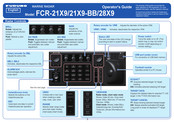
Furuno FCR-28x9 (with 23.1" LCD) Operator's Manual (20 pages)
Brand: Furuno
|
Category: Marine Radar
|
Size: 25 MB
Table of Contents

Furuno FCR-28x9 (with 23.1" LCD) Operator's Manual (20 pages)
Chart radar
Brand: Furuno
|
Category: Marine Radar
|
Size: 8 MB
Advertisement

Furuno FCR-28x9 (with 23.1" LCD) Quick Manual (5 pages)
Chart Radar
Brand: Furuno
|
Category: Marine Radar
|
Size: 4 MB
Table of Contents
Advertisement