Leica GS05 User Manual
Hide thumbs
Also See for GS05:
- Quick manual (16 pages) ,
- User manual (156 pages) ,
- User manual (74 pages)
Table of Contents
Advertisement
Quick Links
Advertisement
Table of Contents

Related Manuals for Leica GS05


Summary of Contents for Leica GS05
- Page 1 Leica GS05 User Manual Version 1.0 English...
- Page 2 Bluetooth® is a registered trademark of Bluetooth SIG, Inc. • All other trademarks are the property of their respective owners. Validity of this This manual applies to all models of the Leica GS05 GNSS instrument. manual Where there are differences between the various instruments they are clearly described.
- Page 3 Description My Products Register all products that you and your company own and explore your world of Leica Geosystems: View detailed information on your products and update your products with the latest software and keep up-to-date with the latest documentation.
- Page 4 Service Description My Trusted Services Leica Geosystems Trusted Services offer you increased productivity while at the same time providing maximum security. New software services and state‑of‑the‑art IT infrastructure offer a vast potential to optimise your workflow and increase your efficiency and productivity, both now and in the future.
-
Page 5: Table Of Contents
GVP754 GNSS Base & Rover Container 2.3.2 GVP753 GNSS Rover Container 2.3.3 GVP750 GS05 Container Instrument Components User Interface Keyboard LED Indicators on GS05 Operating Principles Operation Equipment Setup 4.1.1 Setting up as a Post-Processing Base 4.1.2 Setting up as a Real-Time Base 4.1.3... -
Page 6: Safety Directions
Safety Directions General Introduction Description The following directions enable the person responsible for the product, and the person who actually uses the equipment, to anticipate and avoid opera- tional hazards. The person responsible for the product must ensure that all users understand these directions and adhere to them. -
Page 7: Definition Of Use
Responsibilities Manufacturer of the Leica Geosystems AG, CH-9435 Heerbrugg, hereinafter referred to as Leica product Geosystems, is responsible for supplying the product, including the User Manual and original accessories, in a safe condition. -
Page 8: Hazards Of Use
To be familiar with local regulations relating to safety and accident pre- • vention To stop operating the system and inform Leica Geosystems immediately if • the product and the application become unsafe To ensure that the national laws, regulations and conditions for the oper- •... - Page 9 CAUTION Not properly secured accessories If the accessories used with the product are not properly secured and the product is subjected to mechanical shock, for example blows or falling, the product may be damaged or people can sustain injury. Precautions: ▶...
- Page 10 • Precautions: ▶ Do not open the product! ▶ Only Leica Geosystems authorised service centres are entitled to repair these products. WARNING Dropping the product, high mechanical stress or high ambient temper- ature Possible damage to the internal non-removeable battery may occur. Interna- tional transportation regulations might prohibit transportation of those bat- teries.
-
Page 11: Electromagnetic Compatibility (Emc)
Although the product meets the strict regulations and standards which are in force in this respect, Leica Geosystems cannot completely exclude the possib- ility that the function of the product may be disturbed in such an electromag- netic environment. - Page 12 Precautions: ▶ Although the product meets the strict regulations and standards which are in force in this respect, Leica Geosystems cannot completely exclude the possibility that other equipment can be disturbed or that humans or animals can be affected. ▶...
-
Page 13: Description Of The System
75% full before beginning the upload, and do not remove the battery during the upload process. Software for Description All GS05 models The software can be updated loading the firmware file to the internal memory of the GS05 instrument. Refer to 4.1.6 Updating the Firmware. 2.2.2 Power Concept General Use the batteries, chargers and accessories recommended by Leica Geosys- tems to ensure the correct functionality of the instrument. -
Page 14: Data Storage Concept
For permanent operations use Uninterruptible Power Supply units as a back- up in a main power failure. 2.2.3 Data Storage Concept Description Data (Leica GNSS raw data and RINEX data) can be recorded in the internal memory. Memory device Internal The GS05 GNSS instrument has an internal memory. - Page 15 GHT63 clamp Manuals and USB documentation card GEB212, GEB260 or GEB334 batteries Antenna LTE antennas, for example GAT36 Radio antennas, for example GAT35 Field controller or tablet with holder Tribrach Height hook USB stick CBA4, Li-ion battery for CC200 Cables Antenna Stylus SD cards...
-
Page 16: Gvp753 Gnss Rover Container
LTE antennas, for example GAT36 Stylus GHT63 clamp USB stick CRP15, quick release adaptor for quick mounting and demounting the GS05 to the pole without screwing GHT87 tablet holder GAT1, GAT2 or GAT35 radio antennas Antenna arm microSD card including adapter or SD card... -
Page 17: Gvp750 Gs05 Container
2.3.3 GVP750 GS05 Container Container for GS05 29298_001 GAD33 arm Field controller or tablet with holder GAT33 Multiband GSM/UMTS/LTE antenna, or GAT27/GAT28/GAT36 Antenna arm Manuals and USB documentation card GPR121 circular prism PRO or GZT4 target plate for GPH1 and GPH1... -
Page 18: Instrument Components
Container for GS05 29303_001 GHT87 tablet holder bracket GAD103 adapter Protective cover for instrument, sunshade for objective lens and cleaning cloth CBA4, Li-ion Battery for CC200 GAT radio antennas, long flexible GKL311 battery charger GRZ101 mini prism Cables GRZ4 or GRZ122 prism... - Page 19 ☞ A Bluetooth port is included inside all GS GNSS instruments enabling con- nectivity to the field controller. Description of the System...
-
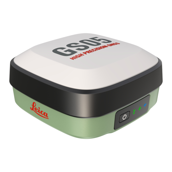
Page 20: User Interface
After the reset, the GNSS instrument is rebooted. ☞ The Position and Connectivity LEDs flash in orange and blue. LED Indicators on GS05 LED indicators Description The GS05 instrument has Light Emitting Diode (LED) indicators. They indicate the basic instrument status. User Interface... - Page 21 Satellites are tracked, a position is not yet orange available. orange A navigated position is available. flashing A code-only position is available. green green A fixed RTK position is available. Connectivity GS05 is not powered or module is not ready. User Interface...
-
Page 22: Operating Principles
GS05 is connected to a field controller via Bluetooth. Operating Principles Operating the instru- The GS05 GNSS instrument is operated by pressing the ON/OFF button or by ment the field controller. Operation by button The GS05 GNSS instrument is operated by pressing its button. Refer to Keyboard for a detailed description of the buttons and their function. -
Page 23: Operation
Operation Equipment Setup 4.1.1 Setting up as a Post-Processing Base The equipment setup described is used for static operations over markers. Description The instrument can be programmed with the field controller before use which can then be omitted from the setup. The antenna is mounted directly using screw fitting. -
Page 24: Setting Up As A Real-Time Base
Raw observation data can also be collected for post-processing. Description The GS05 instrument can be programmed with the field controller before use which can then be omitted from the setup. The connection between GS05 and the field controller is made via Bluetooth. - Page 25 Place and lock the carrier in the tribrach. Screw the GS05 onto the carrier. Check that the tribrach is still level. Connect the UHF or LTE antenna to the GS05. Insert the data storage device and the battery into the field control- ler.
-
Page 26: Setting Up As A Real-Time Rover
Connections are made to the GNSS antenna, radio antenna and field control- ler. The field controller is fixed to the pole with the GHT63. Connection between the GS05 instrument and the field controller is made through Bluetooth. The antenna is mounted directly using screw fitting. If using stub and ☞... - Page 27 Equipment setup - GS05 LTE 27505_001 GS instrument CS30 tablet GLS30 carbon fibre pole USB stick GAT36 LTE antenna GHT81 holder CS20 field controller CC180 tablet SD card for CS20 GHT90 holder GEB334 battery CC200 tablet GHT66 holder CMB16 holder...
-
Page 28: Fixing The Field Controller To A Holder And Pole
Press ON/OFF button on the field controller to switch on. Press ON/OFF button on the GS05 to switch on. Screw the GS05 to the top of the pole. The field controller and GS05 are connected via Bluetooth. -
Page 29: Connecting To A Personal Computer
Windows PC. 4.1.6 Updating the Firmware Description The firmware of the GS05 GNSS instrument is updated by copying the firmware file onto the internal memory of the GS05. Update firmware Firmware packages are available for download at the following Inter-... -
Page 30: Batteries
• operating temperatures reduce the service life of the battery. 4.2.2 Battery for GS05 GS05 has an internal battery that cannot be removed. Refer to 2.2.2 Power Concept for information about how to charge the battery. Working with the Tilt Compensation... - Page 31 Diagram Tilt α 27518_001 Tilt compensation Action Result step-by-step A GS05 must be configured as ☞ real-time rover and connected to a field controller running Captiv- ate software. Leica Captivate - Home: Set- tings\GS sensor\Tilt compens- ation Tilt Compensation Use tilt compensation: Check box checked.
- Page 32 Action Result Click the GS position icon. Select Current position. Current GS position, Tiltpage The fields are updated according to the setting for GS position update rate in Screen, Audio & Text Input. 27519_001 Direction of tilt α Tilt β 27522_001 GS heading α...
- Page 33 Action Result Use the 3D viewer with dxf data or a background image: Measure points Leica Captivate - Home: Meas- The position of the tilted GS05 is shown in the 3D viewer. Measure Stop Store Application example: 27524_001 Stake points...
-
Page 34: Configuring An Esim
LTE-M (also known as Cat-M or Cat-M1) and Cat-1bis. When ordering your eSIM, please ensure that your Mobile Network Oper- ator (MNO) supports Cat-M or Cat-1bis in the area where the GS05 will be deployed. Additionally, the eSIM should be properly provisioned for these net- works to ensure seamless operation. -
Page 35: Licence Activation
First time licence The GS05 is delivered with all purchased licenses not yet activated. Connect activation the GS05 to the Internet for the initial license activation. For simplicity, we recommend doing this via the GS05 WLAN. Subsequent licence If new licenses have been re-ordered, they will be activated on the GS05... -
Page 36: Guidelines For Correct Results With Gnss Surveys
Guidelines for Correct Results with GNSS Surveys Undisturbed satellite Successful GNSS surveys require undisturbed satellite signal reception, espe- signal reception cially at the instrument which serves as a base. Set up the instrument in locations which are free of obstructions such as trees, buildings or mountains. Steady instrument for For static surveys, the instrument must be kept perfectly steady throughout static surveys... -
Page 37: Care And Transport
Always carry the product in its container and secure it. Shipping When transporting the product by rail, air or sea, always use the complete original Leica Geosystems packaging, container and cardboard box, or its equi- valent, to protect against shock and vibration. Shipping, transport of... - Page 38 Cables and plugs Keep plugs clean and dry. Blow away any dirt lodged in the plugs of the connecting cables. Connectors with dust Wet connectors must be dry before attaching the dust cap. caps Care and Transport...
-
Page 39: Technical Data
The following accuracies, given as root mean square, are based on measure- ments processed using Leica Infinity and on real-time measurements. The use of multiple GNSS systems can increase accuracy by up to 30% relative to GPS only. -
Page 40: Technical Data
0.75 / 1.76 Recording Data (Leica GNSS raw data and RINEX data) can be recorded on the internal memory or on the SD card. 1 GB is sufficient for over 1 year of raw data logging based on logging every 15 s from an average of 15 satellites. - Page 41 GNSS Signal Frequency GS05 GPS L2C 1227.6000 MHz ü GLONASS L2C 1243.375 — 1248.625 MHz ü BeiDou B1I 1561.0980 MHz ü GPS L1 1575.4200 MHz ü Galileo E1 GLONASS L1 1598.625—1605.375 MHz ü Gain (LNA) Typically 22 dB Noise Figure Typically <...
-
Page 42: Conformity To National Regulations
IP68 IMEI: XX XXXXXX XXXXXX X GB Importe r: Leica Geosystems Ltd. Hexagon H ouse, Michigan Drive, Tongwel l , Mi l t on Keynes, MK15 8HT ...... - Page 43 Hereby, Leica Geosystems AG declares that the radio equipment type GS05 is in compliance with Directive 2014/53/EU and other applicable European Directives. The full text of the EU declaration of conformity is avail- able at the following Internet address: http://www.leica-geosys-...
- Page 44 Consult the dealer or an experienced radio/TV technician for help. • Changes or modifications not expressly approved by Leica Geosystems for compliance could void the user's authority to operate the equipment. Canada CAN ICES-003 B/NMB-003 B...
-
Page 45: Dangerous Goods Regulations
(IATA Lithium Batteries) to ensure that you are in accordance with the IATA Dan- gerous Goods Regulations and that the Leica products can be trans- ported correctly. Damaged or defective batteries are prohibited from being carried or ☞... -
Page 46: Software Licence Agreement/Warranty
Property Rights, Limitation of Liability, Exclusion of other Assurances, Govern- ing Law and Place of Jurisdiction. Please make sure, that at any time you fully comply with the terms and conditions of the Leica Geosystems Software Licence Agreement. Such agreement is provided together with all products and can also be referred to and downloaded at the Leica Geosystems home page at Hexagon −... - Page 47 (CD-ROM, DVD or USB memory stick) for a period of 3 (three) years after our last shipment of the corresponding product by sending an email to opensource@leica-geosystems.com. Please specify the address to which you wish us to send the source code. Additional product information (e.g.
- Page 48 989216-1.0.0en Original text (989216-1.0.0en) Published in Switzerland, © 2024 Leica Geosystems AG Leica Geosystems AG Heinrich-Wild-Strasse 9435 Heerbrugg Switzerland www.leica-geosystems.com...
Need help?
Do you have a question about the GS05 and is the answer not in the manual?
Questions and answers