Garmin G950 Pilot's Manual
Integrated flight deck, tecnam p2006t
Hide thumbs
Also See for G950:
- Installation and maintenance manual (681 pages) ,
- Pilot's manual (510 pages)
Table of Contents
Advertisement
Quick Links
Advertisement
Table of Contents

Related Manuals for Garmin G950


Summary of Contents for Garmin G950
- Page 1 G950 Integrated Flight Deck ™ Pilot’s Guide Tecnam P2006T...
- Page 3 SYSTEM OVERVIEW FLIGHT INSTRUMENTS ENGINE INDICATION SYSTEM AUDIO PANEL & CNS FLIGHT MANAGEMENT HAZARD AVOIDANCE AUTOMATIC FLIGHT CONTROL SYSTEM ADDITIONAL FEATURES APPENDICES INDEX...
- Page 4 Except as expressly provided herein, no part of this manual may be reproduced, copied, transmitted, disseminated, downloaded or stored in any storage medium, for any purpose without the express written permission of Garmin. Garmin hereby grants permission to download a single copy of this manual and of any revision to this manual onto a hard drive or other electronic storage medium to be viewed for personal use, provided that such electronic or printed copy of this manual or revision must contain the complete text of this copyright notice and provided further that any unauthorized commercial distribution of this manual or any revision hereto is strictly prohibited.
-
Page 5: Limited Warranty
Garmin retains the exclusive right to repair or replace the unit or software, or to offer a full refund of the purchase price, at its sole discretion. - Page 6 Although unlikely, it may be possible for erroneous operation to occur without a fault indication shown by the G950. It is thus the responsibility of the pilot to detect such an occurrence by means of cross- checking with all redundant or correlated information available in the cockpit.
- Page 7 The GPS system is subject to changes which could affect the accuracy and performance of all GPS equipment. Portions of the Garmin G950 utilize GPS as a precision electronic NAVigation AID (NAVAID). Therefore, as with all NAVAIDs, information presented by the G950 can be misused or misinterpreted and, therefore, become unsafe.
- Page 8 All visual depictions contained within this document, including screen images of the G950 panel and NOTE: displays, are subject to change and may not reflect the most current G950 system. Depictions of equipment may differ slightly from the actual equipment.
- Page 9 REVISION INFORMATION Record of Revisions Part Number Revision Date Page Range Description 190-01146-00 2/10/10 i – I-6 Initial release for 9.15 software. 190-01146-00 Rev. A Garmin G950 Pilot’s Guide for the Tecnam P2006T...
-
Page 10: Table Of Contents
Traffic Annunciation ..........113 Entertainment Inputs ............72 Altitude Alerting 4.6 Audio Panel Preflight Procedure ....... 114 .......... 72 Low Altitude Annunciation ..73 Minimum Descent Altitude/Decision Height Alerting Garmin G950 Pilot’s Guide for the Tecnam P2006T 190-01146-00 Rev. A... - Page 11 Activating a Flight Plan Leg General TIS Information ..........325 ..........210 Inverting a Flight Plan Map Symbols ..............327 ............211 Flight Plan Views INDEX ..........213 Closest Point of FPL 190-01146-00 Rev. A Garmin G950 Pilot’s Guide for the Tecnam P2006T...
- Page 12 TAbLE OF CONTENTS lank viii Garmin G950 Pilot’s Guide for the Tecnam P2006T 190-01146-00 Rev. A...
-
Page 13: Section 1 System Overview
SYSTEM OVERVIEW SECTION 1 SYSTEM OVERVIEW The G950 Integrated Flight Deck System presents flight instrumentation, position, navigation, communication, and identification information to the pilot using flat-panel color displays. The system is distributed across the following Line Replaceable Units (LRUs): • GDU 1040 Primary Flight Display (PFD) • GDC 74A Air Data Computer (ADC) -
Page 14: Line Replaceable Units
LRUs with the on-side display. Each IAU contains a GPS WAAS receiver, VHF COM/NAV/GS receivers, and system integration microprocessors, and is paired with the on-side display via HSDB connection. The IAUs are not paired together and do not communicate with each other directly. Garmin G950 Pilot’s Guide for the Tecnam P2006T 190-01146-00 Rev. A... - Page 15 • GDC 74A (1) – The Air Data Computer (ADC) processes data from the pitot/static system and outside air temperature (OAT) sensor. The ADC provides pressure altitude, airspeed, vertical speed, and OAT information to the G950 System, and it communicates with the primary IAU, displays, and AHRS using an ARINC 429 digital interface.
- Page 16 GRS 77 VHF NAV/LOC AHRS Glideslope Glideslope Attitude Rate of Turn GPS Output GPS Output Slip/Skid GMU 44 Magnetometer Heading GTX 33 Transponder Figure 1-1 Basic G950 Block Diagram Garmin G950 Pilot’s Guide for the Tecnam P2006T 190-01146-00 Rev. A...
- Page 17 (optional) (optional) Figure 1-3 G950 With Optional/Additional Equipment For information on non-Garmin optional/additional equipment shown in Figure 1-3, consult the NOTE: applicable optional interface user’s guide. This document assumes that the reader is already familiar with the operation of this additional equipment.
-
Page 18: Secure Digital (Sd) Cards
SYSTEM OVERVIEW 1.2 SECURE DIGITAL (SD) CARDS Ensure the G950 System is powered off before inserting an SD card. NOTE: Refer to Appendix B for instructions on updating the aviation database. NOTE: The PFD and MFD data card slots use Secure Digital (SD) cards and are located on the upper right side of the display bezels. -
Page 19: System Power-Up
Refer to Appendix A for system-specific annunciations and alerts. NOTE: The G950 System is integrated with the aircraft electrical system and receives power directly from electrical busses. The PFD, MFD, and supporting sub-systems include both power-on and continuous built-in test features that exercise the processor, RAM, ROM, external inputs, and outputs to provide safe operation. -
Page 20: System Operation
SYSTEM OVERVIEW 1.4 SYSTEM OPERATION The G950 system alerts the pilot when backup paths are utilized by the LRUs. Refer to the Appendices NOTE: for further information regarding system-specific alerts. The displays are connected together via a single Ethernet bus for high-speed communication. As shown in Figure 1-1, each IAU is connected to the on-side display. -
Page 21: G950 System Annunciations
(Figure 1-10 displays all possible flags and responsible LRUs). Upon G950 power-up, certain instruments remain invalid as equipment begins to initialize. All instruments should be operational within one minute of power-up. If any instrument remains flagged, the G950 should be serviced by a Garmin-authorized repair facility. -
Page 22: System Status
With ‘Select LRU Window’ highlighted, press the ENT Key. 3) Use the FMS Knob to scroll through the box to view LRU status information. Figure 1-11 Example System Status Page Garmin G950 Pilot’s Guide for the Tecnam P2006T 190-01146-00 Rev. A... - Page 23 3) Use the FMS Knob to scroll through the box to view database status information. The G950 uses aural tones to convey the priority of airframe-specific alerts. The alerting system’ s annunciation tone may be tested from the System Status Page. Refer to the Appendices for airframe-specific alerts.
-
Page 24: Ahrs Operation
The Attitude and Heading Reference System (AHRS) performs attitude, heading, and vertical acceleration calculations for the G950 System, utilizing GPS, magnetometer, and air data in addition to information from its internal sensors. Attitude and heading information are updated on the PFD while the AHRS receives appropriate combinations of information from the external sensor inputs. -
Page 25: Gps Receiver Operation
Use the FMS Knob to highlight the receiver which is not selected and press the ENT Key. Satellite Constellation Satellite Signal Diagram Information Receiver Status RAIM Availability Prediction Satellite Signal Strength Bars Figure 1-13 GPS Status Page 190-01146-00 Rev. A Garmin G950 Pilot’s Guide for the Tecnam P2006T... - Page 26 3) Press the FMS Knob, and turn the large FMS Knob to hightlight ‘MSAS’ or ‘WAAS’. 4) Press the ENT Key to uncheck the box. 5) Press the FMS Knob to remove the cursor Figure 1-14 Enable/Disable SBAS Garmin G950 Pilot’s Guide for the Tecnam P2006T 190-01146-00 Rev. A...
- Page 27 Because of the tighter protection limit on approaches, there may be times when RAIM is not available. The G950 automatically monitors RAIM and warns with an alert message when it is not available. If RAIM is not predicted to be available for the final approach course, the approach does not become active, as indicated by the messages “Approach is not active”.
- Page 28 (displayed below the satellite signal accuracy measurements for reference). The following quantities denote the accuracy of the aircraft’ s GPS fix: Garmin G950 Pilot’s Guide for the Tecnam P2006T 190-01146-00 Rev. A...
- Page 29 0.0 to 9.9, with lower numbers denoting better accuracy • Horizontal and Vertical Figures of Merit (HFOM and VFOM)—Measures of horizontal and vertical position uncertainty; the current 95% confidence horizontal and vertical accuracy values reported by the GPS receiver 190-01146-00 Rev. A Garmin G950 Pilot’s Guide for the Tecnam P2006T...
-
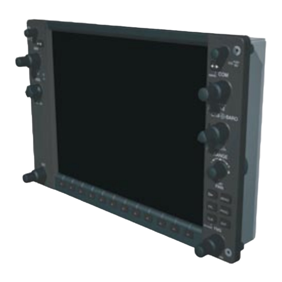
Page 30: G950 Controls
SYSTEM OVERVIEW 1.5 G950 CONTROLS The G950 controls have been designed to simplify operation of the system and minimize workload and the time required to access sophisticated functionality. Controls are located on the PFD and MFD bezels, and the Audio Panel. - Page 31 Press to select softkey shown above the bezel key on the PFD/MFD display Keys ALT Knob Sets the Selected Altitude, shown above the Altimeter (the large knob selects the thousands, the small knob selects the hundreds) 190-01146-00 Rev. A Garmin G950 Pilot’s Guide for the Tecnam P2006T...
-
Page 32: Softkey Function
When a softkey function is disabled, the softkey label is subdued (dimmed). Softkeys revert to the previous level after 45 seconds of inactivity. Softkey Softkey Names (Displayed) Bezel-Mounted Softkeys (Press) Figure 1-18 Softkeys (Third-Level PFD Configuration) Garmin G950 Pilot’s Guide for the Tecnam P2006T 190-01146-00 Rev. A... - Page 33 Press to display the BARO setting as inches of mercury Press to display the BARO setting as hectopacals STD BARO Sets barometric pressure to 29.92 in Hg (1013 hPa if metric units are selected) 190-01146-00 Rev. A Garmin G950 Pilot’s Guide for the Tecnam P2006T...
- Page 34 Press the BACK Softkey to return DCLTR-1 TRFC-1 to the top-level softkeys. Press the BACK Softkey to return DCLTR-1 TRFC-1 DCLTR-2 TRFC-2 to the top-level softkeys. DCLTR-2 DCLTR-3 TRFC-2 DCLTR-3 Figure 1-20 INSET Softkeys Garmin G950 Pilot’s Guide for the Tecnam P2006T 190-01146-00 Rev. A...
- Page 35 ALERTS IDENT BKSP BACK ALERTS Press the BACK Softkey to return Press the BACK Softkey to return to the top-level softkeys. to the top-level softkeys. Figure 1-22 XPDR Softkeys 190-01146-00 Rev. A Garmin G950 Pilot’s Guide for the Tecnam P2006T...
- Page 36 Selects desired amount of map detail; cycles through declutter levels: DCLTR (No Declutter): All map features visible DCLTR-1: Removes land data DCLTR-2: Removes land and SUA data DCLTR-3: Removes everything except the active flight plan Garmin G950 Pilot’s Guide for the Tecnam P2006T 190-01146-00 Rev. A...
-
Page 37: Accessing G950 Functionality
G950 is by using the FMS Knob corresponding to the display (PFD, MFD). In some instances, such as when entering an identifier, the G950 tries to predict the desired identifier based on the characters being entered. In this case, if the desired identifier appears, use the ENT Key to confirm the entry without entering the rest of the identifier manually. - Page 38 (FPL), nearest (NRST), recently-entered (RECENT), user-defined (USER), and airway (AIRWAY)(AIRWAY available when active leg is part of an airway). The G950 automatically fills in the identifier, facility, and city fields with the information for the selected waypoint.
-
Page 39: Page Groups
FMS Knob, then with the appropriate softkey at the bottom of the page. In this case, the page remains set to the selected page until a different page softkey is selected, even if a different page group is selected. 190-01146-00 Rev. A Garmin G950 Pilot’s Guide for the Tecnam P2006T... - Page 40 (DP Softkey) - Arrival Information (STAR Softkey) - Approach Information (APR Softkey) Intersection Information NDB Information VOR Information Airport/Procedures/ Weather Information User Waypoint Information Pages Figure 1-27 Waypoint Pages Garmin G950 Pilot’s Guide for the Tecnam P2006T 190-01146-00 Rev. A...
- Page 41 System Status Figure 1-28 Auxiliary Pages • Nearest Page Group (NRST) Nearest Airports Nearest Intersections Nearest NDB Nearest VOR Nearest User Waypoints Nearest Frequencies Nearest Airspaces Figure 1-29 Nearest Pages 190-01146-00 Rev. A Garmin G950 Pilot’s Guide for the Tecnam P2006T...
- Page 42 Figure 1-31 Procedure Loading Pages Information on optional electronic checklist pages is offered later in this section. Checklist pages may be accessed from any page on the MFD using the CHKLIST Softkey. Garmin G950 Pilot’s Guide for the Tecnam P2006T 190-01146-00 Rev. A...
-
Page 43: System Settings
Or : 1) Use the FMS Knob to select the AUX - System Setup Page. 2) Press the MENU Key. 3) Highlight ‘Restore Defaults’ and press the ENT Key. 190-01146-00 Rev. A Garmin G950 Pilot’s Guide for the Tecnam P2006T... - Page 44 System settings may be saved under a pilot profile. When the system is powered on, the last selected pilot profile is shown on the MFD Power-up Screen (Figure 1-5). The G950 can store up to 25 profiles; the currently active profile, the amount of memory used, and the amount of memory available are shown at the top of the System Setup Page in the box labeled ‘Pilot Profile’.
- Page 45 4) Turn the small FMS Knob to select the desired format and press the ENT Key to confirm selection. The ‘Time Offset’ field is highlighted (for local time formats). 5) Use the FMS Knob to enter the desired time offset (±HH:MM) and press the ENT Key to confirm selection. 190-01146-00 Rev. A Garmin G950 Pilot’s Guide for the Tecnam P2006T...
- Page 46 SYSTEM OVERVIEW DISPLAY UNITS Units in which various quantities are displayed on the G950 screens can be changed on the System Setup Page. Changing a display units setting: 1) Use the FMS Knob to select the AUX - System Setup Page on the MFD.
- Page 47 Alerts Window. When Arrival Alerts is set to OFF, only the PFD Navigation Status Box message “Arriving at waypoint” is displayed, and it is displayed when the time to the final destination is approximately ten seconds. Figure 1-33 Arrival Alert Settings (System Setup Page) 190-01146-00 Rev. A Garmin G950 Pilot’s Guide for the Tecnam P2006T...
- Page 48 (DIS), estimated time enroute (ETE), and enroute safe altitude (ESA). These four data fields can be changed to display the following information: • Bearing (BRG) • Distance (DIS) • Desired Track (DTK) • Endurance (END) • Enroute Safe Altitude (ESA) • Estimated Time of Arrival (ETA) • Estimated Time Enroute (ETE) • Fuel on Board (FOB) • Fuel over Destination (FOD) • Ground Speed (GS) • Minimum Safe Altitude (MSA) Garmin G950 Pilot’s Guide for the Tecnam P2006T 190-01146-00 Rev. A...
- Page 49 3) Turn the large FMS Knob to highlight ‘Selected’ in the ‘GPS CDI’ box. 4) Turn the small FMS Knob to highlight the desired setting (2 nm, 1 nm, 0.3 nm, Auto) and press the ENT Key. 190-01146-00 Rev. A Garmin G950 Pilot’s Guide for the Tecnam P2006T...
-
Page 50: System Utilities
A scheduler feature is also provided so the pilot can enter reminder messages to be displayed at specified intervals in the Alerts Window on the PFD (see Figure 1-36). Garmin G950 Pilot’s Guide for the Tecnam P2006T 190-01146-00 Rev. A... - Page 51 6) To stop the timer, press the ENT Key with ‘STOP?’ highlighted. The field changes to ‘RESET?’. 7) To reset the timer, press the ENT Key with ‘RESET?’ highlighted. The field changes back to ‘START?’ and the digits are reset. 190-01146-00 Rev. A Garmin G950 Pilot’s Guide for the Tecnam P2006T...
- Page 52 3) With ‘Reset Flight Timer’ highlighted, press the ENT Key. The G950 records the time at which departure occurs, measured from system power-up or aircraft lift off. The displayed departure time can also be reset to display the current time at the point of reset. The format in which the time is displayed is controlled from the System Setup Page.
- Page 53 2) Press the FMS Knob momentarily to activate the flashing cursor. 3) Turn the large FMS Knob to highlight the name field of the scheduler message to be deleted. 190-01146-00 Rev. A Garmin G950 Pilot’s Guide for the Tecnam P2006T...
-
Page 54: Display Backlighting
3) Use the FMS Knob to enter the desired backlighting then press the ENT Key. 4) Turn the large FMS Knob to highlight ‘AUTO’ next to ‘MFD DSPL’ and repeat steps 2-4. 5) To remove the menu, press the CLR or MENU Key. Garmin G950 Pilot’s Guide for the Tecnam P2006T 190-01146-00 Rev. A... - Page 55 8) Turn the small FMS Knob in the direction of the green arrowhead to display ‘MFD KEY’ and repeat steps 4-7. 9) To remove the menu, press the CLR or MENU Key. Figure 1-37 PFD Setup Menu 190-01146-00 Rev. A Garmin G950 Pilot’s Guide for the Tecnam P2006T...
- Page 56 SYSTEM OVERVIEW lank Garmin G950 Pilot’s Guide for the Tecnam P2006T 190-01146-00 Rev. A...
-
Page 57: Section 2 Flight Instruments
– Course Deviation Indicator – Trend vector (CDI) • Vertical Navigation indications – Barometric setting – Bearing pointers and – Selected Altitude information windows • Outside Air Temperature (OAT) The PFD also displays various alerts and annunciations. 190-01146-00 Rev. A Garmin G950 Pilot’s Guide for the Tecnam P2006T... - Page 58 Selected Altitude Softkeys COM Frequency Box System Time Navigation Status Box Transponder Data Box Slip/Skid Indicator Horizontal Situation Indicator ( HSI) Attitude Indicator Figure 2-1 Primary Flight Display (Default) Garmin G950 Pilot’s Guide for the Tecnam P2006T 190-01146-00 Rev. A...
- Page 59 Inset Map Vertical Speed Required DME Information Window Vertical Deviation Indicator (VDI) Bearing Information Windows Current VNV Target Altitude Minimum Descent Altitude/Decision Height Figure 2-2 Primary Flight Display (Additional Information) 190-01146-00 Rev. A Garmin G950 Pilot’s Guide for the Tecnam P2006T...
-
Page 60: Flight Instruments
, the text of the actual airspeed readout changes to yellow. The trend vector is absent if the speed remains constant or if any data needed to calculate airspeed is not available due to a system failure. Garmin G950 Pilot’s Guide for the Tecnam P2006T 190-01146-00 Rev. A... - Page 61 4) To remove all Vspeed flags, turn the FMS Knob to highlight ‘All References Off’ and press the ENT Key. Restoring all Vspeed defaults: 1) Select the TMR/REF Softkey. 2) Press the MENU Key. 3) Turn the FMS Knob to highlight ‘Restore Defaults’ and press the ENT Key. 190-01146-00 Rev. A Garmin G950 Pilot’s Guide for the Tecnam P2006T...
-
Page 62: Attitude Indicator
Slip/skid is indicated by the location of the bar relative to the pointer. One bar displacement is equal to one ball displacement on a traditional Slip/Skid Indicator. Figure 2-8 Slip/Skid Indication Garmin G950 Pilot’s Guide for the Tecnam P2006T 190-01146-00 Rev. A... -
Page 63: Altimeter
Indicated Altitude (Meters) Indicated Altitude Altitude Trend Vector Selected Minimum Descent Altitude Bug Altitude/Decision Height Bug Barometric Setting Barometric (Hectopascals) Setting Figure 2-9 Altimeter Figure 2-10 Altimeter (Metric Units) 190-01146-00 Rev. A Garmin G950 Pilot’s Guide for the Tecnam P2006T... - Page 64 3) Select the IN Softkey to display the barometric pressure setting in inches of mercury (in Hg). Or, select the HPA Softkey to display the barometric pressure setting in hectopascals (hPa; see Figure 2-10). 4) Select the BACK Softkey to return to the top-level softkeys. Garmin G950 Pilot’s Guide for the Tecnam P2006T 190-01146-00 Rev. A...
- Page 65 STD BARO Softkey transition altitude to indicate setting has not has not been pressed. been changed from STD BARO. Figure 2-12 Baro Transition Alert (AUX - System Setup Page) 190-01146-00 Rev. A Garmin G950 Pilot’s Guide for the Tecnam P2006T...
-
Page 66: Vertical Speed Indicator (Vsi)
Glidepath Vertical Vertical Indicator Deviation Speed Indicator Pointer Required Vertical Speed Figure 2-13 Vertical Speed and Figure 2-14 Glideslope Indicator Figure 2-15 Glidepath Indicator Deviation Indicators (VSI and VDI) Garmin G950 Pilot’s Guide for the Tecnam P2006T 190-01146-00 Rev. A... -
Page 67: Horizontal Situation Indicator (Hsi)
Navigation Source Flight Phase Aircraft Symbol Turn Rate/Heading Trend Vector Course Deviation Indicator Current Heading (CDI) Rotating Compass Rose Lubber Line OBS Mode Active Figure 2-16 Horizontal Situation Indicator (HSI) 190-01146-00 Rev. A Garmin G950 Pilot’s Guide for the Tecnam P2006T... - Page 68 Press the CRS Knob to re-center the CDI and return the course pointer to the bearing of the active waypoint or navigation station (see OBS Mode for adjusting a GPS course). Current Track Indicator Current Heading Selected Course Selected Heading Selected Heading Figure 2-18 Heading and Course Indications Garmin G950 Pilot’s Guide for the Tecnam P2006T 190-01146-00 Rev. A...
- Page 69 • TRUE - References angles to true north (denoted with ‘T’) • MAGNETIC - Angles corrected to the computed magnetic variation (‘Mag Var’) Figure 2-20 Navigation Angle Settings (AUX - System Setup Page) 190-01146-00 Rev. A Garmin G950 Pilot’s Guide for the Tecnam P2006T...
- Page 70 Distance to Station Bearing Source Identifier Pointer Bearing Icon Source Bearing 2 Information Window Bearing Pointer Source Icon Bearing 1 Information Window Figure 2-22 HSI with Bearing and DME Information Garmin G950 Pilot’s Guide for the Tecnam P2006T 190-01146-00 Rev. A...
- Page 71 1) Press the PFD Softkey. 2) Press the DME Softkey to display the DME Information Window above the BRG1 Information Window. 3) To remove the DME Information Window, press the DME Softkey again. 190-01146-00 Rev. A Garmin G950 Pilot’s Guide for the Tecnam P2006T...
-
Page 72: Course Deviation Indicator (Cdi)
CDI. If the CDI exceeds the maximum deviation on the scale (two dots) while coupled to GPS, the crosstrack error (XTK) is displayed below the white aircraft symbol. Figure 2-24 Navigation Sources Garmin G950 Pilot’s Guide for the Tecnam P2006T 190-01146-00 Rev. A... - Page 73 Final Approach Fix (FAF) for an ILS approach, or until GPS information becomes invalid. Activating a Vector-to-Final (VTF; see the Flight Management Section) also causes the CDI to switch to LOC navigation source; GPS steering guidance is not provided after this switch. 190-01146-00 Rev. A Garmin G950 Pilot’s Guide for the Tecnam P2006T...
- Page 74 (AUX - System Setup Page) When set to ‘Auto’ (default), the GPS CDI scale automatically adjusts to the desired limits based upon the current phase of flight (Figure 2-27, Table 2-1). Garmin G950 Pilot’s Guide for the Tecnam P2006T 190-01146-00 Rev. A...
- Page 75 - If the active waypoint is part of the missed approach procedure, the active leg and preceding missed approach legs must be aligned with the final approach segment course and the aircraft must not have passed the turn initiation point. 190-01146-00 Rev. A Garmin G950 Pilot’s Guide for the Tecnam P2006T...
- Page 76 1.0 nm decreasing to a specified course width, then 0.3 nm, depending on variables (see Figure 2-30) Approach (LPV) MAPR Missed Approach 0.3 nm Table 2-1 Automatic GPS CDI Scaling Garmin G950 Pilot’s Guide for the Tecnam P2006T 190-01146-00 Rev. A...
- Page 77 2) Turn the CRS Knob to select the desired course to/from the waypoint. Press the CRS Knob to synchronize the Selected Course with the bearing to the next waypoint. 3) Select the OBS Softkey again to return to automatic waypoint sequencing. 190-01146-00 Rev. A Garmin G950 Pilot’s Guide for the Tecnam P2006T...
- Page 78 Figure 2-31. Pressing the SUSP Softkey, deactivates the suspension and resumes automatic sequencing of approach waypoints. SUSP Annunciation SUSP Softkey Suspends Waypoint Sequencing Figure 2-31 Suspending Automatic Waypoint Sequencing Garmin G950 Pilot’s Guide for the Tecnam P2006T 190-01146-00 Rev. A...
-
Page 79: Supplemental Flight Data
During reversionary display conditions the OAT is displayed to the right of the flap indicator. Normal Display Reversionary Mode with EIS Figure 2-32 Outside Air Temperature 190-01146-00 Rev. A Garmin G950 Pilot’s Guide for the Tecnam P2006T... -
Page 80: Wind Data
• OPTN 2: Total wind direction and speed • OPTN 3: Total wind direction with head and crosswind speed components 4) To remove the window, select the OFF Softkey. Garmin G950 Pilot’s Guide for the Tecnam P2006T 190-01146-00 Rev. A... -
Page 81: Vertical Navigation (Vnv) Indications
Current crosstrack or track angle error has exceeded limit Active altitude-constrained waypoint can not be reached within maximum allowed flight path angle and vertical speed Table 2-2 VNV Indication Removal Criteria 190-01146-00 Rev. A Garmin G950 Pilot’s Guide for the Tecnam P2006T... -
Page 82: Pfd Annunciations And Alerting Functions
G950 message advisory occurs. System alert messages are provided for aware of G950 system problems or status and may not require pilot action. The Alerts Window allows system alerts to be displayed simultaneously. The FMS Knob can be used to scroll through the alert messages. The Alerts Window is enabled/disabled by selecting the ALERTS Softkey. -
Page 83: Marker Beacon Annunciations
Figure 2-36 Marker Beacon Annunciations TRAFFIC ANNUNCIATION The G950 System displays traffic symbolically on the PFD Inset Map, the Navigation Map Page (MFD), and various other MFD page maps. Refer to the Hazard Avoidance Section and Appendix E for more details about the Traffic Information Service (TIS). -
Page 84: Altitude Alerting
FAF. A black-on-yellow ‘LOW ALT’ annunciation appears to the top right of the Altimeter, flashing for several seconds then remaining displayed until the condition is resolved. Altimeter Figure 2-39 Low Altitude on RNAV GPS Approach with Vertical Guidance Garmin G950 Pilot’s Guide for the Tecnam P2006T 190-01146-00 Rev. A... -
Page 85: Minimum Descent Altitude/Decision Height Alerting
If the aircraft proceeds to climb after having reached the MDA/DH, once it reaches 50 feet above the MDA/DH, alerting is disabled. Within 2500 feet Within 100 feet Altitude Reached MDA/DH MDA/DH Setting Figure 2-40 Minimum Descent Altitude/Decision Height Alerting Visual Annunciations 190-01146-00 Rev. A Garmin G950 Pilot’s Guide for the Tecnam P2006T... - Page 86 4) Use the small FMS Knob to enter the desired altitude (from zero to 16,000 feet). 5) To remove the window, press the CLR Key or press the TMR/REF Softkey. Figure 2-41 MDA/DH Setting (Timer/References Window) Garmin G950 Pilot’s Guide for the Tecnam P2006T 190-01146-00 Rev. A...
-
Page 87: Abnormal Operations
PFD to be shown in yellow: • Current Track Indicator • Wind Data • Ground Speed • Distances in the Bearing Information windows • GPS bearing pointers These items should be verified when operating in Dead Reckoning Mode as they become increasingly inaccurate over time. 190-01146-00 Rev. A Garmin G950 Pilot’s Guide for the Tecnam P2006T... -
Page 88: Unusual Attitudes
PFD: • Vertical Deviation, Glideslope, • Outside air temperature (OAT) and Glidepath Indicators – Timer/References • DME Information Window • Altimeter Barometric Setting – Nearest Airports • Wind data • Selected Altitude – Flight Plan • Selected Heading readout • VNV Target Altitude – Messages • Selected Course readout Garmin G950 Pilot’s Guide for the Tecnam P2006T 190-01146-00 Rev. A... -
Page 89: Section 3 Engine Indication System
ENGINE INDICATION SYSTEM SECTION 3 ENGINE INDICATION SYSTEM The G950 Engine Indication System (EIS) is not available in the Tecnam P2006T. Refer to the Pilot’s NOTE: Operating Handbook (POH) for engine display information and operating limitations. Garmin G950 Pilot’s Guide for the Tecnam P2006T... -
Page 90: Engine Indication System
ENGINE INDICATION SYSTEM lank Garmin G950 Pilot’s Guide for the Tecnam P2006T 190-01146-00 Rev. A... -
Page 91: Section 4 Audio Panel And Cns
The Communication/Navigation/Surveillance (CNS) system includes the Audio Panel, communication radios, navigation radios, and Mode S transponder. The System Overview Section provides a block diagram description of the Audio Panel and CNS system interconnection. CNS operation in the G950 is performed by the following Line Replacement Units (LRUs): • Primary Flight Display (PFD) • Audio Panel • Multifunction Display (MFD) -
Page 92: Pfd Controls And Frequency Display
AUDIO PANEL AND CNS PFD CONTROLS AND FREqUENCY DISPLAY Figure 4-1 PFD Controls, NAV/COM Frequency Tuning Boxes, and NRST Window Garmin G950 Pilot’s Guide for the Tecnam P2006T 190-01146-00 Rev. A... - Page 93 The small knob selects individual characters for the highlighted cursor location. Transponder Data Box – Indicates the selected transponder code, operating mode, reply, and ident status for the applicable transponder. Garmin G950 Pilot’s Guide for the Tecnam P2006T 190-01146-00 Rev. A...
-
Page 94: Gma 1347 Audio Panel Controls
#2 COM receiver to be heard. COM1 receive can be added by pressing the COM1 Key. COM2 – When selected, audio from the #2 COM receiver can be heard. COM3 MIC – Reserved for optional COM radio. Garmin G950 Pilot’s Guide for the Tecnam P2006T 190-01146-00 Rev. A... - Page 95 PASS Knob – Turn to adjust Copilot/Passenger intercom volume or squelch. The MAN SQ Key must be selected to allow squelch adjustment. DISPLAY BACKUP Button – Manually selects Reversionary Mode. Garmin G950 Pilot’s Guide for the Tecnam P2006T 190-01146-00 Rev. A...
-
Page 96: Com Operation
During PA Mode, the COM MIC Annunciator is extinguished and the COM active frequency color NOTE: changes to white, indicating that neither COM transmitter is active. When turning on the G950 for use, the system remembers the last frequencies used and the active NOTE: COM transceiver state prior to shutdown. -
Page 97: Com Transceiver Manual Tuning
Automatic Squelch On or Off Key to Transfer COM Frequencies Between Active and Standby Frequency Boxes Turn the COM Knob to Tune the Frequency in the Tuning Box Figure 4-5 COM Frequency Tuning Garmin G950 Pilot’s Guide for the Tecnam P2006T 190-01146-00 Rev. A... -
Page 98: Quick-Tuning And Activating 121.500 Mhz
In the example shown, pressing the Audio Panel COM2 MIC Key activates the transceiver. Press for Two Seconds to Load 121.500 MHz Figure 4-7 Quickly Tuning 121.500 MHz Garmin G950 Pilot’s Guide for the Tecnam P2006T 190-01146-00 Rev. A... -
Page 99: Auto-Tuning The Com Frequency
4) Press the Frequency Transfer Key to transfer the frequency to the COM Active Frequency Field. Select the NRST Softkey to Open the Nearest Airports Window Figure 4-8 Nearest Airports Window Garmin G950 Pilot’s Guide for the Tecnam P2006T 190-01146-00 Rev. A... -
Page 100: Auto-Tuning From The Mfd
5) Press the ENT Key to load the COM frequency into the standby field of the selected COM radio. 6) Press the Frequency Transfer Key to transfer the frequency to the COM Active Frequency Field. Garmin G950 Pilot’s Guide for the Tecnam P2006T 190-01146-00 Rev. A... - Page 101 PFD COM Standby Field. Cursor then advances to the next frequency. Select INFO Softkey for AIRPORT, RUNWAYS, and FREQUENCIES Windows Figure 4-11 WPT – Airport Information Page Garmin G950 Pilot’s Guide for the Tecnam P2006T 190-01146-00 Rev. A...
- Page 102 NRST – Nearest Airports Pages on the MFD in a similar manner using the appropriate softkeys or MENU Key, the FMS Knob, and the ENT Key. Figure 4-12 NRST – Nearest Airspaces, NRST – Nearest Airports, and NRST – Nearest Frequencies Pages Garmin G950 Pilot’s Guide for the Tecnam P2006T 190-01146-00 Rev. A...
-
Page 103: Frequency Spacing
AUDIO PANEL AND CNS FREqUENCY SPACING The G950 COM radios can tune either 25-kHz spacing (118.000 to 136.975 MHz) or 8.33-kHz spacing (118.000 to 136.990 MHz) for 760-channel or 3040-channel configuration. When 8.33-kHz channel spacing is selected, all of the 25-kHz channel spacing frequencies are also available in the complete 3040-channel list. -
Page 104: Automatic Squelch
Volume level indication remains for two seconds after the change. COM Volume Level Remains for Two Seconds Figure 4-16 COM Volume Level Garmin G950 Pilot’s Guide for the Tecnam P2006T 190-01146-00 Rev. A... -
Page 105: Nav Operation
Figure 4-17 Selecting a NAV Radio for Navigation See the Flight Instruments Section for selecting the DME and Bearing Information windows and using VOR as the source for the bearing pointer. Garmin G950 Pilot’s Guide for the Tecnam P2006T 190-01146-00 Rev. A... -
Page 106: Nav Receiver Manual Tuning
Press the Frequency Transfer Key to Transfer NAV Frequencies Between Active and Standby Frequency Fields Turn the NAV Knob to Tune the Frequency in the Tuning Box Figure 4-19 NAV Frequency Tuning Garmin G950 Pilot’s Guide for the Tecnam P2006T 190-01146-00 Rev. A... - Page 107 When adjusting, the level is displayed in place of the standby frequencies. Volume level indication remains for two seconds after the change. NAV Volume Level Remains for Two Seconds Figure 4-22 NAV Volume Levels Garmin G950 Pilot’s Guide for the Tecnam P2006T 190-01146-00 Rev. A...
-
Page 108: Auto-Tuning A Nav Frequency From The Mfd
Key to Load a Highlighted Frequency into the NAV Standby Turn the FMS Frequency Box Knob to Scroll Through a List of Frequencies Figure 4-23 NAV Frequency Auto-Tuning from the MFD Garmin G950 Pilot’s Guide for the Tecnam P2006T 190-01146-00 Rev. A... - Page 109 6) Press the Frequency Transfer Key to transfer the frequency to the NAV Active Frequency Field. Nearest Airports Menu Nearest VOR Menu Nearest Frequencies Menu Nearest Airspaces Menu Figure 4-24 Nearest Pages Menus Garmin G950 Pilot’s Guide for the Tecnam P2006T 190-01146-00 Rev. A...
- Page 110 Place the Cursor on to Place the Cursor on the VOR Identifier the VOR Frequency Figure 4-25 Loading the NAV Frequency from the NRST – Nearest VOR Page Garmin G950 Pilot’s Guide for the Tecnam P2006T 190-01146-00 Rev. A...
- Page 111 MENU Key, the FMS Knob, and the ENT Key. Figure 4-26 NRST – Nearest Frequencies, WPT – VOR Information, WPT – Airport Information, and NRST – Nearest Airports Pages Garmin G950 Pilot’s Guide for the Tecnam P2006T 190-01146-00 Rev. A...
-
Page 112: Auto-Tuning Nav Frequencies On Approach Activation
The frequency that was previously in the NAV1 or NAV2 active frequency fields are transferred to standby. • If the current CDI navigation source is GPS, and if the approach frequency is already loaded into the NAV1 or NAV2 standby frequency field, the standby frequency is transferred to active. • If the current CDI navigation source is NAV1 or NAV2, the approach frequency is transferred to the standby frequency fields of the selected CDI NAV radio. Garmin G950 Pilot’s Guide for the Tecnam P2006T 190-01146-00 Rev. A... -
Page 113: Marker Beacon Receiver
(annunciator illuminated) is used to provide an earlier indication when nearing a marker during an approach. The LO SENS function (annunciator extinguished) results in a narrower marker dwell while over a station. Garmin G950 Pilot’s Guide for the Tecnam P2006T 190-01146-00 Rev. A... -
Page 114: Gtx 33 Mode S Transponder
Selecting the IDENT Softkey while in Mode or Code Selection initiates the ident function and reverts to the top-level softkeys. After 45 seconds of transponder control inactivity, the system reverts back to the top-level softkeys. Garmin G950 Pilot’s Guide for the Tecnam P2006T 190-01146-00 Rev. A... -
Page 115: Transponder Mode Selection
Mode S interrogations. When Standby Mode has been selected on the ground, the transponder can be returned to Ground Mode by selecting the GND Softkey. Mode Figure 4-30 Ground Mode Garmin G950 Pilot’s Guide for the Tecnam P2006T 190-01146-00 Rev. A... - Page 116 If Altitude Mode is selected, a green ALT indication and transponder code appear in the mode field of the Transponder Data Box, and all transponder replies requesting altitude information are provided with pressure altitude information. ALT Mode (Mode C Altitude Reporting) Figure 4-33 Altitude Mode Garmin G950 Pilot’s Guide for the Tecnam P2006T 190-01146-00 Rev. A...
-
Page 117: Entering A Transponder Code
Turn the Large Enter Two Code FMS Knob Digits at a Time to Move the Cursor to the Next Code Field Figure 4-36 Entering a Code with the FMS Knob Garmin G950 Pilot’s Guide for the Tecnam P2006T 190-01146-00 Rev. A... -
Page 118: Ident Function
After the IDENT Softkey is selected while in Mode or Code Selection, the system reverts to the top-level softkeys. IDNT Indication Select the IDENT Softkey to Initiate the ID Function Figure 4-38 IDENT Softkey and Indication Garmin G950 Pilot’s Guide for the Tecnam P2006T 190-01146-00 Rev. A... -
Page 119: Flight Id Reporting
AUDIO PANEL AND CNS FLIGHT ID REPORTING If the Flight ID is required but the system is not configured for it, contact a Garmin-authorized service NOTE: center for configuration. When the Flight ID must be entered before flight operation, the identifier is placed in the Timer/References Window on the PFD. -
Page 120: Additional Audio Panel Functions
MONO/STEREO HEADSETS Stereo headsets are recommended for use with the G950. Using a monaural headset in a stereo jack shorts the right headset channel output to ground. While this does not damage the Audio Panel, a person listening on a monaural headset hears only the left channel in both ears. -
Page 121: Intercom
When both the PILOT and COPLT Annunciators are extinguished, everyone hears the selected radios, aural alerts, and is able to communicate with everyone else. Garmin G950 Pilot’s Guide for the Tecnam P2006T 190-01146-00 Rev. A... - Page 122 VOL and SQ. Turn Copilot/Passenger to adjust Squelch when SQ Volume or Annunciation is lit, Volume Manual Squelch when VOL Annunciation is lit. Volume Annunciation Squelch Annunciation Figure 4-42 Volume/Squelch Control Garmin G950 Pilot’s Guide for the Tecnam P2006T 190-01146-00 Rev. A...
-
Page 123: Passenger Address (Pa) System
Pressing the PLAY Key while audio is playing begins playing the previously recorded memory block. Each subsequent press of the PLAY Key selects the previously recorded memory block. Powering off the unit automatically clears all recorded blocks. Figure 4-44 Play Key Garmin G950 Pilot’s Guide for the Tecnam P2006T 190-01146-00 Rev. A... -
Page 124: Split Com Operation
COM1 MIC Annunciator flashes when the pilot’ s microphone PTT is pressed. The COM2 MIC Annunciator flashes when the copilot’ s microphone PTT is pressed. COM1 Radio is Used by the Pilot COM2 Radio is Used by the Copilot Figure 4-45 Split COM Operation Garmin G950 Pilot’s Guide for the Tecnam P2006T 190-01146-00 Rev. A... -
Page 125: Entertainment Inputs
Crew music muting is reset (enabled) during power up. PASSENGER MUSIC Passenger music (Music2) can be heard only by the passengers and is never muted. Garmin G950 Pilot’s Guide for the Tecnam P2006T 190-01146-00 Rev. A... -
Page 126: Audio Panel Preflight Procedure
6) Reset squelch to automatic, or adjust to the appropriate level manually. Once this procedure has been completed, the pilot and copilot can change settings, keeping in mind the notes above. Garmin G950 Pilot’s Guide for the Tecnam P2006T 190-01146-00 Rev. A... -
Page 127: Abnormal Operation
AUDIO PANEL AND CNS 4.7 AbNORMAL OPERATION Abnormal operation of the G950 includes equipment failures of the G950 components and failure of associated equipment, including switches and external devices. STUCk MICROPHONE If the push-to-talk (PTT) Key becomes stuck, the COM transmitter stops transmitting after 35 seconds of continuous operation. - Page 128 AUDIO PANEL AND CNS lank Garmin G950 Pilot’s Guide for the Tecnam P2006T 190-01146-00 Rev. A...
-
Page 129: Section 5 Flight Management
Pilot’ s Guide explains flight management using the G950. The most prominent part of the G950 are the full color displays: one Primary Flight Display (PFD) and a Multi Function Display (MFD). The information to successfully navigate the aircraft using the GPS sensors is displayed on the PFD and the MFD. -
Page 130: Navigation Status Box
Figure 5-2 GPS Navigation Information on the MFD Navigation Page NAVIGATION STATUS bOX The Navigation Status Box located at the top of the PFD contains two fields displaying the following information: PFD Navigation Status Box Garmin G950 Pilot’s Guide for the Tecnam P2006T 190-01146-00 Rev. A... - Page 131 4) Turn the small FMS Knob to display and scroll through the data options list. 5) Select the desired data. 6) Press the ENT Key. Pressing the DFLTS Softkey returns all fields to the default setting. 190-01146-00 Rev. A Garmin G950 Pilot’s Guide for the Tecnam P2006T...
-
Page 132: Using Map Displays
FLIGHT MANAGEMENT 5.2 USING MAP DISPLAYS Map displays are used extensively in the G950 to provide situational awareness in flight. Most G950 maps can display the following information: • Airports, NAVAIDs, airspaces, airways, land data • Aircraft icon (representing present position) (highways, cities, lakes, rivers, borders, etc.) with • Nav range ring... - Page 133 4) Turn the small FMS Knob to select the desired orientation. 5) Press the ENT Key to select the new orientation. 6) Press the FMS Knob to return to the base page. 190-01146-00 Rev. A Garmin G950 Pilot’s Guide for the Tecnam P2006T...
-
Page 134: Map Range
When the map range is decreased to a point that exceeds the capability of the G950 to accurately represent the map, a magnifying glass icon is shown to the left of the map range. To change the map range turn the Joystick counter-clockwise to decrease the range, or clockwise to increase the range. - Page 135 9) Repeat step 8 for ‘MIN LOOK FWD’ (zero to 99 minutes) and ‘TIME OUT’ (zero to 99 minutes). 10) Press the FMS Knob to return to the Navigation Map Page. 190-01146-00 Rev. A Garmin G950 Pilot’s Guide for the Tecnam P2006T...
-
Page 136: Map Panning
The map is normally centered on the aircraft’s position. If the map has been panned and there has NOTE: been no pointer movement for about 60 seconds, the map reverts back to centered on the aircraft position and the flashing pointer is removed. Garmin G950 Pilot’s Guide for the Tecnam P2006T 190-01146-00 Rev. A... - Page 137 When any map feature or object is selected on the map display, pertinent information is displayed. Information about Point of Interest Map Pointer on POI Figure 5-9 Navigation Map - Map Pointer on Point of Interest 190-01146-00 Rev. A Garmin G950 Pilot’s Guide for the Tecnam P2006T...
- Page 138 2) Move the Joystick to move the Map Pointer around the map. 3) Press the Joystick to remove the Map Pointer and recenter the map on the aircraft’s current position. Garmin G950 Pilot’s Guide for the Tecnam P2006T 190-01146-00 Rev. A...
- Page 139 3) Press the GO BACK Softkey, the CLR Key, or the ENT Key to exit the Waypoint Information Page and return to the Navigation Map showing the selected waypoint. NAVAID Information GO BACK Softkey Figure 5-11 Navigation Map - Information Window - NAVAID 190-01146-00 Rev. A Garmin G950 Pilot’s Guide for the Tecnam P2006T...
- Page 140 Information Page for the selected airspace. 4) Press the CLR or ENT Key to exit the Airspace Information Page. Airspace Information Figure 5-12 Navigation Map - Information Window - Airspace Garmin G950 Pilot’s Guide for the Tecnam P2006T 190-01146-00 Rev. A...
-
Page 141: Measuring Bearing And Distance
5) To exit the Measure Bearing/Distance option, press the Joystick; or select ‘Stop Measuring’ from the Page Menu and press the ENT Key. Measurement Information Pointer Lat/Long Measurement Line Figure 5-13 Navigation Map - Measuring Bearing and Distance 190-01146-00 Rev. A Garmin G950 Pilot’s Guide for the Tecnam P2006T... -
Page 142: Topography
3) Select the ‘Map’ group. 4) Press the ENT Key. 5) Highlight the ‘TOPO DATA’ field. 6) Select ‘On’ or ‘Off’. 7) Press the FMS Knob to return to the Navigation Map Page. Garmin G950 Pilot’s Guide for the Tecnam P2006T 190-01146-00 Rev. A... - Page 143 In addition, the Navigation Map can display a topographic scale (located in the lower right hand side of the map) showing a scale of the terrain elevation and current elevation values. 190-01146-00 Rev. A Garmin G950 Pilot’s Guide for the Tecnam P2006T...
- Page 144 5) Select ‘On’ or ‘Off’. 6) Press the FMS Knob to return to the Navigation Map Page. TOPO SCALE On/Off Figure 5-17 Navigation Map Setup Menu - TOPO SCALE Setup Garmin G950 Pilot’s Guide for the Tecnam P2006T 190-01146-00 Rev. A...
-
Page 145: Map Symbols
LARGE CITY (> 200,000) 1500 MEDIUM CITY (> 50,000) SMALL CITY (> 5,000) States and Provinces (STATE/PROV) 1500 Rivers and Lakes (RIVER/LAKE) USER WAYPOINT Table 5-1 Land Symbol Information 190-01146-00 Rev. A Garmin G950 Pilot’s Guide for the Tecnam P2006T... - Page 146 Class C Airspace/TCA (CLASS C/TCA) Class D Airspace (CLASS D) Restricted Area (RESTRICTED) Military Operations Area [MOA(MILITARY)] Other/Air Defense Interdiction Zone (OTHER/ADIZ) Temporary Flight Restriction (TFR) 2000 Table 5-2 Aviation Symbol Information Garmin G950 Pilot’s Guide for the Tecnam P2006T 190-01146-00 Rev. A...
- Page 147 4) Press the ENT Key. The cursor flashes on the first field. 5) Select the desired land option. 6) Select the desired text size. 7) Press the ENT Key to accept the selected size. 8) Select the desired range. 190-01146-00 Rev. A Garmin G950 Pilot’s Guide for the Tecnam P2006T...
- Page 148 PFD Inset Map two range levels smaller than the range selected in the Map Setup pages (e.g., a setting of 100 nm removes the item at ranges above 100 nm on MFD navigation maps, while the PFD Inset Map removes the same item at 50 nm). Garmin G950 Pilot’s Guide for the Tecnam P2006T 190-01146-00 Rev. A...
- Page 149 Decluttering the PFD Inset Map: 1) Press the INSET Softkey. 2) Press the DCLTR Softkey. The current declutter level is shown. With each selection, another level of map information is removed. 190-01146-00 Rev. A Garmin G950 Pilot’s Guide for the Tecnam P2006T...
- Page 150 Class B Airspaces/TMA Class C Airspaces/TCA Class D Airspaces Other Airspaces/ADIZ TFRs Obstacles Land/Country Text Cities Roads Railroads State/Province Boundaries River/Lake Names Table 5-3 Navigation Map Items Displayed by Declutter Level Garmin G950 Pilot’s Guide for the Tecnam P2006T 190-01146-00 Rev. A...
-
Page 151: Airways
When airways are selected for display on the map, the airway waypoints (VORs, NDBs and Intersections) are also displayed. Low Altitude Airway (Victor Airway) High Altitude Airway (Jet Route) Figure 5-22 Airways on MFD Navigation Page 190-01146-00 Rev. A Garmin G950 Pilot’s Guide for the Tecnam P2006T... - Page 152 5) To change the range setting, turn the small FMS Knob to display the range list. 6) Select the desired range using the small FMS Knob. 7) Press the ENT Key. 8) Press the FMS Knob to return to the Navigation Map Page. Garmin G950 Pilot’s Guide for the Tecnam P2006T 190-01146-00 Rev. A...
-
Page 153: Track Vector
6) Select ‘On’ or ‘Off’. Press the ENT Key to accept the selected option. The flashing cursor highlights the look ahead time field. Use the FMS Knob to select the desired time. Press the ENT Key. 7) Press the FMS Knob to return to the Navigation Map Page. 190-01146-00 Rev. A Garmin G950 Pilot’s Guide for the Tecnam P2006T... -
Page 154: Wind Vector
3) Select the ‘Map’ group. 4) Press the ENT Key. 5) Highlight the ‘WIND VECTOR’ field. 6) Select ‘On’ or ‘Off’. 7) Press the FMS Knob to return to the Navigation Map Page. Garmin G950 Pilot’s Guide for the Tecnam P2006T 190-01146-00 Rev. A... -
Page 155: Nav Range Ring
7) Press the FMS Knob to return to the Navigation Map Page. The Nav Range Ring is referenced to either magnetic or true north, based on the selection on the AUX NOTE: - System Setup Page. 190-01146-00 Rev. A Garmin G950 Pilot’s Guide for the Tecnam P2006T... -
Page 156: Fuel Range Ring
8) To change the reserve fuel time, enter a time (00:00 to 23:59; hours:minutes). The default setting is 00:45 minutes. 9) Press the ENT Key. 10) Press the FMS Knob to return to the Navigation Map Page. Garmin G950 Pilot’s Guide for the Tecnam P2006T 190-01146-00 Rev. A... -
Page 157: Navigation Information Display
‘AUTO’). In destination mode, the softkey label displays ‘DEST’. Figure 5-31 shows the various modes of operation for the display. Navigation Information Display Mode Softkey Figure 5-30 Navigation Information Display 190-01146-00 Rev. A Garmin G950 Pilot’s Guide for the Tecnam P2006T... - Page 158 No Flight Plan Loaded Plan Loaded Plan Loaded Figure 5-31 Navigation Information Display Modes of Operation The next section describes the four Data Boxes within the Navigation Information Display. Garmin G950 Pilot’s Guide for the Tecnam P2006T 190-01146-00 Rev. A...
- Page 159 Longest Runway (Displayed when Airport is not the Destination Airport) METAR Flag (When METAR information available) Position From (Distance and Direction from Nearest Airport) Bearing to Nearest Airport COM Frequency (Displayed when Airport is not the Destination Airport) 190-01146-00 Rev. A Garmin G950 Pilot’s Guide for the Tecnam P2006T...
- Page 160 If none of these conditions are met, then the destination airport is undefined, and a single label is displayed in the box, reading “NO DESTINATION AIRPORT”. When a destination airport has been determined, the fields shown in Figure 5-34 are displayed in the Destination Airport Box. Garmin G950 Pilot’s Guide for the Tecnam P2006T 190-01146-00 Rev. A...
- Page 161 Longest Runways, identifier and size of the longest or the two longest runways. Identifier and size of the longest or the two longest runways. One: Always visible; Two: visible when destination mode active, or nearest airport is same as destination airport 190-01146-00 Rev. A Garmin G950 Pilot’s Guide for the Tecnam P2006T...
- Page 162 Estimated Time of Arrival; sum of the present time and ETE, visible when destination is set Flight Time (total time since takeoff) ‘FLT’ if in-air timer is selected on AUX Utility Page, otherwise ‘PWR’. Always visible Garmin G950 Pilot’s Guide for the Tecnam P2006T 190-01146-00 Rev. A...
-
Page 163: Waypoints
Waypoints can be selected by entering the ICAO identifier, entering the name of the facility, or by entering the city name. See the System Overview section for detailed instructions on entering data in the G950. As a waypoint identifier, facility name, or location is entered, the G950’ s Spell’N’Find™ feature scrolls through the database, displaying those waypoints matching the characters which have been entered to that point. -
Page 164: Airports
Page displays airport information in three boxes labeled ‘AIRPORT’, ‘RUNWAYS’, and ‘FREQUENCIES’. For airports with multiple runways, information for each runway is available. This information is viewed on the Airport Information Page by pressing the INFO Softkey. Garmin G950 Pilot’s Guide for the Tecnam P2006T 190-01146-00 Rev. A... - Page 165 3) Turn the small FMS Knob to display the desired runway (if more than one) for the selected airport. 4) To remove the flashing cursor, press the FMS Knob. 190-01146-00 Rev. A Garmin G950 Pilot’s Guide for the Tecnam P2006T...
- Page 166 Hazard Avoidance section for details about weather). The G950 provides a NRST Softkey on the PFD, which gives the pilot quick access to nearest airport information (very useful if an immediate landing is required). The Nearest Airports Window displays a list of up to 25 nearest airports (three entries can be displayed at one time).
- Page 167 If there are no items for display in a boxed area, text indicating that fact is displayed. The currently selected airport remains in the list until it is unselected. 190-01146-00 Rev. A Garmin G950 Pilot’s Guide for the Tecnam P2006T...
- Page 168 4) Turn the FMS Knob to highlight the desired airport. (Pressing the ENT Key also moves to the next airport.) 5) Press the FMS Knob to remove the flashing cursor. Garmin G950 Pilot’s Guide for the Tecnam P2006T 190-01146-00 Rev. A...
- Page 169 5) Press the FMS Knob to remove the flashing cursor. Nearest Airport Criteria - Type of Runway Surface - Minimum Runway Length Figure 5-35 System Setup Page - Nearest Airport Selection Criteria 190-01146-00 Rev. A Garmin G950 Pilot’s Guide for the Tecnam P2006T...
-
Page 170: Intersections
2) Press the ENT Key or turn either FMS Knob to select an identifier in the Nearest Intersection Box. 3) Press the FMS Knob to remove the flashing cursor. Garmin G950 Pilot’s Guide for the Tecnam P2006T 190-01146-00 Rev. A... - Page 171 - Identifier/Symbol - Bearing/Distance to intersection from aircraft position Intersection Lat/Long Reference VOR Info - Identifier/Type (symbol) - VOR Frequency - Bearing/Distance to VOR Figure 5-37 Nearest Intersections Page 190-01146-00 Rev. A Garmin G950 Pilot’s Guide for the Tecnam P2006T...
-
Page 172: Ndbs
2) Press the ENT Key or turn either FMS Knob to select an identifier in the Nearest NDB Box. 3) Press the FMS Knob to remove the flashing cursor. Garmin G950 Pilot’s Guide for the Tecnam P2006T 190-01146-00 Rev. A... - Page 173 Navigation Map Showing Selected NDB Nearest NDB NDB Identifier/Symbol - Bearing/Distance to NDB from aircraft position NDB Information - Facility Name/City - Type - Lat/Long NDB Frequency Figure 5-39 Nearest NDB Page 190-01146-00 Rev. A Garmin G950 Pilot’s Guide for the Tecnam P2006T...
-
Page 174: Vors
1) With the VOR Information Page displayed, enter an identifier, the name of the VOR, or the city in which it’s located in the VOR Box. 2) Press the ENT Key. 3) Press the FMS Knob to remove the flashing cursor. Or : Garmin G950 Pilot’s Guide for the Tecnam P2006T 190-01146-00 Rev. A... - Page 175 Navigation Map Showing Nearest VOR VOR Identifier/Symbol - Bearing/Distance to VOR from aircraft position VOR Information - Facility Name/City - Class/Magnetic Variation - Lat/Long VOR Frequency Figure 5-41 Nearest VOR Page 190-01146-00 Rev. A Garmin G950 Pilot’s Guide for the Tecnam P2006T...
-
Page 176: User Waypoints
FLIGHT MANAGEMENT USER WAYPOINTS The G950 can create and store up to 1,000 user-defined waypoints. User waypoints can be created from any map page (except PFD Inset Map, AUX-Trip Planning Page, or Procedure Pages) by selecting a position on the map using the Joystick, or from the User Waypoint Information Page by referencing a bearing/distance from an existing waypoint, bearings from two existing waypoints, or latitude and longitude. - Page 177 Select “LAT/LON” using the small FMS Knob, press the ENT Key, and enter the latitude and longitude into the INFORMATION window using the FMS Knobs. 5) Press the ENT Key to accept the new waypoint. 190-01146-00 Rev. A Garmin G950 Pilot’s Guide for the Tecnam P2006T...
- Page 178 1) Press the Joystick to activate the panning function and pan to the map location of the desired user waypoint. 2) Press the ENT Key. The User Waypoint Information Page is displayed with the captured position. Garmin G950 Pilot’s Guide for the Tecnam P2006T 190-01146-00 Rev. A...
- Page 179 ‘Rename User Waypoint’. 2) Enter a new name. 3) Press the ENT Key. The message ‘Do you want to rename the user waypoint AAAAAA to BBBBBB?’ is displayed. 190-01146-00 Rev. A Garmin G950 Pilot’s Guide for the Tecnam P2006T...
- Page 180 3) Select ‘NORMAL’ or ‘TEMPORARY’ as desired, and press the ENT Key. 4) Press the FMS Knob to remove the flashing cursor and return to the User Waypoint Information Page. Garmin G950 Pilot’s Guide for the Tecnam P2006T 190-01146-00 Rev. A...
- Page 181 2) Press the MENU Key. 3) Select ‘Delete All User Waypoints’. 4) Press the ENT Key twice to confirm the selection. 5) Press the FMS Knob to remove the flashing cursor. 190-01146-00 Rev. A Garmin G950 Pilot’s Guide for the Tecnam P2006T...
-
Page 182: Airspaces
FLIGHT MANAGEMENT 5.4 AIRSPACES The G950 can display the following types of airspaces: Class B/TMA, Class C/TCA, Class D, Restricted, MOA (Military), Other Airspace, Air Defense Interdiction Zone (ADIZ), and Temporary Flight Restriction (TFR). Class D Airspace MOA (Military) Class B Airspace... - Page 183 Map ranges for the airspace boundaries are selected from the Aviation Group in the Map Setup Menu. See Table 5-2 for the default and maximum ranges for each type of airspace and the symbol used to define the airspace area. 190-01146-00 Rev. A Garmin G950 Pilot’s Guide for the Tecnam P2006T...
- Page 184 ENT Key. The cursor is placed in the ‘AIRSPACE ALERTS’ Box. 3) Select the desired airspace. 4) Press the FMS Knob to remove the flashing cursor. Garmin G950 Pilot’s Guide for the Tecnam P2006T 190-01146-00 Rev. A...
- Page 185 Special use airspace is near and ahead of the aircraft position. ahead. ARSPC NEAR – Airspace near – Special use airspace is within 2 nm of the aircraft position. less than 2 nm. Table 5-6 PFD Airspace Alert Messages 190-01146-00 Rev. A Garmin G950 Pilot’s Guide for the Tecnam P2006T...
-
Page 186: Direct-To-Navigation
Once a direct-to is activated, the G950 establishes a point-to-point course line from the present position to the selected direct-to destination. - Page 187 - Flight Plan Waypoints - Nearest Airports - Recent Waypoints - User Waypoints - Airway Waypoints (only available when active leg is part of an airway) Figure 5-50 Waypoint Submenu 190-01146-00 Rev. A Garmin G950 Pilot’s Guide for the Tecnam P2006T...
- Page 188 2) Press the Direct-to Key to display the Direct-to Window with the selected waypoint as the direct-to destination. 3) Press the ENT Key. The cursor is now displayed on ‘ACTIVATE?’. 4) Press ENT again to activate the direct-to. Garmin G950 Pilot’s Guide for the Tecnam P2006T 190-01146-00 Rev. A...
- Page 189 1) Press the Direct-to Key to display the Direct-to Window. 2) Press the MENU Key. 3) With ‘Cancel Direct-To NAV’ highlighted, press the ENT Key. If a flight plan is still active, the G950 resumes navigating the flight plan along the closest leg.
- Page 190 Figure 5-51 Direct-to Window - Cancelling Direct-to Navigation When navigating a direct-to, the G950 sets a direct great circle course to the selected destination. The course to a destination can also be manually selected using the course field (‘COURSE’) on the Direct-to Window.
- Page 191 6) Press the ENT Key. The cursor is now flashing in the VNV offset distance field. 7) Enter the desired along-track distance before the waypoint. 8) Press the ENT Key. The ‘Activate?’ field is highlighted. 9) Press the ENT Key to activate. 190-01146-00 Rev. A Garmin G950 Pilot’s Guide for the Tecnam P2006T...
- Page 192 2) Press the MENU Key. 3) With ‘Clear Vertical Constraints’ highlighted, press the ENT Key. Page Menu - Clear Vertical Navigation Constraints Figure 5-52 Direct-to Window - Clearing Vertical Constraints Garmin G950 Pilot’s Guide for the Tecnam P2006T 190-01146-00 Rev. A...
-
Page 193: Flight Planning
FLIGHT MANAGEMENT 5.6 FLIGHT PLANNING Flight planning on the G950 consists of building a flight plan by entering waypoints one at a time, adding waypoints along airways, and inserting departures, airways, arrivals, or approaches as needed. The G950 allows flight planning information to be entered from either the MFD or PFD. The flight plan is displayed on maps using different line widths, colors, and types, based on the type of leg and the segment of the flight plan currently being flown (departure, enroute, arrival, approach, or missed approach). -
Page 194: Flight Plan Creation
- Active Vertical WPT Alt/ID - Vertical Speed Target - Flight Path Angle - Vertical Speed Target - Time to Top of Descent - Vertical Deviation Figure 5-53 Active Flight Plan Page Garmin G950 Pilot’s Guide for the Tecnam P2006T 190-01146-00 Rev. A... - Page 195 The active flight plan is listed on the active Flight Plan Page on the MFD, and in the Active Flight Plan Window on the PFD. It is the flight plan to which the G950 is currently providing guidance, and is shown on the navigation maps.
- Page 196 6) Repeat step numbers 4 and 5 to enter each additional flight plan waypoint. 7) When all waypoints have been entered, press the FMS Knob to return to the Flight Plan Catalog Page. The new flight plan is now in the list. Garmin G950 Pilot’s Guide for the Tecnam P2006T 190-01146-00 Rev. A...
- Page 197 9) Press the ENT Key again to confirm the import. Import/Export Softkeys List of Flight Plans to Import & Import Successful Details for the Selected File Figure 5-56 Flight Plan Import 190-01146-00 Rev. A Garmin G950 Pilot’s Guide for the Tecnam P2006T...
- Page 198 The exported flight plan will not contain any procedures or airways. NOTE: Import/Export Softkeys Stored Flight Plan to be Exported & Export Successful Exported Flight Plan Name Figure 5-57 Flight Plan Export Garmin G950 Pilot’s Guide for the Tecnam P2006T 190-01146-00 Rev. A...
-
Page 199: Adding Waypoints To An Existing Flight Plan
- Desired Track to Waypoint - Distance to Waypoint - Waypoint Altitude Constraint Softkeys Figure 5-58 Stored Flight Plan Page Flight Plan Full Message Figure 5-59 Active Flight Plan Page - FPL Full 190-01146-00 Rev. A Garmin G950 Pilot’s Guide for the Tecnam P2006T... - Page 200 5) Enter the identifier, facility, or city name of the waypoint or select a waypoint from the submenu of waypoints and press the ENT Key. The active flight plan is modified as each waypoint is entered. Garmin G950 Pilot’s Guide for the Tecnam P2006T 190-01146-00 Rev. A...
-
Page 201: Adding Airways To A Flight Plan
The G950 also anticipates the desired airway and exit point based on loaded flight plan waypoints. Airway Entry Waypoint... - Page 202 7) Press the ENT Key. The system returns to editing the flight plan with the new airway inserted. Airway Entry Waypoint Selected Airway Selected Exit Point Airway Exit Points Available Preview of Selected Airway Figure 5-62 Select Airway Page - Selecting Exit Point Garmin G950 Pilot’s Guide for the Tecnam P2006T 190-01146-00 Rev. A...
- Page 203 The system only allows correct airway sequences to be inserted. If the pilot subsequently inverts the flight plan, the system inverts the airway waypoint sequence and removes the airway header. 190-01146-00 Rev. A Garmin G950 Pilot’s Guide for the Tecnam P2006T...
-
Page 204: Adding Procedures To A Stored Flight Plan
ADDING PROCEDURES TO A STORED FLIGHT PLAN The G950 allows the pilot to insert pre-defined instrument procedures from the navigation database into a flight plan. The procedures are designed to facilitate routing of traffic leaving an airport (departure), arriving at an airport (arrival), and landing at an airport (approach). - Page 205 5) Select a runway served by the selected departure, if required. Press the ENT Key. 6) Select a transition for the selected departure. Press the ENT Key. 7) Press the ENT Key to load the selected departure procedure. 190-01146-00 Rev. A Garmin G950 Pilot’s Guide for the Tecnam P2006T...
- Page 206 Figure 5-66 Departure Loading Page - Selecting Transition Inserted Departure Header - Departure Identifier: [departure airport]-[departure runway]. [departure transition]. [departure end point] (e.g., KMKC-ALL.WLDCT2.SLN) Figure 5-67 Stored Flight Plan Page - Departure Inserted Garmin G950 Pilot’s Guide for the Tecnam P2006T 190-01146-00 Rev. A...
- Page 207 5) Select a transition for the selected arrival. Press the ENT Key. 6) Select a runway served by the selected arrival, if required. Press the ENT Key. 7) Press the ENT Key to load the selected arrival procedure. 190-01146-00 Rev. A Garmin G950 Pilot’s Guide for the Tecnam P2006T...
- Page 208 Figure 5-69 Arrival Loading Page - Selecting the Transition Inserted Arrival Header - Arrival Identifier: [arrival airport]-[arrival transition]. [arrival].[arrival runway] (e.g., KCOS-TBE.DBRY1.ALL) Figure 5-70 Stored Flight Plan Page - Arrival Inserted Garmin G950 Pilot’s Guide for the Tecnam P2006T 190-01146-00 Rev. A...
- Page 209 4) Select an approach. Press the ENT Key. 5) Select a transition for the selected approach. Press the ENT Key. 6) Press the ENT Key to load the selected approach procedure. 190-01146-00 Rev. A Garmin G950 Pilot’s Guide for the Tecnam P2006T...
- Page 210 Figure 5-72 Approach Loading Page - Selecting the Transition Inserted Approach Header - Approach Identifier: [approach airport].[runway and approach type] (e.g., KCOS-RNAV 35R LPV) Figure 5-73 Stored Flight Plan Page - Approach Inserted Garmin G950 Pilot’s Guide for the Tecnam P2006T 190-01146-00 Rev. A...
-
Page 211: Flight Plan Storage
FLIGHT PLAN STORAGE The G950 can store up to 99 flight plans, numbered 1 through 99. The active flight plan is erased when the G950 is powered off or when another flight plan is activated. Details about each stored flight plan can be viewed on the Flight Plan Catalog Page and on the Stored Flight Plan Page. - Page 212 COPY A FLIGHT PLAN The G950 allows copying a flight plan into a new flight plan memory slot, allowing editing, etc., without affecting the original flight plan. This can be used to duplicate an existing stored flight plan for use in creating a modified version of the original stored flight plan.
-
Page 213: Flight Plan Editing
The active flight plan or any stored flight plan can be edited. The edits made to the active flight plan affect navigation as soon as they are entered. DELETING THE ACTIVE FLIGHT PLAN The G950 allows deletion of an active flight plan. Deleting the active flight plan suspends navigation by the G950. Deleting the active flight plan: 1) Press the FPL Key to display the Active Flight Plan Page (MFD) or the Active Flight Plan Window (PFD). - Page 214 3) Press the ENT Key. The ‘Remove <procedure name> from flight plan?’ window is displayed. 4) With ‘OK’ highlighted, press the ENT Key. To cancel the request, press the CLR Key, or highlight ‘CANCEL’ and press the ENT Key. Garmin G950 Pilot’s Guide for the Tecnam P2006T 190-01146-00 Rev. A...
- Page 215 7) With ‘OK’ highlighted, press the ENT Key. To cancel the request, press the CLR Key, or highlight ‘CANCEL’ and press the ENT Key. 8) Press the FMS Knob to remove the flashing cursor. 190-01146-00 Rev. A Garmin G950 Pilot’s Guide for the Tecnam P2006T...
-
Page 216: Along Track Offsets
Along track offset waypoints lie along the path of the existing flight plan, and can be used to make the system reach a specified altitude before or after reaching the specified flight plan waypoint. Offset distances can be Garmin G950 Pilot’s Guide for the Tecnam P2006T 190-01146-00 Rev. A... - Page 217 4) Enter a positive or negative offset distance in the range of +/- 1 to 99 nm (limited by leg distances). 5) Press the ENT Key to create the offset waypoint. 6) Press the FMS Knob to remove the flashing cursor. 190-01146-00 Rev. A Garmin G950 Pilot’s Guide for the Tecnam P2006T...
-
Page 218: Parallel Track
4) Turn the small FMS Knob to enter a distance from 1-99 nm and press the ENT Key. ‘ACTIVATE PARALLEL TRACK’ is highlighted. 5) Press the ENT Key to activate parallel track. Press the FMS Knob or the CLR Key to cancel the parallel track activation. Garmin G950 Pilot’s Guide for the Tecnam P2006T 190-01146-00 Rev. A... - Page 219 Attempting to activate parallel track with these conditions results in the message ‘Parallel Track Unavailable Invalid Route Geometry’. If an approach leg is active the status 190-01146-00 Rev. A Garmin G950 Pilot’s Guide for the Tecnam P2006T...
- Page 220 2) Press the MENU Key, highlight ‘Parallel Track’, and press the ENT Key. The Parallel Track Window is displayed with ‘CANCEL PARALLEL TRACK?’ highlighted. 3) Press the ENT Key. Garmin G950 Pilot’s Guide for the Tecnam P2006T 190-01146-00 Rev. A...
-
Page 221: Activating A Flight Plan Leg
FLIGHT MANAGEMENT ACTIVATING A FLIGHT PLAN LEG The G950 allows selection of a highlighted leg as the “active leg” (the flight plan leg which is currently used for navigation guidance). Activating a flight plan leg: 1) Press the FPL Key to display the Active Flight Plan Page (MFD) or the Active Flight Plan Window (PFD). -
Page 222: Inverting A Flight Plan
The ‘Invert and activate stored flight plan?’ window is displayed. 4) With ‘OK’ highlighted, press the ENT Key. To cancel the request, press the CLR Key, or highlight ‘CANCEL’ and press the ENT Key. Garmin G950 Pilot’s Guide for the Tecnam P2006T 190-01146-00 Rev. A... -
Page 223: Flight Plan Views
3) Press the WIDE Softkey to display the wide view, or press the NARROW Softkey to display the narrow view. 4) Press the BACK Softkey to return to the top level active flight plan softkeys. 190-01146-00 Rev. A Garmin G950 Pilot’s Guide for the Tecnam P2006T... - Page 224 Figure 5-84 Active Flight Plan - Wide vs. Narrow View COLLAPSING AIRWAYS The G950 allows airways on the active flight plan to be collapsed or expanded from the Active Flight Plan Page/Window. When airways have been collapsed, it is indicated on the airway heading.
-
Page 225: Closest Point Of Fpl
3) Enter the identifier of the reference waypoint and press the ENT Key. The G950 displays the bearing (BRG) and distance (DIS) to the closest point along the flight plan to the selected reference waypoint and creates a user waypoint at this location. -
Page 226: Vertical Navigation
FLIGHT MANAGEMENT 5.7 VERTICAL NAVIGATION The G950 supports vertical navigation for all lateral leg types except for CA, CI, FA, FM, HA, HM, PI, NOTE: VA, VD, VI, VR, and VM. Vertical constraints are not retained in stored flight plans. - Page 227 Vertical guidance in reversionary mode can only be enabled for a direct-to waypoint. The G950 allows a vertical navigation direct-to to any waypoint in the active flight plan with an altitude constraint “designated” for vertical guidance. Pressing the VNV Direct-to Softkey on the Active Flight Plan Page allows the flight plan to be flown, while vertical guidance based on the altitude constraint at the VNV direct-to waypoint is provided.
-
Page 228: Altitude Constraints
4) Press the FMS Knob to remove the flashing cursor. ALTITUDE CONSTRAINTS The G950 system can use altitude constraints associated with lateral waypoints to give guidance for vertical navigation. These altitudes are, depending on the specific instance, manually entered or retrieved from the published altitudes in the navigation database. - Page 229 (AGL) format is supported for airports. When a database altitude restriction is displayed, the G950 allows entry of a different altitude when creating a waypoint, effectively overriding the database restriction (only before the FAF). When a database altitude restriction of type “AT or ABOVE”...
- Page 230 G950 displays the altitude restriction from the database provided no predicted altitude can be provided. The G950 also provides a way to reinstate a published altitude constraint that has been edited. Deleting an altitude constraint provided by the navigation database: 1) Press the FPL Key to display the Active Flight Plan Page on the MFD.
- Page 231 4) Select ‘EDIT’ and press the ENT Key. 5) Edit the value using the FMS Knobs, and press the ENT Key. 5) Press the FMS Knob to remove the flashing cursor. 190-01146-00 Rev. A Garmin G950 Pilot’s Guide for the Tecnam P2006T...
-
Page 232: Procedures
FLIGHT MANAGEMENT 5.8 PROCEDURES The G950 can access the whole range of instrument procedures available. Departures (DPs), arrivals (STARs), and non-precision and precision approaches (APPRs) are stored within the database and can be loaded using the Procedures (PROC) Key. The selected procedure for the departure or arrival airport is added to the active flight plan. No waypoints are required to be in the active flight plan to load procedures;... - Page 233 FLIGHT MANAGEMENT Available Procedure Actions Departure Airport Loaded Procedures Departure Preview Departure Choices Figure 5-89 Departure Selection Selected Departure Loaded Departure Procedure Loading Page Selection Softkeys Figure 5-90 Departure Loading 190-01146-00 Rev. A Garmin G950 Pilot’s Guide for the Tecnam P2006T...
- Page 234 4) With ‘OK’ highlighted, press the ENT Key. To cancel the removal request, highlight ‘CANCEL’ and press the ENT Key. 5) Press the FMS Knob to remove the flashing cursor. Garmin G950 Pilot’s Guide for the Tecnam P2006T 190-01146-00 Rev. A...
-
Page 235: Arrivals
7) Select a runway (if required) and press the ENT Key. ‘LOAD?’ is highlighted. 8) Press the ENT Key to load the arrival procedure. Destination Airport Available Procedure Actions Loaded Procedures Arrival Preview Arrival Choices Figure 5-91 Arrival Selection 190-01146-00 Rev. A Garmin G950 Pilot’s Guide for the Tecnam P2006T... - Page 236 6) Turn the small FMS Knob to view the available runways. Press the ENT Key to select the runway. The cursor moves to the Sequence box. The arrival is previewed on the map. 7) Press the INFO Softkey to return to the Airport Information Page. Garmin G950 Pilot’s Guide for the Tecnam P2006T 190-01146-00 Rev. A...
-
Page 237: Approaches
ILS). The final course segment of ILS approaches, for example, must be flown by tuning the NAV receiver to the proper frequency and selecting that NAV receiver on the CDI. 190-01146-00 Rev. A Garmin G950 Pilot’s Guide for the Tecnam P2006T... - Page 238 ILS glideslope on approach. This guidance is displayed on the G950 PFD in the same location as the ILS glideslope using a magenta diamond. In all cases where LNAV+V is indicated by the system during an approach, LNAV minima are used. The active approach type...
- Page 239 Destination Airport Loaded Procedures Approach Preview Approach Choices Figure 5-93 Approach Selection Selected Approach Loaded Approach Procedure Loading Page Selection Softkeys LOAD or ACTIVATE? Annunciation Figure 5-94 Approach Loading 190-01146-00 Rev. A Garmin G950 Pilot’s Guide for the Tecnam P2006T...
- Page 240 ‘NOT APPROVED FOR GPS’ is displayed. GPS provides guidance to the approach, but the HSI must to be switched to a NAV receiver to fly the final course of the approach. Garmin G950 Pilot’s Guide for the Tecnam P2006T 190-01146-00 Rev. A...
- Page 241 4) With ‘OK’ highlighted, press the ENT Key. To cancel the removal, highlight ‘CANCEL’ and press the ENT Key. 5) Press the FMS Knob to remove the flashing cursor. 190-01146-00 Rev. A Garmin G950 Pilot’s Guide for the Tecnam P2006T...
- Page 242 Course to Altitude leg when the missed approach procedure is activated. Course to Altitude Leg Figure 5-95 Course to Altitude Garmin G950 Pilot’s Guide for the Tecnam P2006T 190-01146-00 Rev. A...
-
Page 243: Trip Planning
FLIGHT MANAGEMENT 5.9 TRIP PLANNING The G950 allows the pilot to view trip planning information, fuel information, and other information for a specified flight plan or flight plan leg based on automatic data, or based on manually entered data. Weight planning is also available, based on fuel data and the active flight plan (to estimate remaining fuel). - Page 244 If the entire flight plan is selected, then the ETA is calculated as if the last leg of the flight plan was selected. • Enroute safe altitude (ESA) - The ESA is shown as nnnnnFT • Destination sunrise and sunset times (SUNRISE, SUNSET) - These times are shown as hours:minutes and are the local time at the destination. Garmin G950 Pilot’s Guide for the Tecnam P2006T 190-01146-00 Rev. A...
- Page 245 Figure 5-97 Trip Planning Page - Flight Plan Mode Selected Flight Plan Selected Leg(s) Not Available Not Available Selected Starting and Ending Waypoints Figure 5-98 Trip Planning Page - Waypoint Mode 190-01146-00 Rev. A Garmin G950 Pilot’s Guide for the Tecnam P2006T...
- Page 246 2) Turn the FMS Knobs to move the cursor onto the DEP TIME field and enter the desired value. Press the ENT Key. The statistics are calculated using the new value and the cursor moves to the next entry field. Repeat until all desired values have been entered. Garmin G950 Pilot’s Guide for the Tecnam P2006T 190-01146-00 Rev. A...
-
Page 247: Raim Prediction
3) Turn the small FMS Knob to display the Waypoint Information Window. (Turning it clockwise displays a blank Waypoint Information Window, turning it counter-clockwise displays the Waypoint Information Window with a waypoint selection submenu allowing selection of active flight plan, nearest, recent, user, or airway waypoints). 190-01146-00 Rev. A Garmin G950 Pilot’s Guide for the Tecnam P2006T... - Page 248 • ‘RAIM NOT AVAILABLE’ - RAIM is predicted to be unavailable. The Satellite Based Augmentation System (SBAS) provides increased navigation accuracy when available. SBAS can be enabled or disabled manually on the GPS Status Page. Garmin G950 Pilot’s Guide for the Tecnam P2006T 190-01146-00 Rev. A...
- Page 249 2) Press the SBAS Softkey. 3) Press the FMS Knob. The SBAS SELECTION ‘WAAS’ field is highlighted. 4) Press the ENT Key to disable SBAS. Press the ENT Key again to enable SBAS. 190-01146-00 Rev. A Garmin G950 Pilot’s Guide for the Tecnam P2006T...
- Page 250 FLIGHT MANAGEMENT SBAS Status SBAS SELECTION Box - WAAS Enable/Disable RAIM Softkey (displays RAIM PREDICTION) SBAS Softkey (displays SBAS Selection) Figure 5-101 SBAS Display - Active Garmin G950 Pilot’s Guide for the Tecnam P2006T 190-01146-00 Rev. A...
-
Page 251: Navigating A Flight Plan
The following discussion is an example of navigating a flight plan with the WAAS capable GPS system while the G950 provides vertical guidance through descents. A lateral flight plan (LNAV) would be navigated in much the same way, but would not include vertical guidance when the final approach course is active. - Page 252 3) ATC now assigns routing to join V4. A heading of 290º is assigned to intercept V4. The aircraft turns to heading 290° as seen in Figure 5-103. Figure 5-103 Assigned Heading of 290º 4) Enter V4 into the flight plan. a) Press the FMS Knob to activate the cursor. Garmin G950 Pilot’s Guide for the Tecnam P2006T 190-01146-00 Rev. A...
- Page 253 Turn the small FMS Knob to display the Waypoint Information Window. Enter the desired entry point for V4, Topeka VOR (TOP), as shown in Figure 5-105. Figure 5-105 Entering V4 Entry Point 190-01146-00 Rev. A Garmin G950 Pilot’s Guide for the Tecnam P2006T...
- Page 254 Press the LD AIRWY Softkey to display the list of available airways for TOP as seen in Figure 5-107. Figure 5-107 List of Available Airways for TOP g) Turn either FMS Knob to highlight V4 in the list as seen in Figure 5-107. Garmin G950 Pilot’s Guide for the Tecnam P2006T 190-01146-00 Rev. A...
- Page 255 Press the ENT Key. The selected airway and exit are displayed, and the prompt “LOAD?” highlighted as in Figure 5-109. Figure 5-109 Ready to Load V4 k) Press the ENT Key. 190-01146-00 Rev. A Garmin G950 Pilot’s Guide for the Tecnam P2006T...
- Page 256 Press the ACT LEG Softkey. The confirmation window is now displayed as in Figure 5-111. Note the TOP to SLN leg is actually part of V4. Figure 5-111 Comfirm Active Leg Garmin G950 Pilot’s Guide for the Tecnam P2006T 190-01146-00 Rev. A...
- Page 257 6) The aircraft continues on heading 290º. When crosstrack distance is less than 2.0 nm, the XTK disappears from the HSI and the CDI is positioned on the last dot indicating a 2.0 nm distance from the centerline of the next course. 190-01146-00 Rev. A Garmin G950 Pilot’s Guide for the Tecnam P2006T...
- Page 258 8) At SLN, Victor Airway 244 (V244) is intercepted. Turn prompts are displayed in the PFD Navigation Status Box as seen in Figure 5-114. Figure 5-114 Turn to Intercept V244 Garmin G950 Pilot’s Guide for the Tecnam P2006T 190-01146-00 Rev. A...
- Page 259 FLIGHT MANAGEMENT 9) As seen in Figure 5-115, V244 is now the active flight plan leg. Figure 5-115 V244 Now Active Leg 190-01146-00 Rev. A Garmin G950 Pilot’s Guide for the Tecnam P2006T...
- Page 260 Turn the large FMS Knob to select OPSHN in the flight plan list. c) Press the Direct-to ( ) Key. The Direct-to Window is now displayed as shown in Figure 5-117. Figure 5-117 Direct To OPSHN Garmin G950 Pilot’s Guide for the Tecnam P2006T 190-01146-00 Rev. A...
- Page 261 Enter the offset, or distance from the waypoint at which to reach the selected altitude. In this case, three miles prior to OPSHN is entered. In other words, the G950 gives vertical guidance so the aircraft arrives at an altitude of 10,000 feet three miles prior to OPSHN.
- Page 262 12) The aircraft is proceeding to OPSHN. The expected approach is the RNAV LPV approach to runway 35R, so it is selected. a) Press the PROC Key to display the Procedures Window. Garmin G950 Pilot’s Guide for the Tecnam P2006T 190-01146-00 Rev. A...
- Page 263 Press the ENT Key. A list of available approaches for the destination airport is displayed as in Figure 5-122. Figure 5-122 List of Available Approaches d) Turn either FMS Knob to select the LPV approach for 35R as shown in Figure 5-122. 190-01146-00 Rev. A Garmin G950 Pilot’s Guide for the Tecnam P2006T...
- Page 264 To set ‘MINIMUMS’, turn the small FMS Knob to select ‘BARO’, and press the ENT Key. Turn the small FMS Knob to select the altitude, and press the ENT Key. Or : To skip setting minimums, press the ENT Key. Garmin G950 Pilot’s Guide for the Tecnam P2006T 190-01146-00 Rev. A...
- Page 265 Figure 5-124 Barometric Minimums Set i) With ‘LOAD?’ highlighted, again press the ENT Key. The selected approach is added to the flight plan as seen in Figure 5-125. Figure 5-125 Loaded Approach 190-01146-00 Rev. A Garmin G950 Pilot’s Guide for the Tecnam P2006T...
- Page 266 Vertical guidance from the FAF and on to the Missed Approach Point (MAP) is given using the WAAS GPS altitude source, therefore, the displayed altitude values are for reference only. Figure 5-126 Vertical Guidance is Active to the FAF Garmin G950 Pilot’s Guide for the Tecnam P2006T 190-01146-00 Rev. A...
- Page 267 TOD that results in a -3.0 degree FPA descent to an altitude of 10,000 feet upon reaching the offset waypoint. Figure 5-127 Adjusting the Descent c) Press the ENT Key. 190-01146-00 Rev. A Garmin G950 Pilot’s Guide for the Tecnam P2006T...
- Page 268 Figure 5-128 Approaching Top of Descent (TOD) Target Altitude Vertical Deviation Indicator (VDI) Required Vertical Speed Indicator (RVSI) Figure 5-129 VDI & RVSI Upon Reaching Top of Descent (TOD) Garmin G950 Pilot’s Guide for the Tecnam P2006T 190-01146-00 Rev. A...
- Page 269 17) When the aircraft is one minute from the bottom of descent (BOD) it is annunciated as shown in Figure 5-131. Upon reaching the offset waypoint for OPSHN, the aircraft is at 10,000 feet. Figure 5-131 Approaching Bottom of Descent (BOD) at OPSHN Offset Waypoint 190-01146-00 Rev. A Garmin G950 Pilot’s Guide for the Tecnam P2006T...
- Page 270 PFD as seen in Figure 5-132. Initiate the turn and maneuver the aircraft on a track through the turn radius to intercept the magenta line for the OPSHN to FSHER leg and center the CDI. Figure 5-132 Turn to intercept OPSHN to FSHER Leg Garmin G950 Pilot’s Guide for the Tecnam P2006T 190-01146-00 Rev. A...
- Page 271 A descent to HABUK is in the next leg. Note the TOD point on the map. Annunciations for the upcoming turn and descent, as well as the VDI and RVSI, appear on the PFD as the flight progresses. 190-01146-00 Rev. A Garmin G950 Pilot’s Guide for the Tecnam P2006T...
- Page 272 FLIGHT MANAGEMENT Figure 5-134 Approaching PYNON Garmin G950 Pilot’s Guide for the Tecnam P2006T 190-01146-00 Rev. A...
- Page 273 Turn the large FMS Knob to highlight ‘ACTIVATE APPROACH’ as shown in Figure 5-136. c) Press the ENT Key to activate the approach. Figure 5-136 Manually Activate Approach 190-01146-00 Rev. A Garmin G950 Pilot’s Guide for the Tecnam P2006T...
- Page 274 22) The IAF is the next waypoint. At the TOD, establish a descent vertical speed as previously discussed in Step 16. The aircraft altitude is 9,000 feet upon reaching HABUK. Figure 5-137 Descending Turn to the Initial Approach Fix (IAF) Garmin G950 Pilot’s Guide for the Tecnam P2006T 190-01146-00 Rev. A...
- Page 275 “AT” 7,800 feet at the FAF. Note the altitude restriction lines over and under (At) the altitude in the ‘ALT’ field in Figure 5-138. 190-01146-00 Rev. A Garmin G950 Pilot’s Guide for the Tecnam P2006T...
- Page 276 Point (MAHP). In this case, the altitude would appear in the list of waypoints as ‘5500ft’. Again, if the aircraft altitude is lower than the prescribed altitude, a direct-to is established on a Course to Altitude leg when the missed approach procedure is activated. Garmin G950 Pilot’s Guide for the Tecnam P2006T 190-01146-00 Rev. A...
- Page 277 A direct-to is initiated to MOGAL, which is the Missed Approach Hold Point (MAHP) as seen in Figure 5-140. The aircraft is climbing to 10,000 feet. The CDI flight phase now changes from LPV to MAPR as seen on the HSI. Figure 5-140 Missed Approach Active 190-01146-00 Rev. A Garmin G950 Pilot’s Guide for the Tecnam P2006T...
- Page 278 MAHP (MOGAL) as shown in Figure 5-141. Figure 5-141 Establishing the Holding Pattern 27) The aircraft maintains 10,000 feet while following the magenta line through the hold as in Figure 5-142. Figure 5-142 Hold Established Garmin G950 Pilot’s Guide for the Tecnam P2006T 190-01146-00 Rev. A...
-
Page 279: Abnormal Operation
GPS. While in Enroute or Oceanic phase of flight, if the G950 detects an invalid GPS solution or is unable to calculate a GPS position, the system automatically reverts to Dead Reckoning (DR) Mode. In DR Mode, the G950 uses its last-known position combined with continuously updated airspeed and heading data (when available) to calculate and display the aircraft’... - Page 280 The Inset Map is removed from the PFD any time aircraft pitch is greater than +30° or less than –20°, NOTE: or when a 65° bank angle is reached. Garmin G950 Pilot’s Guide for the Tecnam P2006T 190-01146-00 Rev. A...
-
Page 281: Section 6 Hazard Avoidance
HAZARD AVOIDANCE SECTION 6 HAZARD AVOIDANCE Hazard avoidance features available for the G950 are designed to aid situational awareness and provide advisory information with regard to potential hazards to flight safety associated with terrain and air traffic. Terrain Avoidance • Terrain Proximity Traffic • Traffic Information Service (TIS) -
Page 282: Displaying Terrain Proximity Data
The Navigation Map Page Setup Menu provides a means in addition to the softkey for enabling/disabling display of terrain and obstacles. The setup menu also controls the map range settings above which terrain and Garmin G950 Pilot’s Guide for the Tecnam P2006T 190-01146-00 Rev. A... - Page 283 8) Press the FMS Knob or CLR Key to return to the Navigation Map Page with the changed settings. Figure 6-2 Navigation Map Page Menu Figure 6-3 Navigation Map Page Setup Menu Figure 6-4 Navigation Map Page Setup Menu, Map Group Garmin G950 Pilot’s Guide for the Tecnam P2006T 190-01146-00 Rev. A...
-
Page 284: Terrain Proximity Page
Press the 360 or ARC Softkey to select the desired view. Or : a) Press the MENU Key. b) Select ‘View Arc’ or ‘View 360º’ (choice dependent on current state) and press the ENT Key to change the view. Garmin G950 Pilot’s Guide for the Tecnam P2006T 190-01146-00 Rev. A... - Page 285 Black Terrain (Terrain More Red Terrain than 1000’ (Above or Within Below the 100’ Below the Aircraft Altitude) Aircraft Altitude) Terrain Legend Figure 6-7 Terrain Proximity Page (ARC View) Garmin G950 Pilot’s Guide for the Tecnam P2006T 190-01146-00 Rev. A...
-
Page 286: Traffic Information Service (Tis)
Mode S transponder for the traffic data link. TIS receives traffic information from ground stations, and is updated every 5 seconds. The G950 displays up to eight traffic targets within a 7.5-nm radius, from 3000 feet below to 3500 feet above the requesting aircraft. Traffic is displayed using TCAS symbology. -
Page 287: Displaying Traffic Data
(Figure 6-8). Non-Threat Traffic Advisory, Traffic, 5000’ 1000’ Above, Above, Climbing Descending Traffic Display Traffic Enabled Icon Status Banner Figure 6-8 TIS Traffic on the Navigation Map Page Garmin G950 Pilot’s Guide for the Tecnam P2006T 190-01146-00 Rev. A... - Page 288 6) Turn the small FMS Knob to scroll through options for each product (ON/OFF, range settings, etc.). 7) Press the ENT Key to select an option. 8) Press the FMS Knob or CLR Key to return to the Navigation Map Page with the changed settings. Garmin G950 Pilot’s Guide for the Tecnam P2006T 190-01146-00 Rev. A...
- Page 289 HAZARD AVOIDANCE Figure 6-9 Navigation Map Page Menu Figure 6-10 Navigation Map Page Setup Menu Figure 6-11 Navigation Map Page Setup Menu, Traffic Group Garmin G950 Pilot’s Guide for the Tecnam P2006T 190-01146-00 Rev. A...
-
Page 290: Traffic Map Page
The traffic mode is annunciated in the upper left corner of the Traffic Map Page. When the aircraft is on the ground, TIS automatically enters Standby Mode. Once the aircraft is airborne, TIS switches from Standby to Operating Mode and the G950 begins to display traffic information. Refer to the System Status discussion for more information. -
Page 291: Tis Alerts
The “TIS Not Available” (TNA) voice alert can be manually muted to reduce nuisance alerting. TNA muting status is shown in the upper left corner of the Traffic Map Page. Garmin G950 Pilot’s Guide for the Tecnam P2006T 190-01146-00 Rev. A... -
Page 292: System Status
SYSTEM STATUS The G950 performs an automatic test of TIS during power-up. If TIS passes the test, TIS enters Standby Mode (on the ground) or Operating Mode (in the air). If TIS fails the power up test, an annunciation is shown in the center of the Traffic Map Page. - Page 293 Traffic Map Page. Or : a) Press the MENU Key. b) Select ‘Operate Mode’ or ‘Standby Mode’ (choice dependent on current state) and press the ENT Key. Garmin G950 Pilot’s Guide for the Tecnam P2006T 190-01146-00 Rev. A...
- Page 294 The traffic service is unavailable or out of range *Shown as symbol on Traffic Map Page **Shown in center of Traffic Map Page Table 6-5 TIS Traffic Status Annunciations Garmin G950 Pilot’s Guide for the Tecnam P2006T 190-01146-00 Rev. A...
-
Page 295: Section 7 Automatic Flight Control System
Only the additional ‘FD’ mode annunciation that may appear in the G950 AFCS Status Box is discussed NOTE: below. This mode annunciation is not analogous to both the G950 and the S-TEC Fifty Five X. Refer to the approved S-TEC Fifty Five X Pilot’s Operating Handbook (POH) for comprehensive list of annunciations and operating instructions. - Page 296 AUTOMATIC FLIGHT CONTROL SYSTEM lank Garmin G950 Pilot’s Guide for the Tecnam P2006T 190-01146-00 Rev. A...
-
Page 297: Section 8 Additional Features
Any map page that displays the navigation view can also show the SafeTaxi airport layout within the maximum configured range. The following is a list of pages where the SafeTaxi feature can be seen: • Navigation Map Page • VOR Information Page • Inset Map (PFD) • User Waypoint Information Page • Airport Information Page • Trip Planning Page • Intersection Information Page • Nearest Pages • NDB Information Page • Active and Stored Flight Plan Pages 190-01146-00 Rev A Garmin G950 Pilot’s Guide for the Tecnam P2006T... - Page 298 Pressing the DCLTR-3 Softkey cycles back to the original map detail. Refer to Map Declutter Levels in the Flight Management Section. Garmin G950 Pilot’s Guide for the Tecnam P2006T 190-01146-00 Rev A...
- Page 299 7) Press the ENT Key to complete the selection. 8) Press the FMS Knob to return to the Navigation Map Page. SAFETAXI Option SafeTaxi Range Options Figure 8-3 MAP SETUP Menu, Aviation Group, SAFETAXI Range Options 190-01146-00 Rev A Garmin G950 Pilot’s Guide for the Tecnam P2006T...
-
Page 300: Safetaxi Database Cycle Number And Revision
Select the DBASE Softkey to place the cursor in the DATABASE window. Scroll through the listed information by turning the FMS Knob or pressing the ENT Key until the SafeTaxi database information is shown. Garmin G950 Pilot’s Guide for the Tecnam P2006T 190-01146-00 Rev A... - Page 301 REGION field if SafeTaxi data is not available on the database card (Figure 8-6). An expired SafeTaxi database is not disabled and will continue to function indefinitely. Refer to Updating Garmin Databases in Appendix B for instructions on revising the SafeTaxi database. 190-01146-00 Rev A...
- Page 302 Current Date is before Effective Date SafeTaxi Database has Expired SafeTaxi Database Not Installed Figure 8-6 AUX – System Status Page, SafeTaxi Expired, SafeTaxi Not Available Garmin G950 Pilot’s Guide for the Tecnam P2006T 190-01146-00 Rev A...
-
Page 303: Scheduler
7) Press the ENT Key again or use the large FMS Knob to move the cursor to the next field. 8) For periodic and one-time message, use the FMS Knob to enter the timer value (HH:MM:SS) from which to countdown and press the ENT Key. 190-01146-00 Rev A Garmin G950 Pilot’s Guide for the Tecnam P2006T... - Page 304 The softkey label reverts to ALERTS when pressed, the Alerts Window is removed from the display, and the scheduler message is deleted from the message queue. Figure 8-6 PFD Alerts Window Garmin G950 Pilot’s Guide for the Tecnam P2006T 190-01146-00 Rev A...
-
Page 305: Annunciations And Alerts
Pressing the ALERTS Softkey a second time views the alert text messages. • System Annunciations: Typically, a large red ‘X’ appears over instruments whose information is supplied by a failed Line Replaceable Unit (LRU). See the G950 System Annunciations Section for more information. System Annunciation (Red ‘X’) - Page 306 APPENDIX A • Audio Alerting System: The G950 System issues audio alert tones when specific system conditions are met. See the Alert Level Definitions Section for more information. Should the #1 GIA 63W fail, audio and voice alerts are not generated. The annunciation tone may be tested from the AUX - System Status Page.
- Page 307 APPENDIX A ALERT LEVEL DEFINITIONS The G950 Alerting System uses four alert levels. • WARNING: This level of alert requires immediate attention. Warning alert text is shown in red in the Annunciation Window and is accompanied by a continuous chime and a flashing WARNING Softkey annunciation (see Figure A-3). Pressing the WARNING Softkey acknowledges the presence of the warning alert and stops the aural chime.
-
Page 308: Aircraft Alerts
Alerts Window Message Audio Alert PFD FAN FAIL – The cooling fan for the PFD is inoperative. None MFD FAN FAIL – The cooling fan for the MFD is inoperative. None Garmin G950 Pilot’s Guide for the Tecnam P2006T 190-01146-00 Rev. A... - Page 309 APPENDIX A G950 SYSTEM ANNUNCIATIONS Upon power-up, certain windows remain invalid as G950 equipment begins to initialize. All windows NOTE: should be operational within one minute of power-up. If any window continues to remain flagged, the G950 System should be serviced by a Garmin-authorized repair facility.
- Page 310 Other Various Red X instrumentation fields) Indications Display system is not receiving indicates that the field is not airspeed input from air data receiving valid data. computer. Table A-2 G950 System Annunciations Garmin G950 Pilot’s Guide for the Tecnam P2006T 190-01146-00 Rev. A...
-
Page 311: G950 System Message Advisories
APPENDIX A G950 SYSTEM MESSAGE ADVISORIES This section describes various G950 system message advisories. Certain messages are issued due to an LRU or an LRU function failure. Such messages are normally accompanied by a corresponding red ‘X’ annunciation as shown previously in the G950 System Annunciation section. -
Page 312: Database Message Advisories
The MFD and/or PFD detected a failure in the airport terrain database. Ensure that database error exists. the data card is properly inserted. Replace data card. If problem persists, the G950 PFD1 DB ERR – PFD1 airport terrain system should be serviced. - Page 313 The audio panel self-test has detected a problem in the unit. Certain audio functions service. Return unit for repair. may still be available, and the audio panel may still be usable. The G950 system should be serviced when possible. GIA 63W MESSAGE ADVISORIES...
- Page 314 Comments GIA1 SERVICE – GIA1 needs service. Return the unit for repair. The GIA1 and/or GIA2 self-test has detected a problem in the unit. The G950 system should be serviced. GIA2 SERVICE – GIA2 needs service. Return the unit for repair.
-
Page 315: Gtx 33 Message Advisories
G950 system should be serviced. transfer key is stuck. G/S1 FAIL – G/S1 is inoperative. A failure has been detected in glideslope receiver 1 and/or receiver 2. The G950 system should be serviced. G/S2 FAIL – G/S2 is inoperative. - Page 316 GPS information to augment the lack of airspeed. The G950 system should be serviced. AHRS1 GPS – AHRS1 using backup The #1 AHRS is using the backup GPS path. Primary GPS path has failed. The G950 GPS source. system should be serviced when possible.
- Page 317 Message Comments FPL WPT LOCK – Flight plan waypoint Upon power-up, the G950 system detects that a stored flight plan waypoint is locked. is locked. This occurs when an aviation database update eliminates an obsolete waypoint. The flight plan cannot find the specified waypoint and flags this message. This can also occur with user waypoints in a flight plan that is deleted.
- Page 318 Do not use GPS to navigate to the selected non-WGS84 waypoint. TRAFFIC FAIL – Traffic device has The G950 is no longer receiving data from the traffic system. The traffic device should failed. be serviced.
-
Page 319: Flight Plan Import/Export Messages
The stored flight plan was not successfully exported to the SD card. The SD card may not have sufficient available memory or the card may have been removed prematurely. 190-01146-00 Rev. A Garmin G950 Pilot’s Guide for the Tecnam P2006T... -
Page 320: Voice Alerts
APPENDIX A VOICE ALERTS Voice alerts are provided to the G950 by the #1 GIA 63W; should this unit fail, audio and voice alerts are not generated. Voice Alert Alert Trigger “Minimums, minimums” Aircraft is transitioning through the minimum descent altitude/decision height (MDA/DH) “Vertical track”... -
Page 321: Sd Card Use And Databases
1) With the G950 System OFF, insert the SD card containing the aviation database update into the top card slot of the PFD to be updated (label of SD card should face left). 2) Turn the G950 System ON. A prompt similar to the following is displayed in the upper left corner of the PFD: Figure B-1 Database Update Prompt 190-01146-00 Rev. -
Page 322: Garmin Databases
7) Verify the correct update cycle is loaded during MFD power-up. GARMIN DATAbASES The data contained in the terrain and obstacle databases comes from government agencies. Garmin NOTE: accurately processes and cross-validates the data, but cannot guarantee the accuracy and completeness of the data. - Page 323 2) Insert one SD card in the bottom card slot of the MFD and one in the bottom card slot of each PFD. 3) Apply power to the G950 System. View the MFD Power-up screen. Check that the databases are initialized and displayed on the Power-up screen.
- Page 324 APPENDIX b lank Garmin G950 Pilot’s Guide for the Tecnam P2006T 190-01146-00 Rev. A...
-
Page 325: Glossary
Automated Surface Observing System Surveillance Air Traffic Control carbon monoxide ATCRBS ATC Radar Beacon System communication radio ATIS Automatic Terminal Information Service CONFIG configuration along-track COOL coolant AUTOSEQ automatic sequence COPLT co-pilot 190-01146-00 Rev. A Garmin G950 Pilot’s Guide for the Tecnam P2006T... - Page 326 The recommended minimum altitude Direct to Fix Altitude within ten miles left or right of the desired course on an active flight plan DFLT default or direct-to. DGRD degrade Garmin G950 Pilot’s Guide for the Tecnam P2006T 190-01146-00 Rev. A...
- Page 327 Flight Level Change Groundspeed The velocity that the aircraft is Course From Fix to Manual Termination travelling relative to a ground position. Flight Management System Ground Track see Track 190-01146-00 Rev. A Garmin G950 Pilot’s Guide for the Tecnam P2006T...
- Page 328 Identification/Morse Code Identifier known consumption rate. IDENT, IDNT identification The portion of a flight plan between Initial Fix two waypoints. Instrument Flight Rules LIFR Low Instrument Flight Rules Garmin G950 Pilot’s Guide for the Tecnam P2006T 190-01146-00 Rev. A...
- Page 329 P. POS Present Position marker beacon PRES, PRESS pressure Military Operations Area PROC procedure(s), procedure turn movement pounds per square inch meters per minute Procedure Turn 190-01146-00 Rev. A Garmin G950 Pilot’s Guide for the Tecnam P2006T...
- Page 330 Terrain Awareness and Warning System SBAS Satellite-Based Augmentation System Terminal Control Area SCIT Storm Cell Identification and Tracking TCAS Traffic Collision Avoidance System Secure Digital telephone second(s) TEMP temperature Garmin G950 Pilot’s Guide for the Tecnam P2006T 190-01146-00 Rev. A...
- Page 331 Heading Vector to DME Distance volts, direct current XFER, XFR transfer VERT vertical XPDR transponder Vertical Figure A measure of the uncertainty in the XTALK cross-talk of Merit aircraft’s vertical position. cross-track 190-01146-00 Rev. A Garmin G950 Pilot’s Guide for the Tecnam P2006T...
- Page 332 APPENDIX C lank Garmin G950 Pilot’s Guide for the Tecnam P2006T 190-01146-00 Rev. A...
-
Page 333: Frequently Asked Questions
APPENDIX D FREqUENTLY ASkED qUESTIONS If a particular aspect of G950 operational capability is not addressed by these commonly asked questions or in the index, contact Garmin (see the copyright page or back cover for contact information) or a Garmin-authorized dealer. - Page 334 Also, the active flight plan is overwritten when another flight plan is activated. When storing flight plans with an approach, a departure, or an arrival, the G950 uses the waypoint information from the current database to define the waypoints. If the database is changed or updated, the G950 System automatically updates the information, provided the procedure has not been modified.
- Page 335 APPENDIX D When OBS mode is active, the G950 allows the pilot to set a desired course to/from a waypoint using the CRS/BARO Knob and HSI (much like a VOR). The most common application for using the OBS Softkey is the missed approach. The G950 suspends automatic waypoint sequencing (indicated by a ‘SUSP’...
- Page 336 (MAP). If an attempt to do so is made, an alert message “Are you sure you want to discontinue the current approach?” appears. The G950 directs the pilot back to the transition waypoint and does not take into consideration any missed approach procedures, if the current approach is reactivated.
-
Page 337: General Tis Information
The TIS ground sensor uses real-time track reports to generate traffic notification. The G950 System displays TIS traffic information on the Traffic Map Page of the MFD. TIS information may also be displayed for overlay on the MFD Navigation Map Page, as well as on the PFD Inset Map. - Page 338 APPENDIX E Garmin is not responsible for Mode S geographical coverage. Operation of the ground stations WARNING: is the responsibility of the FAA. Refer to the AIM for a Terminal Mode S radar site map. TIS information is collected during a single radar sweep. Collected information is then sent through the Mode S uplink on the next radar sweep.
-
Page 339: Map Symbols
Prohibited Area VOR/ILS Alert Area Restricted Area Caution Area Training Area VORTAC Danger Area Unknown Area TACAN Class C Terminal Radar Service Area Mode C Area Military Operations Area (MOA) 190-01146-00 Rev. A Garmin G950 Pilot’s Guide for the Tecnam P2006T... - Page 340 Vertical Navigation Along Track Waypoint Traffic Advisory, Out of Range Parallel Track Waypoint Traffic Advisory Unanchored Flight Path Waypoint Top of Descent (TOD) Bottom of Descent (BOD) Navigating using Dead Reckoning Garmin G950 Pilot’s Guide for the Tecnam P2006T 190-01146-00 Rev. A...
- Page 341 Yellow terrain is between 100 ft and 1000 ft below the aircraft altitude Black terrain is more than 1000 ft below the aircraft altitude Figure F-1 Terrain Altitude/Color Correlation 190-01146-00 Rev. A Garmin G950 Pilot’s Guide for the Tecnam P2006T...
- Page 342 APPENDIX F lank Garmin G950 Pilot’s Guide for the Tecnam P2006T 190-01146-00 Rev. A...
- Page 343 Audio Panel ---------------------------------------------------- 2 Time -------------------------------------------------------231 Audio Panel Fail-Safe Operation -------------------------115 Departure procedure --------------------------------------220 Automatic Flight Control System (AFCS) ---------------283 Dilution of Precision (DOP) -------------------------------- 17 Automatic squelch ------------------------------------------ 92 190-01146-00 Rev. A Garmin G950 Pilot’s Guide for the Tecnam P2006T...
- Page 344 HSI double green arrow ------------------------------------ 93 Map ------------------------------------117, 129, 155, 177 HSI magenta arrow ----------------------------------------- 93 Status Box ------------------------------------------------- 36 HSI single green arrow ------------------------------------- 93 Navigation (NAV) Frequency Box ------------------------- 46 Garmin G950 Pilot’s Guide for the Tecnam P2006T 190-01146-00 Rev. A...
- Page 345 Required Vertical Speed -----------------------------------256 TOPO DATA ------------------------------------ 130, 131, 140 Required Vertical Speed Indicator (RVSI) -------- 256, 257 Top of Descent (TOD) ------------------------- 255, 256, 262 Reversionary Mode ----------------------------------------115 190-01146-00 Rev. A Garmin G950 Pilot’s Guide for the Tecnam P2006T...
- Page 346 VNV --------------------------------------------------- 255, 319 Guidance Disabling -------------------------------------------------214 Enabling --------------------------------------------------214 Target Altitude -------------------------------------------- 54 VNV indications, PFD --------------------------------------- 69 Voice alerts -------------------------------------------------296 Voice alerts, TIS Traffic -------------------------------- 71, 279 VOL annunciation ------------------------------------------110 Garmin G950 Pilot’s Guide for the Tecnam P2006T 190-01146-00 Rev. A...
- Page 348 Garmin International, Inc. 1200 East 151st Street Olathe, KS 66062, U.S.A. p:913.397.8200 f:913.397.8282 Garmin AT, Inc. 2345 Turner Road SE Salem, OR 97302, U.S.A. p:503.391.3411 f:503.364.2138 Garmin (Europe) Ltd. Liberty House, Bulls Copse Road Houndsdown Business Park Southampton, SO40 9RB, U.K.
Need help?
Do you have a question about the G950 and is the answer not in the manual?
Questions and answers