Sign In
Upload
Manuals
Brands
JRC Manuals
Marine Radar
RADAR 1800
JRC RADAR 1800 Manuals
Manuals and User Guides for JRC RADAR 1800. We have
1
JRC RADAR 1800 manual available for free PDF download: Instruction Manual
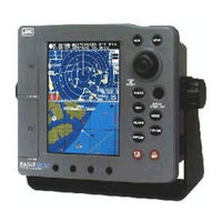
JRC RADAR 1800 Instruction Manual (148 pages)
COLOR LCD RADAR-PLOTTER
Brand:
JRC
| Category:
Marine Radar
| Size: 2.01 MB
Table of Contents
Before You Begin
2
Symbols Used in this Manual
3
Usage Hints
4
EMC Installation & Service Guidelines
6
Outside View
8
Table of Contents
9
Definition on Terms
17
SECTION 1 Introduction
20
Function
20
Features
21
Components
22
Standard Equipment
22
GPS Sensor (Option)
22
Construction
23
System Configuration
25
SECTION 2 Installation
26
Installing the Display Unit
26
Choosing a Location for Installation
26
Standard Mounting
26
Console Mounting/ Surface Mounting
28
Installing the Scanner Unit
29
Connecting the Scanner Unit Cable
29
Installing the GPS/DGPS Sensor
30
Selecting the Position for Installation
30
Installation Procedure
32
Connecting DC Power
34
Grounding the Display Unit
35
Connecting GPS/DGPS Sensor or Making NMEA0183 Data Connections (Option)
36
Connecting Electronic Compass/Gps Compass (Option)
38
Initial Operation and Set-Up
38
Inspection after Installation
38
Operating the INSTALLATION Menu
39
Radar Set up
39
Tune Preset
39
Relative BEARING Alignment
40
Display Timing
40
Stc Preset
40
Connecting Personal Computer
41
Inserting a Chart Card
42
Removing a Chart Card
42
SECTION 3 Operation
43
Screen Layout
43
Control Panel
46
Rear Panel
48
Basic Operations
49
The Power Control (Turning the Radar on and OFF)
50
LCD Backlight and Contrast Control
50
Display Modes
50
Vessel's Information/Waypoint's Information
54
Graph Display
55
Finding Function
55
Using the Jog Dial
56
Using the Joy Stick
56
Changing CURSOR Operation in RADAR/CHART Mode
56
General MEMU Operation
56
Buzzer ON/OFF
57
Setting LANGUAGE
57
Radar Operation
58
Selecting a RANGE
58
Adjusting Receiver Sensitivity
59
Adjusting TUNING
59
Reducing SEA CLUTTER
59
Adjusting RAIN CLUTTER
60
Setting OFFSET
60
Range Measurement
60
Bearing Measurement
61
Changing CURSOR Operation Mode in RADAR/CHART Screen
61
RADAR Operating Menu
62
Rings
62
Display Mode (Bearing)
62
Interference Rejection
63
Setting AUTO/MANUAL SEA Clutter Rejection
64
Setting AUTO/MANUAL TUNING
64
Target EXPANDER
64
Process
65
Trails
65
Clear Trails
66
Waypoint
66
Setting Radar COLOR
66
Planned-Tx Mode
67
Setting GUARD ZONE
68
Display of RADAR Transponder
70
Plotter Operation
72
Using the Joy Stick in CHART Mode
72
Enter the Event
72
Enter the WAYPOINT or the MARK
72
Enter the WAYPOINT
72
Soft Keys at the WAYPOINT Mode
73
Enter the MARK Mode
73
Man Overboard
74
Range Setting
74
In the CHART Display
74
In the CDI/COMPASS Display
74
In the RADAR Display
74
In the RADAR/CHART Display
75
Navigation Setting
75
SELECT ROUTE (Selecting Navigation)
75
WAYPOINT DIRECT (Selecting a Waypoint)
75
PLANNED ROUTE (Navigating According to a Planned Route)
76
TEMPORARY ROUTE (Navigating According to a Temporary Route)
76
NEAREST PORT (Searching for and Navigating to a Nearest Port)
78
PREVIOUS MOB (Setting a Waypoint to the MOB)
78
SEQUENCE (Selecting the Order of Waypoint Navigation)
78
WPT STEP (Selecting the Method to Switch the Waypoint)
79
NEXT WPT (Skipping to the Next Waypoint)
79
PREV. WPT (Skipping to the Previous Waypoint)
79
Stop Watch
79
Tidal Info
80
(Displaying Tide Height Graph of a Specified Point)
80
Object Info
80
(Displaying Detailed Information of a Specified Point)
80
Edit
81
Editing a Waypoint
81
Edit in Chart
81
Storing a Waypoint
81
Erasing a Waypoint
82
Go to a Waypoint
82
Modifying a Waypoint
82
Moving Waypoint
82
Edit by List
83
Modifying a Waypoint
83
Storing a Waypoint
83
Copying a Waypoint
84
Erasing a Waypoint
84
Jumping to a Waypoint List Page
84
Planning a Route
84
Storing a New Route
84
Adding a New Waypoint
85
Change
85
Editing a Route
85
Editing a Waypoint
85
Erase
85
Insert
85
Converting a Track to a Planned Route
86
Selecting a New Route
86
Construct
87
Divide
87
Construction
87
Constructing a Line
87
Constructing a Rectangle
88
Menu Operations
89
General
89
Top Menu
89
Radar Setting
89
Rings
89
Bearing
90
Clear Trails
90
Expander
90
Interference Rejection
90
Process
90
Sea
90
Trails
90
Tune
90
Waypoint
90
Color
90
Tx-Plan
91
Plot Setting
91
TRACK ERASE (Erasing a Track)
91
MARK ERASE (Erasing a Mark)
91
MARK SIZE (Selecting a Size)
91
Track Setup
91
MEMORY SIZE (Selecting a Number of Points)
91
TRACK COLOR (Selecting a Color)
91
TRACK PLOT (Selecting Memory Intervals)
91
VESSEL SHAPE (Selecting a Mark for Your Vessel)
91
L/L-Td Convert
92
LORAN-C CHAIN (Selecting a Format of LORAN-C CHAIN)
92
POSTION DISPLAY (Selecting a Format of Position Display)
92
TD CORRECTION (Selecting a Format of Time Difference)
92
Chart Display
92
BRG LINE (Turning the Direction Line ON/OFF)
92
CHART DISP MODE (Selecting a Chart Display Mode)
92
SCALE BAR (Turning the Scale Bar ON/OFF)
92
VECTOR RAY (Selecting a Type of Direction Display)
92
WAYPOINT (Selecting a Waypoint Display)
92
Chart Colors
93
L/L GRID (Selecting a Color for the Grid)
93
LAND (Selecting a Color for the Land)
93
SEA (Selecting a Color for the Sea)
93
Custom Chart
93
Chart Boundary
93
Cultural
93
Land Marks
93
Light Sectors
93
Names
93
Depth Contour
94
Detailed
94
Graph Setting
94
GRAPH DISPLAY (Selecting What to Display)
94
DEPTH SCALE (Setting a Display Range of the Water Depth Graph)
94
TEMP. SCALE (Setting a Display Range of the Temperature Graph)
94
SPEED SCALE (Setting a Display Range of the Speed Graph)
94
Gps Setting
95
VESSEL POSITION (Setting the Vessel Position)
95
TIME DIFFERENCE (Setting the Time Difference)
95
ANTENNA HEIGHT (Setting the Antenna Height)
95
GEODETIC DATUM (Setting a Geodetic System)
95
FIX MODE (Setting the Fixing Mode)
95
HDOP LEVEL (Setting the HDOP Level)
96
AVERAGE (Setting an Interval to Average the Data)
96
EXCLUDE SAT (Setting the Satellite Number Not Used)
96
Dgps Setting
96
MODE (Setting the Reception Mode of the Beacon)
96
FREQUENCY (Setting the Beacon Frequency)
96
BAUDRATE (Setting the Beacon Baud Rate)
96
Waas Setting
97
Mode
97
Ranging
97
Ng Waas
97
Waas no
97
Installation
98
SIMULATION (Turning the Simulator ON/OFF)
98
INITIAL POSITION (Setting the Standard Position of the Chart Display)
98
CLOCK ADJUST (Adjusting the Date and Time)
98
DATE & TIME (Selecting a System of Time)
98
RADAR ADJUST (Adjusting the Radar)
98
Data In/Out
99
TEMP. in (Selecting Temperature Input)
99
COURSE in (Selecting Course Data Input)
100
DEPTH in (Selecting Depth Data Input)
100
POSITION in (Selecting Position Input)
100
NMEA out (Putting out Data)
101
Units
101
DEPTH (Selecting Depth Units)
101
SPEED & DIST UNIT (Changing Speed and Distance Units)
101
TEMPERATURE (Changing Temperature Units)
101
YOUR DEPTH (Setting Custom Depth Units)
101
Calibration
101
LAT/LON (Calibrating the Longitude/Latitude)
101
MAGNETIC CORR. (Correcting the Magnetic Compass)
102
RESET LOG (Resetting the Trip Log)
102
Operation
102
Centering
102
Guide
102
J-Stick Push
102
Custom Initialize
103
Custom Setup
103
Memory Copy
103
Preset
103
Use the Card
104
Use the Pc
105
Alarm
106
NAV ALARM (Navigation Alarms)
106
Bz Alarm
108
Radar Alarm
108
BUZZER (Alarm Buzzer)
109
Clock Alarm
109
TEMP. ALARM (Temperature Alarms)
109
Self Test Operation
110
Master Reset and Language Select Operation
111
SECTION 4 Maintenance
116
General
116
Scanner Unit
116
Radome Scanner Unit
117
Display Unit
117
Cleaning the Display Unit Screen
117
SECTION 5 Principle
118
Radar Basics
118
Strength of Reflection from the Targets
118
Sea Clutters
118
False Echoes
119
GPS/DGPS Basics
121
Gps
121
Differential GPS (DGPS)
122
Wide Area Augmentation System (WAAS)
123
SECTION 6 Interswitch (Option)
124
Outline
124
Components
124
Construction
125
Installation
126
Setting Jumpers
126
Unit Connecting Cable
127
Operation
129
The Following Is for the Jumpers in the Junction Box. (Setting 1)
129
The Following Is for the Jumpers in the Junction Box. (Setting 2)
129
SECTION 7 After-Sales Service
131
When Asking for Service
131
Checks and Inspection
131
SECTION 8 Disposal
132
Disposal of LCD Module
132
Handling Used Lithium Batteries
132
SECTION 9 Specification
133
General
133
Scanner
134
Display Unit
135
Radar
136
Plotter
138
Input/Output Signal
139
Appendices
140
Wiring Diagram
140
Geodetic System Table
141
NMEA0183 Standard Input/Output Sentences
142
Input Sentences
142
Output Sentences
143
Waypoint List
144
Advertisement
Advertisement
Related Products
JRC RADAR 1500 MKII
JRC Radar 1000
JRC Radar 1000 MKII
JRC Radar 3000
JRC Radar XTX
JRC 2000
JRC JAN-701B -
JRC JAN-7201
JRC JAN-7202
JRC JAN-901B -
JRC Categories
Water Filtration Systems
Marine Radar
Marine Equipment
Radio Parts
Receiver
More JRC Manuals
Login
Sign In
OR
Sign in with Facebook
Sign in with Google
Upload manual
Upload from disk
Upload from URL