DeLorme GPS PN-20 User Manual
An all-in-one handheld gps solution from delorme, the leading digital mapping and gps company
Hide thumbs
Also See for GPS PN-20:
- User manual (93 pages) ,
- Getting started manual (6 pages) ,
- Quick start manual (2 pages)

Related Manuals for DeLorme GPS PN-20


Summary of Contents for DeLorme GPS PN-20
- Page 1 LORME Earthmate GPS PN-20 ® An All-in-One Handheld GPS Solution from DeLorme, the Leading Digital Mapping and GPS Company User Manual...
- Page 2 GPS PN-20 Accessories ® We offer a variety of products designed to help you get the most out of your Earthmate GPS PN-20. For more information, be sure to visit www.delorme.com/pn20. And, remember to use your compatible DeLorme software's NetLink tab to access aerial imagery and data downloads from DeLorme.
-
Page 3: Table Of Contents
Table of Contents Getting Started ...................................2 Basic Functions ..................................9 Scenarios ....................................11 The Satellites Page...................................20 The Map Page ..................................23 The Compass Page ..................................36 The Trip Info Page ..................................38 The Find Page ..................................41 The Waypoints Page ................................50 The Routes Page ..................................55 The Tracks Page ..................................59 The Sun/Moon Page ................................63 The Tide Page ..................................65... -
Page 4: Getting Started
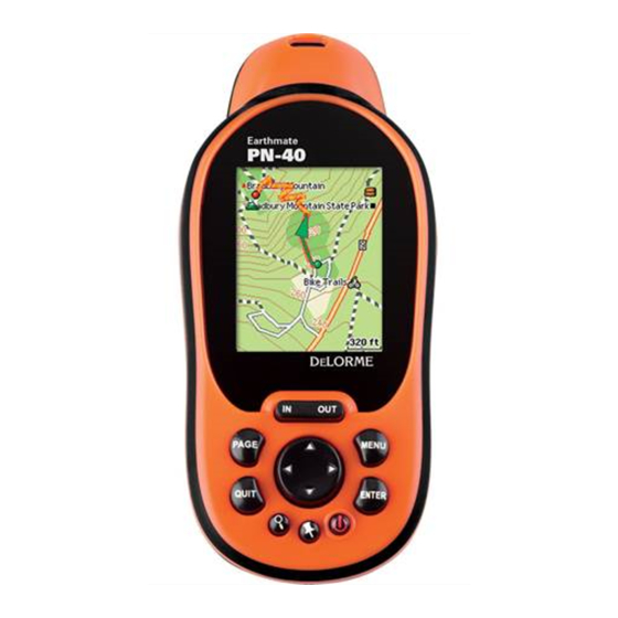
(for example, more than a month between uses), To install the batteries, unscrew the D-rings on the back of the Earthmate GPS PN-20 until you can remove the batteries for remove the battery cover. Then, insert the batteries according to the polarity symbols found inside... - Page 5 Earthmate GPS PN-20 off. Step 3 — Using the Buttons on the Earthmate GPS PN-20 The buttons on the Earthmate GPS PN-20 give you access to all of the functions on the device. Each button has a unique purpose: In/Out Use the IN and OUT button to zoom in or zoom out on the map.
- Page 6 ENTER button to view detailed information, if available. Quit The function of the QUIT button varies depending on the current status of the Earthmate GPS PN-20. You can use the QUIT button to cancel actions, such as panning, keyboard entry, to delete individual points when measuring distance, and so on.
- Page 7 ENTER to power down” message, press the ENTER button to confirm that you want to turn off the Earthmate GPS PN-20. If you do not want to turn the Earthmate GPS PN-20 off, wait five seconds or press the QUIT button.
-
Page 8: About Gps
(SD) card in the Maps directory. Step 5 — Use the Pages to Track, View Your Position While You Travel, and More This manual describes all of the functions found in each page on the Earthmate GPS PN-20. See the Note: Large maps may take Table of Contents to find the headings that are most important to you. -
Page 9: Frequently Asked Questions
Frequently Asked Questions Can I install non-DeLorme maps on the Earthmate GPS PN-20? DeLorme’s professional GIS software, XMap , allows you to register non-DeLorme maps and ®... - Page 10 Why does it take so long to find satellites? Acquiring satellite data takes longer if the batteries are low or if the Earthmate GPS PN-20 does not have a clear view of the sky. Be sure that trees, buildings, and other obstacles are not blocking the Earthmate GPS PN-20 when you begin tracking.
-
Page 11: Basic Functions
• You are navigating with the Earthmate GPS PN-20 when you use it to follow a route. (by highlighting the waypoint • You are tracking with the Earthmate GPS PN-20 when the GPS is on, but you are not following information, pressing ENTER and then modifying the infor- a route. - Page 12 20 battery by connecting the USB end of the cable to your computer and the other end of the cable Earthmate GPS PN-20 to charge rechargeable AA batteries. to the Earthmate GPS PN-20. To charge the device with the USB cable, the device must be powered on while connected. Tip: Use multiple SD cards to...
-
Page 13: Scenarios
Before they leave for their adventure, they visit www.geocaching.com to find a cache in their area. Once they find a cache, they use their compatible DeLorme mapping program to see the geocache on the map and then download a map package of the area. - Page 14 10. With the map centered on the geocache area, click the Select/Edit tool and then click the grids on the map that cover the map area you want to export to the Earthmate GPS PN-20. 11. Name and save your map package.
- Page 15 To do so, they must mark a waypoint at the geocache location and then use the Averaging function on the Earthmate GPS PN-20. When a waypoint is averaged, a series of GPS readings for the waypoint’s location is recorded and averaged to increase the positional accuracy of the waypoint.
- Page 16 1. Visit http://data.delorme.com to download the area where you will be bird watching. Once the map of the location is saved on the Earthmate GPS PN-20, Tom leaves for his bird watching trip. When he arrives at the location, he parks his truck, turns on the Earthmate GPS PN-20, waits until he gets a 2-D or 3-D fix, places a waypoint to represent the parking lot, modifies his tracking settings, and then turns on Track recording.
- Page 17 Shrimp Rock, Upper Shrimp Rock, and Mt. View Cave. Then they export the data of the region, as well as the route they created, to their Earthmate GPS PN-20. Once they arrive at the trail, they mount their GPS devices onto their bikes,...
- Page 18 12. Highlight the View button and press ENTER to see a snapshot of where you went on the trail. When they arrive home, they download the track and waypoint information into their DeLorme soft- ware so they can see a larger view of where they were. They finish by saving the track information in Editing track details their mountain biking library project.
- Page 19 GIS layers. The Earthmate GPS PN-20 is ideally suited to handle these needs; you can transfer virtually any type of data from DeLorme software onto the device for use in the field, and then use the Earthmate GPS PN-20 to map new assets and the conditions of existing assets.
- Page 20 Using the Earthmate GPS PN-20 in the field With all the data transferred to the Earthmate GPS PN-20, the field crew for each quadrant is ready to head into the field to update and verify the utility data. One field crew is responsible for updating a quadrant with significant additions and changes to the existing infrastructure.
- Page 21 Scenarios tracks to XMap. Then they review the data to update any labels that need clarification and put additional notes for the points using the mapnote feature in the Draw tab. 5. Once they are finished with the review, they synchronize their field data to the central database using the synchronize feature in XMap.
-
Page 22: The Satellites Page
Once you turn on the Earthmate GPS PN-20, the Satellites Page displays. The Satellites Page informs you of your current GPS status, the number of satellites the Earthmate GPS PN-20 is acquiring data from, the signal strength, and the GPS accuracy (available only when a 2-D or 3-D fix is obtained). - Page 23 To Disable GPS Battery indicator label changes There are many features on the Earthmate GPS PN-20 that do not require a GPS fix. You can turn off to “external” when charging the GPS connection using the Disable GPS option in the Satellites menu.
- Page 24 • GPS is temporarily disabled when in simulate mode (dur- ing track playback, navigation simulation, and so on). • If the Earthmate GPS PN-20 is unable to acquire a fix after approximately ten minutes, you will see the following message, “Would you like...
-
Page 25: The Map Page
The color of the GPS arrow depends on your GPS signal. • A flashing red arrow indicates that the Earthmate GPS PN-20 cannot obtain a GPS signal. • A blue arrow indicates that the device is in Track Playback mode or Simulate Navigation mode. - Page 26 • World base data The list above shows the default layering of the data types (from top to bottom). To change the data layering, see Layering Your Data on page 31. To Show/Hide the Information Fields You can hide the information fields to enlarge the map area. 1.
- Page 27 The Map Page To Change the Information Fields You can customize the information fields to display the information that is most important to you. You may want to change the information that displays based on the type of activity you are doing. Note: The information fields change when navigating.
- Page 28 GPS PN-20. Information Field Option Description Bearing The direction of travel from the current location to the desti- nation (finish or next stop). Expressed in degrees. Displays a green arrow pointing in the direction of the next waypoint or route point. The arrow is grayed out when no movement is reported by the device.
- Page 29 The Map Page Information Field Option Description ETA at Finish The Estimated Time of Arrival at the route finish. Expressed as hours:minutes AM/PM. ETA is based on the current device time, not on the local time at the destination. ETA at Next Turn The Estimated Time of Arrival at the next turn in the route.
- Page 30 Information Field Option Description Speed: Average The average speed of the device including stop time. Expressed in distance per unit of time. This field may be reset when you clear Trip Info. Speed: Maximum The maximum speed achieved. Expressed in distance per unit of time.
- Page 31 The Map Page Information Field Option Description Time to Sunrise/set The time remaining until the sun rises and sets. This information is calculated for the specific geographic area where the GPS has acquired a 3-D fix. Trip: Odometer The total distance the GPS device has been moving. This information may be reset when you clear Trip Info.
- Page 32 If Turn Imagery Off is highlighted, imagery is turned on. Press ENTER to turn off imagery. To Measure Distance and Area Your Earthmate GPS PN-20 has a measurement tool that allows you to measure the distance of a line or perimeter and area of a polygon.
- Page 33 You can use the Data Layering menu option to prioritize the order in which to display the many differ- ent data types available for use on the Earthmate GPS PN-20. Data layers at the top of the list display Map Setup menu options first when available.
- Page 34 5. Press ENTER. The Data Layering screen displays a list of all of the data types loaded on the Earthmate GPS PN-20. The data type at the top of the list has the highest priority. The data type at the bottom of the list has the lowest priority.
- Page 35 Note: If you want to perma- nently remove the map from 6. Optional: To view the map’s center on the screen, press MENU, use the arrow keypad to the Earthmate GPS PN-20, press MENU, use the arrow highlight View Map, and press ENTER.
- Page 36 tering the map. 1. From the Map Page, press MENU. 2. Use the arrow keypad to highlight Map Setup. 3. Press ENTER. The Map Setup screen displays. 4. Use the arrow keypad to highlight the POI Detail drop-down list and press ENTER. 5.
- Page 37 Data Layering High-Resolution Cities Scale Menu Options Color Aerial Imagery Aerial Imagery (DOQQ) USGS Quads (3DTQ) NOAA Nautical Charts Satellite Imagery DeLorme Topographic Data Orientation Heading Up POI Detail Show All POIs Waypoint Detail Show Waypoings Small Waypoint Symbols Never...
-
Page 38: The Compass Page
The Compass Page Viewing the Compass Page The Compass Page is a graphic representation of a traditional floating needle compass. It displays differently depending on if you are navigating a route or tracking. The compass rotates so that the heading is always up. You can choose to direct the bearing arrow when you are navigating so that it points in the direction of the next stop on the route or it points you back on course if you leave the route. - Page 39 1. From the Compass Page, press MENU. The Compass Page 2. Use the arrow keypad to highlight Change Info Fields. 3. Press ENTER. 4. Use the arrow keypad to highlight the information field you want to change. 5. Press ENTER. The available information field options display. 6.
-
Page 40: The Trip Info Page
The Trip Info Page includes eight information fields that occupy the entire screen (three information fields display if the Earthmate GPS PN-20 is in large text mode). You can customize each field with one of the many available information field options (see page 25 for a table of the information field options). - Page 41 3. Press ENTER. The Trip Info Page 4. To change which information fields display in large text: a) Press MENU, highlight the Change Info Fields option, and press ENTER. b) Use the arrow keypad to highlight the information field to change. c) Press ENTER.
- Page 42 Note: Resetting Trip Values resets the trip odemeter for the current Trip Info reading, while Tip: Interested in seeing how resetting Device Odometer resets the cumulative odometer for all trips on the device. far you’ve traveled for a month, season, or year? If so, restore 5.
-
Page 43: The Find Page
The Find Page Using the Find Page You can use the Find button (the one with a magnifying glass) to search for addresses, roads, cities, Notes: points of interest, waypoints, coordinates, and more. There are two Find search options: Find Near •... - Page 44 ENTER. A confirmation message displays. Use the arrow keypad to highlight the OK button and press ENTER to delete the waypoint from the Earthmate GPS PN-20. To center the map on the location, use the arrow keypad to highlight the View button and press ENTER.
- Page 45 The Find Page For a Find by Name search, use the arrow keypad to highlight the Name field and press Note: Not all map data types ENTER. To enter the name, highlight each letter of the name on the keyboard and press ENTER include natural features.
- Page 46 If your current Find setting is Find By Name and you want to search for natural features that are near the map center, press MENU. Find Near Map Center is highlighted. Press ENTER to select the Find Near Map Center option. 4.
- Page 47 To Find an Address The Find Page 1. Press the Find button. The Find Page displays. 2. Press MENU. 3. Optional: If your current Find setting is Find Near Map Center and you want to search for addresses by name, press MENU. Find By Name is highlighted. Press ENTER to select the Find By Name option.
- Page 48 To create a route from your current location to the search result, use the arrow keypad to highlight the Route button and press ENTER. For more information, see To Create a Route on page 55. To Find a Coordinate 1. Press the Find button. The Find Page displays. 2.
- Page 49 The Find Page If your current Find setting is Find By Name and you want to search for addresses that are near the map center, press MENU. Find Near Map Center is highlighted. Press ENTER to select the Find Near Map Center option. 4.
- Page 50 cities by name, press MENU. Find By Name is highlighted. Press ENTER to select the Find By Name option. If your current Find setting is Find By Name and you want to search for cities that are near the map center, press MENU. Find Near Map Center is highlighted. Press ENTER to select the Find Near Map Center option.
- Page 51 The Find Page 1. Press the Find button. The Find Page displays 2. Press MENU. 3. Use the arrow keypad to highlight the Show field, press ENTER, select History, and press ENTER. 4. Use the arrow keypad to highlight the search result you want to find and press ENTER. 5.
-
Page 52: The Waypoints Page
Using the Mark Button You can use the Mark button (the button with a push pin) on the Earthmate GPS PN-20 to mark a waypoint at your current GPS location or, if panning, at the cursor position. If you are not panning and your are not using GPS, the current map center is used. - Page 53 The Waypoints Page highlight OK and press ENTER. 8. To save the waypoint to the Earthmate GPS PN-20, use the arrow keypad to highlight the Save button and press ENTER. Note: After you save a waypoint, you can use the Waypoint Details Page to delete the waypoint, center the map on the waypoint, or create a route to the waypoint.
- Page 54 To Edit a Waypoint 1. Find the waypoint you want to edit using the Waypoints Page, Find search functionality, or by selecting a waypoint on the map. 2. Use the arrow keypad to highlight the waypoint you want to edit and press ENTER. 3.
- Page 55 4. Use the arrow keypad to Highlight the Delete button and press ENTER. A confirmation message displays. 5. Use the arrow keypad to highlight the Yes button and press ENTER to delete the waypoints with that symbol from the Earthmate GPS PN-20. To Delete All Waypoints 1. From the Waypoints Page, press MENU.
- Page 56 2. Use the arrow keypad to highlight the Delete all Waypoints button and press ENTER. A confirmation message displays. 3. Use the arrow keypad to highlight the Yes button and press ENTER to delete all waypoints from the Earthmate GPS PN-20.
-
Page 57: The Routes Page
The Routes Page Using the Route Page There are many ways to create routes on the Earthmate GPS PN-20. You can create a route: • From your current GPS location to a waypoint. • From your current GPS location to a Find search result. - Page 58 4. Repeat step 3 for each point you want to include in your route. Tip: To exit Navigation mode, 5. Optional: If you do not want to include your current GPS position as a route point, use the press MENU, use the arrow keypad to highlight Stop Navi- arrow keypad to highlight Current Position and press ENTER.
- Page 59 information, see The Find Page section that starts on page 41). After you find the point, The Routes Page highlight the result, press ENTER, and then highlight Add and press ENTER to add the search result as a point in the route. To select a route point that is on the map, highlight Use Map and press ENTER to pan to the location on the map that you want to use as a route point.
- Page 60 3. Press MENU. 4. Use the arrow keypad to highlight Delete Route and press ENTER. The route is deleted. To Delete All Routes 1. From the Routes Page, press MENU. 3. Use the arrow keypad to highlight the Delete All Routes option and press ENTER. To Edit the Route Settings 1.
-
Page 61: The Tracks Page
The Tracks Page Using the Tracks Page Your Earthmate GPS PN-20 is set by default to record GPS tracks. That means the device creates a Note: Visible tracks display in the Tracks Page with red text. track, or “breadcrumb trail,” of your travels until you turn recording off. The breadcrumb trail displays You can view only one track at differently based on your GPS status. - Page 62 1. From the Tracks Page, use the arrow keypad to highlight the Clear button and press ENTER. ment. The active track is cleared from the Earthmate GPS PN-20. 2. Press QUIT to return to the previous Page. To Delete a Saved Track 1.
- Page 63 To View a Saved Track The Tracks Page 1. From the Tracks Page, use the arrow keypad to highlight the track to view and press ENTER. Tip: View a saved track when The Track Details Page displays. Track logs that display with red text are visible on the map. you want a reference from a previous trip but do not want to 2.
- Page 64 To Enable the Reset Info Screen The Reset Info screen allows you to synchronize your Trip Info with a track when you press Save or Clear on the Track Details Page. This feature is enabled by default. 1. From the Tracks Page, press MENU. 2.
-
Page 65: The Sun/Moon Page
The Sun/Moon Page Using the Sun/Moon Page Use the Sun/Moon Page to view the sunrise/sunset and moonrise/moonset information and the moon phase information for your current GPS location. The current date and time displays at the top of the screen. To Set the Time Note: Setting the time in the Sun/Moon Page affects only the Sun/Moon Page values, not the device’s time information. - Page 66 To View the Sun and Moon Rise/Set Information The Sun/Moon rise and set information is found underneath the Sun/Moon graphics. The information displays the time that both the sun and moon will rise and set based on the current time and date set- tings.
-
Page 67: The Tide Page
The Tide Page Using the Tide Page Use the Tide Page to view high and low tide information based on a specific time, date, and tide station. To Get Tide Information for a Particular Time and/or Date Note: Setting the time or date in the Tide Page affects only the Tide Page’s time or date, not the device’s time or date. -
Page 68: The Hunt/Fish Page
The Hunt/Fish Page Using the Hunt/Fish Page Use the Hunt/Fish page to view a predicition of the type of day it will be for hunting or fishing, the best times to hunt or fish, and good times to hunt or fish for your current GPS location. To Set the Date Note: Setting the date in the Hunt/Fish Page affects only the Hunt/Fish Page’s date, not the device’s date. -
Page 69: The Device Setup Page
The Device Setup Page Use the Device Setup Page options to modify the default settings on the Earthmate GPS PN-20, such Tip: When viewing the Device as the battery type, backlight settings, and more. Setup preferences, you can highlight the Restore Factory... - Page 70 To clear the check box if it is selected, highlight Enable Serial Port and press ENTER. If you are connecting the device to your computer via a USB cable, highlight the USB Setting drop-down list and press ENTER. Then, highlight DeLorme or one of the Mass Storage options and press ENTER.
- Page 71 • If you want to access the files on your SD card and you do not have an SD card reader, select Mass Storage: SD/MMC Card as the USB setting. • Select DeLorme if you are using the device with compatible DeLorme mapping software. 3. Press QUIT to return to the Device Setup Page.
- Page 72 To Modify the Page Order Settings Use the following steps to change the page order, add a page to the page button sequence, or hide a page. 1. From the Device Setup Page, highlight the Page Order option and press ENTER. 2.
- Page 73 Select the option you want and press ENTER. The Device Setup Page Note: Selecting an Automatic option allows the device to update the time zone based on your current GPS location. 5. Press QUIT to return to the Device Setup Page. To Modify the Units Settings 1.
- Page 74 About this Device The About This Device screen displays the serial, build, and version numbers for your Earthmate GPS PN-20. This screen contains the serial number you need when downloading maps for the device. 1. From the Device Setup Page, highlight the About This Device option and press ENTER.
-
Page 75: Appendix A: Page Function Table
Appendix A: Page Function Table This table provides an overview of what you can view/do on each page, as well as each page’s menu functions: With this Page... You Can... And Use the Page’s MENU to... Satellite View the: • Disable/Enable GPS •... - Page 76 With this Page... You Can... And Use the Page’s MENU to... Trip Info View user-selected information • Change/reset information fields • Show large text in the informaiton fields (which displays three large fields) • Reset trip values • Stop navigation (if in navigation mode) Find Button •...
- Page 77 Appendix A With this Page... You Can... And Use the Page’s MENU to... Tracks • Turn tracking off • Delete all tracks • Save a track • Start/stop track playback • Return to the track start • Clear the current track •...
- Page 78 With this Page... You Can... And Use the Page’s MENU to... • Select the backlight timer • Change the serial port status • Change USB settings • Selecting sounds s Button Press s Alarm s Power s Turn Alert s All sounds •...
-
Page 79: Appendix B: Specifications
Appendix B: Specifications Physical Specifications Case: IPX-7 waterproof, impact resistant Size: 5.25” x 2.43” x 1.5” Weight: 0.33 lb Technical Specifications General • NMEA-compliant 12-channel receiver • WAAS-enabled (SBAS) • Low-power baseband and RF chip set (RF chip based on the ultra-low-power silicon-germanium BiCMOS process) •... -
Page 80: Limited Warranty
DeLorme warrants that your Earthmate GPS PN-20 will be free from defects in materials and work- manship for 1 year from the date of purchase. If your Earthmate GPS PN-20 fails in normal use, De- Lorme will, at its sole option, either repair or replace the unit. DeLorme reserves the right to either... - Page 81 Such repairs or replacements will be made at no charge for labor or materials; however, the customer will be responsible for any shipping charges incurred to send the device to DeLorme. The repaired or replaced product will be warranted for 90 days from the date of return shipment, or for the balance of the original warranty, whichever is longer.
-
Page 82: Copyright Information
DeLorme Support • Your return shipping address • Your daytime telephone number If you have contacted DeLorme Support and have been instructed to send the device in for warranty service, send the unit to: DeLorme Earthmate GPS PN-20 Service Department... -
Page 83: Appendix C Waypoint Symbols
Appendix C Waypoint Symbols American Flag Birch Tree Danger Anchor Bird Tracks Deciduous Tree Animal Tracks Bird Deer Tracks Arrow, Down-left Boat Launch Deer Arrow, Down-right Bridge Dining Building Diver Down Arrow, Down Arrow, Left Buoy Dog Sledding Arrow, Right Camera Downhill Skiing Arrow, Up-left... -
Page 84: Waypoint Symbols
Waypoint Symbols Fish Jeep Public Airport Fishing Pole Kayaking Radio Tower Flower Garden Lighthouse Railroad Crossing Four-wheel ATV Restroom Lodging Gas Station Military Airport Sailboat Geocache Found Military Base School Bus Geocache Mining School Glider Area Money Shelter Golf Course Moose Shipwreck Health Facility... - Page 85 Waypoint Symbols Appendix C Tow Truck Push Pin Small Dot (available in red, dark (available in red, dark Traffic Light red, yellow, dark yellow, red, yellow, dark yellow, green, dark green, blue, green, dark green, blue, dark blue, turquoise, dark dark blue, turquoise, dark Truck turquoise, gray, and dark...
-
Page 86: Glossary
Glossary Back on Course—The direction of travel needed to return to the course. Base Map—A low-detail map that comes pre-loaded on the Earthmate GPS PN-20. Battery Life—The percentage of battery life that is left on the device. Bearing—The direction of travel from the current location to the destination. - Page 87 Scale—The relationship between the extent of features in the real world and the size at which they are portrayed on the map. On the Earthmate GPS PN-20, you can choose Bar, Zoom, or Ratio. Speed—The current rate of travel for the device.
- Page 88 Time to Next Turn—The estimated time to the next turn in the route based on road classifications and speed settings. Time to Sunrise/set—The time remaining until the sun rises and sets. Trip Odometer—The total distance the GPS device has been moving. Trip Time Moving—The total time the GPS device has been moving.
-
Page 89: Index
Find Page........41-49 Finding Charging the device .....10, 21 Addresses ......45-46 Compass Page ........36 Cities ........47-48 Contacting DeLorme ......80 Coordinates ........46 Contains ..........41 Natural features ...... 43-44 Creating a route ........55 Points of interest ....42-43 Search history ......48-49... - Page 90 Streets ........46-47 Waypoints .......41-42 Frequently asked questions ....7-8 Map cursor ...........4 Map Data ........5, 23 Map Page ........23-35 Glossary ........84-86 Map Setup ..........31 Mark button ..........4 Disabling ........21-22 Marking a waypoint ...... 50-51 How GPS works ......6-7 Mass Storage ........69 Modifying GPS Settings ....67 Measuring distance/area .....
- Page 91 Index Editing........57-58 Page button ..........3 Reversing........57 Page Order .........70 Simulating ........56 Pages ..........73-76 Panning the map ......4, 9 Satellites Page ......20-22 POI detail ........42-43 Scenarios ........11-19 Power button........2, 5 SD card ...........6, 10 Serial number ........72 Service Plan .........
- Page 92 Time settings ........70-71 Centering the map on....53 Tracking ..........9 Creating a route from ....52 Tracks Deleting ........53 Clearing ........60 Editing...........52 Deleting ........60, 62 Marking ........50 Following ........60 View list ........51 Recording ........59 Waypoints Page ......50-54 Saving ........59-60 Setting preferences ......61 Viewing .........61 Zooming the map in/out.......3...
- Page 93 Notes...
- Page 94 Notes...
- Page 95 Notes...
- Page 96 Notes...
- Page 97 NiMH, alkaline, or lithium), or an Earthmate GPS PN-20 rechargeable lithium-ion battery pack. Rechargeable Lithium-Ion Battery Pack Caution Use only an Earthmate GPS PN-20 Battery Type. Risk of explosion if battery is replaced by an incorrect type. Dispose of used batteries according to the instructions.
- Page 98 ™ Since its incorporation in 1976, DeLorme has developed an unprecedented reputation as a leader in the mapping industry. From early beginnings as a paper atlas publisher, the company quickly emerged as a pioneering technological innovator. DeLorme not only embraced new technologies, it developed them.
Need help?
Do you have a question about the GPS PN-20 and is the answer not in the manual?
Questions and answers