DeLorme Earthmate GPS PN-20 Getting Started Manual
Delorme earthmate gps pn-20: quick start
Hide thumbs
Also See for Earthmate GPS PN-20:
- User manual (98 pages) ,
- Getting started manual (6 pages) ,
- Quick start manual (2 pages)
Table of Contents
Advertisement
Quick Links
Download this manual
See also:
User Manual
Sending DeLorme Imagery and Data to Your Device
You must install Topo USA 7.0 and enable your Earthmate GPS PN-20 before you
download imagery and data. See Exchanging GPS Data for more information.
Step 1 — Download data
You can use the NetLink tab to do many things, such as download imagery and maps for
your area and get updates for your Earthmate GPS PN-20 and Topo USA software. To
download available data from DeLorme, follow the instructions in the Datasets area of
the NetLink tab. You can use the Data Download Dollars certificate included with your
software to download USGS Quad maps, NOAA Nautical Charts, Color Aerial Imagery
and many other types of data.
Step 2 — Create a map package that includes the DeLorme
topographic data and the downloaded imagery
1. Click the Handheld Export tab.
2. To manually select the map area, choose an appropriate grid size from the Grid
Size drop-down list, click the Select/Edit button, and click grids on the map to add
or remove them. Grids selected for export are shaded red.
OR
Select the grid size from the Grid Size drop-down list, type a location in the
Search box, click a result in the results list, and then click the Preview button.
The map area for the search result appears with shaded grids. Click Select All
to select the previewed area or click Select/Edit to add or remove grids. Grids
selected for export are shaded red.
3. To change the default package name, type a new name in the Save your Map
for Exchange text box.
4. Click the Save button to save imagery and DeLorme topographic data.
Step 3 — Transfer the map to the device
1. Click the Exchange button on the Handheld Export tab or on the toolbar to open the
Earthmate GPS PN-20 Exchange dialog.
2. To save the map package on the internal memory of the device or on an SD card in
the device, select Earthmate GPS PN-20 from the drop-down list in the top right
corner of the dialog box.
OR
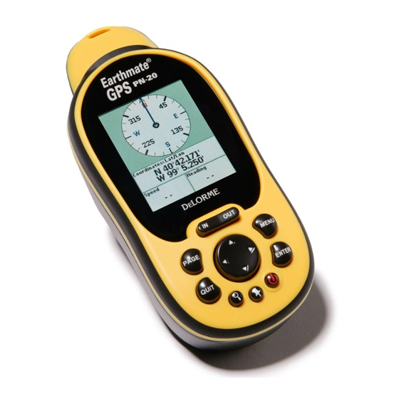
Earthmate GPS PN-20
®
You can also create and send maps to your
Earthmate GPS PN-20 using the Earthmate GPS
PN-20 Online Map Center at data.delorme.com.
To save the map package on an SD card using an SD card reader, select the
removable disk option for your SD card reader from the drop-down list in the top
right corner of the dialog box.
Note: Using an SD card reader is the fastest method for transferring large map
packages and using them in the device.
3. On the left side of the dialog under Saved Map Packages, click the map package
to highlight it and click Send.
4. On the left side of the dialog under Regional Map Packages, click the regional
map package for your area and click Send. Regional maps provide map detail
necessary for routing.
5. Click Done.
Earthmate GPS PN-20
®
Getting Started Guide
D
LORME
E
Advertisement
Table of Contents

Related Manuals for DeLorme Earthmate GPS PN-20


Summary of Contents for DeLorme Earthmate GPS PN-20
- Page 1 You can use the NetLink tab to do many things, such as download imagery and maps for your area and get updates for your Earthmate GPS PN-20 and Topo USA software. To You can also create and send maps to your...
- Page 2 USA 7.0 maps for your Earthmate GPS PN-20, and a DeLorme Topo USA 7.0 DVD. right side of the dialog you see all of the objects on your Earthmate GPS PN-20. Use ® To install Topo USA 7.0, follow the instructions in the Getting Started Guide for Topo Your package may also include a 1GB SD card and reader, which allow you to quickly USA 7.0 located in the software DVD case.
Need help?
Do you have a question about the Earthmate GPS PN-20 and is the answer not in the manual?
Questions and answers