Table of Contents
Advertisement
Advertisement
Table of Contents

Subscribe to Our Youtube Channel
Related Manuals for Simrad NSS16 EVO3S


Summary of Contents for Simrad NSS16 EVO3S
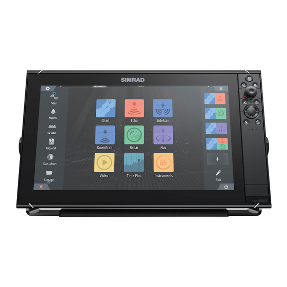
- Page 1 NSS evo3S Installation Manual ENGLISH www.simrad-yachting.com...
- Page 3 Copyright © 2020 Navico Holding AS. Warranty The warranty card is supplied as a separate document. In case of any queries, refer to the brand website of your unit or system: www.simrad-yachting.com Compliance statements Declarations The relevant declarations of conformity are available at: www.simrad-yachting.com...
- Page 4 If you are unsure, contact your service provider to confirm rates and restrictions. Trademarks ® Navico is a registered trademark of Navico Holding AS. ® Simrad is used by license from Kongsberg. ® Bluetooth is a registered trademark of Bluetooth SIG, Inc. ™ C-Monster is a trademark of JL Marine Systems, Inc.
- Page 5 The manual assumes that the reader has basic knowledge about this type of equipment with regards to: • installation work to be carried out • nautical terminology and practices Translated manuals Available translated versions of this manual can be found on the following website: • www.simrad-yachting.com Preface | NSS evo3S Installation Manual...
-
Page 6: Table Of Contents
Contents Introduction Parts included Front controls Card reader Connectors 11 Installation General mounting guidelines U-bracket mounting Panel mounting Bezel fitment and removal 15 Wiring Connectors Wiring guidelines Power NMEA 2000 Video IN and NMEA 0183 Ethernet Sonar CH1 - blue connector Sonar CH2 - black connector HDMI out USB port... -
Page 7: Introduction
Introduction Parts included Display unit Bezel trim Documentation pack Sun cover Power cable kit • Power cable • Fuse • Fuse holder U-bracket kit - 9" units • Plastic U-bracket • Bracket knobs • Mounting screws - 4x #10x3/4" self-tapping pan head U-bracket kit - 12"... -
Page 8: Front Controls
Front controls Touch screen Pages/Home • Press to open the Home page for page selection and setup options. WheelKey - user configurable key. Refer to "Configure WheelKey" on page 26. Default without an autopilot connected to the system: • Short press: toggles between panels on split screen. •... -
Page 9: Card Reader
Power key • Press and hold to turn the unit ON/OFF. • Press once to display the System Controls dialog. Repeat short presses to toggle through the default dimming levels. Card reader door Card reader A memory card can be used for: •... -
Page 10: Connectors
Connectors Connectors 9" units 12" units ETHERNET ETHERNET HDMI VIDEO NMEA2000 POWER SONAR 1 SONAR 2 NMEA2000 VIDEO ETHERNET POWER SONAR 1 SONAR 2 16" units ETHERNET ETHERNET HDMI VIDEO NMEA2000 POWER SONAR 1 SONAR 2 Ethernet - Ethernet network Power - power, power control, and external alarm Video- composite video and NMEA0183 NMEA 2000 - NMEA 2000 data... -
Page 11: Installation
Installation General mounting guidelines Warning: Do not install the unit in a hazardous/flammable atmosphere. Ú Note: Choose a mounting location that will not expose the unit to conditions that exceed the technical specifications. Mounting location Ensure that the selected area allows for: •... - Page 12 Compass safe distance The unit outputs electromagnetic interference that can cause inaccurate readings on a nearby compass. To prevent compass inaccuracy the unit must be mounted far enough away so the interference does not affect compass readings. For minimum compass safe distance, refer to "Technical specifications"...
-
Page 13: Bracket Mounting
U-bracket mounting Place the bracket in the desired mounting location. Ensure that the chosen location has enough height to accommodate the unit fitted in the bracket, and allows tilting of the unit. Also adequate space is required on both sides to allow tightening and loosening of the knobs. -
Page 14: Panel Mounting
Panel mounting Refer to the separate mounting template for panel mounting instructions. Bezel fitment and removal Ú Note: The unit in the illustration is an example only. Installation | NSS evo3S Installation Manual... -
Page 15: Wiring
Wiring Connectors Different models have different connectors. For available connectors and connector layout refer to "Connectors" on page 10. Wiring guidelines Don't: • Make sharp bends in the cables. • Run cables in a way that allows water to flow down into the connectors. •... - Page 16 It is protected against reverse polarity, under voltage, and over voltage (for a limited duration). A fuse or circuit breaker should be fitted to the positive supply. For recommended fuse rating refer to "Technical specifications" on page 43. Purpose Color +12/24 V DC DC negative Black...
- Page 17 Purpose Color Power control wire Yellow Ignition switch Power controlled by power bus The yellow power control wire can either be an input that will turn on the unit when power is applied, or an output that turns on other devices when the unit is powered on. It can be configured at the installation stage to control the power state of displays and compatible devices.
-
Page 18: Nmea 2000
External alarm For sirens that draw more than 1 A, use a relay. Purpose Color External alarm output Blue Siren and relay Buzzer NMEA 2000 The NMEA 2000 data port allows receiving and sharing of a multitude of data from various sources. -
Page 19: Video In And Nmea 0183
• A terminator must be installed at each end of the backbone. The terminator can be a terminator plug or a unit with built-in terminator. NMEA 2000 device Drop-cable Terminator Power supply Backbone Powering the NMEA 2000 network The network requires its own 12 V DC power supply, protected by a 3 amp fuse. For smaller systems: connect power at any location in the backbone. - Page 20 Purpose Video 1 Ground Video 1 (+) Video 2 Ground Video 2 (+) NMEA 0183 TX_B NMEA 0183 TX_A NMEA 0183 RX_A NMEA 0183 RX_B VIDEO IN/NMEA 0183 cable Ú Note: This cable (part number 000-00129-001) is not included with the unit. Color Purpose Video in/data cable connector to unit...
-
Page 21: Ethernet
Talkers and listeners Only one talker (output device) can be connected to a serial input (RX) on the unit, in accordance with the NMEA0183 protocol. However, an output port (TX) on the unit may be connected to up to three listener (receiver) devices, dependent on the hardware capabilities of the receiver. -
Page 22: Sonar Ch1 - Blue Connector
Sonar CH1 - blue connector Supports: • Sonar / CHIRP Sonar • DownScan Ú Note: A 7-pin transducer cable can be connected to a 9-pin port using a 7-pin to 9-pin adaptor cable. However, if the transducer has a paddle wheel speed sensor, the water- speed data will not be displayed on the unit. -
Page 23: Hdmi Out
Connector details Unit socket (female) Purpose Drain/Ground Starboard + Starboard - Transducer - Transducer + Port + Port - Temp Transducer ID HDMI out The unit can be connected to an external monitor to replicate video at a remote location. The image is shown on the external monitor at the units own native resolution, so the external monitor should support the same resolution or be able to scale. - Page 24 Charge a connected device. For maximum output power refer to the "Technical specifications" • on page 43. • Connect a storage device. • Connect a card reader. Ú Note: If you want to read chart cards using a USB card reader connected to the USB port, an MI10 USB card reader is required.
-
Page 25: System Setup
System setup Turning the system on and off The system is turned on by pressing the Power key. Press and hold the Power key to turn the unit off. If the key is released before the shut-down is completed, the power off process is cancelled. You can also turn the unit off from the System Controls dialog. - Page 26 Boat settings Used to specify the physical attributes of the boat. Time Configure time settings to suit vessel location, along with time and date formats. Configure WheelKey Configures the action of the WheelKey on the front of the unit. PIN code Sets a PIN code to prevent unauthorized access to your system's settings.
-
Page 27: Activating/Deactivating Features And Applications
SOG as boat speed and COG as heading Use SOG as boat speed If boat speed is not available from a paddle wheel sensor, it is possible to use speed over ground from a GPS. SOG will be displayed as boat speed and used in the true wind calculations and the speed log. -
Page 28: Radar Installation
Siren enable The Siren enabled option must be set in order for the unit to activate the buzzer when an alarm condition arises. Its setting also determines the operation of the external alarm output. Radar installation The radar system requires radar sensor specific settings in order to adjust for a number of variables found in different installations. - Page 29 Adjust bearing alignment This option is used to align the heading marker on the screen with the center line of the vessel. This will compensate for any slight misalignment of the scanner during installation. Misalignment that is not corrected for will compromise target tracking and can result in dangerous misinterpretation of potential navigation hazards.
-
Page 30: Echosounder Settings
Main radar PPI Radar overlay on a chart Adjust open array park angle The park angle is the final resting position of the antenna relative to the heading line of the radar when the radar is set to standby. The antenna will stop rotating at the desired offset. Adjust local interference reject Interference from some onboard sources can interfere with the Broadband radar. - Page 31 Network Echosounder Select to share transducers from this unit with other units connected on the Ethernet network. In addition, the setting must be selected in order to see other enabled sonar devices on the network. When unselected, transducers connected to this unit cannot be shared with other units connected on the network, nor can it see other sources on the network that have this feature enabled.
- Page 32 Source Select this option to display a list of sources available for setup. The settings you make in the rest of the dialog pertain to the source selected. Source name Select this option to set a descriptive name for the selected transducer. Search depth Noise may cause the echosounder to search for unrealistic depths.
-
Page 33: Autopilot Settings
Calibration range: 50-200 %. Default is 100 %. Water speed averaging Averages water speed by measuring your speed at a selected interval of time. Water speed intervals range from one to thirty seconds. For example if you select five seconds, your displayed water speed will be based on averaging over 5 seconds of sampling. - Page 34 Ú Note: The autopilot must be commissioned prior to first use and any time after autopilot default settings have been restored. Cable steer calibration Ú Note: The rudder source must be set to rudder feedback to be able to run this calibration Start the calibration process by selecting the rudder feedback calibration option, and follow the onscreen instructions.
-
Page 35: Fuel Settings
Fuel settings The fuel utility monitors a vessel's fuel consumption. This information is totaled to indicate trip and seasonal fuel usage, and is used to calculate fuel economy for display on instrument pages and the data bar. To use the utility, a Navico Fuel Flow sensor, or a NMEA 2000 engine adaptor cable/gateway with Navico Fuel Data Storage device must be fitted to the vessel. -
Page 36: Wireless Settings
Calibrate Calibration may be required to accurately match measured flow with actual fuel flow. Access calibration from the Refuel dialog. Calibration is only possible on Navico’s Fuel Flow sensor. Start with a full tank and run the engine as it would normally be operated. After at least several liters (a few gallons) have been used, the tank should be fully refilled, and the Set to full option selected. -
Page 37: Network Settings
Network settings Device name Assigning a name is useful in systems using more than one device of the same type and size. Sources Data sources provide live data to the system. When a device is connected to more than one source providing the same data, the user can choose the preferred source. - Page 38 Ú Note: In order to enable group selection, the unit must be set to the Simrad group. Devices with no selected group can use different sources than the rest of the network devices. Advanced source selection This allows the most flexible and precise manual control over which devices provide data.
- Page 39 Send waypoint Select this option to allow this unit to send waypoints to another device via NMEA 2000. Ú Note: The system can only transmit or receive one waypoint at a time on creation of that waypoint. For bulk import or export of waypoints see the operator manual. NMEA 0183 setup The NMEA 0183 port(s) must be set to suit the speed of connected devices, and can be configured to output only the sentences required by listening devices.
-
Page 40: 3Rd Party Support
3rd party support CZone CZone connection to NMEA 2000 When interfacing to CZone network it is recommended to use a BEP Network interface bridge to join the two network backbones together. The CZone / NMEA 2000 Network interface bridge isolates the power of the two networks, but allows data to be freely shared between both sides. -
Page 41: Naviop
Compatible FLIR cameras are plug and play when used in conjunction with a device acting as a DHCP host. For setup on networks not utilizing a DHCP host, refer to the website www.simrad-yachting.com, or contact technical support. FLIR settings can be found in the advanced settings dialog. - Page 42 3rd party support | NSS evo3S Installation Manual...
-
Page 43: Appendix
Appendix Technical specifications Technical specifications Display Resolution 9" unit 1280 x 720 12" unit 1280 x 800 16" unit 1920 x 1080 Type High Visibility SolarMax HD® IPS optically bonded TFT Brightness 1200 nits Touch screen Full touch screen (multi-touch) Viewing angles in degrees (typical value @ 80°... - Page 44 Video output 9" unit Not applicable 12" and 16" units 1 port (HDMI 1.4 sink and HDCP) Data card reader 2 slots (microSD, max 32 GB, FAT32) Wireless 802.11b/g/n Bluetooth Bluetooth 4.0 with support for Bluetooth Classic 9" and 12" units Not applicable 16"...
-
Page 45: Dimensional Drawings
Dimensional drawings 9" unit 131.0 mm (5.15”) 310.9 mm (12.24”) 18.5 mm (0.73”) 287.0 mm (11.30”) 69.6 mm (2.74”) 296.2 mm (11.66”) 66.6 mm (2.62”) 12" unit 170.3 mm (6.70”) 377.1 mm (14.85”) 18.5 mm (0.73”) 351.5 mm (13.84”) 78.1 mm (3.07”) 106.7 mm (4.20”) 349.0 mm (13.74”) -
Page 46: Supported Data
Supported data NMEA 2000 compliant PGN List NMEA 2000 PGN (receive) 59392 ISO Acknowledgement 59904 ISO Request 60160 ISO Transport Protocol, Data Transfer 60416 ISO Transport Protocol, Connection M. 65240 ISO Commanded Address 60928 ISO Address Claim 126208 ISO Command Group Function 126992 System Time 126996... - Page 47 129283 Cross Track Error 129284 Navigation Data 129539 GNSS DOPs 129540 AIS Class B Extended Position Report 129545 GNSS RAIM Output 129549 DGNSS Corrections 129551 GNSS Differential Correction Receiver Signal 129793 AIS UTC and Date Report 129794 AIS aids to Navigation 129798 AIS SAR Aircraft Position Report 129801...
- Page 48 130585 Entertainment - Bluetooth Source Status NMEA 2000 PGN (transmit) 60160 ISO Transport Protocol, Data Transfer 60416 ISO Transport Protocol, Connection M. 126208 ISO Command Group Function 126992 System Time 126993 Heartbeat 126996 Product Info 127237 Heading/Track Control 127250 Vessel Heading 127258 Magnetic Variation 127502...
- Page 49 NMEA 0183 supported sentences TX / RX - GPS Name Description Datum reference Global positioning system (GPS) fix data Geographic position - Loran-C Geograpic position - Latitude/longitude GNSS DOP and active satellites GNSS fix data GNSS satellites in view Course over ground and ground speed Time and date TX / RX - Navigation Name...
- Page 50 TX / RX - Wind Name Description Wind direction and speed Wind speed and angle TX / RX - AIS / DSC Name Description Digital selective calling information Expanded digital selective calling AIS VHF data-link message AIS VHF data-link own-vessel report Ú...
Need help?
Do you have a question about the NSS16 EVO3S and is the answer not in the manual?
Questions and answers