Table of Contents
Advertisement
Advertisement
Table of Contents

Related Manuals for C-Nav IALA


Summary of Contents for C-Nav IALA
- Page 1 DGNSS Systems Hardware Guide www.cnavgnss.com...
- Page 2 Contact the C-Nav® office or dealer nearest you: C-Nav Regional Office Regional Distributor Contacts: North America: Lafayette, LA (Head Office): +1 337 210 0000 Houston, TX: +1 713 468 1536 Bothell, WA: +1 425 408 9190 Mexico: +52 938 381 8973...
-
Page 3: Contact Information
Web: http://www.cnavgnss.com/ C-Nav Technical Support normal operational hours are 7am to 5pm, Monday through Friday U.S. Central Standard Time. In addition, our regional offices can provide first line support for the C-Nav DGNSS System. Please reference your unit serial number (located on sticker on the front or side of the DGNSS/DGPS receiver) when making any service calls. -
Page 4: Table Of Contents
Measuring GNSS Accuracy .......................... 10 Common Values Used with GNSS ....................... 11 C-Nav Subscription Service.......................... 12 C-NavC2 Subscription Service ........................13 How to Access the C-Nav Subscription Service .................... 14 L-band Correction Signal ..........................15 Chapter 2 Installation Guide ..............17 C-Nav Antenna Installation Notice .................... -
Page 5: List Of Tables
C-Nav Hardware Reference Guide IALA Receiver (MBX-3S, MBX-4) ......................... 50 IALA Whip Antenna Dimensions ........................52 C-NaviGator II ..........................53 C-NaviGator II Control and Display Unit ......................53 C-NaviGator II Mounting Options ........................55 C-NaviGator II LCD Touch-screen Care and Cleaning .................. 62 Chapter 4 Hardware Accessories ............ -
Page 6: List Of Figures
Table 4-1: Coax-Seal Product Specifications ............................82 List of Figures Figure 1-1: C-Nav Corrections Service Network Coverage ........................15 Figure 2-1: C-Nav3050 Antenna Properly Installed on Mast ........................18 Figure 2-2: C-Nav3050 Antenna on Mast – Hose Clamp Installation ....................19 Figure 2-3: C-Nav Antenna Mounting Pole Dimensions ......................... - Page 7 C-Nav Hardware Reference Guide Figure 3-50: C-NaviGator II Side-panel Connectors ..........................53 Figure 3-51: C-NaviGator II Power Supply .............................. 53 Figure 3-52: RAM 100 75 VESA Base (w/ Steel Reinforce) / RAM-D-246U-IN1................... 55 Figure 3-53: RAM Double Socket Arms ..............................55 Figure 3-54: RAM 11"...
-
Page 8: Chapter 1 Overview
C-Nav Hardware Reference Guide Chapter 1 ............... Overview C-Nav and Global Navigation Satellite Systems Traditional Differential GNSS Positioning Traditional Differential GNSS (DGNSS ) relies on the concept that errors in position at one location are similar to those for all locations within a given (local) area. By recording GNSS... - Page 9 C-Nav Hardware Reference Guide Ephemeris error occurs when the broadcast GNSS message for the satellite’s orbital location is inaccurate. It is typical that the radial component of this error is the smallest; the along-track and cross-track errors are larger by an order of magnitude. The ‘line of sight’ projections of the GNSS satellite positioning error affect each GNSS observation differently.
-
Page 10: Measuring Gnss Accuracy
C-Nav Hardware Reference Guide receiver near large reflecting surfaces. The first line of defense is to use the combination of antenna cut-off angle and antenna location in order to minimize the problem. A second approach is to utilize software algorithms within the receiver to minimize the impact of multipath on range tracking accuracy. -
Page 11: Common Values Used With Gnss
C-Nav Hardware Reference Guide The following table describes some of the statistical formulas and measures commonly used for GNSS positional accuracy measurement: Table 1-1: Common Accuracy Measures Used with GPS Measurement Statistical Related Abbreviation Probability Approximation Dimension Measure Expressions MSE – mean... -
Page 12: C-Nav Subscription Service
It is the use of multi-frequency receivers at both the reference stations and the user equipment, A single-frequency operation mode is available for the C-Nav3050. Contact C-Nav Support for details on using this feature. Single-frequency is a receiver mode that uses only the L1 GPS/G1 GLONASS signals. There is no... -
Page 13: C-Navc2 Subscription Service
GNSS receiver and an L-Band communications receiver, both designed by C-Nav for this system. The GNSS receiver tracks all the satellites in view and makes pseudorange measurements to the GNSS satellites. Simultaneously, the L-Band receiver receives the correction messages broadcast via the L-Band satellite. -
Page 14: How To Access The C-Nav Subscription Service
An authorized subscription will provide an encrypted key, which is specific to the Serial Number of the C-Nav receiver to be authorized. This is entered into the receiver using a C-Nav controller solution such as the C-NaviGator II CDU, C-Monitor or C-Setup PC software, or Over the Air (C- Nav3050 only). -
Page 15: L-Band Correction Signal
C-Nav Hardware Reference Guide Figure 1-1: C-Nav Corrections Service Network Coverage L-band Correction Signal C-Nav DGNSS Receivers can obtain C-Nav signals from six (6) separate and independent geo- stationary communication satellites. The Satellite Based Augmentation System (SBAS) signals obtained from geo-stationary communication satellites are selected by GPS L1 PRN ID. -
Page 16: Table 1-2: L-Band Correction Identifiers And Modes
C-Nav Hardware Reference Guide Table 1-2: L-band Correction Identifiers and Modes Geo-stationary L-band ID SV Name SBAS Position Am-1 Americas Net-1 97.65° W EuA-1 Europe/Africa Net-1 25° E Pac-1 Asia/Pacific Net-1 109° E Am-2 Americas Net-2 142° W EuA-2 Europe/Africa Net-2 15.5°... -
Page 17: Chapter 2 Installation Guide
C-Nav Hardware Reference Guide Chapter 2 ............Installation Guide C-Nav Antenna Installation Notice This manual provides guidance on hardware installation for optimum performance. Prior to commencing any installation, discuss proposed mounting locations/methods and cable routes with the vessel chief engineer or master to ensure that all parties are aware of the work to be done and the risks involved. -
Page 18: Figure 2-1: C-Nav3050 Antenna Properly Installed On Mast
Use satellite prediction software with a recent satellite almanac to assess the impact on satellite visibility at your location. An L-Band Communication Satellite Locator tool is available on C-Nav’s website to aid in determining potential obstructions to C-Nav Corrections Service Signals: www.cnavgnss.com/calculator... -
Page 19: Antenna Installation
C-Nav Hardware Reference Guide Antenna Installation 1. Once the antenna location has been determined based on the previously mentioned criteria, mount the antenna onto the antenna mounting pole This should be done on deck prior to climbing the mast as mounting the antenna aloft poses potential risks to personnel and equipment due to possible dropped object hazards. -
Page 20: Figure 2-3: C-Nav Antenna Mounting Pole Dimensions
C-Nav Hardware Reference Guide Figure 2-3: C-Nav Antenna Mounting Pole Dimensions... -
Page 21: Coaxial Cable
C-Nav Hardware Reference Guide Coaxial Cable Proper installation of coaxial cables is important to ensure successful communication between the antenna and the GNSS Receiver. Cable Route When choosing a cable route for coaxial cable, consider the following: Avoid running coaxial cable across, or parallel too power cables and high power RF cables. -
Page 22: Figure 2-4: C-Nav3050 Antenna Tnc Connector
C-Nav Hardware Reference Guide Figure 2-4: C-Nav3050 Antenna TNC Connector 2. Slacken the coaxial cable and attach to the antenna mounting pole with a zip-tie. This will prevent any undue strain on the cable connector and antenna. 3. With the cable connected to the antenna, run the cable down the mast, securing with zip ties every 3 or 4 feet. -
Page 23: Lightning Protection
11.181 205.399' (62.606m) 528.169' (160.986m) *Note: 18dB Loss Point applies to the C-Nav1000 System only, all other C-Nav GNSS/GPS Systems should not experience signal loss greater than 7dB Lightning Protection Where the GNSS antenna is exposed to sources of electromagnetic discharge such as lightning, install a properly grounded in-line electrical surge suppressor between the GNSS receiver and antenna. -
Page 24: Chapter 3 C-Nav Dgnss Hardware Specifications
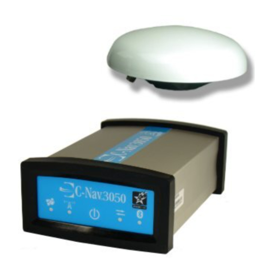
C-Nav Hardware Reference Guide Chapter 3 ......C-Nav DGNSS Hardware Specifications C-Nav3050 C-Nav3050 Receiver Figure 3-1: C-Nav3050 Base Plate Dimensions Without Mounting Brackets Figure 3-2: C-Nav3050 Base Plate Dimensions With Mounting Brackets... -
Page 25: Table 3-1: C-Nav3050 Physical And Environmental
Marine Equipment: Marine Equipment Directive (MED) 96/98/EC Table 3-2: C-Nav3050 I/O Messages Control Commands C-Nav proprietary commands (contact C-Nav Support for more information) (Input Only): RTCM 2.3 and 3.0, RTCM types 1, 3, and 9, SBAS (WAAS/EGNOS/ MSAS/ Differential Correction (I/O): GAGAN), and C-Nav CMR/CMR+, RTCM types 18-22, and 1001-1006, 1009-1012, 1014-1017;... -
Page 26: C-Nav3050 Antennas
GPS L2: 1227.60MHz, ±16MHz (Frequency is dependent on software bundle options.) GPS L2C: 1227.60MHz, ±16MHz GPS L5: 1176.45MHz, ±16MHz C-Nav L-Band: 1525 -1585 MHz GLONASS G1: 1603.00MHz, ±6.5MHz GLONASS G2: 1247.00MHz, ±5MHz Galileo E1: 1575.42MHz, ±16MHz Galileo E5A: 1176.45MHz, ±12.5 MHz Phase Centre GPS L1: 66mm (2.60in) -
Page 27: Figure 3-3: C-Nav3050 Standard Gnss Antenna Offset
C-Nav Hardware Reference Guide Figure 3-3: C-Nav3050 Standard GNSS Antenna Offset • Figure 3-3 is a drawing of the label on the Standard GNSS antenna (P/N NAV82- 001020-3001LF). The phase center provided is based on NGS test results. NGS does not currently provide GLONASS calibrated values. -
Page 28: Figure 3-5: C-Nav3050 Airborne (P/N Nav82-001022-3001Lf) Antenna Dimensions
C-Nav Hardware Reference Guide Figure 3-5: C-Nav3050 Airborne (P/N NAV82-001022-3001LF) Antenna Dimensions Figure 3-6: C-Nav3050 Base (P/N NAV82-001021-3001LF) Antenna Dimensions... -
Page 29: Figure 3-7: C-Nav3050 Standard & Airborne Antenna Radiation Pattern
C-Nav Hardware Reference Guide Figure 3-7: C-Nav3050 Standard & Airborne Antenna Radiation Pattern • Optimal antenna performance is realized at elevations greater than 25º. • There is a 10dB variation between 0º and 90º elevation (factor 10x); therefore, lower elevation satellites are always more difficult to track. -
Page 30: C-Nav1010
C-Nav Hardware Reference Guide C-Nav1010 C-Nav1010 Receiver Figure 3-9: C-Nav1010 Receiver without Mounting Brackets Figure 3-10: C-Nav1010 Receiver with Mounting Brackets... -
Page 31: Table 3-7: C-Nav1010 Physical And Environmental
DC Power: TNC-F GPS/L-band Antenna: L-band Antenna: TNC-F (C-Nav1010R Only) Antenna Power: ANT 1: 5.0 VDC, 150mA ANT 2 (C-Nav 1010R Only): 5.0 VDC, 150mA Temperature (ambient) Operating -30º to +70º C (-22º to +158º F) -40º to +85º C Storage: (-40º... -
Page 32: C-Nav1010 Antennas
C-Nav Hardware Reference Guide Figure 3-11: C-Nav1010 Power Supply C-Nav1010 Antennas Table 3-10: C-Nav1010 Standard Antenna Specifications Frequency 1525-1660 MHz GPS L1 plus C-Nav Polarization Right Hand Circular (RHCP) Pre–Amplifier 35dB gain (+/-1.2dB) Noise Figure <2.1dB Filter Rejection 9dB @ 1690MHz... -
Page 33: Table 3-11: C-Nav1010 L-Band Antenna Specifications (45° - 25°)
C-Nav Hardware Reference Guide 5” [127mm] 2.3” 1.5” [59mm] [38mm] Figure 3-12: C-Nav1010 Standard Antenna Dimensions Figure 3-13: C-Nav1010 Standard Antenna Radiation Pattern Table 3-11: C-Nav1010 L-band Antenna Specifications (45° - 25°) Part Number P/N: NAV82-001018-0001LF (45° - 25°) Frequency 1525-1575 MHz INMARSAT StarFire™... -
Page 34: Figure 3-14: C-Nav1010 L-Band Antenna Dimensions (45° - 25°)
C-Nav Hardware Reference Guide Operating Temp -55°C to +85°C Finish Skydrol resistant polyurethane Enamel base Iriditeper MIL-C-5541 Material 6061-T6 Aluminum alloy base composite radome, impact, abrasion, UV, solvent, skydrol resistant, and fire retardant Weight 5.2oz [146g] Vibration >30g’s Designed to... -
Page 35: Table 3-12: C-Nav1010 L-Band Antenna Specifications (<25°)
C-Nav Hardware Reference Guide Figure 3-16: C-Nav1010 NAV82-001018-0001LF Radiation Pattern (45° - 25°) Table 3-12: C-Nav1010 L-band Antenna Specifications (<25°) Part Number NAV82-001003-0001LF Frequency 1525-1585 MHz INMARSAT StarFire™ Polarization Right Hand Circular (RHCP) Pre–Amplifier 25dB gain min. (to coax end) Noise Figure 1.0dB typical... -
Page 36: Figure 3-17: C-Nav1010 Nav82-001003-0001Lf Antenna And Mounts (<25°)
C-Nav Hardware Reference Guide Figure 3-17: C-Nav1010 NAV82-001003-0001LF Antenna and Mounts (<25°) Figure 3-18: C-Nav1010 NAV82-001003-0001LF Radiation Pattern (<25°) -
Page 37: C-Nav2050
C-Nav Hardware Reference Guide C-Nav2050 C-Nav2050 Receiver Figure 3-19: C-Nav2050 Front View Figure 3-20: C-Nav2050 Top View... -
Page 38: Table 3-13: C-Nav2050 Physical And Environmental
C-Nav Hardware Reference Guide Table 3-13: C-Nav2050 Physical and Environmental Size (L x W x H): < 8.18” x 5.67” x 3.06” Weight: <4 lbs (1.81 kg) External Power: Input Voltage: 10 VDC to 30 VDC Consumption: Connectors: I/O Ports:... -
Page 39: Figure 3-21: C-Nav2050 Power Supply
C-Nav Hardware Reference Guide Figure 3-21: C-Nav2050 Power Supply Figure 3-22: C-Nav2050 RS-232 to DP RS-422 MOXA Converter (MOXTCC-801) • The C-Nav2050 chassis/ground is internally connected to the power ground, thus the Isolation Mount Adaptor may be needed when using DC power to prevent ground loops. -
Page 40: C-Nav2050 Antennas
C-Nav2050 Antennas Table 3-16: C-Nav2050 Standard Antenna Part Standard Antenna Part Number 8250001-0 Frequency 1525-1585 MHz, GPS L1, plus INMARSAT C-Nav Correction Service 1217-1237 MHz, GPS L2 L1 Phase Centre 58.7mm Polarization Right Hand Circular (RHCP) Pre–Amplifier 39dB gain (+/-2dB) Noise Figure <2.5dB... -
Page 41: Figure 3-24: C-Nav2050 Standard Antenna Phase Center Dimensions
C-Nav Hardware Reference Guide • To achieve the greatest level of accuracy, the absolute phase center values must be incorporated into your processing. Phase center information on this antenna is found on the antenna bottom, and in the figure below. -
Page 42: Figure 3-27: C-Nav2050 Standard & Airborne Antenna Radiation Patterns
C-Nav Hardware Reference Guide Figure 3-27: C-Nav2050 Standard & Airborne Antenna Radiation Patterns • Optimal antenna performance is realized at elevations greater than 30º. • There is a 10dB variation between 0º and 90º elevation (factor 10x); therefore, lower elevation satellites are always more difficult to track. -
Page 43: Table 3-18: C-Nav2050R Antenna
C-Nav Hardware Reference Guide Table 3-18: C-Nav2050R Antenna Part L-band C-Nav2050R Antenna Part Number 825R003-0 Frequency 1525-1576 MHz INMARSAT C-Nav Correction Service Polarization Right Hand Circular (RHCP) Pre–Amplifier 25dB gain min. (to coax end) Noise Figure 1.0dB typical Impedance 50 Ohms Input Voltage 3.0 to 5.5 VDC... -
Page 44: Figure 3-30: C-Nav2050R Antenna Radiation Pattern
C-Nav Hardware Reference Guide Figure 3-30: C-Nav2050R Antenna Radiation Pattern Figure 3-31: C-Nav2050R Antenna LNA Wide-band Response • Optimal antenna performance is realized at elevations between 10º and 50º. • There is an 8dB variation between 40º and 90º elevation (factor 6.3x); therefore, higher elevation satellites are always more difficult to track. -
Page 45: C-Nav1000
C-Nav Hardware Reference Guide C-Nav1000 C-Nav1000 Receiver Figure 3-32: C-Nav1000 Receiver Front View (mm) Figure 3-33: C-Nav1000 Receiver Top View (mm) Figure 3-34: C-Nav1000 Receiver Clearance Area... -
Page 46: C-Nav1000 Display
C-Nav Hardware Reference Guide Figure 3-35: C-Nav1000 RS-422 to DP RS-232 MOXA Converter (MOXTCC-801) C-Nav1000 Display Figure 3-36: C-Nav1000 Display Front View (mm) Figure 3-37: C-Nav1000 Display Top View (mm) -
Page 47: C-Nav1000 Antennas
C-Nav Hardware Reference Guide C-Nav1000 Antennas Beacon Receiver Specifications Beacon Frequency Range 283.5 - 325.0 kHz Beacon LNA Gain 34 dB L- band Receiver Specifications L- band Frequency Range N/ A L- band LNA Gain N/ A Power Input Specifications Input Voltage 4.0 - 13 VDC... -
Page 48: C-Nav1000 Display Mounting Options
C-Nav Hardware Reference Guide C-Nav1000 Display Mounting Options Gimbal Mount Figure 3-40: Gimbal Mount Clearance Area Panel Mount Figure 3-41: Panel Mount Frame Dimensions (mm) Figure 3-42: Clearance Distance Behind the Display (Panel Mount) -
Page 49: Figure 3-43: Panel Mount Hole Dimensions (Mm)
C-Nav Hardware Reference Guide Figure 3-43: Panel Mount Hole Dimensions (mm) Figure 3-44: Panel Mounting C-Nav1000 Display Figure 3-45: C-Nav1000 Display Panel Mounted... -
Page 50: Iala Gps System
C-Nav Hardware Reference Guide IALA GPS System IALA Receiver (MBX-3S, MBX-4) Operational Specifications: Operational SpecificationItem Specification Frequency Range 283.5 - 325 kHz Channels 2.5 μV/m for 10 dB SNR Input Sensitivity @ 100 bps MSK Rate Acquisition Time < 1 Second Typical... -
Page 51: Figure 3-46: Mbx-4 Receiver With Mounting Bracket (Top Mounted)
C-Nav Hardware Reference Guide Figure 3-46: MBX-4 Receiver with Mounting Bracket (Top Mounted) Figure 3-47: Bottom-view MBX-4 With Mounting Bracket (Bottom Mounted) Figure 3-48: IALA Receiver Mounting Bracket Dimensions... -
Page 52: Iala Whip Antenna Dimensions
C-Nav Hardware Reference Guide IALA Whip Antenna Dimensions This antenna, referred to as an E-field whip antenna, is sensitive to the electrical field of contained in the base of the MBA-3, which together amplify signals in the 283.5 to 325.0 kHz frequency band. -
Page 53: C-Navigator Ii
C-Nav Hardware Reference Guide C-NaviGator II C-NaviGator II Control and Display Unit Figure 3-49: C-NaviGator II Display (Front View) Figure 3-50: C-NaviGator II Side-panel Connectors Figure 3-51: C-NaviGator II Power Supply... - Page 54 C-Nav Hardware Reference Guide Mechanical Specifications Size (L x W x H) 82.2mm (3.2”) x 340mm (13.4”) x 260mm (10.2”) Weight 4.8 kg (10.6 lbs) Display 10.4” TFT LCD, 1024x768, 400 nit, Resistive TS 1.0 GHz VIA 7C, 512 MB, 2GB CF...
-
Page 55: C-Navigator Ii Mounting Options
C-Nav Hardware Reference Guide C-NaviGator II Mounting Options Option #1: Allows mounting from ceiling, wall or desktop with fully adjustable positioning. Figure 3-52: RAM 100 75 VESA Base (w/ Steel Reinforce) / RAM-D-246U-IN1 This piece fits to the standard VESA mounting holes on the back of the C-NaviGator. -
Page 56: Figure 3-55: Flat Screen Table Stand (For C-Navigator Ii) / Chifsb018Blk
C-Nav Hardware Reference Guide Option #2: Desktop Stand Figure 3-55: Flat Screen Table Stand (for C-NaviGator II) / CHIFSB018BLK Option #3: Wall Mount Figure 3-56: Tilting VESA Wall Mount (for C-NaviGator II) / PEEST630... -
Page 57: Figure 3-57: Front Mount Kit (For C-Navigator Ii) / Syniwo-6710-7Crbr2
C-Nav Hardware Reference Guide Option #4: Front Panel Mount Use this adaptor if unable to secure display from the back. Appropriate hardware is included to secure the C-NaviGator to the Front Panel Mount prior to mounting. Bolt thread size is M4 x... -
Page 58: Figure 3-58: 19" Mounting Kit (For C-Navigator Ii) / Syniwo-6710-7Cbr9
C-Nav Hardware Reference Guide Option #5: 19” Rack Mount Use this adaptor if installing the C-NaviGator to a rack. The 19” Rack Mount takes up 7U of rack space and is 12 ¼” in height. Appropriate hardware is included to secure the C-NaviGator to the Rack Mount prior to mounting. -
Page 59: Figure 3-59: C-Navigator Ii (Side Usb-Port Model) Outline Diagram (Mm)
C-Nav Hardware Reference Guide Figure 3-59: C-NaviGator II (side USB-port model) Outline Diagram (mm) Both inside and outside mounting holes on vesa mount are M4 x 16mm in size. Inside holes have 75mm spacing Outside holes have 100mm spacing... -
Page 60: Figure 3-60: C-Navigator Ii Cut-Out Diagram (Mm)
C-Nav Hardware Reference Guide Figure 3-60: C-NaviGator II Cut-out Diagram (mm) Cut-out Panel includes hardware to facilitate bolting of the C-NaviGator from the rear via M4 x 16mm sized bolts (6 places) or from the front via M4 or #10 sized bolts (4 places, rev. A only) -
Page 61: Figure 3-61: C-Navigator Ii Rev. A (Front Usb-Port Model) Outline Diagram (Mm)
C-Nav Hardware Reference Guide Figure 3-61: C-NaviGator II rev. A (front USB-port model) Outline Diagram (mm) -
Page 62: C-Navigator Ii Lcd Touch-Screen Care And Cleaning
C-Nav Hardware Reference Guide C-NaviGator II LCD Touch-screen Care and Cleaning LCD screens are not like ordinary monitor screens in that they are not made of glass, rather they are made up of a soft film that can easily be damaged by abrasive cloth or paper, chloride and other chemicals found in ordinary tap water. -
Page 63: Chapter 4 Hardware Accessories
C-Nav Hardware Reference Guide Chapter 4 ........... Hardware Accessories Huber + Suhner Lightning Protectors Model No. 3403.17.0045 Specifications... -
Page 64: Model No. 3403.17.0045 Dimensions
C-Nav Hardware Reference Guide Model No. 3403.17.0045 Dimensions Figure 4-1: Huber + Suhner Model No. 3403.17.0045... -
Page 65: Model No. 3402.17.0070 Specifications
C-Nav Hardware Reference Guide Model No. 3402.17.0070 Specifications... -
Page 66: Model No. 3402.17.0070 Dimensions
C-Nav Hardware Reference Guide Model No. 3402.17.0070 Dimensions Figure 4-2: Huber + Suhner Model No. 3402.17.0070... -
Page 67: Huber + Suhner Lightning Protector Mounting Instructions
C-Nav Hardware Reference Guide Huber + Suhner Lightning Protector Mounting Instructions... - Page 68 C-Nav Hardware Reference Guide...
-
Page 69: Moxa Converters
C-Nav Hardware Reference Guide MOXA Converters TCC-80I TCC-80I Specifications... -
Page 70: Tcc-80I Dimensions
C-Nav Hardware Reference Guide TCC-80I Dimensions Figure 4-3: Moxa TCC-80I Converter Dimensions TCC-82... -
Page 71: Tcc-82 Specifications
C-Nav Hardware Reference Guide TCC-82 Specifications TCC-82 Dimensions Figure 4-4: TCC-82 Converter Dimensions... -
Page 72: Times-Microwave Lmr400 Coaxial Cable
C-Nav Hardware Reference Guide Times-Microwave LMR400 Coaxial Cable LMR400 Specifications... -
Page 73: Lmr400 Connectors
C-Nav Hardware Reference Guide Figure 4-5: LMR400 Attenuation vs. Frequency Graph LMR400 Connectors Figure 4-6: LMR400 Connectors... - Page 74 C-Nav Hardware Reference Guide...
-
Page 75: Chapter 5 Technical Reference And Interface Guide
C-Nav Hardware Reference Guide Chapter 5 ...... Technical Reference and Interface Guide Coaxial Cable Terminating Coaxial Cable (Times Microwave Systems) 1. Flush cut the cable squarely Figure 5-1: Components for Termination of Coaxial Cable 2. Slide the heat shrink boot over the end of the cable, followed by the ferrule. Slide the first end of the prep/strip tool over the end of the cable and rotate it clockwise. -
Page 76: Figure 5-3: Duburring Tool
C-Nav Hardware Reference Guide 3. Debur the center conductor using a deburring tool or a file. Figure 5-3: Duburring Tool 4. Insert the cable into the opposite end of the prep/strip tool and rotate clockwise until the tool spins freely. Remove the tool (If you are using a knife to complete this step, be careful not to nick the braids). -
Page 77: Figure 5-5: Rma Flux Application
C-Nav Hardware Reference Guide 5. Apply a small amount of RMA flux around the exposed center conductor. Figure 5-5: RMA Flux Application 6. Place a piece of solder into the pin until it bottoms. Trim the solder flush with the back of the pin with a knife. -
Page 78: Figure 5-7: Connector Installation
C-Nav Hardware Reference Guide 7. Remove the shim and slide the connector over the pin. Once the connector has been pushed all the way on so that the connector bottoms out onto the core, slide the ferrule over the braid, making an impression in the braid at the point that it protrudes between the ferrule and the connector. -
Page 79: Coax-Seal® Weather Sealant Installation
C-Nav Hardware Reference Guide Coax-Seal® Weather Sealant Installation 1. Shown below is a short pigtail of RG-59U coax cable terminated in a Snap and Seal "F" connector which is then joined to a female-female adapter or barrel connector. Figure 5-9: RG-59U Coaxial Cable 2. -
Page 80: Figure 5-11: Coax-Seal Roll
C-Nav Hardware Reference Guide 3. The second cable with connector is attached to the barrel adapter and was tightened. The connector on the right has an O ring and is sealed to the coax internally with silicone grease. Figure 5-11: Coax-seal Roll 4. -
Page 81: Figure 5-13: Coaxial Cable Fully Sealed
C-Nav Hardware Reference Guide 5. Note that the first wrap comes back on itself exactly and the second run starts the diagonal wrap. Wrap from the coax cover toward the fitting with one half overlap with each winding. The last wrap again comes straight back over the previous wrap without a diagonal. -
Page 82: Table 4-1: Coax-Seal Product Specifications
C-Nav Hardware Reference Guide Table 4-1: Coax-Seal Product Specifications COAX-SEAL PRODUCT SPECIFICATIONS • PACKAGING: 60” consumer rolls, 3/32" thick x 1/2" wide, in retail packaging for pegboard or counter display. • 12’ industrial rolls, 3/32" thick x 1/2" wide or 1” wide. -
Page 83: Chapter 6 Glossary
Chapter 6 ................ Glossary Troubleshooting The following information is provided for the use and operation of C-Nav DGNSS Systems. It is recommended that you read through this chapter before calling C-Nav Support. Refer to p. 2 for C-Nav 24/7 support contact information. You can also visit www.cnavgnss.com/faq... - Page 84 RF interference from power lines or high power radio transmitters, you may not receive the C-Nav corrections. High voltage power lines can be a severe source of noise, particularly if there is a leaky insulator or other source of corona discharge.
- Page 85 C-Nav Hardware Reference Guide Loss of Settings When the Unit is Powered Off C-Nav GNSS Receiver configuration parameter settings are stored in battery-backed RAM (random access memory). The internal lithium battery has a 10-year life span. You can assume the Lithium battery has failed when the receiver no longer retains configuration parameter setting changes.
-
Page 86: Abbreviations
C-Nav Hardware Reference Guide Abbreviations 1PPS - 1 Pulse Per Second 2dRMS – Twice the distance Root Mean Square A/S – Antispoofing APC – Antenna Phase Center BER - Bit Error Rate bps – bits per second BSW – British Standard Whitworth C/A –... - Page 87 C-Nav Hardware Reference Guide IGN - Ignition IMO – International Maritime Organization INMARSAT – International Maritime Satellite Consortium, Ltd. INS – Inertial Navigation System IODC – Issue of Data, Clock ITRF – International Terrestrial Reference Frame JPL – Jet Propulsion Laboratory Kbps –...
- Page 88 C-Nav Hardware Reference Guide RINEX – Receiver Independent Exchange RMS – Root Mean Square RTCM - Radio Technical Commission for Maritime Services RTG – Real-time Gypsy RTK – Real-time Kinematic S/A – Selective Availability SBAS – Satellite Based Augmentation System SEP –...
-
Page 89: Definitions
C-Nav Hardware Reference Guide Definitions 1 Pulse Per Second (1PPS) is a precision electronic pulse output (at TTL levels) from the GPS receiver that marks exact second intervals. It is used for precise timing and to synchronize sensors and acquisition computers. - Page 90 Azimuth the azimuth of a line is its direction as given by the angle between the meridian and the line measured in a clockwise direction from the north branch of the meridian. Bad Packets refer to the number of bad C-Nav Corrections Service packets received since the unit was turned on.
- Page 91 Consolidated Space Operations Center (CSPOC) at Colorado Springs, Colorado. Convergence Period (C-Nav) is the time necessary for the received C-Nav signal corrections to be applied and the position filtered to optimal performance. The convergence period is typically 30 to 45 minutes to achieve decimeter accuracy.
-
Page 92: Figure 6-1: Dte To Dce Rs-232 Pin Assignments
C-Nav Hardware Reference Guide igure 6-1: DTE to DCE RS-232 Pin Assignments Deflection of the Vertical is the angle between the perpendicular to the geoid (plumb line) and the perpendicular to the ellipsoid. DGPS see Differential GPS. Differencing is a technique used in baseline processing to resolve the integer cycle ambiguity and to reduce a number of error sources including oscillator variations and atmospheric and orbital modeling errors. - Page 93 C-Nav Hardware Reference Guide Dynamic Mode when a GPS receiver operates in dynamic mode, it assumes that it is in motion and certain algorithms for GPS position fixing are enabled in order to calculate a tighter position fix. Dynamic Positioning (GPS) is the determination of the position of a moving receiver such as one mounted on a boat.
- Page 94 C-Nav Hardware Reference Guide Geoidal Height is the undulation of the geoid above or below the reference ellipsoid. Geographical Information System (GIS) is a computer system capable of assembling, storing, manipulating, updating, analyzing and displaying geographically referenced information, i.e. data identified according to their locations. GIS technology can be used for scientific investigations, resource management, and development planning.
- Page 95 C-Nav Hardware Reference Guide L-band is the group of radio frequencies extending from approximately 400MHz to approximately 1600MHz. The GPS carrier frequencies L1 (1575.4MHz) and L2 (1227.6 MHz) are in the L-band range. L1 carrier frequency is the primary L-band carrier used by GPS satellites to transmit satellite data.
- Page 96 C-Nav Hardware Reference Guide or more objects—the ground, a vehicle, boat, building or some other surface—and once received by the antenna, will yield a larger pseudo-range estimate and increase the error. Multipath Error is a positioning error resulting from interference between radio waves that has traveled between the transmitter and the receiver by two paths of different electrical lengths.
- Page 97 C-Nav Hardware Reference Guide Post-processing is a method of differential data correction, which compares data logged from a known reference point to data logged by a roving receiver over the same period of time. Variations in the position reported by the reference station can be used to correct the positions logged by the roving receiver.
- Page 98 Rover is any mobile GPS receiver and field computer collecting data in the field. A roving receiver’s position can be differentially corrected relative to a stationary reference GPS receiver or by using GPS orbit and clock corrections from a SBAS such as C-Nav. Roving Receiver see rover Satellite Based Augmentation System (SBAS) this is a more general term, which encompasses WAAS, C-Nav and EGNOS type corrections.
- Page 99 C-Nav Hardware Reference Guide secure. Because spread spectrum signals are so wide, they can be transmitted at much lower spectral power density (Watts per Hertz), than narrow band signals. Standard Deviation is a measure of how widely values are dispersed from the mean. The larger the standard deviation is, the more spread out the values are from the mean.
Need help?
Do you have a question about the IALA and is the answer not in the manual?
Questions and answers