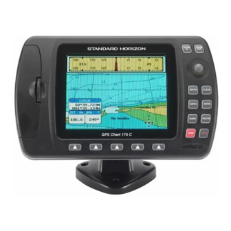
Standard Horizon CP1000C Addendum
Max functions description
Hide thumbs
Also See for CP1000C:
- Owner's manual (82 pages) ,
- Owner's manual addendum (1 page) ,
- Owner's manual (41 pages)
Table of Contents
Advertisement
Quick Links
MAX FUNCTIONS DESCRIPTION
Addendum
STANDARD HORIZON
Copyright 2005.
All rights reserved. Printed in Italy.
No part of this publication may be reproduced or distributed in any form or by any means, or stored in a database
or retrieval system, without prior written permission of the publisher.
CODE: IssueB - 010305
Advertisement
Table of Contents

Related Manuals for Standard Horizon CP1000C


Summary of Contents for Standard Horizon CP1000C
- Page 1 MAX FUNCTIONS DESCRIPTION Addendum STANDARD HORIZON Copyright 2005. All rights reserved. Printed in Italy. No part of this publication may be reproduced or distributed in any form or by any means, or stored in a database or retrieval system, without prior written permission of the publisher.
-
Page 2: Table Of Contents
4.0.0 How to show the pictures or diagrams of a Multimedia Object ... 15 4.0.1 How to show the pictures or diagrams of a cartographic object ... 16 4.1 ENHANCED PORT INFO ... 17 Page 4 CP1000C ) ... 8 ONLY ADDENDUM... -
Page 3: About This Addendum
When a word(s) is bold capital letters and underlined, this refers to a menu selection item. Any menu operation and function activation in this Addendum is related to all GPS chartplotter models (see the following table). Whenever it is necessary, a note has been inserted for those models with differences. -
Page 4: Max Overview
MAX operating system and also the improved North America base map. After the card is received perform the following procedure: 1. Turn off the Standard Horizon GPS Chart Plotter 2. Remove the C-Map cartography card. 3. Insert the C-Map MAX upgrade card 4. - Page 5 The screen will be blank for about 40 seconds then a Internal WWB chart upload status screen will be shown. On this screen you will notice the GPS chartplotter will erase the old WWB ground area, write the new background to the GPS chartplotter, and verify the data has been loaded correctly.
-
Page 6: Map Functions
ShuttlePoint knob to the left a few times. 3.0.1 Fonts & Symbols (for CP1000C only) On MAX charts it is possible to set the size of all names and symbols drawn on the charts, selecting between Normal size (the regular characters size) and Large size. -
Page 7: Perspective View
To activate this function follow the procedure: 1. Press [MENU]. Move the ShuttlePoint knob to highlight MAX FUNCTIONS and press [ENTER] or move the ShuttlePoint knob to the right. 2. Move the ShuttlePoint knob to highlight FONTS & SYMBOLS and press [ENTER] or move the ShuttlePoint knob to the right. -
Page 8: Dynamic Nav-Aids
3.0.3 Dynamic Nav-Aids This function allows settings blinking lights on Nav-Aids. The blink period and color of each Nav-aid is read from the Nav-Aid attributes available on the data cartridge. When the ship is inside the Nav-Aid nominal range, the light of the Nav-Aid will start blinking. To activate this function follow the procedure: 1. -
Page 9: Currents Prediction
2. Move the ShuttlePoint knob to highlight [ENTER] or move the ShuttlePoint knob to the right. 3. A window is shown on the low-left side of the chart. On the CP175C and CP1000C, press ] to set the date and time manually, and [I increase time;... -
Page 10: Marine Settings
When data/time is available, Tidal stream arrows are shown on the charts, indicating the direction and strength of the Tide. If no data/time is available from the GPS or the chart plotter is not in Simulation mode, the icon on the map is generic one. The color of the arrow denotes... -
Page 11: Depth Settings
VAD object. Mixing Levels : When the map coverage at the current chart scale does not fill the entire display, the GPS chartplotter draws the rest of the map using charts from above and below the current scale. When this function is turned on you will notice the display may redraw 2 to 3 times to show all the details. - Page 12 Sunlight (default) is designed to enhance the visibility of the screen when the GPS chartplotter is exoposed to sunlight. The maps are much brighter than in the other modes and the depth areas are filled with the white color so different depth areas not easily distinguishable.
-
Page 13: Data Features
4. DATA FEATURES This chapter contains new features related to the MAX map data files (ie: cartography and related data) that have been added. PICTURES & DIAGRAMS Using C-Map MAX data cards allows you to show pictures or diagrams on the chart plotter display. -
Page 14: How To Show The Pictures Or Diagrams Of A Cartographic Object
Figure 4.0.0b - Example of Full Info on MULTIMEDIA object On the Full Info, there will be the small camera icon on a corner of the square containing the object icon. To see the picture press [MENU] when the object with a picture is highlighted. When the picture is shown, it is possible to fit it to screen by pressing [ENTER]. -
Page 15: Enhanced Port Info
Press [ ] or [ENTER] for 1second to display the image on the screen or press [ EXPAND MAGE or [ENTER] to open the Full Info on the object: Figure 4.0.1b - Example of Full Info on object with picture On the Full Info, there will be the small camera icon on a corner of the square containing the object icon. - Page 16 Product or part(s) therein which, upon examination by STANDARD HORIZON, appear to be defective or not up to factory specifications. STANDARD HORIZON may, at its option, repair or replace parts or subassemblies with or reconditioned parts and subassemblies.
Need help?
Do you have a question about the CP1000C and is the answer not in the manual?
Questions and answers