Table of Contents
Advertisement
Advertisement
Table of Contents

Subscribe to Our Youtube Channel
Summary of Contents for Saab R4
- Page 1 Saab TransponderTech OPERATOR’S MANUAL R4 Navigation System...
- Page 2 The entire contents of this manual and its appendices, including any future updates and modifications, shall remain the property of Saab TransponderTech AB at all times. The contents must not, whether in its original form or modified, be wholly or partly copied or reproduced, nor used for any other purpose than the subject of this manual.
-
Page 3: Table Of Contents
Getting Started ............11 Front Panel Keys How to Operate the R4 Display Views and Function Keys Change Settings Alarm Pop-ups Turning On and Off the R4 Display System Modes Status Bar Status Icons RAIM Accuracy Level Show Current Position... - Page 4 Adjusting Settings Man Over Board Event Mark Alarm Pop-ups Changing System Mode Navigate Mode Overview Position GPS Status Beacon Status Satellite Info SBAS Info Set RAIM Active Route Edit Active Route Plot User Defined Trip Logs Trip Log Details Anchor Watch Route List Plan Voyage Mode Overview...
- Page 5 View Time Alert View ETA Alert Config Mode Overview Time Config Display Config Visual Config Sound Config Nav Config Alarm Config Units Config GPS/DGPS Config GPS Config Beacon Config SBAS Config Redund Config I/O Config Input Config Compass Config Depth Config Wp/Rte Input Output Config Port Rate Config...
-
Page 7: Product Description
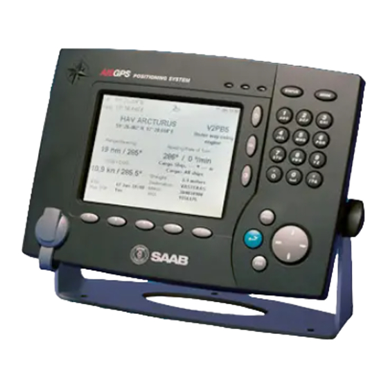
R4 DGPS Navigation Sensor and an MGL-4 combined GPS/Beacon antenna. The R4 Display provides a graphical interface to the system. Via the display it is possible to create, edit and modify routes and waypoints, navigate following a route, plot the route, view sensor data, perform setup as well as supervise the systems status. -
Page 8: Main Features
• Upgradeable without hardware modifications due to fully integrated DSP solution. • Output of GPS positioning information on User port 1 and 2, enabling external sys- tems to connect to and use the GPS information from the R4 Navigation Sensor. • Meets the following standards: •... -
Page 9: Concepts And Terminology
RAIM Status The RAIM status can be one of safe, caution and unsafe, and is indicated by the LEDs on the front of the R4 Display. Navigation Algorithm The navigation algorithm is the algorithm used for calculating the course to steer to reach the next waypoint. - Page 10 Great Circle Navigation The great circle navigation algorithm calculates a course line that is the shortest path be- tween two points on the surface of the earth. Using this navigation algorithm, course to steer when navigating towards a waypoint is not constant. The resulting track of this nav- igation algorithm will differ from the straight line drawn on a Mercator projected chart.
-
Page 11: Getting Started
Front Panel Keys POWER Used for turning the R4 Display on and off. To turn the power off press and hold the key for 3 seconds. Used to mark the spot of an event or when a person has fallen overboard. To mark an event, press the key momentarily. -
Page 12: How To Operate The R4 Display
PAGE provides access to additional pages of function keys in some views. An example view is shown below. In the following sections of the manual the views of the R4 Navigation Sys- tem are described. System status... -
Page 13: Alarm Pop-Ups
The R4 Display will power up in the Navigate mode, showing the Position view. The dif- ferent modes and the basic operation of the R4 Navigation System are described in the following sections. -
Page 14: System Modes
System Modes System Modes The user interface of the R4 Display has four different system modes, which each corre- spond to different types of user activities. The four modes are Navigate, Plan Voyage, Alarms & Msgs and Config. Current mode is... - Page 15 91 and onwards in the Reference chapter. Config Mode The Config mode comprises functions used to setup and configure the R4 Navigation Sys- tem. It includes functions for modifying visual and sound settings, navigation settings, disable and enable different alarms, used units, GPS and beacon settings, serial port set- tings and viewing system information.
-
Page 16: Status Bar
Status Bar Status Bar The top of the screen of the R4 Display always displays a summary of the system’s status. See illustration below. Current RAIM accuracy level Current position Status icons Current time (UTC) If a valid navigation position is available, it is displayed to the left. The status icons are displayed in the middle, and to the right current RAIM accuracy level (in meters) and time is shown. -
Page 17: Raim Accuracy Level
The LEDs on the front of the R4 display will show the RAIM status. The green LED in- dicates safe state; the calculated position accuracy is better than the set accuracy level. -
Page 18: Show Current Position
Waypoints are the basis for ship navigation. A waypoint is a position on the earth surface that is given a unique name and stored in the memory of the R4 Display. Waypoints can be entered in several different ways, and used for building routes as well as for direct nav- igation to a specific position. -
Page 19: Create New Waypoint
Show Current Position Create New Waypoint Create New Access the Waypoint List view as described above. Press the function key . The Create Waypoint view is displayed. To name the waypoint, select the Name field using ∧ and press ENTER . -
Page 20: Sail To A Waypoint
Sail To a Waypoint Sail To a Waypoint The R4 Navigation System supports sailing directly to a waypoint. Starting to sail to a waypoint is done in Plan Voyage mode, just as creating waypoints. The mode is accessed by pressing the...


Need help?
Do you have a question about the R4 and is the answer not in the manual?
Questions and answers
How to insert data