Advertisement
Quick Links
Download this manual
See also:
User Manual
GS20 Quickguide – WoRCS RTS
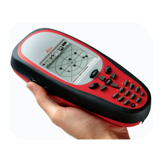
Powering Up the Unit
The GS20 operates on a single battery. Once a battery is fully charged, you are ready to power up
the GS20.
Remember: Although the unit can power on without the flash card, most functionality will not be
available.
1. Open the GS20 Battery door by turning the door latch 90 degrees counterclockwise, and pull open the
battery door.
2. Place the battery in the well with the gold contacts facing down and making contact.
3. Shut the battery door and return the latch to the locked position, with the spin arrow facing upward
toward the dot on the housing.
4. On the keypad, depress the Power Button in the Lower Left corner, just left of the 0 key. Startup will
be followed by an audible tone, then after a memory check (2 to 3 seconds) the GS20 Splash Screen will
be followed by the Main Menu.
5. Once the Main Menu appears, the receiver will begin to search and acquire satellites.
Make sure that the GS20 has a clear view of the sky!
Advertisement

Subscribe to Our Youtube Channel
Related Manuals for Leica GS20


Summary of Contents for Leica GS20
-
Page 1: Powering Up The Unit
4. On the keypad, depress the Power Button in the Lower Left corner, just left of the 0 key. Startup will be followed by an audible tone, then after a memory check (2 to 3 seconds) the GS20 Splash Screen will be followed by the Main Menu. - Page 2 ALMANAC Initially (first time use, out of the box) the GPS unit will not have an Almanac. The almanac is a library of satellite orbits, that helps the GPS locate the satellites more quickly. When using the unit for the first time, or after a long period without use, it may take several minutes to acquire a position.
-
Page 3: Differential Corrections
GETTING YOUR FIRST POSITION In order to collect Data, it will be necessary to have a GPS Position. Power on the GS20 outside with a clear sky view and the receiver will begin to track satellites and calculate a position. - Page 4 This can be seen by selecting Staus|GPS|Satellite View or by simply checking the Satellite Indicator. Connecting to WoRCS Real Time Satellite (RTS) If you purchased the Leica Geosystems GS20 with the Wireless real-time Correction System, the WoRCS, you are only steps away from collecting real-time sub-meter data. The WoRCS comes pre- configured with the Blue- tooth linked to your GS20.
- Page 5 2.Expand the Wireless tree, expand the Bluetooth, and view WoRCS. 3.If the GS20 has been linked to the WoRCS Bluetooth Module (see page 35), an address that corresponds to the address on the top of the Bluetooth Module will appear. If the address does not correspond, press menu and select clear.
- Page 6 6.Press Inquire and wait until the Cancel button becomes Inquire again. 7.You will see the Available Devices in the choice list. By highlighting the available devices and pressing Enter, you will see the entire list of available bluetooth devices in the choice list. If multiple devices have been found, select the device that matches your WoRCS bluetooth address, displayed on the top of the bluetooth module.
- Page 7 WoRCS RTS 1. From the Main Menu select Status. Expand the Interfaces branch and select Real-Time. If you have communication with the RACAL module (RTS), you will see information about the Station ID, frequency, signal strength etc. The real-time screen does not refresh automatically; to refresh the values, you will need to escape and re-enter.
-
Page 8: Collecting Data
Data Collection map. Code Management Because the Leica Geosystems GS20 is designed for GIS data creation and update, existing feature layer will be used as a code template for each particular job. Additional codelists can be attached to a job via Codelist Manager. - Page 9 Attribution After a code is selected, press Enter to open the attribution screen. By default the focus is on the Occupy button; however, by using the cursor and Enter key, attribution values can be entered. Additional occupation selections can be accessed via the context menu. Point Collection Point collection is often as simple as entering attributes, pressing Occupy and Save;...
- Page 10 Line and Area Collection Unlike point collection, lines and areas offer multiple methods of collection; noding (i.e. collecting by vertex), streaming by time or distance, locating nodes by point offsets, creating linear offsets to either side of the collected line, pasting a node from the clipboard, and nesting additional features. Because the Start/Stop button is necessary to both stop in noding and pause in streaming, features must be saved by the Done button or the Save Feature in the context menu.
- Page 11 Modes of Collection When a line or area feature is selected, the attribution screen will display the current mode of collection (i.e. stream or node.) The last selected mode becomes the default by being stored in the user’s recent value file. 2 Node Mode or noding is the manual collection of nodes or “vertices.”...
Need help?
Do you have a question about the GS20 and is the answer not in the manual?
Questions and answers