
Related Manuals for Amazone GPS-Switch


Summary of Contents for Amazone GPS-Switch
- Page 1 Operating Manual GPS-Switch On-board computer Please read this operating ma- nual before first MG3442 commissioning. BAG0059.8 11.12 Keep it in a safe place for Printed in Germany future use.
- Page 2 Only in this way could you be satisfied both with the machine and with yourself. This goal is the purpose of this instruction manual. Leipzig-Plagwitz 1872. GPS-Switch BAG0059.8 11.12...
- Page 3 + 49 5405 501-234 E-mail: amazone@amazone.de Spare part orders Spare parts lists are freely accessible in the spare parts portal at www.amazone.de. Please send orders to your AMAZONE dealer. Formalities of the operating manual Document number: MG3442 Compilation date: 11.12 ...
- Page 4 Send us your suggestions by fax. AMAZONEN-WERKE H. DREYER GmbH & Co. KG Postfach 51 D-49202 Hasbergen Tel.: + 49 5405 501-0 Fax: + 49 5405 501-234 E-mail: amazone@amazone.de GPS-Switch BAG0059.8 11.12...
-
Page 5: Table Of Contents
User Information ..................7 Purpose of the document......................7 Locations in the operating manual...................7 Diagrams used .........................7 General Safety Instructions ................8 Representation of safety symbols....................8 Safety instructions for the GPS-Switch ................9 Installation instructions ................10 Connection diagram.......................10 Connections on the GPS-Switch...................10 Product description ...................11 GPS-Switch..........................11 GPS track (option) .........................11... - Page 6 Lead tracks via A+ guide pattern ..................58 Setup (GPS track) ......................... 59 7.5.1 Guide pattern......................... 59 7.5.2 Travel beds..........................60 Fault......................61 Maintenance....................65 USB stick data management....................65 Selecting EGNOS satellites ....................66 Carrying out a software update ..................... 67 Storage..........................69 GPS-Switch BAG0059.8 11.12...
-
Page 7: User Information
Numbers in round brackets refer to the item numbers in the diagrams. The first number refers to the diagram and the second number to the item in the figure. Example: (Fig. 3/6) Figure 3 Item 6 GPS-Switch BAG0059.8 11.12... -
Page 8: General Safety Instructions
Non-compliance with these instructions can cause faults on the machine or in the environment. NOTE Indicates handling tips and particularly useful information. These instructions will help you to use all the functions of your machine to the optimum. GPS-Switch BAG0059.8 11.12... -
Page 9: Safety Instructions For The Gps-Switch
General Safety Instructions Safety instructions for the GPS-Switch WARNING In automatic mode, the spread fan of the fertiliser spreader po- ses a danger to persons in the working area. The danger may arise through the automatic opening of the shutter. -
Page 10: Installation Instructions
If the GPS antenna was previously mounted on the machine, for the calibration of existing reference points the altered antenna position must be taken into account - see page 47. Connections on the GPS-Switch Fig. 1/… (1) Y-cable connection. (2) GPS receiver connection. -
Page 11: Product Description
These disadvantages can be prevented using a GPS-Switch connected to a GPS receiver. The GPS-Switch enables positionally accurate switching on the headland, on the field edge or when driving around obstacles. -
Page 12: Design
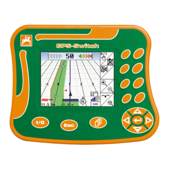
Fig. 2 Content of the GPS package (1) Terminal for GPS switch (2) Bracket for terminal (3) USB memory stick (4) Cable package Series connector cable Zero modem cable Y-cable GPS-Switch BAG0059.8 11.12... -
Page 13: Software Version
1. Select 2. Confirm GPS-Switch USB interface The GPS-Switch has a USB interface for data exchange with a USB memory stick (included in the delivery). Main menu The main menu is divided into 3 submenus into which the required data must be entered before beginning work (Fig. -
Page 14: Work Menu
Before the work menu is visible, the machine must be created in the Settings/machine geometry menu. Main menu work menu During operation, the GPS-Switch displays the work menu. Fig. 4, display of field border in the work menu. Fig. 4 Fig. 5, display of partially treated field in the work menu. - Page 15 Fig. 6, display of partially treated headland in the work menu. Fig. 6 Fig. 7, display of completely tilled field in the work menu. Fig. 7 Fig. 8, Display in 3D, Application maps loaded in the Work menu. Fig. 8 GPS-Switch BAG0059.8 11.12...
-
Page 16: Gps Diagnosis Menu
Product description 4.11 GPS diagnosis menu Main menu GPS- diagnosis menu GPS data display The GPS diagnosis shows current data about the GPS signal and the raw data for troubleshooting. Fig. 9 GPS-Switch BAG0059.8 11.12... -
Page 17: Hierarchy Of The Gps-Switch Menu
Product description 4.12 Hierarchy of the GPS-Switch menu Work menu Main menu diagnosis Manual / Settings Setup automatic Lot data Machine ge- GPS-Switch (Rec) ometry Define the field border Field view lar-... -
Page 18: Keys And Function Fields
Move cursor up in display Increase specified quantity during work by percentage applica- tion rate increase (e.g.:+10%). Move cursor down in display Reduce specified quantity during work by percentage application rate decrease (e.g.:-10%). GPS-Switch BAG0059.8 11.12... -
Page 19: Shift Key
If the Shift key is active, this is indicated on the display (Fig. 12). When the Shift key is actuated, further func- tion fields appear (Fig. 13) and the assign- ment of the function keys is altered accord- ingly. Fig. 11 Fig. 12 Fig. 13 GPS-Switch BAG0059.8 11.12... -
Page 20: Entries On The Gps-Switch
4.15 Entering text and numbers If it is necessary to enter texts or numbers on the GPS-Switch, the input menu (Fig. 15) ap- pears. In the lower part of the display, a selection field appears with letters, numbers and arrows (Fig. -
Page 21: Selection Of Options
Again press function key Function off. Fig. 17 4.16 Definition of the GPS parameters Global Positioning System DGPS Differential GPS Correction system increases accuracy to +/- 0.5 m to 0.02 m. Dilution of Precision (Quality of GPS values) GPS-Switch BAG0059.8 11.12... -
Page 22: Requirements For The Gps Quality
Worked area is shown in yellow Poor quality: GPS too imprecise. Field is no longer shown on the GPS-Switch. Thus the worked area is also not marked, which means that neither automatic mode nor creating a field border is pos- sible. -
Page 23: Commissioning
4. Confirm selection. 5.1.2 Connection to a third-party GPS system If using a third-party GPS system instead of the AMAZONE GPS receiver, the following entries must be made on the GPS system: Serial interface must be present, Connection via 9-pin sub-D RS232 connector ... -
Page 24: Basic State
Select the machine that is present. (See page 25). Select the previously entered ma- chine or a new machine via Activate a selected machine for work using the GPS-Switch. The active machine is shown on the display. GPS-Switch BAG0059.8 11.12... -
Page 25: Creating A New Machine
Specify GPS x as negative value. Fertiliser spreader: In order to adjust the switch-off point of the fertil- iser spreader, the GPS value x can be manipulated. Manipulating the switch-on point according to headland distance - see page 31. GPS-Switch BAG0059.8 11.12... - Page 26 The working width resulting from the en- tered machine data is determined and dis- played automatically. Save the entry. The save process is displayed. Return to the Set machine geome- try menu. Activate the new machine. Changes are applied. GPS-Switch BAG0059.8 11.12...
-
Page 27: Setup Gps Switch Menu
- see page 31. Fig. 22 By means of machine modelling, the various characteristics of the different ma- chine types are simulated. Fig. 23 deactivated (machine with three-point attachment) Pulled machine Self-propelled machine GPS-Switch BAG0059.8 11.12... - Page 28 Manual device geometry settings, see page 33. Field sprayer: Automatic boom lowering within the field boundary. Enter the time in milliseconds. Time before switching on the sprayer in which the booms are lowered. Default: 0 ms Maximum: 5000 ms GPS-Switch BAG0059.8 11.12...
-
Page 29: Degree Of Overlap
The part width section is not switched off until there is complete overlap of a part width section. For field sprayer only: At the border, work is always carried out with a degree of overlap of 0%. Fig. 29 GPS-Switch BAG0059.8 11.12... -
Page 30: Overlap Tolerance
Setting range: 0 to 50 cm. Example 1 (Fig. 30): Degree of overlap: 0 % Overlap tolerance: 50 cm Fig. 30 Example 2 (Fig. 31): Degree of overlap: 100 % Overlap tolerance: 50 cm Fig. 31 GPS-Switch BAG0059.8 11.12... -
Page 31: Field Sprayer: Overlap Tolerance At Field Border
In order to adjust the switch-on and switch-off points of the fertiliser spreader, the GPS value x and headland distance can be manipu- lated. Set the switch-on point by entering the headland distance only when the switch-off point (GPS x) is correct. GPS-Switch BAG0059.8 11.12... -
Page 32: Preview On / Off For Field Sprayer
When driving at very low speeds, a longer lead in/delay off time can be set. The maximum lead in/delay off time that can be set is 5,000 ms Longer lead in/delay off times and higher speeds may lead to undesired switching conditions. GPS-Switch BAG0059.8 11.12... -
Page 33: Setting The Device Geometry
Record and display the worked areas on the screen via the function in the work menu. Manually switch the boom part width sections according to the recommendations for the GPS-Switch. Enter the following settings for the manual device geometry: ... -
Page 34: Terminal Setup
Commissioning Terminal Setup Press Scroll and Shift simultaneously. Terminal Set-up is used to change display set- tings. Change display settings. Fig. 35 Reduce brightness on the display. Increase brightness on the display. Fig. 36 GPS-Switch BAG0059.8 11.12... -
Page 35: Lot Data Menu
USB stick. Fig. 38 Optimise the memory of the USB stick if the available memory is not suffi- cient. After 50 save procedures, the memory is optimised automatically. Confirm message on the display. GPS-Switch BAG0059.8 11.12... -
Page 36: Loading/Deleting Lot Data
Save the current area. Fig. 39 Only fields in the set radius are displayed - see page 28. Display all fields. Select desired field search for field after entering a Fig. 40 text passage. Confirm selection. GPS-Switch BAG0059.8 11.12... - Page 37 Grey field attributes cannot be selected. Load field attribute. Selected field appears on the display. Fig. 41 Back to main menu. Delete a field on the USB stick Select desired field. 2. Press Fig. 42 GPS-Switch BAG0059.8 11.12...
-
Page 38: Importing Shape Files
Fig. 43 Select the directory where the Shape file is located. Change directory \ Highest directory level \.. One directory level higher \xxx Change to this directory Shape file was saved to the current field. Fig. 44 GPS-Switch BAG0059.8 11.12... - Page 39 Change all spray rates of the appli- cation map to the entered value in %. Fig. 45 Select individual spray rate and change it. Delete application map. GPS-Switch BAG0059.8 11.12...
-
Page 40: Use On The Field
(12) "Machine at field border" warning (5) Working width (13) Prompt to calibrate (6) GPS signal strength (14) up to three overlaps (only for field sprayer) (15) Inserted obstacle (7) Degree of overlap (8) Automatic mode or manual mode GPS-Switch BAG0059.8 11.12... - Page 41 Symbol for implement with part width sections in work menu, Fig. 47. (1) Part width sections (grey – machine not in working position) (2) Switched-on part width sections blue (3) Switched-off boom part width section yellow (manual device geometry) Fig. 47 GPS-Switch BAG0059.8 11.12...
-
Page 42: Function Fields In Work Menu
Alternative: delete field border. GPS-Track: create lead track, delete lead track, see page 58. Increase field view Decrease field view Display entire field Centre location GPS-Switch BAG0059.8 11.12... - Page 43 47. Before a new trace of a field. Calibrate the field. When working an already traced field. Switch to Setup menu, machine re- mains in automatic mode, see page 27. GPS-Switch BAG0059.8 11.12...
-
Page 44: Automatic Mode And Manual Mode
Use on the field Automatic mode and manual mode The GPS-Switch can be used both in manual and automatic mode. In automatic mode, switching the part width sections is automatic both in the field and in the headland. Automatic mode: ... - Page 45 Selecting individual part width sections on the AMATRON possible in automatic mode. In doing so, part width sections that are disengaged on the out- side are also switched off at all times in the GPS-Switch, and this area is not marked in green. ...
- Page 46 The GPS-Switch functions properly in the direction of travel only. Therefore, for safety reasons, switch the GPS-Switch to manual mode for shunting, particularly in combination with reversing.
-
Page 47: The Reference Point
In this case, calibration is not sufficient. 6.4.1 Incorrect calibration Incorrectly calibrated data cannot be used. Should you have inadvertently carried out a calibration at a wrong location, it is possible to drive to the correct location and repeat the calibration. GPS-Switch BAG0059.8 11.12... -
Page 48: Assign New Reference Point
Processing the GPS data when setting or calibrating the reference point takes ap- proximately 15 seconds (30 seconds with- out an correction signal) and is indicated on the display. Confirm the reference point. Fig. 50 GPS-Switch BAG0059.8 11.12... -
Page 49: Marking Of Obstacles
The position of the obstacle in relation to the GPS antenna is displayed. Confirm position Delete the obstacles within a circum- ference of 30 metres. Before reaching the obstacles, an acoustic and visual warning is re- leased. Fig. 52 GPS-Switch BAG0059.8 11.12... -
Page 50: Procedure For New Trace Of The Field
Fig. 53, before new trace: Display without field/field border. Fig. 53 Switch on the AMATRON , the GPS-Switch switches on automatically. After approximately 30 seconds, the GPS-Switch receives DGPS signals. Select the Lot data menu. New trace of a field. Field -unspecified- created. - Page 51 9. On AMATRON : Switch off machine. Determine the field border. The field border is displayed. Set the GPS-Switch to auto. Confirm automatic mode. 13. On AMATRON : Switch on machine. 14. Till the inside of the field. ...
-
Page 52: Procedure For Loading A Field Border / A Field
Back to main menu. Select the work menu. 5. Drive to the reference point. Calibrate the field and remain in place for 15 seconds. Set the GPS-Switch to auto, see page 44. Confirm automatic mode. 9. On AMATRON : Switch on machine. -
Page 53: Interrupting The Work
During the work If a reference point has been set. Carry out a new calibration as soon as possible if the last calibration was four hours ago and the GPS-Switch prompts you to do so. Fig. 56 GPS-Switch BAG0059.8 11.12... -
Page 54: Safety Zone
Width of the safety zone for field sprayer: Default: 0 m (no safety zone). For poor GPS signal: Half the working width (AB). Fig. 57 Automatic mode: Individual part width sections that are in the safety zone are switched off. Fig. 58 GPS-Switch BAG0059.8 11.12... -
Page 55: Rec For Manual Device Geometry
Fig. 59 Once the field borders have been recorded by driving around the perimeter, the field borders can be created and saved in the terminal, and used for machines with automatic part width section control. GPS-Switch BAG0059.8 11.12... -
Page 56: Gps Track Application
(2) Active lead track (blue) (3) Following lead track (4) Light bar for finding the lead track (5) Distance from the lead track in cm (A) Starting point for creating the lead tracks (B) Terminal point for creating the lead tracks GPS-Switch BAG0059.8 11.12... -
Page 57: Use Of The Gps Track
When the lead track is reached, it is marked in blue. 4. Drive down the lead track. Observe the light bar in the process. 5. When travelling the first time, register the obstacles present, see page 49. GPS-Switch BAG0059.8 11.12... -
Page 58: Creating Lead Tracks
7.4.2 Lead tracks via A+ guide pattern Establish starting point A to create the lead tracks. Enter the angle for the course of the lead tracks. The lead tracks are calculated and displayed on the terminal. GPS-Switch BAG0059.8 11.12... -
Page 59: Setup (Gps Track)
AB The lead tracks are straight, parallel lines to connect the set points A and B. A+ The lead tracks are straight, parallel lines established by points A and B. and an angle in which the lead tracks should run. GPS-Switch BAG0059.8 11.12... -
Page 60: Travel Beds
When travelling the beds, one lead track is not travelled after the other, but one or more lead tracks are left out and worked later. Thus, the adjacent lead track can be avoided when manoeuvring. The lead track interval is to be entered. GPS-Switch BAG0059.8 11.12... -
Page 61: Fault
Wait a few seconds and switch on again. Pull out 9-pin connector of basic equipment and reconnect. The GPS switch does not switch cor- Check external GPS. Are GGA, VTG and rectly GSA transmitted with 5Hz? (mostly too late). GPS-Switch BAG0059.8 11.12... - Page 62 GPS switch does not respond, or re- Pull out 9-pin connector of basic equipment sponds incorrectly. and reconnect. Switch on the GPS switch Create a new field! Do not store the old field! GPS-Switch BAG0059.8 11.12...
- Page 63 Fault If the GPS-Switch does not receive a GPS signal, this is indicated in the display (Fig. 63). The GPS-Switch switches from auto- matic to manual mode. Fig. 63 If the GPS-Switch identifies a signal as an outlier, this is indicated in the display (Fig. 64).
- Page 64 The safety zone is increased. Fig. 66 No GPS signal present. Display of the field is not possible. Fig. 67 Machine not prepared: Spreader disc drive not switched on? Sprayer boom not unlocked? Fig. 68 GPS-Switch BAG0059.8 11.12...
-
Page 65: Maintenance
The USB stick contains two folders for storing the data: Data Three files with all stored fields and field borders. "Data" folder for storage on computer, if memory of the USB stick is full. GPS-SwitchExport Shape data for GIS program. GPS-Switch BAG0059.8 11.12... -
Page 66: Selecting Egnos Satellites
Selecting EGNOS satellites This configuration menu is suitable only for the Receiver Hemisphere Crescent A100 offered by AMAZONE. Three EGNOS satellites are available for signal correction. Of these, two satellites must be selected (standard SAT1 120, SAT2 124 / op- tional SAT 126). -
Page 67: Carrying Out A Software Update
Maintenance Carrying out a software update Switch on the GPS-Switch. Select Settings/machine geometry. Fig. 72 3. Make a note of the entered machines in the list. Call up settings for the individual machines. Fig. 73 5. Make a note of the settings of each individ- ual machine. - Page 68 Any files that are already on the stick can remain there. 11. Insert the stick into the switched-off GPS- Switch. 12. Press and hold, Switch on the GPS-Switch. 13. Press buttons 1, 2, 3 (Fig. 77) in sequence. Fig. 77 GPS-Switch BAG0059.8 11.12...
-
Page 69: Storage
The installation is complete as soon as the AMAZONE logo appears. 15. Remove the stick and delete the five files from the computer. Switch off the GPS-Switch. Fig. 78 Switch the GPS-Switch back Select Settings/machine geometry. Set up the machines again. - Page 70 Phone: +49 5405 501-0 D-49202 Hasbergen-Gaste Fax: +49 5405 501-234 Germany e-mail: amazone@amazone.de http:// www.amazone.de Plants: D-27794 Hude D-04249 Leipzig F-57602 Forbach Branches in England and France Manufacturers of mineral fertiliser spreaders, field sprayers, seed drills, soil cultivation machines, mul-...
Need help?
Do you have a question about the GPS-Switch and is the answer not in the manual?
Questions and answers