
Related Manuals for Garmin GPSMAP 7x2


Summary of Contents for Garmin GPSMAP 7x2
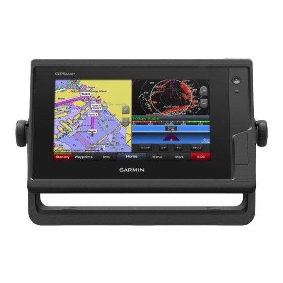
- Page 1 GPSMAP OWNER'S MANUAL ® 7x2, 9x2, 12x2 Touch, A12, 7x2 Plus, 9x2 Plus, 12x2 Plus, 7x3, 9x3, 12x3...
- Page 2 © 2019 Garmin Ltd. or its subsidiaries All rights reserved. Under the copyright laws, this manual may not be copied, in whole or in part, without the written consent of Garmin. Garmin reserves the right to change or improve its products and to make changes in the content of this manual without obligation to notify any person or organization of such changes or improvements.
-
Page 3: Table Of Contents
Making Notifications Private ........... 7 Contours Feature ..............15 Updating Software with the ActiveCaptain App ......7 Adding a Label to a Garmin Quickdraw Contours Map .... 15 Updating Charts with ActiveCaptain ........... 7 Garmin Quickdraw Community ..........15 Communication with Wireless Devices......7 Connecting to the Garmin Quickdraw Community with Wi‑Fi Network ................ - Page 4 Converting a Route to a Boundary ........22 Playing Sonar Recordings ........... 29 Converting a Track to a Boundary ........22 Traditional, Garmin ClearVü, and SideVü Sonar Setup ... 29 Editing a Boundary ............... 22 Setting the Zoom Level on the Sonar Screen ...... 29 Linking a Boundary to a SmartMode Layout ......
- Page 5 Adjusting the Autopilot Response ..........41 Setting Up the Timed Transmit Mode ........35 Enabling the Autopilot Controls on a Garmin Watch ....41 Enabling and Adjusting a Radar No Transmit Zone .... 35 Customizing the Autopilot Button Actions ......41 Adjusting the Radar Range ............
- Page 6 Viewing a Position Report ............ 45 Saving Messages to a Memory Card ........50 Navigating to a Tracked Vessel ........... 45 Clearing all of the Messages ............ 50 Creating a Waypoint at the Position of a Tracked Vessel ..45 Media Player ..............
- Page 7 Period ................... 55 Other Vessels Settings ............. 63 Viewing Buoy Reports .............. 55 Settings that are Synced on the Garmin Marine Network ..63 Viewing Local Weather Information near a Buoy ....55 Restoring the Original Chartplotter Factory Settings ....63 Weather Overlay ...............
-
Page 9: Introduction
CVBS IN Composite video in download software and chart updates. There is also contact J1939 Engine or J1939 network information to Garmin support should you have any questions. ETHERNET Garmin Marine Network Device Overview HDMI OUT HDMI video out ®... -
Page 10: Using The Touchscreen
Creates an Auto Guidance route to the destination Begins navigation You can get the latest owner's manual and translations of manuals from the Garmin website. The owner's manual includes Ends navigation instructions for using device features and accessing regulatory Stops and starts radar transmission information. -
Page 11: Inserting Memory Cards (Gpsmap 7X2/9X2/12X2 Touch/A12/7X2 Plus/9X2 Plus/12X2 Plus)
The device may need a clear view of the sky to acquire satellite signals. The time and date are set automatically based on the When multiple displays are installed on the Garmin Marine GPS position. Network, you can group them together into a station. A station enables the displays to work together, instead of as several Turn on the device. -
Page 12: Adding An Item To Favorites
each display, making each page different on each display. When Changing the Background Image you change the layout of a page in one display, the changes From the home screen, select Menu > Background. appear on only that display. When you change the name and TIP: You can also adjust this setting from Settings >... -
Page 13: Creating A New Combination Page
Creating a New Combination Page Resetting the Station Layouts You can create a custom combination page to suit your needs. You can restore the layouts in this station to the factory default settings. Select Combos > Menu > Add Combo. Select Settings >... -
Page 14: Enabling Screen Lock
GPSMAP device and complete such NOTICE tasks as sharing data, registering, updating the device software, If you enable the Screen Lock feature, Garmin Support cannot and receiving mobile device notifications. retrieve the PIN or access your device. It is your responsibility to From the GPSMAP device, select A/V, Gauges, Controls >... -
Page 15: Receiving Notifications
When the Smart Notifications feature is enabled and your mobile areas of the chart you need. device receives a notification, a pop-up notification appears on If you are downloading an entire chart, you can use the Garmin the GPSMAP screen briefly. You can access and manage the Express ™... -
Page 16: Wi-Fi Network
Advanced > Wi-Fi Host. chartplotter to view data from the chartplotter. Follow the on-screen instructions. Bring the Garmin watch within range (3 m) of the chartplotter. Wireless Remote Control From the watch clock screen, select START > Boat Data >... -
Page 17: Viewing Boat Data On A Garmin Nautix Device
To open the Nav. Chart, select Charts > Nav. compatible devices for better coverage on larger vessels. Chart. Bring the a Garmin Nautix device within range (3 m) of the chartplotter. The device automatically looks for all compatible devices within range. -
Page 18: Viewing Details About Navaids
Select Information. NOTE: Not all models support all charts. Optional premium charts, such as BlueChart g3 Vision, allow ® Viewing Details about Navaids you to get the most out of your chartplotter. In addition to From the Navigation chart, Fishing chart, Perspective 3D chart detailed marine charting, premium charts may contain these view, or Mariner’s Eye 3D chart view, you can view details about features, which are available in some areas. -
Page 19: Showing Tides And Current Indicators
Automatic Identification System station indicator, the height of the tide at the station appears above the station indicator. The Automatic Identification System (AIS) enables you to Current direction indicators appear as arrows on the chart. The identify and track other vessels, and alerts you to area traffic. direction of each arrow indicates the direction of the current at a When connected to an external AIS device, the chartplotter can specific location on the chart. -
Page 20: Activating A Target For An Ais Vessel
When course over ground, heading, and rate of turn information sent from another location. Virtual ATONs do not actually exist, are provided by an activated AIS target, the projected course of and their identifying and location information is sent from the target is calculated based on the course over ground and the another location. -
Page 21: Turning Off Ais Reception
When in sailing mode (Setting the Vessel Type, page 5), you page 14). can display laylines on the navigation chart. Laylines can be Quickdraw Contours: Shows and hides Garmin Quickdraw very helpful when racing. Contours data (Garmin Quickdraw Contours Settings, page 16). -
Page 22: User Data Layer Settings
For a smoother layline that filters out some of the changes in the boat's heading or true wind angle, enter a Some Garmin LakeVü and premium supplemental charts have ™ higher number. For laylines that display a higher sensitivity to multiple depth range shading by default. -
Page 23: Radar Overlay Settings
Adding a Label to a Garmin Quickdraw the transducer. Contours Map Fish Symbols: Shows suspended targets. You can add labels to a Garmin Quickdraw Contours map to mark hazards or points of interest. Supported Maps From the Navigation chart, select a location. -
Page 24: Connecting To The Garmin Quickdraw Community With Activecaptain
Select Getting Started > Quickdraw Community > Getting Started. Garmin Quickdraw Contours Settings If you do not have a Garmin Connect account, create one. From a chart, select Menu > Quickdraw Contours > Settings. Sign in to your Garmin Connect account. -
Page 25: Navigation With A Chartplotter
Basic Navigation Questions Survey Coloring: Sets the color of the Garmin Quickdraw Contours display. When this setting is turned on, the colors Question Answer indicate the quality of the recording. -
Page 26: Setting And Following A Direct Course Using Go To
Setting and Following a Direct Course Using Go To Projecting a Waypoint You can create a new waypoint by projecting the distance and WARNING bearing from a different location. This can be helpful when When using Go To, a direct course and a corrected course may creating sail racing start and finish lines. -
Page 27: Deleting A Waypoint Or An Mob
Select Navigate To. If necessary, select Filter to see routes only or Auto Guidance paths only. Select an option: Editing a Saved Route • To navigate directly to the location, select Go To. You can change the name of a route or change the turns the •... -
Page 28: Initiating A Search Pattern
• To navigate the route from the destination point used Setting and Following an Auto Guidance Path when the route was created, to the right of the original Select a destination (Destinations, page 17). route, select Backward - Starboard. Select Navigate To > Auto Guidance. If necessary, select Done. -
Page 29: Adjusting The Distance From Shore
NOTE: Auto Guidance is available with premium charts, in some • If the Auto Guidance line is too close to known obstacles, areas. select Settings > Preferences > Navigation > Auto Guidance > Shoreline Distance > Farthest. NOTE: Not all settings apply to all maps. •... -
Page 30: Deleting A Saved Track
Select an option: You can create boundary areas, lines, and circles using the map. You can also convert saved tracks and routes into • To navigate the track from the starting point used when boundary lines. You can create a boundary area using the track was created, select Forward. -
Page 31: Disabling All Boundary Alarms
Disabling all Boundary Alarms • To switch the position of the port and starboard marks after you have set them, select Swap Port & Starbd.. Select Info > User Data > Boundaries > Alarms. Using the Starting Line Guidance Deleting a Boundary You can use the starting line guidance feature to help get you Select Info >... -
Page 32: Setting The Keel Offset
Leeward Ang.: Allows you to set a layline based on the leeward Sailboat Autopilot Operation sailing angle. CAUTION Tide Correction: Corrects the laylines based on the tide. When engaged, the autopilot controls only the rudder. You and Layline Filter: Filters the layline data based on the time interval your crew remain responsible for the sails while the autopilot is entered. -
Page 33: Enabling The Gybe Inhibitor
Garmin ClearVü Sonar View chartplotter can be used as a fishfinder. Chartplotter models without an xsv or xs in their names require a Garmin sounder NOTE: To receive Garmin ClearVü scanning sonar, you need a module and transducer to display sonar information. -
Page 34: Sidevü Sonar View
Traditional transducers emit a conical beam. The Garmin ClearVü scanning sonar technology emits two narrow beams, similar to the shape of the beam in a copying machine. These beams provide a clearer, picture-like image of what is beneath the boat. -
Page 35: Livevü Forward Sonar View
Drop shot rig Color legend Bottom Boat Sonar beam LiveVü Forward Sonar View Range This sonar view shows a two-dimensional view of what is in front Fish of the boat and can be used to see a bait ball and fish. Bottom RealVü... -
Page 36: Perspective View
This also increases noise, and can sonar view. For example, if you have two sources for Garmin make it more difficult to recognize actual returns. -
Page 37: Sonar Recordings
From a sonar view, select Menu. Appearance: Configures the appearance of the sonar screen Select an option: (Sonar Appearance Settings, page 30). • While in the Garmin ClearVü or SideVü sonar view, select Alarms: Sets sonar alarms (Sonar Alarms, page 30). Contrast. -
Page 38: Adjusting The Range Of The Depth Or Width Scale
You can adjust the range of the depth scale traditional and Edge: Highlights the strongest signal from the bottom to help Garmin ClearVü sonar views and the range of the width scale define the hardness or softness of the signal. -
Page 39: Advanced Sonar Settings
NOTE: You cannot adjust the frequency for all sonar views and Installation Settings transducers. From a Traditional, Garmin ClearVü, or SideVü sonar view, You can select which frequencies appear on the sonar screen. select Menu > Sonar Setup > Installation. -
Page 40: Panoptix Sonar Setup
Adjusting the RealVü Sweep Speed The a-scope is a vertical flasher along the right side of the view, showing you what is underneath the transducer right now. You You can update how quickly the transducer sweeps back and can use the a-scope to identify target returns that may be forth. -
Page 41: Setting The Frontvü Depth Alarm
Setting the FrontVü Depth Alarm returns and noise. If you want to see all return information, you can increase the gain to see more information on the WARNING screen. Increasing the gain also increases noise, and can The FrontVü depth alarm is a tool for situational awareness only, make it more difficult to recognize actual returns. -
Page 42: Livescope And Perspective Appearance Settings
Installation: Configures the transducer (Traditional, Garmin Focus: Adjusts the sonar view to compensate for the speed of ClearVü, and SideVü Transducer Installation Settings, sound in water. The Auto setting uses the temperature of the page 31). water to calculate the speed of sound. -
Page 43: Radar
Radar Overlay From a radar screen, select Menu > Radar Setup > When you connect your chartplotter to an optional Garmin Installation > No Transmit Zone. marine radar, you can use overlay radar information on the The no-transmit zone is indicated by a shaded area on the Navigation chart or on the Fishing chart. -
Page 44: Tips For Selecting A Radar Range
distant targets. Closer targets, especially rain and waves, also Select the location of the outer guard zone circle. reflect the longer pulses, which can add noise to the Radar Select the location of the inner guard zone circle to define the screen. -
Page 45: Assigning A Marpa Tag To An Object
From a radar screen, select Menu > Layers > Other From a radar screen, select Menu > Radar Options > VRM/ Vessels > MARPA > Auto Acquire. EBL. Select , and adjust additional settings (optional). To adjust the VRM/EBL, select the arrows on the VRM/EBL button. -
Page 46: Adjusting Gain On The Radar Screen Manually
From a radar screen or the radar overlay, select Menu > nearby clutter and targets more than it affects the appearance of Gain. distant clutter and targets. A higher sea clutter setting reduces the appearance of clutter caused by nearby waves, but it can Select an option: also reduce or eliminate the appearance of nearby targets. -
Page 47: Radar Setup Menu
Echo Trails: Enables you to track the movement of vessels on Front-of-Boat Offset the radar screen. This option is not available on xHD open The front-of-boat offset compensates for the physical location of array or HD/HD+ radome models. the radar scanner on a boat, if the radar scanner does not align with the bow-stern axis. -
Page 48: Opening The Autopilot Screen
When the chartplotter is connected to a compatible Garmin If you have more than one heading source on the network, you autopilot system, you can engage and control the autopilot from can select a your preferred source. -
Page 49: Steering Patterns
Before you can set the autopilot button actions, you must install and configure a compatible Garmin autopilot. Following an Orbit Pattern You can select up to three autopilot actions for your Garmin You can use the orbit pattern to steer the boat in a continuous watch to perform. -
Page 50: Reactor™ Autopilot Remote Control
The FishPoint® option maintains Insert a memory card into the card slot on the computer. the position, but does not maintain the heading. The Go to buy.garmin.com/p/636376, and select Software. DriftPoint® option allows the boat to drift with the wind or Select Download. -
Page 51: Force Trolling Motor Control
Trolling Motor Settings You can connect the chartplotter wirelessly to a compatible From the trolling motor bar, select Garmin Force trolling motor on your boat to control the trolling Calibrate: Calibrates the trolling motor compass (Calibrating the motor from the chartplotter. -
Page 52: Assigning A Shortcut To The Trolling Motor Remote Control Shortcut Keys
Shortcut Keys: Enables the shortcut keys on the trolling motor If you have a Garmin NMEA 2000 VHF radio connected to your remote control to work with this particular chartplotter. The chartplotter, these features are also enabled. keys work with only one chartplotter at a time. -
Page 53: Man-Overboard And Sos Distress Calls Initiated From The Chartplotter
SOS or man-overboard location, the radio shows the Distress Call page so you can When you connect the chartplotter to a Garmin VHF radio, you quickly initiate a distress call. can use the chartplotter interface to set up an individual routine call. - Page 54 Select Replace Data. When an engine alarms is triggered, a gauge status alarm message appears and the gauge may become red depending Select a data type. on the type of alarm. Select the data to display. Enabling Some Engine Gauge Status Alarms Customizing the Gauges From the engine gauges screen, select Menu >...
- Page 55 Available on the Helm Master EX system equipped with an Water in the fuel. autopilot. For Garmin autopilot information, see (Autopilot, Water has collected in the fuel filter (fuel separator). page 39).
- Page 56 Viewing the Wind Gauges • To set the odometer reading to zero, select Reset Odometer. Before you can view wind information, you must have a wind • To set all the readings to zero, select Reset All. sensor connected to the chartplotter. Select A/V, Gauges, Controls >...
- Page 57 Preset messages are messages that you created at screens (Activating the Optimus Overlay Bar, page 49). explore.garmin.com. Preset messages have predefined text and recipients. From the InReach® page, select Messages > Send inReach Preset. Select a preset message.
- Page 58 Select Info > Tides & Currents > Celestial. If you have a compatible stereo connected to the NMEA 2000 network or Garmin Marine Network, you can control the stereo Viewing Tide Station, Current Station, or using the chartplotter. The chartplotter should automatically Celestial Information for a Different Date detect the media player when it is first connected.
- Page 59 Selecting the Media Device and Source From the media screen, select Menu > Audio Levels > Enable/Disable Zones. You can select the media source connected to the stereo. When Select a zone. you have multiple stereo or media devices connected on a network, you can select the device from which you want to play VHF Radio music.
- Page 60 Select a preset from the list. Selecting a DAB Preset from a List From the DAB media screen, select Browse > Presets > Select Tune to Channel. View Presets. Removing a Preset Select a preset from the list. From an applicable media screen, select Presets. Removing DAB Presets Select a preset from the list.
- Page 61 From the media menu, select Installation > Factory feature. For example, radar is broadcast at five-minute intervals. Defaults. When the Garmin receiver is turned on, or when a different weather feature is selected, the receiver must receive new data Select Yes.
-
Page 62: Surface Winds
Changing the Weather Chart Front Symbol Description Cold front From a combination screen or SmartMode layout with a weather chart, select Menu > Weather Menu > Change Warm front Weather. Stationary front Select a weather chart. Occluded front Trough Viewing Precipitation Information Precipitation ranging from very light rain and snow, up to strong Pressure-center symbols often appear near weather fronts. -
Page 63: Wave Height, Wave Period, And Wave Direction
Compatible devices include video devices connected to the seen at the surface, as shown in the legend on the left of the ports on the chartplotter or to the Garmin Marine Network, as screen. Variations in the visibility shading show the forecast well as supported network (IP-based) video cameras, encoders, change in surface visibility. -
Page 64: Selecting A Video Source
You can connect multiple supported video cameras and up to camera during a scan. two video encoders to the Garmin Marine Network. You can select and view up to four video sources at once. Chartplotters Stabilization: Stabilizes the picture using mechanical means. -
Page 65: Controlling Video Cameras Using On-Screen Controls
NOTE: The VIRB image shown on the chartplotter is a in a format, select Standard > Auto. lower resolution than the VIRB action camera records. To view the high-resolution video, view the video on a computer or Garmin VIRB Action Cameras ® television. -
Page 66: Controlling The Virb Action Camera Video Playback
Select Menu > Start Slideshow. The Garmin GPSMAP HDMI accessory cable is 4.5 m (15 ft.) To stop the slideshow, selcet Menu > Stop Slideshow. long. If you need a longer cable, you should use an active HDMI VIRB Action Camera Settings cable only. -
Page 67: Device Configuration
(if applicable), the software the time, date, speed, and simulated location. version for an optional Garmin radar (if applicable), and the unit ID number. You may need this information to update the system Sounds and Display Settings software or to purchase additional map data information. -
Page 68: Navigation Settings
Map Datum: Sets the coordinate system on which the map is setting are relative, not absolute. To ensure the Auto Guidance structured. Do not change this setting unless you are using a line is placed the appropriate distance from shore, you can map or chart that specifies a different map datum. -
Page 69: Configuring Nmea 0183 Output Sentences
AIS receivers, select NMEA High Speed. NOTE: Not all options are available on all transducers. • To support the input or output of Garmin proprietary data From an applicable sonar view, select Menu > Sonar Setup >... -
Page 70: Setting Weather Alarms
Setting Weather Alarms If you want to know the true water depth and the transducer is installed below the water line, measure the distance from the Before you can set weather alarms, you must have a compatible bottom of the transducer up to the water line. chartplotter connected to a weather device, such as a GXM device, and have a valid weather subscription. -
Page 71: Calibrating A Water-Speed Device
• Position Format If the wheel turns freely, check the cable connections. • System Units If you continue to get the message, contact Garmin product • Calibrate Water Speed support. • Radar Antenna Size Other Vessels Settings Chart Settings: •... -
Page 72: Sharing And Managing User Data
Backing Up Data to a Computer Select GPX. Insert a memory card into the card slot. To transfer data with Garmin devices again, select the ADM file Select Info > User Data > Data Transfer > Save to Card. type. -
Page 73: Garmin Express App
When you add devices to the chartplotter network, repeat these Update your Garmin charts steps to register the new devices using the Garmin Express app. Download new Garmin charts Updating Your Charts Using the Garmin Express App Access the Garmin Quickdraw... -
Page 74: Loading The New Software On A Memory Card Using Garmin Express
(Updating Software with the ActiveCaptain App, the chartplotter. page Remove the memory card. You can also use the Garmin Express desktop app to update NOTE: If the memory card is removed before the device your chartplotter software (Loading the New Software on a restarts fully, the software update is not complete. -
Page 75: Screenshots
Select Settings > Preferences > Units. into a card reader that is attached to a computer. Select the correct map datum and position format settings. From Windows Explorer, open the Garmin\scrn folder on the Create the waypoint again. memory card. -
Page 76: Gpsmap 9X2/9X2 Plus Specifications
The device withstands incidental exposure to water of up to 1 m for up to 30 min. The device withstands incidental exposure to water of up to 1 m for up to 30 min. For more information, go to www.garmin.com/waterrating. For more information, go to www.garmin.com/waterrating. -
Page 77: Gpsmap 12X3 Specifications
(1,200 kHz), CHIRP range: 1,060 to 1,170 kHz 126992 System time Sonar transmit power CHIRP: 1000 W 127251 Rate of turn (RMS) Garmin ClearVü and SideVü CHIRP: 500 W 127257 Attitude Sonar depth 5,000 ft. at 1 kW 127498 Engine parameters: Static 127503... -
Page 78: Nmea 0183 Information
Description Description 130313 Humidity Active diagnostic trouble codes 65226 130314 Actual pressure Vehicle distance 65248 130316 Temperature: Extended range Water in fuel indicator 65279 130576 Trim tab status Engine wait to start lamp 65252 1081 130577 Direction data Engine over speed test 65252 2812 Engine air shutoff command status 65252 2813... -
Page 79: Index
Garmin Express 64, 65 navigation 9–11 AIS 11–14 updating charts 65 quickdraw 15, 16 ATONs 12 Garmin Marine Network 61 radar 15 distress signal device 12 Garmin product support. See product support settings 13 radar 37 gauges 45–47 symbols 9 SART 12 engine 45, 46 updating 7, 65 targeting 11, 12 fuel 45, 47 circuits 49 threats 12, 37 limits 46 clock 61... - Page 80 FrontVü 27 SiriusXM Satellite Radio 52 range 35, 36 gain 28 source 51 range rings 39 Garmin ClearVü 25 stereo 51 source 39 interference 30 tuner region 51, 52 timed transmit 35 measuring distances 26 tuning mode 51 transmitting 35 noise 28 VHF 51 waypoints 39 numbers 5 zones 51 radar overlay 35...
- Page 81 vessel trails 14, 45 radio 44 calling an AIS target 45 distress calls 44, 45 channel 45 individual routine call 45 video 55–58 configuring 56, 57 source 56 viewing 56 VIRB camera 58 voltage 61 VRM 37 measuring 37 showing 37 WAAS 59 warning manager 50 messages 50 watch, marine 41 water speed 63 temperature log 48 temperature offset 62 waypoints 18, 67 copying 64 creating 9, 18 deleting 19...
- Page 82 October 2020 GUID-413FE004-9D7D-474E-8423-3B787BC4A5BF v6...
Need help?
Do you have a question about the GPSMAP 7x2 and is the answer not in the manual?
Questions and answers
does the 9x2 have a port that would allow me to run a line to another screen in the back of the boat?
Yes, the Garmin GPSMAP 7x2 has an ETHERNET port for connecting to the Garmin Marine Network, which can be used to connect to another screen.
This answer is automatically generated