Garmin GPSMAP 78 series Owner's Manual
Gpsmap 78 series
Hide thumbs
Also See for GPSMAP 78 series:
- Owner's manual (56 pages) ,
- Quick start manual (36 pages) ,
- Safety and product information (40 pages)

Related Manuals for Garmin GPSMAP 78 series


Summary of Contents for Garmin GPSMAP 78 series
- Page 1 GPSMAP 78 series ® owner’s manual for use with the GPSMAP 78, GPSMAP 78S, and GPSMAP 78Sc...
- Page 2 Visit the Garmin Web site (www.garmin.com) for current updates and supplemental information concerning the use and operation of this and other Garmin products.
-
Page 3: Table Of Contents
Table of Contents Map...........11 Compass ......... Getting Started ....Using the Compass ....Using Sight ‘N Go ....Manual Conventions ....Elevation Plot......Device Overview......Opening the Main Menu ..Battery Information ....Trip Computer ......Installing the Batteries ....Turning the Device On or Off .. - Page 4 Geocache Settings ....Index ........Routing Settings ...... Fitness ........Profiles........Appendix ......Registering Your Device ..Updating the Software ..... Viewing Important Device Information ......Contacting Garmin Product Support Using the Backlight ....Specifications ......Maximizing Battery Life ...
-
Page 5: Getting Started
Install the batteries (page Turn on the device (page Acquire satellites (page Mark a waypoint (page Navigate a route (page Record a track (page Calibrate the compass (page 13). GPSMAP 78 Series Owner’s Manual... -
Page 6: Device Overview
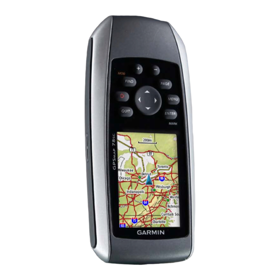
Getting Started Device Overview MCX connector for Internal external GPS antenna antenna Serial port (under weather cap) (under weather cap) mini-USB port Buttons (under weather cap) Battery Display compartment microSD ™ card slot (under batteries) GPSMAP 78 Series Owner’s Manual... -
Page 7: Battery Information
When the bars are green, the device has For best results, after you install new acquired satellite signals. batteries, update the battery type in the system settings (page 37). Turning the Device On or Off Press and hold GPSMAP 78 Series Owner’s Manual... -
Page 8: Buttons
Press and hold to turn the device on and off. Quickly press to open the backlight status page. GPSMAP 78 Series Owner’s Manual... -
Page 9: Navigating With Waypoints And Routes
Using the Search Menu You can use the search menu to quickly find waypoints, tracks, routes, and coordinates that you have saved. From any page, press FinD. Select waypoints. Select a waypoint. Select Go. GPSMAP 78 Series Owner’s Manual... -
Page 10: Routes
First Point. On the map, move the pointer to a location near which you want to Select a category. search for tides. Select the first point in the route. Press FinD. Select Use. Select Tides. GPSMAP 78 Series Owner’s Manual... -
Page 11: Editing A Route
From the main menu, select route Planner. Deleting a route Select a route. From the main menu, select route Select Edit route. Planner. Select a point. Select a route. Select an option: Select Delete route. GPSMAP 78 Series Owner’s Manual... -
Page 12: Additional Maps
From the main menu, select route postal code searching. Planner. Select the city. Select a route. Enter the house number. Select reverse route. Enter the street. Select the route again. Select Go. Select View Map. Select Go. GPSMAP 78 Series Owner’s Manual... -
Page 13: Tracks
• Time–records tracks at a specified time. about Tracks • auto—records tracks at a Your Garmin device records a track log variable rate to create an while you are moving. You can save optimum representation of your these tracks and navigate to them later. -
Page 14: Navigating A Saved Track
• Save Track—saves the entire active track. • Save Portion—allows you to select a portion of the current track to save. Clearing the Current Track From the main menu, select Setup > reset > Clear Current Track > Yes. GPSMAP 78 Series Owner’s Manual... -
Page 15: Using The Main Pages
Follow the on-screen instructions. top of the page. restoring Default Page • Select automotive Mode to Settings show a perspective view. From a main page, press MEnU. Select restore Defaults. Press EnTEr. GPSMAP 78 Series Owner’s Manual... -
Page 16: Measuring Distance
• Shaded relief—shows detail relief (page 11). on the map (if available) or turns off shading. • Map information—allows you to enable or disable the maps currently GPSMAP 78 Series Owner’s Manual... -
Page 17: Compass
Calibrate the electronic compass outdoors. Do not stand near objects that influence magnetic fields, such as cars, buildings, or overhead power lines. nOTE: The three-axis compass is available only with the GPSMAP 78S and GPSMAP 78Sc. GPSMAP 78 Series Owner’s Manual... -
Page 18: Using Sight 'N Go
◦ Bearing (Small/Large) indicates ◦ Directional Letters—sets the the direction to your destination. compass reading to directional ◦ Course indicates your letters (N, S, E, W). relationship to a course line leading to a destination. GPSMAP 78 Series Owner’s Manual... -
Page 19: Elevation Plot
From the elevation plot, press MEnU. data: Select Calibrate Altimeter. ◦ reset Trip Data—resets all trip Follow the on-screen instructions. data. Elevation Plot Setup Options ◦ Delete all waypoints—deletes all saved waypoints. From the elevation plot, press MEnU. GPSMAP 78 Series Owner’s Manual... -
Page 20: Opening The Main Menu
GPS coordinates posted From the trip computer, press MEnU. on the Internet by those hiding the geocache. • reset—resets all the trip computer values to zero. For accurate information, reset the trip information before beginning a trip. GPSMAP 78 Series Owner’s Manual... -
Page 21: Share Wirelessly
Your device can send or receive data when connected to another compatible Register your device (page 30). device. You must be within 10 feet Connect your device to your (3 m) of the compatible Garmin device. computer (page 35). Sending and receiving Data Go to www.garmin.com/products /communicator. -
Page 22: Profile Change
Walk around the perimeter of the • Set Location On Map—allows you area you want to calculate. to mark your current location on the Select Calculate when finished. map. This option is available only GPSMAP 78 Series Owner’s Manual... -
Page 23: Additional Main Menu Tools
• autoLocate Position—calculates ® your GPS position using the Garmin AutoLocate feature. Customizing Your Device additional Main Menu Tools • Calendar—displays a calendar. Customizing Data Fields •... -
Page 24: Data Field Options
**Barometer The calibrated current **Descent - Total The total elevation pressure. distance descended. Battery Level The remaining battery Distance to Dest. The distance to your power. final destination. GPSMAP 78 Series Owner’s Manual... - Page 25 Glide Ratio To The glide ratio required travel. Dest. to descend from your current position and elevation to the destination elevation. GPSMAP 78 Series Owner’s Manual...
- Page 26 The time of sunset Trip Odometer A running tally of the based on your GPS distance traveled since position. the last reset. Trip Time - Moving A running tally of time since the last reset. GPSMAP 78 Series Owner’s Manual...
-
Page 27: System Settings
Your rate of altitude as street names. gain or loss over time. • Battery Type—allows you to select Waypoint at Dest. The last point on the type of battery you are using. a route to your destination. GPSMAP 78 Series Owner’s Manual... -
Page 28: Display Settings
◦ Text Out—provides simple ASCII Setting Up Tones text output of location and velocity information. Your Garmin device allows you to customize the key tones, message ◦ rTCM Radio Technical beeps, or turn off tones. Commission for Maritime Services—allows the device to... -
Page 29: Setting Up Marine Alarms
Select Off Course alarm > On. NOAA or IALA symbols on the map. Enter a distance. • Marine alarm Setup—sets the Select Done. anchor drag alarm, off course alarm, deep water alarm, and shallow water alarm. GPSMAP 78 Series Owner’s Manual... -
Page 30: Resetting Data
From the main menu, select Setup > restore default values. Page Sequence. From the main menu, select Setup > Select add Page. reset. Select a page to add. Select an item to reset. GPSMAP 78 Series Owner’s Manual... -
Page 31: Customizing The Unit Settings
From the main menu, select Setup > Select a unit for the setting. Position Format. Repeat steps 2–3 for each setting • Position Format—sets the position you want to customize. format in which a given location reading appears. GPSMAP 78 Series Owner’s Manual... -
Page 32: Altimeter Settings
◦ Fixed Elevation—the barometer functions while you are stationary. • Pressure Trending ◦ Save when Power On—records pressure data only when the device is turned on. This can be GPSMAP 78 Series Owner’s Manual... -
Page 33: Geocache Settings
• avoidance Setup—allows you to minimal time to drive. select the road type you want to ◦ On road For Distance— avoid. calculates on-road routes that are shorter in distance. GPSMAP 78 Series Owner’s Manual... -
Page 34: Fitness
Help us better support you by completing Profiles. our online registration today. Select Create new Profile > OK. • Go to http://my.garmin.com. • Keep the original sales receipt, or a photocopy, in a safe place. GPSMAP 78 Series Owner’s Manual... -
Page 35: Updating The Software
Customizing Your Device Updating the Software by phone at (913) 397.8200 or (800) 800.1020. You must connect the device to your • In the UK, contact Garmin (Europe) computer to update the software Ltd. by phone at 0808 2380000. (page 35). -
Page 36: Specifications
(SA) Program when 78Sc have a microSD activated. card slot for additional data storage. DGPS From 10 to 16 ft. (from 3 to 5 m) 95% typical Computer USB and serial (WAAS accuracy in interface North America) GPSMAP 78 Series Owner’s Manual... -
Page 37: Maximizing Battery Life
Alkaline batteries can rupture at high temperatures. Alkaline batteries Decreasing the Backlight lose a significant amount of their capacity Extensive use of screen backlighting as temperature decreases. Use lithium can significantly reduce battery life. GPSMAP 78 Series Owner’s Manual... -
Page 38: Buying Optional Accessories
Garmin dealer for information about optional Select an option: accessories, preloaded map data • Select Heart Rate Monitor cards, fitness accessories, and > On. replacement parts. • Select Bike Cadence Sensor > On. GPSMAP 78 Series Owner’s Manual... -
Page 39: Data Management
File Types compatible with your Garmin device. The device supports the following file • Before you pair the ANT+ accessory types: with your Garmin device, move 10 m • Files from BaseCamp ™ away from other ANT+ accessories. HomePort . Go to www.garmin.com. - Page 40 Push in and slide up the metal cover. Replace the batteries and the battery cover. removing a microSD Card Slide down and pull out the metal cover. Remove the card from the slot. Push in and slide up the metal cover. GPSMAP 78 Series Owner’s Manual...
-
Page 41: Deleting Files
Browse your computer for the file. Select the file. microSD Select Edit > Copy. card slot (inside battery Open the “Garmin” or memory card compartment) drive/volume. Select Edit > Paste. Deleting Files Plug the small end of the USB cable notice into the mini-USB port. -
Page 42: Attaching The Wrist Strap
Apply the liquid to the cloth, and Place gently wipe the screen with the cloth. loop of the wrist strap through the slot opening at the bottom of the device. Route the strap through the loop and pull it tight. GPSMAP 78 Series Owner’s Manual... -
Page 43: Troubleshooting
(page 33). long. How do I know my On the device, a screen appears showing the Garmin logo and device is in USB mass the USB symbol. On your computer, you should see a new storage mode? removable disk drive in My Computer on Windows computers and a mounted volume on Mac computers. - Page 44 Windows may have trouble assigning drive letters to your list of drives. Garmin drives. See the Help file for your operating system to learn how to assign drive letters. I need replacement parts Go to http://buy.garmin.com, or contact your Garmin dealer.
-
Page 45: Index
4, 31, 33 routes BaseCamp editing waypoints batteries 20, 23, 32 profiles customizing about routes data fields information waypoints device settings 23–30 installing elevation plot 10, 15 profiles maximizing life barometric altimeter GPSMAP 78 Series Owner’s Manual... - Page 46 MOB button HomePort tracks moonphase hunting and fishing times registering your device reset current track navigating data language 3, 23 compass defaults routes trip data to geocaches waypoints main menu to waypoints restoring default settings GPSMAP 78 Series Owner’s Manual...
- Page 47 GPS recording saving saving tracks viewing search menu 4, 5 transferring files Sight ‘N Go using USB software wirelessly updating trip computer version troubleshooting specifications stopwatch sun and moon times unit ID system settings updating GPSMAP 78 Series Owner’s Manual...
- Page 48 For the latest free software updates (excluding map data) throughout the life of your Garmin products, visit the Garmin Web site at www.garmin.com. © 2010-2013 Garmin Ltd. or its subsidiaries Garmin International, Inc. 1200 East 151st Street, Olathe, Kansas 66062, USA Garmin (Europe) Ltd.
Need help?
Do you have a question about the GPSMAP 78 series and is the answer not in the manual?
Questions and answers