Table of Contents
Advertisement
Quick Links
Advertisement
Table of Contents

Subscribe to Our Youtube Channel
Related Manuals for Garmin GPSMAP 9x2


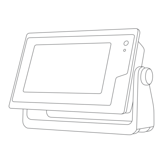
Summary of Contents for Garmin GPSMAP 9x2
- Page 1 GPSMAP OWNER'S MANUAL ® 7x2, 9x2, 12x2 Touch, A12, 7x2 Plus, 9x2 Plus, 12x2 Plus...
- Page 2 © 2019 Garmin Ltd. or its subsidiaries All rights reserved. Under the copyright laws, this manual may not be copied, in whole or in part, without the written consent of Garmin. Garmin reserves the right to change or improve its products and to make changes in the content of this manual without obligation to notify any person or organization of such changes or improvements.
-
Page 3: Table Of Contents
Making Notifications Private ........... 6 Contours Feature ..............15 Updating Software with the ActiveCaptain App ......6 Adding a Label to a Garmin Quickdraw Contours Map .... 15 Updating Charts with ActiveCaptain ........... 7 Garmin Quickdraw Community ..........15 Communication with Wireless Devices......7 Connecting to the Garmin Quickdraw Community with Wi‑Fi Network ................ - Page 4 Converting a Route to a Boundary ........21 Playing Sonar Recordings ........... 28 Converting a Track to a Boundary ........21 Traditional, Garmin ClearVü, and SideVü Sonar Setup ... 28 Editing a Boundary ............... 21 Setting the Zoom Level on the Sonar Screen ...... 28 Linking a Boundary to a SmartMode Layout ......
- Page 5 Adjusting the Autopilot Response ..........40 Setting Up the Timed Transmit Mode ........34 Enabling the Autopilot Controls on a Garmin Watch ....40 Enabling and Adjusting a Radar No Transmit Zone .... 34 Customizing the Autopilot Button Actions ......40 Adjusting the Radar Range ............
- Page 6 Selecting a DSC Channel ............ 44 Browsing for Music ............... 49 Making an Individual Routine Call ........44 Enabling Alphabetical Search ......... 49 Making an Individual Routine Call to an AIS Target .... 44 Setting a Song to Repeat ............. 49 Setting All Songs to Repeat ..........
- Page 7 Period ................... 53 Other Vessels Settings ............. 61 Viewing Buoy Reports .............. 54 Settings that are Synced on the Garmin Marine Network ..61 Viewing Local Weather Information near a Buoy ....54 Restoring the Original Chartplotter Factory Settings ....62 Weather Overlay ...............
-
Page 9: Introduction
CVBS IN Composite video in download software and chart updates. There is also contact J1939 Engine or J1939 network information to Garmin support should you have any questions. ETHERNET Garmin Marine Network Device Overview HDMI OUT HDMI video out ®... -
Page 10: Tips And Shortcuts (Mfd Models)
You can get the latest owner's manual and translations of Select Settings > System > GPS > Source. manuals from the Garmin website. The owner's manual includes instructions for using device features and accessing regulatory Select the source for GPS data. -
Page 11: Adding An Item To Favorites
48). • To assign a preset to a portion of the SmartMode screen, When multiple displays are installed on the Garmin Marine select Presets > Include, and select a preset from the list Network, you can group them together into a station. A station on the right. -
Page 12: Adding A Smartmode Layout
Display resolution Image width Image height WXGA 1080 1240 WUXGA 1700 Adding a SmartMode Layout You can add SmartMode layouts to suit your needs. Each customization made to one SmartMode layout for the home screen in a station appears on all displays in the station. From the home screen, select SmartMode™... -
Page 13: Setting The Vessel Type
NOTICE and receiving mobile device notifications. If you enable the Screen Lock feature, Garmin Support cannot From the GPSMAP device, select A/V, Gauges, Controls > retrieve the PIN or access your device. It is your responsibility to ActiveCaptain. -
Page 14: Enabling Smart Notifications
Garmin device, using NOTE: The available options vary based on your mobile the name and password you entered in the Garmin device. device and the notification type. • To dismiss and remove the notification from the... -
Page 15: Updating Charts With Activecaptain
Changing the Wi‑Fi Host If you are downloading an entire chart, you can use the Garmin If there are multiple chartplotters with Wi‑Fi technology on the Express app to download the map onto a memory card. The ™... -
Page 16: Viewing Boat Data On A Garmin Watch
Chart. NOTE: You can connect a Garmin Nautix device to multiple compatible devices for better coverage on larger vessels. Bring the a Garmin Nautix device within range (3 m) of the chartplotter. The device automatically looks for all compatible devices within range. -
Page 17: Measuring A Distance On The Chart
When using Go To, a direct course and a corrected course may Icon Description pass over land or shallow water. Use visual sightings, and steer Buoy to avoid land, shallow water, and other dangerous objects. Information Marine services NOTE: The Fishing chart is available with premium charts, in some areas. -
Page 18: Fish Eye 3D Chart View
Fish Eye 3D Chart View Showing Satellite Imagery on the Navigation Chart Using the depth contour lines of the premium charts, such as NOTE: This feature is available with premium charts, in some BlueChart g3 Vision, the Fish Eye 3D chart view provides an areas. -
Page 19: Heading And Projected Course Of Activated Ais Targets
Deactivating a Target for an AIS Vessel Symbol Description From a chart or a 3D chart view, select an AIS vessel. Target is lost. A green X indicates that the AIS transmission from the vessel is lost, and the chartplotter displays a Select AIS Vessel >... -
Page 20: Ais Distress Signals
Water: Shows and hides depth items (Water Layer Settings, their distress signal device, and does not represent a true page 13). emergency. Quickdraw Contours: Shows and hides Garmin Quickdraw Transmission test lost. Contours data (Garmin Quickdraw Contours Settings, page 16). -
Page 21: My Vessel Layer Settings
Layline Filter: Filters the layline data based on the time interval entered. For a smoother layline that filters out some of the Some Garmin LakeVü and premium supplemental charts have ™ changes in the boat's heading or true wind angle, enter a multiple depth range shading by default. -
Page 22: Weather Layer Settings
Forecast Layers: Sets which forecasted weather items are You can purchase maps from Garmin. If you purchase maps shown. from a seller other than Garmin, investigate the seller before Layer Mode: Shows forecasted or observed weather purchasing. -
Page 23: Mapping A Body Of Water Using The Garmin Quickdraw Contours Feature
Adding a Label to a Garmin Quickdraw community automatically. Contours Map Connecting to the Garmin Quickdraw Community with You can add labels to a Garmin Quickdraw Contours map to Garmin Connect mark hazards or points of interest. Go to connect.garmin.com. -
Page 24: Garmin Quickdraw Contours Settings
Question Answer Survey Coloring: Sets the color of the Garmin Quickdraw How do I make the Navigate using Go To (Setting and Contours display. -
Page 25: Destinations
Destinations • Select You can select destinations using various charts and 3D chart Waypoints views or using the lists. Waypoints are locations you record and store in the device. Searching for a Destination by Name Waypoints can mark where you are, where you are going, or You can search for saved waypoints, saved routes, saved where you have been. -
Page 26: Browsing For And Navigating To A Saved Waypoint
Indicate a new location for the waypoint: From the Navigation chart or Fishing chart, select a destination. • To move the waypoint while using the chart, select Use Chart, select a new location on the chart, and select Select Navigate To > Route To. Move. -
Page 27: Browsing For And Navigating Parallel To A Saved Route
A magenta line appears. In the center of the magenta line is If necessary, select Engage. a thinner purple line that represents the corrected course Deleting a Saved Route from your present location to the destination. The corrected Select Info > User Data > Routes & Auto Guidance Paths. course is dynamic, and it moves with your boat when you are off course. -
Page 28: Canceling An Auto Guidance Calculation In Progress
If necessary, select a point, and select Remove. Select a destination that you have navigated to previously. Select Done. Select Navigate To > Auto Guidance. Review the placement of the Auto Guidance line, and Canceling an Auto Guidance Calculation in Progress determine whether the line safely avoids known obstacles From the Navigation chart, select Menu >... -
Page 29: Viewing A List Of Saved Tracks
Select an option: • To record a track log until the track memory is full, select Fill. • Select the time the active track began. • To continuously record a track log, replacing the oldest • Select Entire Log. track data with new data, select Wrap. Select Save. -
Page 30: Linking A Boundary To A Smartmode Layout
• To edit the boundary alarm, select Alarm. After you set the starboard and port start line pins, and the target speed and time, and after you start the race timer, a Linking a Boundary to a SmartMode Layout predictor line appears. The predictor line extends from your You can link a boundary to a SmartMode layout to automatically current location toward the start line and the laylines that extend open the layout when entering or exiting the boundary. -
Page 31: Laylines Settings
Laylines Settings To use the laylines features, you must connect a wind sensor to the chartplotter. When in sailing mode (Setting the Vessel Type, page 5), you can display laylines on the navigation chart. Laylines can be very helpful when racing. Complete an action: From the navigation chart, select Menu >... -
Page 32: Adjusting The Wind Hold Angle With The Autopilot
Chartplotter models Tacking and Gybing from Wind Hold without an xsv or xs in their names require a Garmin sounder Before you can engage wind hold, you must have a wind sensor module and transducer to display sonar information. -
Page 33: Split-Frequency Sonar View
The transducer on your vessel Trees Garmin ClearVü Sonar View Old tires NOTE: To receive Garmin ClearVü scanning sonar, you need a compatible chartplotter or fishfinder and a compatible Logs transducer. For information about compatible transducers, go to Distance from the side of the boat garmin.com/transducers. -
Page 34: Livevü Down Sonar View
The RealVü 3D sonar views provide three-dimensional views of either what is in front of or below your boat. The screen updates with each sweep of the transducer. To see all five Panoptix sonar views, you need one transducer to show the down views and a second transducer to show the forward views. -
Page 35: Frontvü Sonar View
When you are using more than one sonar data source for a particular sonar view, you can select the source to use for that sonar view. For example, if you have two sources for Garmin ClearVü, you can select the source to use from the Garmin ClearVü... -
Page 36: Adjusting The Level Of Detail
From a sonar view, select Menu. Settings, page 29). Select an option: Appearance: Configures the appearance of the sonar screen • While in the Garmin ClearVü or SideVü sonar view, select (Sonar Appearance Settings, page 29). Contrast. Alarms: Sets sonar alarms (Sonar Alarms, page 30). -
Page 37: Setting The Scroll Speed
You can adjust the range of the depth scale traditional and Edge: Highlights the strongest signal from the bottom to help Garmin ClearVü sonar views and the range of the width scale define the hardness or softness of the signal. -
Page 38: Sonar Alarms
Traditional, Garmin ClearVü, and SideVü Transducer Installation Settings From a Traditional, Garmin ClearVü, or SideVü sonar view, select Menu > Sonar Setup > Installation. Transmit Rate: Sets the length of time between sonar pings. -
Page 39: Selecting The Transducer Frequency
From a Panoptix LiveVü or LiveScope 2D sonar view, spread NOTICE two fingers apart to zoom in on the area. Always be aware of local regulations on sonar frequencies. For example, to protect orca whale pods, you might be prohibited An inset window appears and displays a small version of from using frequencies between 50 to 80 khz with in ½... -
Page 40: Setting The Livevü And Frontvü Transducer Transmit Angle
Allowing the device to adjust the range automatically adjusts to differentiate low intensity returns higher in the water the forward scale in relation to the depth. Manually adjusting column, but this causes a loss in the differentiation of the the range enables you to view a specified range. The bottom returns at the bottom. -
Page 41: Setting The Bow Offset
When you connect your compatible chartplotter to an optional installation location. Garmin marine radar, such as a GMR ™ Fantom ™... -
Page 42: Radar Overlay
Radar Overlay From a radar screen, select Menu > Radar Setup > When you connect your chartplotter to an optional Garmin Installation > No Transmit Zone. marine radar, you can use overlay radar information on the The no-transmit zone is indicated by a shaded area on the Navigation chart or on the Fishing chart. -
Page 43: Enabling A Guard Zone
MARPA Targeting Symbols Acquiring a target. Concentric, dashed green rings radiate from the target while the radar is locking onto it. Target has been acquired. A solid green ring indicates the location of a target that the radar has locked onto. A dashed green line attached to the circle indicates the projected course over ground or the GPS heading of the target. -
Page 44: Vrm And Ebl
Select an option: Select the length of the trail. • To indicate the distance from your location within which Clearing the Echo Trails AIS vessels appear, select Display Range, and select a You can remove the echo trails from the radar screen to reduce distance. -
Page 45: Minimizing Side-Lobe Interference On The Radar Screen
Reducing the gain to eliminate nearby large-object From a radar screen or the radar overlay, select Menu > interference may cause smaller or distant targets to blink or Radar Filters > Scan Average. disappear from the Radar screen. Select an option. Minimizing Side-Lobe Interference on the Radar Screen The High setting filters out the most noise. -
Page 46: Radar Appearance Settings
Using a magnetic compass, take an optical bearing of a steering functions and patterns. stationary target located within viewable range. When the chartplotter is connected to a compatible Garmin Measure the target bearing on the radar. autopilot system, you can engage and control the autopilot from If the bearing deviation is more than +/- 1°, set the front-of-... -
Page 47: Adjusting The Step Steering Increment
Engaging the Autopilot Actual heading (when in standby mode) Intended heading (when engaged) When you engage the autopilot, the autopilot takes control of the Rudder position indicator (This functionality is available only when a helm and steers the boat to maintain your heading. rudder sensor is connected.) From any screen, select Engage. -
Page 48: Following The Williamson Turn Pattern
Garmin autopilot. You can use the orbit pattern to steer the boat in a continuous You can select up to three autopilot actions for your Garmin circle around the active waypoint. The size of the circle is watch to perform. -
Page 49: Updating The Reactor Autopilot Remote Control Software
Connecting to a Trolling Motor Intended heading (heading the autopilot is steering toward) You can connect the chartplotter wirelessly to a compatible Garmin Force trolling motor on your boat to control the trolling Yamaha Autopilot Settings motor from the chartplotter. -
Page 50: Adding The Trolling Motor Controls To Screens
On the chartplotter, select Settings > Communications > Navigation Gain: Sets the response of the trolling motor when Wireless Devices > Garmin Trolling Motor. navigating. If you need the trolling motor to be more responsive and move quicker, increase the value. If the... -
Page 51: Digital Selective Calling
Chartplotter position reports. When your chartplotter is connected to a Garmin NMEA 2000 If you have a Garmin NMEA 2000 VHF radio connected to your compatible radio and you mark an SOS or man-overboard chartplotter, these features are also enabled. -
Page 52: Creating A Waypoint At The Position Of A Tracked Vessel
Individual Routine Calls Customizing the Gauges When you connect the chartplotter to a Garmin VHF radio, you You can change the layout of the gauge pages, how the gauges can use the chartplotter interface to set up an individual routine pages are displayed, and the data in each gauge. - Page 53 • To set the lower limit of the gauge lower than the rated Shift position minimum, select Scale Min.. Tachometer and trim angle • To set the upper limit of the gauge higher than the rated Hold to change the background. maximum, select Scale Max..
- Page 54 Select Tank Capacity, enter the capacity of the tank, and Select A/V, Gauges, Controls > Wind. select Done. Configuring the Sailing Wind Gauge Select Calibration, and follow the on-screen instructions to You can configure the sailing wind gauge to show true or calibrate the tank levels.
- Page 55 Sending an inReach Preset Message select Done. Preset messages are messages that you created at If necessary, select Change Icon, select a new symbol, and explore.garmin.com. Preset messages have predefined text and select Done. recipients. Repeat steps 2 through 5 for each device.
- Page 56 Dometic Optimus Features Tide, Current, and Celestial ® ® Information When connected to a compatible Optimus system, the chartplotter allows you to access and control the system. You Tide Station Information can enable the Optimus overlay to control the Optimus system (Activating the Optimus Overlay Bar, page 48).
- Page 57 If you have a compatible stereo connected to the NMEA 2000 NOTE: A Fusion PartyBus zone stereo, such as the Apollo ™ network or Garmin Marine Network, you can control the stereo SRX400 zone stereo, cannot stream sources to other Fusion using the chartplotter. The chartplotter should automatically PartyBus devices on the network.
- Page 58 Adjusting the VHF Squelch To use the DAB source, you must be in a region in which DAB is available, and select the tuner region (Setting the DAB Tuner NOTE: This feature is available on some stereos with a VHF Region, page 50).
- Page 59 SiriusXM Satellite Radio Setting Parental Controls on SiriusXM Radio Channels Before you can set parental controls, the parental controls must When you have a FUSION-Link ™ capable stereo and SiriusXM be unlocked. Connect Tuner installed and connected to the chartplotter, you may have access to SiriusXM satellite radio, depending on your The parental control feature allows you to limit access to any subscription.
- Page 60 For example, radar is broadcast at five-minute intervals. received from the weather data provider. When the Garmin receiver is turned on, or when a different weather feature is selected, the receiver must receive new data Forecast Information before it can be shown.
-
Page 61: Visibility Information
The wave period indicates the time (in seconds) between Pressure- Description Center successive waves. Wave period lines indicate areas that have Symbol the same wave period. Indicates a low-pressure center, which is a region of Wave directions appear on the chart using red arrows. The relatively lower pressure. -
Page 62: Viewing Buoy Reports
Compatible devices include video devices connected to the Camera Settings ports on the chartplotter or to the Garmin Marine Network, as well as supported network (IP-based) video cameras, encoders, Some cameras provide additional options to control the camera and thermal cameras. -
Page 63: Video Settings
Associating the Camera to a Video Source format, select Standard > Auto. You may need to associate the camera with a video source. From the video screen, select Menu > Source. Garmin VIRB Action Cameras ® Select the camera. WARNING Select Video Setup >... -
Page 64: Connecting A Virb Action Camera
Press to select WPS, and press OK. Select a video or image. On the chartplotter, select A/V, Gauges, Controls > VIRB® Control the playback using the on-screen buttons or menu > options: The camera searches for the Wi‑Fi network and connects. •... -
Page 65: Hdmi Out Video Considerations
Startup Layout: Sets the layout that appears when you turn on The Garmin GPSMAP HDMI accessory cable is 4.5 m (15 ft.) the device. long. If you need a longer cable, you should use an active HDMI cable only. -
Page 66: Viewing System Software Information
(if applicable), the software autopilot accuracy. version for an optional Garmin radar (if applicable), and the unit ID number. You may need this information to update the system Speed Sources: Sets the source for the speed readings. -
Page 67: Communications Settings
Select an option: data for most AIS receivers, select NMEA High Speed. • To support the input or output of Garmin proprietary data • If the placement of the Auto Guidance line is satisfactory, select Menu > Navigation Options > Stop Navigation, for interfacing with Garmin software, select Garmin. -
Page 68: Setting The Anchor Drag Alarm
Setting the Anchor Drag Alarm My Vessel Settings You can set an alarm to sound if you have moved more than an NOTE: Some settings and options require additional charts or allowable distance. This is very useful when anchoring hardware. overnight. -
Page 69: Setting The Water Temperature Offset
If the message appears again, stop the boat, and ensure the speed-sensor wheel is not stuck. If the wheel turns freely, check the cable connections. If you continue to get the message, contact Garmin product support. Other Vessels Settings When your compatible chartplotter is connected to an AIS device or VHF radio, you can set up how other vessels are displayed on the chartplotter. -
Page 70: Restoring The Original Chartplotter Factory Settings
Select Info > User Data > Data Transfer > File Type. • Chart Borders Select GPX. • Hazard Colors To transfer data with Garmin devices again, select the ADM file type. • Heading Line • Land POIs Copying User Data from a Memory Card •... -
Page 71: Backing Up Data To A Computer
Open the Garmin Express application. Insert a memory card into the card slot (Inserting Memory Cards, page If you do not have the Garmin Express application installed on your computer, you can download it from garmin.com Wait a few moments. -
Page 72: Updating The Device Software
Select Settings > Communications > Marine Network. minutes to load onto the memory card. Select the GRID device. If you are on a Mac computer, copy the Garmin folder to the root directory of the memory card. Cleaning the Screen The software update can take several minutes to load onto the memory card. -
Page 73: My Device Will Not Turn On Or Keeps Turning Off
15.4 × 8.6 cm (6.1 × 3.4 in.) 7 in. diagonal Display resolution WVGA, 800 × 480 pixels The device withstands incidental exposure to water of up to 1 m for up to 30 min. For more information, go to www.garmin.com/waterrating. Appendix... -
Page 74: Sonar Models Specifications
Garmin ClearVü CHIRP: 260/455/800 kHz 126992 System time Sonar transmit power CHIRP: 1000 W 127251 Rate of turn (RMS) Garmin ClearVü and SideVü CHIRP: 500 W 127257 Attitude Sonar depth 5,000 ft. at 1 kW 127498 Engine parameters: Static NMEA 2000 PGN Information... -
Page 75: J1939 Information
Sentence Description Description GPGSA GSA: GNSS DOP and active satellites Engine coolant pressure 65263 109 GPGSV GSV: GNSS satellites in view Engine coolant temperature 65263 110 GPRMB RMB: Recommended minimum navigation information Engine coolant level 65263 111 GPRMC RMC: Recommended minimum specific GNSS data Engine fuel rate 65266 183 GPRTE... -
Page 76: Index
13 updating software 6 Garmin ClearVü 25 measuring distance 9 aerial photos 10 Garmin Marine Network 59 navigation 8–10 AIS 10–13 Garmin product support. See product support quickdraw 14, 15 ATONs 11 gauges 44, 46 radar 14 distress signal device 12 engine 44, 45 settings 12 radar 35 fuel 44, 46 symbols 8 SART 12 limits 44 updating 7... - Page 77 54 MARPA 11 depth scale 29 radio 51 optimizing display 36, 37 frequencies 30, 31 repeating 49 overlay 14 FrontVü 27 shuffling 49 overlay screen 34 gain 28 SiriusXM Satellite Radio 51 range 34 Garmin ClearVü 25 source 49 range rings 38 interference 29 stereo 49 source 38 measuring distances 25 tuner region 50 timed transmit 34 noise 28 tuning mode 50 transmitting 34 numbers 4...
- Page 78 radio 43 calling an AIS target 44 distress calls 43 channel 44 individual routine call 44 video 54–57 configuring 54, 55 source 54, 55 viewing 54, 55 VIRB camera 56 voltage 60 VRM 36 measuring 36 showing 36 WAAS 57 warning manager 48 messages 49 watch, marine 40 water speed 61 temperature log 47 temperature offset 61 waypoints 17, 65 copying 62 creating 9, 17 deleting 18 editing 17 overboard 17...
- Page 80 July 2020 GUID-413FE004-9D7D-474E-8423-3B787BC4A5BF v5...
Need help?
Do you have a question about the GPSMAP 9x2 and is the answer not in the manual?
Questions and answers
DOES THIS DEVICE HAVE A FISH FINDER