Table of Contents
Advertisement
Quick Links
Advertisement
Table of Contents

Related Manuals for Garmin GPSMAP A12


Summary of Contents for Garmin GPSMAP A12
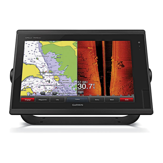
- Page 1 GPSMAP ® Owner’s Manual...
- Page 2 © 2017–2018 Garmin Ltd. or its subsidiaries All rights reserved. Under the copyright laws, this manual may not be copied, in whole or in part, without the written consent of Garmin. Garmin reserves the right to change or improve its products and to make changes in the content of this manual without obligation to notify any person or organization of such changes or improvements.
-
Page 3: Table Of Contents
Enabling Smart Notifications ............5 Contours Feature ..............13 Receiving Notifications ............5 Adding a Label to a Garmin Quickdraw Contours Map .... 13 Managing Notifications ............5 Garmin Quickdraw Community ..........13 Updating Software with the ActiveCaptain App ......5 Connecting to the Garmin Quickdraw Community with Updating Charts with ActiveCaptain ........... - Page 4 Boundaries ................20 Playing Sonar Recordings ........... 27 Creating a Boundary ............20 Traditional, Garmin ClearVü, and SideVü Sonar Setup ... 27 Converting a Route to a Boundary ........20 Setting the Zoom Level on the Sonar Screen ...... 27 Converting a Track to a Boundary ........20 Setting the Scroll Speed ............
- Page 5 Radar Interpretation ..............32 Cancelling a Steering Pattern ..........38 Radar Overlay ..............32 Enabling the Autopilot Controls on a Garmin Watch ....38 Radar Overlay and Chart Data Alignment ......32 Customizing the Autopilot Button Actions ......38 Transmitting Radar Signals ............32 Reactor™...
- Page 6 Locating a SiriusXM Radio ID ..........45 Screens ................51 Activating a SiriusXM Subscription ........45 Pairing the GC™ 100 Camera with a Garmin Chartplotter ..51 Customizing the Channel Guide .......... 46 Device Configuration........... 51 Saving a SiriusXM Channel to the Presets List ....46 System Settings ................
- Page 7 Setting the Water Temperature Offset ......... 55 Calibrating a Water Speed Device ........55 Other Vessels Settings ............. 55 Settings that are Synced on the Garmin Marine Network ..55 Restoring the Original Chartplotter Factory Settings ....56 Sharing and Managing User Data....... 56 Copying Waypoints, Routes, and Tracks from HomePort to a Chartplotter ................
-
Page 9: Introduction
Creates a new waypoint download software and chart updates. There is also contact information to Garmin support should you have any questions. Creates a route, with turns, to the destination Device Overview... -
Page 10: Accessing Owner's Manuals On The Chartplotter
Settings button. The Settings button is accessible only from the home screen. When multiple displays are installed on the Garmin Marine Insert the memory card Network, you can group them together into a station. A station Press the card in until it clicks. -
Page 11: Adding An Item To Favorites
each display, making each page different on each display. When • To assign a preset to a portion of the SmartMode screen, you change the layout of a page in one display, the changes select Presets > Include, and select a preset from the list appear on only that display. -
Page 12: Resetting The Station Layouts
Garmin Quickdraw Select an option. Contours Community, and update device software. You can also plan your trip, and view and control the GPSMAP A12 device Adjusting the Backlight from the app. Select Settings > System > Display > Backlight. -
Page 13: Getting Started With The Activecaptain App
Getting Started with the ActiveCaptain App Notifications feature (Enabling Smart Notifications, page You can connect a mobile device to the GPSMAP A12 device When the Smart Notifications feature is enabled and your mobile using the ActiveCaptain app. The app provides a quick and easy... -
Page 14: Updating Charts With Activecaptain
ActiveCaptain app to download only the You do not need to change the wireless channel of devices areas of the chart you need. connected to this network. If you are downloading an entire chart, you can use the Garmin Changing the Wi‑Fi Host Express ™... -
Page 15: Adjusting The Wind Sensor Orientation
Garmin Nautix device. NOTE: You can connect a Garmin Nautix device to multiple compatible devices for better coverage on larger vessels. Bring the a Garmin Nautix device within range (3 m) of the chartplotter. The device automatically looks for all compatible devices within range. -
Page 16: Chart Symbols
Chart Symbols The Auto Guidance feature is based on electronic chart information. That data does not ensure obstacle and bottom This table contains some of the common symbols you might see clearance. Carefully compare the course to all visual sightings, on the detailed charts. -
Page 17: Fish Eye 3D Chart View
Detailed Roads and POI data: Shows detailed road and point Select an option: of interest (POI) data, which includes highly detailed coastal • To show animated tide station indicators and animated roads and POIs such as restaurants, lodging, and local current direction indicators on the chart, select Animated. -
Page 18: Heading And Projected Course Of Activated Ais Targets
Viewing Information about a Targeted AIS Vessel Symbol Description You can view the AIS signal status, MMSI, GPS speed, GPS Target is activated. The target appears larger on the chart. A heading, and other information that is reported about a targeted green line attached to the target indicates the heading of the AIS vessel. -
Page 19: Enabling Ais Transmission Test Alerts
Laylines can be very helpful when racing. Water: Shows and hides depth items (Water Layer Settings, page 12). Quickdraw: Shows and hides Garmin Quickdraw data (Garmin Quickdraw Contours Settings, page 14). Weather: Shows and hides weather-related items (Weather Layer Settings, page 12). -
Page 20: User Data Layer Settings
From the navigation chart, select Menu > Layers > My Vessel > Weather Layer Settings Laylines > Setup. From the Navigation or Fishing chart, select Menu > Layers > Chart > Weather > . Display: Sets how the laylines and vessel appear on the chart, and sets the length of the laylines. -
Page 21: Supported Maps
Adding a Label to a Garmin Quickdraw the transducer. Contours Map Fish Symbols: Shows suspended targets. You can add labels to a Garmin Quickdraw Contours map to mark hazards or points of interest. Supported Maps From the Navigation chart, select a location. -
Page 22: Connecting To The Garmin Quickdraw Community With Garmin Connect
The next time you connect the ActiveCaptain app to the Insert the memory card into the card slot (Inserting Memory GPSMAP A12 device, your contour maps are transferred to the Cards, page community automatically. The chartplotter automatically recognizes the contours maps. -
Page 23: Navigation With A Chartplotter
18). You can select Next Page or Previous Page to view When you are using a compatible Garmin autopilot additional information or to show the location on a chart. connected to the chartplotter using NMEA 2000, the autopilot follows the Auto Guidance route. -
Page 24: Stopping Navigation
If you are off course, follow the purple line (corrected course) Select a waypoint. to go to your destination, or steer back to the magenta line Select Review > Edit. (direct course). Select an option: You can also use the orange course-to-steer arrow, which •... -
Page 25: Deleting A Waypoint Or An Mob
Deleting a Waypoint or an MOB • To select a turn using the chart, select Edit Turns > Use Chart, and select a location on the chart. Select Info > User Data > Waypoints. Select a waypoint or an MOB. Browsing for and Navigating a Saved Route Before you can browse a list of routes and navigate to one of Select Review >... -
Page 26: Deleting A Saved Route
Select Info > User Data > Routes & Auto Guidance Paths • To view a hazard and adjust the path near a hazard, > New > Route Using SAR Pattern. select Hazard Review. Select a pattern: • To adjust the path, select Adjust Path, and follow the on- screen instructions. -
Page 27: Adjusting The Distance From Shore
that require navigation through a narrow waterway (Adjusting Tracks the Distance from Shore, page 19). A track is a recording of the path of your boat. The track currently being recorded is called the active track, and it can be Adjusting the Distance from Shore saved. -
Page 28: Clearing The Active Track
Select Info > User Data > Tracks > Follow Active Track. Converting a Track to a Boundary Before you can convert a track to a boundary, you must record Select an option: and save at least one track (Saving the Active Track, page 19). -
Page 29: Starting Line Guidance
this data to indicate whether your boat will cross the start line Setting the Distance between the Bow and the GPS before, after, or at the correct time to start the race. Antenna You can enter the distance between the bow of your boat and Starting Line Guidance the location of your GPS antenna. -
Page 30: Sailboat Autopilot Operation
Measure the distance: With heading hold engaged, select Menu > Wind Hold. • If the transducer is installed at the water line Adjusting the Wind Hold Angle with the Autopilot anywhere above the end of the keel, measure the You can adjust the wind hold angle on the autopilot when wind distance from the transducer location to the keel of the hold is engaged. -
Page 31: Sonar Fishfinder
Chartplotter models NOTE: To receive Garmin ClearVü scanning sonar, you need a without an xsv or xs in their names require a Garmin sounder compatible chartplotter or fishfinder and a compatible module and transducer to display sonar information. -
Page 32: Sidevü Sonar View
SideVü Sonar View Panoptix Sonar Views NOTE: Not all models provide built-in SideVü sonar support. If NOTE: Not all models support Panoptix transducers. your model does not provide built-in SideVü sonar, you need a To receive Panoptix sonar, you need a compatible chartplotter compatible sounder module and compatible SideVü... -
Page 33: Realvü 3D Forward Sonar View
Bottom kind of transducer you have. This chartplotter is compatible with a range of accessory RealVü 3D Historical Sonar View transducers, including the Garmin ClearVü ™ transducers, which This sonar view provides a three-dimensional view of what is are available at www.garmin.com/transducers. -
Page 34: Selecting A Sonar Source
From a sonar view, select Menu > Sonar Setup > Sonar Recording > Record Sonar. ClearVü mounted at the back of the boat, you can view the sonar data using the GPSMAP A12 mounted at the front of your 15 minutes of sonar recording uses approximately 200 MB of boat. -
Page 35: Playing Sonar Recordings
Adjusting the Range of the Depth or Width Scale Select Playback. You can adjust the range of the depth scale traditional and Garmin ClearVü sonar views and the range of the width scale Traditional, Garmin ClearVü, and SideVü for the SideVü sonar view. -
Page 36: Sonar Appearance Settings
Traditional, Garmin ClearVü, and SideVü Transducer Installation Settings From a Traditional, Garmin ClearVü, or SideVü sonar view, select Menu > Sonar Setup > Installation. Transmit Rate: Sets the length of time between sonar pings. -
Page 37: Sonar Frequencies
Sonar Frequencies The a-scope is a vertical flasher along the right side of the view, showing you what is underneath the transducer right now. You NOTE: The frequencies available depend on the device and can use the a-scope to identify target returns that may be trandsucers being used. -
Page 38: Adjusting The Realvü Sweep Speed
Adjusting the RealVü Sweep Speed Setting the FrontVü Depth Alarm You can update how quickly the transducer sweeps back and WARNING forth. A faster sweep rate creates a less detailed image, but the The FrontVü depth alarm is a tool for situational awareness only, screen refreshes faster. -
Page 39: Setting The Bow Offset
When the radar is transmitting, do not look directly at the antenna at close range; eyes are the most sensitive part of the body to electromagnetic energy. When you connect your compatible chartplotter to an optional Garmin marine radar, such as a GMR Fantom 6 radar or a ™... -
Page 40: Radar Interpretation
From a radar screen, select Menu > Radar Setup > Installation > No Transmit Zone. Radar Overlay When you connect your chartplotter to an optional Garmin The no-transmit zone is indicated by a shaded area on the marine radar, you can use overlay radar information on the radar screen. -
Page 41: Motionscope™ Doppler Radar Technology
• Select the shortest effective range, given your reason for using radar and the present environmental conditions. MotionScope Doppler Radar Technology ™ The GMR Fantom radar uses the Doppler effect to detect and highlight moving targets to help you avoid potential collisions, find flocks of birds, and track weather formations. -
Page 42: Showing Ais Vessels On The Radar Screen
From a Radar screen, select Menu > Layers > Other Vessels > List > Show. Select the type of threats to include in the list. Showing AIS Vessels on the Radar Screen AIS requires the use of an external AIS device and active transponder signals from other vessels. -
Page 43: Minimizing Nearby Large-Object Interference
From a Radar screen or the Radar overlay, select Menu > the appearance of clutter caused by nearby waves, but it can Gain. also reduce or eliminate the appearance of nearby targets. Select Up to raise the gain, until light speckles appear across NOTE: Depending upon the radar in use, the sea clutter setting the Radar screen. -
Page 44: Radar Setup Menu
32). steering functions and patterns. Front-of-Boat Offset When the chartplotter is connected to a compatible Garmin The front-of-boat offset compensates for the physical location of autopilot system, you can engage and control the autopilot from the radar scanner on a boat, if the radar scanner does not align the chartplotter. -
Page 45: Opening The Autopilot Screen
Opening the Autopilot Screen Autopilot Overlay Bar Before you can open the autopilot screen, you must have a compatible Garmin autopilot installed and configured. Select A/V, Gauges, Controls > Autopilot. Actual heading Autopilot Screen Intended heading (heading the autopilot is steering toward) -
Page 46: Setting Up And Following The Zigzag Pattern
Enabling the Autopilot Controls on a Garmin position reports. Watch If you have a Garmin NMEA 2000 VHF radio connected to your chartplotter, these features are also enabled. You can control the Garmin autopilot with a compatible Garmin • The chartplotter allows you to quickly set up and send watch. -
Page 47: Turning On Dsc
Chartplotter For example, if you select 4 Hours, all trail points that are When your chartplotter is connected to a Garmin NMEA 2000 less than four hours old appear for all tracked vessels. compatible radio and you mark an SOS or man-overboard location, the radio shows the Distress Call page so you can quickly initiate a distress call. -
Page 48: Individual Routine Calls
Customizing the Gauges You can change the layout of the gauge pages, how the gauges When you connect the chartplotter to a Garmin VHF radio, you pages are displayed, and the data in each gauge. can use the chartplotter interface to set up an individual routine call. -
Page 49: Enabling Some Engine Gauge Status Alarms
Enabling Some Engine Gauge Status Alarms Engine overheating. Stop the engine immediately. Check the cooling water inlet, and From the engine gauges screen, select Menu > Installation clear it if it is blocked. > Status Alarms > Custom. Select one or more engine gauge alarms to turn on or off. NOTICE Do not continue to run the engine if this indicator is on. -
Page 50: Engine Information
Tanks: Displays detailed tank level sensor information. • To show true or apparent wind angle, select Needle, and select an option. Trim: Displays the trim angle of the engines. • To show true or apparent wind speed, select Wind Speed, Active Alarms: Displays any active alarms for the engines. -
Page 51: Setting Up The Battery Management
the screen are devices that use the batteries and other power Viewing Tide Station, Current Station, or sources. Celestial Information for a Different Date Setting Up the Battery Management Page Select Info > Tides & Currents. Select A/V, Gauges, Controls > Battery Management > Select Tides, Currents, or Celestial. -
Page 52: Opening The Media Player
Opening the Media Player From the media screen, select Source. NOTE: After few moments, the compatible FUSION PartyBus Before you can open the media player, you must connect a stereos appear as sources. compatible device to the chartplotter. Select the FUSION PartyBus stereo. Select A/V, Gauges, Controls >... -
Page 53: Presets
From the media screen, select Menu > Tuning Mode. Select a station from the list. Select an option. Selecting a DAB Station from a Category If necessary, select Select. From the DAB media screen, select Browse > Categories. Select a category from the list. Presets Select a station from the list. -
Page 54: Customizing The Channel Guide
From the media menu, select Installation > Factory feature. For example, radar is broadcast at five-minute intervals. Defaults. When the Garmin receiver is turned on, or when a different weather feature is selected, the receiver must receive new data Select Yes. -
Page 55: Viewing Precipitation Information
Viewing Precipitation Information Weather Fronts and Pressure Centers Precipitation ranging from very light rain and snow, up to strong Weather fronts appear as lines that indicate the leading edge of thunderstorms, is indicated in varying shades and colors. an air mass. Precipitation is shown either independently or with other weather Front Symbol Description... -
Page 56: Wave Height, Wave Period, And Wave Direction
Compatible devices include video devices connected to the screen. Variations in the visibility shading show the forecast ports on the chartplotter or to the Garmin Marine Network, as change in surface visibility. well as supported network (IP-based) video cameras, encoders, NOTE: This feature is not available on all devices and in all and thermal cameras. -
Page 57: Selecting A Video Source
Garmin Marine Network. ® Set Input: Associates the camera with a video source. Connecting a PoE device directly to a Garmin Marine Network Mirror: Reverses the image like a rearview mirror. chartplotter damages the Garmin chartplotter and may damage Standby: Places the camera in standby mode to conserve the PoE device. -
Page 58: Controlling A Video Camera Using Gestures
• To allow the chartplotter to automatically select the source format, select Standard > Auto. Controlling the VIRB Action Camera with the Chartplotter Garmin VIRB Action Cameras ® Before you can control a VIRB action camera with the chartplotter, you must connect the devices using a wireless WARNING connection. -
Page 59: Controlling The Virb Action Camera Video Playback
On the chartplotter, select Settings > Communications > From the VIRB® screen, select Wireless Devices > Garmin Camera > Start. Wait a few seconds for the thumbnail images to load. Follow the on-screen instructions. Select a video or image. -
Page 60: Auto Guidance Path Configurations
(if applicable), the software autopilot accuracy. version for an optional Garmin radar (if applicable), and the unit Speed Sources: Sets the source for the speed readings. ID number. You may need this information to update the system Auto Guidance: Sets the measurements for the Preferred software or to purchase additional map data information. -
Page 61: Adjusting The Distance From Shore
AIS receivers, select NMEA High Speed. select Menu > Navigation Options > Stop Navigation, • To support the input or output of Garmin proprietary data and proceed to step 10. for interfacing with Garmin software, select Garmin. -
Page 62: Nmea 2000 Settings
Naming Devices and Sensors on the Network Fish: Sets an alarm to sound when the device detects a suspended target. You can name devices and sensors connected to the Garmin Marine Network and the NMEA 2000 network. • sets the alarm to sound when fish of all sizes are detected. -
Page 63: Setting The Keel Offset
If the wheel turns freely, check the cable connections. boat. Enter this value as a positive number. If you continue to get the message, contact Garmin product • If the transducer is installed at the bottom of the keel support. -
Page 64: Restoring The Original Chartplotter Factory Settings
Select Info > User Data > Data Transfer > File Type. • Calibrate Water Speed Select GPX. • Radar Antenna Size To transfer data with Garmin devices again, select the ADM file Chart Settings: type. • Chart Borders Copying User Data from a Memory Card •... -
Page 65: Updating Built-In Maps With A Memory Card And Garmin Express
Appendix Updating Built-In Maps with a Memory Card and Garmin Express Registering Your Device with Garmin You can update the built-in maps using Garmin Express and a memory card. Express Insert a memory card into the computer's card slot. NOTE: You should use the ActiveCaptain app to register the... -
Page 66: Updating The Device Software
Select the drive associated with the memory card, and select Next > Finish. Pairing the GRID Remote Input Device with A Garmin folder containing the software update is created on the memory card. The software update can take several minutes to the Chartplotter load onto the memory card. -
Page 67: Viewing Images On A Memory Card
Select Settings > Preferences > Units. From Windows Explorer, open the Garmin\scrn folder on the Select the correct map datum and position format settings. memory card. Create the waypoint again. -
Page 68: Nmea 2000 Pgn Information
127506 DC detailed status *The device withstands incidental exposure to water of up to 1 m 127507 Charger status for up to 30 min. For more information, go to www.garmin.com 127509 Inverter status /waterrating. 128000 Nautical leeway angle NMEA 2000 PGN Information... -
Page 69: J1939 Pgn Information
Sentence Description SDMTW MTW: Water temperature SDVHW VHW: Water speed and heading Receive Sentence Description Depth Depth below transducer Water temperature Water speed and heading Waypoint location Digital selective calling information Expanded digital selective calling Heading, deviation, and variation Heading, magnetic Wind direction and speed Meteorological composite Wind speed and angle... -
Page 70: Index
PartyBus 44 details 8 fishing 7 ActiveCaptain 4, 5 Garmin ClearVü 23 layers 11, 12 quickdraw 13 Garmin Marine Network 54 measuring distance 8 smart notifications 5 Garmin product support. See product support navigation 7–9 updating charts 6 gauges 40, 41 quickdraw 13, 14 updating software 5 engine 40 radar 12 aerial photos 9 fuel 40, 42 settings 11 AIS 9–12 limits 40... - Page 71 VRM 34 depth scale 27 gain 34 measuring 34 frequencies 29 guard zone 33 showing 34 FrontVü 25 MARPA 10 gain 26 optimizing display 35 Garmin ClearVü 23 overlay 12 WAAS 52 interference 27 overlay screen 32 warning manager 43 measuring distances 24 range 32 messages 43 noise 26 range rings 36 watch, marine 38 numbers 3 source 36...
- Page 72 water speed 55 temperature log 43 temperature offset 55 waypoints 16, 59 copying 56 creating 8, 16 deleting 17 editing 16 overboard 16 navigating to 16 projecting 16 showing 12 sonar 26 tracked vessel 39 viewing list of 16 weather 46, 47 alarms 54 broadcasts 46 charts 12, 46 fishing 48 forecast 47, 48 overlay 48 precipitation 47 conditions 47, 48 subscription 46, 48 surface pressure 48 visibility 48 water...
- Page 74 December 2018 190-02262-00_0D...
Need help?
Do you have a question about the GPSMAP A12 and is the answer not in the manual?
Questions and answers