Table of Contents
Advertisement
Advertisement
Table of Contents

Related Manuals for Garmin eTrex 10


Summary of Contents for Garmin eTrex 10
- Page 1 eTrex ® quick start manual...
-
Page 2: Getting Started
warninG ‹ See the Important Safety and Product Information guide in the product box for product warnings and other important information. When using your device the first time, you should complete these tasks to set up the device and get to know the basic features. -
Page 3: Installing Aa Batteries
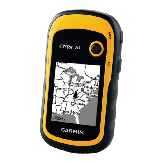
➏ ➐ ➑ ➒ Mini-USB port (under weather cap) ➏ Battery cover ➐ Battery cover locking ring ➑ Mounting spine ➒ eTrex 10 Quick Start Manual Battery information warninG ‹ The temperature rating for the device (-4°F to 158°F, or -20°C to 70°C) may exceed the usable range of some batteries. -
Page 4: Turning On And Off
Rechargeable NiMH. Turning the Device On or Hold (page registering Your Device • Go to http://my.garmin.com. • Keep the original sales receipt, or a photocopy, in a safe place. Satellite Signals After the device is turned on, it begins acquiring satellite signals. The device may need a clear view of the sky to acquire satellite signals. -
Page 5: Adjusting The Screen
adjusting the Screen NoTe: The backlight brightness may be limited when the remaining capacity in the batteries is low. Extensive use of screen backlighting can significantly reduce battery life. 1. While the device is on, press . 2. Move the Thumb Stick left and right to adjust the brightness level. -
Page 6: Increasing The Accuracy Of A Waypoint Location
increasing the accuracy of a waypoint Location Waypoint averaging allows you to increase the accuracy of a waypoint location by collecting multiple samples of the waypoint location. 1. Select Waypoint Averaging. 2. Select a waypoint. 3. Move to the location. 4. -
Page 7: Recording Track Logs
Tracks A track is a recording of your path. The track log contains information about points along the recorded path, including time, location, and elevation for each point. recording Track Logs 1. Select Setup > Tracks > Track Log. 2. Select Record, Do Not Show or Record, Show on Map. -
Page 8: Navigating To A Destination
navigating to a Destination You can navigate to a destination using the map. 1. Select Where To?. 2. Select a category. 3. Select a destination. 4. Select Go. The map page opens with your route marked with a magenta line. 5. -
Page 9: Downloading Geocaches
.com. Optional accessories Optional accessories, such as mounts, maps, and replacement parts, are available at from your Garmin dealer. Contacting Garmin Product Support • Go to and click Contact Support for in-country support information. • In the USA, call (913) 397.8200 or (800) 800.1020. - Page 12 , the Garmin logo, and eTrex ® USA and other countries. Thumb Stick may not be used without the express permission of Garmin. Other trademarks and trade names are those of their respective owners. Garmin International, Inc.,1200 East 151 Liberty House, Hounsdown Business Park, Southampton, Hampshire, SO40 9LR UK No.
Need help?
Do you have a question about the eTrex 10 and is the answer not in the manual?
Questions and answers