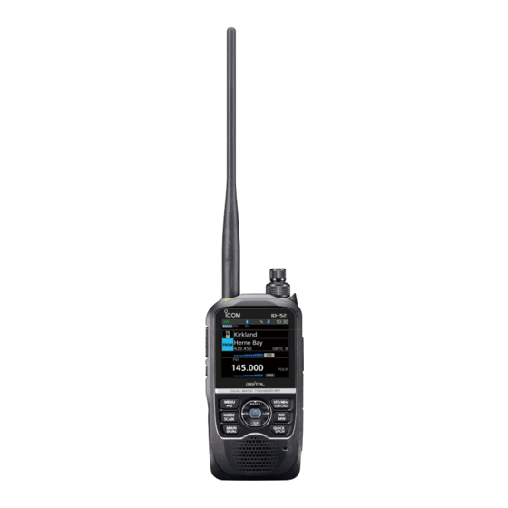
Icom ID-52A Manual
D-star using the gps logger function
Hide thumbs
Also See for ID-52A:
- Advanced manual (263 pages) ,
- Basic manual (88 pages) ,
- Manual (88 pages)
Advertisement
Table of Contents
The GPS Logger function enables you to save the location data from a GPS receiver onto a microSD card as a log.
The GPS Logger saves Latitude, Longitude, Altitude, Positioning state, Course, Speed, Date, and Time.
If you use this GPS Logger while traveling, you can check your trip history on a mapping software.
D-STAR (Digital Smart Technology for Amateur Radio) is a digital radio protocol developed by JARL (Japan
Amateur Radio League).
About the log file
If you have the log file imported to a mapping software, you can display your route as you move on the software map.
L The log files may not be compatible with all mapping software.
L This manual explains how to use the GPS Logger using ID-52A/ID-52E as an example.
NOTE:
• The GPS Logger function requires a microSD card (User supplied).
• Once the GPS Logger function is turned ON, the transceiver continuously saves position data from the GPS receiver,
even if the transceiver is turned OFF, then ON again. To cancel this function, turn OFF the function. While this function is
ON, and when the transceiver is turned OFF, the log file will be closed. Then the transceiver is turned ON, and the GPS
receiver carries out positioning, a new log file will be created.
• When the microSD card is full, this function is automatically paused.
Table of contents
1. How to use the GPS Logger function ................ 1
2. Before Using the GPS Logger function ............. 2
3. To use the GPS Logger function ........................ 4
4. How to use the GPS Logger Only mode ............ 5
1. How to use the GPS Logger function
GOAL!
GOAL!
GPS Logger running
GPS Logger running
z Record your favorite mobile operation
location with the logger.
z Record the altitude of the routes you have
hiked with your friends.
Refer also to the instruction manual of the transceiver you are using.
Icom, Icom Inc. and the Icom logo are registered trademarks of Icom Incorporated (Japan) in Japan, the United States, the United Kingdom,
Germany, France, Spain, Russia, Australia, New Zealand, and/or other countries.
Google and the Google Logo are registered trademarks or trademarks of Google LLC.
All other products or brands are registered trademarks or trademarks of their respective holders.
D-STAR
Using the GPS Logger function
5. Viewing the log data on a PC Map ..................... 6
6. Q&A (GPS Logger mode) .................................... 7
I'm almost to the top!
I'm almost to the top!
Altitude
Altitude
z Record the routes traveled by rail or car
as a reminder of our trips.
1
logging .................................................................. 8
Top
Top
Home
Home
Time
Time
Nov. 2021
You can also see
You can also see
the difference in height
the difference in height
between mountains!
between mountains!
Travel routes
Travel routes
can be recorded!
can be recorded!
Destination
Destination
Advertisement
Table of Contents

Subscribe to Our Youtube Channel
Related Manuals for Icom ID-52A


Summary of Contents for Icom ID-52A
-
Page 1: Table Of Contents
Refer also to the instruction manual of the transceiver you are using. Icom, Icom Inc. and the Icom logo are registered trademarks of Icom Incorporated (Japan) in Japan, the United States, the United Kingdom, Germany, France, Spain, Russia, Australia, New Zealand, and/or other countries. -
Page 2: Before Using The Gps Logger Function
2. Before Using the GPS Logger function When using the GPS Logger function, check the following items. Set the Recording Interval and Recording Sentence as necessary. Inserting a microSD card (User supplied). 2. Check that the GPS signal has been received by the GPS icon on the transceiver ( lights). - Page 3 2. Before Using the GPS Logger function DSetting the GPS record sentence Select the GPS sentence of the content you want to record. All sentences are selected by default. Cancel the recording sentence setting to reduce the amount of data when using the GPS Logger function. Contents of GPS sentence Date Sentence...
-
Page 4: To Use The Gps Logger Function
3. To use the GPS Logger function Set whether or not to record the information received from GPS. When “ON” is set, the data received by GPS is recorded on a microSD card for each recording interval. How to set the GPS Logger function 1. -
Page 5: How To Use The Gps Logger Only Mode
4. How to use the GPS Logger Only mode You can activate the GPS Logger Only mode from the Quick Menu window displayed by pushing [QUICK] on the transceiver. This mode is useful when you do not want to use the transceiver for communication while moving, and want to use it only as a GPS Logger for a long time. -
Page 6: Viewing The Log Data On A Pc Map
5. Viewing the log data on a PC Map You can download log information to a PC and check it. TIP: You can display your route on Google Earth L Windows 10 is used for these instructions. (free map software). 1. -
Page 7: Q&A (Gps Logger Mode)
Only mode? environment. The ID-31A/E and ID-51A/E series, the ID-52A/E, and the IC-R30 are supported. What is the recording interval? The recording interval of the GPS Logger function depends on the transceiver you are using. -
Page 8: About The Recorded Nmea Sentence For Gps Logging
Check Sum (*03) Error detection data started with “*” (hex code) r Speed over ground, knots (0.13 knots) i End code t Speed over ground, kilometer per hour (0.2 km/hr) *Blank shows when not positioned. Nov. 2021 A7603-5EX-2 © 2020–2021 Icom Inc.
Need help?
Do you have a question about the ID-52A and is the answer not in the manual?
Questions and answers