Garmin ECHOMAP UHD Owner's Manual
Hide thumbs
Also See for ECHOMAP UHD:
- Manual (260 pages) ,
- Owner's manual (134 pages) ,
- Installation instructions manual (6 pages)
Table of Contents
Advertisement
Advertisement
Table of Contents

Related Manuals for Garmin ECHOMAP UHD


Summary of Contents for Garmin ECHOMAP UHD
- Page 1 ECHOMAP ™ Owner’s Manual...
- Page 2 © 2019 Garmin Ltd. or its subsidiaries All rights reserved. Under the copyright laws, this manual may not be copied, in whole or in part, without the written consent of Garmin. Garmin reserves the right to change or improve its products and to make changes in the content of this manual without obligation to notify any person or organization of such changes or improvements.
-
Page 3: Table Of Contents
Table of Contents Mapping a Body of Water Using the Garmin Quickdraw Contours Feature ..............11 Adding a Label to a Garmin Quickdraw Contours Map .... 11 Introduction..............1 Garmin Quickdraw Community ..........11 ECHOMAP UHD 60 Front View ..........1 Connecting to the Garmin Quickdraw Community with Device Keys ................ - Page 4 Making an Individual Routine Call to an AIS Target .... 33 Deleting a Sonar Recording ..........24 Gauges and Graphs............. 33 Traditional, Garmin ClearVü, and SideVü Sonar Setup ... 24 Viewing the Compass ............... 33 Setting the Zoom Level on the Sonar Screen ...... 24 Viewing Trip Gauges ..............
- Page 5 Tide, Current, and Celestial Information....34 Sharing and Managing User Data....... 41 Tide Station Information ............34 Connecting to a Garmin Device to Share User Data ....41 Current Station Information ............34 User Data Sharing Cable Wiring Diagram ......41 Celestial Information ..............
-
Page 7: Introduction
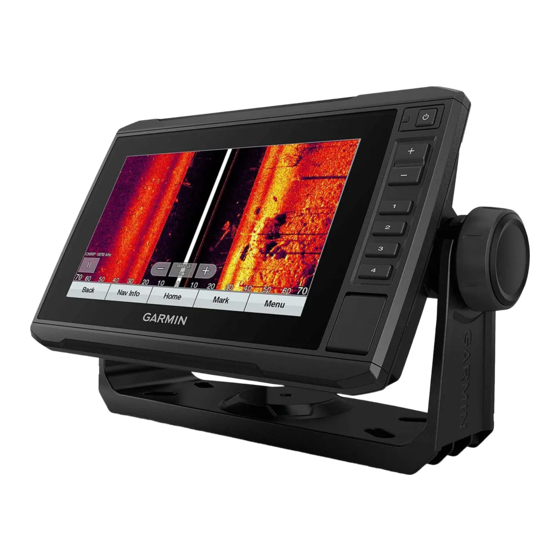
NOTICE information. To prevent corrosion of the metal contacts, cover unused connectors with weather caps. ECHOMAP UHD 60 Front View ECHOMAP UHD 70/90 Front View Power key Automatic backlight sensor Power key... -
Page 8: Tips And Shortcuts
• Select HOME from any screen to return to the Home screen. For more information about GPS, go to garmin.com/aboutGPS. • Select MENU to open additional settings about that screen. For help acquiring satellite signals, see (My device will not •... -
Page 9: Creating A New Combination Page With The Echomap Uhd 60
Top Bar or Bottom Bar, and select the necessary Getting Started with the ActiveCaptain App options. You can connect a mobile device to the ECHOMAP UHD device Select Done. using the ActiveCaptain app. The app provides a quick and easy... -
Page 10: Enabling Smart Notifications
From the ActiveCaptain page, select MENU > Wi-Fi Setup areas of the chart you need. > Wi-Fi Network > Wi-Fi > On. If you are downloading an entire chart, you can use the Garmin Enter a name and password for this network. Express ™... -
Page 11: Navigation Chart And Fishing Chart
Mariner's Eye 3D: Shows a detailed, three-dimensional view Icon Description from above and behind the boat (according to your course) Current station and provides a visual navigation aid. This view is helpful Overhead photo available when navigating tricky shoals, reefs, bridges, or channels, Perspective photo available and when trying to identify entry and exit routes in unfamiliar harbors or anchorages. -
Page 12: Viewing Details About Navaids
A list of options appears. The options that appear vary based The Auto Guidance feature is based on electronic chart on the location or object you selected. information. That data does not ensure obstacle and bottom clearance. Carefully compare the course to all visual sightings, Select Information. -
Page 13: Showing Satellite Imagery On The Navigation Chart
An indicator for a tide station appears on the chart as a vertical Select Photo. bar graph with an arrow. A red arrow pointing downward indicates a falling tide, and a blue arrow pointing upward Automatic Identification System indicates a rising tide. When you move the cursor over the tide The Automatic Identification System (AIS) enables you to station indicator, the height of the tide at the station appears identify and track other vessels, and alerts you to area traffic. -
Page 14: Activating A Target For An Ais Vessel
When course over ground, heading, and rate of turn information and their identifying and location information is sent from are provided by an activated AIS target, the projected course of another location. the target is calculated based on the course over ground and the You can view AIS ATONs on the chart when the chartplotter is rate of turn information. -
Page 15: Turning Off Ais Reception
10). Sailing Angle: Allows you to select how the device calculates Quickdraw Contours: Shows and hides Garmin Quickdraw laylines. The Actual option calculates the laylines using the Contours data (Garmin Quickdraw Contours Settings, measured wind angle from the wind sensor. -
Page 16: Fish Eye 3D Settings
You can purchase maps from Garmin. If you purchase maps the chart view. from a seller other than Garmin, investigate the seller before NOTE: Not all settings apply to all charts, views, and chartplotter purchasing. -
Page 17: Mapping A Body Of Water Using The Garmin Quickdraw Contours Feature
ECHOMAP UHD device, your contour maps are transferred to Contours Map the community automatically. You can add labels to a Garmin Quickdraw Contours map to Connecting to the Garmin Quickdraw Community with mark hazards or points of interest. Garmin Connect From the Navigation chart, select a location. -
Page 18: Garmin Quickdraw Contours Settings
GPS position, and a speed between 16 and 32 km/h (10 and 20 mph). Red indicates poor depth or GPS position, and a Browse to your memory card, and select the Garmin folder. speed above 32 km/h (20 mph). Open the Quickdraw folder, and select the file named ContoursLog.svy. -
Page 19: Destinations
If you are off course, follow the purple line (corrected course) Question Answer to go to your destination, or steer back to the magenta line How do I make the device Build a multi-leg route and navigate it (direct course). guide me to a location while using Route To (Creating and... -
Page 20: Moving A Saved Waypoint
• To change the comment, select Comment. Routes • To move the position of the waypoint, select Position. A route is a path from one location to one or more destinations. Moving a Saved Waypoint Creating and Navigating a Route From Your Present Select Nav Info >... -
Page 21: Browsing For And Navigating Parallel To A Saved Route
Select a route. Auto Guidance Select Navigate To. WARNING Select an option: The Auto Guidance feature is based on electronic chart • To navigate the route from the starting point used when information. That data does not ensure obstacle and bottom the route was created, select Forward. -
Page 22: Auto Guidance Path Configurations
From the Navigation chart, select MENU. • If the turns in the Auto Guidance line are too wide, select Settings > Navigation > Auto Guidance > Shoreline Select Timed Arrival. Distance > Near. TIP: You can quickly open the Timed Arrival menu by If you selected Near or Far in step 6, review the placement of selecting a point on the path or route. -
Page 23: Saving A Track As A Route
• Select Track Color, and select a color. • To record the track based on a distance between points, select Interval > Distance > Change, and enter the Saving a Track as a Route distance. Select Nav Info > Tracks > Saved Tracks. •... -
Page 24: Deleting A Boundary
Select Alarm. • To mark the port and starboard starting line marks as you sail past them, select Ping Marks. Select an option: • To mark the port and starboard starting line marks by • To set an alarm for when your boat is a specified distance entering their coordinates, select Enter Coordinates. - Page 25 Tide Correction: Corrects the laylines based on the tide. Sailboat Autopilot Operation Filter Time Constant: Filters the layline data based on the time CAUTION interval entered. For a smoother layline that filters out some When engaged, the autopilot controls only the rudder. You and of the changes in the boat's heading or true wind angle, enter your crew remain responsible for the sails while the autopilot is a higher number.
- Page 26 Select Enabled. Garmin ClearVü Sonar View Sonar Fishfinder NOTE: To receive Garmin ClearVü scanning sonar, you need a compatible transducer. For information about compatible When properly connected to a compatible transducer, your transducers, go to garmin.com/transducers. chartplotter can be used as a fishfinder.
- Page 27 Left side of the boat Range Right side of the boat Trails The transducer on your vessel Drop shot rig Logs Bottom Old tires LiveVü Forward Sonar View Trees This sonar view shows a two-dimensional view of what is in front Water between the vessel and the bottom of the boat and can be used to see a bait ball and fish.
- Page 28 This sonar view shows a live view of what is in front of or below the boat and can be used to see fish and structures. On the ECHOMAP UHD 60 models, you can press to move the zoom area up and down.
- Page 29 If necessary, select Use AHRS to turn on the AHRS sensor. on your boat. For example, from one ECHOMAP UHD 92sv device mounted at the back of the boat, you can view the sonar Select Calibrate Compass.
- Page 30 , select View Up or View Down to set the depth range of the magnified area, and select Zoom • While in the Garmin ClearVü or SideVü sonar view, select In or Zoom Out to increase or decrease the magnification Contrast.
- Page 31 can be useful for tracking a bottom that has minimal or moderate FrontVü Alarm: Sets an alarm to sound when the depth in front terrain changes. of the vessel is less than the specified value, which can help you avoid running aground (Setting the FrontVü...
- Page 32 Adjusting the frequency helps adapt the sonar for your particular goals and the present depth of the water. Higher frequencies use narrow beam widths, and are better for high-speed operation and rough sea conditions. Bottom definition and thermocline definition can be better when using a higher frequency.
- Page 33 FrontVü Alarm: Sets an alarm to sound when the depth in front Grid Overlay: Shows a grid of range lines. of the vessel is less than the specified value (Setting the Scroll History: Shows the sonar history in a traditional sonar FrontVü...
- Page 34 Noise Reject: Reduces noise and interference and attempts to transducers are installed at a 45-degree angle and down remove returns that are not actually targets in the water. view transducers are installed at a zero-degree angle. Ghost Reject: Reduces the occurrence of "ghost" images, Flipped: Sets the orientation of the Panoptix sonar view when which are duplicated or reflected images that are not actually the down view transducer is installed with the cables pointing...
- Page 35 When the compatible chartplotter is connected to a compatible For best results, use the autopilot CCU internal compass for the Garmin autopilot system, you can engage and control the heading source. Using a third-party GPS compass can cause autopilot from the chartplotter.
- Page 36 Connecting to a Trolling Motor You can connect the chartplotter wirelessly to a compatible WARNING Garmin Force trolling motor on your boat to control the trolling You are responsible for the safe and prudent operation of your motor from the chartplotter.
- Page 37 Adding the Trolling Motor Controls to setting, the propeller turns off when the boat reaches the end of the route. Screens After you have connected the chartplotter to the Force trolling CAUTION motor, you must add the trolling motor control bar to screens to You are responsible for the safe operation of your boat.
- Page 38 Navigation chart at the time of the DSC distress call. When you connect the chartplotter to a Garmin VHF radio, you can use the chartplotter interface to set up an individual routine Select Nav Info > Other Vessels > DSC List.
- Page 39 The chartplotter sends information about the call to the radio. From the engine gauges screen, select MENU > Gauge Setup > Engine Selection > Number of Engines. On your Garmin VHF radio, complete the call. Select First Engine. Making an Individual Routine Call to an AIS Target Select the engine to display in the first gauge.
- Page 40 Speed Display. For more information about purchasing and configuring a digital Select an option: switching system, contact your Garmin dealer. • To calculate the vessel speed based on data from the water-speed sensor, select Water Speed. Adding and Editing a Digital Switching Page •...
- Page 41 Celestial Information NOTE: You can play media only from sources that are connected to the device. You can view information about sunrise, sunset, moonrise, NOTE: Not all features are available on all media sources. moonset, moon phase, and the approximate sky view location of the sun and moon.
- Page 42 To listen to SiriusXM radio, you must have the appropriate When scanning is complete, the first available station in the ® equipment and subscriptions (SiriusXM Satellite Radio, first ensemble found begins playing. page 36). For instructions on connecting a SiriusXM Connect NOTE: After the first scan is complete, you can select Scan Vehicle Tuner, see the stereo installation instructions.
- Page 43 You should be able to hear the preview channel. If not, check Restoring Default Parental Control Settings Values the SiriusXM Connect Tuner and antenna installation and This process deletes all the settings information you have connections, and try again. entered. When you restore the parental control settings to their default values, the passcode value is reset to 0000.
- Page 44 (if applicable), the software NOTE: This option is only available when you have valid depth version for an optional Garmin radar (if applicable), and the unit data. ID number. You may need this information to update the system Measure the distance: software or to purchase additional map data information.
- Page 45 If the message appears again, stop the boat, and ensure the speed-sensor wheel is not stuck. If the wheel turns freely, check the cable connections. If you continue to get the message, contact Garmin product support. Setting the Fuel Capacity of the Vessel Select Settings >...
- Page 46 Naming Devices and Sensors on the Network Before you can set a fuel level alarm, a compatible fuel flow You can name devices and sensors connected to the Garmin sensor must be connected to the chartplotter. Marine Network and the NMEA 2000 network.
- Page 47 NMEA 0183 devices only. at higher speeds. For straighter routes or slower speeds, You can connect the ECHOMAP UHD 60 device to a compatible lowering this value can improve autopilot accuracy. Garmin device to share user data, such as waypoints. If the Turn Transition Dist.: Sets how far before the turn that you...
- Page 48 Type. Select Nav Info > Manage Data > Data Transfer > Replace from Card. Select GPX. To transfer data with Garmin devices again, select the ADM file Saving System Information to a Memory type. Card Copying User Data from a Memory Card You can save system information to a memory card as a troubleshooting tool.
- Page 49 When you add devices to the chartplotter network, repeat these Update your Garmin chartplotter steps to register the new devices using the Garmin Express app. software Updating Your Charts Using the Garmin Express App Update your Garmin charts...
- Page 50 (Updating Software with the Gently wipe the screen with a soft, clean, lint-free cloth. ActiveCaptain App, page 4) or the Garmin Express desktop app (Loading the New Software on a Memory Card Using Garmin Screenshots Express, page 44). You can capture a screenshot of any screen shown on your Loading the New Software on a Memory Card Using Garmin chartplotter as a .png file.
- Page 51 The device withstands incidental exposure Wireless frequency 2.4 GHz @ 18.5 dBm maximum to water of up to 1 m for up to 30 min. For more information, go to www.garmin.com /waterrating. Temperature range From -15° to 55°C (from 5° to 131°F) Input voltage...
- Page 52 Transmit and Receive Specification Measurement Description Sonar frequencies Traditional: 50, 77, 83, or 200 kHz CHIRP Garmin ClearVü: 260, 455, or 059392 ISO acknowledgment 800 kHz 059904 ISO request CHIRP SideVü: 260, 455, or 800 kHz 060928 ISO address claim...
- Page 53 32 updating charts 43 layers 9, 10 navigation inset 3 Garmin Marine Network 39, 40 measuring distance 5 NMEA 0183 32, 39, 40, 46 Garmin product support. See product support navigation 5, 7 NMEA 2000 40, 46 Garmin SideVü 20 panning 5 notifications 4 gauges quickdraw 10–12 engine 33 settings 9 fuel 33, 39 symbols 5...
- Page 54 26 projecting 13 Panoptix 28 FrontVü 22 sharing 41 photos, aerial 7 gain 23 showing 10 ports 1 Garmin ClearVü 20 sonar 23 position, tracking 32 interference 25 tracked vessel 32 position report 32 measuring distances 23 viewing list of 13 power key 1, 2, 37 noise 23–25 Wi‑Fi 3 powerboat 3, 18...
- Page 55 TA-2018/154 TA-2018/209 TA-2018/183 February 2021 GUID-0D15DF1D-FE0A-4101-9423-8240088D45C2 v3...
- Page 56 ECHOMAP UHD 6x Connector View ECHOMAP ™ POWER Power and data sharing NMEA 2000 network ® INSTALLATION XDCR 4-pin transducer INSTRUCTIONS NOTICE To prevent corrosion of the metal contacts, cover unused Important Safety Information connectors with weather caps. ECHOMAP UHD 7x/9x Connector View...
- Page 57 Some models have the option of adding a swivel base to the bail mount, so you can turn the device for a wider range of viewing angles. NOTE: The ECHOMAP UHD 9x models do not have a swivel Place the cradle into the bail-mount bracket , and tighten option.
- Page 58 Cradle The cables connectors fit only in the correct ports on the ECHOMAP UHD 7x/9x cradle. The connected cables are held in If you will not have access to the back of the device after you place by locking rings.
- Page 59 The blue and brown wires on those devices can connect to NMEA 0183 devices only. You can connect the ECHOMAP UHD 6x device to a compatible Garmin device to share user data, such as waypoints. If the devices are mounted near each other, you can connect the blue and brown wires.
- Page 60 127250 Vessel heading The device withstands incidental exposure to water of up to 1 m for up to 30 min. For more information, go to www.garmin.com/waterrating. 127488 Engine parameters: Rapid update NMEA 2000 is available on ECHOMAP UHD 7x/9x models.
- Page 61 This data applies only to NMEA 2000-compatible products. (GB/T26572) 规定的限量 NMEA 0183 Information *該產品說明書應提供在環保使用期限和特殊標記的部分詳細講解 產品的擔保使用條件。 Transmit Sentence Description © 2019 Garmin Ltd. or its subsidiaries GPAPB APB: Heading or track controller (autopilot) sentence "B" Garmin ® , the Garmin logo, and ECHOMAP ™...
- Page 62 If your transducer cable is not long enough to reach the chartplotter, you can add an extension cable (Garmin part GT36UHD/GT56UHD number 010-11617-42 or 010-11617-32, not included). To avoid signal degradation, do not extend the cable more than 9 m (30 TRANSDUCERS ft.).
- Page 63 The transducer must be in clean (non-turbulent) water for optimal performance. • On single-drive boats, the transducer must not be mounted in the path of the propeller. The transducer can cause cavitation that can degrade the performance of the boat and damage the propeller. •...
- Page 64 Place the cable-entry cover over the hole and the cable, with the opening pointing downward, and mark the location of the two pilot holes. Before tightening the screws, route the cable inside the mount to a cable exit. The trolling motor mount is designed with multiple cable exits. You should use a cable exit that allows the cable to be on the Remove the cable-entry cover, and, using a 3.2 mm ( in.)
- Page 65 Appendix trademarks of Garmin Ltd. or its subsidiaries. These trademarks may not be used without the express permission of Garmin. Specifications All models Dimensions (L x W x H) 218.5 x 51.8 x 27.7 mm (8.61 x 2.04 x 1.09 in.) Operating temperature range From 0°...
- Page 66 Правила техники безопасности и сведения об изделии 15 produto Važne informacije o proizvodu i sigurnosti Belangrijke veiligheids- en productinformatie Σημαντικές πληροφορίες για την ασφάλεια και το προϊόν Vigtige produkt- og sikkerhedinformationer 重要安全和产品信息 April 2017 190-00720-32_0F © 2013–2017 Garmin Ltd. or its subsidiaries...
- Page 67 This device does not relieve you from the of any country. Garmin navigation products are intended to be used only as a travel aid and must not responsibility of safely operating your vessel. Avoid navigational hazards and never leave the helm be used for any purpose requiring precise measurement of direction, distance, location or topography.
- Page 68 If the paper size is not large enough, select Properties and select a Page Size that is larger than the template. ➎ NOTICE Garmin is not responsible for any damages or expenses resulting from a miscut mounting surface arising from a failure to follow these instructions.
- Page 69 3.2 mm (1/8 in.) 10 mm (13/32 in.) 143.7 mm ECHOMAP™ UHD 9x Series (5 11/16 in.) 250.8 mm (9 7/8 in.) September 2019 Printed in Taiwan 190-02598-05_0A...
Need help?
Do you have a question about the ECHOMAP UHD and is the answer not in the manual?
Questions and answers