Sign In
Upload
Manuals
Brands
Garmin Manuals
Marine Equipment
ECHOMAP UHD 70
Garmin ECHOMAP UHD 70 Manuals
Manuals and User Guides for Garmin ECHOMAP UHD 70. We have
1
Garmin ECHOMAP UHD 70 manual available for free PDF download: Owner's Manual
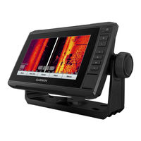
Garmin ECHOMAP UHD 70 Owner's Manual (69 pages)
Brand:
Garmin
| Category:
Marine Equipment
| Size: 6 MB
Table of Contents
Table of Contents
3
Introduction
7
ECHOMAP UHD 60 Front View
7
Device Keys
7
ECHOMAP UHD 60 Connector View
7
ECHOMAP UHD 70/90 Front View
7
Assigning a Shortcut Key
7
ECHOMAP UHD 70/90 Connector View
7
Tips and Shortcuts
8
Downloading the Manuals from the Web
8
Garmin Support Center
8
Inserting Memory Cards
8
Acquiring GPS Satellite Signals
8
Selecting the GPS Source
8
Customizing the Chartplotter
8
Customizing the Home Screen
8
Customizing Pages
8
Creating a New Combination Page with the ECHOMAP UHD 70/90
8
Creating a New Combination Page with the ECHOMAP UHD 60
9
Customizing the Data Overlays
9
Setting the Vessel Type
9
Adjusting the Backlight
9
Adjusting the Color Mode
9
Changing the Background Image
9
Activecaptain App
9
Activecaptain Roles
9
Getting Started with the Activecaptain App
9
Enabling Smart Notifications
10
Updating Software with the Activecaptain App
10
Updating Charts with Activecaptain
10
Charts and 3D Chart Views
10
Navigation Chart and Fishing Chart
11
Zooming in and out of the Chart
11
Panning the Chart with the Keys
11
Selecting an Item on the Map Using the Device Keys
11
Chart Symbols
11
Measuring a Distance on the Chart
11
Creating a Waypoint on the Chart
11
Navigating to a Point on the Chart
11
Viewing Location and Object Information on a Chart
11
Viewing Details about Navaids
12
Heading Line and Angle Markers
12
Premium Charts
12
Viewing Tide Station Information
12
Showing Satellite Imagery on the Navigation Chart
13
Viewing Aerial Photos of Landmarks
13
Automatic Identification System
13
AIS Targeting Symbols
13
Heading and Projected Course of Activated AIS Targets
13
Activating a Target for an AIS Vessel
14
Viewing a List of AIS Threats
14
Setting the Safe-Zone Collision Alarm
14
AIS Aids to Navigation
14
AIS Distress Signals
14
Turning off AIS Reception
15
Chart Menu
15
Chart Layers
15
Fish Eye 3D Settings
16
Supported Maps
16
Garmin Quickdraw Contours Mapping
16
Mapping a Body of Water Using the Garmin Quickdraw Contours Feature
17
Adding a Label to a Garmin Quickdraw Contours Map
17
Garmin Quickdraw Community
17
Connecting to the Garmin Quickdraw Community with Activecaptain
17
Connecting to the Garmin Quickdraw Community with Garmin Connect
17
Garmin Quickdraw Contours Settings
18
Navigation with a Chartplotter
18
Basic Navigation Questions
18
Destinations
19
Searching for a Destination by Name
19
Selecting a Destination Using the Navigation Chart
19
Searching for a Marine Services Destination
19
Setting and Following a Direct Course Using Go to
19
Stopping Navigation
19
Waypoints
19
Marking Your Present Location as a Waypoint
19
Creating a Waypoint at a Different Location
19
Marking an MOB Location
19
Moving a Saved Waypoint
20
Browsing for and Navigating to a Saved Waypoint
20
Deleting a Waypoint or an MOB
20
Deleting All Waypoints
20
Routes
20
Creating and Navigating a Route from Your Present Location
20
Creating and Saving a Route
20
Viewing a List of Routes and Auto Guidance Paths
20
Editing a Saved Route
20
Browsing for and Navigating a Saved Route
20
Browsing for and Navigating Parallel to a Saved Route
21
Deleting a Saved Route
21
Deleting All Saved Routes
21
Auto Guidance
21
Setting and Following an Auto Guidance Path
21
Creating and Saving an Auto Guidance Path
21
Adjusting an Auto Guidance Path
21
Canceling an Auto Guidance Calculation in Progress
21
Setting a Timed Arrival
21
Auto Guidance Path Configurations
22
Tracks
22
Showing Tracks
22
Setting the Color of the Active Track
22
Saving the Active Track
22
Viewing a List of Saved Tracks
22
Editing a Saved Track
22
Saving a Track as a Route
23
Browsing for and Navigating a Recorded Track
23
Deleting a Saved Track
23
Deleting All Saved Tracks
23
Retracing the Active Track
23
Clearing the Active Track
23
Managing the Track Log Memory During Recording
23
Configuring the Recording Interval of the Track Log
23
Boundaries
23
Creating a Boundary
23
Deleting a Boundary
24
Advertisement
Advertisement
Related Products
Garmin ECHOMAP UHD 60
Garmin ECHOMAP UHD90
Garmin ECHOMAP Ultra Series
Garmin ECHOMAP UHD
Garmin ECHOMAP UHD2 5X
Garmin ECHOMAP UHD2 5 Series
Garmin ECHOMAP UHD2 7 Series
Garmin ECHOMAP UHD2 55cv
Garmin ECHOMAP UHD2 52cv
Garmin ECHOMAP UHD2 6 SV
Garmin Categories
GPS
Watch
Car Navigation system
Avionics Display
Marine Equipment
More Garmin Manuals
Login
Sign In
OR
Sign in with Facebook
Sign in with Google
Upload manual
Upload from disk
Upload from URL