Table of Contents
Advertisement
Advertisement
Table of Contents

Related Manuals for Leica GS14


Summary of Contents for Leica GS14
-
Page 1: User Manual
Leica GS14 User Manual Version 1.1.1 English... - Page 2 • microSD Logo is a trademark of SD-3C, LLC. All other trademarks are the property of their respective owners. Validity of this This manual applies to all models of the GS14 GNSS instrument. Where there are manual differences between the various instruments they are clearly described.
- Page 3 View the service history of your products in Leica Geosystems Service Centers and detailed information on the services performed on your products. For your products that are currently in Leica Geosystems Service Centers view the current service status and the expected end date of service.
-
Page 4: Table Of Contents
Batteries 4.2.1 Operating Principles 4.2.2 Battery for GS14 Working with the Memory Device Working with the RTK Device LED Indicators on GS14 Guidelines for Correct Results with GNSS Surveys Care and Transport Transport Storage Cleaning and Drying Technical Data GS14 Technical Data 6.1.1... -
Page 5: Safety Directions
Important paragraphs which must be adhered to in practice as they enable the product to be used in a technically correct and efficient manner. GS14, Safety Directions... -
Page 6: Definition Of Use
• To ensure that it is used in accordance with the instructions. • To be familiar with local regulations relating to safety and accident prevention. • To inform Leica Geosystems immediately if the product and the application becomes unsafe. • To ensure that the national laws, regulations and conditions for the operation of e.g. -
Page 7: Hazards Of Use
• If the product has to be permanently mounted in an exposed location, it is advis- able to provide a lightning conductor system. A suggestion on how to design a lightning conductor for the product is given below. Always follow the regulations in GS14, Safety Directions... - Page 8 When transporting or shipping batteries, the person in charge of the product must ensure that the applicable national and international rules and regulations are observed. Before transportation or shipping contact your local passenger or freight transport company. GS14, Safety Directions...
- Page 9 Product-specific treatment and waste management information can be downloaded from the Leica Geosystems home page at http://www.leica- geosystems.com/treatment or received from your Leica Geosystems dealer. Only Leica Geosystems authorised service workshops are entitled to repair these prod- WARNING ucts. GS14, Safety Directions...
-
Page 10: Electromagnetic Compatibility Emc
WARNING Although the product meets the strict regulations and standards which are in force in this respect, Leica Geosystems cannot completely exclude the possibility that other equipment may be disturbed. There is a risk that disturbances may be caused in other equipment if the product is... -
Page 11: Fcc Statement, Applicable In U
• Connect the equipment into an outlet on a circuit different from that to which the receiver is connected. • Consult the dealer or an experienced radio/TV technician for help. Changes or modifications not expressly approved by Leica Geosystems for compliance WARNING could void the user's authority to operate the equipment. -
Page 12: Description Of The System
75% full before beginning the upload, and do not remove the battery during the upload process. Software for Description The software can be uploaded using the Leica Web server All GS models application or myWorld@Leica Geosystems. Ensure that a Leica microSD card is inserted into the GS instrument before starting the upload. -
Page 13: Power Concept
2.2.3 Data Storage Concept Description Data (Leica GNSS raw data and RINEX data) can be recorded on the microSD card. Memory device microSD card: The GS14 GNSS instrument has a microSD card slot fitted as standard. A microSD card can be inserted and removed. Available capacity: 1 GB ... -
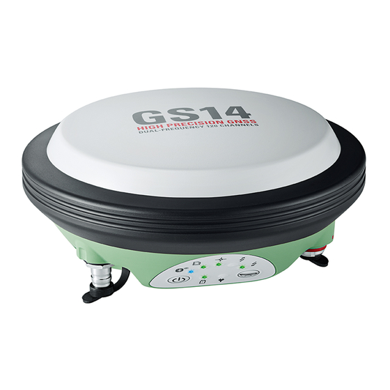
Page 14: Instrument Components
LEDs, ON/OFF button and Function button d) LEMO port, serial and USB e) Mechanical Reference Plane (MRP) 004107_002 A Bluetooth port is included inside all GS GNSS instruments to enable connectivity to the CS10/CS15 field controller. GS14, Description of the System... -
Page 15: User Interface
If the GS14 is in: • base mode: The GS14 switches to be in rover mode. • rover mode and in static mode: The GS14 switches to be in base mode. • rover mode and in kinematic mode: The GS14 switches to be in base mode. - Page 16 • base mode: No action. • rover mode and configured for a dial-up or Ntrip connec- tion: The RTK rover LED flashes green for 2 s. The GS14 will connect to the RTK base station or the Ntrip server configured.
-
Page 17: Operating Principles
Keyboard" for a detailed description of the buttons and their function. Operation by CS field controller The GS14 GNSS instrument is operated by the CS field controller using the SmartWorx Viva software. Refer to the Leica CS10/CS15 User Manual or Leica Viva GNSS Getting Started Guide for a detailed description of the keys and their function. -
Page 18: Operation
Insert the Leica Viva Series USB card. Run the SetupViva&GR_USB_XX.exe to install the drivers necessary for Leica Viva devices. Depending on the version (32bit or 64bit) of the oper- ating system on your PC, you have to select between the three setup files following: •... - Page 19 Run the ActiveSync installation program if not already installed. Allow USB connections inside the Connection Settings window of ActiveSync. For PCs with Windows Vista or Windows 7 operating system: Windows Mobile Device Center starts up automatically. If does not start automatically, start Windows Mobile Device Center. GS14, Operation...
- Page 20 ActiveSync. Click Explore in ActiveSync. The folders on the GS14 GNSS instrument are displayed under Mobile Devices. The folders of the data storage device can be found in StorageCard. For PCs with Windows Vista or Windows 7 operating system: ...
-
Page 21: Connecting To The Web Server
Instead of connecting to your PC, you can connect your GS GNSS instrument to the Leica CS field controller. In this case, turn on the Leica CS field controller, start SmartWorx Viva and establish a Blue- tooth connection to the GS GNSS instrument. - Page 22 • Current Status – To access GNSS information of the GS as well as the instrument firm- ware. • Instrument – To access configuration settings for the GS. • User – To upload and activate firmware, licence keys and languages. GS14, Operation...
-
Page 23: Batteries
+10°C to +20°C/+50°F to +68°F if possible. • It is normal for the battery to become warm during charging. Using the chargers recommended by Leica Geosystems, it is not possible to charge the battery if the temperature is too high. -
Page 24: Working With The Memory Device
Step Description Removing the microSD card while the GS14 is turned on can cause loss of data. Only remove the microSD card or unplug connecting cables when the GS14 is switched off. The microSD card is inserted into a slot inside the battery compartment of the instrument. -
Page 25: Working With The Rtk Device
Working with the RTK Device Devices fitted into Depending on the GS14 model one or two of the following devices are integrated: the GS14 GNSS Type Device instrument 2G GSM Cinterion BGS2-W 3.75G GSM/UMTS Cinterion PHS8-P 3.75G GSM/UMTS Cinterion PXS8... -
Page 26: Led Indicators On Gs14
LED Indicators on GS14 LED indicators Description The GS14 GNSS instrument has Light Emitting Diode indicators. They indicate the basic instrument status. Diagram a bc de f a) Bluetooth LED b) Storage LED c) Power LEDs d) Position LED e) RTK Base LED... -
Page 27: Guidelines For Correct Results With Gnss Surveys
RTK Base LED off GS14 is in RTK rover mode or GS14 is switched off. green GS14 is in RTK base mode. No RTK data is being passed to the interface of the communication device. flashing green GS14 is in RTK base mode. Data is being passed to the interface of the communication device. -
Page 28: Care And Transport
Always carry the product in its transport container and secure it. Shipping When transporting the product by rail, air or sea, always use the complete original Leica Geosystems packaging, transport container and cardboard box, or its equivalent, to protect against shock and vibration. Shipping, transport... -
Page 29: Cleaning And Drying
Cables and plugs Keep plugs clean and dry. Blow away any dirt lodged in the plugs of the connecting cables. Connectors with Wet connectors must be dry before attaching the dust cap. dust caps GS14, Care and Transport... -
Page 30: Technical Data
Technical Data GS14 Technical Data 6.1.1 Tracking Characteristics Instrument tech- SmartTrack nology Satellite reception Dual frequency Supported codes and phases Carrier phase, C/A-code Carrier phase, C code (L2C) and P2-code GLONASS Carrier phase, C/A-code Carrier phase, P2-code Galileo Alt-BOC Carrier phase, code - ... -
Page 31: Technical Data
Instrument weight without battery, SIM card and SD card: Type Weight [kg]/[lbs] GS14 0.93/2.04 Recording Data (Leica GNSS raw data and RINEX data) can be recorded on the data storage device. Type Capacity [GB] Data capacity microSD • 1 1 GB is typically sufficient for about... - Page 32 Dust tight Protected against continuous immersion in water Tested for 2 hours in 1.40 m depth Humidity Protection Up to 100 % The effects of condensation are to be effectively counteracted by periodically drying out the instrument. GS14, Technical Data...
-
Page 33: Conformity To National Regulations
• FCC Part 15 (applicable in US) national regulations • Hereby, Leica Geosystems AG, declares that the product GS14 is in compliance with the essential requirements and other relevant provisions of Directive 1999/5/EC and other applicable European Directives. The declaration of conformity can be consulted at http://www.leica-geosystems.com/ce. - Page 34 Antenna Gain [dBi] GNSS Internal GNSS antenna element (receive only) Bluetooth Internal Microstrip antenna 2 max. External antenna GSM/UMTS Integrated antenna 0 max. @ 800 / 850 / 900 3 max. @ 1800 / 1900 / 2100 GS14, Technical Data...
-
Page 35: Software Licence Agreement
Leica Geosystems. Such software is protected by copyright and other laws and its use is defined and regulated by the Leica Geosystems Software Licence Agreement, which covers aspects such as, but not limited to, Scope of the Licence, Warranty, Intellectual Property Rights, Limitation of Liability, Exclusion of other Assurances, Governing Law and Place of Jurisdiction. -
Page 36: Appendix A Pin Assignments And Sockets
In or out Signal ground RS232, receive data PIN_001 RS232, transmit data Identification pin In or out Power input, 10.5 V-28 V GPIO RS232, general-purpose signal In or out Sockets Port 1: LEMO-1, 8 pin, LEMO HMI.1B.308.CLWP GS14, Pin Assignments and Sockets... -
Page 37: Index
Charging, first-time use ........23 SIM card ............25 Operation, Discharging ........23 Instrument ............12 Battery Instrument components ........14 Change in GS14 ..........23 Internal power supply .........13 External, instrument ........31 For internal power supply ....... 13 Internal, instrument ........31 Keyboard Bluetooth GS14 ..............15... - Page 38 Pin Assignment ..........36 Position Uninterruptible Power Supply ......13 LED on GS14 ..........26 Upload software ..........12 Power UPS ..............13 GS14 .............. 31 User Interface ............15 Power LED User Manual GS14 .............. 26 Validity of ............2 Power supply ............. 13 Web server ............12...
- Page 39 GS14, Index...
- Page 40 798165-1.1.1en Original text Published in Switzerland © 2013 Leica Geosystems AG, Heerbrugg, Switzerland Leica Geosystems AG Heinrich-Wild-Strasse CH-9435 Heerbrugg Switzerland Phone +41 71 727 31 31 www.leica-geosystems.com...
Need help?
Do you have a question about the GS14 and is the answer not in the manual?
Questions and answers