Raymarine E-Series Operating Manual
Hide thumbs
Also See for E-Series:
- Reference manual (360 pages) ,
- User reference handbook (260 pages) ,
- Installation instructions manual (112 pages)
Table of Contents
Advertisement
Quick Links
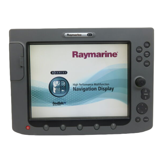
E-Series Display
Operating Guide
What can I see?
Understanding the chart
Using the chart
Basic Navigation
Working with waypoints
How do I get to a point?
What is around me?
Understanding the radar
Avoiding a collision
Using MARPA
Where am I going?
Monitoring a course
What's under the boat?
Understanding the fishfinder
Using the fishfinder
Other functions
Monitoring data and engines
Viewing video images
Operating a networked E-Series Display
PAGE
ACTIVE
WPTS
MOB
DATA
MENU
General Operation
The control panel
OUT
RANGE
IN
Using the controls
Setting up the display
OK
CANCEL
Using CompactFlash cards
www.raymarine.com
Card 1
Card 2
Card 3
Card 4
Card 5
Card 6
Card 7
Card 8
Card 9
Card 10
Card 11
Card 12
Card 13
Card 14
Card 15
Card 15
Card 16
Advertisement
Table of Contents

Related Manuals for Raymarine E-Series


Summary of Contents for Raymarine E-Series
- Page 1 Where am I going? Card 12 Monitoring a course What's under the boat? Understanding the fishfinder Card 13 Using the fishfinder Card 14 Other functions Monitoring data and engines Card 15 Viewing video images Card 15 Operating a networked E-Series Display Card 16...
-
Page 2: General Operation
General Operation The control panel Card No. 1 DATA ACTIVE PAGE Press to access When multiple windows are open: Press to scroll through available pages. ruler, chart vectors, - Press to select required window. Press and hold to select different page archive &... -
Page 3: Using The Controls Card
General Operation Using the controls Card No. 2 How do the controls work? Buttons PAGE Example: Access system functions or change what you see on-screen. This example shows the ACTIVE Within the text of this document they are written in bold capitals series of button and soft WPTS/ e.g. -
Page 4: Setting Up The Display Card
General Operation Setting up the display Card No. 3 How do I select how the applications are displayed? The applications are shown using a combination of page sets, pages and windows. There are four pre- configured page sets each containing five pages with a combination of windows and applications in each. -
Page 5: Using Compactflash Cards Card
Card No. 4 CAUTION CompactFlash Card In order to protect your E-Series Display and CompactFlash cards from irreparable damage, please adhere to the following: Fit the card the correct way around. DO NOT force. Ensure card door is firmly closed at all times. -
Page 6: Understanding The Chart Card
What can I see? FIND SHIP GOTO ROUTES TRACKS PRESENTATION Understanding the chart Card No. 5 What can I use the chart for? Find where you are. Record where you have been. Interpret your surroundings. Measure the distance between two points. Place waypoints at specific locations. -
Page 7: Using The Chart Card
What can I see? FIND SHIP GOTO ROUTES TRACKS PRESENTATION Using the chart ... Card No. 6 How do I find where I am on the chart? If you cannot find the boat symbol on the screen: The screen automatically pans to FIND SHIP your boat's position and re- The boat symbol... -
Page 8: Basic Navigation
Fishfinder. The details of each waypoint are stored in a waypoint list which can hold up to 1200 waypoints. If you have networked two or more E-Series Displays, the waypoints are stored on the master display and transferred to other displays via the SeaTalk High Speed network. If required, waypoints can be archived to a CompactFlash card or transferred to another NMEA compatible instrument. - Page 9 You can save a route for future use or follow it immediately (Quick Route). Routes are stored in a route list. If you have networked two or more E-Series displays, the routes are stored in the master display and are transferred to the other displays via the SeaTalk High Speed network.
-
Page 10: Understanding The Radar Card
What is around me? TARGET VRM/EBL GAIN TARGETS PRESENTATION TRACKING Understanding the radar Card No. 9 What does the radar show me?..Orientation Motion mode Range ring spacing Data bar Icon confirming Range Head-Up Relative Motion Rings ½nm radar connection Range ring Ship's... -
Page 11: Avoiding A Collision Card
How can the radar help me avoid a collision? You can set up your E-Series Display to sound an alarm when anything comes within a pre-set range of the boat. These guard zones allow you to take any necessary action to avoid a collision. -
Page 12: Using Marpa Card
What is around me? MONITOR ACQUIRE TARGET MARPA LIST MARPA OPTIONS IN ZONES Using MARPA..Card No. 11 What is MARPA? Mini Automatic Radar Plotting Aid (MARPA) functions are used for target tracking and risk analysis. MARPA improves your standards of collision avoidance by obtaining detailed information for up to 10 targets, and provides continuous and rapid situation evaluation. -
Page 13: Monitoring A Course Card
Where am I? FIND SHIP GOTO ROUTES TRACKS PRESENTATION Monitoring a course..Card No. 12 How do I monitor my course?..Your course is shown on the chart application whilst motion mode is active. Using COG and heading vectors (Press DATA - CHART VECTORS - COG/HDG VECTORS). Use the Course Deviation Indicator (CDI). -
Page 14: Understanding The Fishfinder Card
These waypoints are added to the waypoint list and can be used by other applications in your E-Series display. What can I see on the screen? -
Page 15: Using The Fishfinder Card
What's under the boat? TRANSDUCER ZOOM BOTTOM LOCK A - SCOPE PRESENTATION SETTINGS Using the fishfinder..Card No. 14 How do I change the range or shift the image? Your system automatically adjusts the display depth range, selecting the shallowest depth that keeps the bottom on the lower half of the window. -
Page 16: Viewing Video Images Card
Monitoring data and engines Viewing video images Card No. 15 How do I monitor data?..NAVIGATION WAYPOINT ROUTE FISHING SAILING The digital data application enables you to view numeric data generated by the system or by instruments available on NMEA or SeaTalk. This information is displayed in a series of pre- configured panels which contain data relating to a particular function or activity. -
Page 17: Operating A Networked E-Series Display Card
Card No. 16 What does a networked system do? If you have connected two or more E-Series Displays (via either a crossover coupler or SeaTalk High Speed Switch), data can be transferred across the network enabling you to input, view and maintain data across all your Displays irrespective of the Display from which the data originated (excepting Video Input). - Page 18 Raymarine Ltd Raymarine Inc. Quay Point 22 Cotton Road, Unit D Northarbour Road, Nashua, NH 03063-4219 Portsmouth, Hampshire England PO6 3TD 603-881-5200 +44 (0)23 9269 3611 603-864-4756 fax +44 (0)23 9269 4642 fax www.raymarine.com www.raymarine.com D6826_1...
Need help?
Do you have a question about the E-Series and is the answer not in the manual?
Questions and answers