Advertisement

1.
Important safety instructions ............................................
2.
Accessories ...................................................................
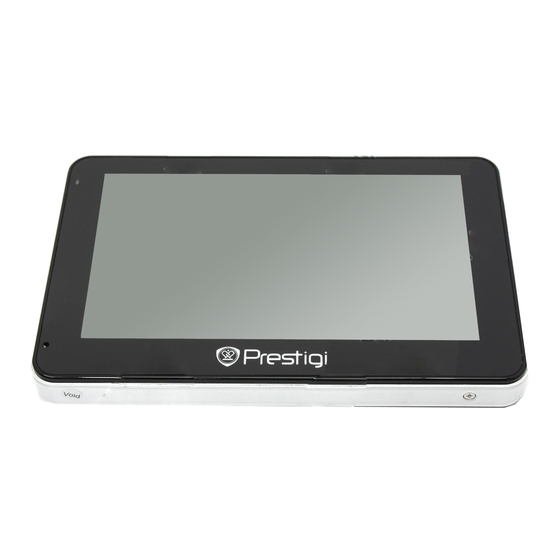
3.
View of main unit .............................................................
4.
Device connections ............................................................
5.
Cautions on battery charging ..............................................
6.
Getting started ...............................................................
7.
Device Settings...............................................................
8.
Bluetooth Function .........................................................
9.
FM Function .......................................
11. Programme interface........................................................
12. Autorouting .......................................................................
13. "More" menu ............................................................
14. Troubleshooting .............................................................
EN-1
Contents
2
3
4
6
8
9
10
11
15
16
17
21
23
24

Advertisement

Table of Contents
loading

Summary of Contents for Prestigio GeoVision 4500

  • Page 1: Table Of Contents

    Contents Important safety instructions ………………………………..…... Accessories …………………………………………………………. View of main unit …………………….……………………………... Device connections ……………………….…………....Cautions on battery charging ………….……………....Getting started ……………………………………………………… Device Settings…………………………………………..…………. Bluetooth Function …………………………….………………….. FM Function ………………..………………. 10. Connecting to “Navitel.Traffic”…………………....11. Programme interface………...……………….……....12. Autorouting …..……………………………......... 13.
  • Page 2: Important Safety Instructions

    Important Safety Instructions The exclamation point within an equilateral triangle is intended to alert the user to the presence of important operating and maintenance (servicing) instructions in the literature accompanying the appliance. CAUTION To reduce the risk of electric shock, do not remove the cover (or back). No user-serviceable parts inside.
  • Page 3: Accessories

    Accessories Prestigio GeoVision 4500/4500BTFM/5500BTFMHD–Accessories List ITEM NAME Car Charger USB Cable Stylus Pen Stylish Carry Case (GV5500BT only) User Manual Warranty Card Driver/Document CD EN-3...
  • Page 4: View Of Main Unit

    View of Main Unit Prestigio GeoVision 4500/4500BTFM/5500BTFMHD Front and Side View LCD Touch Screen Tap the screen with touch pen or finger to select menu commands or to enter information. Battery Status Indicator The indicator glows in bright green colour when battery is fully charged and in red color when charging.
  • Page 5 View of Main Unit Prestigio GeoVision 4500/4500BTFM/5500BTFMHD Rear and Top View Speaker Emits sound, voice or music. Reset Button Press to reboot the device. Light Sensor Adjust the brightness of touch screen Power Button Press to power the device ON/OFF.
  • Page 6: Device Connections

    Device Connections Inserting microSD Card  To insert a microSD card, place the connector towards the device and the card label towards the front side of the device.  To remove a microSD card, gently press the edge of the card to release the safety lock and pull the card out of the slot.
  • Page 7 Device Connections Connecting to Car Charger  Insert the USB connector into the appropriate USB port.  Insert car charger connector into vehicle 12V accessory/cigarette socket to start charging. NOTE: Please connect the car charger to vehicle 12V accessory/cigarette socket after the vehicle engine is started to protect the device from sudden surges in current.
  • Page 8: Cautions On Battery Charging

    Cautions on Battery Charging About Rechargeable Battery The device is equipped with a built-in rechargeable battery. Please fully charge the battery (for at least 5 hours) before initial use. The battery status indicator glows in red colour when charging and turns bright green colour when charging is complete. Charging time is approximately 4 hours.
  • Page 9: Getting Started

    Getting Started 1. Press and hold Power Button to turn on the device. 2. Shortly after the greeting screen is shown, the main menu will be displayed. 3. Tap the corresponding buttons with touch pen included to navigate through various functions. 4.
  • Page 10: Device Settings

    Device Settings  In the main menu, tap on enter the device settings.  to display other settings. Volume Adjust sound volume, mute device, or enable warning messages. Adjust the brightness of touch screen, enable/disable auto Backlight backlight. Language Select desired language. DateTime Set up Time Zone/Date/Time.
  • Page 11: Bluetooth Function

    Bluetooth Function (GeoVision 5500BTFMHD/4500BTFM) Tap on Bluetooth icon on the main menu to start using Bluetooth function. The link status is shown at the bottom of the interface. Tap on to exit the current function. Tap on in Bluetooth interface to start pairing with mobile phone device with GPRS function.
  • Page 12 Bluetooth Function (GeoVision 5500BTFMHD/4500BTFM) Tap on to adjust the volume. Tap on to end call. 10. Tap on to enter call record. Tap to enter keypad. Tap on to switch the call to mobile phone or switch it back to device. 11.
  • Page 13 Bluetooth Function (GeoVision 5500BTFMHD/4500BTFM) 14. Tap on on Bluetooth interface to enter Dial Record. 15. Tap on to view Dialed Call list, Received Call list, and Missed Call list. Tap on to start dialing. 16. To delete a desired phone number on the list, select the number and tap .
  • Page 14 Bluetooth Function (GeoVision 5500BTFMHD/4500BTFM) 21. Tap on in Bluetooth interface to enter Paired Device List function. 22. Tap on to delete mobile phone name from the list. Tap on disconnect the PND (Personal Navigation Device) from the mobile phone. Select mobile phone name from Paired Device List and tap on to enter Profile list.
  • Page 15: Fm Function

    Bluetooth Function (GeoVision 5500BTFMHD/4500BTFM) 27. Tap on enter Phonebook. 28. Tap on to download the phone numbers of the mobile phone to the PND (Personal Navigation Device). 29. Tap on to dial the phone number. 30. Tap on to delete mobile phone name from the list.
  • Page 16: Connecting To "Navitel.traffic

    Connecting to “Navitel.Traffic” (GeoVision 5500BTFMHD/4500BTFM) 7. Tap on in Bluetooth interface to start pairing with mobile phone device with GPRS function. 8. Please make sure Bluetooth function on mobile phone is detectable by other devices. 9. After successful pairing enter Profile list and tap on Dialup Networking Service.
  • Page 17: Programme Interface

    Program interface Name Function Press the compass loon to edit map rotation mode, map view Compass and day/night mode. Sound Press this button to turn on/off voice and sound effects. Next maneuver on the way and distance up to it. Press this Icon Next maneuver to open route options menu.
  • Page 18 Program interface Name Function When you approach a speed camera with visual warnings being activated the window will appear In upper right comer at the Speedcam screen. This window shows you permitted speed and distance window left. Press the window to turn On/Off speed exceeding sound warnings.
  • Page 19 Program interface Name Function When you approach a speed camera with visual warnings being activated the window will appear In upper right comer at the Speedcam screen. This window shows you permitted speed and distance window left. Press the window to turn On/Off speed exceeding sound warnings.
  • Page 20 Program interface Name Function Track record. Green icon - track record enabled, white icon Track record function disabled. Touch the screen with a stylus to set a mark. You can save this Mark on map mark as a way point add it to the route or see object’s characteristics the mark was set on.
  • Page 21: Autorouting

    Autorouting Route to the object from search To create a route to the object, which address you know, press the «Find» button at the left bottom of the screen(1]. Select the «By Address» menu(2]. Press the city select button(3] and enter its name(4]. To minimize keyboard press the icon at the right top of the screen.
  • Page 22 Autorouting Route to the selected mark on the map You can set a route to any mark on the map. This mark will be the end point of your route while the start will be in your current location. To create a route, create a mark by pressing a map in the necessary place[1].
  • Page 23: More" Menu

    Additional features If your device has GSMfGPRS-module, you will be able to use some «Navitel Navigator» software features like «NaviteLTraffic» and .NaviteLSMS» services Navitel.Traffic Using this service you can see the traffic situation in Russia, Ukraine, Belarus or any other country you have official map for.
  • Page 24: Troubleshooting

    Troubleshooting Take steps described in the tables below to solve simple problems before contacting customer service. NOTE: Immediately turn off the device and disconnect the power adapter if the device is not working properly. Never try to repair the unit without authorized professionals for it may damage the unit.
  • Page 25 Troubleshooting POSSIBLE CAUSE POSSIBLE SOLUTION PROBLEM Use the adaptor to supply The built-in rechargeable power or charge the Irregularity or battery is weak. battery. instability in signal receiving. The unit may be obstructed Remove the material. by material, such as heat insulation paper.

This manual is also suitable for:

Geovision 4500btfmGeovision 5500btfmhd

Table of Contents