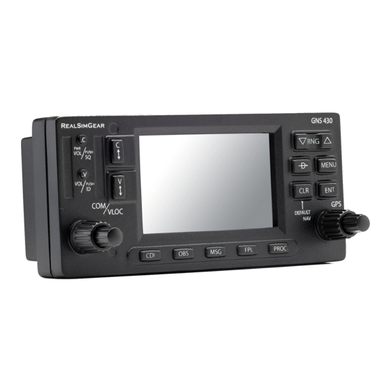
Garmin gns 430 Quick Refence
Airplane navigator
Hide thumbs
Also See for gns 430:
- Pilot's manual & reference (267 pages) ,
- Pilot's manual and reference (234 pages) ,
- Operating manual (27 pages)
Table of Contents
Advertisement
Quick Links
Advertisement
Table of Contents

Related Manuals for Garmin gns 430


Summary of Contents for Garmin gns 430
- Page 1 G N S 4 3 0 Q u i c k R e f e r e n c e...
-
Page 2: Left-Hand Keys And Knobs
KEYS AND KNOBS Left-hand Keys and Knobs Right-hand Keys and Knobs Range (map scale) Menu COM flip-flop power/volume Direct-To Enter VLOC flip-flop VLOC volume Clear Large left knob Small right knob Small left knob Large right knob The COM power/volume knob ( ) controls unit power and communica- The range key ( ) allows you to select the desired map scale. -
Page 3: Bottom Row Keys
) is used to view system messages and to alert 4. The instrument panel self-test page you to important warnings and requirements. allows you to verify that the GNS 430 The flight plan key ( ) allows you to create, edit, activate and invert is communicating properly with flight plans, as well as access approaches, departures and arrivals. -
Page 4: Frequency Selection
“117.80”. 3. Rotate the small left knob ( f ) The GNS 430’s display is divided into three separate “windows” (or select the desired kilohertz (kHz) screen areas). The left 1/4 of the display provides a COM window (top two value. -
Page 5: Page Selection
Page selection FPL Group (Small right knob to select pages within the group) Flight plan pages are selected by pressing NAV Group key and using the small right knob ( ) to select the desired page. NAVCOM Satellite Status VNAV Default NAV Position Active Flight Plan... -
Page 6: Direct-To Navigation
As you spell the facility the desired destination waypoint. name or city, the GNS 430’s Spell’N’Find feature will select the first entry in the data- 3. Press to confirm the selected waypoint, and to activate the direct-to base based upon the characters you have entered up to that point. -
Page 7: Airport Information
Information tion of the desired destination waypoint. As you spell the facility name or city, the GNS 430’s Spell’N’Find feature will select the first entry in the database based upon 1. From any page, press and hold the characters you have entered up to that point. -
Page 8: Default Nav Page
Default NAV Page Default NAV Page To Select a Different Data Item for any Data Field 1. With the default NAV page displayed, Course Deviation TO/FROM press the key to display an Indicator (CDI) Flag options menu. 2. Rotate the large right knob ( ) to User-selectable highlight the “Change Fields?”... -
Page 9: Map Display
MAP PAGE Map Page To Quickly Declutter the Map Display User-selectable Map Display 1. Press the key momentarily (as Data Fields often as needed) to select the desired amount of map detail. The Present declutter level will appear adjacent to Map Scale Position the map scale. - Page 10 NavCom Page / Annunciators & Messages NAVCOM Page Auto-Tuning a Frequency from the NAVCOM Page Departure, Enroute or Arrival Airport 1. Highlight the desired frequency by scrolling through the list of frequencies, as described in the previous procedure. Frequency Assigned Category 2.
-
Page 11: Nearest Airports
Nearest Airports To View a List of the Nearest Airports 3. To view additional WPT pages for the selected airport (including the airport 1. From any page, press and hold to select the default NAV page. (You may skip runway and airport frequency pages) this step if you are already viewing any of the main GPS pages.) press the small right knob ( ) to... -
Page 12: Flight Plans
FLIGHT PLANS To Create a New Flight Plan To Stop Navigating a Flight Plan 1. Press 1. Press and rotate the small right knob ( ) to display the flight 2. Press to display the flight plan catalog. plan options. 2. - Page 13 Approaches Selecting Approaches 6. For precision approaches and some non-precision approaches, a 1. Press the key to display the reminder window will appear indicat- procedures page. ing that GPS guidance on such approaches is strictly for monitoring 2. Rotate the large right knob ( ) to only—use the VLOC receiver and highlight “Select Approach?”...
-
Page 14: Activating An Approach
APPROACHES Activating an Approach Flying an Approach Due to the variety of available approach procedures, the specific steps 1. With an approach loaded in the active flight plan, press to display the required will vary according to the approach selected. Keep the following procedures page. -
Page 15: Flying The Missed Approach
Approaches / Missed Approach • For GPS-based approaches, receiver autonomous integrity monitor- • The CDI will guide you through a DME arc. Just keep the needle ing (RAIM) will monitor satellite conditions and alert you—using an centered as you fly along the arc. When using an autopilot, the course “INTEG”... - Page 16 © 1998-2000 GARMIN Corporation GARMIN International, Inc., 1200 East 151st Street, Olathe, KS 66062, U.S.A. GARMIN (Europe) LTD, Unit 5, The Quadrangle, Abbey Park Industrial Estate, Romsey, SO51 9AQ, UK GARMIN (Asia) Corporation, No. 68, Jangshu 2 Road, Shijr, Taipei County, Taiwan Web Site Address: www.garmin.com...
Need help?
Do you have a question about the gns 430 and is the answer not in the manual?
Questions and answers