Table of Contents
Advertisement
Advertisement
Table of Contents

Related Manuals for Globalsat BT-338


Summary of Contents for Globalsat BT-338
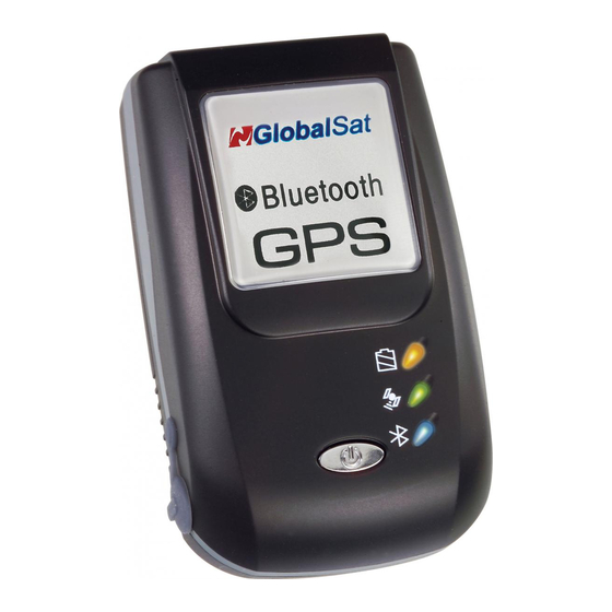
- Page 1 BT-338 GPS User’s Guide v2.1 Bluetooth GPS Receiver BT-338 (SiRF III)
- Page 2 04-20-2005 Modified FAQ section © 2006 Globalsat Technology Corporation/USGlobalsat, Inc. All rights reserved. The Globalsat logo is a trademark of Globalsat Corporation. Windows is a register trademark of Microsoft Corporation. Acrobat is a registered trademark of Adobe Systems Incorporated. Mac is a registered trademark of the Apple Corporation. All other trademarks or registered trademarks are acknowledged as the exclusive property of their respective owners.
-
Page 3: Table Of Contents
2. THE BT-338 ...4 3. CHANGING THE BATTERY...5 4. GPS FUNCTIONS ...6 5. INITIALIZING YOUR GPS RECEIVER...7 6. USING / TESTING YOUR GPS RECEIVER (WIN / PPC only)...8 7. FAQ’s...9 8. CONTACT INFORMATION...11 9. SAFETY AND LEGAL NOTICES...11 10. LIMITED WARRANTY...12 11. -
Page 4: Package Contents
Thank you for purchasing a Globalsat Bluetooth GPS receiver! Globalsat GPS receivers allow for real-time street navigation by using your laptop for graphical plotting and positioning of your route. Simply pair the GPS receiver, with your Bluetooth enabled device, install your own personal mapping software, and begin to view your position in real-time in relation to the surrounding streets in your travel area. -
Page 5: Getting Started
PDA’s, Smartphones, tablet PC’s and notebook PC’s and laptops which are already Bluetooth enable. GPS receivers can be used in a wide variety of applications from in vehicle navigation to and outdoor recreation and commercial applications. 2. THE BT-338 PAGE 4 OF 13 BT338_GPS_v2.0... -
Page 6: Changing The Battery
3. Replace battery making sure that the battery contact on the bottom side of battery touch the contacts on the BT-338 within the battery compartment. (Pull tab should be facing upward and at the head or top of the GPS receiver) 4. -
Page 7: Gps Functions
Lithium-ion (Li-ion) battery. The voltage input into the BT-338 must be 5VDC (1.2 A) center positive connector. receiver for the first time it may require as much as 8 hours to fully charge. Thereafter charging times will reduce. -
Page 8: Initializing Your Gps Receiver
If connected to an external power source (AC or DC charger), then the BT-338 will remain on. (Note: BT-338 with serial numbers between 55301~ 63000 and those starting from 67001 and higher are all v2) We strongly suggest that you first test your USG GPS with the included GPS Info utility program to confirm that the GPS receiver if functioning properly on your PC and that you have successfully configured the right COM Port setting. -
Page 9: Using / Testing Your Gps Receiver (Win / Ppc Only)
5. If there is no GPS data displayed (or data with multiple zeros in them), please exit the software and unplug the GPS receiver from the USB port and reinsert it after 10 seconds to reset the device. BT-338 GPS PAGE 8 OF 13 BT338_GPS_v2.0... -
Page 10: Faq's
Parity: None Stop Bit: 1 Flow Control: None 3. Configure the GPS Info utility with the correct COM Port and test your GPS receiver first before using it in your application. Will the GPS work with other Street Mapping software? Globalsat GPS receivers provides standard NMEA data for mapping software to use and convert to coordinates and should work well with most any NMEA compliant software on the market today. - Page 11 If you are parked in a covered parking lot or near a tall building, it is recommended that you drive away until you have a clear view of the sky before using the GPS receiver. You may need to give the GPS a few minutes to find or get a fix its location.
-
Page 12: Contact Information
9. SAFETY AND LEGAL NOTICES Please read this section carefully before using the GPS receiver. Globalsat Technology Corporation / USGlobalsat, Inc. will not accept any responsibility whatsoever for accidents resulting from failure to observe common sense precautions. Your personal judgment, traffic... -
Page 13: Limited Warranty
Additional products bundled in this package not manufactured by Globalsat/USGlobalsat will hold separate warranties as expressed by the individual manufacturer of that product(s). Product specifications, functions and features are subject to change without notice. BT-338 GPS PAGE 12 OF 13 BT338_GPS_v2.0... -
Page 14: Bt-338 Specifications
11. BT-338 SPECIFICATIONS Electrical Characteristics (Receiver) GPS Chipset Frequency C/A Code Channels Sensitivity Accuracy Position Horizontal Velocity Time WAAS Datum Datum Acquisition Rate Hot start Warm start Cold start Reacquisition Protocol GPS Protocol GPS Output Data GPS transfer rate Connection...
Need help?
Do you have a question about the BT-338 and is the answer not in the manual?
Questions and answers