Table of Contents
Advertisement
Quick Links
Advertisement
Table of Contents

Related Manuals for GeoMax Zoom 30 series


Summarization of Contents
Introduction
Product Identification
Details on locating and recording the product's type and serial number.
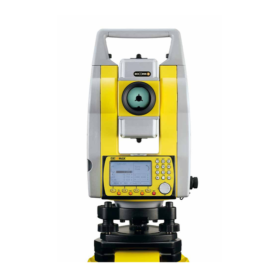
Description of the System
System Components
Overview of the main components that constitute the GeoMax Zoom system.
User Interface
Keyboard
Explains the function of each key on the instrument's keypad.
Screen
Details the components and layout of the instrument's display screen.
Status Icons
Provides a guide to understanding the meaning of various status icons displayed.
Softkeys
Describes the functionality of common softkeys used for quick access.
Operation
Instrument Setup
Step-by-step guide for setting up the instrument on a ground point.
Working with the Battery
Guidelines for charging, operating, and discharging the instrument's battery.
Settings
General Settings
Configuration options for basic instrument parameters like contrast and units.
EDM Settings
Defines the active EDM mode and measurement parameters.
Communication Settings
Configures parameters for data transfer via serial or Bluetooth interfaces.
Tools
Calibration
Menu for accessing electronic calibration tools to maintain instrument accuracy.
Functions
Distance Offset
Calculates target point coordinates when direct aiming is not possible.
Z-Coordinate
Determines the instrument's height using measurements to known points.
Applications - Getting Started
Overview
Introduction to predefined programs covering surveying duties.
Starting an Application
Steps to select and launch an application from the MAIN MENU.
Data Management
Data Management
Functions for entering, editing, checking, and deleting data in the field.
Exporting Data
Procedure for exporting job data from the instrument's internal memory.
Importing Data
Steps for importing data into the instrument's internal memory via USB.
Calibration
Overview
Importance of instrument calibration to maintain accuracy over time.
Preparation
Steps to prepare the instrument for calibration procedures.
Calibrating Line-of-Sight and Vertical Index Error
Procedure for correcting line-of-sight and vertical index errors.
Calibrating the Circular Level of the Instrument and Tribrach
Steps to calibrate the instrument and tribrach circular levels.
Safety Directions
General
General safety instructions to anticipate and avoid operational hazards.
Intended Use
Defines permitted and adverse uses of the product to ensure safety.
Hazards of Use
Warns about potential risks from lack of instruction or improper product usage.
Laser Classification
Provides general safety guidelines based on laser product classification.
Technical Data
Angle Measurement
Details accuracy and display resolution for angle measurements.
Distance Measurement with Reflectors
Provides range data for different reflectors and atmospheric conditions.
Distancer, Measurements without Reflectors (Reflectorless mode)
Lists range data for Kodak Gray Card under different conditions.
Distance Measurement Reflector (Long Range)
Provides range data for long range measurements with reflectors.
General Technical Data of the Instrument
Details telescope magnification, aperture, and compensation.
Need help?
Do you have a question about the Zoom 30 series and is the answer not in the manual?
Questions and answers