Table of Contents
Advertisement
Quick Links
Advertisement
Table of Contents

Subscribe to Our Youtube Channel
Related Manuals for Uniden TRAX353


Summary of Contents for Uniden TRAX353
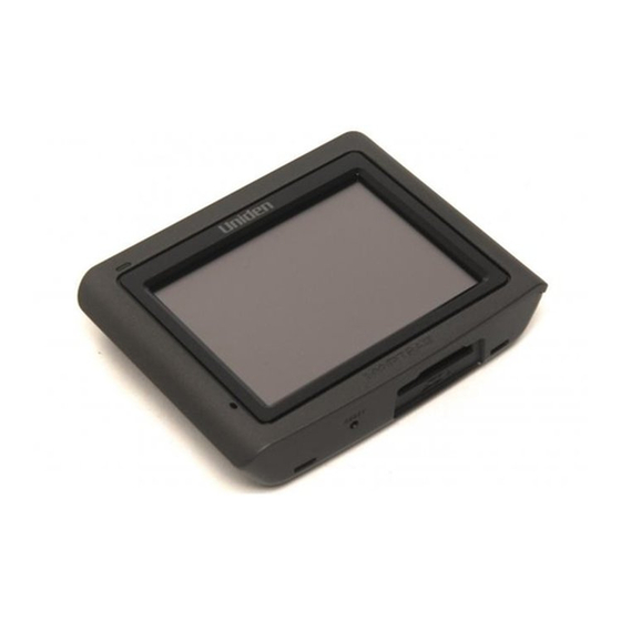
- Page 1 TRAX353 In-Car Navigation OWNER’S MANUAL...
-
Page 2: Table Of Contents
Mounting on the windshield Mounting on a flat surface How Do I Use It? 1: Warnings and Safety Information 2: Getting started with TRAX353 Start using TRAX353 Simple and Advanced modes Hardware button (Power on/off) Buttons and other controls on the screen... - Page 3 Saving Road Safety Cameras Camera warning Camera types Camera directions Speed limit warning 3: Navigating with TRAX353 Selecting the destination of a route Selecting the Cursor as the destination Entering an address or part of an address Entering an address (Australia)
- Page 4 Creating a multi-point route (inserting a via point) Creating a multi-point route (appending a new destination) Editing the route View the whole route on the map (Fit-to-Screen) Watching the simulation of the route Enabling Safety Mode Pausing the active route Deleting the next via point from the route Deleting the active route Using Track Logs...
- Page 5 Route menu Manage menu Manage saved route Manage History Manage Track Logs Manage Favourites Manage POIs Managed Saved Search Criteria User Data management Settings Menu Map Screen settings Sound settings Route Planning options Regional settings Navigation settings Warning settings GPS settings Menu settings Device settings Track Log settings...
-
Page 6: What Do I Do First
What Do I Do First? Make Sure These Items Arrived in the Box If anything listed here is missing or damaged, contact your place of purchase immediately. TRAX353 GPS nAviGATion device ► Press the power button momentarily to turn the screen off (or back on);... -
Page 7: Plug It In
ncluded AcceSSoRieS Adhesive Adhesive anchor anchor disk disk Plug it in ► Connect the power adapter to the power connector on the lower right side of the device. ► Plug the other end into your car’s cigarette lighter (or any standard 12 V DC outlet). ►... -
Page 8: How Do I Put It In My Car
How Do I Put It in My Car? Safety considerations ► Don’t install any device where it will block your view (including your mirrors!) while you’re driving. ► Keep your attention on the road! on any device while you’re driving. If you have to concentrate on a device, pull off the road for a few minutes. -
Page 9: Attaching The Windshield Mount
Attaching the windshield mount Insert the bracket hooks into the notches on the bottom of the device. How Do I Put It in My Car? Rotate the bracket head up..and snap the top hook into the notch on top of the device. -
Page 10: Adjusting The Windshield Mount
How Do I Put It in My Car? djuSTinG The WindShield mounT The bracket pivots in all directions ► The adjustment lock keeps both the bracket and the suction cup locked into place. Lift the adjustment lock to change the position of the device. -
Page 11: Mounting On The Windshield
Mounting on the windshield Make sure the device does not block your view of the road or your mirrors. Once you decide where you want the device, hold the suction cup in that position, then adjust the mount so you have the best view of the device. 1) Press the suction cup flat against the windshield. -
Page 12: Mounting On A Flat Surface
How Do I Put It in My Car? Mounting on a flat surface If you want to put the device somewhere other than your windshield (or anywhere the suction cup won’t stick), you can use the anchor disk. Once you glue the anchor disk down, the windshield mount installs inside the disk just like it does on glass. - Page 13 Hold the disk exactly above the spot where you want to glue it down. (Remember, the glue is designed to be permanent!) Press the disk firmly against the surface. Push down along the edges, too, so that every part of the disk makes good contact with the surface. Before you install the windshield mount, gently tug on the disk to make sure it’s secure.
-
Page 14: How Do I Use It
TRAX353 has a Safety Mode: if you turn on Safety Mode, you cannot change anything in TRAX353 while the vehicle is moving at a speed of 10 km/h (6 mph) or higher. Unless only passengers operate TRAX353, we strongly encourage you to turn on Safety Mode. - Page 15 Tasks Instructions Double tapping You do not need to tap the screen twice for any action. the screen With buttons and controls, a single tap is enough. Tapping and You do not need this to access the basic navigation holding the functions.
-
Page 16: Start Using Trax353
3. Select whether to start the program in Simple mode or in Advanced mode. Later you can change the language or switch between the two operating modes in Settings (page 101). After this, the Navigation menu appears and you can start using TRAX353. The Navigation menu in Simple mode:... -
Page 17: Simple And Advanced Modes
The typical way of using TRAX353 is to select a destination, and start navigating. You can select your destination in the following ways (not all of them are available in Simple mode): • Use the selected location on the map (the Cursor) (page 35). • Enter a full address or a part of an address, for example a street name without a house number or the names of two intersecting streets (page 46). - Page 18 How Do I Use It? Type of action Navigating to a selected map point Navigating to a street address Navigating to an incomplete address Navigating to an intersection Navigating to recent destinations (History) Navigating to Favourites Navigating to a POI Navigating to coordinates Creating a multi-point route...
-
Page 19: Hardware Button (Power On/Off)
Buttons and other controls on the screen When you are using TRAX353, you usually tap buttons on the touch screen. You only need to confirm selections or changes in TRAX353 if the application needs to restart, it needs to perform a major reconfiguration, or you are about to lose some of your data or settings. Otherwise, TRAX353 saves your selections and applies the new settings without confirmation as soon as you use the controls. Type Example... - Page 20 When a feature • Drag the handle has several to move the different slider to its new unnamed values, position. TRAX353 shows • Tap the slider an indicator on where you want a gauge that the handle to displays and sets appear; the a value from a thumb jumps range.
-
Page 21: Using Keyboards
Using keyboards You only need to enter letters or numbers in TRAX353 when you cannot avoid it. You can type with your fingertips on the full-screen keyboards and you can switch between various keyboard layouts, for example ABC, QWERTY, or numerical. Task Switching to another keyboard layout, for example from a Latin... -
Page 22: Using The Map
How Do I Use It? Using the map The map screen is the most frequently used screen of TRAX353. It can be accessed from the Navigation menu by tapping For further information about the map screen, see page 69. Checking the details of a map location • If you are interested in the details of your current position during... -
Page 23: Manipulating The Map
3. For further details, tap 4. Tap . The address, the coordinate and the list of nearby POIs will be displayed. • It is even easier if you select the desired point in the Find menu. Then the Cursor menu opens automatically. You only need to tap the button. Manipulating the map Position markers on the map: • Current GPS position: • Selected location (Cursor): The following controls help you modify the map view to best suit your... - Page 24 • Return to GPS position button • Smart Zoom button Changes how much of the map is displayed on the screen. TRAX353 uses high-quality vector maps that let you see the map at various zoom levels, always with optimised content. It always displays street names and other text with the...
- Page 25 Changes the horizontal view angle of the map in 3D mode. When GPS position is available, TRAX353 always rotates the map so its top faces your direction of travel (Track-U p orientation). You can turn away from Track-Up with these buttons.
- Page 26 • If the next turn is at a distance, TRAX353 zooms out and lowers the view angle to show you the road in front of you. Tap this button once to enable Smart Zoom.
-
Page 27: Status Information And Hidden Controls On The Map
TRAX353 shows the scale of the map in 2D mode. This button does not appear on the Map screen. It is available on the... - Page 28 GPS position and an active route are available, but automatic off-route recalculation is switched off, and you deviated from the route. TRAX353 is calculating or recalculating the route. GPS position and an active route are available, and you navigate the recommended route.
- Page 29 Icon Information There is no valid GPS position Traffic restriction When GPS position is Second route event (manoeuvre after the next manoeuvre) Approaching a Road Safety Camera Stops the running simulation Route recalculation progress Details If there is no valid GPS position, this symbol appears here.
- Page 30 Description The sound output of TRAX353 is muted. The sound output of TRAX353 is enabled. TRAX353 records a Track log when GPS position is available. Track log recording is disabled. The Bluetooth radio is switched off. The Bluetooth radio is turned on, but no telephone is connected.
- Page 31 There is an error in the Bluetooth connection. TRAX353 is connected to a telephone as a handsfree set via Bluetooth. A phone call is in progress over the Bluetooth connection. The following information can be seen in the three data fields shown on the map screen. Tap this area to open the Trip Information screen where you can select which values to be shown in these three fields.
-
Page 32: Using The Cursor (The Selected Map Location)
How Do I Use It? Distance information The next area is a combined status field. Tap this area to open the Quick menu (page 89). Icon Status for GPS position quality Battery status The battery is being charged Vehicle type Using the Cursor (the selected map location) First, place the Cursor at the desired map location with one of the following options: • Use the Find menu to select a location. The map returns with the selected point (the Cursor) in the middle, and the Cursor... -
Page 33: Trax353 Concepts
Smart Zoom Smart Zoom is a lot more than just a usual automatic zoom: • While following a route calculated by TRAX353: when approaching a turn, it will zoom in and raise the view angle to let you easily recognise your manoeuvre at the next junction. -
Page 34: Smart Zoom
How Do I Use It? • While driving without an active route in TRAX353: Smart Zoom will zoom in if you drive slowly and zoom out to the limit set here when you drive at high speed. Enabling Smart Zoom Tap the map to let the map control buttons appear, and then tap enable Smart Zoom. -
Page 35: Current Gps Position And Lock-On-Road
Cursor appears at the selected point on the map. TRAX353 displays the Cursor with a radiating red dot ( it visible at all zoom levels, even when it is in the background of a 3D map view. -
Page 36: Selected Location (Cursor)
To return to the original Cursor position, tap the position with which the Cursor menu was opened, and the appears again. Daytime and night colour schemes TRAX353 uses different colour schemes during the day and during the night. • Daytime colours are similar to paper road maps. • The night colour schemes use dark colours for large objects to keep the average brightness of the screen low. -
Page 37: Route Calculation And Recalculation
Permit Needed • Motorways • Toll Roads • Charge Roads • Ferries • Cross-border Planning TRAX353 automatically recalculates the route if you deviate from the proposed itinerary. For further information about Route Planning options, see page 104. How Do I Use It? Page 37... -
Page 38: Itinerary
How Do I Use It? Itinerary The Itinerary is the list of the route events, that is, the driving instructions. When you are on the Map screen, you can display the Itinerary in one of the following ways: • Tap the area between the Turn preview and the Travel data fields where the symbol of the second next manoeuvre is displayed (for example • In Advanced mode, tap the following buttons:... -
Page 39: Track Logs
A simulation drives you through the route, following the driving instructions (page 64). You can choose from a simulation at high speed or at normal driving speed. You can use it, for example, to see which bridge TRAX353 planned for the How Do I Use It? Page 39... -
Page 40: Route Demonstration
POI (Points of Interest) A point of interest (POI) is a location that someone might find useful or interesting. TRAX353 is delivered with thousands of POIs and you can also create your own POIs in the application. POI locations are marked on the map with special icons. POI icons are quite large so you can easily recognise the symbol. -
Page 41: Road Safety Cameras
How Do I Use It? Road Safety Cameras The location of a Road Safety Camera is a special POI. They cannot be searched like other POIs, and there is a special proximity warning only for cameras. You can save the Cursor as the location of a Road Safety Camera. -
Page 42: Camera Types
For these speed cameras you can specify the controlled traffic direction and the speed limit. TRAX353 warns you when you approach these speed cameras in the measured direction. If your speed exceeds the speed limit near the speed camera, TRAX353 plays a special warning sound. -
Page 43: Camera Directions
The same directions apply to red light cameras. TRAX353 warns you only if you drive in a measured or possibly measured direction. The measured direction of the camera appears with... -
Page 44: Speed Limit Warning
This information may not be available for your region (ask your local dealer) or may not be fully correct for all roads on the map. You can configure TRAX353 to warn you if you exceed the current limit. Tap the following buttons: When you exceed the speed limit, the following happens: • Visible Warning: A symbol with the speed limit appears in the... -
Page 45: 3: Navigating With Trax353
3: Navigating with TRAX353 You can set up your route in TRAX353 in several ways: • If you need a simple route (a route with only one destination, without any intermediate via points), you can select the destination and start navigating to it right away • you can plan a multi-point route (available in Advanced mode only) • you can also plan a route independently of your current GPS... -
Page 46: Selecting The Cursor As The Destination
How Do I Use It? Selecting the Cursor as the destination 1. Locate your destination on the map: move and scale the map as needed (page 14). 2. Tap the location that you want to select as your destination. The Cursor ( ) appears. - Page 47 1. Tap the following buttons: (Advanced mode). 2. By default, TRAX353 proposes the country, state and settlement where you are. If needed, tap the button with the name of the country, and select a different one from the list. If you select a new country, you also need to select the state, or tap to search for a settlement regardless of the state it is in.
-
Page 48: Entering An Address If House Numbering Is Restarted
How Do I Use It? match the string appear in a list. • Tap appears automatically. 4. Pick the settlement from the list. 5. Enter the street name: 1. Tap 2. Start entering the street name on the keyboard. 3. Get to the list of results: • After entering a couple of characters, the names that match the string appear in a list. - Page 49 The procedure is explained starting from the Navigation menu. 1. Tap the following buttons: (Advanced mode). 2. By default, TRAX353 proposes the country/state and settlement where you are. If needed, tap the button with the name of the country/state, and select a different one from the list.
-
Page 50: Entering An Address Without Knowing The District/Suburb
The procedure is explained starting from the Navigation menu. 1. Tap the following buttons: (Advanced mode). 2. By default, TRAX353 proposes the country/state and settlement where you are. If needed, tap the button with the name of the country/state, and select a different one from the list. - Page 51 3. If needed, change the settlement: • To select the settlement from the list of recently used ones, tap the button. • To enter a new settlement: 1. Tap the button with the name of the settlement, or if you have changed the country/state, tap 2. Start entering the settlement name on the keyboard. 3.
-
Page 52: Selecting An Intersection As The Destination
The procedure is explained starting from the Navigation menu. 1. Tap the following buttons: (Advanced mode). 2. By default, TRAX353 proposes the country/state and settlement where you are. If needed, tap the button with the name of the country/state, and select a different one from the list. -
Page 53: Selecting A City Centre As The Destination
appears automatically. 4. Pick the settlement from the list. 4. Enter the street name: 1. Tap 2. Start entering the street name on the keyboard. 3. Get to the list of results: • After entering a couple of characters, the names that match the string appear in a list. • Tap appears automatically. - Page 54 The procedure is explained starting from the Navigation menu. 1. Tap the following buttons: (Advanced mode). 2. By default, TRAX353 proposes the country/state and settlement where you are. If needed, tap the button with the name of the country/state, and select a different one from the list.
-
Page 55: Entering An Address With A Postal Code
The procedure is explained starting from the Navigation menu. 1. Tap the following buttons: (Advanced mode). 2. By default, TRAX353 proposes the country/state and settlement where you are. If needed, tap the button with the name of the country/state, and select a different one from the list. -
Page 56: Tips On Entering Addresses Quickly
Tips on entering addresses quickly • When you are entering the name of a settlement or a street, TRAX353 only displays those characters that appear in possible search results. The other characters are greyed out. • When entering the settlement name or the street name, tap the button after a couple of letters; TRAX353 lists the items that contain the character set. -
Page 57: Selecting Addresses From Your Favourites
Selecting the destination from the POIs You can select your destination from the POIs included with TRAX353 or from the ones you have previously created. The procedure is explained starting from the Navigation menu. - Page 58 How Do I Use It? location. • : The POI will be searched around the current GPS position. • : The POI will be searched around the destination of the active route. • : The POI will be searched not around a given point but by the size of the detour it means from the active route.
-
Page 59: Selecting The Destination With A Saved Poi Search Criteria
POI search criteria can be saved in the POI section of the Manage menu, but TRAX353 is already shipped with some saved criteria you can use instantly when searching for a POI. The procedure is explained starting from the Navigation menu. -
Page 60: Selecting The Destination By Entering Its Coordinate
How Do I Use It? 1. Tap the following buttons: 2. If necessary, turn the page with to see earlier destinations. 3. Tap the desired item. 4. The map appears with the selected point in the middle. Tap (Simple mode) or (Advanced mode) from the Cursor menu. -
Page 61: Creating A Multi-Point Route (Inserting A Via Point)
Creating a multi-point route (inserting a via point) Multi-point routes are created from simple routes, so a route must be active first. One of the ways of expanding the route is to keep the destination, and to add via points (intermediate destinations). This feature is available in Advanced mode only. 1. Select a new location as you did in the previous sections. This will be the additional destination in the route. -
Page 62: Creating A Multi-Point Route (Appending A New Destination)
How Do I Use It? The route is optimised. The start point and the destination remain at their position, but the via points are reordered to make the shortest possible route. The selected point is removed from the route. The route remains as it was before adding the new point. -
Page 63: View The Whole Route On The Map (Fit-To-Screen)
Tap the following buttons: The list of route points appear with the start point at the top of the list and the final destination at the bottom. If several via points exist, you might need to turn the page. Tap one of the route points in the list. You have the following options: Button Action The selected point moves up in the list (becomes a via point... -
Page 64: Watching The Simulation Of The Route
How Do I Use It? • Via the Route Information screen: tap • Via the Route Information screen using a shortcut: tap Watching the simulation of the route This feature is available in Advanced mode only. The procedure is explained starting from the Map screen. 1. Tap the following buttons: 2. The Route menu appears. There are two ways of running the route simulation: • Tap you a quick overview of the route. -
Page 65: Pausing The Active Route
Pausing the active route You do not need to pause the active route: when you start driving again, TRAX353 restarts the voice instructions from your position. Deleting the next via point from the route The easiest way to delete the upcoming route point (the next via point) -
Page 66: Using Track Logs
Using Track Logs TRAX353 can record the track (how your GPS position changed) that you drive. You do not need to select a destination and create a route for this; you can also record your driving path while cruising. -
Page 67: Simulating A Track Log On The Map
The procedure is explained starting from the Map screen. 1. Tap the following buttons: 2. Enter a name for the saved route, and then tap When you save a route, TRAX353 not only saves the route points but the whole itinerary: How Do I Use It? -
Page 68: Loading A Saved Route
TRAX353 in Advanced mode. In Simple mode, these functions work the same way, but only a few of them are available. The Navigation menu: TRAX353 starts with the Navigation menu. From there you can access the following screens: Page 68... -
Page 69: Map Screen
The most important and most often used screen of TRAX353 is the Map screen. During navigation, the screen shows route information and trip data (left Description The Map screen. - Page 70 How Do I Use It? screenshot), but when you tap the map, additional buttons and controls appear for a few seconds (right screenshot). Most parts of the screen behave as buttons. Symbol Name Turn Preview, that is, the next route event Second upcoming route event...
- Page 71 Position menu (appears when navigating a route) Cursor menu (appears when there is no GPS position or the Cursor is not at the current GPS position) Open/Close Map control buttons Rotate left, rotate right Tilt up, tilt down Zoom in, zoom out Return to GPS position (appears when GPS position...
- Page 72 How Do I Use It? Enable Smart Zoom (replaces the previous button if there is no GPS position or the map has not been moved) Zoom preset buttons (available in Advanced mode only) Tilt preset buttons (available in Advanced mode only) Current GPS position (on nearest...
-
Page 73: Icons On The Map
Map scale (2D map only) Icons on the map There are several status icons on the map. Most of them also function as a button. The information they provide is as follows: • GPS position quality • Battery status • Vehicle type used for route calculation • Sound status (muted or enabled) • Track log recording status • Bluetooth connection and communication status Battery, GPS position quality and... - Page 74 How Do I Use It? Icon Description TRAX353 has no connection to the GPS receiver: GPS navigation is not possible. Devices with a built-in GPS receiver are permanently connected. On such devices, the icon does not appear in normal circumstances.
-
Page 75: Status Indicator Strip
Icon Description The sound output of TRAX353 is muted. The sound output of TRAX353 is enabled. TRAX353 records a Track log when GPS position is available. Track log recording is disabled. The Bluetooth radio is switched off. The Bluetooth radio is turned on, but no telephone is connected. -
Page 76: Next Two Route Events (Turn Preview Fields)
How Do I Use It? Next two route events (Turn Preview fields) There are two fields reserved on the Map screen to display the next two manoeuvres (route events that are listed in the Itinerary). Both the type of the event (turn, roundabout, exiting motorway, etc.) and distances are displayed (the top manoeuvre shows the distance from the current GPS position, and the lower manoeuvre shows the distance between the next point and the final destination, or 3rd position). -
Page 77: Objects On The Map
Objects on the map Streets and roads TRAX353 shows the streets in a way that is similar to how the paper road maps show them. Their width and colours correspond to their importance: you can easily tell a motorway from a small street. -
Page 78: Elements Of The Active Route
Building Visibility Feature unavailable. (This switch is presented for future expansion and currently performs no action) Elements of the active route TRAX353 shows the route in the following way: Symbol Name Current GPS position... - Page 79 GPS position, TRAX353 uses the last known GPS position as the start point. When you are using a saved route, TRAX353 asks you if you want to use your GPS position or the first point in the saved route as the start point. You can also modify the start point in the Cursor menu.
-
Page 80: Detour Menu
You can choose whether you want to use or avoid certain road types (page 104). However, when TRAX353 cannot avoid such roads, the route will include them and it will show them in a colour that is different from the route colour. -
Page 81: Cursor Menu
Cursor menu As soon as you select one point in the Find menu, the map appears with the Cursor menu, a menu with possible actions for the selected point. Alternatively, when you tap the map, control buttons appear. Tap again to place the Cursor, a radiating red dot. - Page 82 How Do I Use It? If the Cursor is at or near the destination, this button replaces the previous one, and deletes the current destination from the route. The last via point is promoted as destination, or if there are no via points, the route is deleted.
-
Page 83: Position Menu
Map locations can be marked with Pins. Unlike POIs, a Pin has no name and other details, only a colour to let you tell one from another on the map. If the Cursor is at or near a Pin, this button replaces the previous one, and deletes the Pin the Cursor is near to. - Page 84 How Do I Use It? In the top section of the screen you see information about the current route. The fields on this screen are continuously updated while you keep the screen open. When you open the screen, all fields contain information about reaching your final destination. Tap any of the fields to see data on the via points starting from the first one through the final destination again. You have the following data and functions on this screen: Name Description Destination The upper part of this screen shows your planned route as a horizontal line.
- Page 85 Time Left Shows the time needed to reach the final destination of the route based on information available for the remaining segments of the route. The calculation cannot take into account traffic jams and other possible delays. Method This field shows how the route was calculated. It either displays the Route Calculation Method or the Vehicle field from the Route Planning options.
-
Page 86: Trip Information Screen
How Do I Use It? Appears only if there are no via points in the route. Trip Information screen The Trip Information screen has both route and travel data you might need during your journey. It can be opened directly from the Map screen by tapping the Trip Data field ( The fields on this screen are continuously updated while you keep the screen open. - Page 87 Compass Shows the current heading. Speedo- Shows the current speed both meter graphically and as a number. Distance Shows the distance you need Remaining to travel on the route before reaching your final destination. Time Shows the time needed to reach Remaining the final destination of the route based on information available for the remaining segments of the route.
-
Page 88: Trip Computer Screen
How Do I Use It? Speed Limit Shows the speed limit of the current street if the map contains If you tap the previous button, this one replaces it. Most of the fields on this screen have a shows whether the field it is attached to is shown on the map as a Trip Data. It also shows the position of the data as follows: Symbol Description This value is not shown on the map screen. -
Page 89: Quick Menu
This button replaces the previous one if it has been activated. Tap it to resume collecting trip data. Resets all counters of the currently shown trip. Collecting trip data is restarted only when TRAX353 receives a position from the GPS. Cycles through all trips. - Page 90 If you only adjust the volume, you need to use this button to return to the Map screen. Mutes all sounds of TRAX353. Switches between the daytime and night colour schemes manually. This will not disable the automatic...
-
Page 91: Gps Data Screen
GPS Name Description TRAX353 has a connection to the GPS receiver and GPS position information is available in 3D: TRAX353 can calculate both your horizontal and vertical GPS position. TRAX353 has a connection to the GPS receiver and GPS position... - Page 92 GPS receiver but GPS position information is not available. TRAX353 has no connection to the GPS receiver. TRAX353 is connected to the GPS receiver. TRAX353 has no connection to the GPS receiver but it is still trying to establish a connection.
-
Page 93: Find Menu
The destinations that you have already entered in TRAX353 are available in the History list. You can select your destination by entering its coordinates. You can select as your destination a location that you have already saved as a Favourite. -
Page 94: Manage Menu
You can run a demonstration of the route at high speed. You can run a demonstration of the route at normal speed. Manage menu You can manage the content that TRAX353 stores. Tap the following buttons: Button Description Renaming or deleting saved routes... -
Page 95: Manage Saved Route
Recording, simulating, renaming or deleting track logs, assigning colour to them to be shown on the map Renaming or deleting Favourites Creating, updating or deleting POIs Creating, updating or deleting POI groups Modifying POI visibility settings Creating, renaming or deleting Saved Search Criteria Manage Saved Routes You can manage the previously saved routes. -
Page 96: Manage Track Logs
How Do I Use It? Button Manage Track Logs You can record Track Logs, then play them back, display them on the map, and see their details. Tap the following buttons: Button Button with the name of the track log When track log details are shown: Button Button with the name of... -
Page 97: Manage Favourites
Manage Favourites You can manage the list of your Favourites. Tap the following buttons: Button Button with the name of the Favourite Manage POIs You can manage your POIs, and set the POI visibility for both your POIs and the ones that came with the product. Tap the following buttons: Tap one of the coloured buttons to assign a colour to the Track Log. - Page 98 How Do I Use It? Button Button with the name of the POI group Button with the name and address of a POI item When a POI group is open for editing: Button Page 98 Description Opens the list of the subgroups of this POI group.
-
Page 99: Manage Saved Search Criteria
Button with the icon of the POI group When a POI item is open for editing: Button Button with the name of the POI Button with the name of the POI Manage Saved Search Criteria You can manage the list of search criteria previously saved to easily find frequently searched POI types. Tap the following buttons: Button Button with the name of the Saved Search Criteria... -
Page 100: User Data Management
How Do I Use It? User Data Management You can manage the data you have saved (Pins, POIs, Favourites, History, and Track logs) and the settings you have made in the program. Tap the following buttons: Button Remove Pins Backup User Data Restore User Data Delete User Data Reset All Settings... -
Page 101: Settings Menu
Button Description You can fine-tune the appearance and content of the Map screen. You can adjust the sounds of TRAX353. These settings determine how routes will be calculated. These settings allow you to adjust the application to your local language, measurement units, time and date and their formats, as well as choose the voice guidance profile you prefer. -
Page 102: Map Screen Settings
How Do I Use It? You can change some device settings to control the screen backlight when TRAX353 is running. You can set up an automatic Track Log saving, and fine-tune its settings. This screen has no navigation feature. It merely provides information about the maps and licenses included with your navigation system. -
Page 103: Sound Settings
Colour Profiles TRAX353 is able to show the map and the menus in different colours during the day and during the night. Select the colour profiles to be used in each mode, and select the automatic or manual switching between the daytime and night colour profiles. Elevation on 2D 2D maps can also display 3D information. These top-down maps can display elevation by colours and shading. -
Page 104: Route Planning Options
Using Dynamic Volume you can instruct TRAX353 to increase the volume when your speed exceeds a certain minimum, and reach its highest volume at the given maximum speed. - Page 105 Permit You might need a permit or permission from the owners needed to use certain roads or to enter certain areas. TRAX353 excludes these roads from the route calculation by default. Ferries TRAX353 includes ferries in a planned route by default.
-
Page 106: Regional Settings
Program This button displays the current written language of Language TRAX353. By tapping the button, you can select a new one from the list of available languages. The application will restart if you change this setting; you are asked to confirm this. -
Page 107: Navigation Settings
This allows you to use Auto Time Correction and apply a time zone offset to obtain the desired time. Navigation settings You can control how TRAX353 behaves during navigation. Tap the following buttons: How Do I Use It? Page 107... - Page 108 By turning off this feature you also turn off the GPS position error filtering. The position shown on the map will be subject to all position errors and position fluctuations. Off-route This switch tells TRAX353 whether to automatically Recalculation recalculate the route when you deviate from it. If this feature is turned off, you need to initiate route...
-
Page 109: Warning Settings
Warn when Maps may contain information about the speed limits speeding of the road segments. TRAX353 is able to warn you if you exceed the current limit. This information may not be available for your region (ask your local dealer), or may not be fully correct for all roads in the map. -
Page 110: Gps Settings
How Do I Use It? Speed This feature allows you to receive a warning when Camera approaching a Road Safety Camera. You must ensure Warning on your own liability that using this feature is legal in the country where you intend to use it. You have the following options: • Audible Warning: beeps can be played while you are approaching the camera, or just alert sounds if you... -
Page 111: Menu Settings
Skin This feature is not available on the current software. Device settings You can change some device settings to control the screen backlight when TRAX353 is running. Tap the following buttons: How Do I Use It? Page 111... -
Page 112: Track Log Settings
Enable Auto- When auto-saving is enabled, you do not need to turn saving track log saving on and off manually. TRAX353 will automatically start recording the track log as soon as GPS position is available. Track Log... - Page 113 Create NMEA/ Independently of the normal track log, you can instruct SIRF Log TRAX353 to record the native GPS data received from the GPS device. These logs are saved as separate text files on the internal Flash ROM, and they cannot be shown or replayed in TRAX353.
- Page 114 Phone Menu screen shows Bluetooth Off with no paired phone. Touch exit to Quick Menu. Pairing a Bluetooth Phone Your mobile phone needs to be paired or registered to TRAX353 to use the Bluetooth feature. Touch Page 114 Bluetooth Off (No Phone) and then touch...
-
Page 115: 5: Bluetooth
Bluetooth devices. Make sure the Bluetooth on your phone is enabled. Touch to begin search TRAX353 will search for and list nearby Bluetooth devices. Touch to select the desired Bluetooth device. How Do I Use It? No Paired Devices are... - Page 116 How Do I Use It? About to connect to your phone for the first time. If your phone requires you to specify a password, enter: 1234 You should set up your phone to allow connecting to your navigator automatically in the future. See your phone manual for more details. Pairing is finished.
-
Page 117: Managing Bluetooth Devices
Managing Bluetooth Devices Touch to turn BT on Bluetooth On (Disconnected) You may have multiple phones set up for connection with your TRAX353. Bluetooth Off (Connected) Below is the typical display when Bluetooth on your mobile is set to connect automatically. - Page 118 You can add and remove phones from your list and disconnect and connect to different phones using the List Screen. If you have phones already paired to the TRAX353, but have none of them currently connected, the following screen appears when you touch This screen allows you to connect to a device, add devices, and remove devices.
-
Page 119: Answering A Bluetooth Call
Answering a Bluetooth Call When a Bluetooth call is received the name and number is displayed. Touch to cancel incoming call. Touch end call. Phone Menu (Talk on Phone) Phone Menu (Talk) How Do I Use It? Touch accept the call and begin talk. - Page 120 How Do I Use It? Making a Bluetooth Call (from Dial Pad) To make a Bluetooth call touch the following buttons from the Map screen. 1. i) Input phone number Page 120 Phone Menu (Talk) Phone Menu (Talk) 1. ii) Touch to delete digit 2.
- Page 121 Making a Bluetooth Call (from PhoneBook) Add to Phonebook Touch to open Phonebook list. If the phonebook is empty tap phone. Phonebook Empty Touch to add Phonebook from Mobile Phone Dial from Phonebook Phonebook Downloaded to download phonebook from paired Select Name Touch to scroll down the...
- Page 122 (L). Making a Bluetooth Call (from Call Log) Call Log Touch to open Call Log list. If the call log is empty TRAX353 will download the call log from the paired phone. Page 122 Name w/multiple number Making Call Touch name to select.
- Page 123 Answered Call Dialled Call Missed Call How Do I Use It? Touch to select call log. The details of the selected logged call will display. Making Call Touch to cancel call. Touch to begin call. Page 123...
- Page 124 How Do I Use It? Page 124...
- Page 125 How Do I Use It? Page 125...
-
Page 126: 6: Glossary
The currently navigated route. You can save and load routes in TRAX353, but only one route can be active at any given time, and it is always active until you delete it, reach your destination or you quit TRAX353. See also: Route. - Page 127 2D map view mode and in Overview mode. See also: Track-up map orientation. Overview mode You can instruct TRAX353 to automatically switch to Overview mode if the next route event is in a distance. In Overview mode the map is shown in 2D but scaled down to a predefined zoom level. When you approach the next route event, the previous 2D or 3D map view returns automatically.
- Page 128 Notes Page 128...
- Page 129 Notes Page 129...
-
Page 130: Warranty
Warranty is only valid in the original country of purchase. ELEMENT OF WARRANTY: Uniden warrants to the original retail owner for the duration of this warranty, its TRAX353 (herein after referred to as the Product), to be free from defects in materials and craftsmanship with only the limitations or exclusions set out below. - Page 131 PARTS COVERED: This warranty covers for one (1) year, the Product and included accessories. STATEMENT OF REMEDY: In the event that the Product does not conform to this warranty at any time while this warranty is in effect, the warrantor at its discretion, will repair the defect or replace the Product and return it to you without charge for parts or service.
- Page 132 ThANk yoU for bUyINg A UNIdeN prodUCT. © 2008 Uniden Australia Pty Limited. Uniden New Zealand Ltd. Printed in China. USZZ01214ZZ(0)
Need help?
Do you have a question about the TRAX353 and is the answer not in the manual?
Questions and answers