Table of Contents
Advertisement
Quick Links
Advertisement
Table of Contents

Related Manuals for Uniden TRAX4310


Summary of Contents for Uniden TRAX4310
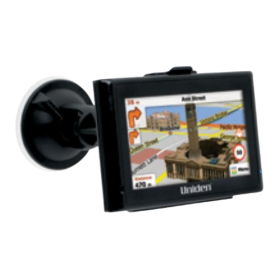
- Page 1 TRAX4310 In-Car Navigation...
- Page 2 Thank you for purchasing this Uniden product. Read the Quick Start Guide first and start using your device right away. This document is the detailed description of the navigation software. You can easily discover your device while you are using it;...
-
Page 3: Table Of Contents
Table of Contents What Do I Do First? Make Sure These Items Arrived in the Box Plug it in Hardware Keys How Do I Put It in My Car? Safety considerations Attaching the windshield mount Adjusting the windshield mount Mounting on the windshield 1 Warnings and Safety information 2 Getting started 2.1 Startup screen: the Navigation menu... - Page 4 2.4.5 Quick menu 2.4.6 Checking the details of the current position (Where Am I?) 3 Navigating 3.1 Selecting the destination of a route 3.1.1 Entering an address or part of an address 3.1.1.1 Entering an address 3.1.1.2 Entering the midpoint of a street as the destination 3.1.1.3 Selecting an intersection as the destination 3.1.1.4 Selecting a city/town centre as the destination 3.1.1.5 Entering an address with a postal code...
- Page 5 3.4.8 Changing the road types used in route planning 3.5 Adding the destination of the route to Favourites 3.6 Watching the simulation of the route 4 Reference Guide 4.1 Concepts 4.1.1 Smart Zoom 4.1.2 Daytime and night colour themes 4.1.3 Colour theme in tunnels 4.1.4 Route calculation and recalculation 4.1.5 Road Safety Cameras 4.1.5.1 Camera types...
-
Page 6: What Do I Do First
What Do I Do First? Make Sure These Items Arrived in the Box If anything listed here is missing or damaged, contact your place of purchase immediately. TRAX4310 GPS navigation device Press the power button at the TOP of the device to turn the navigation on or off. -
Page 7: Plug It In
Plug it in Connect the power adapter to the power connector on the lower right side of the device. Plug the other end into your car’s cigarette lighter (or any standard 12VDC - 24VDC outlet). Only use the power adapter that came with your device. Any other adapter might damage the device. -
Page 8: Hardware Keys
Hardware Keys Component Description Power Key Power on/off/sleep Reset If the device fails to operate properly, try resetting the device. Press the reset button by using the ball point pen or a similar tool. Mini USB Port Charge the GPS device by connecting AC adaptor or car charger. -
Page 9: How Do I Put It In My Car
How Do I Put It in My Car? Safety Considerations Don’t install any device where it will block your view (including your mirrors!) while you’re driving. Keep your attention on the road! Don’t try to operate or focus on any device while you’re driving. -
Page 10: Attaching The Windshield Mount
Attaching the windshield mount Assemble the Windshield mount. 1) Loosen the locking collar on part 2. 2) Push the ball joint of Part 1 through the locking collar into part 2. Insert the bracket hook into the notches at the bottom of the device. -
Page 11: Adjusting The Windshield Mount
Adjusting the Windshield Mount Locking collar Turn the windshield mount arm to a suitable angle for mounting. Suction lock Mounting on the Windshield Make sure the device does not block your view of the road or your mirrors. Once you decide where you want the device, hold the suction cup in that position, then adjust the mount so you have the best view of the device. -
Page 12: Warnings And Safety Information
1 Warnings and Safety information This software is a navigation system that helps you find your way to your destination with the built-in GPS receiver. The software does not transmit your GPS position; others cannot track you. It is important that you look at the display only when it is safe to do so. If you are the driver of the vehicle, we recommend that you operate your software before you start your journey. -
Page 13: Getting Started
2 Getting started The software is optimised for in-car or pedestrian use. There is no need to use a stylus. You can use it easily by tapping the screen buttons and the map with your fingertips. When using the navigation software for the first time, an initial setup process starts automatically. - Page 14 5. If needed, modify the time format, time zone and unit settings. Later you can change them in Regional settings (page 97). 6. If needed, modify the default route planning options. Later you can change them in Route settings (page 92). 7.
- Page 15 After the initial setup, the Navigation menu appears and you can start using the software. This is the screen you see every time navigation starts. The typical way of using the software is to select a destination, and start navigating. You can select your destination in the following ways: •...
-
Page 16: Startup Screen: The Navigation Menu
2.1 Startup screen: the Navigation menu The software starts with its main menu, the Navigation menu. From here you can reach all parts of the software. You have the following options: • to select your destination by entering an address or selecting a place of interest, a location on the map or one of your Favourite destinations. -
Page 17: Hardware Buttons
2.2 Hardware buttons You can use your software mostly by tapping the touch screen. The device has only a few hardware buttons. You can turn the your device on or off at any time. When the your device is switched off, your software does not calculate your GPS position and it does not update the route or the driving instructions. - Page 18 Type Example Description How to use it Button Tap it to initiate a Tap it once. function, to open a new screen, or to set a parameter. Button Some buttons Tap it once. with display the current value value of a field or setting.
-
Page 19: Using Keyboards
Slider When a feature can • Drag the handle to be set to different move the slider to values in a range, its new position. the software shows • Tap the slider an indicator on a where you want the gauge that displays handle to appear;... -
Page 20: Beyond Single Screen Tap
Entering a space, for example Tap the empty button at the bottom centre between a first name and a family of the screen. name or in multi-word street names Entering numbers and symbols to switch to a keyboard offering numeric and symbol characters. Finalising the keyboard entry (accepting the suggested search result) -
Page 21: Map Screen
Tasks Instructions • Tap and hold on keyboard screens: you can delete several characters quickly. • Tap and hold in long lists: you can scroll pages continuously. Gestures You need to drag and drop the screen only in cases like: (drag&drop) •... - Page 22 To enlarge this small map and open the Map screen, tap The map is displayed in black and white when there is no GPS position: ... or in full colour when the current position is available: This map shows the current position (the Vehimarker, a blue arrow by default), the recommended route (an orange line), and the surrounding map area.
- Page 23 Tap any of the data fields to suppress others and display only the selected one. The data fields are different when you are navigating an active route and when you have no specified destination (the orange line is not displayed). Data fields when cruising without a destination: Field Description...
-
Page 24: Position Markers
Field Description Shows the time needed to reach the final destination of the route based on information available for the remaining segments of the route. The calculation cannot take into account traffic jams and other possible delays. Shows the estimated arrival time at the final destination of the route based on information available for the remaining segments of the route. -
Page 25: Selected Location (Cursor) In Find On Map
• If you choose any of the vehicles: The Vehimarker may not show your exact GPS position and heading. If roads are near, it is aligned to the nearest road to suppress GPS position errors, and the direction of the icon is aligned to the direction of the road. - Page 26 A smaller icon shows the type of the second next manoeuvre if it is near the first one. Otherwise, only the next manoeuvre is displayed. Most of these icons are very intuitive. The following table lists some of the frequently shown route events. The same symbols are used in both fields: Icon Description Turn left.
-
Page 27: Lane Information And Signposts
Icon Description Leave ferry. Approaching the destination. 2.4.3.3 Lane information and Signposts When navigating on multilane roads, it is important to take the appropriate lane in order to follow the recommended route. If lane information is available in the map data, the software displays the lanes and their directions using small arrows at the bottom of the map. -
Page 28: Elements Of The Active Route
Type Description 3D terrain 3D terrain map data shows changes in terrain, elevations or depressions in the land when you view the map in 2D, and use it to plot the route map in 3D when you navigate. Hills and mountains are shown in the background of the 3D map, and illustrated by colour and shading on the 2D map. -
Page 29: Manipulating The Map
Map colour The map is vivid and colourful when GPS position is available. Whenever the current position is not available, the map turns grey. The software however may still move the Vehimarker to show a possible but not confirmed position. Route colour The route always stands out with its colour on the map, both in daytime and in night colour mode. - Page 30 Action Button(s) Description Zooming Changes how much of the map is displayed on the in and out screen. your software uses high-quality vector maps that let you examine the map at various zoom levels, always with optimised content. It always displays street names and other text with the same font size, never upside-down, and you only see the streets and objects that you need.
-
Page 31: Quick Menu
2.4.5 Quick menu The Quick menu is a selection of controls that are frequently needed during navigation. It can be opened directly from the Map screen by tapping the map. Buttons in the top row: These buttons are switches. Their current value is displayed on the button. - Page 32 Use the switch to mute all sounds of the device and then to re- enable them again. The map can be displayed in a perspective view (3D) or in a top-down view (2D), and in 3D mode buildings can be displayed on the map.
-
Page 33: Checking The Details Of The Current Position (Where Am I?)
Switches between the daytime and night colour themes. Selectable values: : The map and the menu screens are displayed in daytime colours. : The map and the menu screens are displayed in night colours. : This enables your software to switch automatically between the daytime and the night colour themes based on the current time and GPS position a few minutes before sunrise, when the sky has already turned bright, and a few minutes after... - Page 34 Information on this screen: • : Latitude and Longitude (coordinates of the current position in WGS84 format). • : Altitude (elevation information coming from the GPS receiver - often inaccurate). • : Address details (when available) of the current position. •...
-
Page 35: Navigating
3 Navigating You can set up your route in different ways: • If you need a route for immediate navigation, you can select the destination and start navigating to it right away (normal navigation). • You can also plan a route independently of your current GPS position or even without GPS reception (to achieve this, you need to turn off the GPS receiver and set a new starting point in the Settings menu - see page 72). -
Page 36: Entering An Address
Using the same screen, you can find an address by entering: • the exact address, including house number • the centre of a city/town • an intersection • the midpoint of a street • any of the above, starting the search with the postal code (page 48) 3.1.1.1 Entering an address To enter an address as the destination, do as follows: 1. - Page 37 5. If needed, select a new city/town (see below Tip to select ALL cities): 1. Tap the button with the name of the city/town, or if you have changed the country/state, tap 2. Start entering the name of the city/town on the keyboard. 3.
- Page 38 1. Tap 2. Start entering the street name on the keyboard. 3. Find the street you need: • The most likely street name is always shown in the input field. To accept it, tap • If the desired name does not show up, the names that match the string appear in a list after entering a couple of characters (to open the list of results before it appears automatically, tap ).
-
Page 39: Entering The Midpoint Of A Street As The Destination
same road. If this is the case, a list appears after entering the house number. You need to select the appropriate address by the district/suburb information. 9. After a short summary of the route parameters, the map appears with the selected destination in the middle. - Page 40 3. By default, the software proposes the country, state and settlement where you are. If needed, tap the button with the name of the country, enter the first few letters of the country name on the keyboard, and select a different one from the list. If you select a new country, you also need to select the state, or select the name of the country where it stands without a state to search for an address in all its states.
- Page 41 appear in a list after entering a couple of characters (to open the list of results before it appears automatically, tap ). Select the city/town from the list. 6. Enter the street name: 1. Tap 2. Start entering the street name on the keyboard. 3.
-
Page 42: Selecting An Intersection As The Destination
8. After a short summary of the route parameters, the map appears with the selected destination in the middle. The route is automatically calculated. Tap to modify route parameters, or tap start your journey. 3.1.1.3 Selecting an intersection as the destination To enter an address as the destination, do as follows: 1. - Page 43 4. If you need to change the state, tap the button with the name of the state, enter the first few letters of the state name, and and select a different state from the list. 5. If needed, select a new city/town: 1.
- Page 44 6. Enter the street name: 1. Tap 2. Start entering the street name on the keyboard. 3. Find the street you need: • The most likely street name is always shown in the input field. To accept it, • If the desired name does not show up, the names that match the string appear in a list after entering a couple of characters (to open the list of results before it appears automatically, tap ).
-
Page 45: Selecting A City/Town Centre As The Destination
• If only a few intersecting streets exist, their list appears immediately. • In case of a longer street, a keyboard screen appears. Start entering the name of the intersecting street on the keyboard. As soon as the street names that match the entered string can be shown on one screen, their list appears automatically. - Page 46 3. By default, the software proposes the country, state and settlement where you are. If needed, tap the button with the name of the country, enter the first few letters of the country name on the keyboard, and select a different one from the list.
- Page 47 • If the desired name does not show up, the names that match the string appear in a list after entering a couple of characters (to open the list of results before it appears automatically, tap ). Select the city/town from the list.
-
Page 48: Entering An Address With A Postal Code
3.1.1.5 Entering an address with a postal code All of the above address searching possibilities can be performed with entering the postal code instead of the settlement name. Find below an example with a full address: 1. If you are on the Map screen, tap to return to the Navigation menu. - Page 49 1. Tap the button with the name of the city/town, or if you have changed the country/state, tap 2. Tap to open the numeric keypad. 3. Start entering the postal code. 4. Find the city/town you need: • The most likely postal code is always shown in the input field. To accept it, •...
- Page 50 7. Enter the house number: 1. Tap 2. Enter the house number on the keyboard. (To enter letters, tap 3. Tap to finish entering the address. (If the entered house number cannot be found, the midpoint of the street is selected as the destination.) 8.
-
Page 51: Tips On Entering Addresses Quickly
3.1.1.6 Tips on entering addresses quickly • When you are entering the name of a city/town or a street: • Only those letters are offered on the keyboard that appear in possible search results. All other characters are greyed out. •... -
Page 52: Selecting The Destination From The Places Of Interest
3.1.2 Selecting the destination from the Places of Interest You can select your destination from the Places of Interest included with your software. Using the same screen, you can find a Place in different ways: • with the Quick search feature, you can find frequently searched types of Places with only a few screen taps •... - Page 53 • If there is no active route (destination is not selected), they are searched around the current position. • If the current position is not available either (no GPS signal), they are searched around the last known position. • • If an active route exists, restaurants are searched along the route. •...
- Page 54 4. Tap any of the quick search buttons to get an instant list of Places. 5. The Places in the list are ordered by their distance from the current position, from the destination or by the length of the necessary detour. Normal Places are displayed with their blue category icon only ( ), while Places with extra details (so called “Rich POIs”) are marked with the logo of their data source (...
-
Page 55: Selecting The Destination From Other Places Of Interest By Name
7. Tap to select the displayed Place of Interest as the destination of the route. 8. After a short summary of the route parameters, the map appears with the selected destination in the middle. The route is automatically calculated. Tap to modify route parameters, or tap start your journey. - Page 56 • Tap to search for a place within a selected city or town. (The result list will be ordered by the distance from the centre of the selected city/ town.) • Tap to search for a place around the destination of the active route.
- Page 57 7. Using the keyboard, start entering the name of the Place. 8. After entering a few letters, tap to open the list of Places with names similar to the entered characters. 9. The Places in the list are ordered by their distance from the current position, from the destination, from the centre of the selected city/town or by the length of the necessary detour.
-
Page 58: Selecting The Destination From Other Places Of Interest By Category
10. (optional) If the selected Place is a Rich POI, you can tap display additional information. Then tap to return to the basic details. 11. Tap to select the displayed Place of Interest as the destination of the route. 12. After a short summary of the route parameters, the map appears with the selected destination in the middle. - Page 59 2. In the Navigation menu, tap the following buttons: 3. The Quick search categories appear. Tap 4. Select the area around which the Place should be searched for: • Tap to search around the current position or if it is not available, around the last know position.
- Page 60 6. Tap 7. Select one of the main Place categories (e.g. Accommodation) or tap to list all Places around the selected location or along the route. 8. Select one of the main Place subcategories (e.g. Hotel or Motel) or tap to list all Places in the selected main category around the selected location or along the route.
- Page 61 9. Finally, the results appear in a list. 10. The Places in the list are ordered by their distance from the current position, from the destination, from the centre of the selected city/town or by the length of the necessary detour. Normal Places are displayed with their blue category icon only ( ), while Places with extra details (so called “Rich POIs”) are marked with the logo of their data source (...
-
Page 62: Selecting Nearby Assistance From 'Where Am I
12. Tap to select the displayed Place of Interest as the destination of the route. 13. After a short summary of the route parameters, the map appears with the selected destination in the middle. The route is automatically calculated. Tap to modify route parameters, or tap start your journey. - Page 63 2. Tap , and then 3. The Quick search categories appear, all for searching around the current position (or around the last known position if the current position is notavailable): • : Car repair and roadside assistance services • : Medical and emergency services •...
- Page 64 6. (optional) If the selected Place is a ‘rich POI’, you can tap display additional information. Then tap to return to the basic details. 7. Tap to select the displayed Place of Interest as the destination of the route. 8. After a short summary of the route parameters, the map appears with the selected destination in the middle.
-
Page 65: Selecting A Map Location As The Destination
3.1.3 Selecting a map location as the destination 1. If you are on the Map screen, tap to return to the Navigation menu. 2. In the Navigation menu, tap the following buttons: 3. Locate your destination on the map: move and scale the map as needed. 4. -
Page 66: Selecting The Destination From Your Favourites
3.1.4 Selecting the destination from your Favourites You can select a location that you have already saved as a Favourite to be your destination. Adding a location to the list of Favourite destinations is described on page 82. 1. Access the list of Favourites: •... -
Page 67: Selecting The Most Likely Destination (Smart History)
3.1.5 Selecting the most likely destination (Smart History) The destinations that you have set earlier appear in the History list. One of those recent destinations is shown in the Destination menu for easy access. Smart History offers this location based upon your navigation habits, using parameters like the current time of day, the day of week, and the current location. -
Page 68: Selecting The Destination From The History
3.1.6 Selecting the destination from the History The destinations that you have set earlier appear in the History. 1. If you are on the Map screen, tap to return to the Navigation menu. 2. In the Navigation menu, tap 3. Tap 4. -
Page 69: Viewing The Entire Route On The Map
5. Select a destination from the list. 6. After a short summary of the route parameters, the map appears with the selected destination in the middle. The route is automatically calculated. Tap to modify route parameters, or tap start your journey. 3.2 Viewing the entire route on the map It is easy to get a map overview of the active route. -
Page 70: Checking The Route Parameters
3.3 Checking the route parameters You can check different parameters of the route recommended by the software. 1. If you are on the Map screen, tap to return to the Navigation menu. 2. In the Navigation menu, tap The map showing the active route appears in top-down view facing North. Additional information and controls are displayed around the map. -
Page 71: Modifying The Route
• The route planning method (e.g. Fast). • The symbol of the vehicle type used in route calculation. • The total length of the route. • The total time of the route. 4. You have the following options on this screen: •... -
Page 72: Setting A New Starting Position For The Route
3.4.2 Setting a new starting position for the route For normal navigation, all routes are planned from the current position. In order to check future routes, simulate them or see their length in time and distance, you can turn off the GPS receiver. Then you can set the starting point of the route to a different location than the current GPS position. -
Page 73: Pausing The Active Route
5. Select the address for the starting position, tap , and then tap to confirm. 6. The map returns in grayscale (showing that there is no GPS reception). If an active route already existed, it is now recalculated starting from the selected location. -
Page 74: Deleting The Active Route
3.4.4 Deleting the active route To cancel the navigated route, do as follows: 1. If you are on the Map screen, tap to return to the Navigation menu. 2. In the Navigation menu, tap . The active route is displayed it in its full length on the map together with additional information and controls. - Page 75 3. Tap 4. Tap , and then tap one of the following: • - Gives a quick route if you can travel at or near the speed limit on all roads. Usually the best selection for fast and normal cars. •...
-
Page 76: Checking The Route Alternatives
5. The software recalculates the route with the selected route planning method. The orange line line now shows the new recommended route. 3.4.6 Checking the route alternatives Another way of recalculating the active route with a different route planning method, is to compare these alternatives. Do as follows: 1. -
Page 77: Changing The Vehicle Used In Route Planning
• - Gives a quick route if you can travel at or near the speed limit on all roads. Usually the best selection for fast and normal cars. • - Gives a short route. Usually practical for pedestrians, cyclists or slow vehicles. •... - Page 78 3. Tap 4. Tap , and then tap one of the following: • • • • • • 5. The software recalculates the route optimised for the new vehicle type. The orange line now shows the new recommended route. Page 78...
-
Page 79: Changing The Road Types Used In Route Planning
If you select and you forget to change it back to a vehicle later, the software warns you when you travel with a speed that is too high for a pedestrian. You are allowed to switch back instantly to NOTE 3.4.8 Changing the road types used in route planning To recalculate the active route with different road type preferences, do as follows. -
Page 80: Adding The Destination Of The Route To Favourites
• - Charge roads are pay roads where you can purchase a pass or vignette to use the road for a longer period of time. They can be enabled or disabled separately from toll roads. • - You might need to avoid motorways when you are driving a slow car or you are towing another vehicle. - Page 81 3. Tap 4. Tap . Using the keyboard, enter a name for the Favourite. Tap enter numbers or symbols. 5. Tap to save the location as a new Favourite destination. Page 81...
-
Page 82: Watching The Simulation Of The Route
3.6 Watching the simulation of the route You can run a simulated navigation that demonstrates the active route. Do as follows: 1. If you are on the Map screen, tap to return to the Navigation menu. 2. In the Navigation menu, tap . - Page 83 You have the following controls during the simulation (the control buttons disappear after a few seconds but you can open them again if you tap the map): • : Jump to the next route event (manoeuvre). • : Pause the simulation. •...
-
Page 84: Reference Guide
4 Reference Guide On the following pages you will find the description of the different concepts and menu screens of the software. 4.1 Concepts 4.1.1 Smart Zoom Smart Zoom provides much more than just a usual automatic zoom feature: • While following a route: when approaching a turn, it will zoom in and raise the view angle to let you easily recognise your manoeuvre at the next junction. -
Page 85: Route Calculation And Recalculation
become black. However, roads and streets keep their original colours from the daytime or night colour theme currently used. After leaving the tunnel, the original colours return. 4.1.4 Route calculation and recalculation Your software calculates the route based on your preferences: •... -
Page 86: Road Safety Cameras
• • • • • Your software automatically recalculates the route if you deviate from the proposed itinerary. For further information about Route settings, see page 92. 4.1.5 Road Safety Cameras The location of a Road Safety Camera is a special Place of Interest. These cannot be searched like other Places, and there is a special proximity warning only for cameras. - Page 87 Mobile Some speed cameras are operated from vehicles. They do not always work and they are not set to check a preset speed limit. The warning is similar to fixed speed cameras, but as there is no speed limit given, only the proximity is announced. Built-in Some speed cameras are built into traffic lights.
-
Page 88: Camera Directions
4.1.5.2 Camera directions A speed camera can measure the speed of one direction of the traffic, both directions, or even several directions in an intersection, when they are mounted on a rotating base. The same directions apply to red light cameras. The software warns you only if you drive in a measured or possibly measured direction. -
Page 89: More' Menu
You need to recharge the battery. In the top right corner, the GPS reception quality icon shows the current accuracy of the position information. Icon Description The software has no connection to the GPS receiver: GPS navigation is not possible. Devices with a built-in GPS receiver are permanently connected. - Page 90 Button Description Play games. Tap any of the listed preinstalled games to try it in Demo mode, or tap to get an activation key to play the selected game in its full version. to download additional games from www.naviextras.com. Access travel applications: the unit converter, the clothing size converter, the list of international phone numbers and a calculator.
-
Page 91: Settings Menu
4.3 Settings menu You can configure the program settings, and modify the behaviour of the software. Tap the following buttons: The Settings menu has several options. Tap or scroll the list with your finger to see the full list. Button Description These settings determine how routes will be calculated. -
Page 92: Route Settings
Modify the basic software parameters set during the initial setup process. For details, see page 10. Delete all saved data and reset all settings to their factory defaults. Read the Software and Database End User License Agreement, look up content licenses or check the unique identifier of the software. - Page 93 Charge roads are pay roads where you can purchase a pass or vignette to use the road for a longer period of time. They can be enabled or disabled separately from toll roads. The software includes toll roads (pay roads where there is a per-use charge) in the routes by default.
-
Page 94: Sound Settings
Gives a route that has the smallest total distance of all possible routes. Usually practical for pedestrians, cyclists or slow vehicles. Combines the benefits of Fast and Short: The software calculates as if it were calculating the Fast route, but it takes other roads as well to save fuel. -
Page 95: Vehicle Gallery
Button Description This feature allows you to receive a warning when approaching a Road Safety Camera. You must ensure on your own liability that using this feature is legal in the country where you intend to use it. You have the following warnings: •... -
Page 96: Colour Themes
Select a 3D Vehimarker for navigation when the vehicle type used for route planning is set to Select a 3D Vehimarker for all other vehicle types. You can get more Vehimarkers at www.naviextras.com. 4.3.4 Colour themes You can fine-tune the appearance of the Map screen and the menus. Choose suitable colour themes from the list for both daytime and night use. -
Page 97: Set Starting Position
4.3.5 Set starting position For normal navigation, all routes are planned from the current position. In order to check future routes, you can turn off the GPS receiver, and set the starting point of the route to a different location than the current GPS position. The procedure is explained here: page 72. -
Page 98: Content
Time Formats and Units: Button Description Use this feature to synchronise the time zone of the clock of your device to the time zone based on your current GPS position. This is useful if you travel abroad. Set time zone manually if you do not want to synchronise the time zone automatically. - Page 99 Both the active and the preinstalled inactive content items (activation needed at www.naviextras.com) are listed. Inactive content items are displayed in red. Tap in the ‘More’ menu to buy activation keys for the inactive content. Page 99...
-
Page 100: Glossary
6 Glossary 2D/3D GPS reception The GPS receiver uses satellite signals to calculate its (your) position and needs at least four signals to give a three-dimensional position, including elevation. Because the satellites are moving and because objects can block the signals, your GPS device might not receive four signals. - Page 101 The software works with digital maps which are not simply the computerised versions of traditional paper maps. Similarly to the paper road maps, the 2D mode of digital maps show you streets, roads, and elevation is also shown by colours. In 3D mode, you can see the altitude differences, for example valleys and mountains, elevated roads, and in selected cities 3D landmarks and 3D buildings are also displayed.
- Page 102 direction. This is the default orientation in 3D map view mode. See also: North-up map orientation. Vehimarker The current position is shown with a blue arrowarrow on the map by default. The direction of the blue arrow shows the current heading. This position marker can be replaced with different vehicle and pedestrian symbols.
-
Page 103: End User Licence Agreement
7 End User Licence Agreement 1 The contracting parties 1.1 This Agreement has been entered into by and between Nav N Go Kft. (registered seat: 23 Bérc utca, H-1016 Budapest, Hungary; Company reg.no.: 01- 09-891838) as Licensor (hereinafter: Licensor) and You as the User (hereinafter: User;... - Page 104 4.2 The Software Product shall include the operating computer program, its complete documentation, the map database pertaining thereto and any third- party content and services accessible through the Software Product (hereinafter: Database). 4.3 Any form of display, storage, coding, including printed, electronic or graphic display, storage, source or object code, or any other as yet undefined form of display, storage, or coding, or any medium thereof shall be deemed parts of the Software Product.
- Page 105 one copy of the Software Product or a preinstalled copy of the Software Product thereon. 6.2 The User undertakes and accepts that the Software Product and/or its certain elements and/or contents provided by third parties may require separate action (registration/activation) within the time period specified in the Software product to achieve its partial or full functionality.
- Page 106 other products. 7.2 The User acknowledges that the Software Product may prohibit or block partly or completely the use of the Software Product and/or its parts and/or third party contents if the separate action (activation/registration) as specified in Section 6 is not met within the time defined in the Software Product.
- Page 107 proper and generally expected care and attention in the given situation, and special care and attention required due to the use of the Software Product) is the exclusive responsibility of the User. The Licensor shall not assume any responsibility for any damages occurred in relation to use of the Software Product in a motor vehicle.
- Page 108 or the availability of the service, and it specifically excludes any liability for the suspension of the service, and any damage arising in relation to the service or for complete cancellation of the service. The relevant information and data in connection with the contents and services provided by third parties are available at www.navngo.com.
-
Page 109: Limited One Year Warranty
Warranty is only valid in the original country of purchase. ELEMENT OF WARRANTY: Uniden warrants to the original retail owner for the duration of this warranty, its TRAX4310 (herein after referred to as the Product), to be free from defects in materials and craftsmanship with only the limitations or exclusions set out below. - Page 110 Product should be shipped or delivered, freight pre-paid, with evidence of original purchase (e.g. a copy of the sales docket), to the warrantor at: UNIDEN AUSTRALIA PTY UNIDEN NEW ZEALAND LIMITED...
- Page 111 Notes Page 111...
- Page 112 ThaNk you for buyINg a uNIdeN produCT. © 2009 Uniden Australia Pty Limited. Uniden New Zealand Ltd. Printed in PRC.
Need help?
Do you have a question about the TRAX4310 and is the answer not in the manual?
Questions and answers