Table of Contents
Advertisement
Advertisement
Table of Contents

Related Manuals for Flytec 6030


Summary of Contents for Flytec 6030
- Page 1 Flytec 6030GPS Revision Date:08•12•14 Through firmware v3.38a...
- Page 2 © Flytec USA, 2007 – 2014 Printed on 100% post-consumer recycled paper...
-
Page 3: Warning! Read Before You Proceed! Warning
No part of this manual may be reproduced, stored in a retrieval system, or transmitted in any form or by any means, electronic, mechanical, photocopying, recording, or otherwise without permission in writing from Flytec USA. This manual is protected under US and International Copyright Laws. -
Page 4: Table Of Contents
Table of Contents WARNING! READ BEFORE YOU PROCEED! WARNING! ....................... 3 INSTRUMENT LAYOUT .................................. 6 OVERVIEW ...................................... 7 Turning the 6030 On/Off ........................7 Main Display Page ..........................8 Keypad ..............................9 2.3.1 Function Keys F1 and F2 ....................... 9 2.3.2... - Page 5 Uploading Airspace with FlyChart ....................... 49 8.4.1 Creating an Airspace File with FlyChart ................52 Transferring New Firmware to the 6030 ..................... 52 Optional Software ..........................53 Viewing the Contents of an IGC File ....................53 MAIN DEVICE SETTINGS MENU ..............................55 Flight Memory .............................
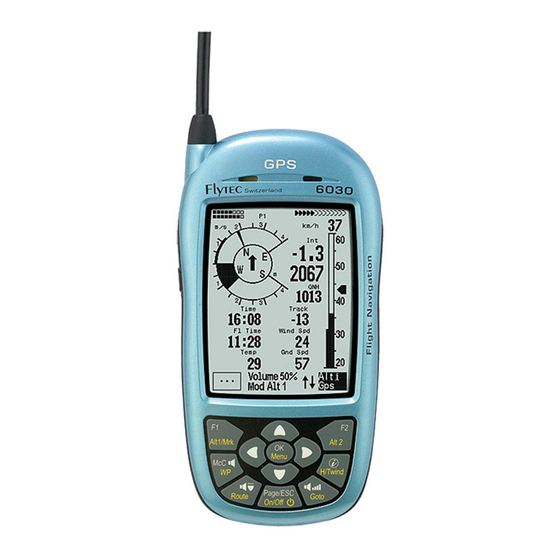
- Page 6 External air speed jack (under flap) Stall speed indicator Thermal Average indicator F2 function identifier Active McCready indicator F2 Key Battery status bank 1 and 2 OK (accept)/Menu key Pitot tube © Flytec USA, 2007 – 2014 Printed on 100% post-consumer recycled paper...
-
Page 7: Overview
PC, and does not necessitate sending the unit to us for service. The cable required to connect the unit to your PC is included. To update your 6030, all you need to do is download the update from our web site and transfer it to your 6030 using the supplied installation software. -
Page 8: Main Display Page
Main Display Page Each time the 6030 is turned on, the display defaults to the main display page. The upper portion of the display provides altitude, vertical speed (vario), air speed (ground speed if pitot sensor is turned off), directional information, as well as battery and GPS status. -
Page 9: Keypad
Units for Numerical Values The numerical values shown on the 6030 display can be set to display in either U.S. Standard units or metric units. Altitude values can be in feet or meters; vertical speed (rate of ascent/descent) in ft/min or m/sec;... -
Page 10: Real-Time Map Page
Information Field). If a zoom or pan key is pressed while the map is being drawn, the original draw will be suspended and will start over again with new pan/zoom selection. This allows you to quickly view the desired section of the map. © Flytec USA, 2007 – 2014 Printed on 100% post-consumer recycled paper... -
Page 11: Batteries And Charging
User-Fields On the Main Display Page, the 6030 can display either five or seven user-fields that can be selected from the list below. There are three pages of user-fields that can be scrolled with a short press of the$ key. The page number (i.e., P1, P2 or P3) of the sub-page is shown left of the GPS status indicator. -
Page 12: Main Setup Menu
* GPS reception required Main Setup Menu Press and hold the Menu key until the Main Setup Menu appears. In this menu you can customize the 6030 to your preferences, view recorded flights, manage routes/waypoints, manage restricted airspace definitions, manage the instrument memory, and access the 6030 Simulation mode. Use the !" keys to highlight the desired selection, and press OK to open that sub-menu. -
Page 13: Flight Functions
If you are flying too fast while thermaling, thus compromising your climb rate, the 6030 will provide a visual indication on the dial display. A radial line will appear above the indicated climb rate (lower right figure). If this example is compared to the... -
Page 14: Average Thermal Climb Indicator
Altimeters and Air Pressure The 6030 tracks and can display five different altitudes as well as the QNH in hPa and InHg, as shown in the table below. The MSL altitude is shown in Altimeter 1 (Alt 1) and appears to the right of the analog variometer. -
Page 15: Speed
It is also well suited for determining the wind speed at takeoff. If this sensor is plugged into a 6030, the pitot sensor will be disabled and the air speed from the vane sensor will be displayed. -
Page 16: Stall Alarm
The wind speed can be displayed in the user-field Wind Spd. Wind direction appears in the compass rose as a small windsock. It is necessary to fly at least two complete 360s as steadily as possible before the 6030 can register and display wind speed and direction. -
Page 17: Speed-To-Fly
(survival mode). The true value of the best glide speed will increase with increased altitude; however, it does not matter if you have chosen to display true or indicated air speed, since the 6030 compensates for this on the various displays. For more information please see Appendix Sections 12.3, True or Indicated Air Speed, and 12.4, Polars and Best Glide Speed. -
Page 18: Polars
The 6030 can store the polar data for two different gliders so that you do not need to re-enter the polar data pairs when flying your second glider. To enter and use a second polar data set, change the use set field in Menu>Pilot settings>Polar data to either 1 or 2. - Page 19 Section 12.1, Stall Alarm, in the Appendix. McCready Sound: When gliding with the McCready Sound activated, the 6030 will provide a beep that corresponds to the McCready speed value (speed to fly). This sound is not adjustable and has been chosen so that it should not be confused with the normal ascent beeping.
-
Page 20: Temperature
Time and Date The 6030 contains a real-time clock that is periodically set to your local time by the GPS signal and can be displayed in the user-field Time. The time does not need to be set since it is automatically set by the GPS receiver. -
Page 21: Distance To Take-Off
This feature is particularly useful when you have gained sufficient altitude to make it around the last turnpoint (or the last few turnpoints in a tight course) and make goal. However, it is not possible for the 6030 to anticipate changes in the wind speed or wind direction along the course and these will affect the accuracy of this value. -
Page 22: Navigation
Real-Time Map Page A short press of the Page/ESC key when the 6030 is in the run mode will bring up the real-time Map page where your track, waypoints, the active route, and any restricted airspace you have defined will be visible. If a Competition Route is active, start/turnpoint/goal cylinders will also be shown. -
Page 23: Relocating Thermals
4.5.1 Current Coordinate Display Provided the 6030 is receiving a GPS signal, the actual position can be displayed in the Information Field by pressing the information key . After twenty seconds, the current position will be replaced by the information previously displayed in the Information Field. -
Page 24: Saving The Current Position
SD card prior to loading a new list so that it can be retrieved for later use. Waypoint lists can be saved to the SD card via a PC in GPS eXchange format (.gpx) and then imported into the 6030. Note: the SD card must be formatted FAT or FAT16. -
Page 25: Navigating Waypoints And Routes
400 meters. This error is due to the very flat angles that result from being off-track a relatively small amount proportional to a long leg. © Flytec USA, 2007 – 2014 Printed on 100% post-consumer recycled paper... -
Page 26: Goto A Waypoint
This feature is particularly useful when you have gained sufficient altitude to make it around the last turnpoint (or last few turnpoints in a tight course) and make goal. However, it is not possible for the 6030 to anticipate a change in the wind speed or direction along the course that will affect the accuracy of this value. -
Page 27: Route Function
Route Function A route is a sequence of waypoints that must be flown in order. The 6030 can store up to twenty routes; the waypoints used on a route must first have been entered into the 6030’s waypoint list. Each route can also be assigned a route name, for example, Quest Air Triangle. -
Page 28: Direction Arrow To Second Turnpoint
To delete a route, scroll through the Route List with the "! keys, and select it with the OK key. Then press F2 (Del.Route). The 6030 will ask: “Delete Route?” Use the "! keys to change the No to a Yes, and then press the OK key. - Page 29 In most cases, competition turnpoints (waypoints between the start cylinder and goal) will have an entry cylinder (often 400m). However, it is becoming increasingly popular for competitions to call more complex tasks. The ability to set any turnpoint as enter or exit allows the 6030 to handle tasks like the example shown below. COMPETITION-ROUTE...
-
Page 30: Flying A Competition Route
There are three modes of Auto-zoom: off, map only, and full. Full auto-zoom will work as described above. If Map only is selected, the 6030 will only transition to the auto-zoom level if the 6030 is on the Map page, that is, it will not automatically switch from the main page to the Map page when you cross the threshold distance. -
Page 31: Flying An Optimized Competition Route
COMPETITION ROUTE. Press the OK key and 6030 will return to the run mode with the optimized Competition Route active. Once the optimized route option has been enabled it will stay active until it is disabled. This means that if you copy a new route to the Competition Route the new route will be optimized. To disable route optimization, long press the Route key, the lower half of the display will show the Opt. -
Page 32: The Start
Competition Route has passed and the pilot either enters an entry cylinder or is within an exit cylinder. Because the GPS receiver in the 6030 confirms its position every second, it will take less than 1 second to alert the pilot of a valid start or of crossing a turnpoint cylinder. -
Page 33: Exit Start
You must enter/exit the start cylinder after the set start time to cause the 6030 to automatically transition to the next turnpoint in the route. If no waypoint is set to be the start, you can start whenever you want and the automatic transition to the next turnpoint occurs as soon you are inside the first cylinder. -
Page 34: Entry Start
Because there is no way for the 6030 to know the nature of the air mass in route to goal, final glide recommendations are just that and should not be interpreted as absolutes. -
Page 35: Final Climb
This assumes that lift and sink on final glide net zero. Because there is no way for the 6030 to know otherwise – or to know if the wind component will change – you must decide, based on an assessment of conditions, whether to leave immediately when Alt a WP = 0, or if it is prudent to continue to climb for some reserve altitude. - Page 36 L/D gnd = L/D reg then you are flying the correct speed to arrive at goal at 0' AGL and the McCready pointer (radial line in the vario dial) will be indicating the corresponding speed ring setting. The McCready © Flytec USA, 2007 – 2014 Printed on 100% post-consumer recycled paper...
-
Page 37: Flight Memory And Flight Analysis
Flight Acceptance. Using this mode the instrument will only record from just before takeoff to 1 minute after landing. To ensure that the flight recording includes the very beginning of a flight, the 6030 will include up to 27 recording points prior to flight acceptance. - Page 38 GPS units. When the record interval is set to 1-second, at the conclusion of a flight, the 6030 will save the flight to the flight memory with a 5-second record interval and will also save two IGC files (one at 5-sec. and one at 1-sec.) to the SD card.
-
Page 39: Graphic Display Of Flights - Map Page
Important: Since the proof of a completed flight depends entirely on the GPS recording, it is important to ensure that the GPS receiver has good reception (at least 4 satellites) before takeoff. Therefore the 6030 should be turned on several minutes before takeoff to help ensure that the GPS is fully acquired. -
Page 40: Restricted Airspace (Ctrs)
Pre-load CTR file on to an SD card: Airspace files are compiled on a PC and saved to an SD card. The SD card is loaded into the 6030, the desired airspace file is selected in the SD-Card menu and the 100 closest airspaces of that file are automatically loaded into the airspace list (after the instrument gets a GPS fix). -
Page 41: Airspace Alerts And Info
See following diagram. Sample airspace: Warning distance 400m (CTR alarm set to 2) 400m$ Bouchs$ 400m$ 50m$ ⌖ 400m$ 400m$ © Flytec USA, 2007 – 2014 Printed on 100% post-consumer recycled paper... -
Page 42: Recalling Detailed Airspace Information
If the airspace name in the OpenAir file has more than 16 characters, the last character is truncated and a serial number in the order of occurrence in the OpenAir file will be added. The airspace above will appear in the faf file as follows; © Flytec USA, 2007 – 2014 Printed on 100% post-consumer recycled paper... -
Page 43: Deselect Or Select Individual Airspace
OpenAir files found on the Internet using the Flytec airspace utility. The airspace file is then loaded onto an SD card. With the SD card loaded into the 6030, the instrument will search for the SD card for the 100 closest airpaces and load them into the 6030 Airspace menu. -
Page 44: Using Airspace Loaded On The Sd Card
Flytec program OpenAir2faf available on the Flytec website. This small program checks to see if the format is correct and, if necessary, corrects any errors. In order for this file to be read by the 6030, the file name must be 8 characters or less with the extension .faf and must be contained in a folder named CTR... - Page 45 The instrument will clear the internal airspace memory, search for the closest 100 CTR's in the specified file and load it into the internal airspace memory (the GPS must be acquired). © Flytec USA, 2007 – 2014 Printed on 100% post-consumer recycled paper...
-
Page 46: Entering Flight Airspace Manually
Innsbruckck software (e.g., GPS dump). The procedure for editing/entering/deleting an airspace with the Comment shown on real 6030 keypad is given below; the procedure for time map (top left) using FlyChart can be found in Section 8.4. ------------------------------------- Stored airspaces can be viewed in the... - Page 47 N 47’19.500 Longi: E011’04.500 1. Point - - - - - - - - - - - - - - - - - - - - Elem Elem © Flytec USA, 2007 – 2014 Printed on 100% post-consumer recycled paper...
-
Page 48: Connection To A Computer
Using FlyChart, it is possible to download the waypoints, routes, Airspaces, recorded flights and user-settings from 6030 to a PC. It is also possible to upload waypoints, routes, Airspaces and user-settings from the PC to the 6030. You can view your recorded flights over real-world terrain in Google Earth directly from FlyChart. And with a simple flasher program you can upgrade the 6030 firmware when new releases become available. -
Page 49: Uploading Airspace With Flychart
Please see section 8.4.1 for more information on creating an airspace file. Once an airspace list has been built and saved with FlyChart (*.fa5 file) it can be uploaded to the 6030 as follows. The following assumes that you have installed and set up FlyChart on your PC and have connected the 6030 with the USB cable. - Page 50 Click on any airspace in the list and its boundary is shown in red. Only selected areas will be uploaded to the 6030 when the Upload button is clicked. Right-click on an airspace (in the list) to perform the following actions: Select>Toggle: Status of selected area is reversed (green check changes to an X and vice versa).
- Page 51 Airspace), click the Upload button to send them to the 6030. Of course the instrument must be connected to the PC with the USB cable and turned on, and in the Airspaces menu. If the speaker is turned on, the 6030 will beep as the airspaces are loaded.
-
Page 52: Creating An Airspace File With Flychart
FlyChart for future use. Click the Upload button to send the airspaces to the 6030. If the speaker is turned on, the 6030 will beep while the airspaces are being loaded. If a problem occurs during transfer, a lower-pitched beep will sound. -
Page 53: Viewing The Contents Of An Igc File
Optional Software With the help of a release code obtainable from the Flytec AG or Flytec USA, additional special functions can be activated. To enter a release code: • Select Optional SW-Packages from Device settings in the Main Menu and press OK. - Page 54 36º 28.350’. Using the number format code ##"º" ##"."### in Excel for the latitude and longitude columns, the coordinate data can be expressed in the XX°XX.XXX’ format. © Flytec USA, 2007 – 2014 Printed on 100% post-consumer recycled paper...
-
Page 55: Main Device Settings Menu
9 Main Setup Menu To access the 6030’s Main Setup Menu, long press the Menu key. To select one of the sub-menus, highlight the desired item with the !" keys and press the OK key. If the sub-menu has more than one page you can scroll through them with the keys. -
Page 56: Waypoints
Waypoints can be added from the keypad in this sub-menu or more easily using FlyChart. The waypoint list can be saved to, and read from, an SD card (see section 9.9). Routes This menu contains all the routes loaded into the 6030. To view the list, highlight Routes in the Main Setup Menu with the !"... - Page 57 It is always possible to reset all of the user settings back to the factory settings using Menu>Clear/Initialize memory>Initialize EEPROM. Important! All flight records, waypoints and routes will be deleted if you reset the unit. © Flytec USA, 2007 – 2014 Printed on 100% post-consumer recycled paper...
-
Page 58: Clear/Initialize Memory
Information Field will show each variable and which of the arrow keys to use to alter it. Simulation mode allows you to explore the relationships between best glide speed, McCready indicator and the sounds produced by the 6030. Toggle the F1 (Next Func.) key to access the different variables and alter them as shown: var %&... -
Page 59: Device Settings
SD card via a PC in GPS eXchange format (.gpx) and then imported into the 6030. The waypoint list in a 6030 can be saved to the SD card prior to loading a new list so that the original list can be reloaded at a later time. - Page 60 Menu>Main Setup Menu>SD-Card>Save settings>change No to Yes>press OK. A file xxxx.cfg (where xxxx= serial number of 6030) will be created in a folder named CFG in the root of the SD card. To restore instrument settings: Menu>Main Setup Menu>SD-Card>restore settings.
-
Page 61: Maintenance, Warranty And Service
10.2 Water Damage If water enters the 6030, damage is likely and the warranty is void. To minimize the extent of the damage the batteries should be removed immediately to prevent destructive short-circuit. The following steps should be performed as soon as reasonably possible. -
Page 62: Specifications And Approvals
This device complies with part 15 of the FCC Rules. Operation is subject to the following two conditions: 1- This device may not cause harmful interference 2- This device must accept any interference received, including interference that may cause undesired operation © Flytec USA, 2007 – 2014 Printed on 100% post-consumer recycled paper... -
Page 63: Appendix
Let’s assume that a pilot is flying at 31 mph (50 km/h) through the air. The 6030 determines from the glider’s polar curve that at this speed there would be a sink rate of 220 ft/min. -
Page 64: Polars And Best Glide Speed
(0.5 m/sec) when flying at 22 mph (35 km/h), the pilot must be in air rising at 160 ft/min (1.3 - 0.5 = 0.8 m/sec). This is also shown by the netto vario (please also see Section 12.2, Netto Vario). Because the 6030 knows... -
Page 65: Mccready Theory - Optimized Speed To Fly
An overly-optimistic polar curve will cause the 6030 to indicate a speed ring setting that is too high. In order to receive accurate speed to fly, netto vario and glide ratio information from the 6030, you must install an accurate polar for your flight configuration (i.e., your particular glider, wing loading, harness, air speed sensor, etc.). - Page 66 Alt a WP Alt a WP must be avoided, because in this case the pilot will waste unnecessarily both time and altitude. The 6030 will sound a rapid low beep tone if the pilot flies slower than best glide Dist Cyl Dist WP 16.3...
-
Page 67: Enter & Exit Competition Start Examples
Race becomes positive and because the pilots are already inside the exit cylinder the TP reached sound is given and the 6030 switches to WP1. Pilot 2 & 3 exit. The cylinder. © Flytec USA, 2007 – 2014... - Page 68 Upon reentry, the Pilot 2 decides to TP reached sound is given take a later start and the 6030 will switch to and leaves the WP1. cylinder. A press of the " key (with next ! pr "...
Need help?
Do you have a question about the 6030 and is the answer not in the manual?
Questions and answers